The next day we finally got to walk a little around a national park. It was the Arches National Park. When I was little, I used to read an overall brilliant Serbian children’s magazine “Politikin zabavnik” which, among other things, regularly featured Ripley’s Believe it or not panels. It would often provide a few words about some natural stone arch that can be found in the state of Utah. Well, this actually mostly concerned this particular place. There are stone arches and natural bridges in several locations, but their concentration is the highest here. In addition to arches, there are also different rocks whose names suggest what they remind people of.
In this park, we walked for around 3 and a half hours along one of the trails and we covered some 7-8 km. That’s not much, but considering that there was a little hiking and a lot of breaks for admiring the views and taking photos, it was just right. The path led from the end of the asphalt road through an area called Devils Garden and it took us either to a few arches themselves or it was possible to see some others from the path. The names of arches are very picturesque: Tunnel, Pine Tree, Landscape, Wall, Double O, Navajo, Partition, Sand dune, Broken, Delicate, Skyline, etc.
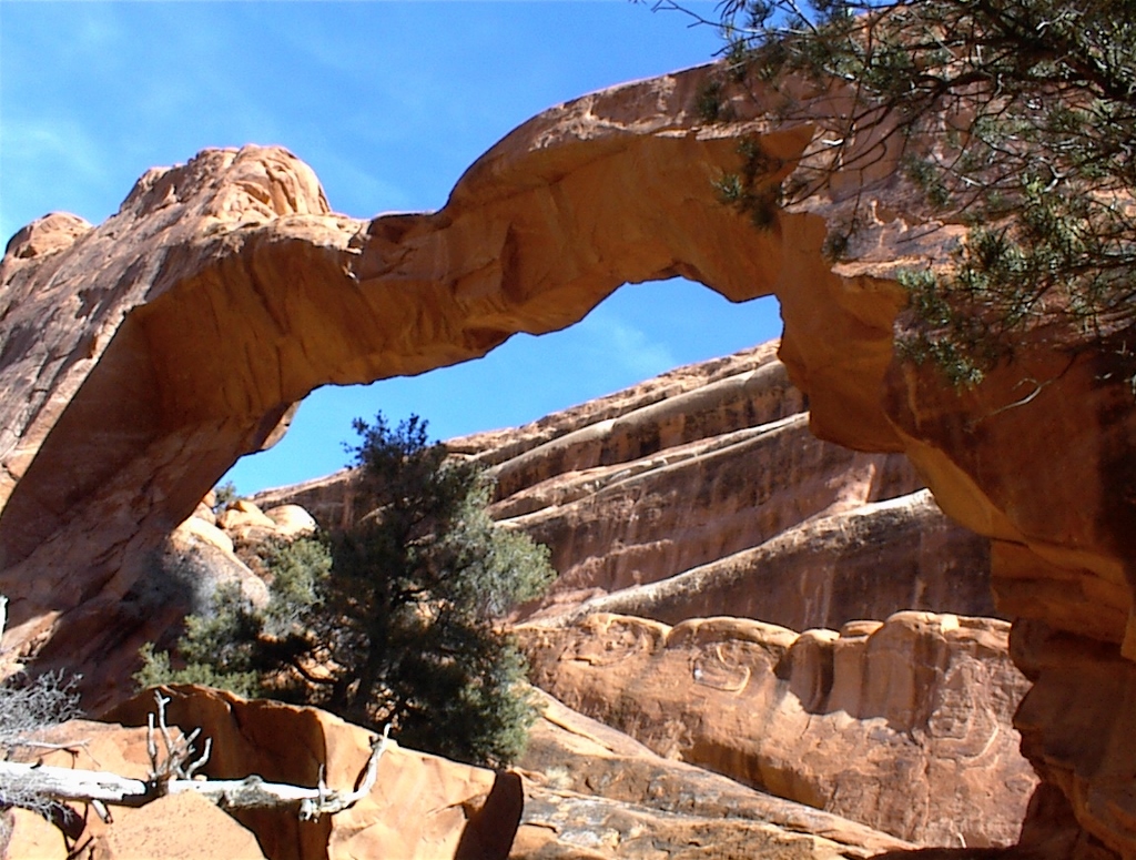 Wall Arch (Photograph courtesy of VT)
All of these arches have been created through the work of erosion that I have already mentioned. These processes take millions of years, but sometimes it happens that some major changes take place at our time. Thus the opening of the Skyline Arch used to be twice as small until 1940 when a large piece of rock fell out of it which automatically enlarged it. A similar thing happened to the Landscape Arch that can now be seen from a certain distance since in 1991 a large piece fell off it and then it was prohibited that visitors either go below it or walk over it. In the meantime, a few more pieces have fallen off, but it still continues to have one of the biggest spans among the world’s natural stone arches (around 100 m).
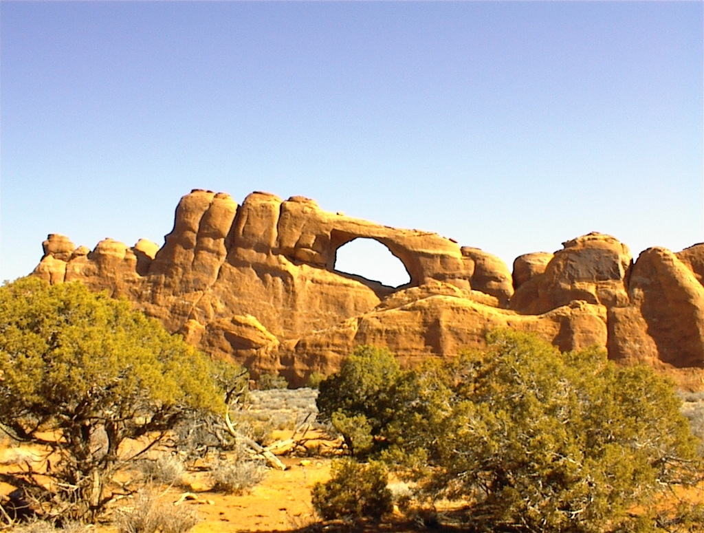 Skyline Arch (Photograph courtesy of VT)
The trail is clearly visible and nicely marked using natural materials (stacked up stones, for instance) and nothing has been drawn using paints or whatever that would stain the beauty of untouched nature. Human interventions have been brought to a minimum, like in the case of a carving made in a rock that stands right in the middle of the path serving as a step for crossing over the rock.
The advantage of visiting this place outside the high season lies in the fact that there are very few visitors. During the entire hike we only came across a couple of people. The rest of the time we were alone with the nature. And this is its playground. The Double O Arch consists of two round openings one below the other. The Partition Arch also has two round openings, but one next to the other.
One of the most beautiful arches in this national park is the Delicate Arch. We saw it from a distance from one of the viewpoints we stopped at before finally leaving the park.
Our journey took us then to yet another national park, the Canyonlands NP, although the entire region we travelled through is also called the Canyonlands simply because it is the land of canyons. Again we drove over a plateau and all of a sudden we ran into a cloud that included a strong wind and snow, although there was no snow on the surrounding ground. At one point it was as if we drove through a snow curtain and then the cloud would abruptly thin up so much that we would still have the snow in front of us, while the sun was visible above. As we were in a warm car, this certainly contributed to our enjoying in this natural event. Although I like all kinds of weather, in my mind, winter (I mean cold winter) is a very special season. That is the only time when it suffices that I enter a warm room after being outside in the cold and wrap myself under a warm blanket to feel pleasure and bliss. That specific sense of inner fulfilment never occurs to me when, for instance, I enter an air-conditioned room during summer and it must be at the level of primal ever since the times when man “invented” fire in order to warm himself.
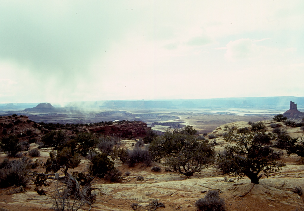
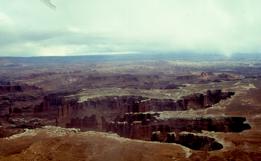
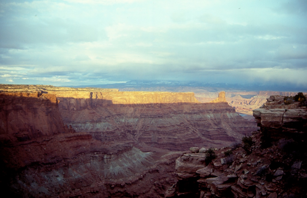
The blizzard passed after some 10 minutes, so it was completely dry when we entered the Canyonlands National Park. There the road runs over a flat highland that is at around 1800 m a.s.l. and it led us to a few viewpoints that provided us with absolutely incredible landscapes in front and below us. That section of the national park is called Island in the Sky and from there it is possible to see the canyons of the Green River and the Colorado that in fact join together here. No matter how much we both tried when taking photos, they simply could not fully convey the beauty of that area. There, like in several other places, we were completely alone before the beauty that was breathtaking. In addition to the magnificent nature, the weather conditions also contributed to the impression: a few clouds carrying snow along or dragging as if their lower sections were just a thinned-up fog, a little sun, different colours of geological layers and wonderful fresh air.
 Canyonlands NP
 Canyonlands NP
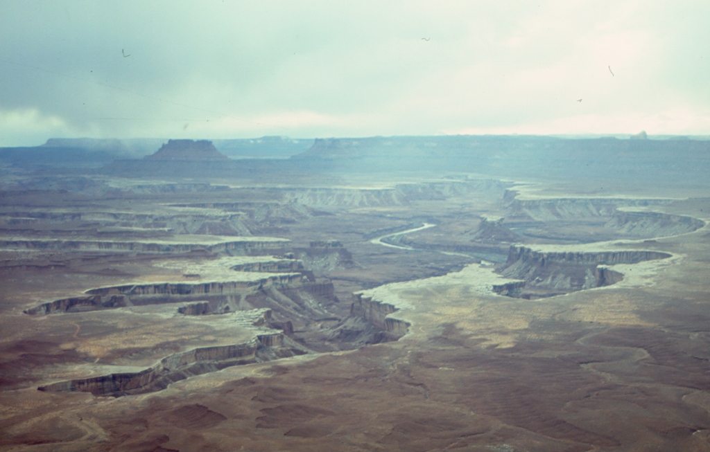 Canyonlands NP
Between a couple of viewpoints we passed through a blizzard again and we also came across yet another herd of deer that calmly grazed close to the road. Before finishing visits for the day, we went to the nearby Dead Horse Point State Park that is adjacent to the Canyonlands NP. This is also a point from which there is a fine view over a canyon where the Colorado makes a large meander. It owes its name to a story about an entire herd of wild horses that died of thirst there although the river was in their sight. They simply could not get down to it.
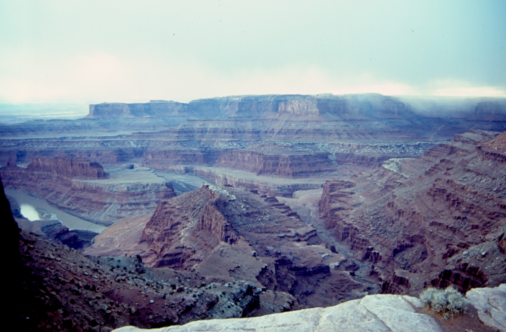 Dead Horse Point State Park
 Dead Horse Point State Park
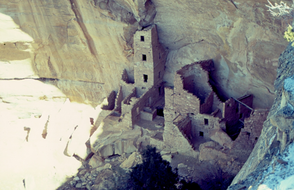
The next day we went to visit one more canyon, but in this case it was not the main attraction. The key thing there is Mesa Verde that is located in the state of Colorado. The Mesa Verde National Park is on the UNESCO World Heritage List and it is the first national part in the USA that included something man-made. The buildings that can be seen here were built by distant ancestors of the Pueblo tribe in the period from 700 to 1300 CE. As a side note, for those ancestors of the contemporary Pueblo Indians, archaeology uses the term Anasazi. These buildings were made in large natural spaces within cliffs that can be found under overhangs. There are several groups of such buildings within the national park. The main section is a group called Spruce Tree House, although the buildings were made of sandstone blocks.
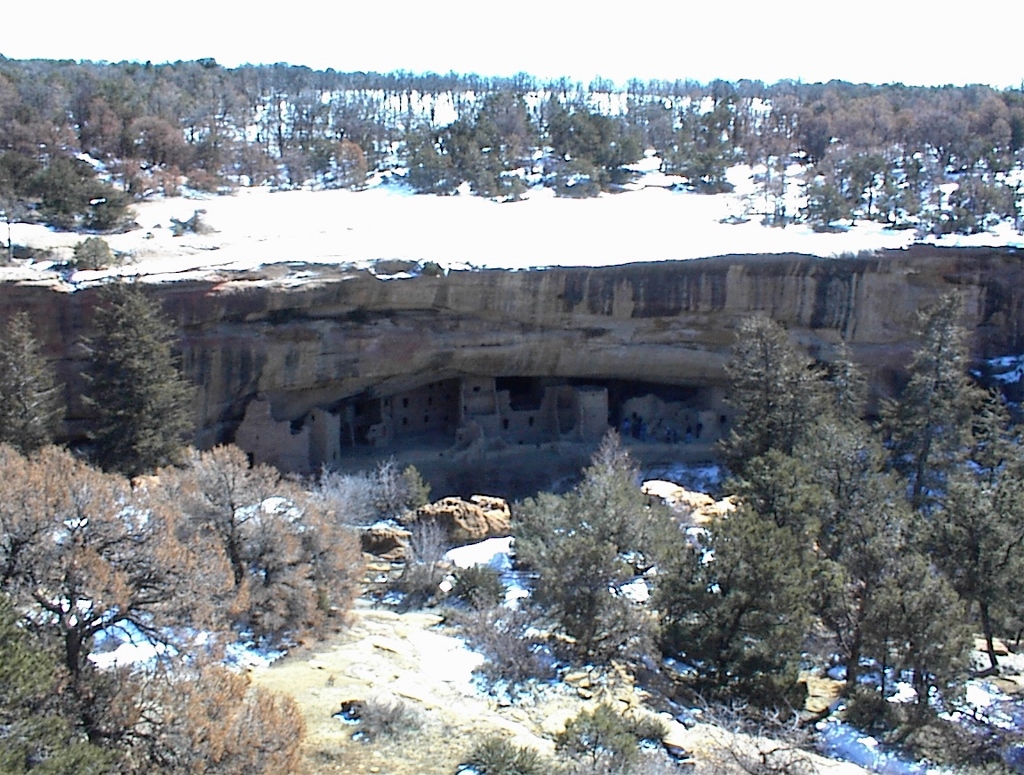 Mesa Verde NP, Spruce Tree House (Photograph courtesy of VT)
Here we were a little late for one group that toured those buildings and it was just too late for us to wait for the next group, so we contended ourselves by walking along an overlook that is at around 2100 m above sea level. There is indeed a very fine view from there, not only of the living areas, but also of the entire cliff, as well as the plateau above it. In order to reach these houses and certainly to leave them, the Anasazi carved hand-holds into the cliffs, thus going up and down completely vertical rocks. It is believed that on the flat terrain above the dwellings they cultivated the land and hunted animals. Still, even though their houses were in such an awkward place, it is assumed that they had a very well developed system of connecting different groups of people and that they did not live in isolation.
One of the groups of buildings is called the Square Tower House, although technically speaking it was not a tower, but rather a local high-rise since it was used for habitation. When the Anasazi mysteriously disappeared from history, everything started to fall apart, but the tower has managed miraculously to survive and is today the highest building in the entire Mesa Verde complex.
 Mesa Verde NP, Square Tower House
In addition to these residential groups scattered along cliffs, the national park also contains sod-houses built by the Anasazi in the period before moving to sandstone buildings. The first one we visited is from 575 CE and nowadays it is possible to clearly see the ground base onto which a wooden construction was added and it is presumed that residents entered them through the roof. Another sod-house we saw was built somewhere between 750 and 900 CE and it consists of two clearly divided rooms. There, it is possible to see a very interesting canal that served for supplying fresh air, although archaeologists believe that it must have been very difficult to breathe anyway because of the open fire. Even today, next to this ventilation shaft there is a large piece of stone that was used in cold winter months to control the quantity of cold air entering the dwelling in order not to cool the space too much.
We also went to see the Sun Temple. There is no evidence on it of any roof construction and it is assumed that the Anasazi abandoned it before the construction was over. It is not known why they left, but it is supposed that they lived in this region until the end of the 13th century when all trace of them was lost in the history. After that, there are no tangible remains that would be linked to them, although the contemporary Pueblo Indians do have some similarities with the Anasazi in their beliefs.
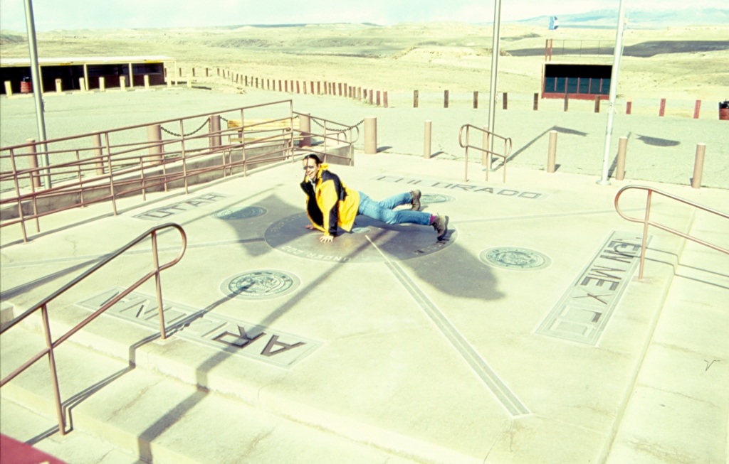
The next place we visited is completely unique. It is the only point in the USA where four states border one another at right angles, rendering this place its name – 4 Corners. These states are Arizona, Utah, Colorado and New Mexico. We had no plans to visit New Mexico, but I was very happy to have stepped in this state, albeit for a short while, because it always reminds me of my childhood. Namely, the capital of New Mexico is Albuquerque and in the Bugs Bunny cartoons, which I adored as a child, problems always came about when he didn’t take the right turn in Albuquerque.
 A personality split between four states
The point where these four states come together is located in a flat, rather featureless, area, marked by a concrete and metal construction and I didn’t mind getting down on all fours and stretching myself across the four states. Here we were already on the Navajo Nation territory, that is, on the territory of the Navajo Indians’ reservation. We took advantage of a nearby kiosk in order to try the specialty of the area which is called “fried bread.” They can be served as sweet (with icing sugar, cinnamon or honey) or savoury with different meaty or vegetable additions.
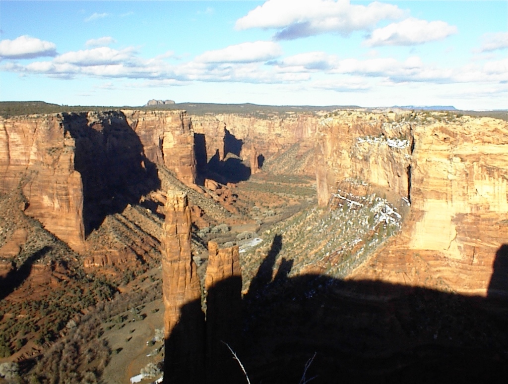
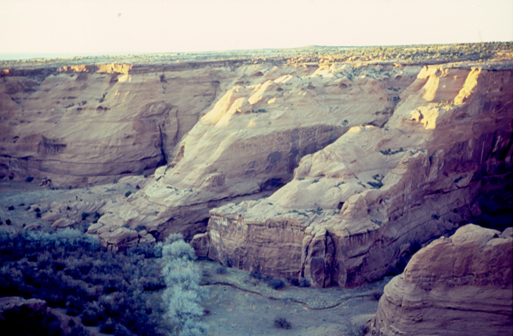
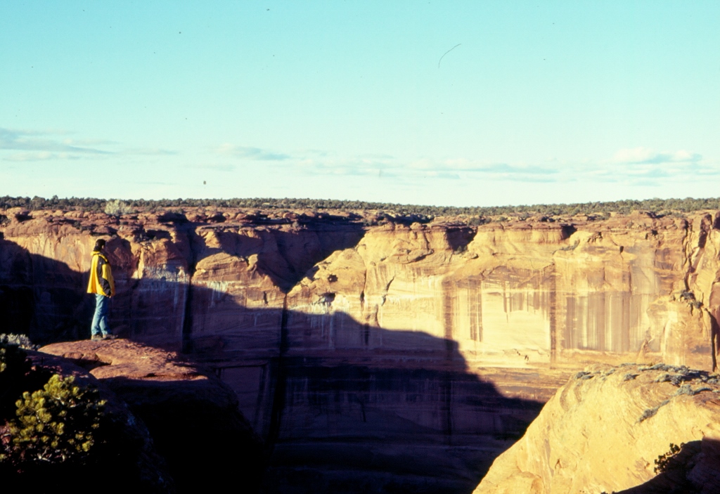
The next stage of our journey took us right across the Navajo territories in Arizona. First we visited the Canyon de Chelly National Monument. Although significantly smaller than some of the previously seen, this canyon does not lag behind by its beauty. We visited this one as well by driving along the south rim across a plane, making stops at viewpoints. The bottom of the canyon is practically dry and the entire area is of dominantly red colour. Here and there across the bottom of the canyon it is possible to see few houses, but although they are inhabited, the curious thing about them is that they don’t have electricity. This canyon comprises in fact three canyons and it is possible to visit its bottom, but not individually, only as part of guided tours organized by members of the Navajo tribe. This is their territory and they can set the rules here.
 Canyon de Chelly National Monument (Photograph courtesy of VT)
 Canyon de Chelly National Monument
So, we went along the top of the canyon and from there, like in the Mesa Verde NP, we could see some buildings which the Anasazi also made here in the horizontal natural cavities in the otherwise vertical cliffs. It is truly amazing how they must have climbed up and down those cliffs. In addition to these remains of the Anasazi culture, we also enjoyed the nature. Some of the rocks we saw from above looked like enormous mud balls dropped from high above and then they flattened from the impact. The sun was close to the sunset and helped emphasize the colours of the surrounding landscape. And then, all of a sudden, we heard what we thought to be the coyotes’ howling on the other side of the canyon.
 Listening to the coyote on the other side, Canyon de Chelly National Monument