The day after hiking along the railway track from Kalavryta to Diakopto, I left the tourist town in the north of the Peloponnese by car and headed toward Ancient Corinth, which is near the modern town of Corinth, also located on the northern coast of the Peloponnese. More specifically, I first drove to a site called Acrocorinth.
Here is a map that better shows the places I visited during the two weeks in September 2023 when I was travelling through the Peloponnese and a part of southern Greece:
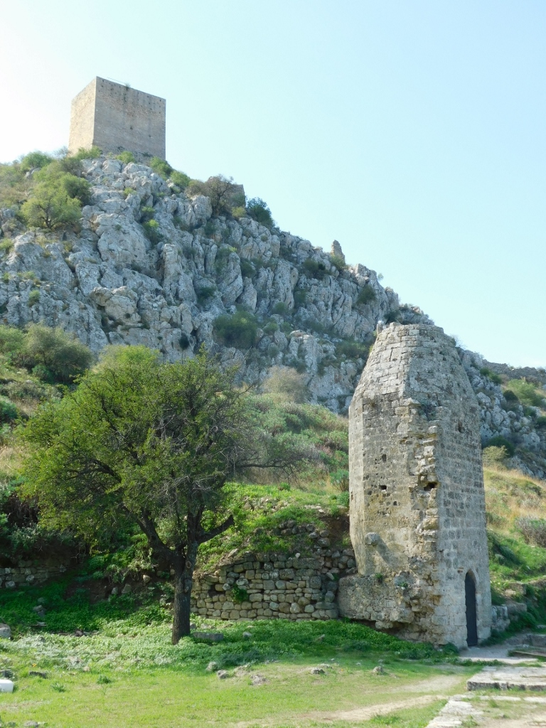
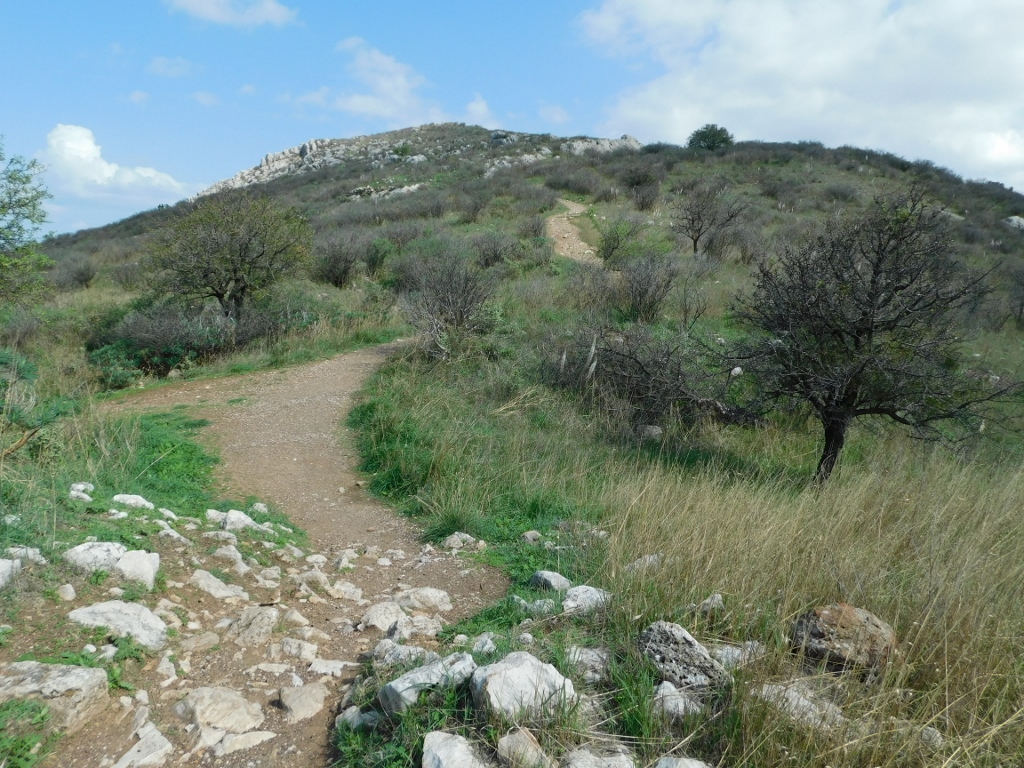
As for Acrocorinth, although it seems less popular and well-known compared to some other places on the Peloponnese, it is an exceptionally important and impressive site. The ruins of Acrocorinth are considered some of the most impressive in the world due to the size of the site, its outstanding location and the views it offers. Perhaps it is precisely its location, or more specifically the exceptional steepness on which it was built, that makes it less attractive to modern tourists. It was built at the top of a rocky elevation that dominates the north-eastern part of the Peloponnese.
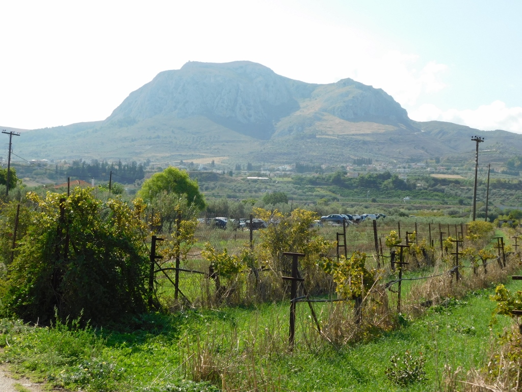 Hill topped by Acrocorinth
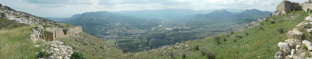
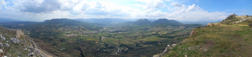
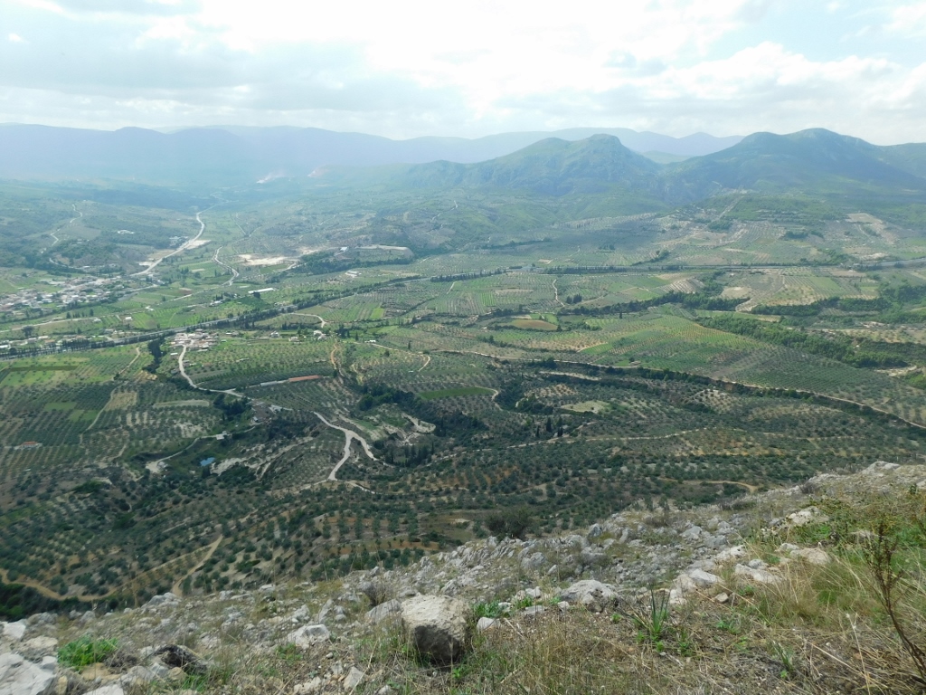
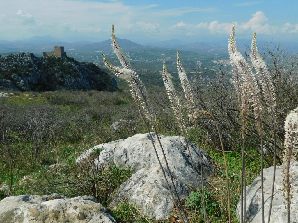
To start with, I drove up the hill and after leaving the car in the parking area, I began my visit on foot. However, I first went to a spot from which you can see a part of the views that stretch around from Acrocorinth.
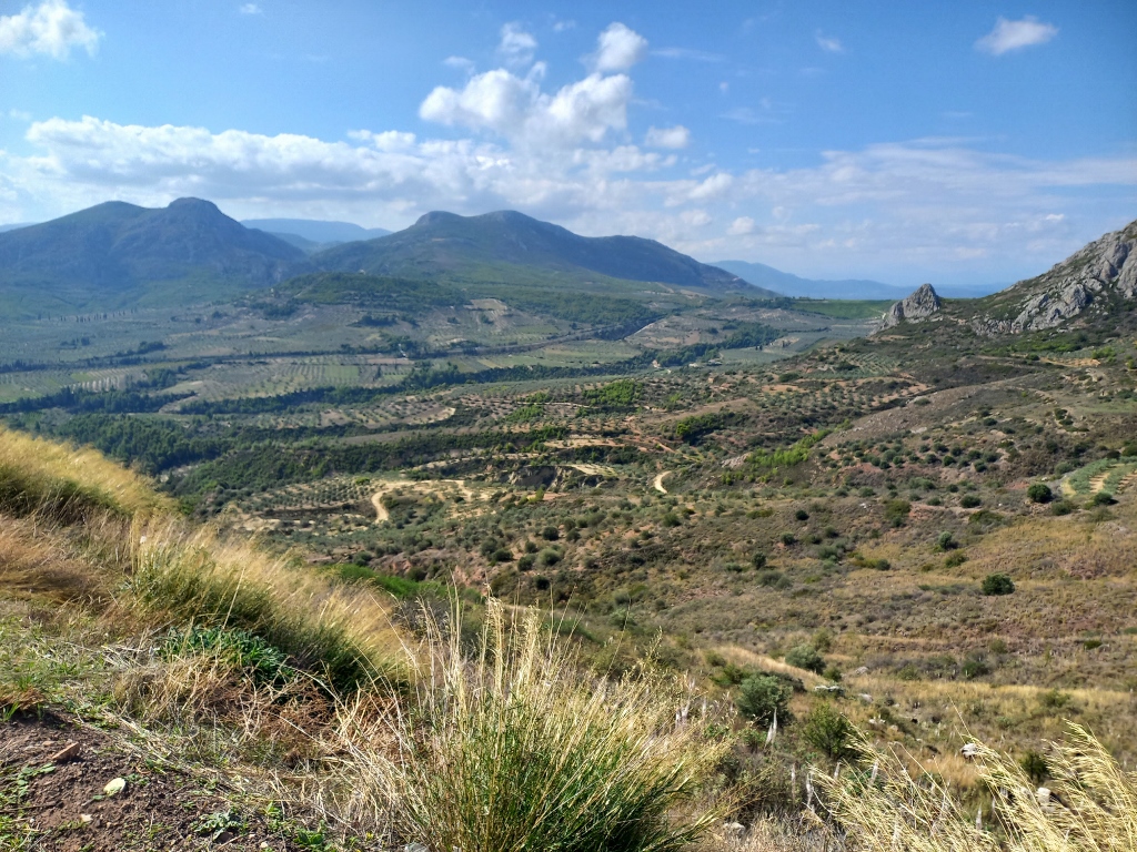 View from the hill topped by Acrocorinth
 View from the hill topped by Acrocorinth
Even when I moved a little, almost from every spot, the surroundings of Acrocorinth were clearly visible.
 View from the hill topped by Acrocorinth
Acrocorinth was initially an ancient Greek polis and then occupation began. The Romans came and built a citadel, which the Byzantines later developed into a fortress. In 1210, the Franks arrived, while in 1358, the Florentines took over the fortress. After that, the Byzantine Palaiologoi from Mystra and the Knights of Rhodes ruled here, until the Ottomans arrived in the 15th century (with a brief period of Venetian presence from 1687 to 1715). This remained the case until the early 19th century and the Greek War of Independence and liberation.
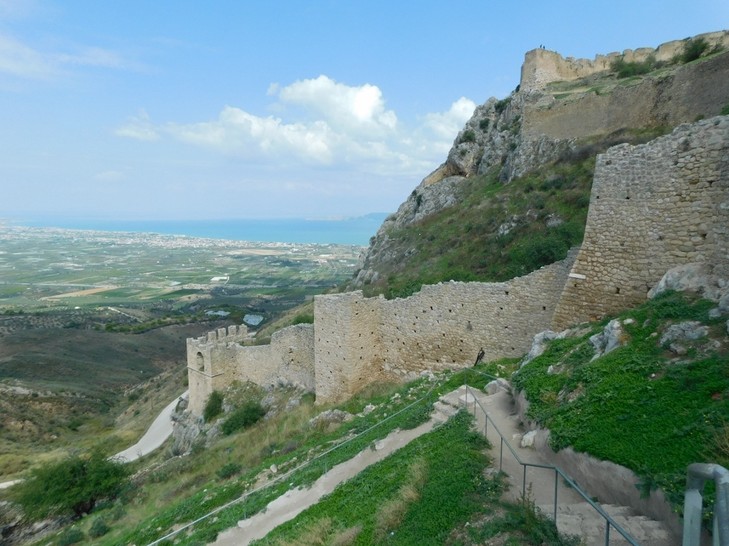
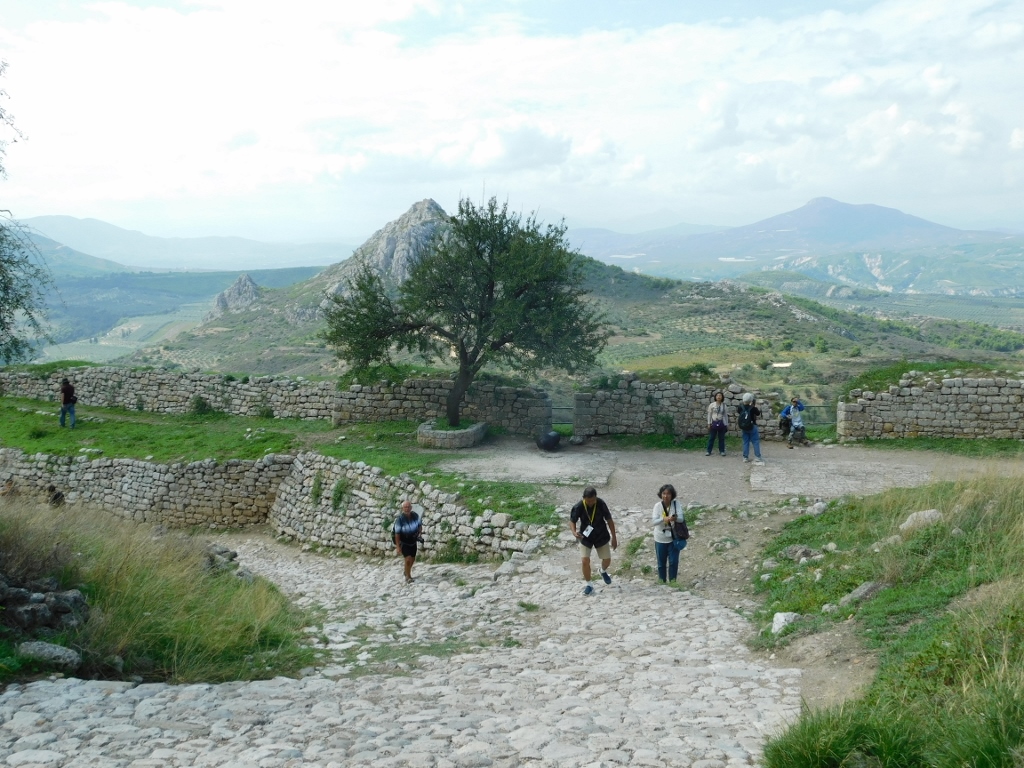
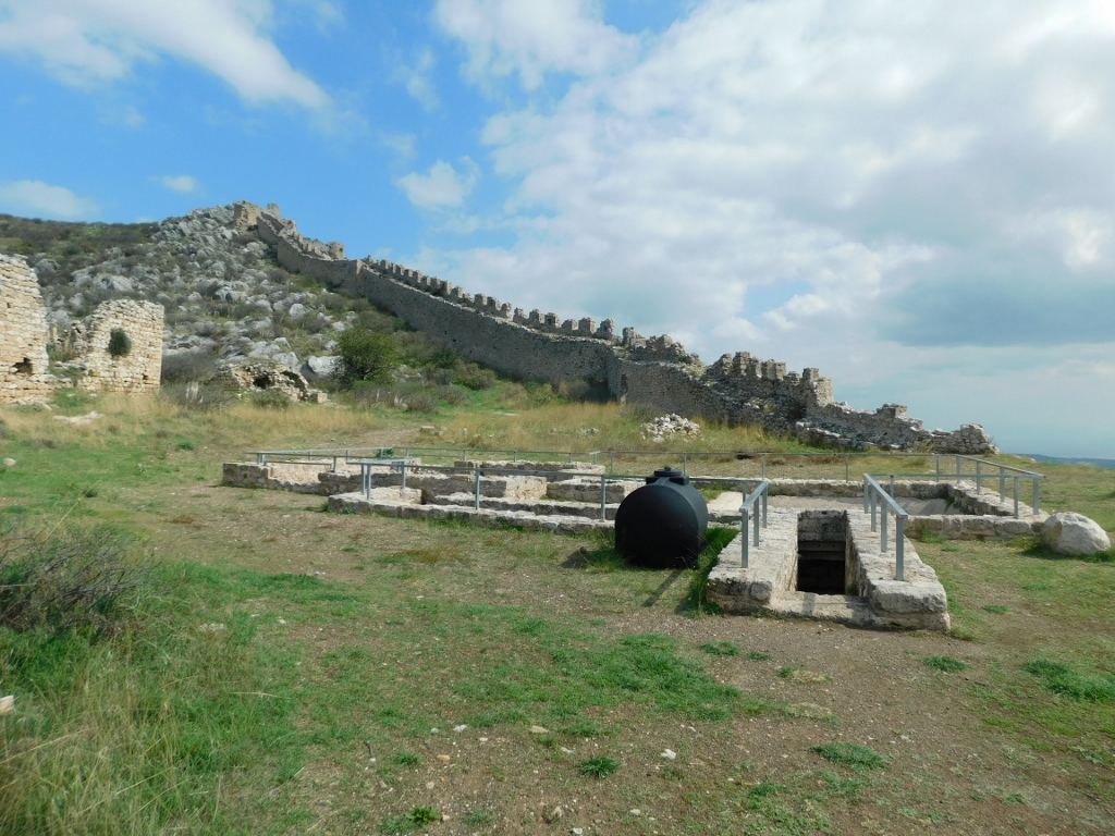
The fortress had three lines of defence and consequently three gates, with the ascent starting right from the parking lot.
 Acrocorinth
Tickets are sold at the first gate, which was built in the 14th century.
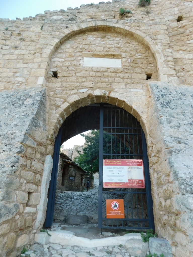 Acrocorinth, the First Gate
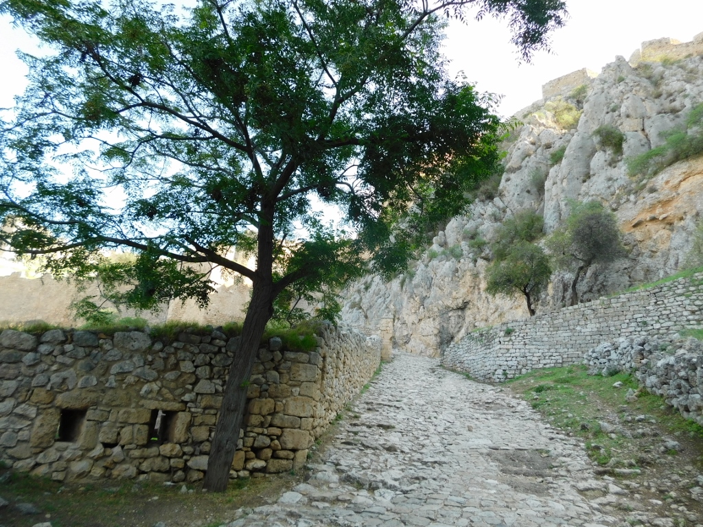
From there, the ascent continues, leading to the second gate.
 Acrocorinth, a detail
The second gate was also built in the 14th century, but it was almost entirely restored by the Venetians during their brief rule. Next to this gate is a tower.
 Acrocorinth, the Second Gate
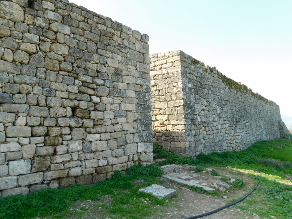
After passing through the second gate, I stopped to look around and from there I could see parts of the fortress on the surrounding slopes. The skill in integrating the fortifications into the occasionally almost vertical cliffs was truly impressive, even for me, someone who isn’t particularly interested in military fortifications, except as cultural monuments.
 Acrocorinth, a detail
From the second gate, a wide path begins, but you can also exit onto the ramparts from there.
 Acrocorinth, a detail
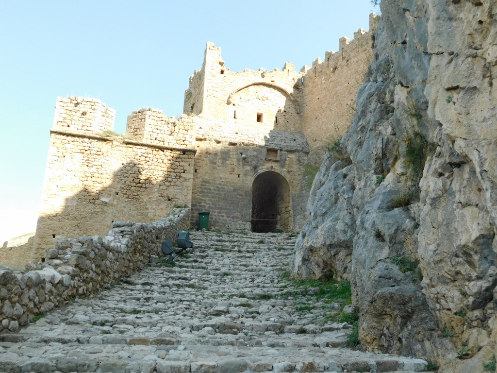
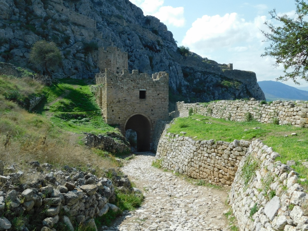
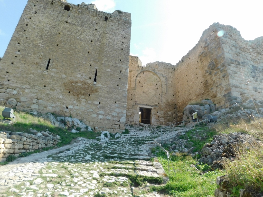
Continuing further, I reached the third gate, whose sides are guarded by two massive towers. Interestingly, the one on the right dates back to the ancient times (4th century BCE), while the one on the left was built by the Byzantines.
 Acrocorinth, a detail
This part was especially steep, so I struggled and was out of breath as I climbed. That's why it was perfect to stop, turn around and, while I started to regain some oxygen in my body, I took a moment to capture the view of the surroundings.
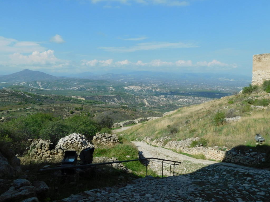 View from the area in front of the Third Gate
After passing the third gate, you enter the inner area of the fortress. There, I was greeted at first by the song of a western rock nuthatch (Sitta neumayer).
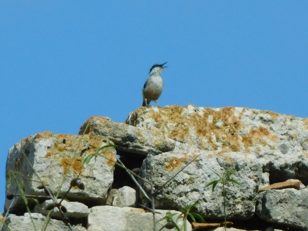 Western rock nuthatch
In this area there was the old Ottoman district. On the right and left sides of the path, you can see the remains of former buildings. One used to be Turkish baths and the other a mosque.
 Acrocorinth, a detail
 Acrocorinth, a detail
In the previous picture, you can see the Church of St. Demetrius a bit further ahead. I didn't go there because there was still a lot of climbing ahead of me.
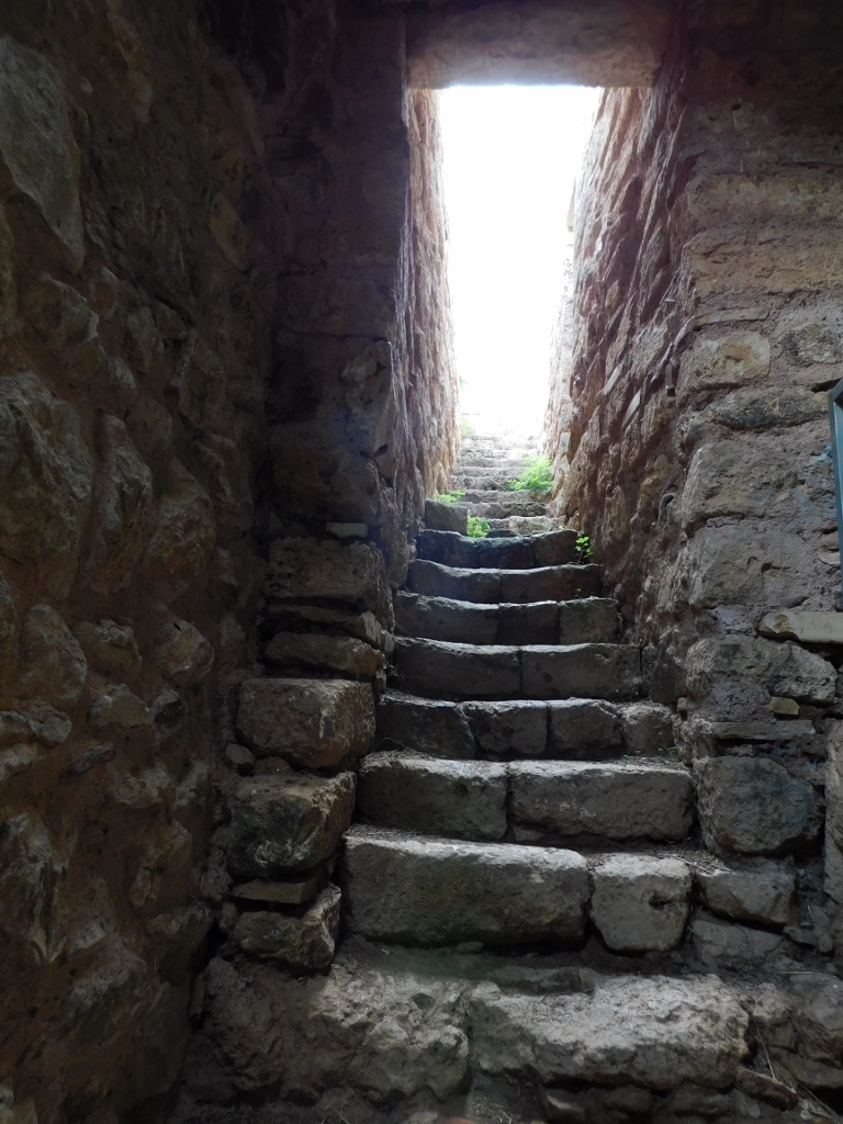
The path first led me to underpinned parts and, between them, there is a passage, that is, stairs that lead to a flat, fairly wide plateau.
 Acrocorinth, a detail
From there, I had a good view again of the Church of St. Demetrius and the surrounding area, as well as the large mosque.
 Acrocorinth, a detail
 Acrocorinth, a detail
On this wide plateau, there are also remains of a former minaret, while at a rise, there is the keep.
 Acrocorinth, a detail
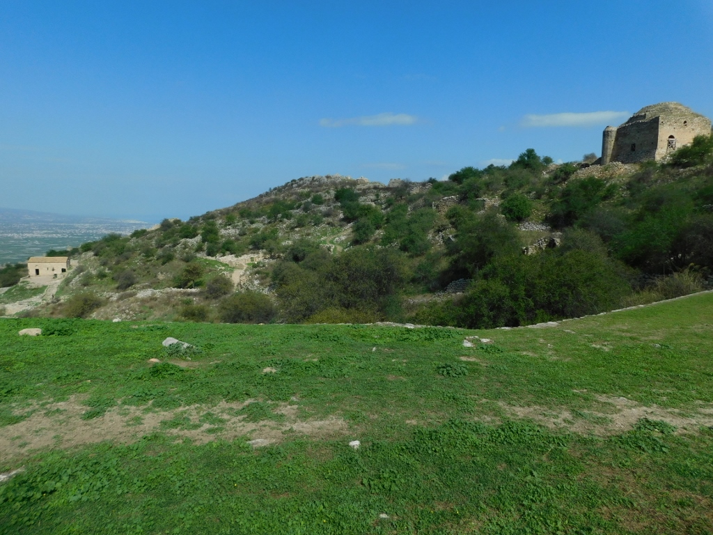
The elevation where Acrocorinth is located essentially has two peaks – one is where the keep stands, while the other, the higher one, holds the remains of a sanctuary dedicated to Aphrodite. After all the walking from the previous day, I still felt a certain fatigue, so it was clear to me that I wouldn't be climbing to both peaks. It was simply easier to decide where I would go – although she had long since lost her voice, Aphrodite clearly called me.
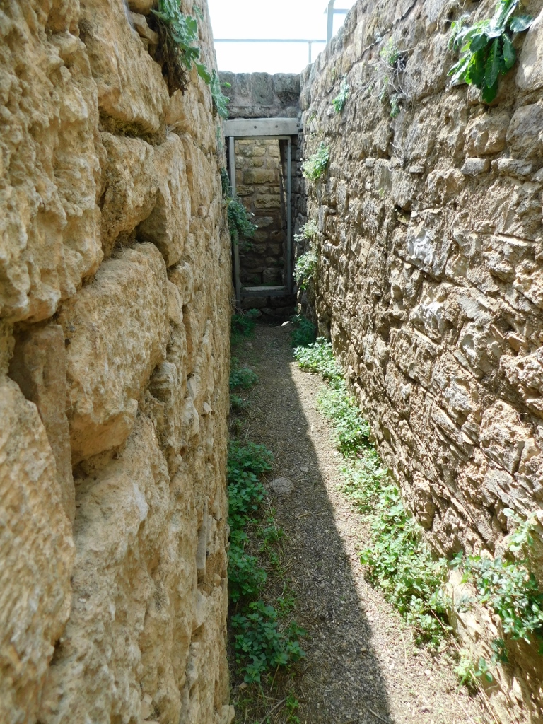
However, before that, I went toward the south-eastern end of the site, where a very important part of the entire fortress is located. Along the way, I occasionally took photos – some of the surroundings, some of the details I noticed.
 Acrocorinth, a detail
For instance, the sea squill plant (Drimia maritima) that grows in several places here.
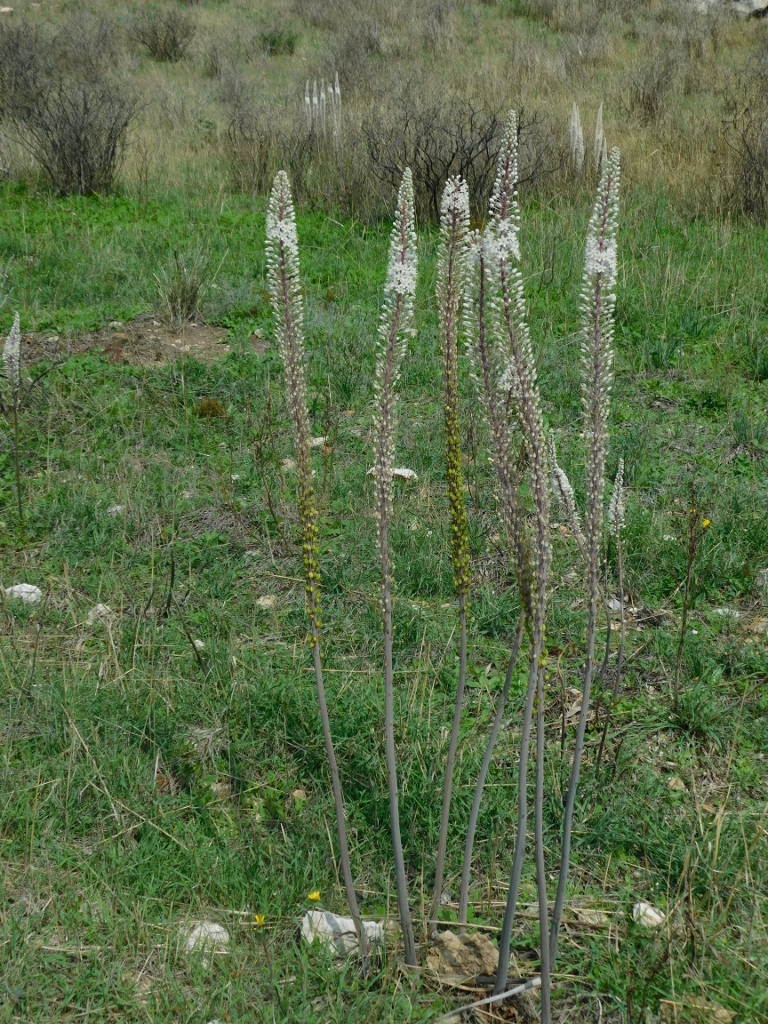 Sea squill
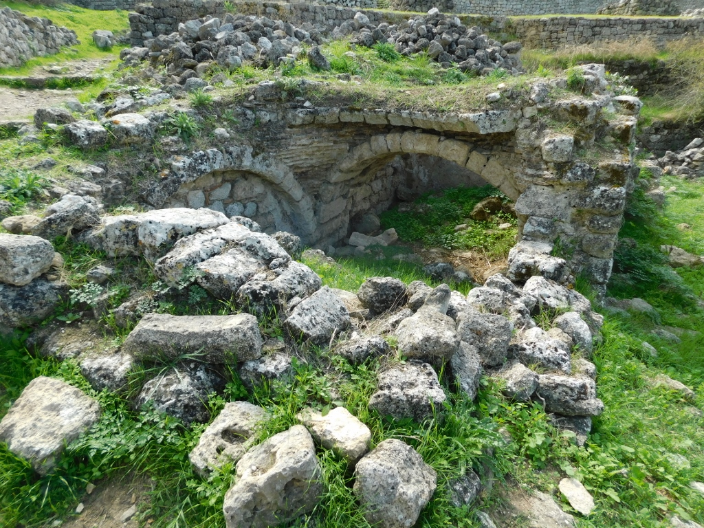
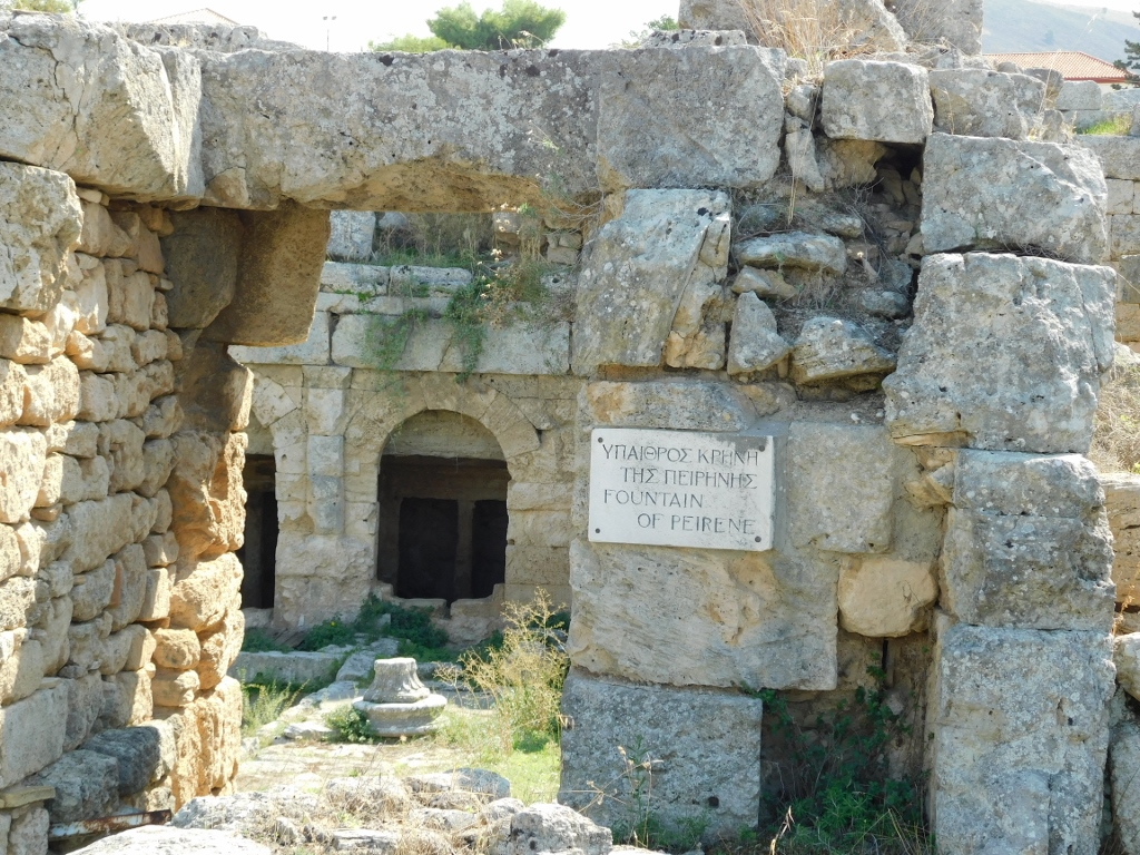
What interested me here was the Upper Peirene Spring, which according to legend was created when the mythical winged horse Pegasus struck the ground with his hoof, while he would often fly here to drink from it.
 Acrocorinth, a detail
Today, here, buried in the ground, you can see the remains of a Hellenistic structure, with some Roman elements, and certainly others must have added to it over time, as the spring still provides water year-round. For any fortress, a regular water supply was of crucial importance. In any case, I took a pleasant walk there. On the left side of the previous photo, you can see a part of the Venetian barracks, while further along, parts of the ramparts are visible.
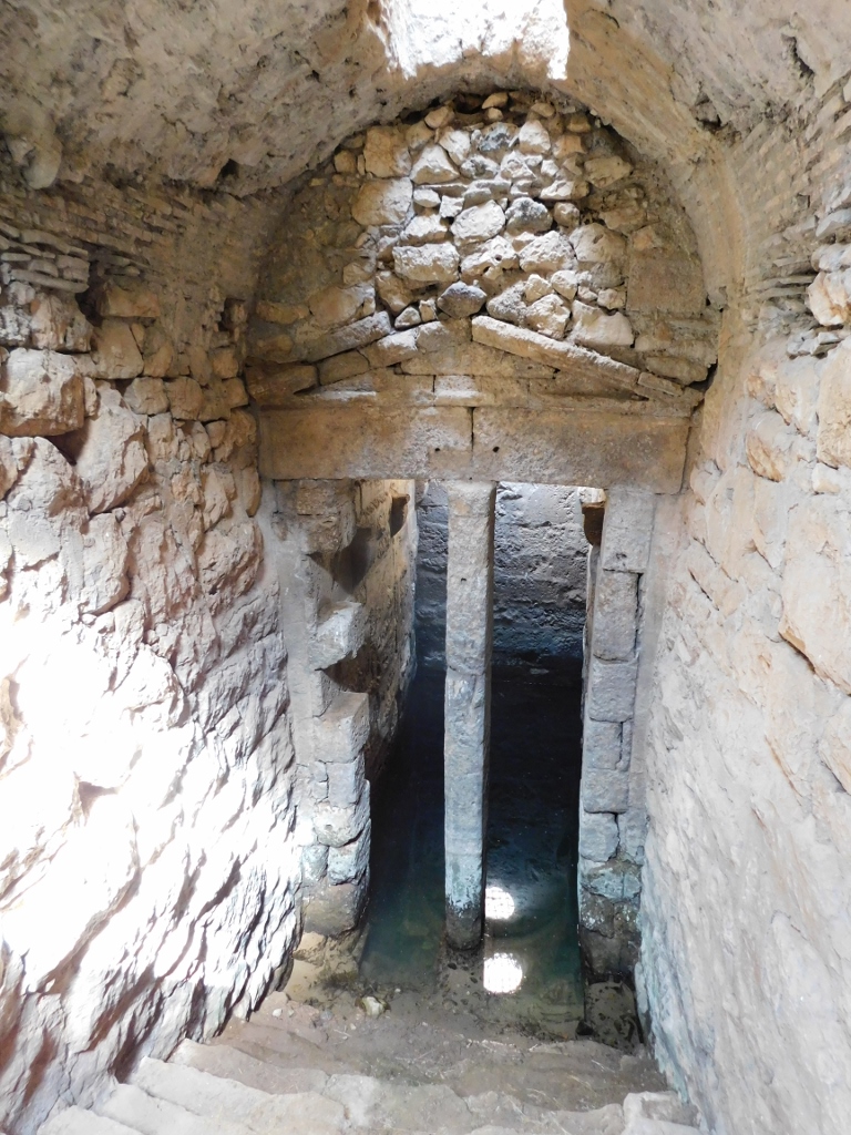 Upper Peirene Spring, a detail
 Upper Peirene Spring, a detail
 Upper Peirene Spring, a detail
 Upper Peirene Spring, a detail
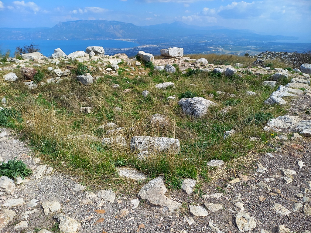
From here, I also had a brilliant view of the surroundings.
 Acrocorinth, a detail
 Acrocorinth, a detail
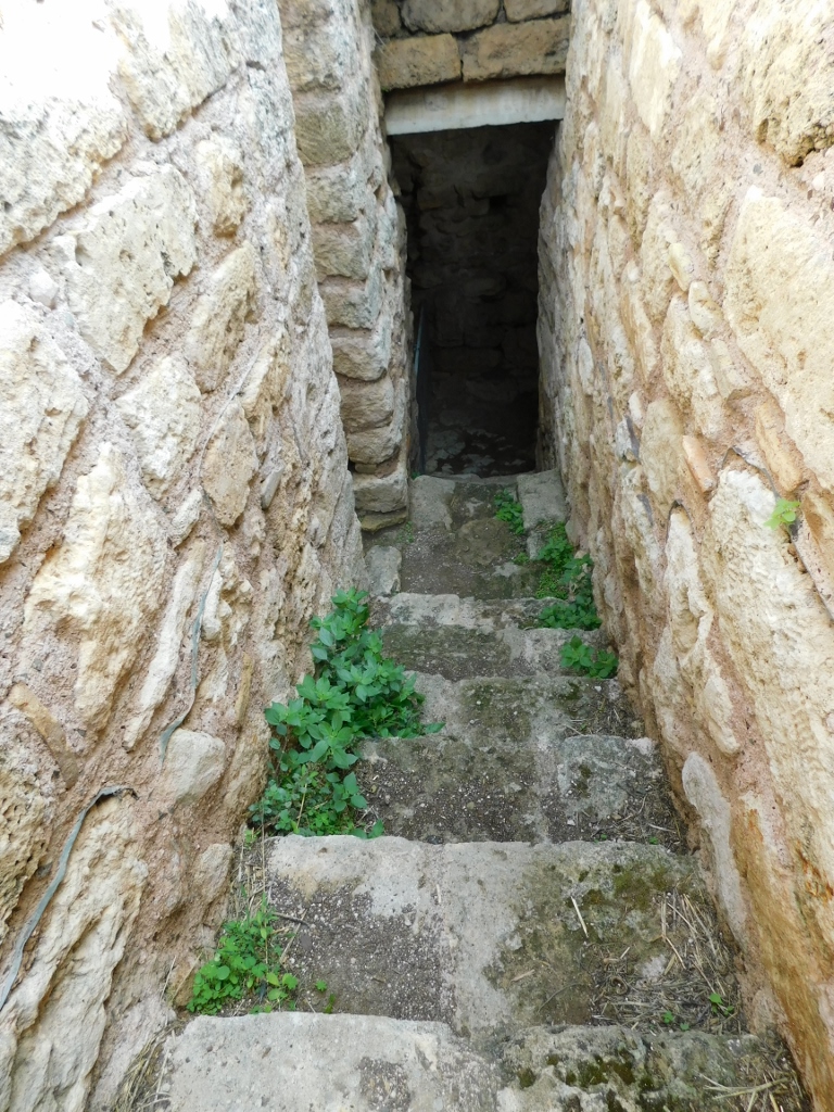
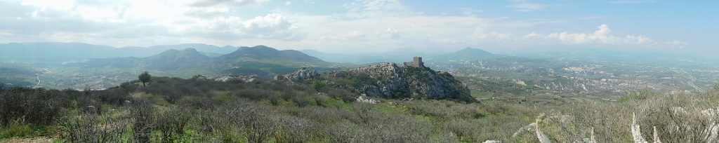
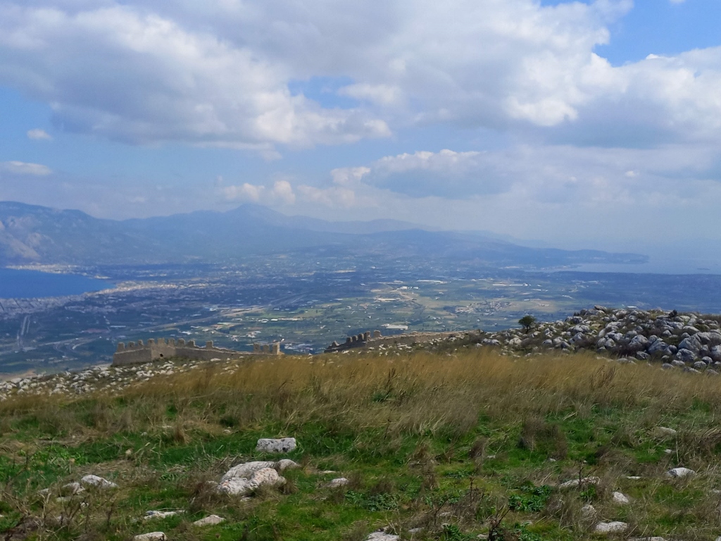
Now, I took one of the paths heading towards the highest peak of Acrocorinth, which is located in the north-eastern part of the site.
 Acrocorinth, a detail
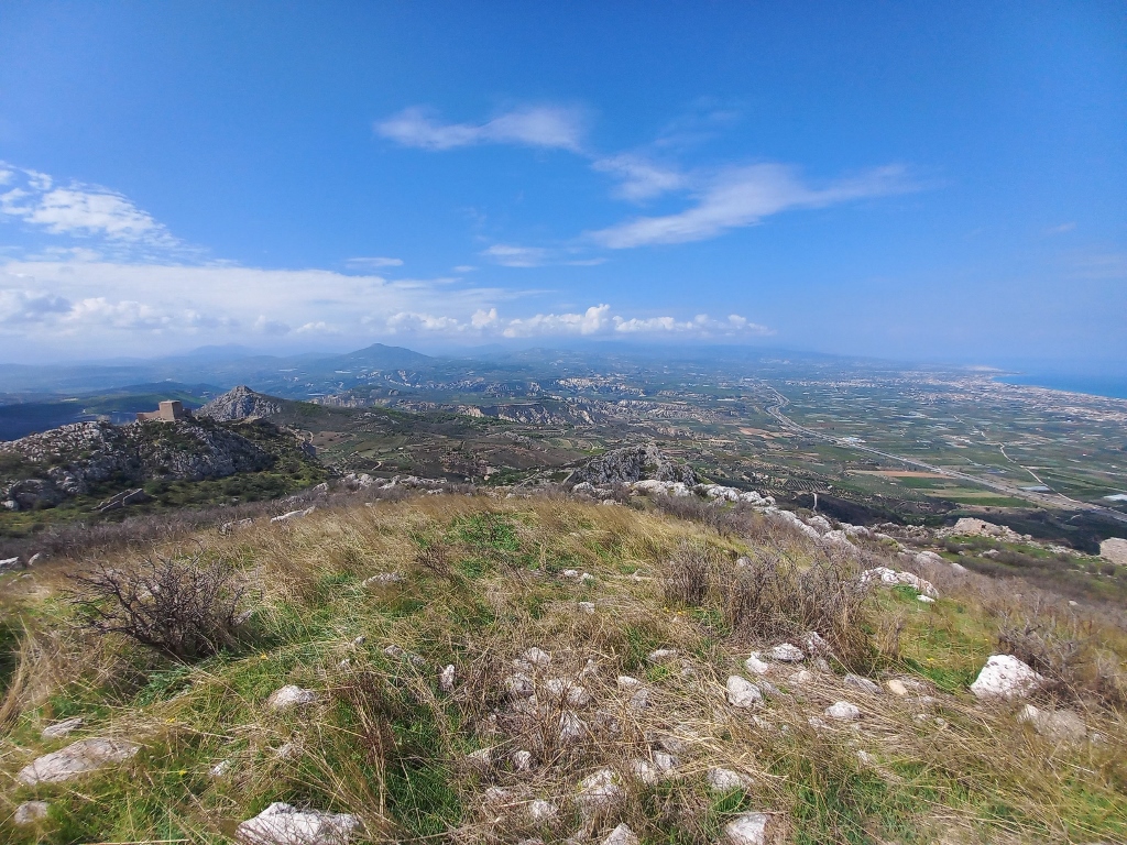
Along the way, I occasionally stopped to capture the surroundings. I must say again that visiting Acrocorinth is quite a strenuous activity due to all the climbing, but it is absolutely worth it.
 Acrocorinth, a detail
 Acrocorinth, a detail
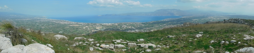
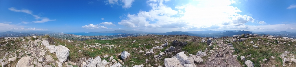
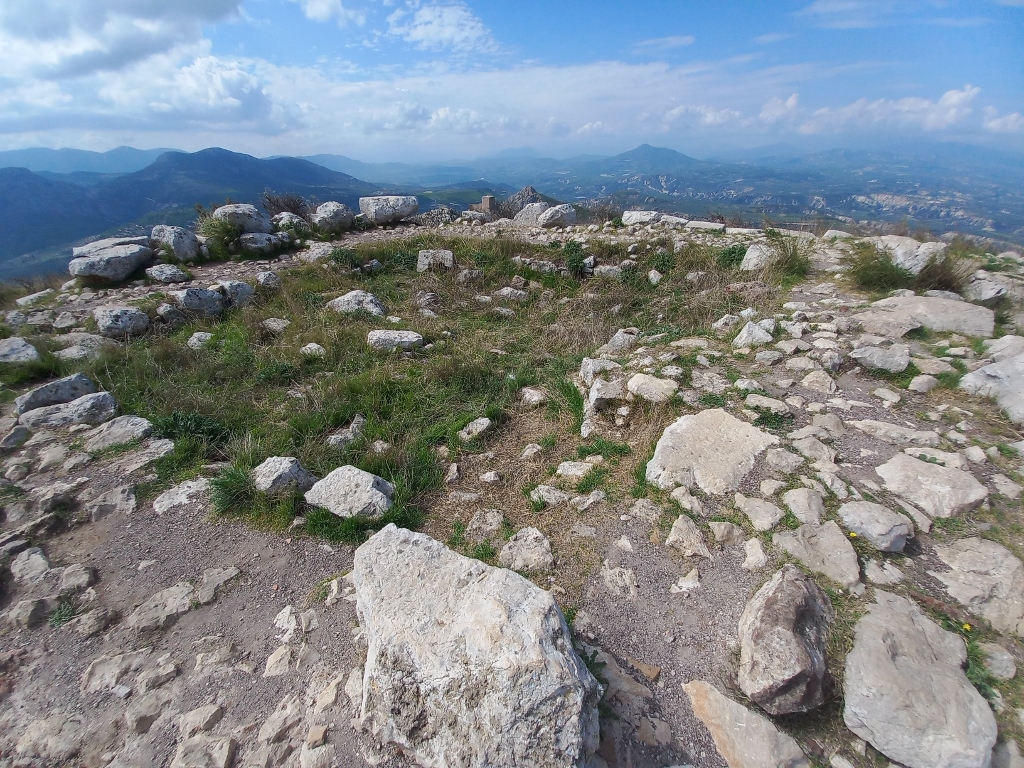
When I reached the top, I first took photos of some parts of the surroundings, while the views extend all around.
 Acrocorinth, a detail
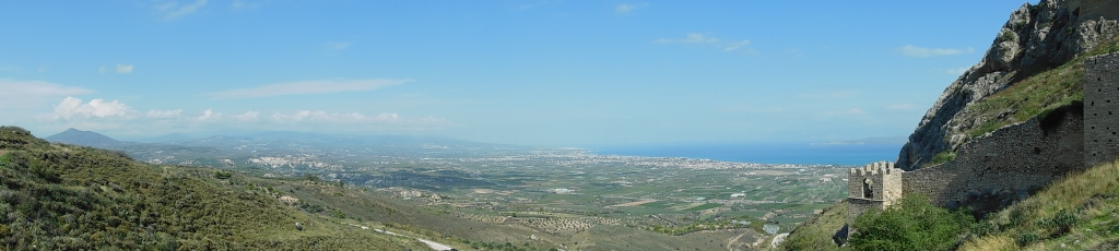
The view towards the Isthmus of Corinth is especially interesting and quite important. The position of the fortress on this elevation provided an excellent vantage point to monitor anyone crossing from mainland Greece to the Peloponnese.
 Acrocorinth, a detail
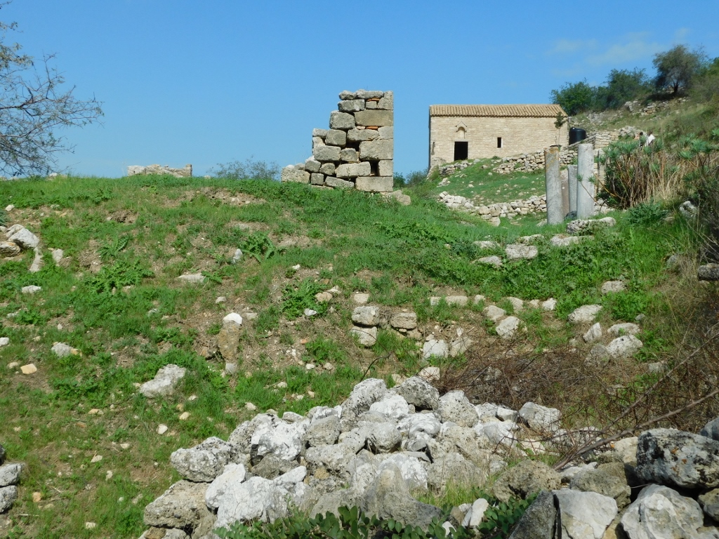
During the past times, here at the top of the Corinthian acropolis, or Acrocorinth, there was the previously mentioned sanctuary of the goddess Aphrodite, as well as an early Christian basilica, a tower at the north-eastern end of the fortress, and an Ottoman tomb. Remains of all these can still be seen today.
 Acrocorinth, a detail
 Acrocorinth, a detail
 Acrocorinth, a detail
After a brief stay at the top, I began to descend slowly, passing through practically the same parts of Acrocorinth that I had walked through on the way up.
 Acrocorinth, a detail
I returned to the parking lot, got in the car and then drove down to the remains of Ancient Corinth, specifically to the parking area near the site.
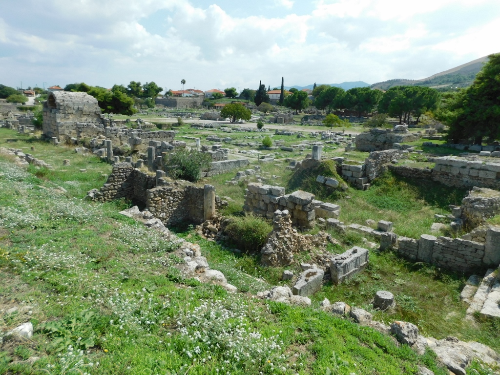
First, I took a path into the area to the northwest of the official site, where the remains of the theatre and some other buildings from Ancient Corinth can be found. On the plot to the south of this area, you can also see much better-preserved remains of the Odeon of Ancient Corinth.
 Remains of the theatre of Ancient Corinth
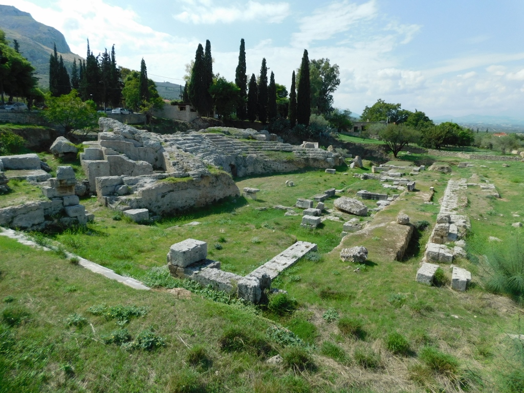 Remains of the Odeon of Ancient Corinth
However, the main part of the site is on the other side of the street, where you first need to buy a ticket before starting the tour. The first structure you encounter is the Fountain of Glauke, named after the daughter of the Corinthian king Creon, the unwed second wife of the ancient Greek hero Jason. The fountain was not built over a natural spring; instead, it received its water through pipes coming from a different source.
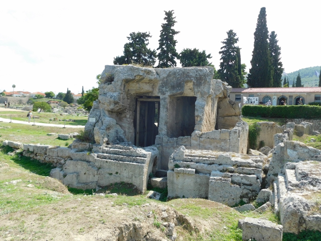 Fountain of Glauke
Ancient Corinth was one of the most powerful city-states in ancient Greece. The site has been continuously inhabited from the Neolithic to the Byzantine period, and it also expanded its influence by founding colonies on the islands in the Ionian Sea and in southern Italy.
But Corinth is not just a part of history, it is also a part of mythology. The hero Bellerophon, who killed the Chimera, was born here, while his grandfather was none other than the founder and king of Corinth – Sisyphus (!) who is probably still performing his Sisyphean labour, futilely pushing his stone uphill.
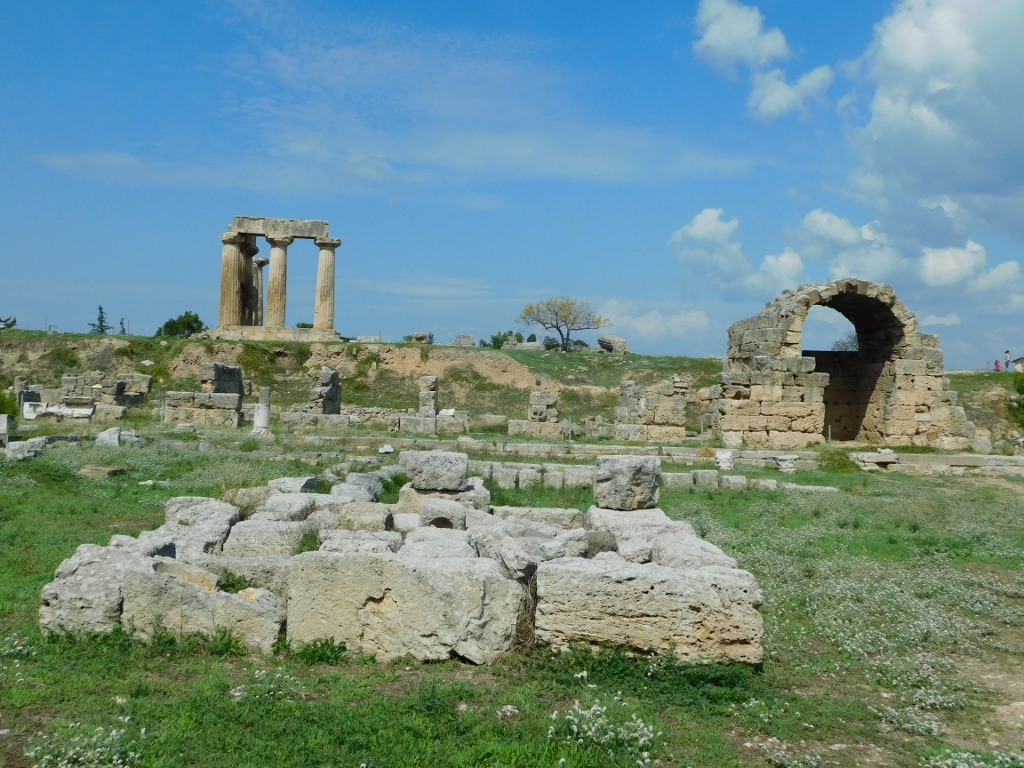
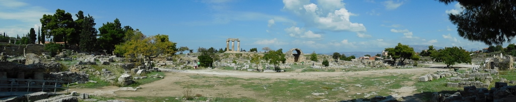
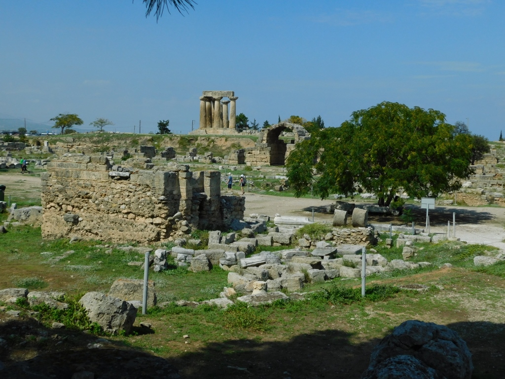
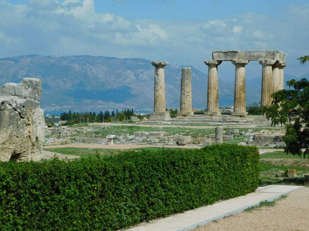
The main part of today’s archaeological site includes the agora, within which are the remains of a Doric temple dedicated to Apollo from the mid-6th century BCE.
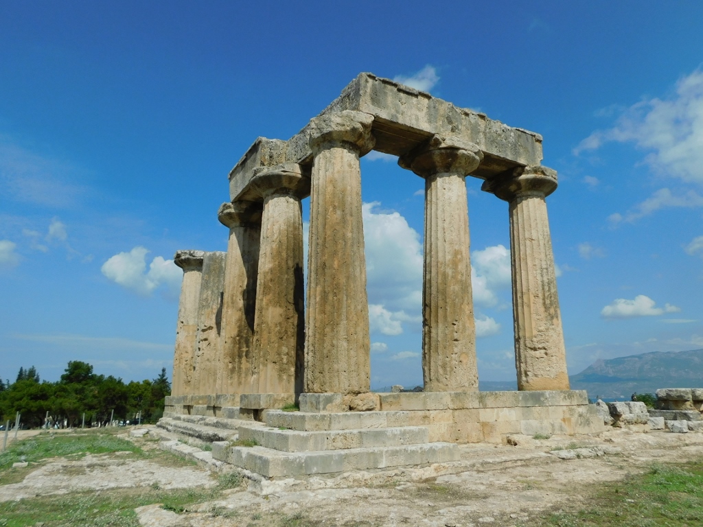 Temple to Apollo
Back in the day, the temple had 38 monolithic columns, but today only 7 have survived and these are the ones that were located at the rear of the temple.
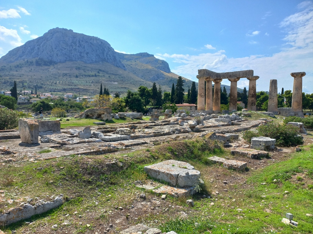 Temple to Apollo, remains of Ancient Corinth and Acrocorinth
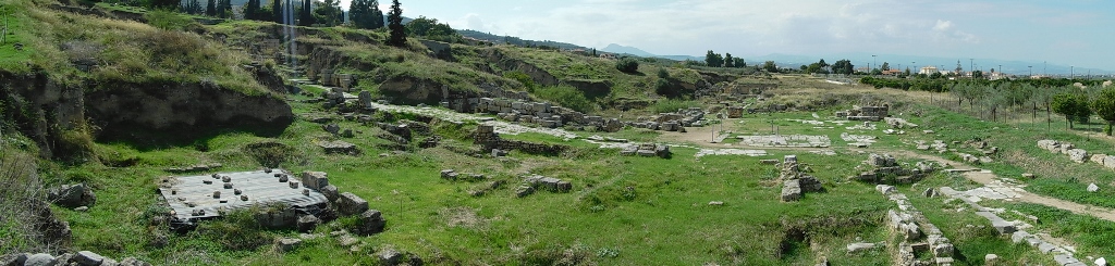
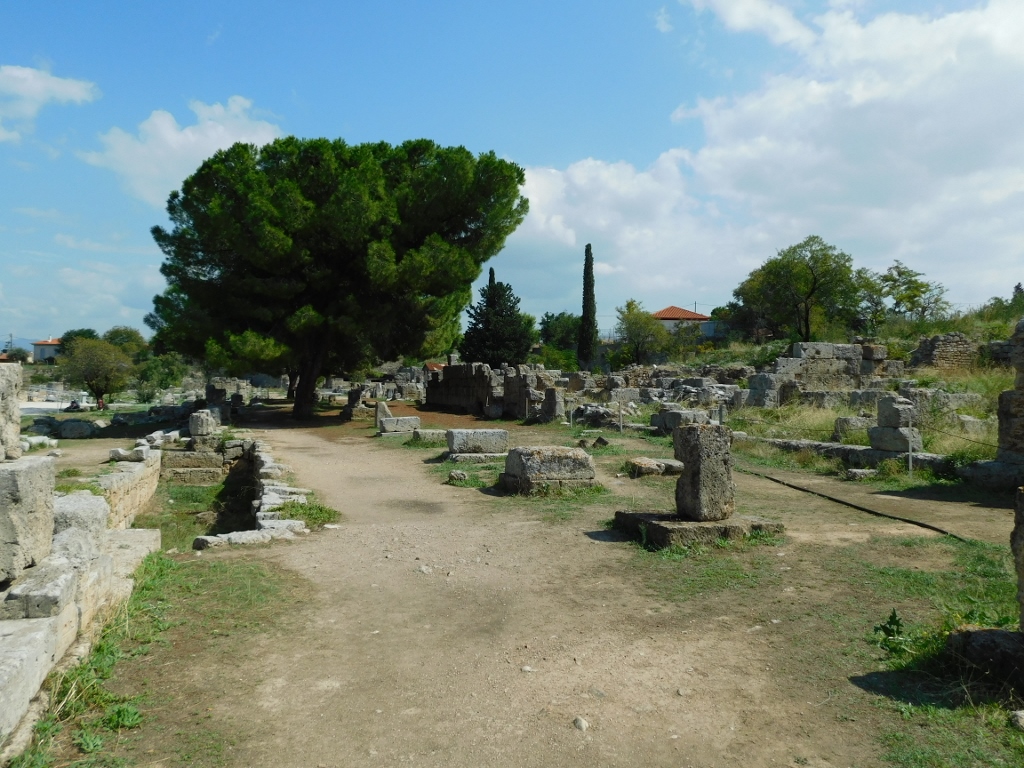
Then I began to stroll slowly around the site, which meant that I descended a set of stairs to the lower part of the agora.
 Ancient Corinth archaeological site
Among other things, there are the remains of the Sacred Spring, where steps descended to an underground water spring that likely also served as part of the oracle.
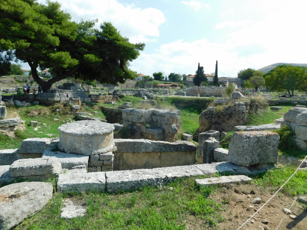 Sacred Spring
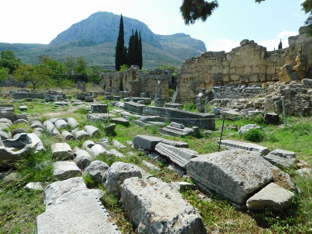
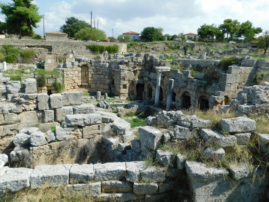
On the northern side of the agora, beneath the elevation where the Temple of Apollo stands, are the remains of 15 Roman shops, one of which still has a roof.
 Ancient Corinth archaeological site
 Ancient Corinth archaeological site
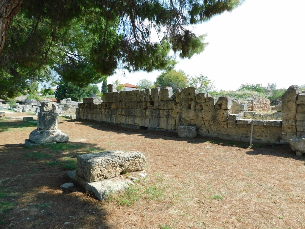
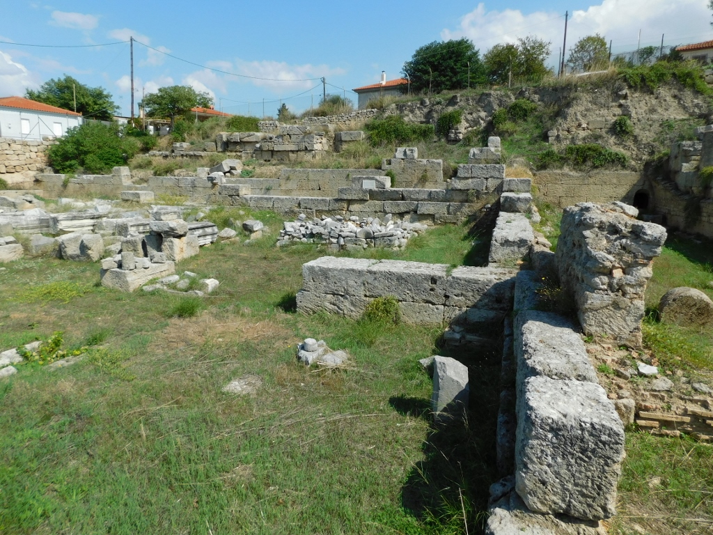
I walked around this part of the agora for a bit and then went to the southern part of the site, where I passed along the remains of the South Stoa.
 Ancient Corinth archaeological site
 Ancient Corinth archaeological site
The South Stoa, from the late 4th century BCE, was a large structure that the ancient Greeks used to house guests, while the Romans later established their administrative centre there. It was a massive building (164.38 m x 25.15 m) that had a portico, or colonnade, along its front (longer) side, consisting of 71 Doric columns, while in the middle there were 34 Ionic columns. The stoa was abandoned in the 6th century CE.
 Remains of the South Stoa
 Remains of the South Stoa
From here, there is a nice view of the agora and, a bit further, the Temple of Apollo.
 Ancient Corinth archaeological site
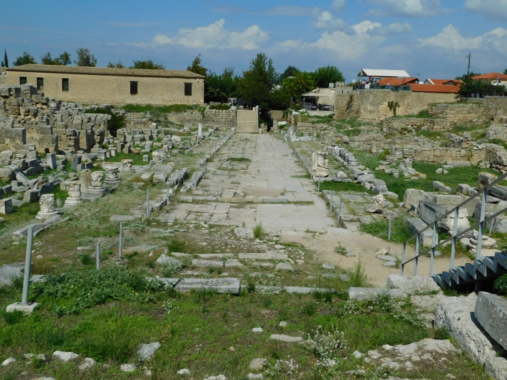
When you descend from the eastern end of the South Stoa back to the level of the agora, which over time became the Roman forum, you come across the remains of a platform that served as a speaker's platform, known as the bema. According to tradition, it was here that the Roman governor Gallio passed judgment regarding the activities of St. Paul.
 Bema
Bema
Namely, St. Paul travelled extensively throughout the eastern Mediterranean, spreading the word of God, and he stayed in Corinth, where he preached Christianity. His First and Second Epistles to the Corinthians are well known. Due to the significance of this place for Christianity, a church was built here during the Byzantine period.
 Bema
Bema
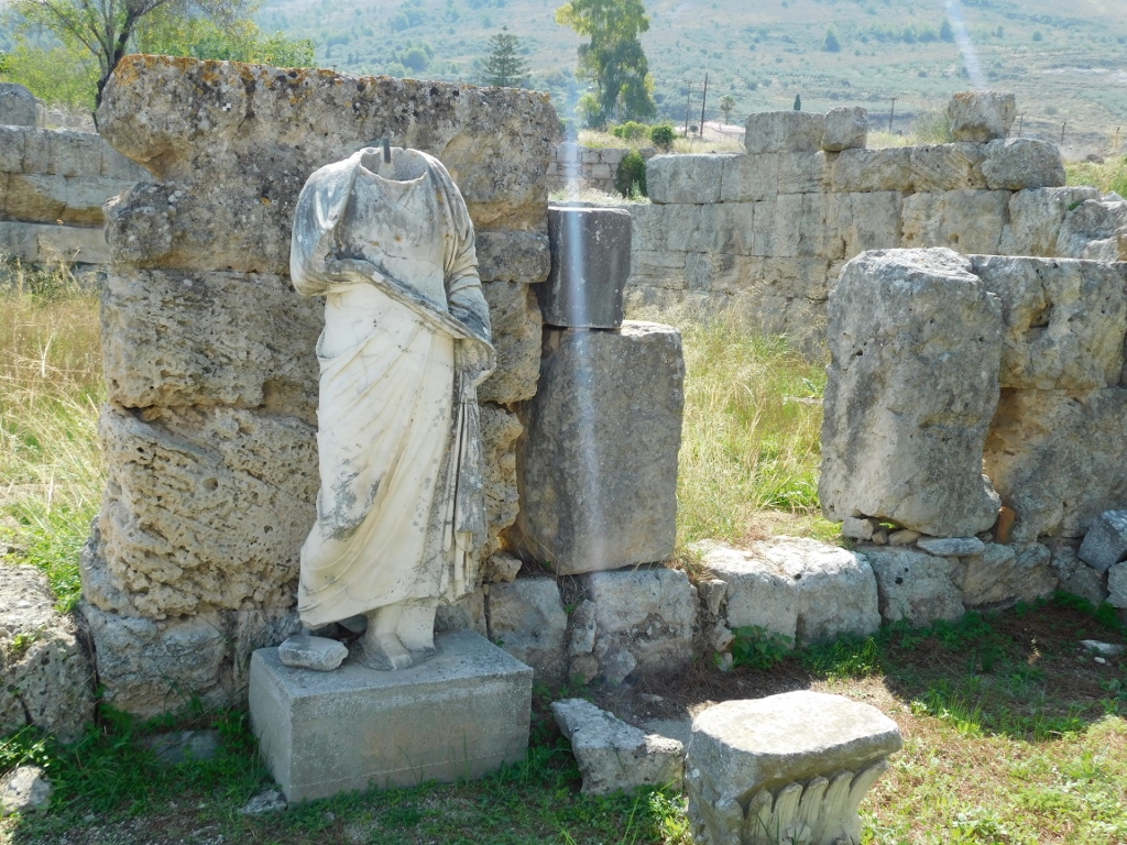
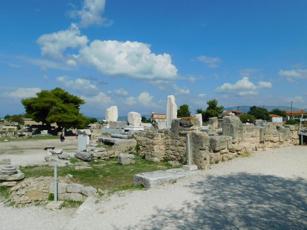
From here, I went to the remains of the Julian Basilica, which in Roman times was used as a court and a meeting place.
 Ancient Corinth archaeological site
From the plateau in front of the remains of the basilica, you can also see the much better-preserved remains of the Peirene Fountain, and here runs the Lechaion Road, which was actually the cardo maximus of Roman Corinth – the main street running north-south, also connecting Corinth with the coastline.
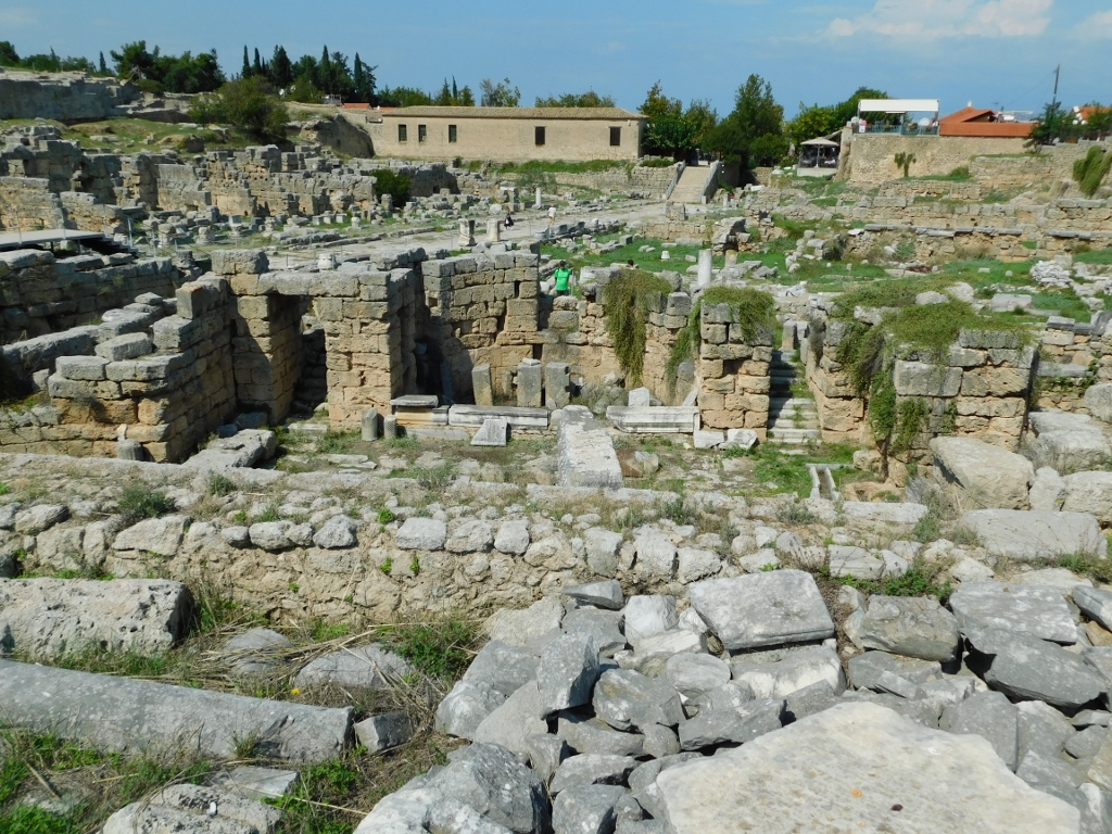 Ancient Corinth archaeological site
 Ancient Corinth archaeological site
 Ancient Corinth archaeological site
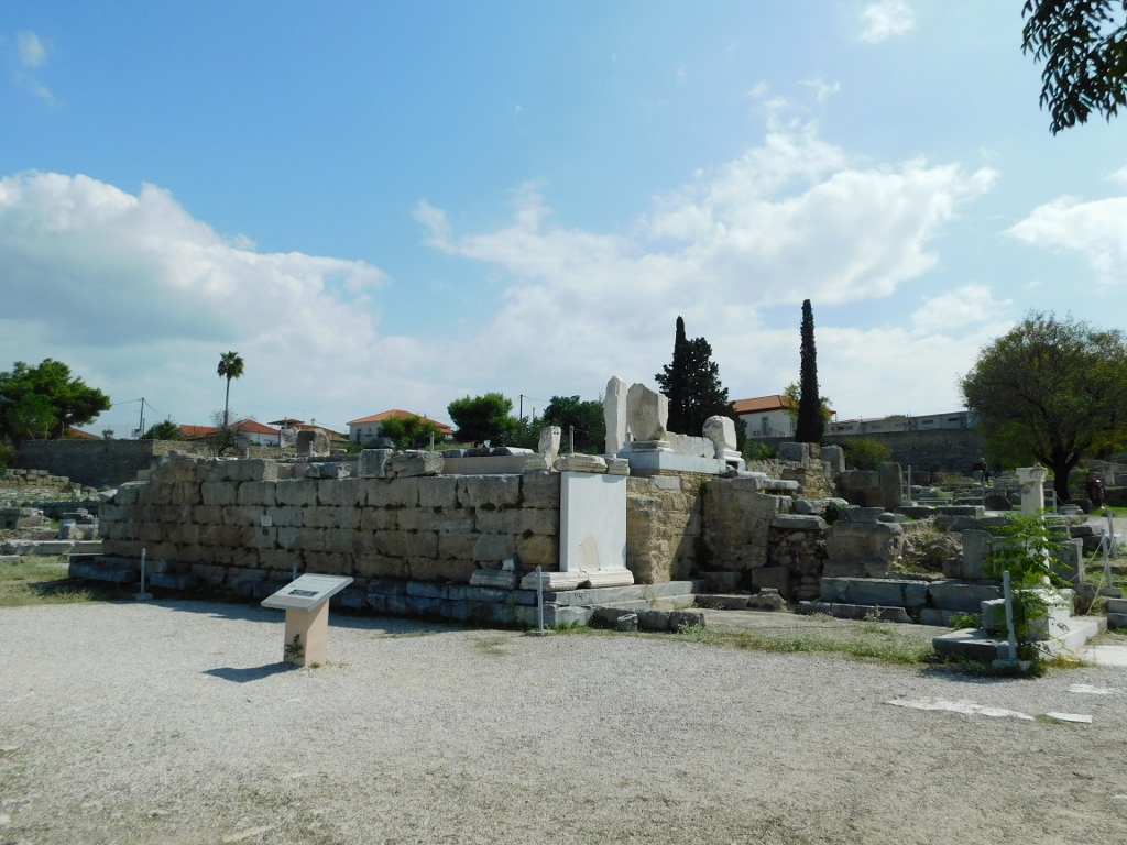
As for the Peirene Fountain, it was originally built in the 6th century BCE, but it was remodelled several times. There are underground reservoirs here, while during the Roman period, a nymphaeum was constructed – an impressive public fountain.
 Ancient Corinth archaeological site
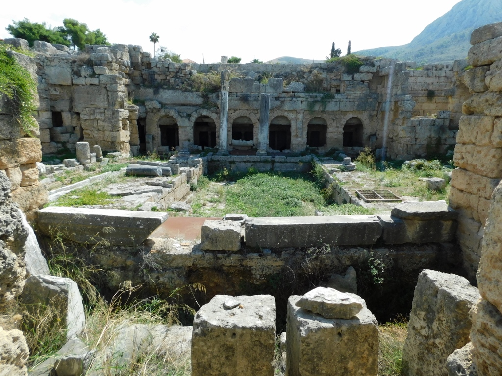 Ancient Corinth archaeological site
 Ancient Corinth archaeological site
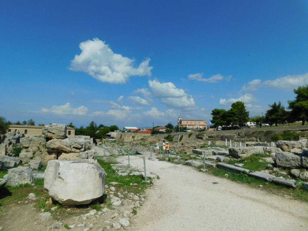
By this point, I was quite exhausted because it was very hot and I hadn't been drinking enough fluids. After all that climbing at Acrocorinth and now touring Ancient Corinth, I was eager to sit down somewhere and refresh myself. But since there was still the museum within the site to visit, I wondered what to do. So, I went to the exit of the site (at the end of Lechaion Road), and the kind women working there told me there was no problem and I could re-enter the site with the same ticket (since the restaurants and cafes were outside the site).
That's exactly what I did. After resting and rehydrating with some water and a refreshing drink, I returned to the site and headed to the museum.
 Ancient Corinth archaeological site
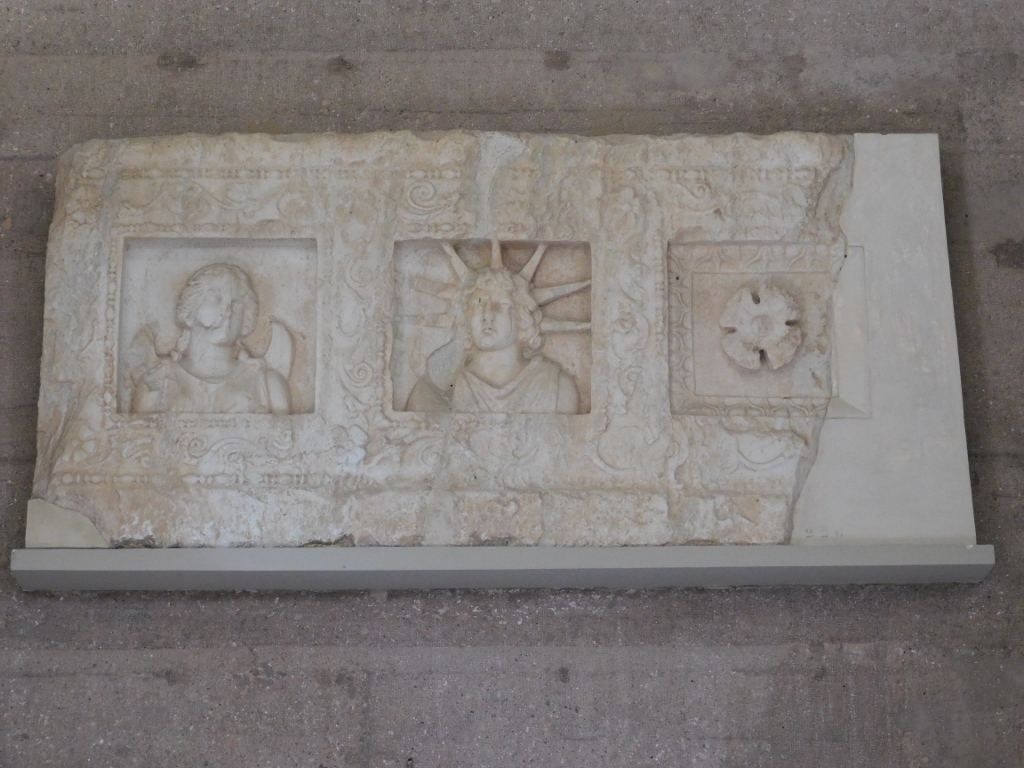
Although it's not very large, the Archaeological Museum of Ancient Corinth is very lovely and I really enjoyed seeing some of its exhibits.
 Archaeological Museum of Ancient Corinth, a detail
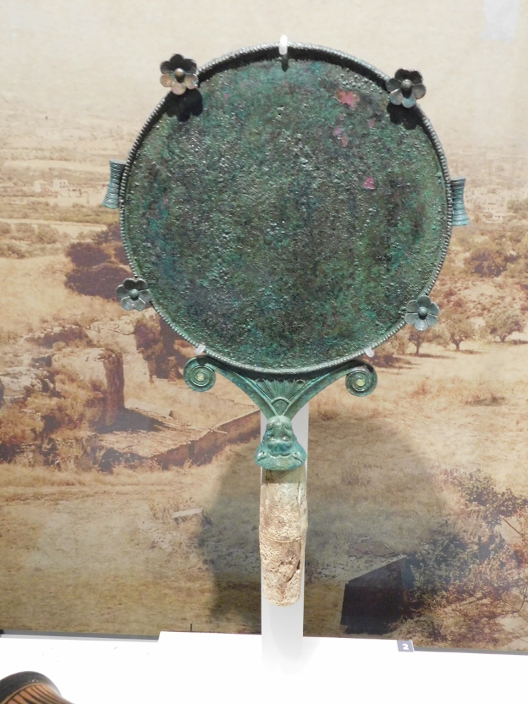 Bronze mirror from the 6th century BCE
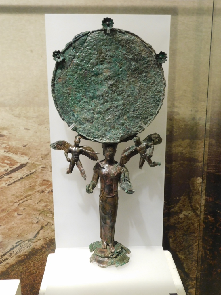 Bronze mirror from the 5th century BCE
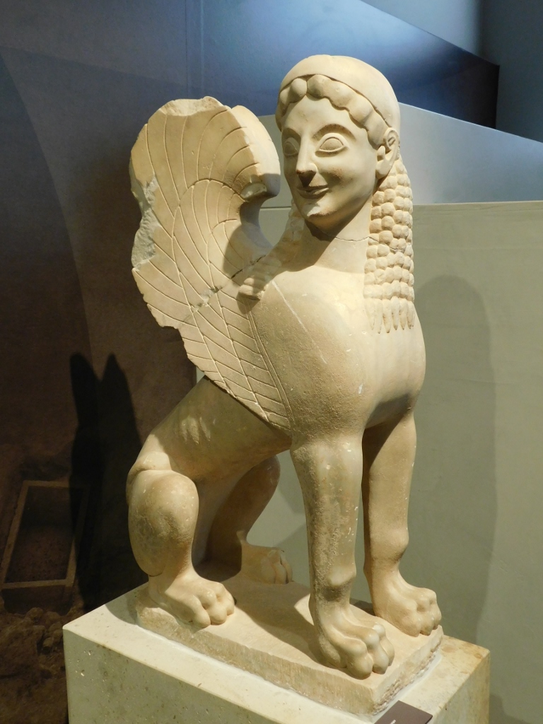 Marble funerary Sphinx, 575-550 BCE
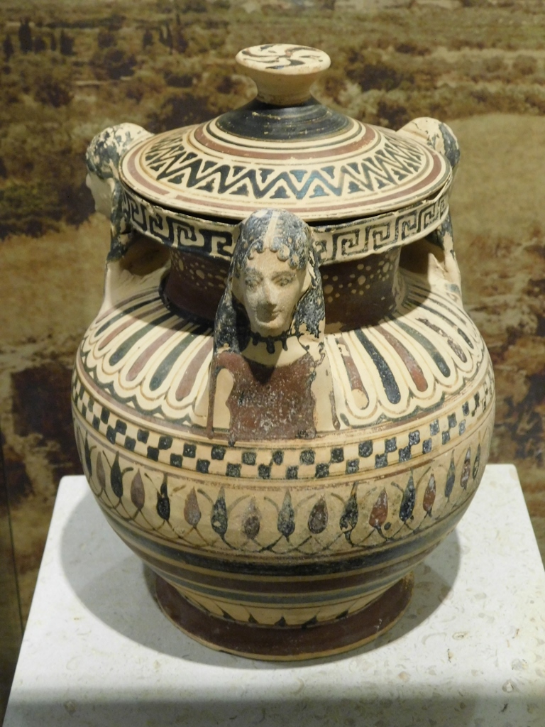
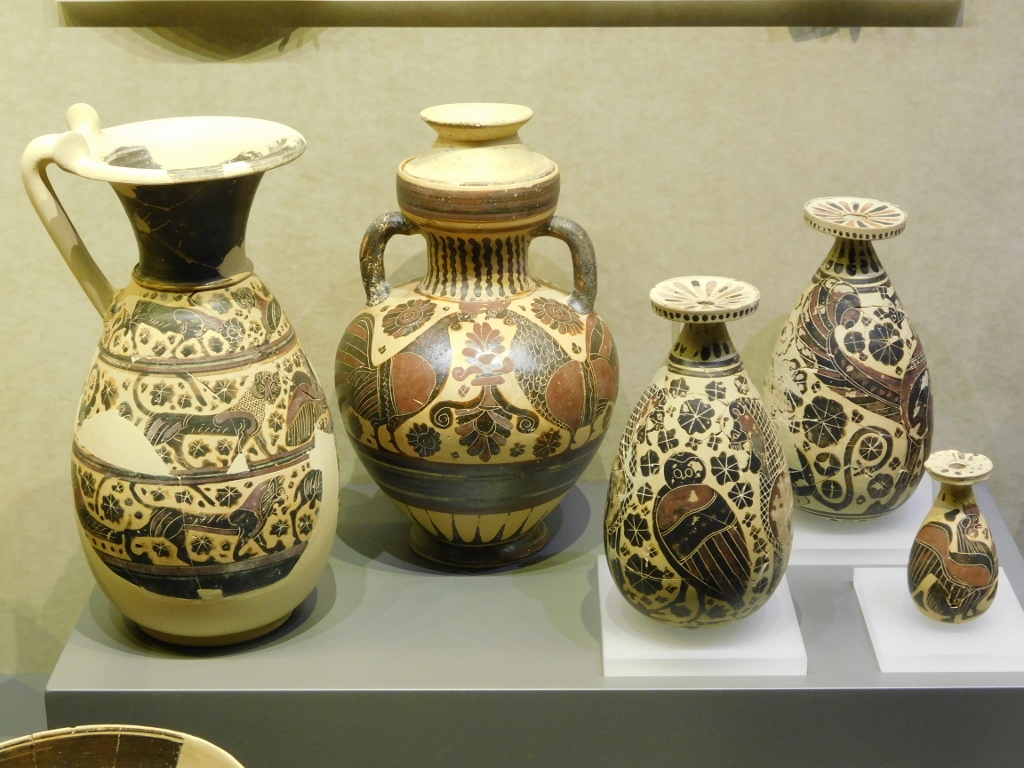 Pottery from the period 6th – 4th century BCE
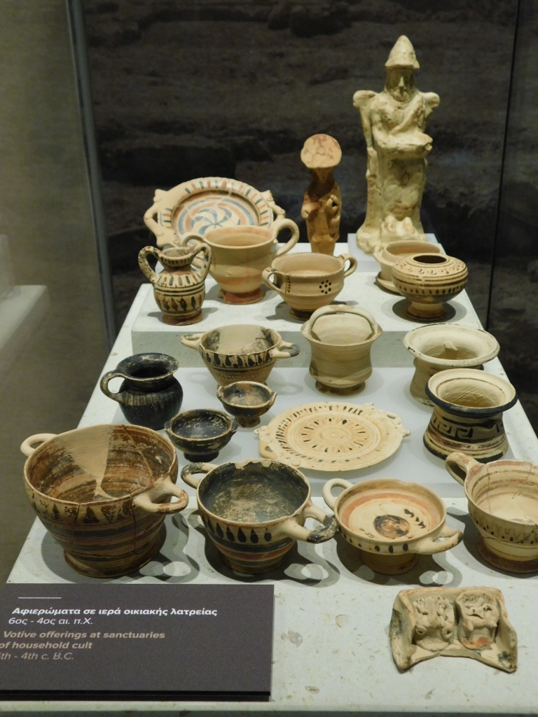 Pottery from the period 6th – 4th century BCE
One item that was particularly charming was a vessel used for feeding babies. In other words, it was a precursor to the modern baby bottle.
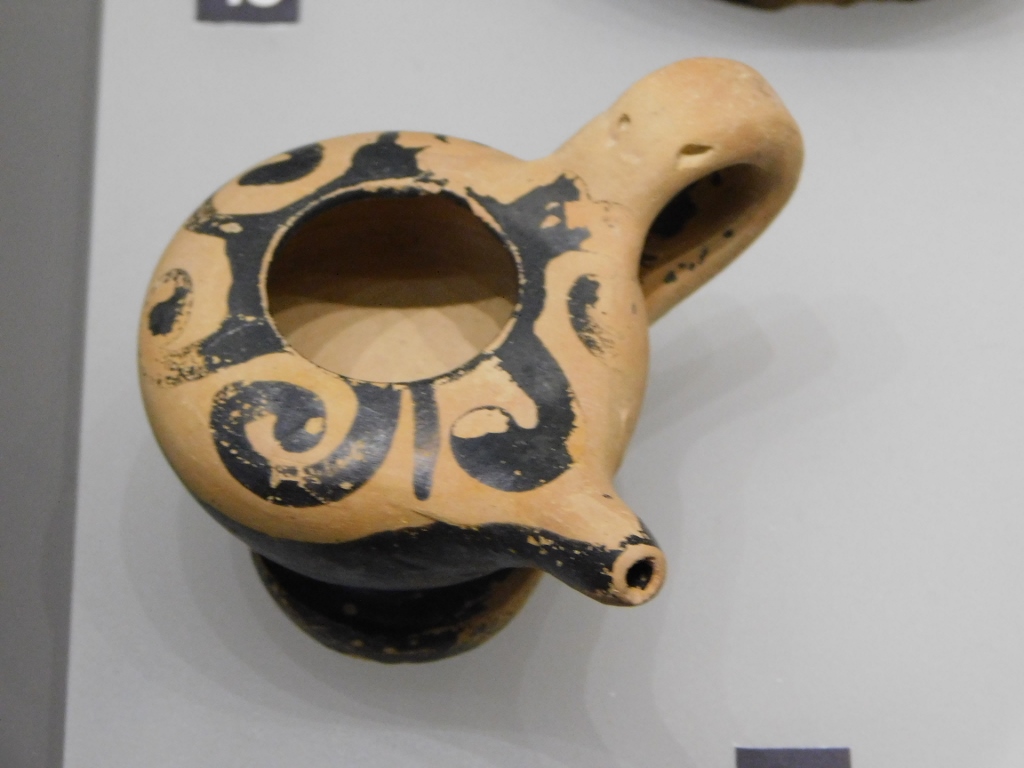 Archaeological Museum of Ancient Corinth, a detail
There are, of course, also exhibits from the Roman period.
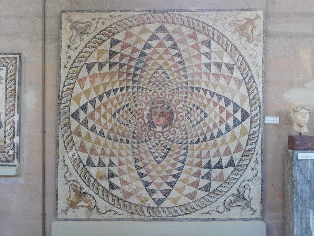 Central panel from the floor of a Roman villa, 150-300 CE
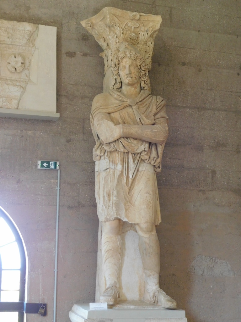 Colossal statue from the North Basilica, 2nd half of the 2nd century to the early 3rd century
 Part of the facade of the North Basilica, 2nd half of the 2nd century to the early 3rd century
It is interesting, or rather sad and tragic, that this museum was looted in 1990 when a large number of exhibits were taken. Some were discovered at the end of the decade in New York, while the majority was found in Miami in 1999.
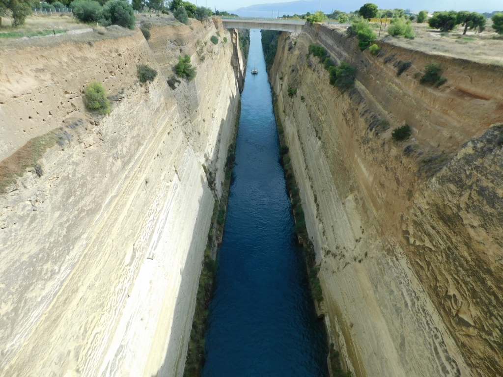
As for me, I had finished my visit to Ancient Corinth, so I drove just under 13 km east to the Corinth Canal.
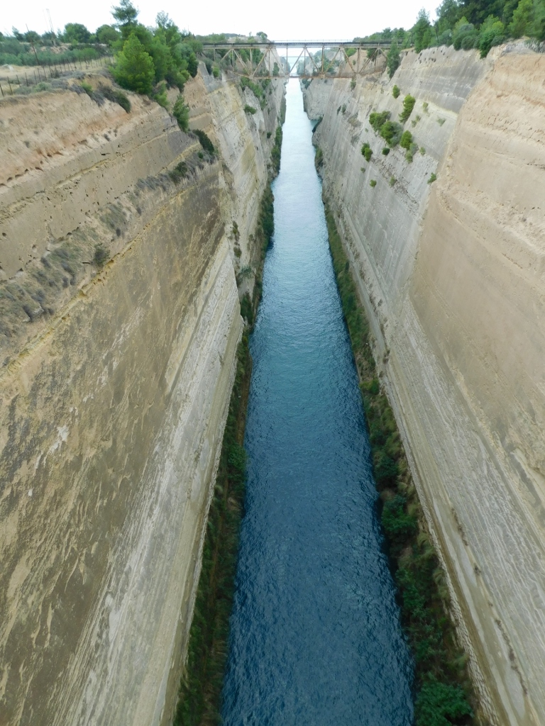 Corinth Canal
The Peloponnese is considered the largest Greek peninsula and it truly was until the Corinth Canal was dug, technically turning the Peloponnese into an island. But I won't dwell on that too much.
The Peloponnese was connected to the southern part of mainland Greece by the Isthmus of Corinth, which is 6.3 km long and was named after the nearby ancient city of Corinth.
 Corinth Canal
In order to get from the Saronic Gulf, southeast of the isthmus, to the Gulf of Corinth, northwest of the isthmus, it used to require sailing over 300 km around the Peloponnese. This was too much for the ancient Greeks as well, so they hauled their ships across the isthmus. The Roman emperor Nero attempted to dig a canal here in 67 AD, but he was unsuccessful. It wasn't until 1893 that the canal was completed. Today, various vessels are allowed to pass through at certain intervals from either side.
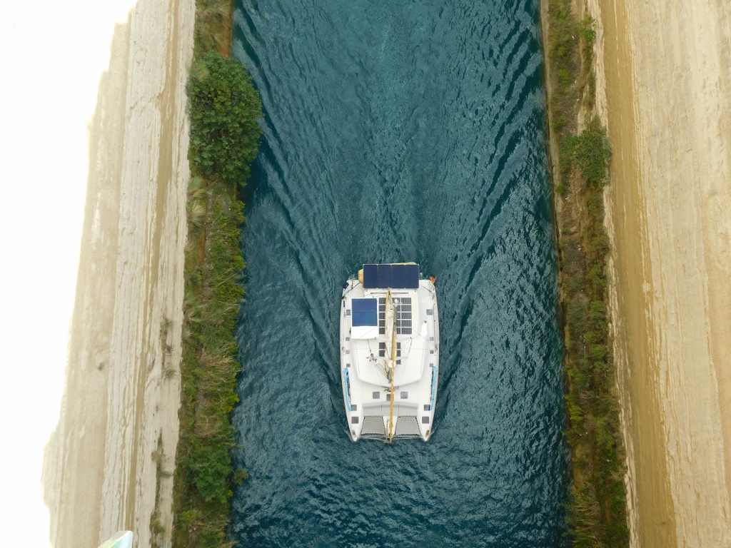 Corinth Canal, a detail
After taking all these beautiful photos, I returned to the car and continued my journey, which also meant that I was leaving the Peloponnese and entering mainland Greece.