After a lot of intense and, for me, very tiring hiking from Stemnitsa to Dimitsana the previous day, the next day was supposed to be relatively "free." I practically decided just to go down to the coast of the Gulf of Corinth in the northern part of the Peloponnese, specifically to the town of Diakopto.
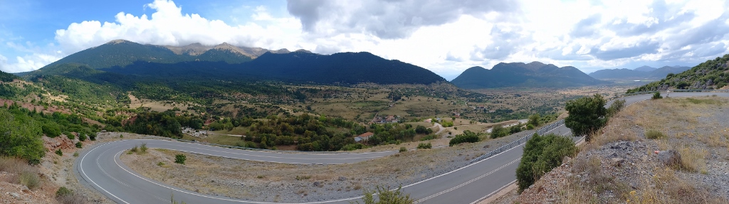
That's exactly what I did, but first, it was important to decide which road to take. Looking at the map, there was an option of taking better roads, including parts of the highway, but going around the long way. Admittedly, this would have gotten me to my destination sooner since a lot of time is lost driving on winding roads.
However, I decided to take the "direct" route, which meant going through the mountain regions of northern Peloponnese, and I didn’t regret it for a moment. In the map below, I didn’t mark the roads I drove, but in the end, anyone driving through the Peloponnese can decide for themselves which routes to take.
To start with, I wasn’t in any hurry to leave Stemnitsa, as there was no reason to rush. So, I took a little more time to stroll around the village and I even climbed up to a nice viewpoint from where parts of Stemnitsa are beautifully visible. Along the way, I also passed by an old church.
This is the exceptionally beautiful Church of Panagia Baphero, dating back to the 12th century. The origin of the name of the church is unknown.
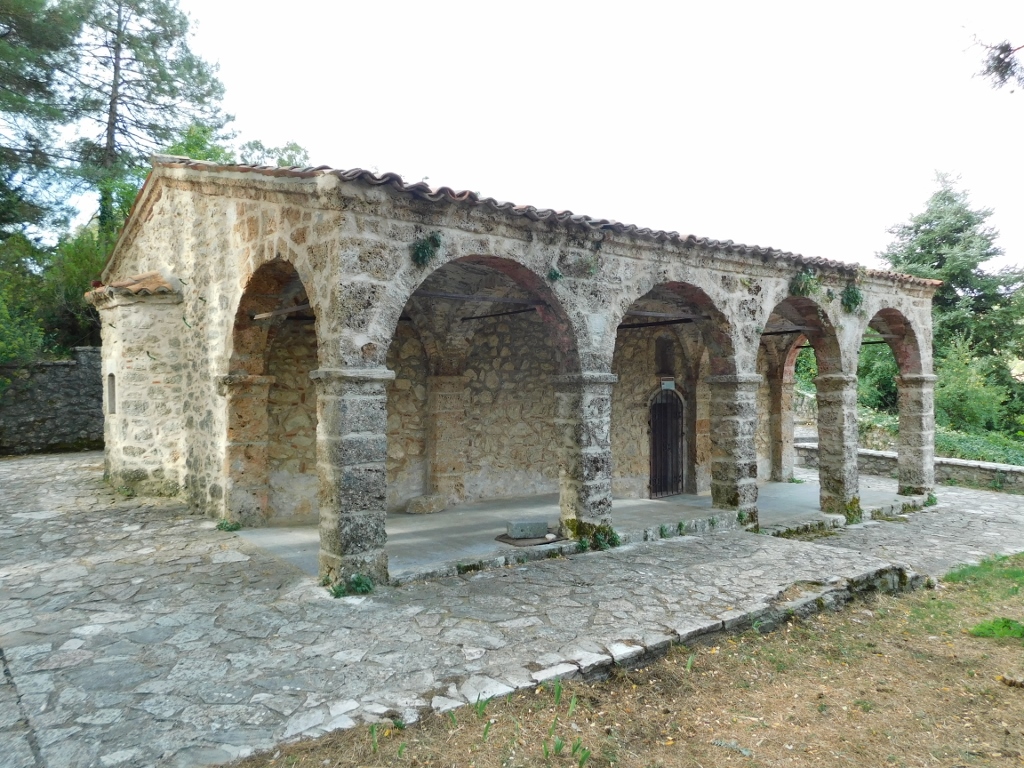 Church of the Panagia of Baphero
Unfortunately, the church was closed, so I couldn’t see the frescoes from the 16th and 17th centuries that are considered to be among the most beautiful on the Peloponnese. In 1910, an arcade was added along the northern side of the church.
In the churchyard, I noticed another smaller church, the Church of St. Nicholas, which was open. This church dates back to the 16th century, but at one time, it was used as a sort of charnel house, so the interior has been quite damaged.
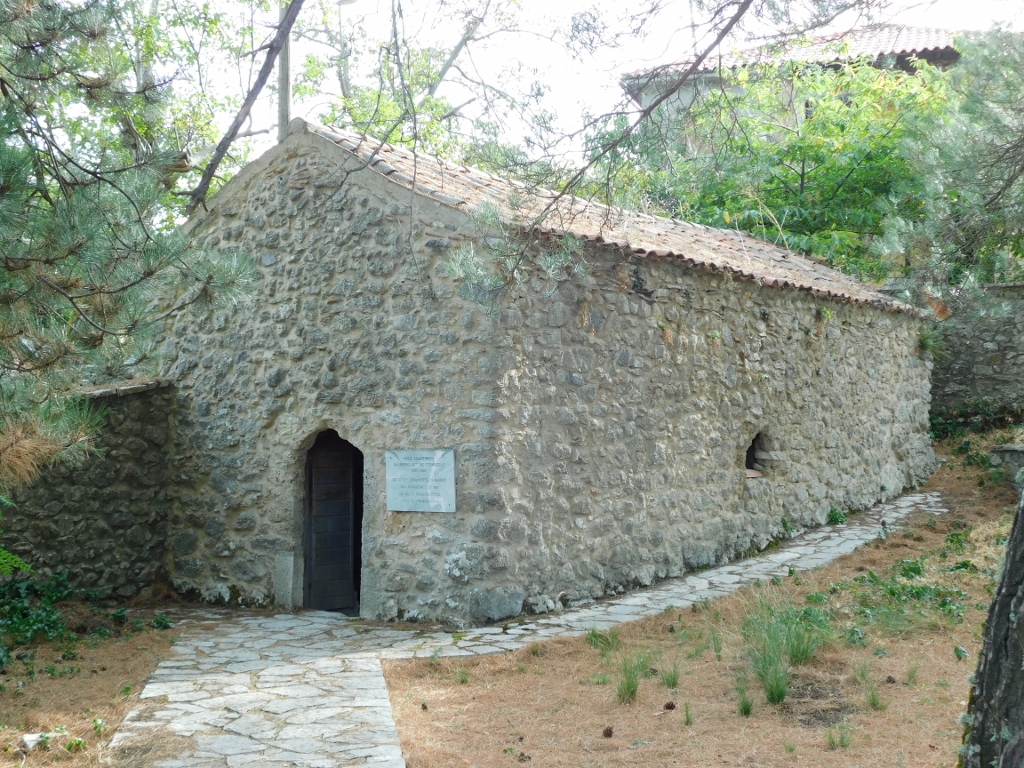 Church of St. Nicholas
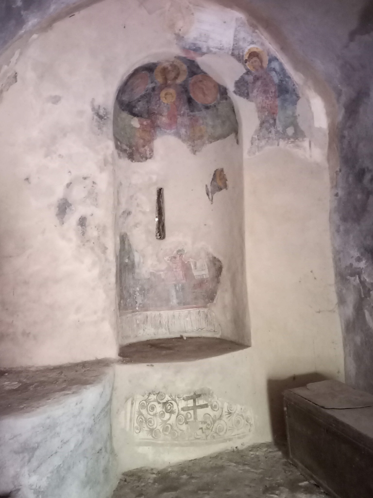 Church of St. Nicholas, a detail
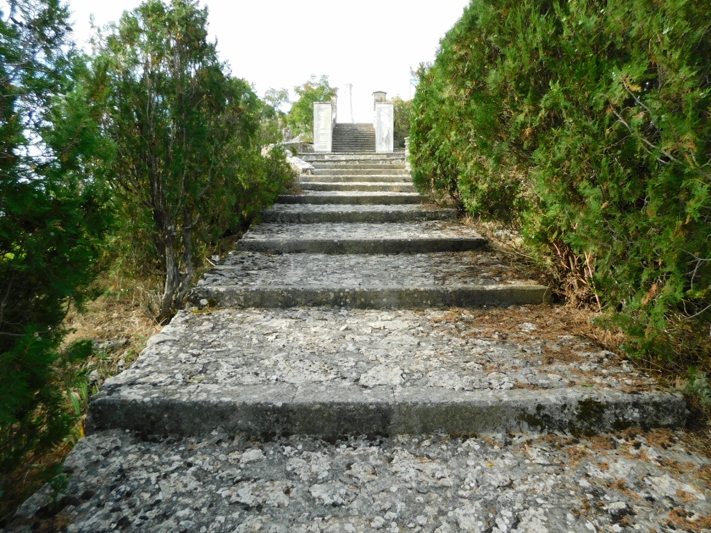
From there, I went to a nearby plateau where there is a monument to the war heroes of Stemnitsa.
 Stemnitsa, a detail
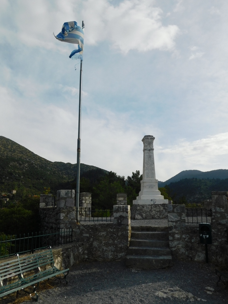 Marble memorial for the war heroes from Stemnitsa
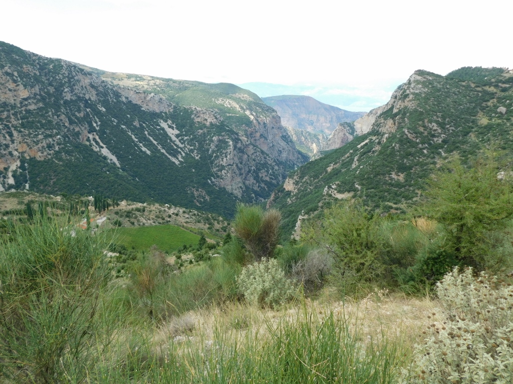
But, this is also a great spot to visit because it offers a wonderful view of the village itself, the surrounding area, and one of the many ravines. I was very pleased to reminisce about the beautiful hiking route, the start of which took me along the edge of this very ravine.
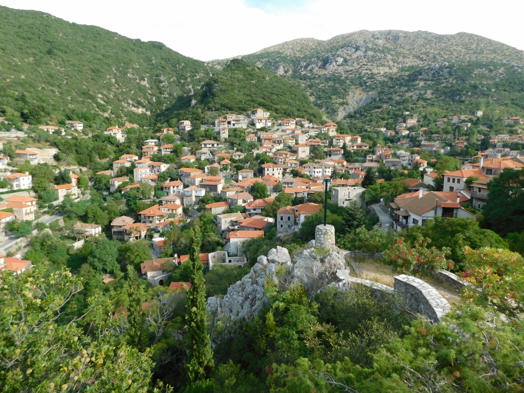 Stemnitsa
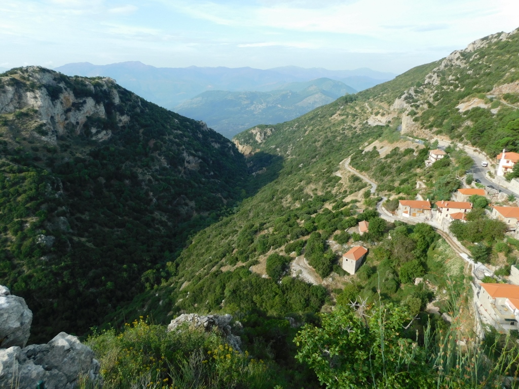 Ravine that is a part of the Menalon Trail
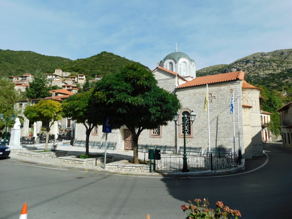
Later, I sat down at a café in the town square and had breakfast there.
 Stemnitsa, a detail
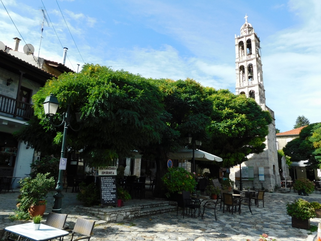 Stemnitsa, a detail
It was nice and once I finished everything I wanted to do, I slowly made my way back to the guesthouse where I was staying and soon I was ready to leave.
The road took me through Dimitsana, but I didn’t stop there. I stopped a bit further along, as from there I had a beautiful view of both Dimitsana and the surrounding area, and then I continued on my way.
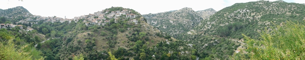 Dimitsana and the surroundings
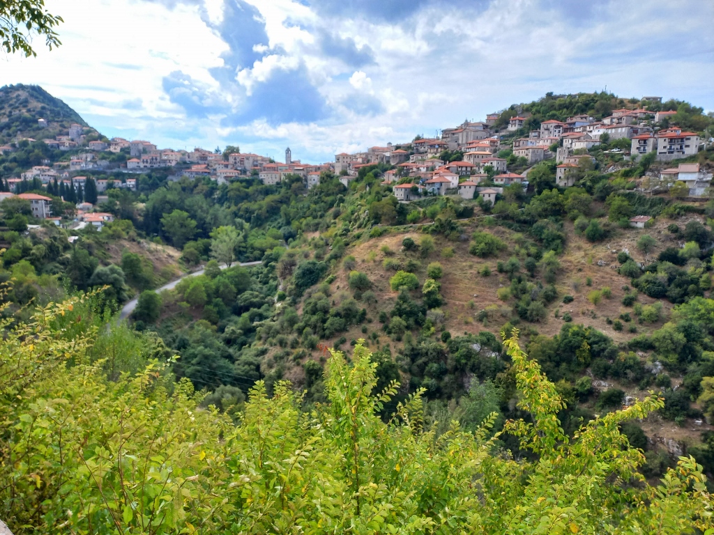 Dimitsana
After about an hour and a half of driving through beautiful landscapes, including high mountains where there are ski resorts in winter, the road took me past a cave called the Cave of the Lakes, which was once known as Troupisio. Completely spontaneously, I decided to stop there, again with the thought that I wasn’t in any particular rush.
As it turned out, the cave could only be visited as part of guided tours at specific times, so I had to wait for a little while. I used that time to take some photos of the surroundings.
 Surroundings of the Cave of the Lakes
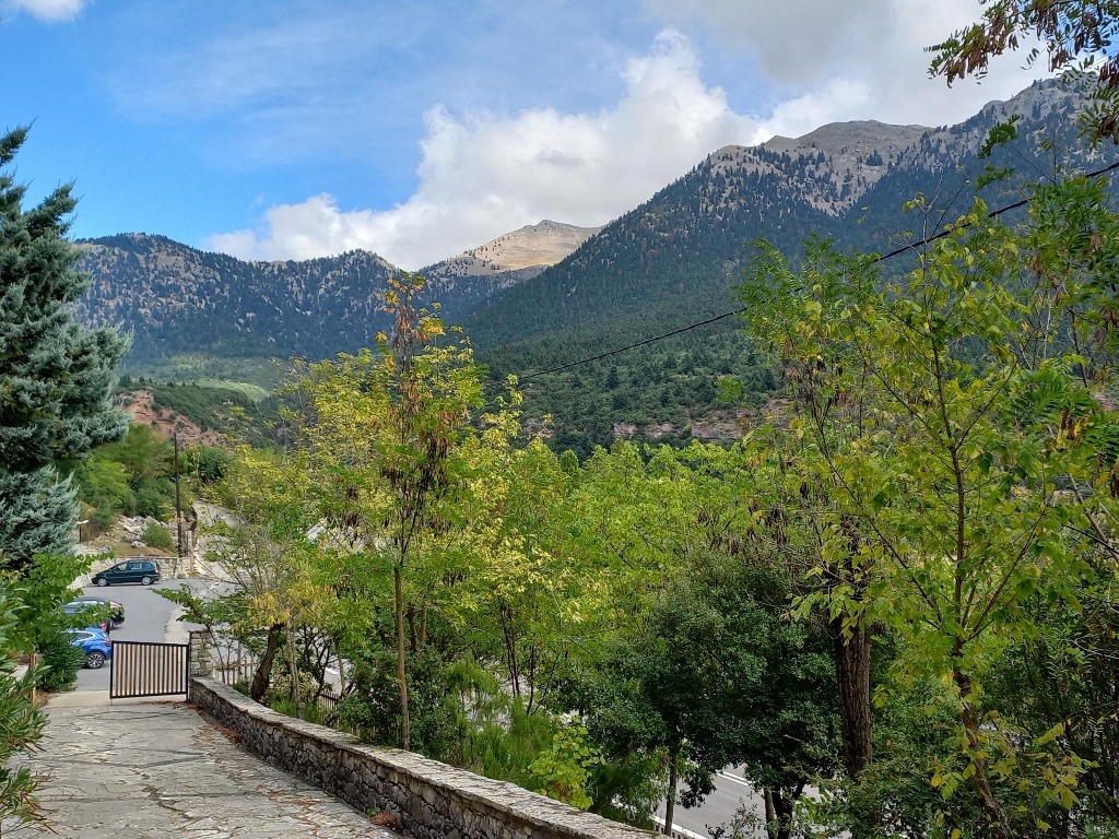 Surroundings of and the access to the Cave of the Lakes
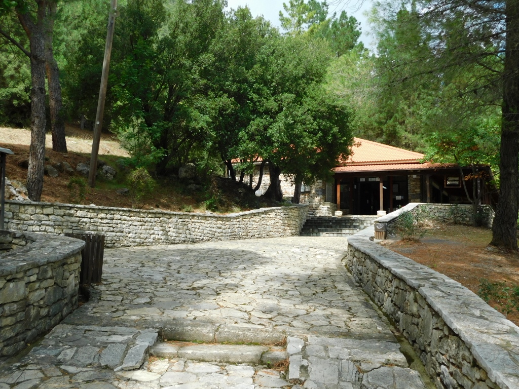
The site also has a building where tickets are purchased and there is a café, as well as a small museum, which I had planned to visit after the cave.
 Part of the Cave of the Lakes site
Unfortunately, photography is not allowed inside the cave, with some explanation that it disrupts the delicate natural balance. Of course, there are photos of the cave online, but it's not for me to judge. In any case, I don’t have any.
That said, it is an interesting cave through which an underground river flows across three levels. Specifically, when the winter snow starts to melt, the river swells, creating cascades. However, during the summer or early autumn, when I was there, the river practically dries up, leaving behind 13 small lakes – hence the name.
Visitors can take a tour starting from an artificially constructed tunnel that leads to the second level and then they walk along metal-and-wooden paths and bridges, totalling about 500 m, going in one direction and then returning. And that’s about it.
Scholars have determined that people used the cave as far back as the Neolithic period and later during the Bronze Age. Significant paleontological and archaeological finds have been discovered in the cave, among them are fossilised bones of humans and various animals, including those of a hippopotamus!
The cave is part of the Chelmos-Vouraikos Global UNESCO Geopark, located in the northern part of the Peloponnese. My plan for the next day was to pass through the Vouraikos River gorge, which is also a part of this geopark. Visiting the cave was just an addition.
Since I couldn’t take photos inside the cave, I went to the small, but modern museum on the site and took a few more pictures of the main building, where I also had a refreshing drink. I guess I needed to restore my photo-taking balance!
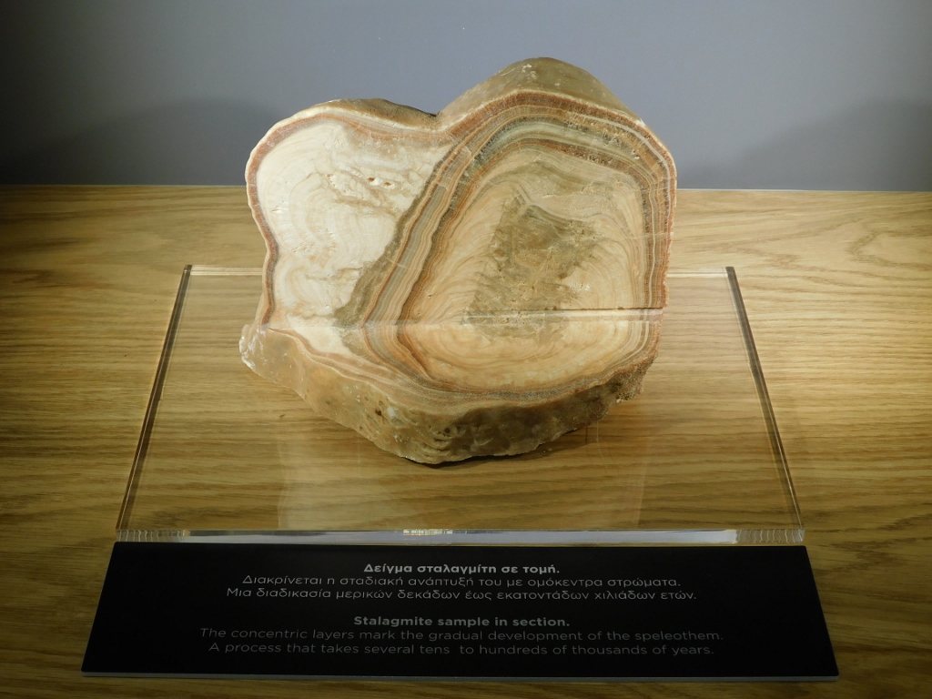 Museum exhibit from the Cave of the Lakes site
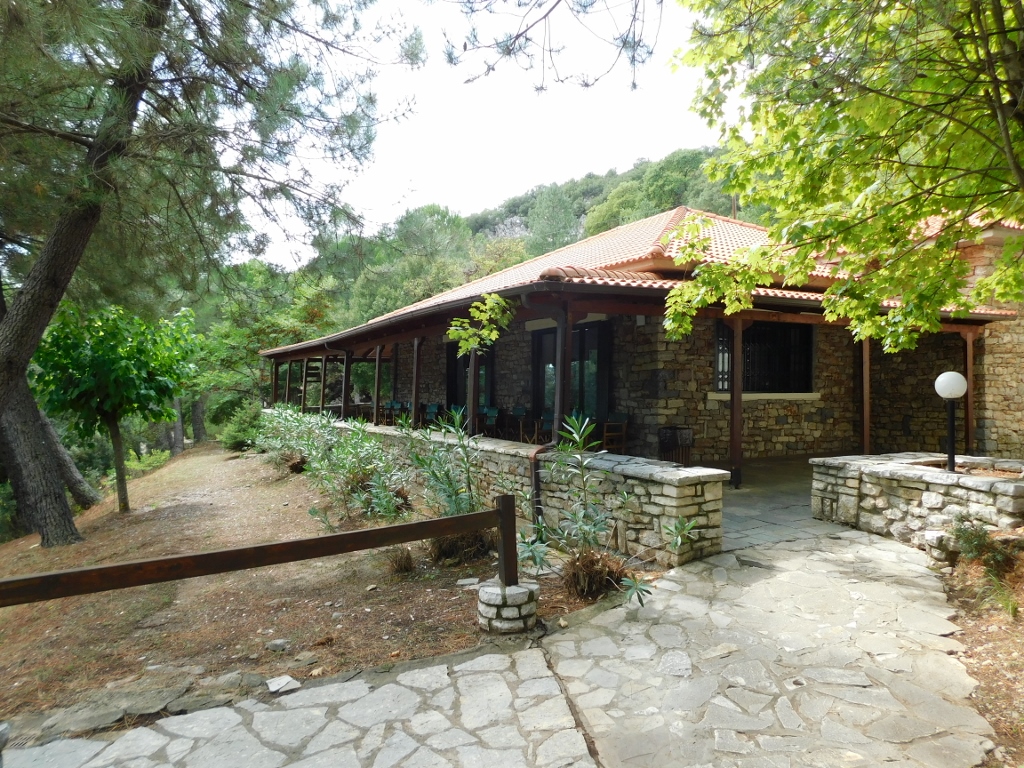 Part of the Cave of the Lakes site
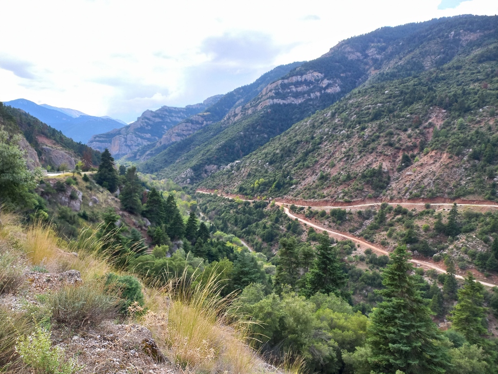
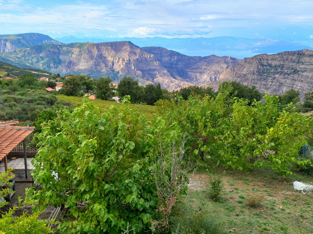
As I’ve mentioned earlier, while driving from Stemnitsa towards the north of the Peloponnese, I passed through incredibly beautiful, mostly mountainous landscapes. I was truly amazed by the nature surrounding me and the scenery I could catch a glimpse of, although somewhat superficially. I still had to pay attention to the road and the curves, and I rarely came across a widened area along the road, covered with gravel, that could serve as a viewpoint.
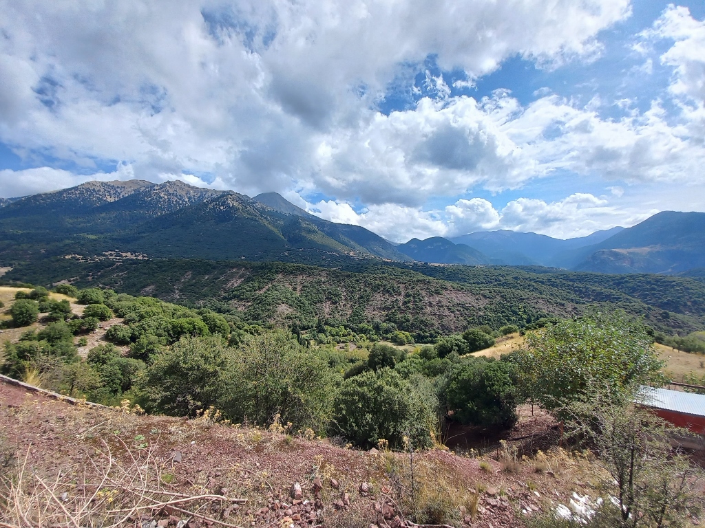
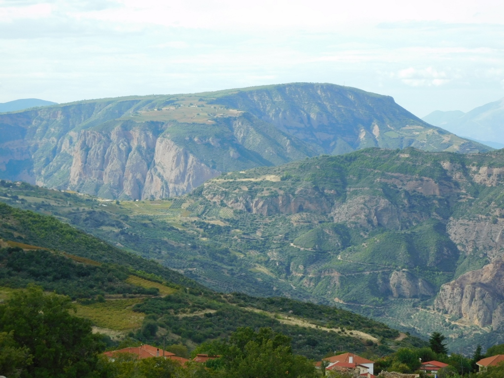
After visiting the Cave of the Lakes, about 4 km further, the road descends into a beautiful flat valley, before starting to climb again. It was precisely in this section that I came across one of those widened areas, so I parked there. From what I saw on the map, the main settlement in the valley is the village of Kato Lousoi, while further away, I could see parts of Mount Chelmos, the highest peak of which rises to 2,355 m above sea level. I had actually come from that direction.
 Chelmos mountain and the valley where Kato Lousoi is
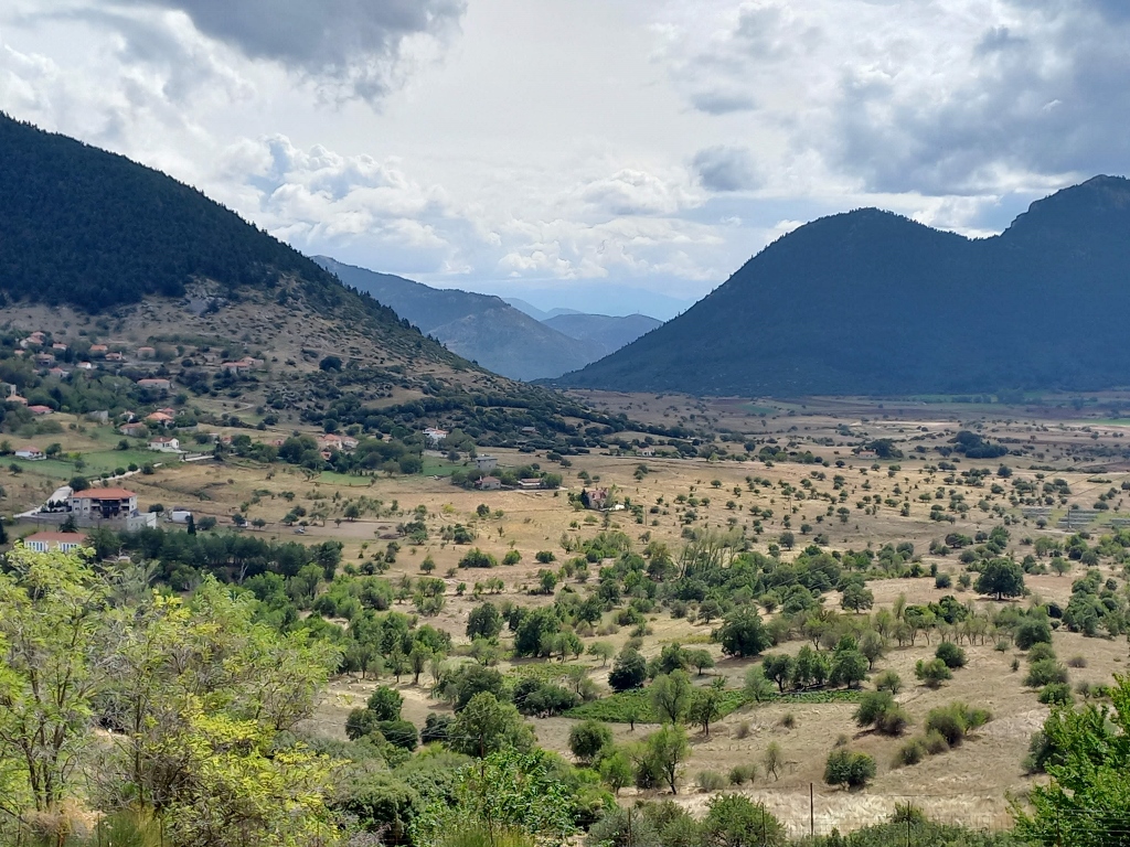 Valley where Kato Lousoi is
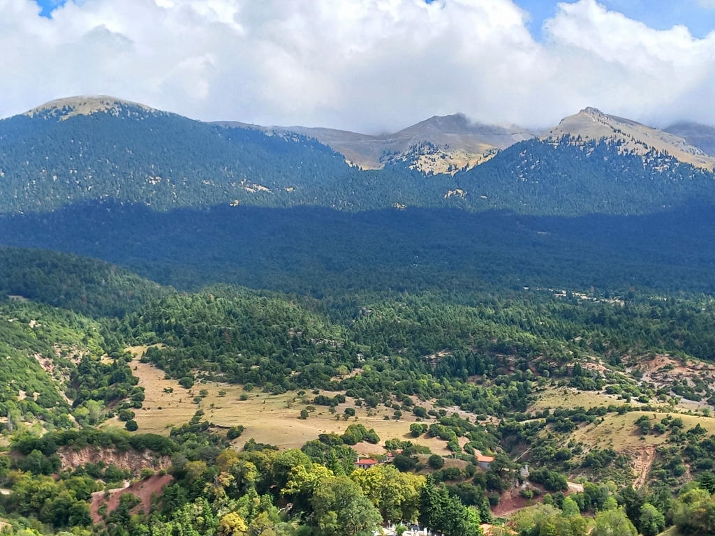 Mount Chelmos
While I was still lingering in Stemnitsa in the morning, looking at the map in order to plan my route, I realised that this leg of the trip would take me through the town of Kalavryta, which was actually quite important for my plans the following day. So, I decided to make a stop there.
After visiting the cave and stopping to take photos of Mount Chelmos and a picturesque valley, I continued on and, after about 10 km, I reached Kalavryta. I drove directly to the train station and parked my car there.
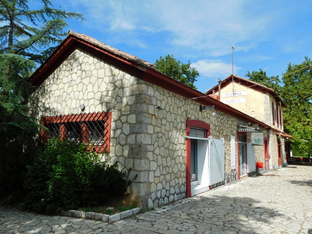 Railway station in Kalavryta
It occurred to me that I could go ahead and buy a ticket for the next day from Diakopto, since that was a part of my plan, but when I got to the station, I was met with an extremely unpleasant surprise – trains weren’t running until further notice due to a landslide!
Oh, how disappointed I was! Although I was fairly certain that this applied to the entire route from Diakopto to Kalavryta, I still held onto a faint hope that maybe the trains were running up to the intermediate station, which was crucial for what I had planned to do the next day, called Zachlorou. I would have to check all that once I got to Diakopto, but for now, I watched the railroad track with longing.
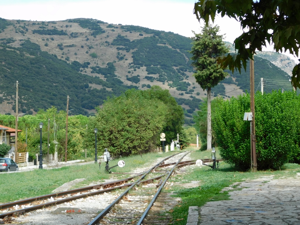 Railway track in Kalavryta
However, since I was already here and feeling a bit hungry, I decided to take a walk around the town, with no intention of staying longer than necessary. As luck would have it, I came across a taverna where there were a few foreigners, but also some Greeks, and that's always a good sign.
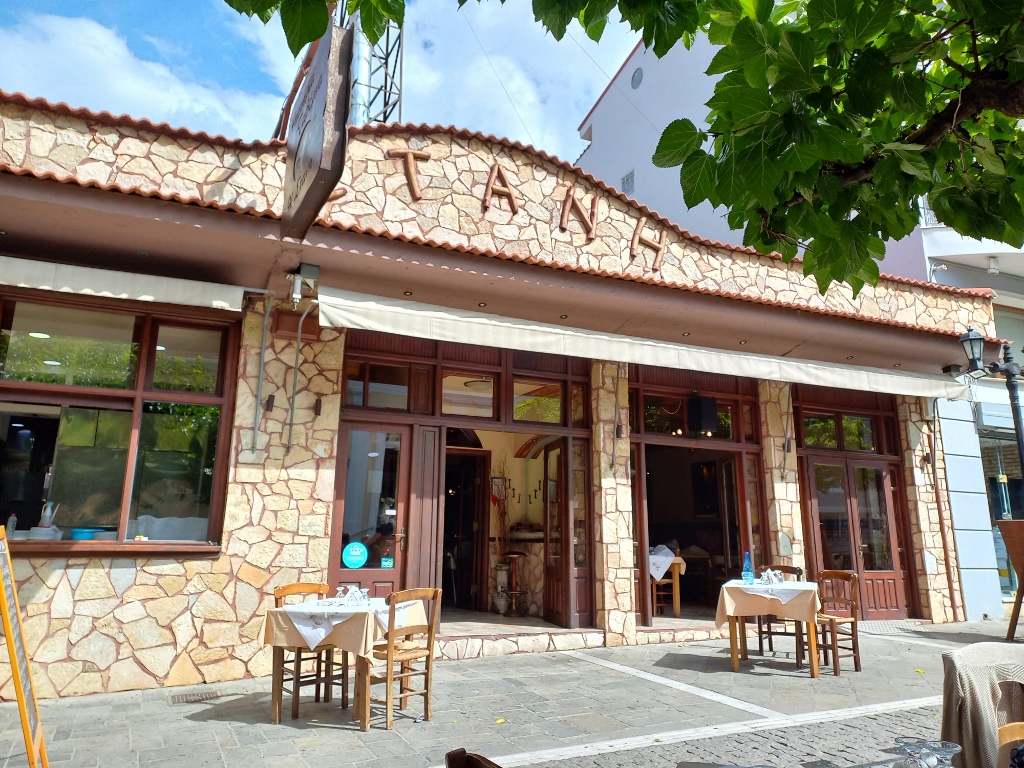 Taverna in Kalavryta
So, I took a seat there and the waiter (who might have also been the owner — who knows?) brought me the menu, but also gave me some of his recommendations. I decided to try the kid meat in a lemon and aromatic herb sauce, with artichokes added. I rarely eat artichokes, so that was especially intriguing for me. In fact, I only recently tried kid meat for the first time, even making it myself, and it turned out quite good. This one was great as well, so I had a really nice lunch.
 Lunch in Kalavryta
Then I took a little walk around the town. Kalavryta has an interesting and long history, and like the rest of the Peloponnese, it has been ruled over time by the Franks, Byzantines, Venetians and Ottomans. Up until 1821, when the Greek War of Independence began, and it was in the nearby monastery of Agia Lavra, just outside Kalavryta, where the flag of the uprising was raised.
Unfortunately, Kalavryta is also known for the Kalavryta Massacre of 1943, when the Germans, in retaliation, executed 693 civilians (men and young boys). Around 1,300 women and children were locked in a local school building that was then set on fire. Fortunately, one door had been left unlocked, so the women and children managed to escape from the burning building.
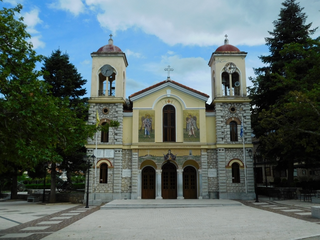
I didn’t do much exploring or walking around here; I just briefly passed through one of the main streets and also went to the Cathedral Church of the Assumption of the Theotokos.
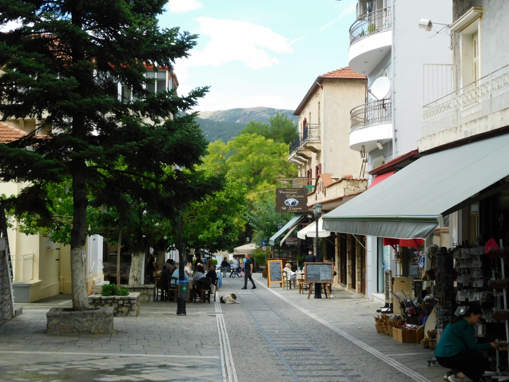 Kalavryta, a detail
 Kalavryta, a detail
At this point, I wanted to get to Diakopto as quickly as possible in order to see if the trains to the Vouraikos Gorge were running or not. Aside from my desire to see the gorge, this was also important because of my hotel reservation and the organisation of the next few days, as my trip was slowly coming to its end.
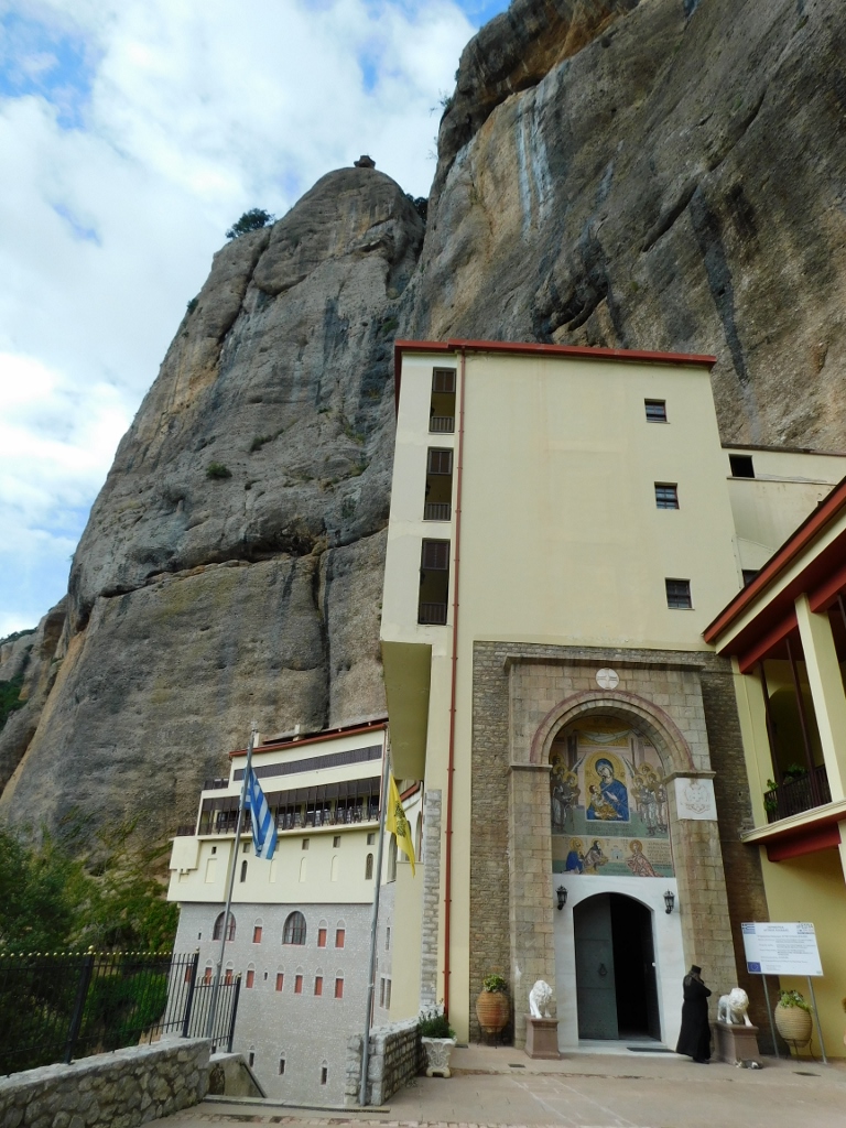
However, the road to Diakopto passed by a well-known monastery, so it was only natural that I would stop there. This was the Mega Spilaio Monastery, which means "Great Cave," while the monastery is formally dedicated to the Assumption of the Theotokos.
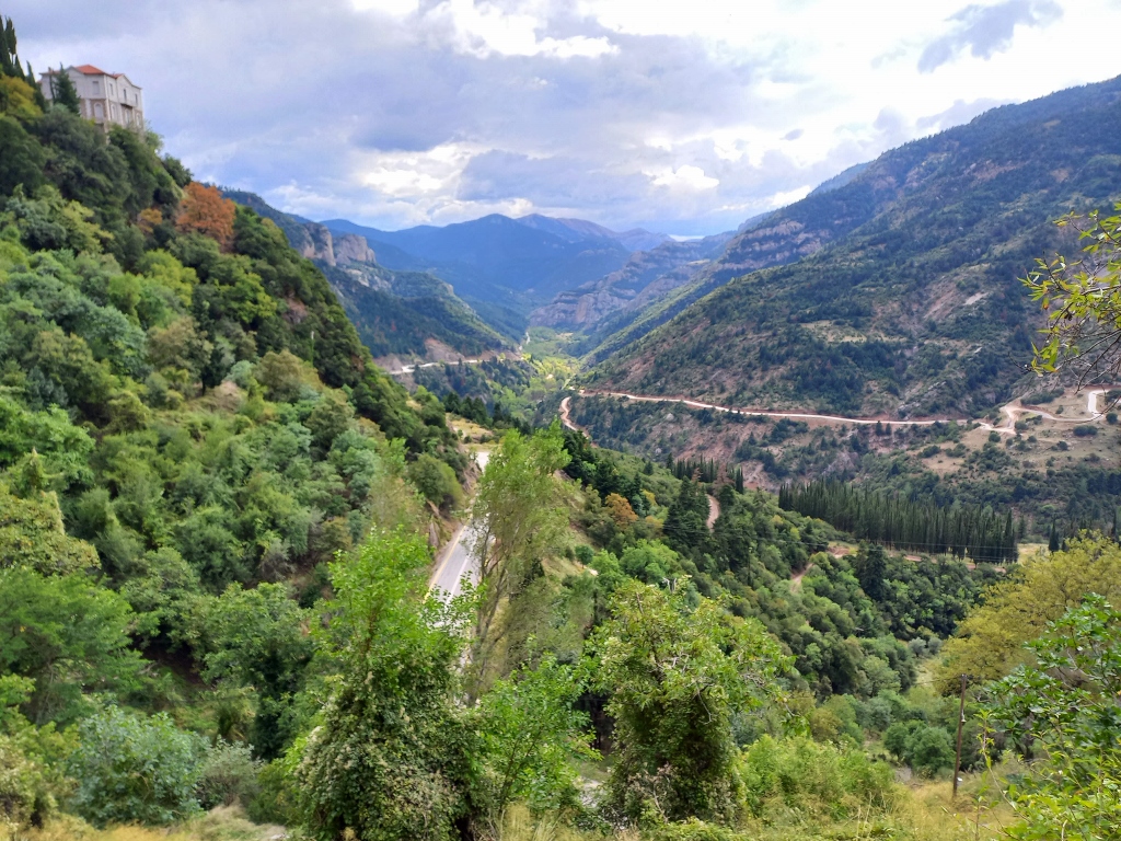
After I had parked my car, I first took some photos from above of the absolutely impressive Vouraikos Gorge and its surroundings.
 View at the south parts of the Vouraikos Gorge
 View at the north parts of the Vouraikos Gorge
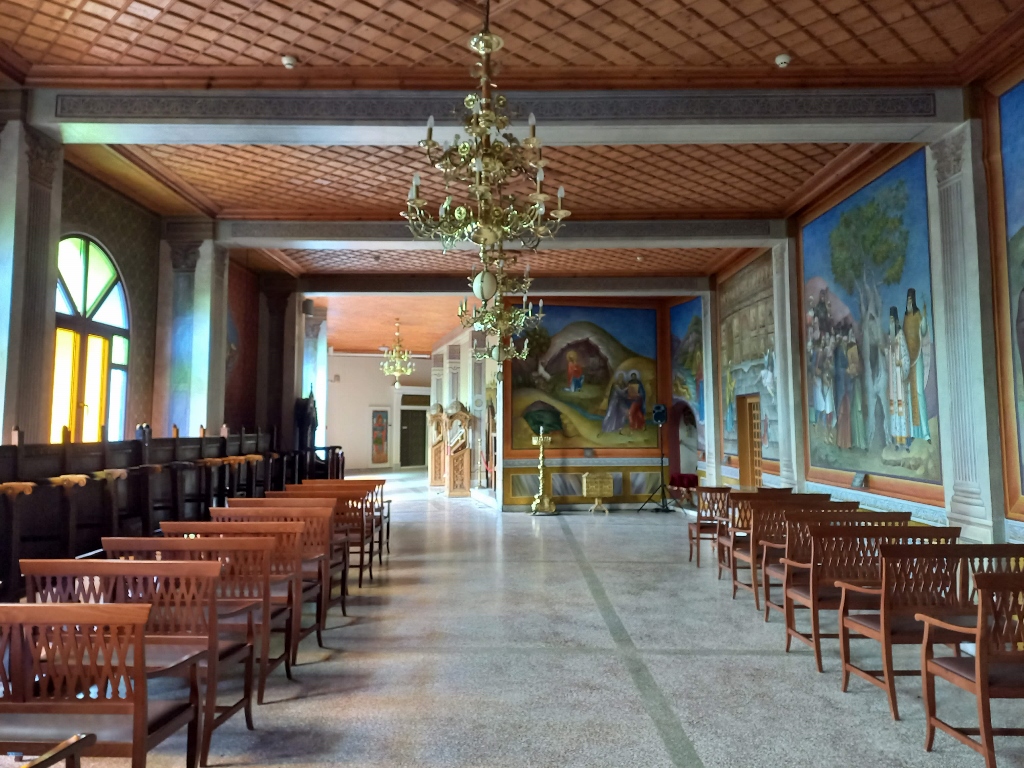
As for the monastery, its very impressive buildings are literally clinging to the high vertical cliff, which is a part of the western slopes of Mount Chelmos.
 Mega Spilaio Monastery
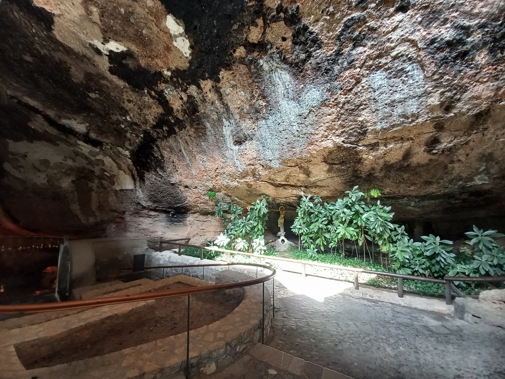
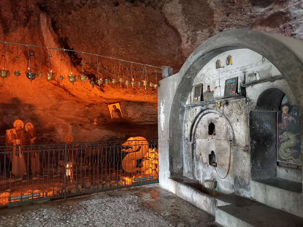
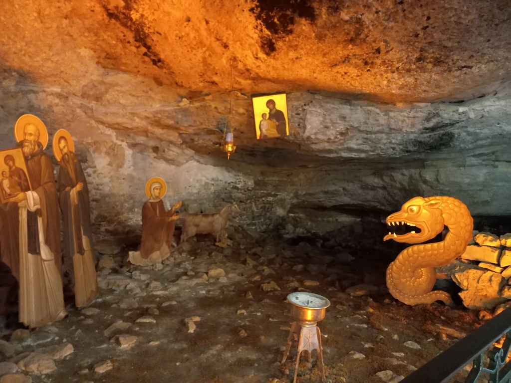
These buildings practically "conceal" the cave and in order to reach it, one must first pass through the modern parts of the monastery.
 Mega Spilaio Monastery, a detail
Although the cave was known in antiquity, according to the oral tradition, a Christian monastery is believed to have been founded here in 362 by two brothers from Thessaloniki, who, together with a local shepherdess, discovered an icon of the Theotokos in the cave, which was said to have been created by Luke the Evangelist. However, the monastery is historically documented from 1354.
Throughout history, it has been destroyed and rebuilt several times. This monastery, too, did not escape the tragic fate of 1943, when it was destroyed by the Germans, who also killed 22 monks and visitors of the monastery.
The monastery was rebuilt from the ground up after World War II and now comprises a complex with eight levels. But, what is most important to see here is precisely the holy cave after which the monastery is named.
 Mega Spilaio Monastery, a detail
 Mega Spilaio Monastery, a detail
 Mega Spilaio Monastery, a detail
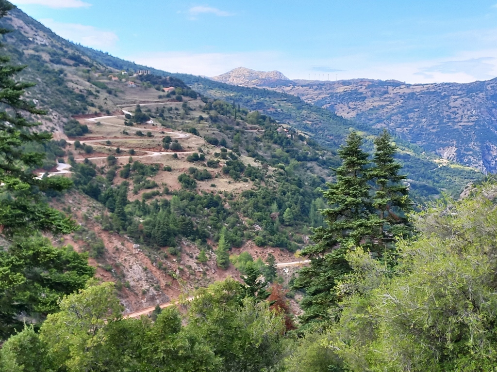
Although I had observed the gorge and some of its parts from the parking lot by the monastery, after visiting the monastery, I stopped at a couple of spots on the road to Diakopto in order to take more photos of the gorge from above, from the road level, because the views were absolutely spectacular. The very thought that I wouldn't have the chance to walk through the gorge, as that had been my plan, filled me with great sorrow, but at that point, there was nothing more I could do about it.
 View at the south parts of the Vouraikos Gorge
 View at the north parts of the Vouraikos Gorge
 View at the north parts of the Vouraikos Gorge; in the distance, you can see the waters of the Gulf of Corinth
 View at the west parts of the Vouraikos Gorge
Having arrived in Diakopto, I first drove to the train station where they confirmed that the trains were not running, but that they would probably start operating again in a couple of days. Since I didn't have a couple of days, I asked the woman at the counter if it would be safe to walk (since I had no idea how big the landslide was) and she hesitantly said it might be possible, but that I would have to be very careful. Hmmmm...
After that, I drove to the hotel, where at the reception, I found a British couple who had checked in before me. As soon as they finished and I started talking to the young woman at the desk, I mentioned that I would probably have to cancel the next day's plans since the trains weren't running to Kalavryta. The British couple then joined in, saying they had bought train tickets online for the very next day.
All in all, we agreed to go together to the train station in the morning to check the situation. They were, of course, interested in taking the train both ways – up and down – and weren’t keen on walking, but I thought it would be better to go with someone in the morning to the station since I had no intention of moving my car.
While I was talking with the exceptionally kind young woman at the hotel reception, who spoke excellent English, I came up with the following idea through our conversation: I would leave my things in the hotel room and, fully equipped, I would head with the Brits to the train station where they would certainly have more information. If I went on the trip I had planned, my things would obviously stay in the room, but if I didn’t go, I could return, pack up, bring my things downstairs and continue on my way. The receptionist completely agreed with my plan.
The plan to head to the station also included the hope that maybe someone else would show up who would want to do the hike like I did.
This was important because, in order to get to either Kalavryta or Zachlorou, we would need to take a taxi, which, of course, is not a cheap option. The receptionist also inquired about how much a taxi to "the top" would cost, so I would have all the information. However, she told me that there was no need for her to organise a taxi, as there are always a few waiting for customers by the train station.
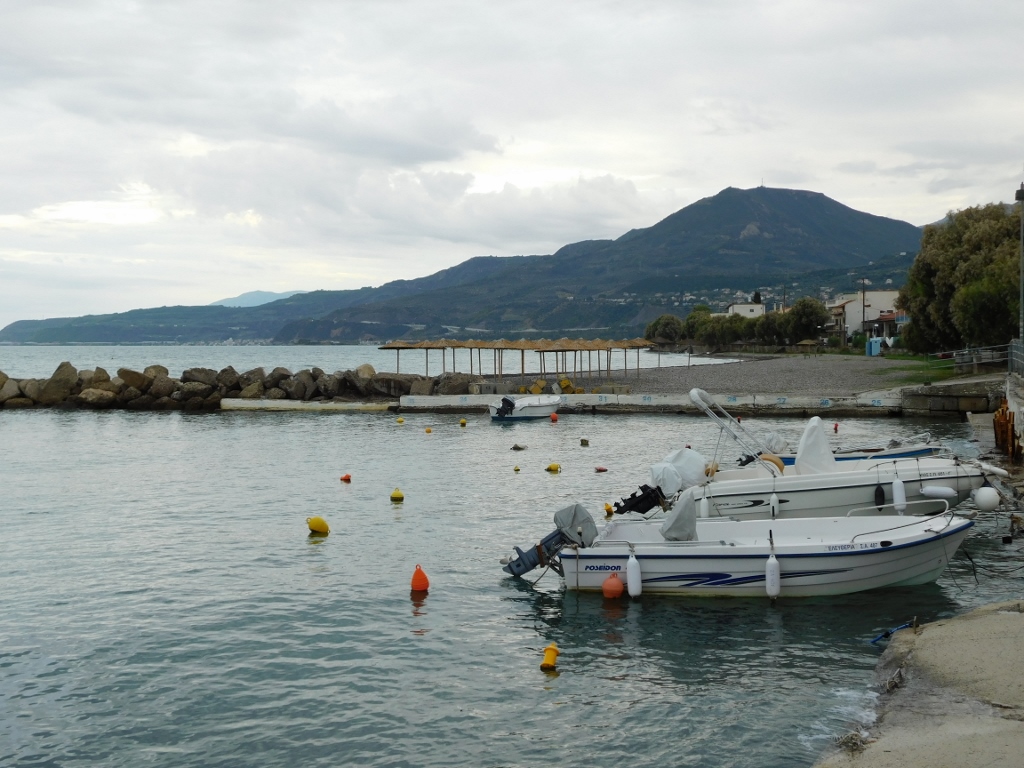
With that in mind, I first sat down for a bit in the hotel restaurant to rest a little and then I went for a walk along the sea, as Diakopto is located on the northern coast of the Peloponnese, on the shore of the Gulf of Corinth.
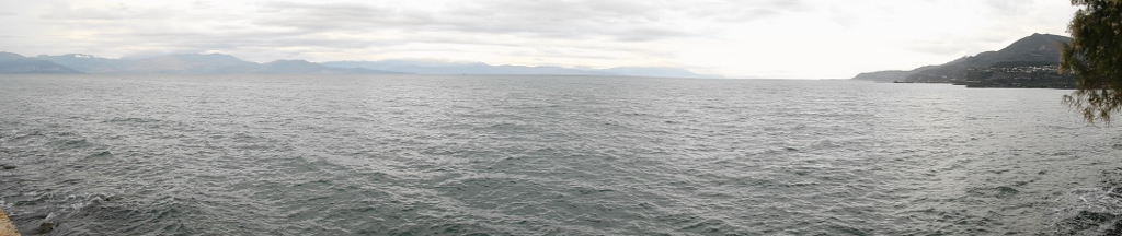 Waters of the Gulf of Corinth
Diakopto didn’t seem to me like a place that would be ideal for a summer vacation, although there were some very nice villas with suites for guests. Perhaps my opinion was influenced by the weather – it was quite cloudy, with occasional light rain, and the wind was blowing, though not too strongly. Still, there were waves. It was a picture of autumn by the sea, while on the opposite shore of the gulf, further from the sea, I could see Mount Parnassus rising in the distance.
 Diakopto in autumn
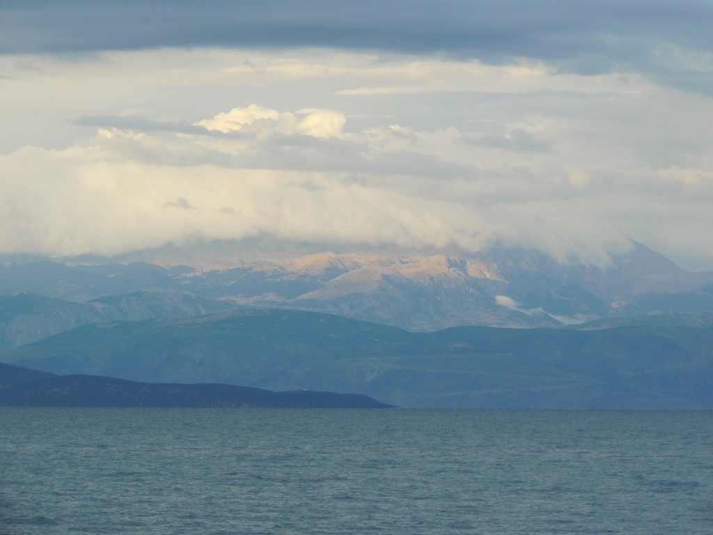 Mount Parnassus
As I was heading back to the hotel, I could see from the seaside promenade the exit from the Vouraikos Gorge. I wondered if I would be passing through there the next day.
 Exit from the Vouraikos Gorge in Diakopto
Since I was still full from that hearty lunch in Kalavryta, I just ordered a beer at the hotel and then retreated to my room, where I organised my things for the following day, holding onto the hope that I would still be able to go on that hike.
 Refreshment in Diakopto