The Citadel in Methoni is quite an interesting place and if anyone visits this part of Greece (the far southwest of the Peloponnese), they should definitely explore it. In the previous sequel of my story about this trip in September 2023, I already wrote about the history of the citadel, so I won’t repeat that now. Instead, I will briefly describe my walk through the inner part of the fortress.
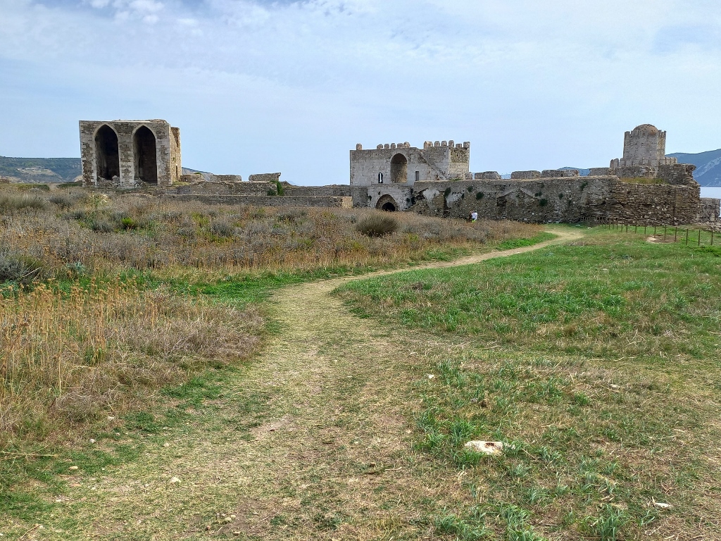
The fortress was built on a peninsula that is about 200 m wide and nearly 600 m long, extending in a north-south direction. In the northern part, the citadel is separated from the hinterland – now the town of Methoni – by a dry moat, with the only connection being the impressive stone bridge that I have already shown in the previous part of the travelogue.
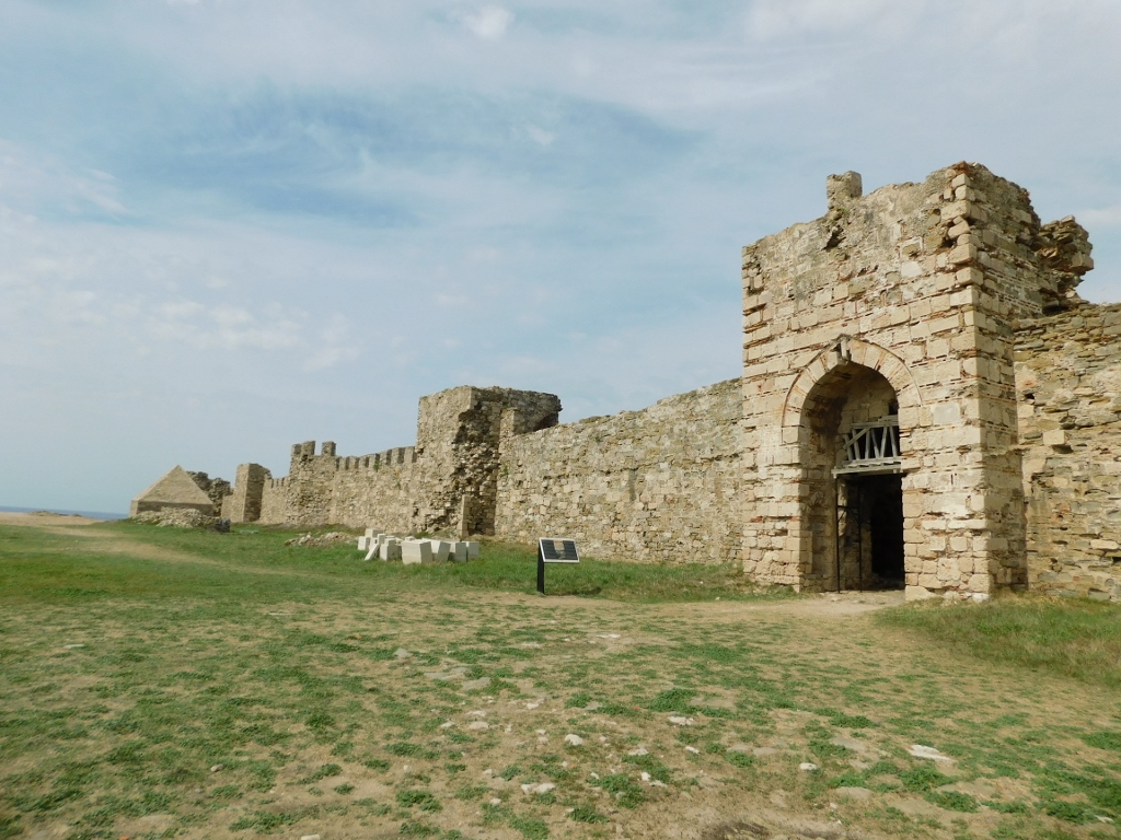
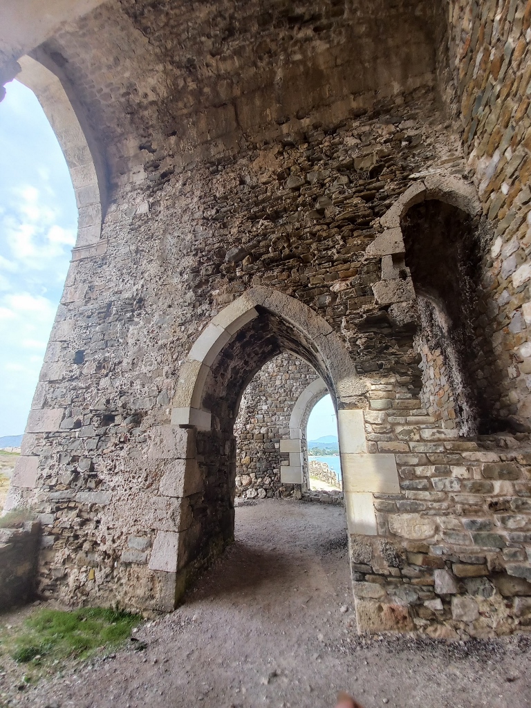
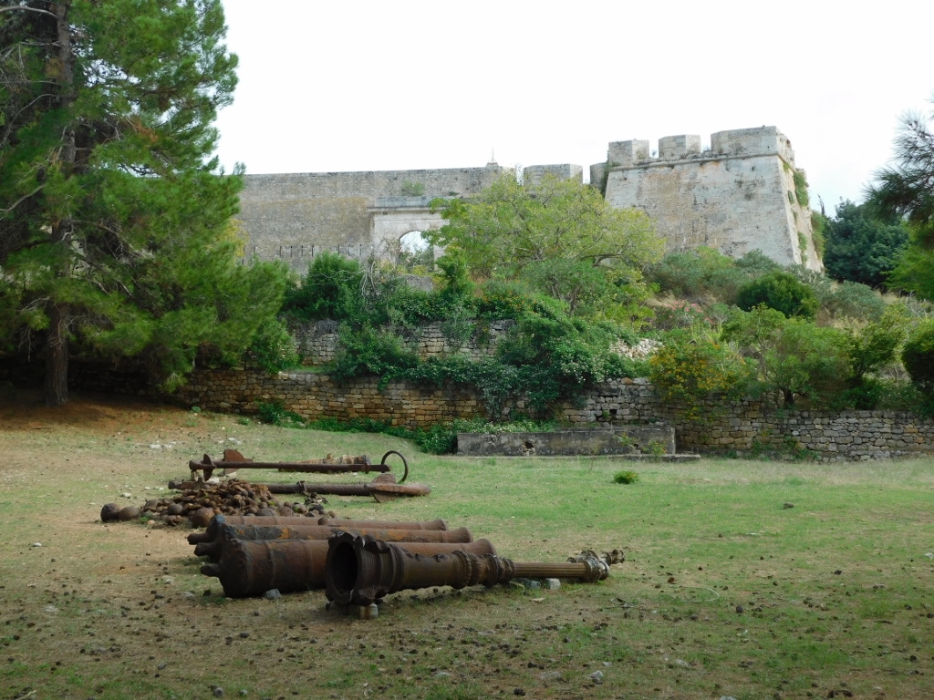
After passing through the defensive walls surrounding the northern, smaller section of the fortress, which has a nearly trapezoidal shape, I entered the larger southern segment that is mostly empty and resembles a barren piece of land.
Most of the buildings within the fortress were destroyed by the French, to whom the Ottoman Methoni surrendered without a fight in 1828, likely to prevent the spread of some sort of disease. They also laid the foundations for a new town outside the walls, while later that same year, the entire area was handed over to the Kingdom of Greece.
For starters, I filmed part of the walls that separate the northern and southern segments of the citadel, as well as the open space south of the ramparts, which was once used as Parade Ground.
 Methoni Citadel, a detail
From there, along one of the paths, I was able to see some surviving structures located at the far southern end of the citadel, but I visited that area a bit later.
 Methoni Citadel, a detail
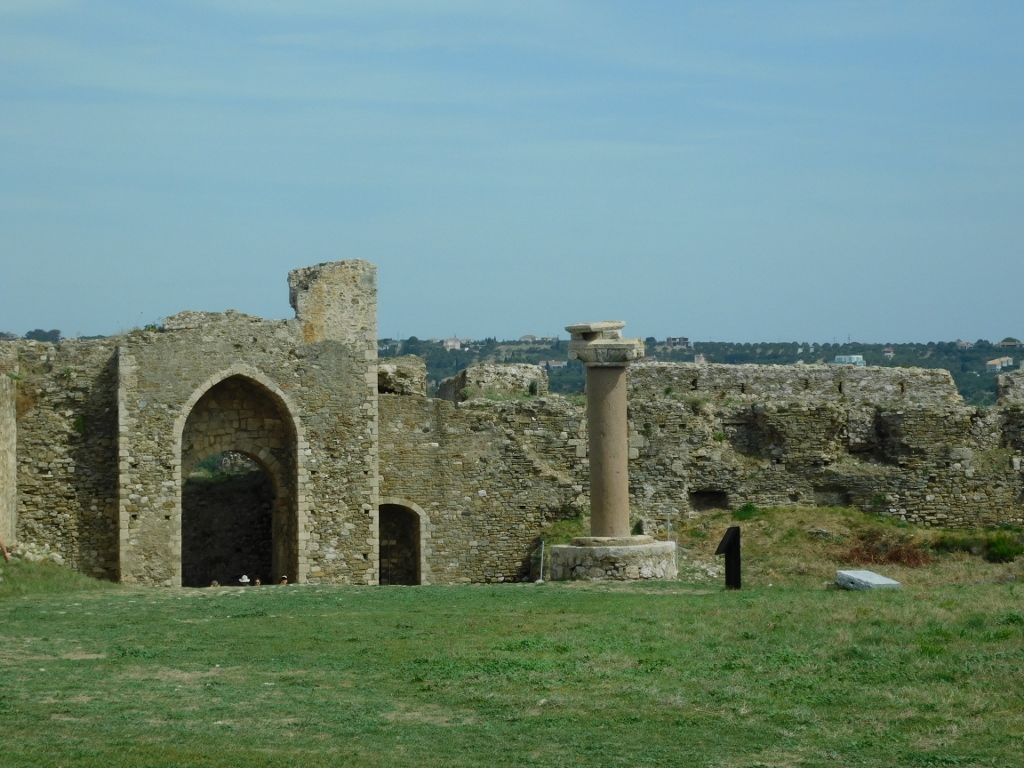
For now, I focused on the gate through which I entered this mostly empty space. There, I saw a granite column, 3.67 meters tall, which was brought here from a ship that ran aground near Methoni.
 Methoni Citadel, a detail
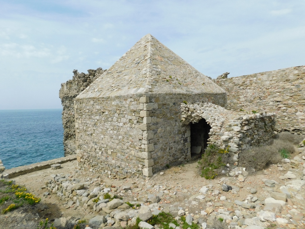
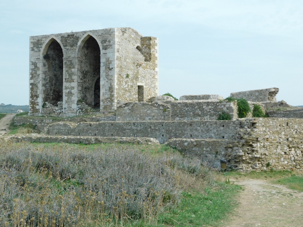
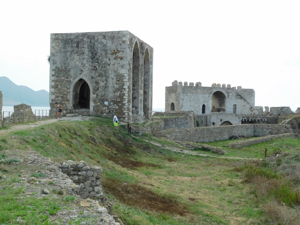
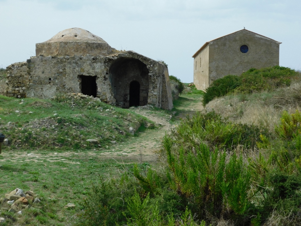
In the very northwest corner of the lower segment, there is the Gunpowder Storeroom that features an interesting pyramidal roof.
 Methoni Citadel, a detail
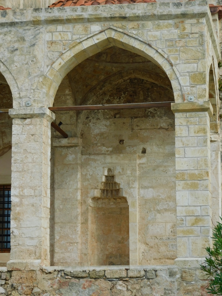
Not far away is the Church of the Transfiguration of the Saviour. The Ottomans originally built this structure to serve as a mosque, but during the second Venetian occupation (1686-1715), it was converted into a church. The settlement within the fortifications was primarily concentrated around this temple. Since the church was open during my visit, I went inside to take a look.
 Methoni Citadel, a detail
 Methoni Citadel, a detail
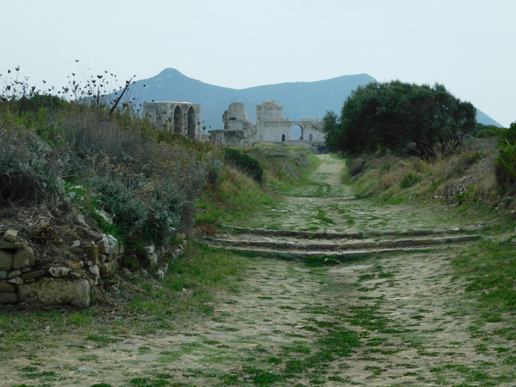
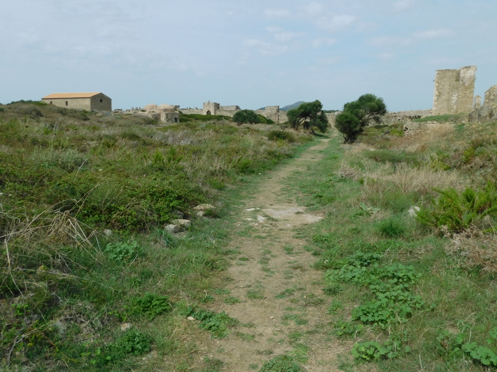
I continued my tour towards the far southern end of the citadel.
 Methoni Citadel, a detail
 Methoni Citadel, a detail
 Methoni Citadel, a detail
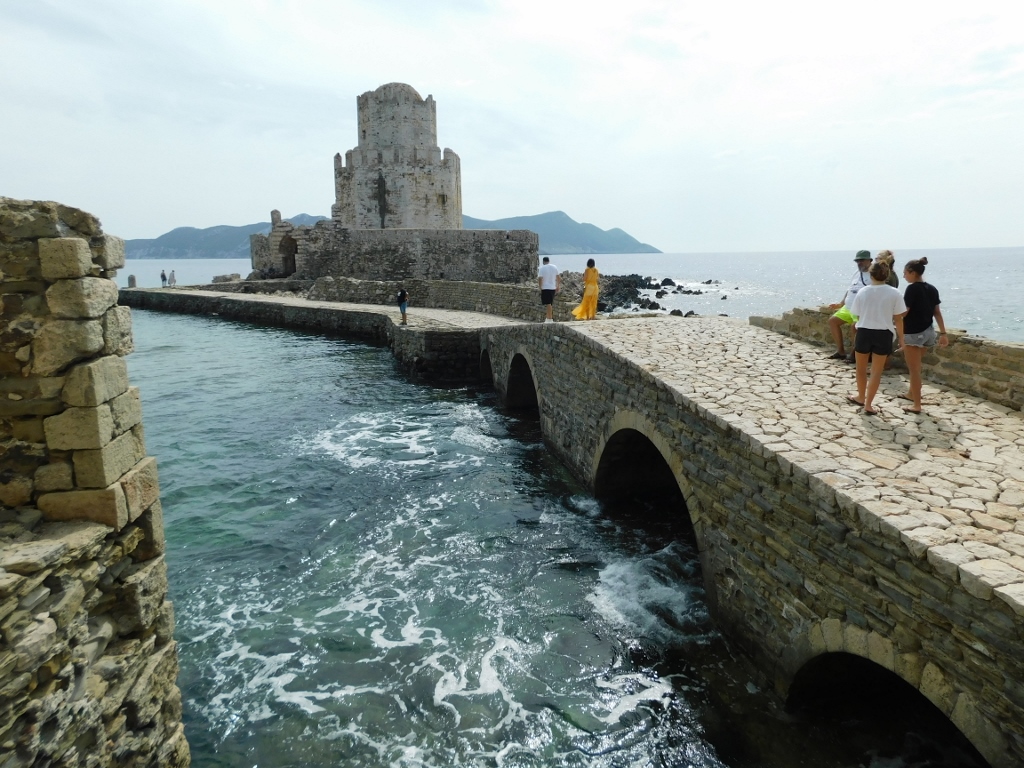
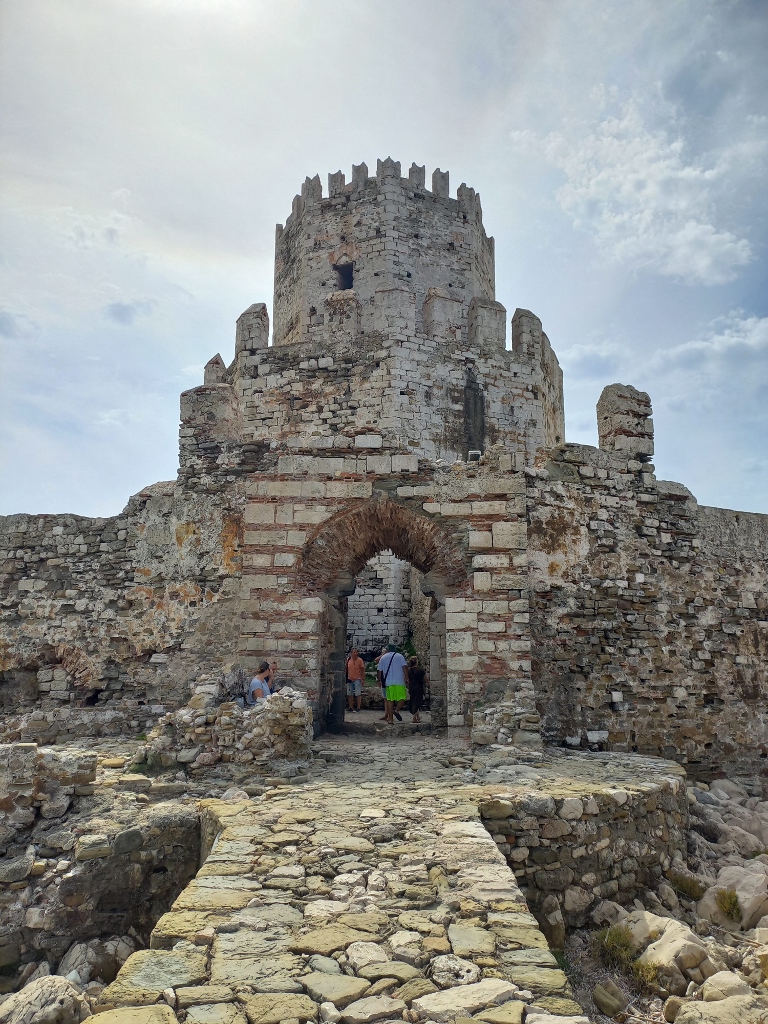
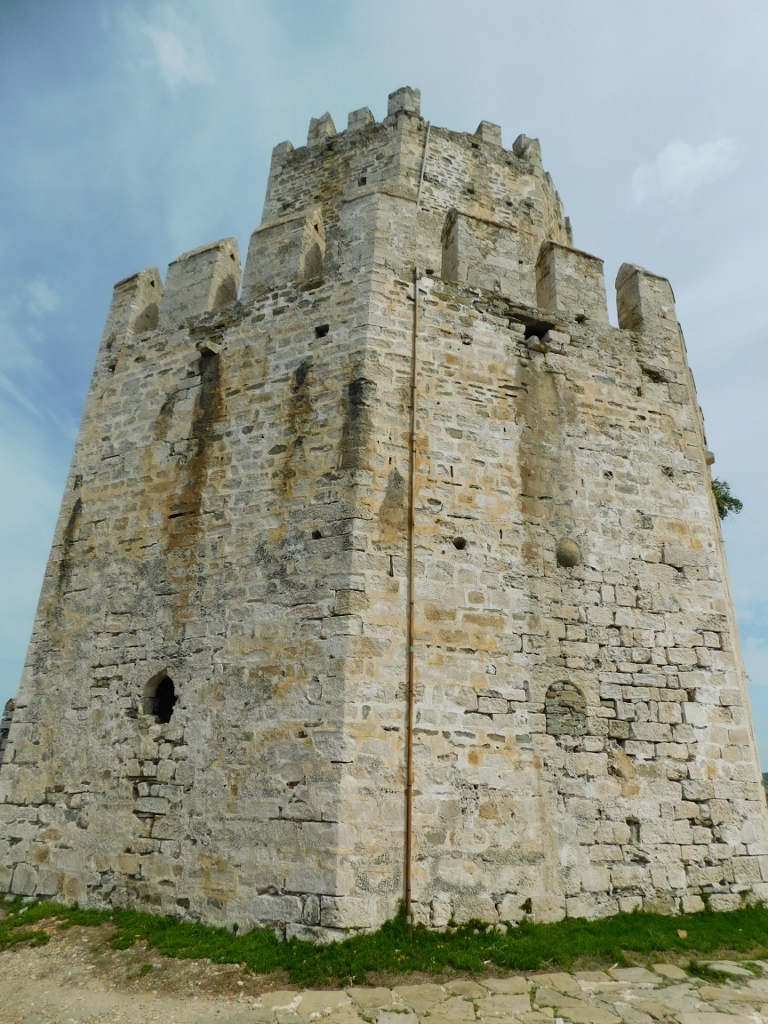
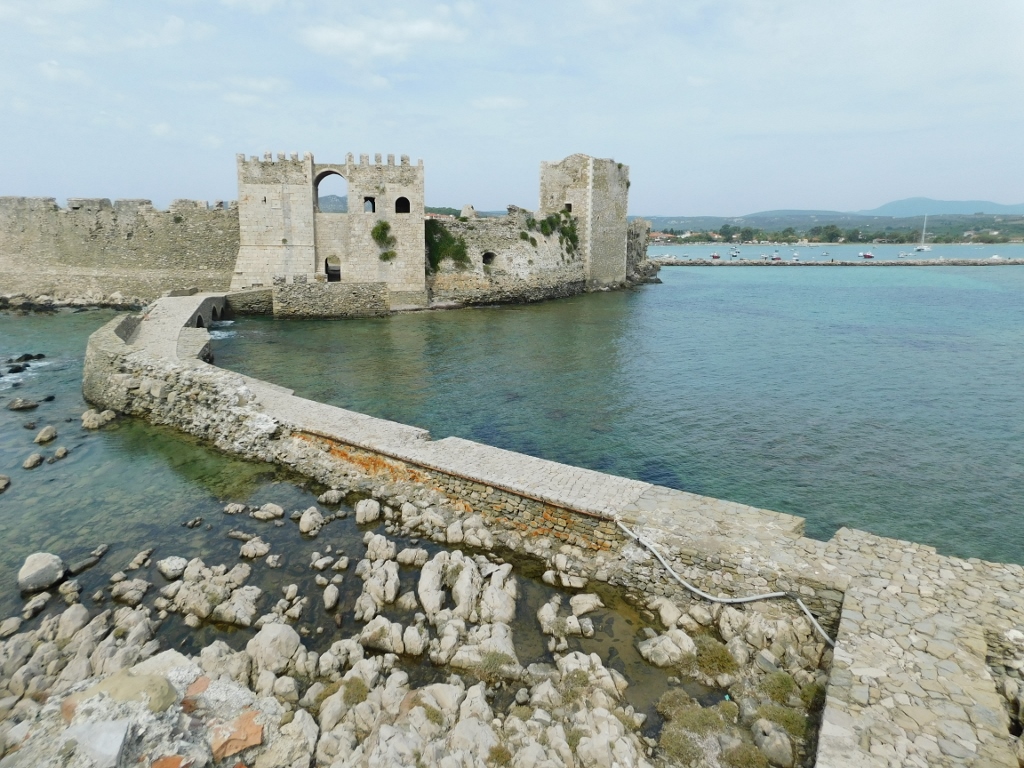
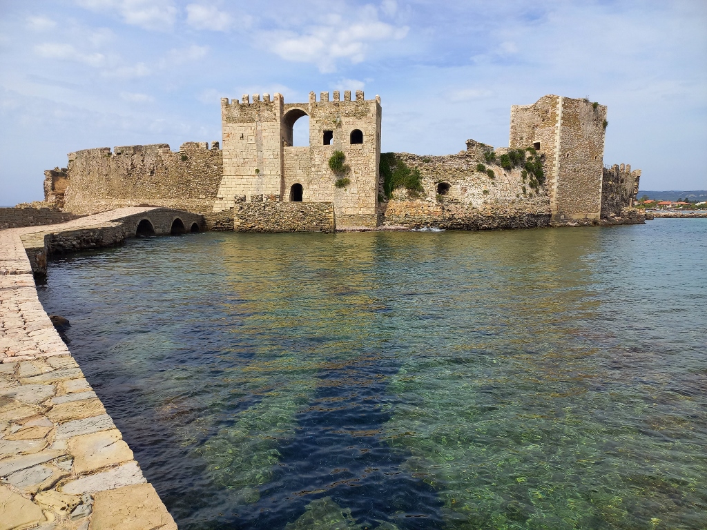
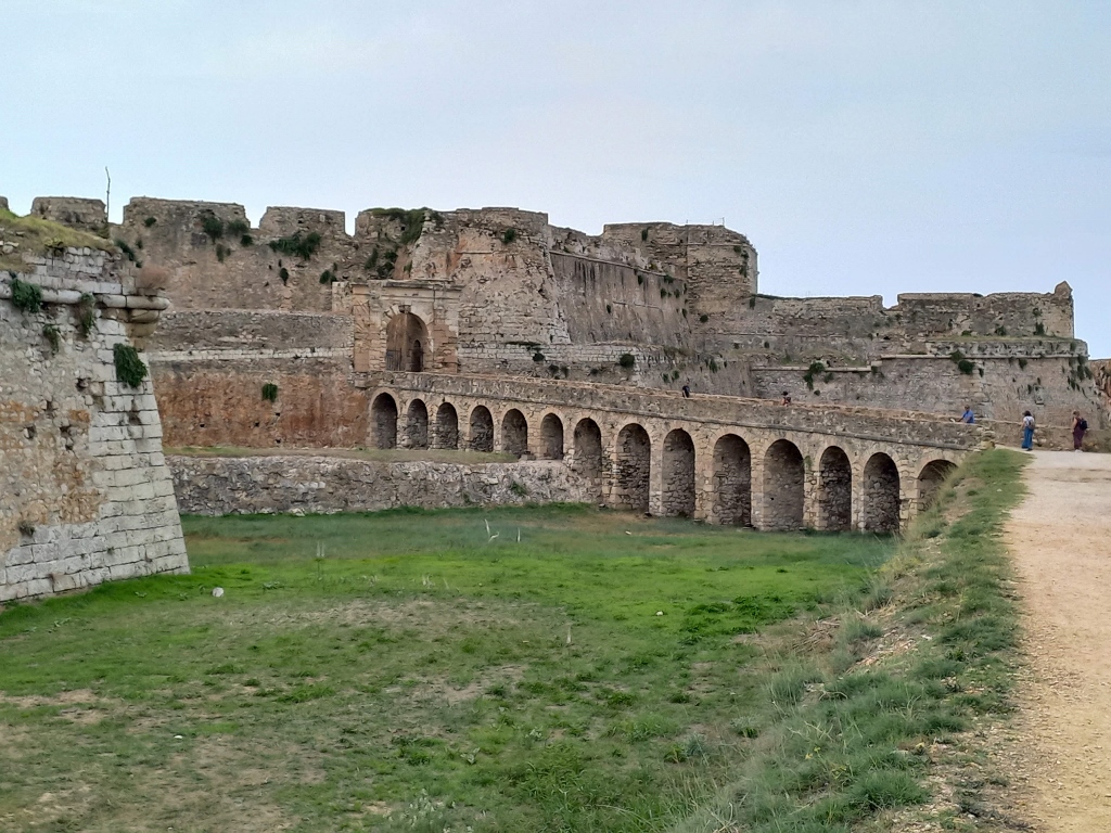
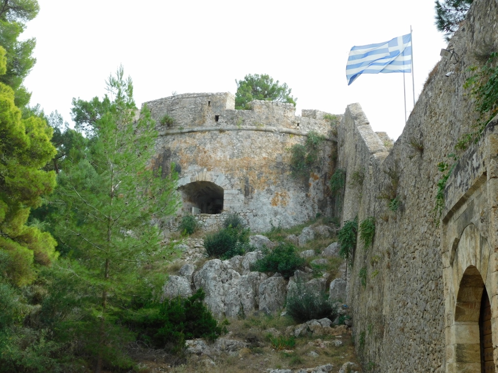
Here, the most interesting part is passing through the Sea Gate in order o reach the octagonal tower, Bourtzi Tower. It is actually a miniature fortress consisting of the tower and the surrounding ramparts. It was the Venetians who before 1500 began the construction on this rocky islet, which is connected to the mainland by a stone bridge, while the Ottomans completed it in the 16th century.
 Methoni Citadel, a detail
The tower served to house guards that monitored the harbour, but it also functioned as a lighthouse, a prison and even a shelter.
 Methoni Citadel, a detail
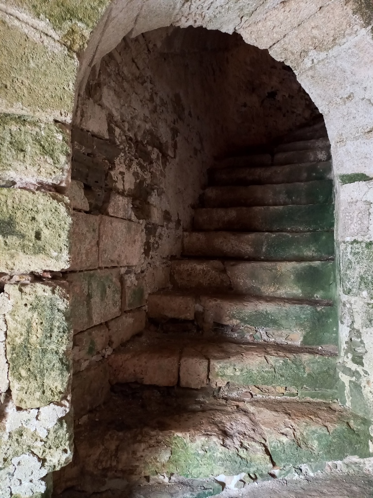
After passing through these walls, you can ascend through a tunnel in order to reach the level of the tower.
 Methoni Citadel, a detail
 Methoni Citadel, a detail
In addition to the nice view of the tower from here, the walls surrounding it also offer a lovely perspective of the bridge, the Sea Gate and the southern end of the citadel.
 Methoni Citadel, a detail
The view is beautiful from the stone bridge itself as well.
 Methoni Citadel, a detail
I returned to the inner space of the citadel and continued my tour along the eastern section of the site. First, I went to the South-East Tower and then I walked parallel to the eastern ramparts.
 Methoni Citadel, a detail
 Methoni Citadel, a detail
 Methoni Citadel, a detail
Occasionally, I peered over the walls and at some point I descended to the path.
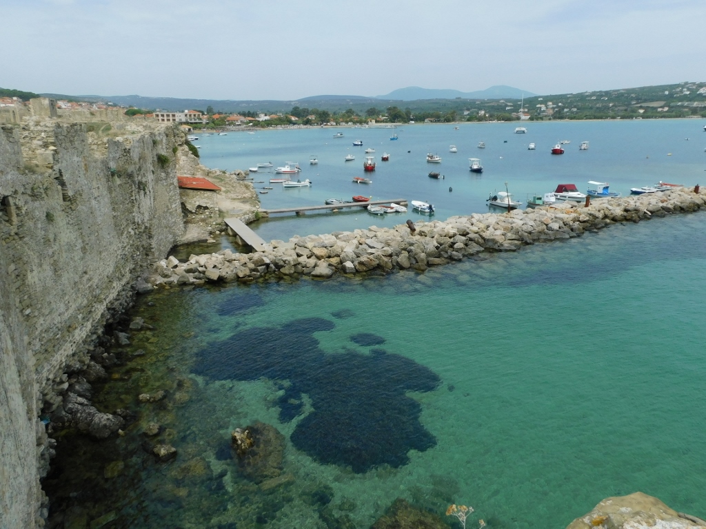 View at the Methoni Bay
 Methoni Citadel, a detail
I also took photos of the remains of the Turkish baths (hammam) and then I headed towards the exit and made my way to the beach in Methoni, where I finally sat down to enjoy a refreshing drink.
 Methoni Citadel, a detail
 Methoni Citadel, a detail
After the pleasant break, I walked along the beach and having taken a couple of photos that I liked, I returned to my car and headed back to the nearby town of Pilos.
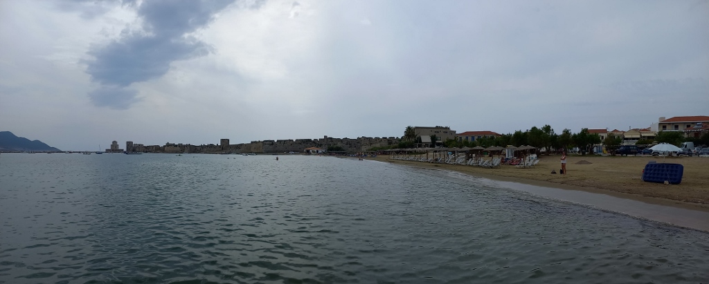 Methoni Beach
 Methoni Citadel, a detail
Upon entering the town of Pilos, I passed by the aqueduct leading to Neo Kastro or the New Castle. I’ll share more about it a bit later.
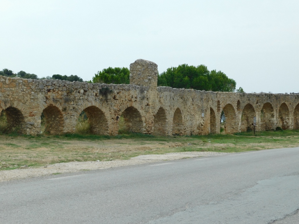 Aqueduct of Pilos
For now, what is important is that I entered the town centre and made my way down to the waterfront, where I parked the car and took a little stroll.
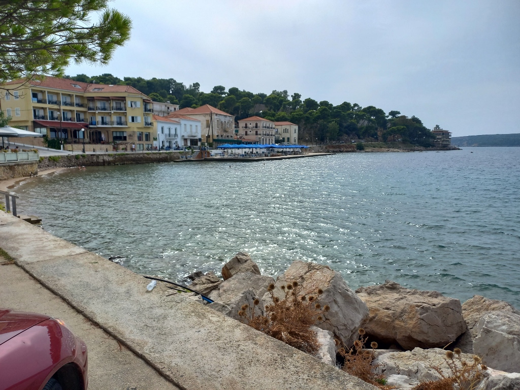 Pilos
Pilos
I have already mentioned in the previous part of my travelogue that the town of Pilos is located on the shores of Navarino Bay.
The strategic importance of Navarino Bay was recognised both in the ancient times and during the Middle Ages. The Venetians and Ottomans fought over this bay for centuries, not only because of its strategic position, but also due to the exceptional characteristics of the bay itself – 3 x 5 km, ideally sheltered from almost all sides, with water depths ranging from 20 m in the north to as much as 60 m in the south.
The famous Battle of Navarino, a naval conflict between the British, French and Russians on one side and the Ottomans and Egyptians on the other, took place in this bay on 20 October, 1827. This battle was a part of the Greek War of Independence (1821-1829) and ultimately the Turks suffered a heavy defeat.
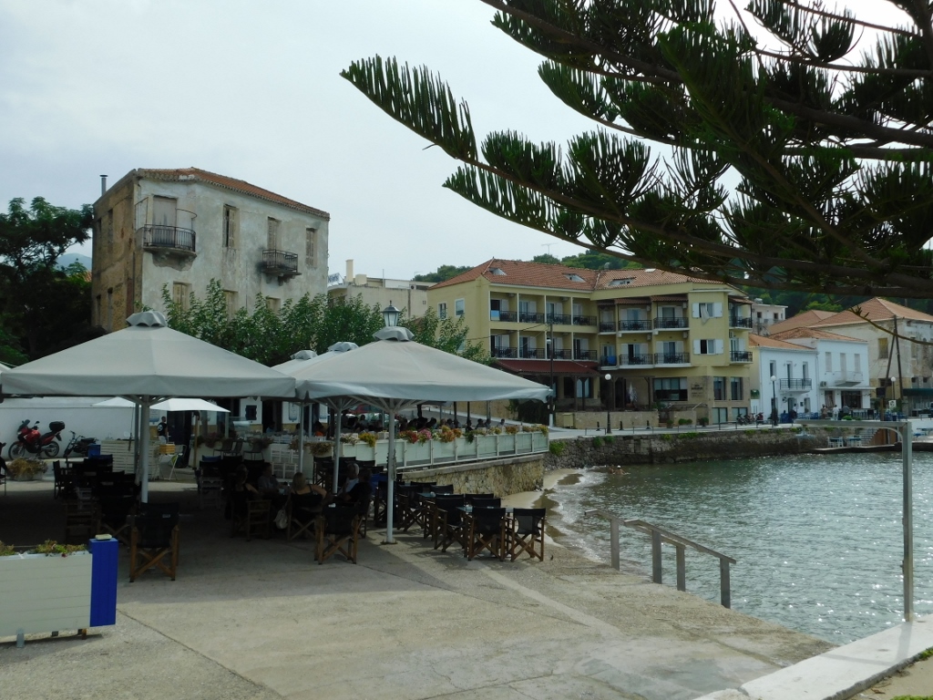 Pilos
Pilos
The construction of the modern town of Pilos began in 1829 by the French. Prior to that, the town was located on the northern side of the bay.
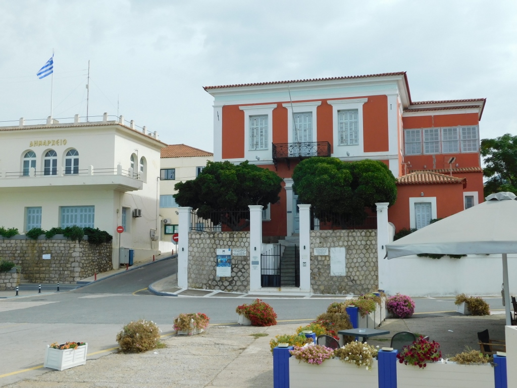 Pilos
Pilos
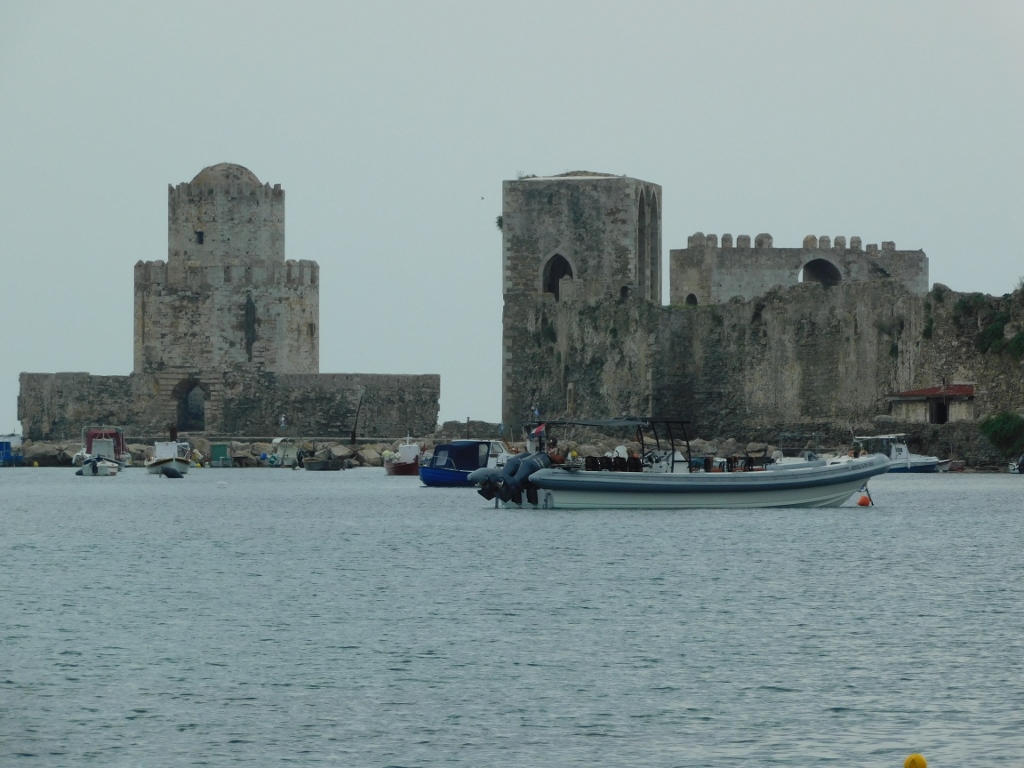
The Ottomans built a fortress at the southern end of the bay in 1573, which is nowadays called the New Castle (Neo Kastro). The Venetians took control of it in 1685.
I decided to take a walk to the citadel later, but for now, I sat down in a restaurant because I was hungry. I opted for a simple meal, as it was important for me to have lunch relatively quickly so that I could visit everything I had planned and still make it to Olympia or, more specifically, to Archaia Olympia, during the day, before the sunset.
 Lunch in Pilos
After the relatively nice lunch, I took a walk to the New Castle (Neo Kastro), which is situated on a small rise directly next to the town, to the west.
 View at Pilos
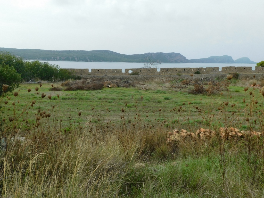
This is essentially a fortified settlement with a roughly triangular ground plan, featuring a hexagonal citadel at its south-eastern corner. At the northern and south-western corners, there are rectangular bastions. These three main defensive structures are connected by ramparts.
 Fortification in Pilos, a detail
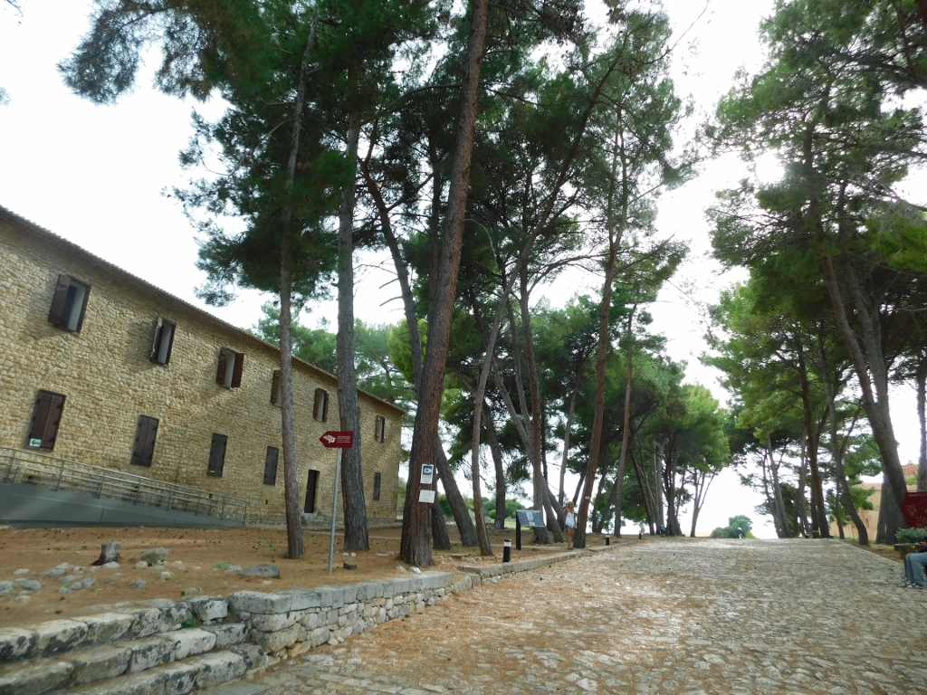
First, you enter a spatial "extension" to the triangular area I have mentioned, which is also enclosed by walls. Here, you’ll find the Archaeological Museum of Pilos, but I didn’t plan to stop there. My idea was simply to take a quick stroll through some parts of the fortress.
 Fortification in Pilos, a detail
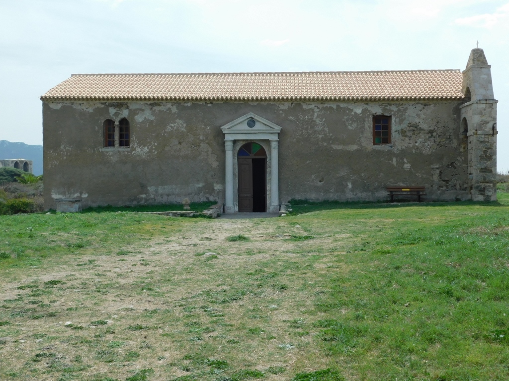
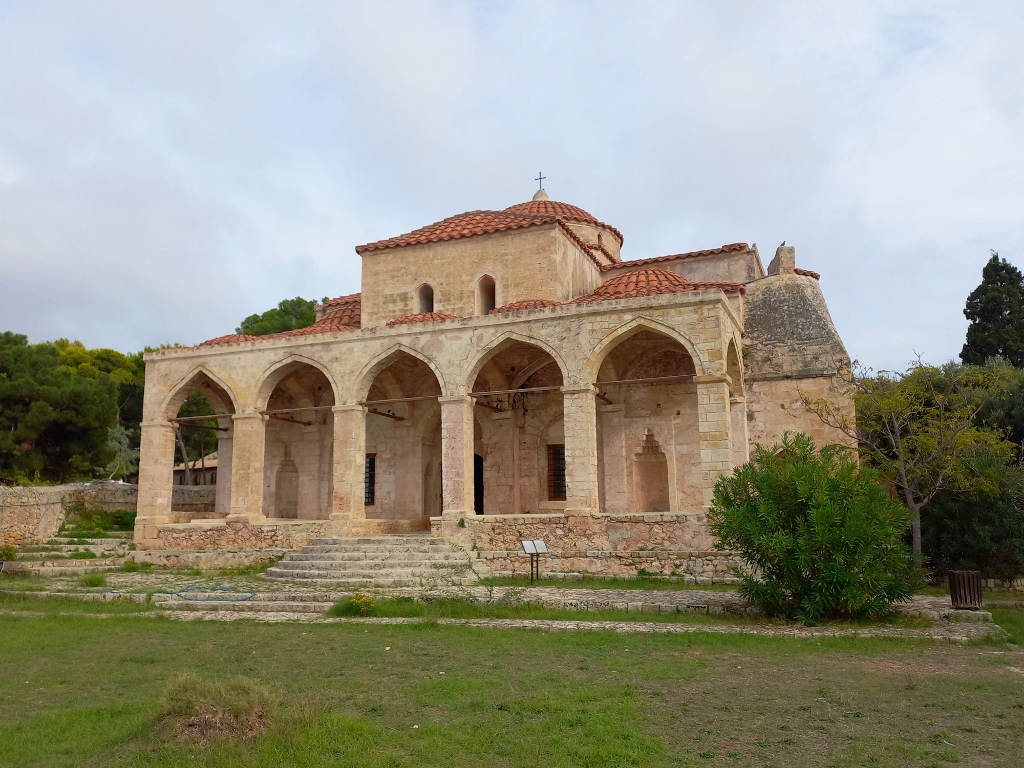
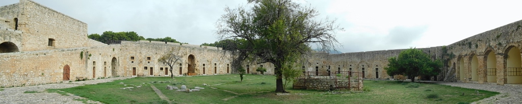
I found it most interesting to walk through the central part of the fortress, where a settlement once used to exist. When the Ottomans built the fortress on the remains of an earlier structure in 1573, there were houses, shops, a mosque, a tavern and a hammam. However, all of this had been abandoned in 1828, while a year later the French added some parts to the fortress. As for those structures within the walls, to this day, only the former mosque has survived, which was converted into the Church of the Transfiguration of the Saviour.
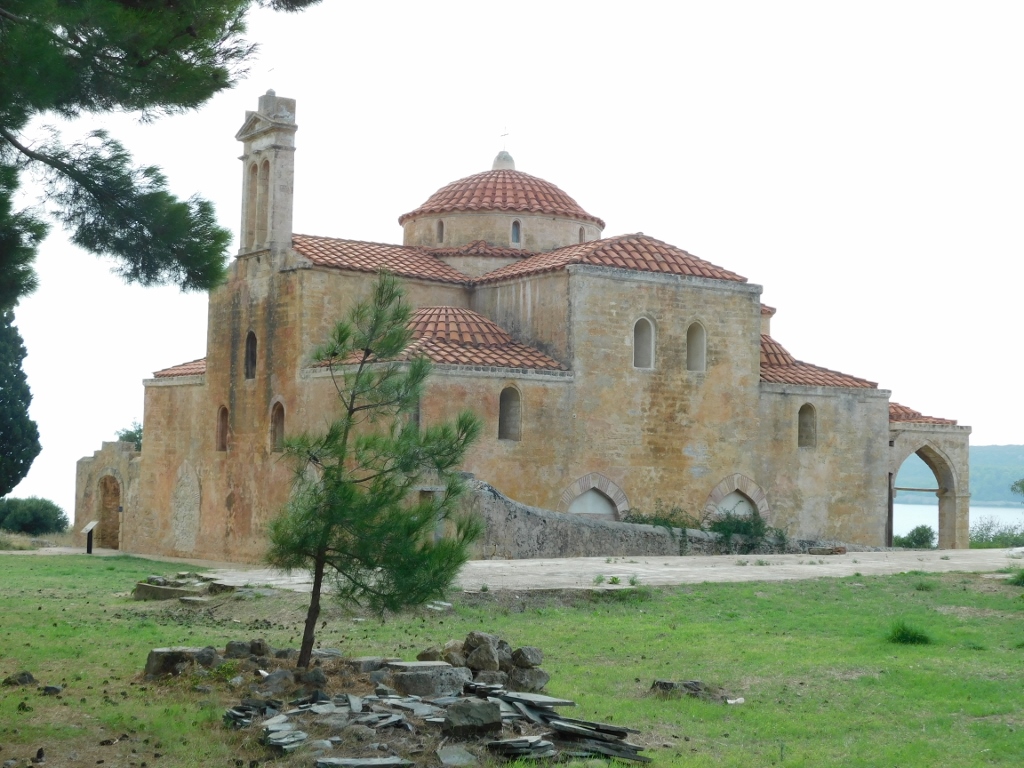 Church of the Transfiguration of the Saviour in Pilos
The building was constructed around 1573 and, aside from the brief periods when the Venetians were here or during an uprising at the end of the 18th century, it served as a mosque.
 Church of the Transfiguration of the Saviour in Pilos
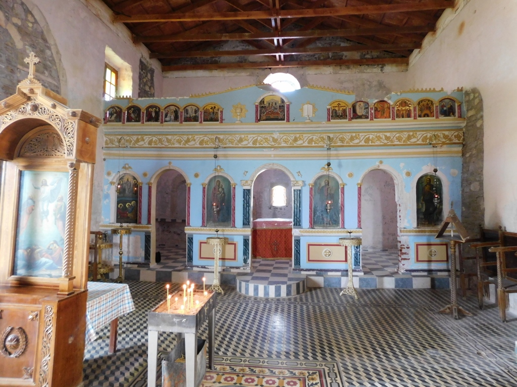
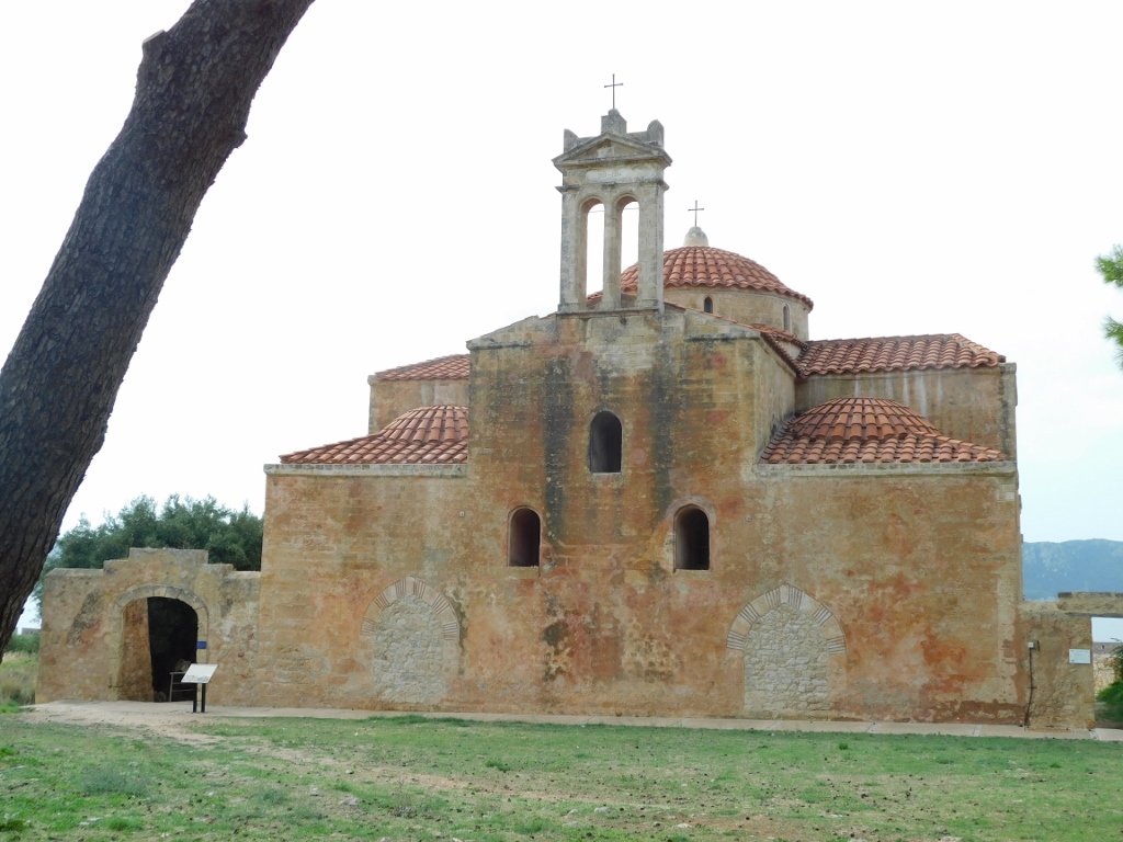
Of course, after the final liberation, the building was converted into a church, but time took its toll and the structure deteriorated significantly. Therefore, in the early 21st century, a rehabilitation project was implemented and today it is in a quite good condition. It was open, so it was with pleasure that I went inside.
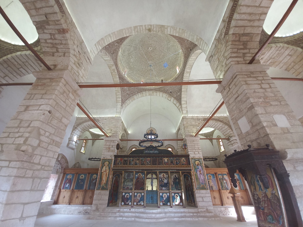 Church of the Transfiguration of the Saviour in Pilos, the interior
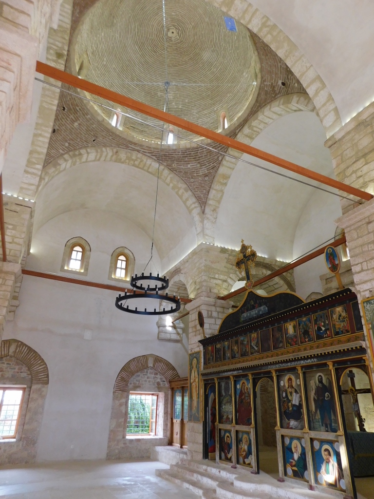 Church of the Transfiguration of the Saviour in Pilos, the interior
In addition to the very beautiful and harmonious front facade of the building, the next photograph also shows the base of the minaret on the right-hand side, as well as the mihrab, the niche indicating the direction of Mecca.
 Church of the Transfiguration of the Saviour in Pilos
 Church of the Transfiguration of the Saviour in Pilos, a detail
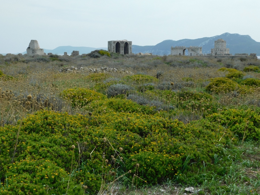
As for the other structures that once existed within the settlement, mostly only their foundations remain today and even that is limited. However, I really enjoyed looking around, as I could not only see the remnants of the old settlement and parts of the ramparts, but also views of Navarino Bay.
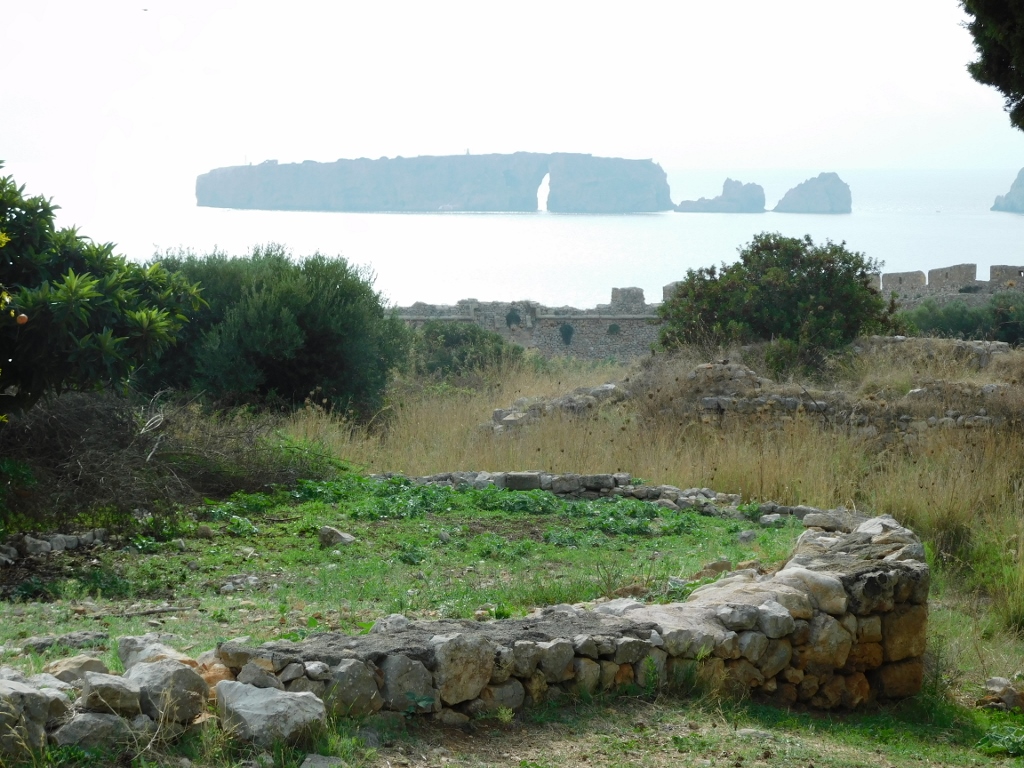
To the south, i.e., in the next photograph, is the island of Tsihli Baba that extends from the larger island of Sfaktiria. Together, they essentially "close off" Navarino Bay from the west, making it an exceptional strategic location.
 Parts of the fortification in Pilos and the island of Tsihli Baba
 Parts of the fortification in Pilos and the island of Sfaktiria
After that, I strolled around the area a bit more before heading to the New Castle (Neo Kastro) itself.
 Fortification in Pilos, a detail
 Within the New Castle
I have already mentioned that the citadel has a regular hexagonal layout with five pentagonal bastions at the corners (there's no bastion at one corner). The Ottomans originally built the citadel in 1573, but it was further developed by the Venetians, the French, and especially the Greeks, as it was used as a prison from the 19th century until the mid-20th century. Today, it is a pleasant space for historical and cultural visits.
After finishing my tour of the citadel, where I didn’t stay for long, I descended from the rise to the parking area by the harbour and headed north.
I must admit that there is a very beautiful place near the road I was travelling, which I didn’t stop at: Voidokilia Beach, with a lagoon behind it that is considered an important bird habitat. However, owing to a lack of time (it was already late afternoon and I had over two hours of driving ahead with one planned stop), I didn’t head in that direction. On the other hand, I think anyone travelling these roads should definitely make a stop there.
As for me, I then drove to the remains of the Mycenaean palace that belonged to the legendary King Nestor of Pylos, located near the village of Nestoras.
King Nestor, who was known in Greek mythology as a wise counsellor and a good leader of people, is one of the prominent secondary characters in Homer’s Iliad and Odyssey, which is how I know about him. The palace I came to visit is attributed to him, although there is no evidence that King Nestor was a real person.
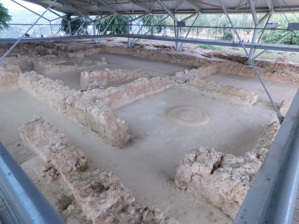
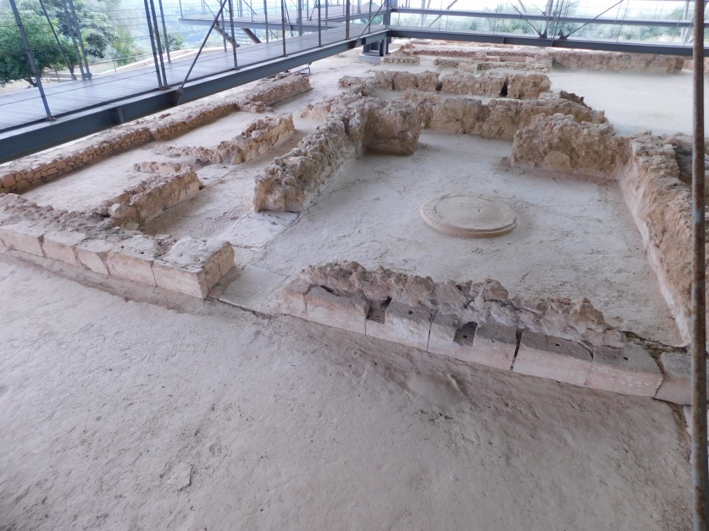
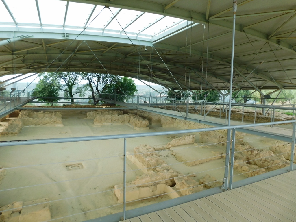
As for the remains of this palace, they are primarily preserved in the form of the lower sections of the walls, while the entire site is protected by a massive roof structure.
 Palace of Nestor
In any case, researchers have established that the palace served as the administrative centre of the kingdom of Pylos, which was exceptionally powerful in its time and belonged to the Mycenaean civilisation that developed mainly in the territory of the Peloponnese from around 1750 to about 1050 BCE.
The kingdom of Pylos itself existed from 1600 to 1200 BCE. This kingdom should not be confused with the modern town of Pilos for several reasons, one of which is that the kingdom covered an area of about 2,000 sq. km. On the other hand, to this day, it is not known for certain where the urban centre of the kingdom was located; various palace remains, administrative and residential structures, as well as villages, are known, but no larger centre has been discovered.
However, in the 13th century BCE, the entire kingdom and the region of Messenia in the south-western Peloponnese were ruled precisely from this palace.
This palace is considered the best-preserved palace from the Mycenaean period in all of mainland Greece and it was the second most important centre within the Mycenaean culture, right after Mycenae itself. I mean, I didn’t just come here by chance. However, the palace is located far from the main tourist routes, which is likely why it is less known and popular among visitors.
It is actually a palatial complex, consisting of multiple structures that constituted the palace. It encompassed four main buildings, including the main structure, as well as several smaller ones. All of this was destroyed around 1200 BCE in a major fire.
As for the main building the remains of which are visited today, it was constructed on two levels, featuring a ground floor and an upper floor, along with courtyards, baths, staircases, lightwells, and a drainage system. Stone, wood and clay were used for the construction, while the walls were decorated with wall paintings. There were even influences from the Minoan culture that developed on Crete (see my 2022 travelogues from this island that begin with: https://www.svudapodji.com/en/crete-1/).
On the other hand, the site isn’t very large and can be explored quite quickly. Artefacts found here can be seen at the Archaeological Museum of Chora (when it’s open, as it is currently undergoing renovations).
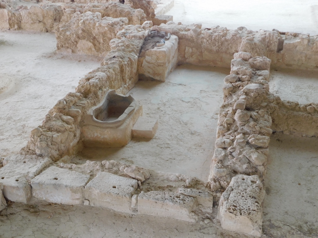
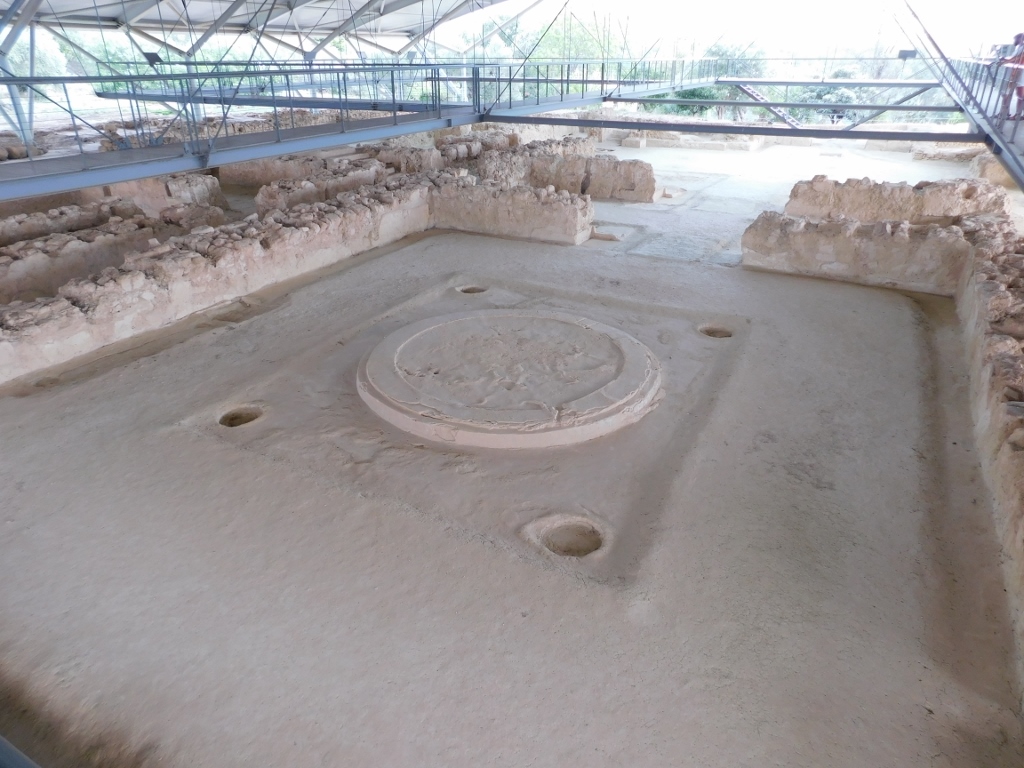
During the visit, you first come across an area known as the Queen’s Megaron, although it is assumed that this was where the guards were stationed, while the queen's chambers were likely on the upper floor. In the centre of the main room, you can see a circular hearth, while the walls were adorned with frescoes of wild and mythical animals, including lions and griffins.
 Palace of Nestor, a detail
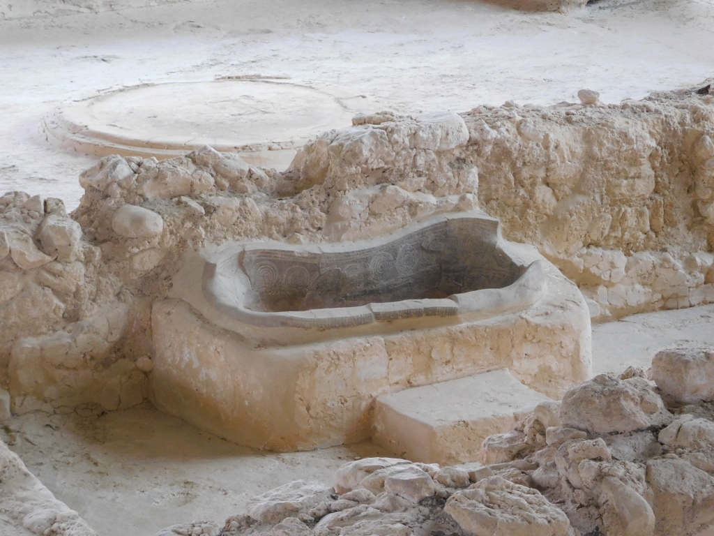
This area connects to a bathroom that represents a unique example of a bath found in a Mycenaean palace in mainland Greece. You can see a fairly well-preserved large clay tub with spiral decoration, accompanied by a step to facilitate entry and exit from the tub. In the corner of the room there are two jars built into a high clay bench, believed to have been used for storing reserve water and aromatic oils. All of this points to a high level of a true civilisation.
 Palace of Nestor, a detail
 Palace of Nestor, a detail
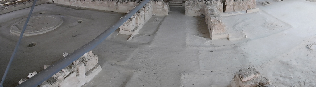
Within the palace, there were rooms that served various purposes and in some of them you can see the foundations of columns that supported the upper floor.
 Palace of Nestor, a detail
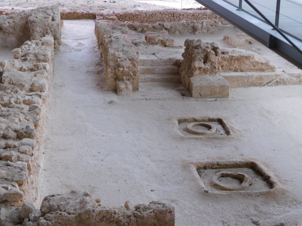
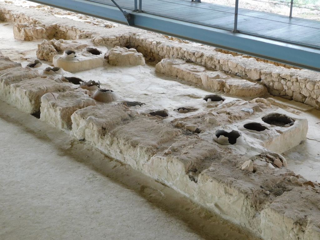
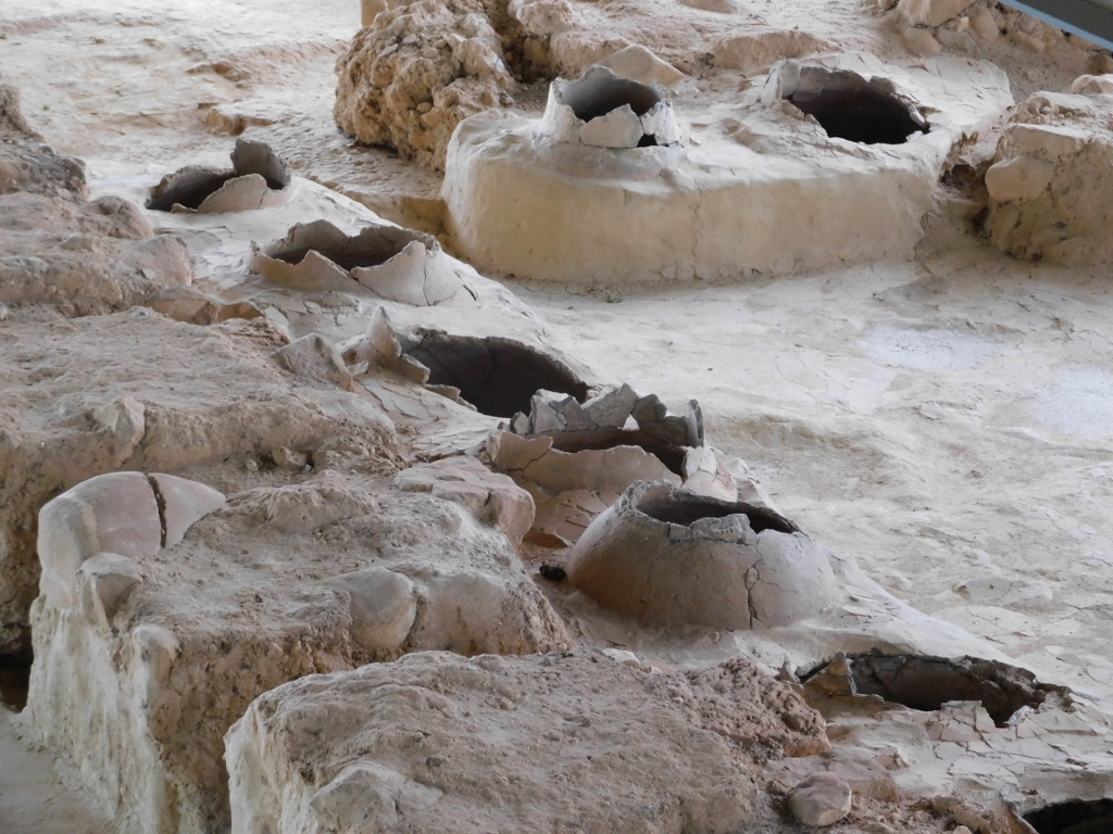
Right next to the Throne Room, which I was about to visit, were the rooms used for storing olive oil.
 Palace of Nestor, a detail
Here, large pithoi – massive clay jars used for storage – were built into clay benches. The production and exchange of aromatic oils were significant economic activities in the palace, representing a well-organised industry. According to numerous clay tablets found at the site, trade in these oils flourished in the eastern Mediterranean from around 1450 to about 1080 BCE. Namely, the oils were used for religious and funerary rituals, medicinal purposes, as well as in everyday life (after bathing or in the production of materials for clothing).
 Palace of Nestor, a detail
The next room along my sightseeing path was the Throne Room.
 Palace of Nestor, a detail
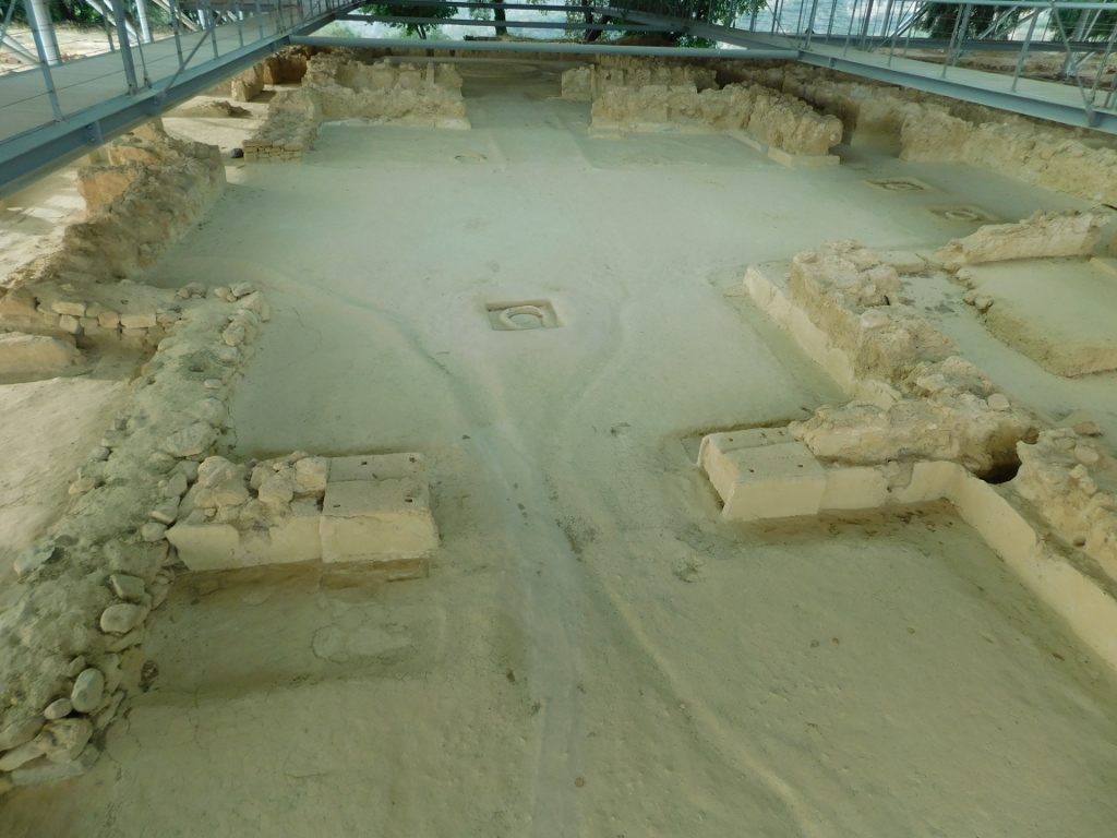
The Throne Room was the centre of royal power where the king discussed political and trade matters, and received foreign visitors and representatives from other Mycenaean kingdoms. In the middle, there was a large hearth surrounded by columns that supported a balcony on the upper floor, which encircled the room. In the photo above, to the left, you can discern the spot where the throne once stood, believed to have been made of wood and decorated with ivory and precious metals.
The Throne Room is a part of the King's Megaron, which consisted of three rooms, all clearly indicating the impressive size and grandeur of the space.
 Palace of Nestor, a detail
In order to reach the King's Megaron, one had to pass through the Propylon, which served as the main entrance, followed by a spacious open-air courtyard. The Propylon had an H-shaped ground plan, with doors in the centre and porticoes on either side, each supported by a column (the base of one column can be seen in the next photograph).
 Palace of Nestor, a detail
From the open-air courtyard, one could pass through the porch with two columns (the bases of which are visible in the top right of the previous photograph, and even better in one of the earlier images) in order to reach other parts of the palace. These two columns also supported a balcony from which one could observe activities in the courtyard and these were most often different rituals.
Here I effectively concluded my tour of Nestor’s Palace, the remains of which are now completely covered and there are also walking paths that greatly facilitate the exploring of the site.
 Palace of Nestor
The palace was built on a gentle rise at an elevation of 192 meters, but from there, there is still a beautiful view of Navarino Bay and the Ionian Sea.
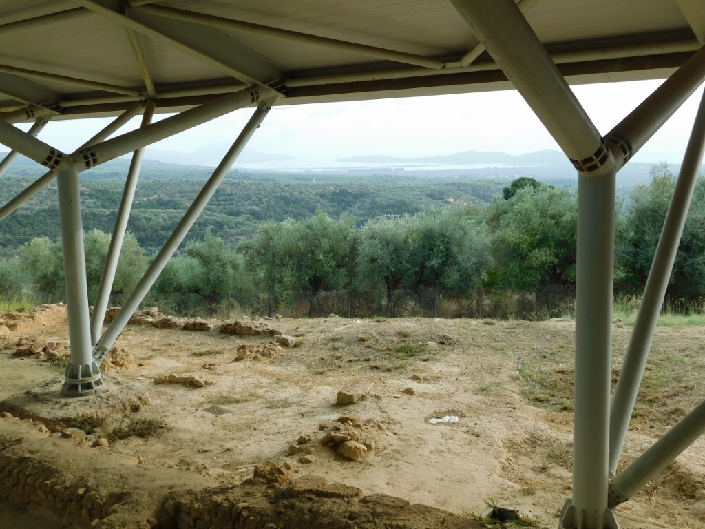 View from the Palace of Nestor
Near the parking area by Nestor's Palace, there is also a tholos or a beehive-shaped tomb. This one is smaller than the one in Mycenae, but I didn’t have time for further explorations. I was now heading to Olympia, officially known as Archaia Olympia, a town close to the archaeological site. I had over an hour and a half to get there, and it was already quite late in the afternoon, so I wanted to arrive before daylight faded.
At one point, I encountered a lovely dog that seemed to want to slow me down a bit (though I wasn't driving too fast).
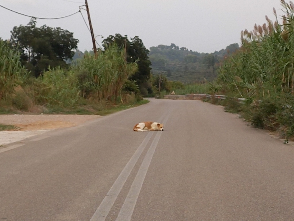 A dog on the road
I actually had to stop, while it stood in front of the car for a while as if it wanted to let me know whose territory this was. On the other hand, it was a remarkably beautiful dog.
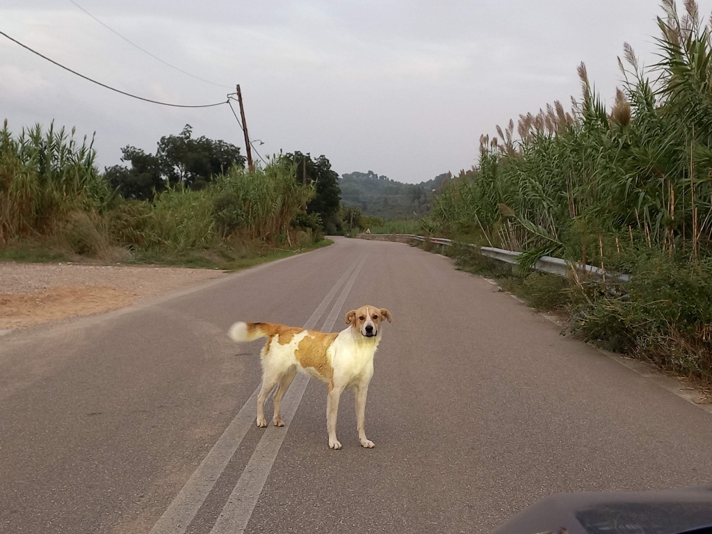 A dog on the road
I let it decide when it would move, and after a minute or two, it kindly stepped aside, allowing me to continue.
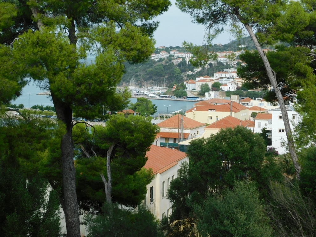
In Olympia, I settled into a flat I had rented for the night, then went out for a stroll. It was clear that the season was coming to an end.
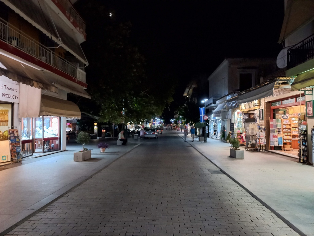 Olympia at night
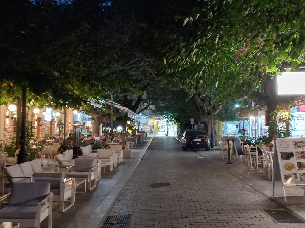 Olympia at night
Still, I did find some restaurants and bars with people, so I sat down to recharge a bit.
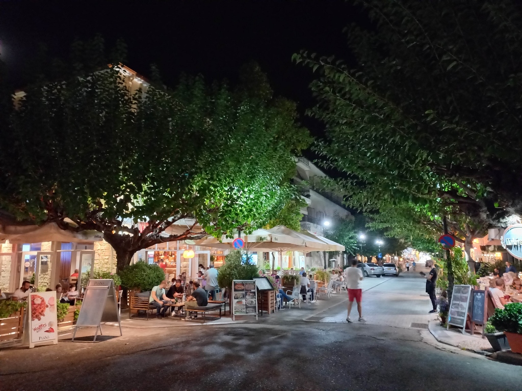 Olympia at night
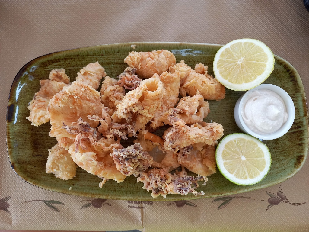
First, I had something savoury and drinkable, and then I moved on to a dessert that was both huge and incredibly sweet.
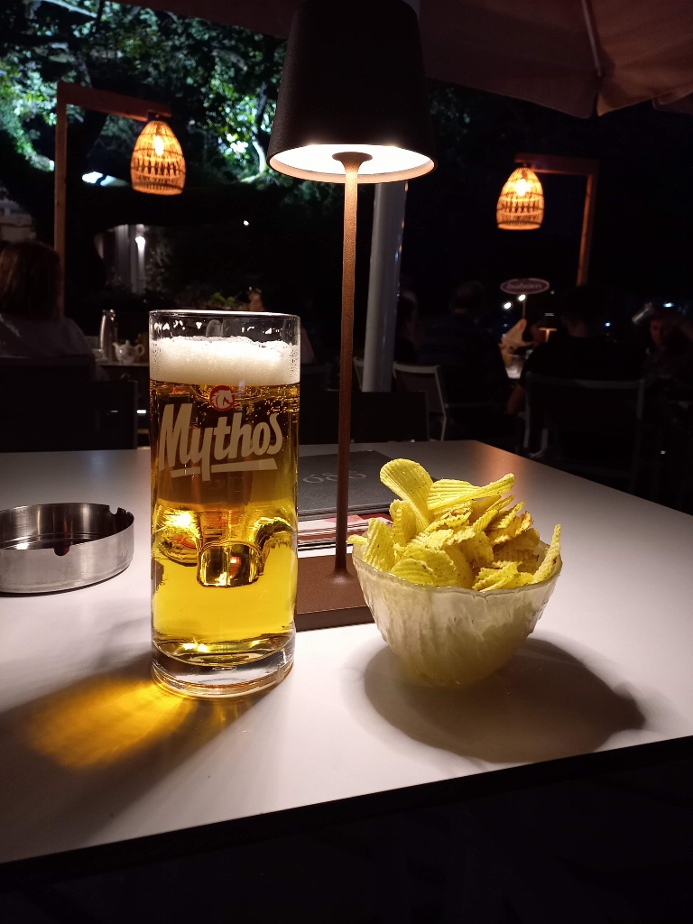 Evening respite in Olympia
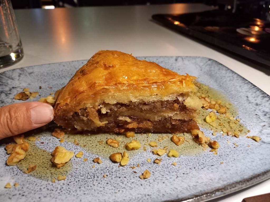 Evening respite in Olympia
Very satisfied with the whole day and with a full stomach, I went to bed a little later.