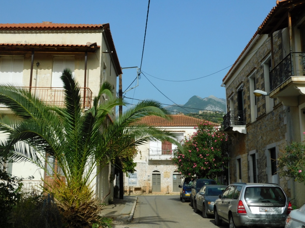
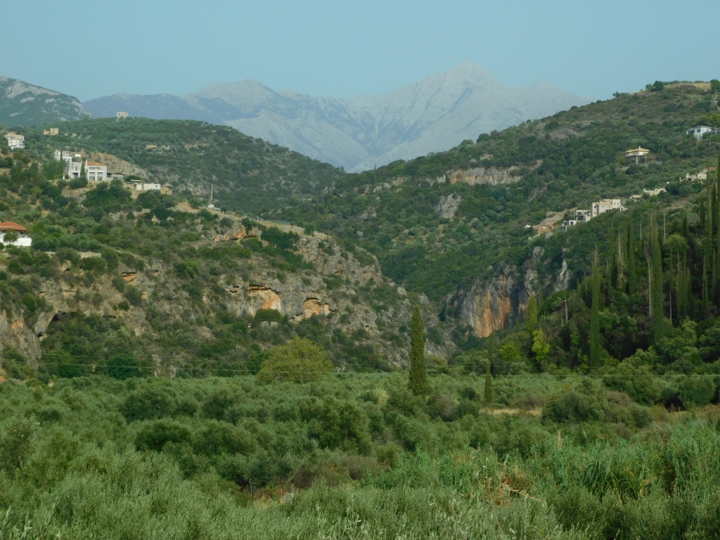
While driving through the Mani Peninsula in southern Peloponnese, Greece, I arrived at the village of Thalames. In this area, the main road along the coast of the Messenian Gulf, which is part of the Ionian Sea, passes through several charming villages and alongside some very beautiful and significant ancient churches.
One of those villages is Thalames, although, as far as I could see, the Church of St. George there isn't particularly significant in terms of its antiquity. However, that wasn't a reason not to stop for a moment, especially since it was literally on my way.
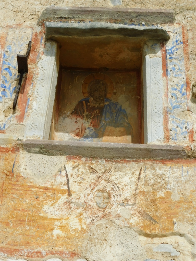
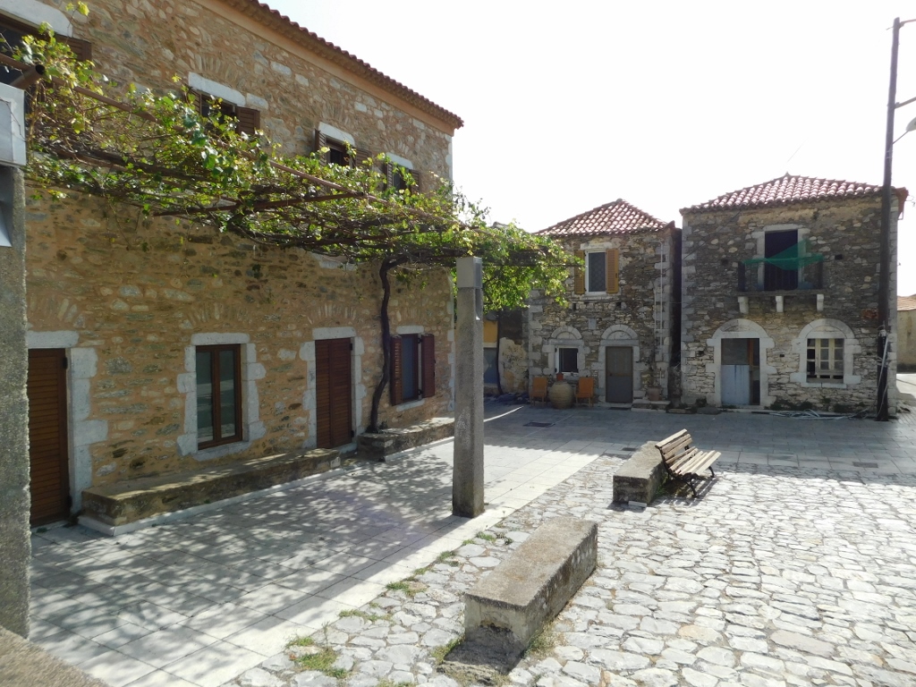 Thalames, a detail
 Thalames, a detail
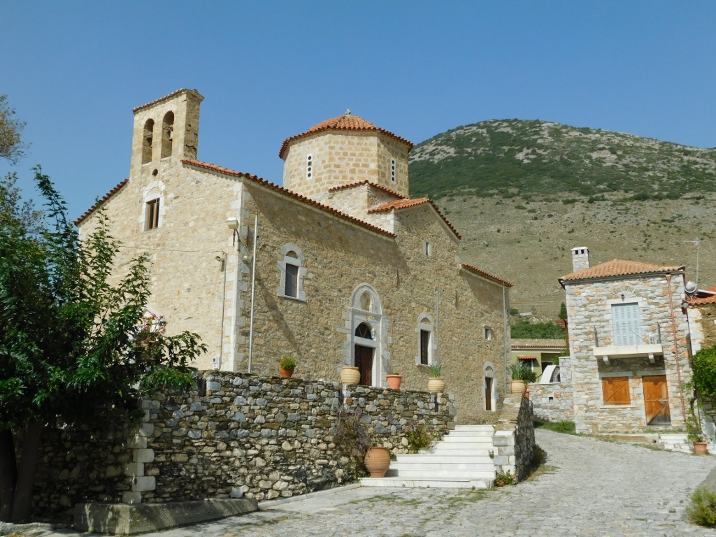
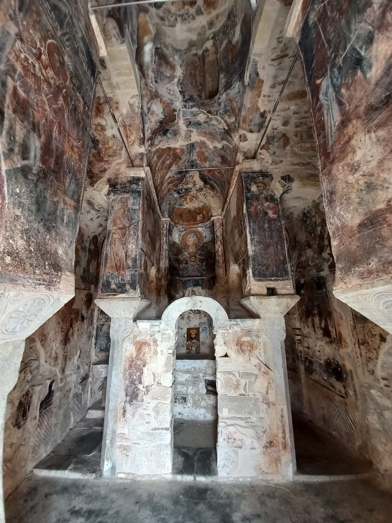
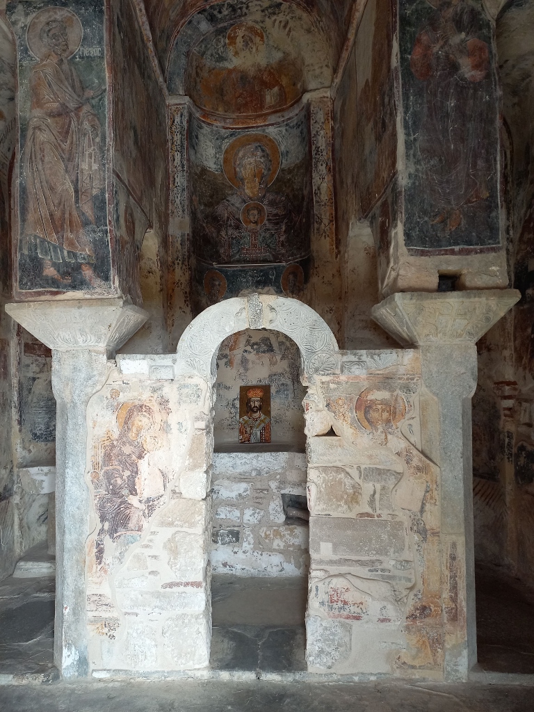
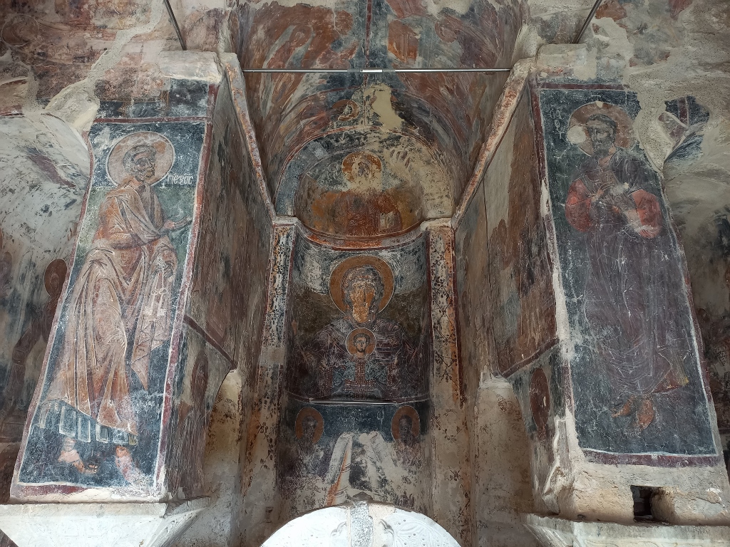
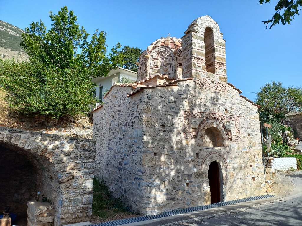
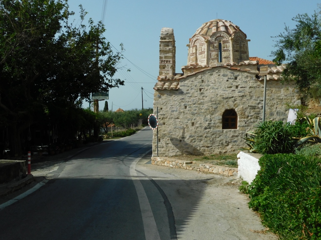
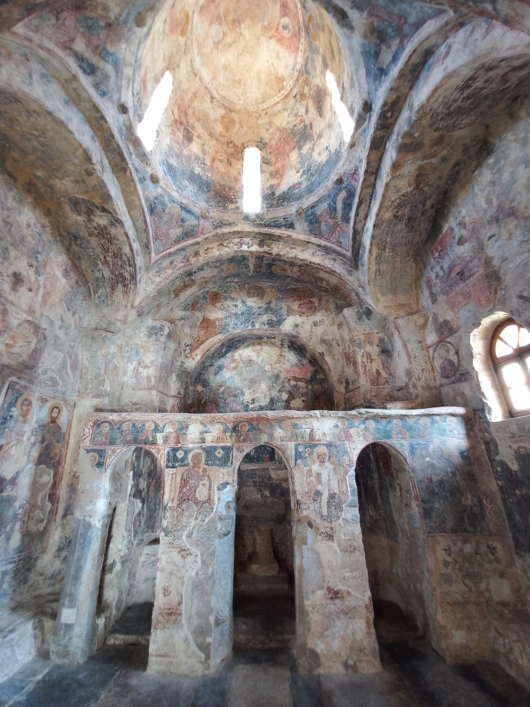
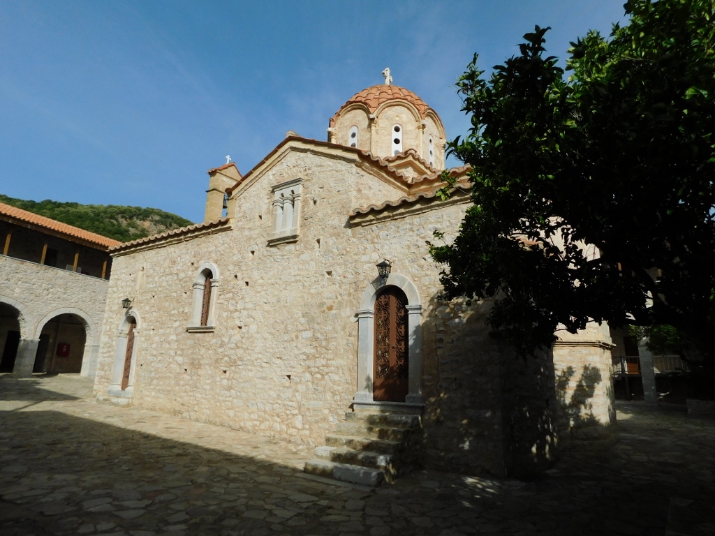
Much more interesting is the Church of the Transfiguration of Christ that belongs to the village of Nomitsi. It is located just 400 m further on the right-hand side of the road when heading north.
 Church of the Transfiguration of Christ in Nomitsi
 Church of the Transfiguration of Christ in Nomitsi, a detail
The church was built in the 11th century and has a cross-in-square plan with a dome rising above the centre of the naos. It features three apses on the eastern side, and it was built using stone and brick, adorned with terracotta decorations on the outer walls. The church was restored and conserved in the early 21st century, allowing visitors today to enjoy its undeniable beauty and elegance.
 Church of the Transfiguration of Christ in Nomitsi, a detail
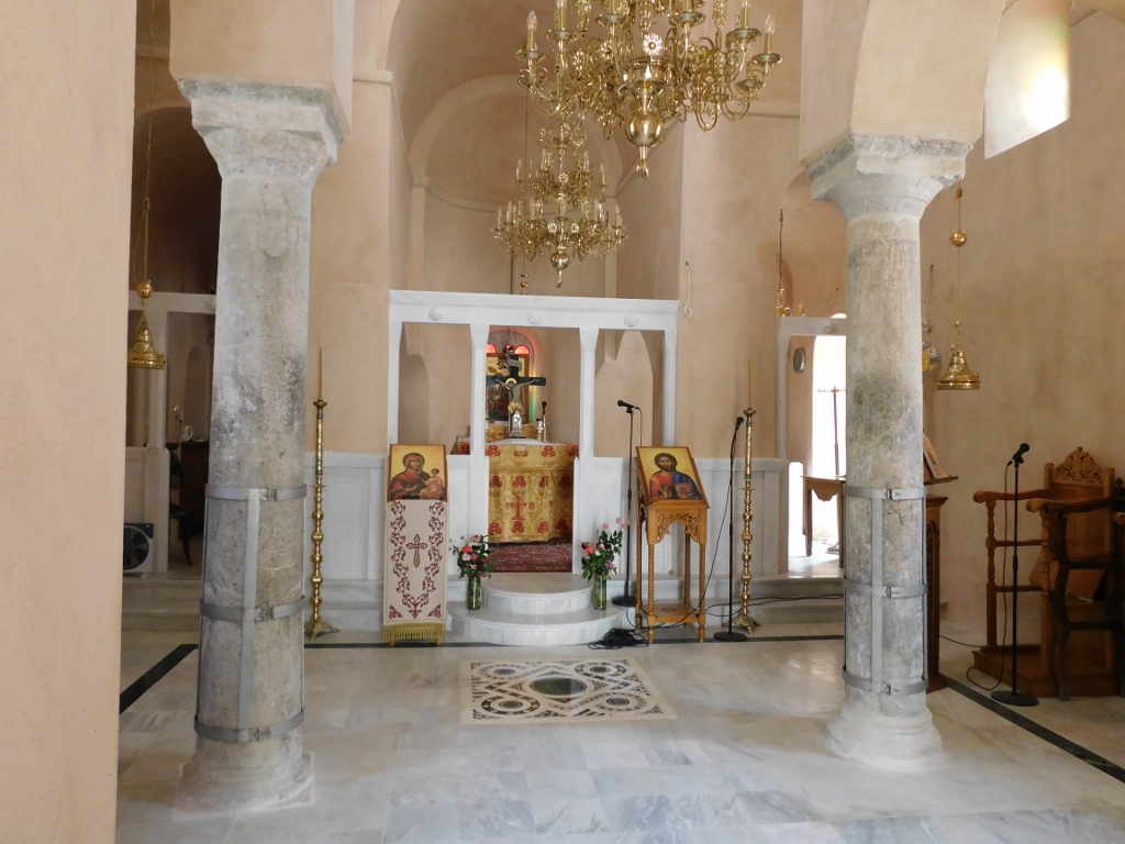
Although it seemed that the church was closed, it turned out that it wasn't, so I went inside and was able to take a look around. I was truly delighted.
 Church of the Transfiguration of Christ in Nomitsi, a detail
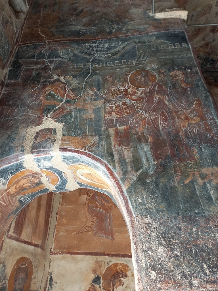
In addition to the frescoes, the beauty of the columns stands out, featuring unusual capitals carved with peacocks and cocks. There is also an impressive iconostasis, most likely constructed in the 18th century from brick, with carved arched architrave made of marble on top, which was part of the original templon.
 Church of the Transfiguration of Christ in Nomitsi, a detail
Regarding the frescoes, the earliest preserved fragments date back to the early 13th century. Most of the wall paintings were created later – some scholars believe they are from the 15th to 16th centuries, while others think they date back to the first half of the 17th century. The final phase of painting was completed in the 18th century.
 Church of the Transfiguration of Christ in Nomitsi, a detail
 Church of the Transfiguration of Christ in Nomitsi, a detail
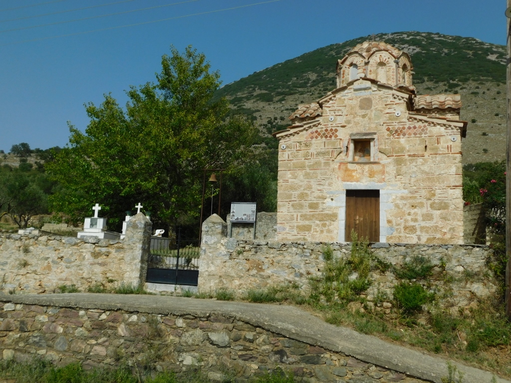
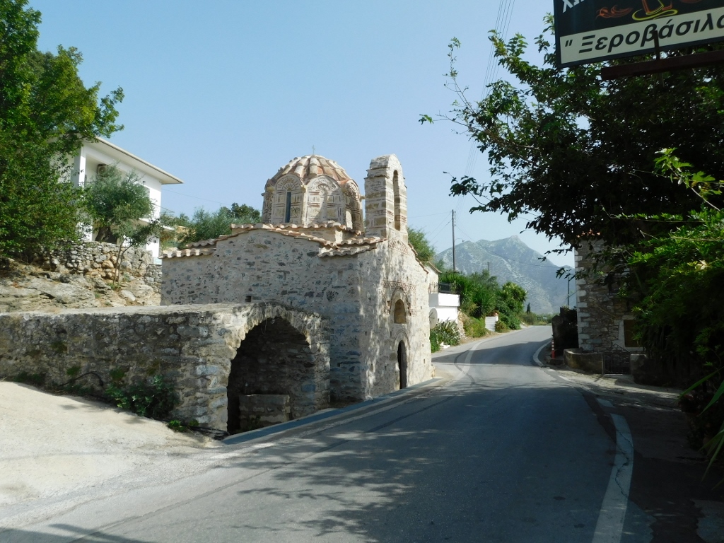
Literally just some hundred metres further, in the hamlet of Koumani, which belongs to the village of Nomitsi, on the same side of the road, there is another beautiful and interesting church. This is the Church of the Holy Unmercenaries, referring to the Holy Healers Cosmas and Damian.
 Church of the Holy Unmercenaries
To start with, I was completely taken aback by the church's position, especially in relation to the road that passes by. It’s not enough just to see the previous photo. So, I first went back a bit along the road in one direction and then in the other in order to take photos of the church and illustrate its unusual proximity to the road where motor vehicles pass.
 Church of the Holy Unmercenaries
 Church of the Holy Unmercenaries
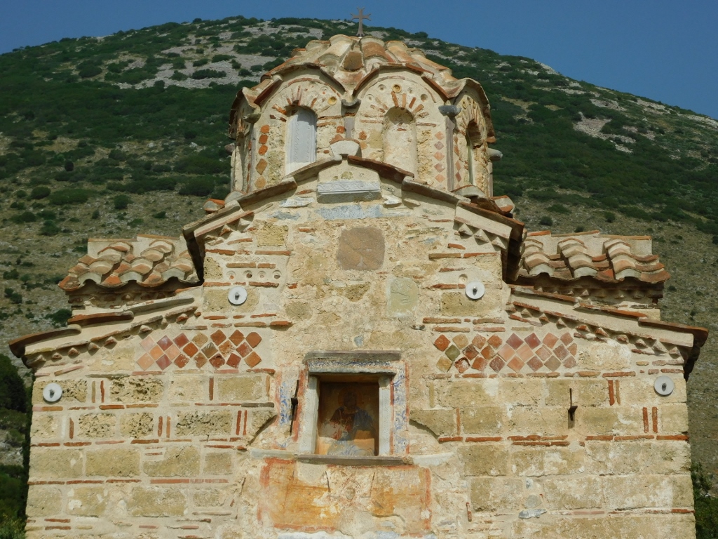
This single-nave church has a cross-in-square ground plan and it particularly stands out for its relatively large dome considering the church's small size. The dome rests on the main arches inside the building and is set on an octagonal drum where window openings are aligned with the main axes.
 Church of the Holy Unmercenaries, a detail
The church was originally built in the 10th to 11th centuries, while its current form was achieved during the Late Byzantine period (13th to 14th centuries). The frescoes were created in three phases.
 Church of the Holy Unmercenaries, a detail
In the area of the village of Nomitsi, there is another church mentioned in my guide, the St. Demetrius Chapel. However, it is tucked away among olive and cypress trees about a hundred metres from the road, with no visible path or signs to indicate clearly where to search for the chapel. I decided to skip it and continued on to the village of Stoupa, where I went to a café/restaurant to have something to drink and refresh myself. The view from there was quite lovely and pleasant.
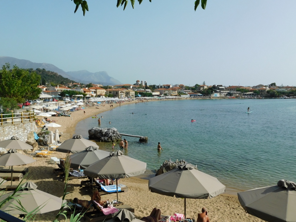 Beach in Stoupa
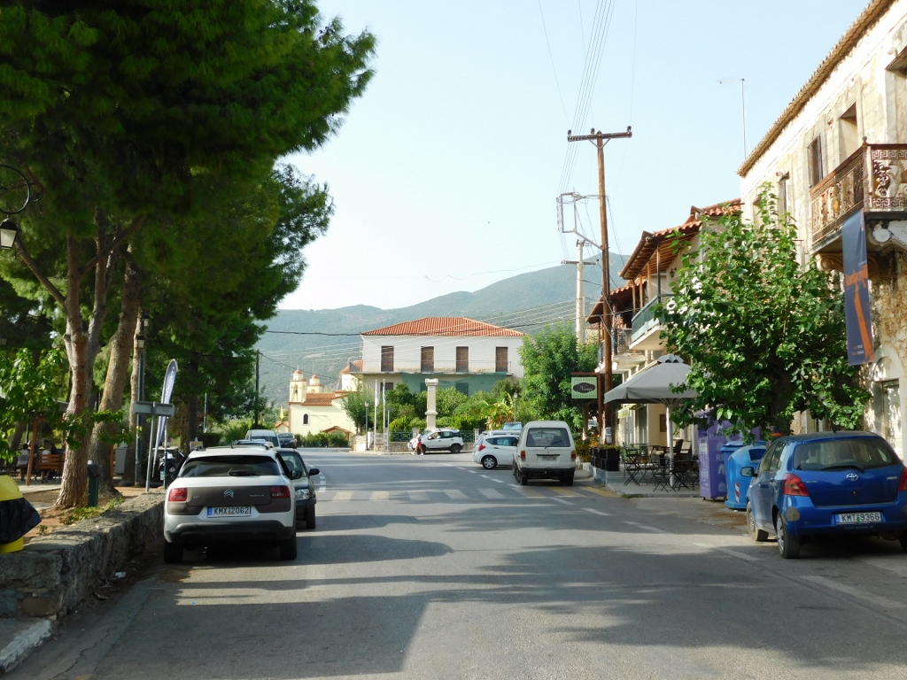
After this nice break, I drove for some 8 km to the town of Kardamyli. From what I had read, it is another tourist destination on the Messenian Gulf, so I thought I could take a stroll there as well. I parked my car and set off for a walk.
 Kardamyli
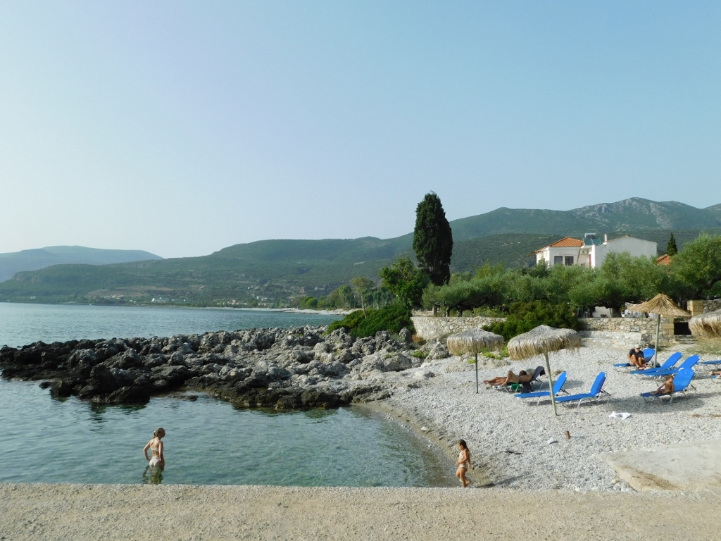 Coast in Kardamyli
However, I wasn't impressed or inspired to find a place for another break here. So, I took a brief walk around the town and then returned to my car to continue on my way.
 Kardamyli
 Kardamyli
At the exit of the village of Kardamyli, there is a bridge that crosses a river when water is present (I assume in the spring when the snow melts in the mountains). In September 2023, it was just a dry riverbed. However, it’s worth stopping here because there is a very nice view of the 13th-century Church of St. Spyridon, as well as the surrounding area, including another remarkable stone tower called Mourtzinos Tower, built in 1807. There is a museum here now, and in hindsight, I should have stopped by. But after a day of almost constantly getting in and out of the car, I was feeling a bit fatigued by it all. On the other hand, the day had stretched on and I needed to get to the place where I had booked a room to rest for the continuation of my journey, so I didn’t want to make any more unplanned stops.
 Parts of Kardamyli and the surroundings
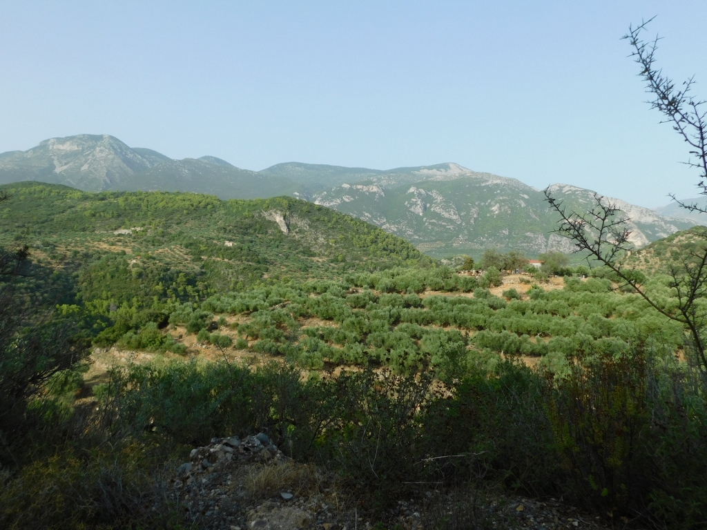
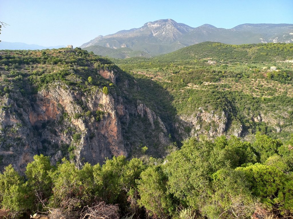
I had booked a room in a tourist suburb of Kalamata, near Mikri Mantinia Beach. I didn’t want to venture into the town, which isn’t small, and I planned to take a leisurely walk along the sea without traffic or noise. I still had about 30 km to go, but due to the often winding and narrow road, it would take around 40 minutes to drive. However, I couldn’t resist stopping a couple of times to take photos of the surroundings. I really enjoyed the landscapes I was passing through.
 On the way from Kardamyli to Kalamata
 On the way from Kardamyli to Kalamata
 On the way from Kardamyli to Kalamata
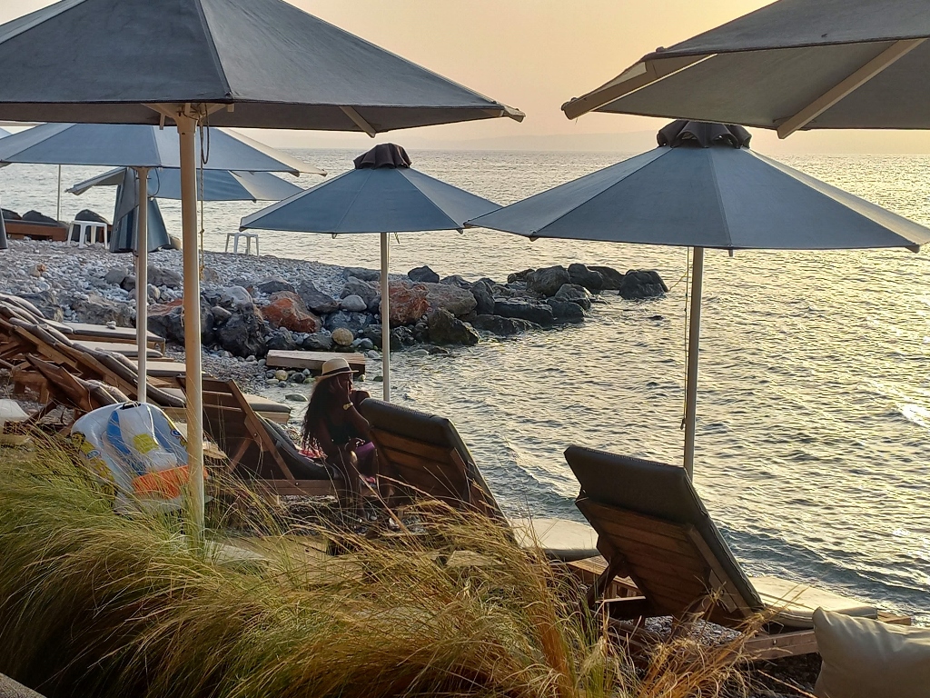
As I had planned, I parked the car and dropped off my things in the room before heading out for a walk. But first, I needed to refresh myself. So, I made my way to the beach and settled into a restaurant, where my drink arrived shortly after.
 Refreshment at Mikri Mantinia Beach
While waiting for my dinner to arrive, I took some photos of the beach, sitting for a while and then going down to the water for a closer look.
 Mikri Mantinia Beach, a detail
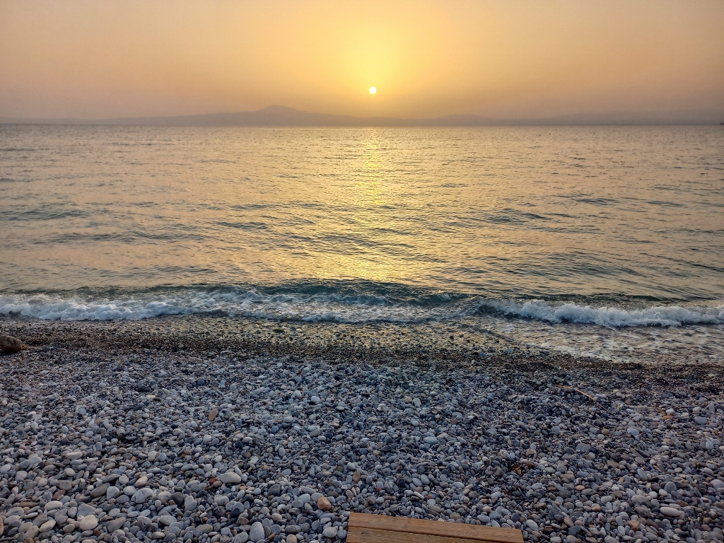 Mikri Mantinia Beach, a detail
 Dinner at Mikri Mantinia Beach
I didn't stay long because I had quite an ambitious plan for the next day. I needed to cover more kilometres than I had on this day (almost 250 km), while the drive itself, without breaks, was expected to take significantly longer (almost 5 hours). So, I needed to rest well and get a good night's sleep.
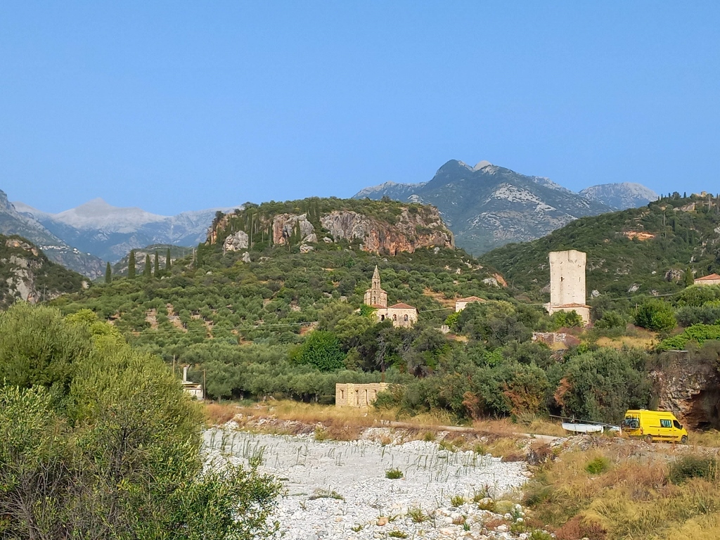
That's exactly what I did and the next day I continued my exploration of the Peloponnese. The plan was to venture inland a bit and then head to the third "finger," the westernmost peninsula in the southern Peloponnese. I planned to end the day by arriving in Olympia.
Here’s the map again as a reminder of all the places I visited on this trip in September 2023.
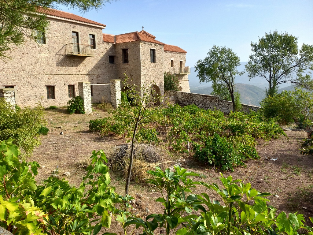
First, I headed toward the Archaeological Site of Ancient Messene and the route took me past the Voulcanou Monastery, which is right beside the road, so I decided to stop there.
The monastery is situated in a wooded area and the closest settlement is Mavrommati, which I had to go to anyway since the site of Messene is in the immediate vicinity of that village. Next to the clearing where I could park, I saw some auxiliary buildings, while the monastery was directly opposite.
 Voulcanou Monastery
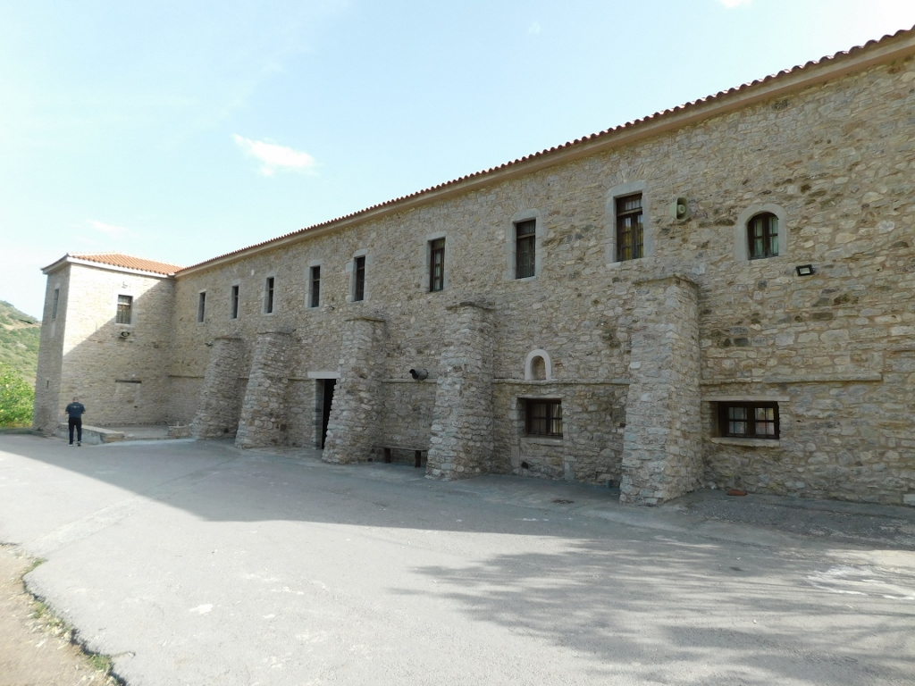
This is the so-called New Voulcanou Monastery, established on this site in 1625. The Old Monastery was located at another site, at the top of the nearby Ithome Mountain, where well-preserved ruins remain. You can reach it by driving along a dirt road or by hiking, as the distance is about 5 km.
The construction of the new monastery occurred in phases and today it resembles a fortress on the outside, with almost a square ground plan.
 Voulcanou Monastery
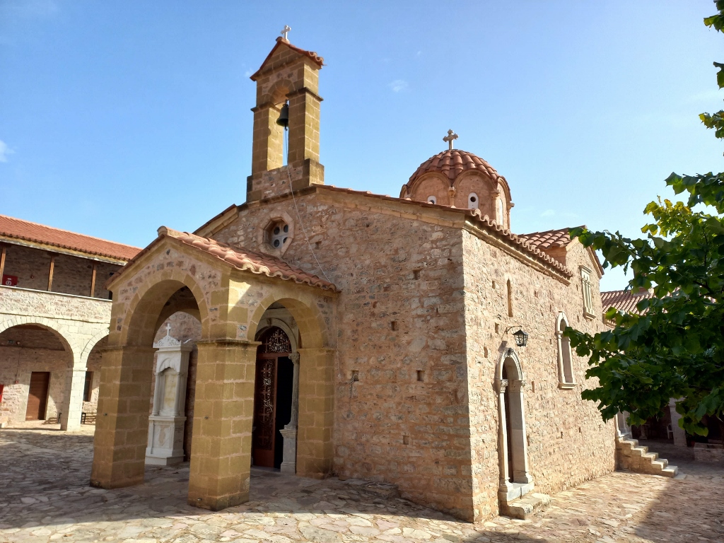
The main monastery church, dedicated to the Assumption of the Theotokos, was built in 1701.
 Katholikon of Voulcanou Monastery
 Katholikon of Voulcanou Monastery
 Katholikon of Voulcanou Monastery
I didn’t stay here for long. I took a few more photos of the gardens right next to the monastery and then continued on towards the ruins of Ancient Messene.
 Voulcanou Monastery
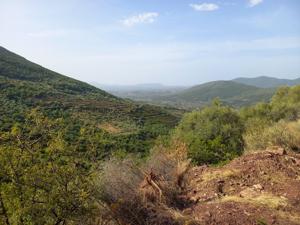
Along the way, I stopped at a spot near the village of Mavrommati in order to capture the beautiful view that stretched out in all directions.
 Surroundings of Mavrommati
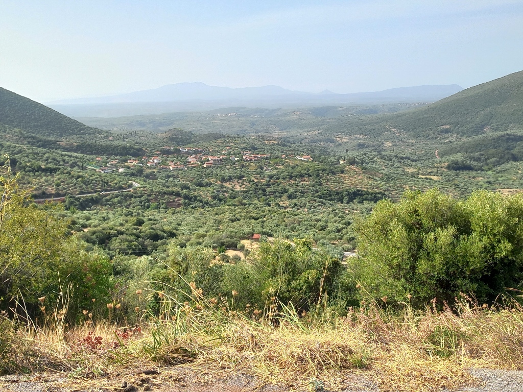 Surroundings of Mavrommati
In order to reach the Archaeological Site of Ancient Messene, I needed to pass through the village of Mavrommati, but I went a bit further – to the Arcadian Gate of Ancient Messene.
First, I should mention that Ancient Messene was the capital of the region of Messenia and was long a rebellious subject of the famous Sparta. Continuous uprisings and conflicts led to the displacement of the local population and at one point, the city was abandoned. However, after 371 BCE, when the Thebans (from Greek Thebes) defeated Sparta and conquered the Peloponnese, Messene was restored. Specifically, its reconstruction began in 369 BCE.
Messene continued to develop and thrive during the Hellenistic period and the early Roman Empire. Nevertheless, the city began to decline and was abandoned around 360/370 CE, but it was reinhabited during the early Byzantine period (5th to 7th centuries CE) and this continued until the late 15th century.
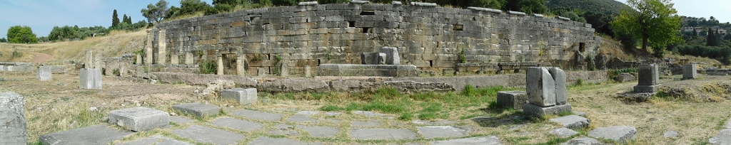
During the city’s construction in the 4th century BCE, strong walls were built around it, totalling about 9.5 km length. There were four gates, while the best-preserved section of the northern wall is located near the Arcadian Gate, which is where I headed first.
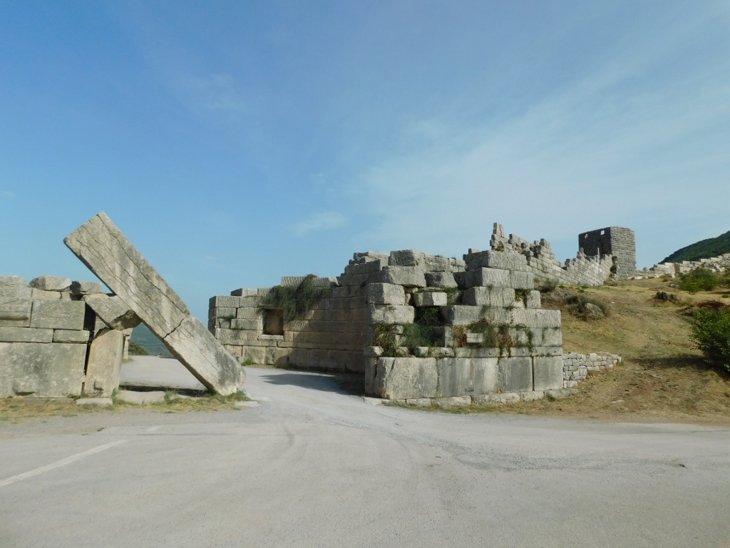 Arcadian Gate
Here, there were actually two massive gates between which there was a courtyard shaped like a circle with a diameter of 19.36 m. Above the inner gate stood a large monolithic lintel that can be seen in both the previous and the following photos. At the outer gate, two towers were erected at the corners and on both sides of the road leading from Arcadia to Messene, there were grave chambers with marble sarcophagi. The walls extended laterally from the gates, while in the previous photograph you can also see a tower that was one of many built along the fortifications.
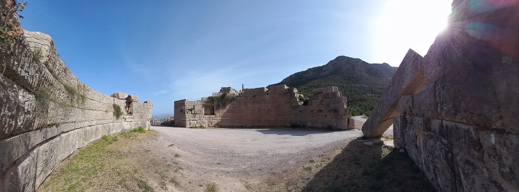 Arcadian Gate, view at the interior space of the gate
Although they are just remnants of former structures, this place still looks quite impressive today.
 Arcadian Gate, view at the sections that were on the exterior side of the ramparts
 Arcadian Gate, remains of a sarcophagus
Finally, I found a nice spot to set up my camera and I took a selfie to remember this place.
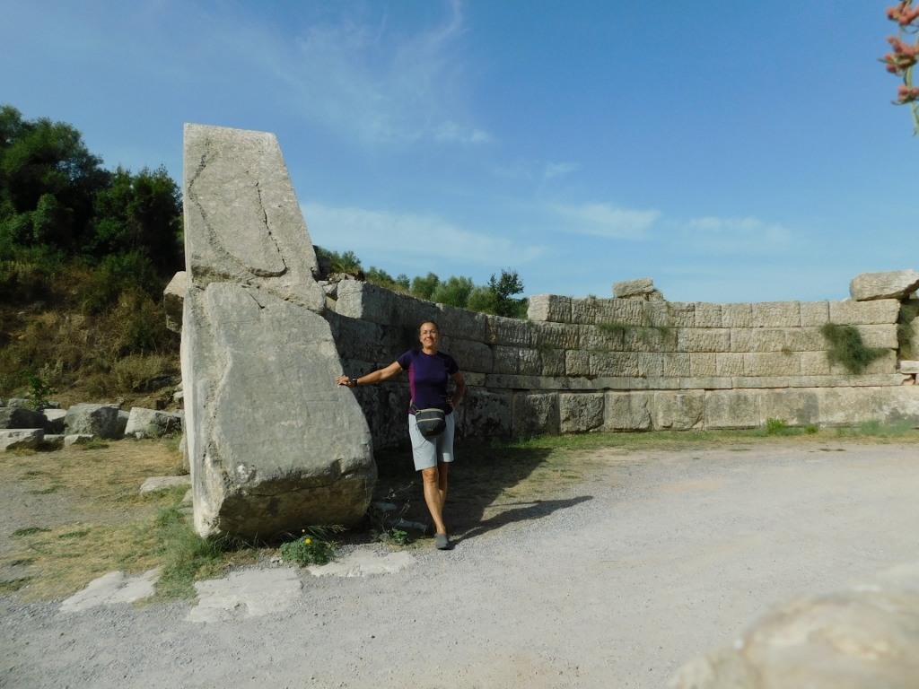 Selfie at the Arcadian Gate
After this, I headed down to the parking area by the entrance to the Archaeological Site of Ancient Messene, where I bought my ticket and began my tour.
I must admit that before arriving here, I didn't really know what to expect. This site is on UNESCO's Tentative List of world heritage sites, but it was only when I got here and started exploring that I realised how remarkable it truly is.
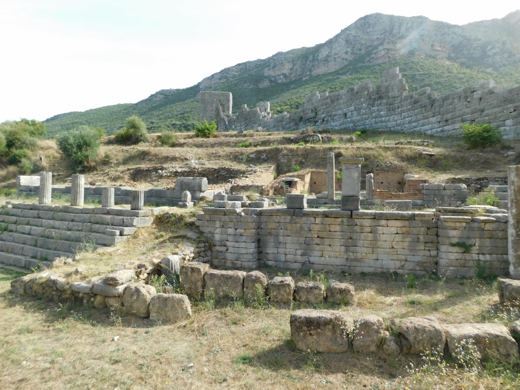
Right from the entrance, you can see ruins that contain some extraordinary features, such as beautiful floor mosaics.
 Archaeological site of Ancient Messene, a detail
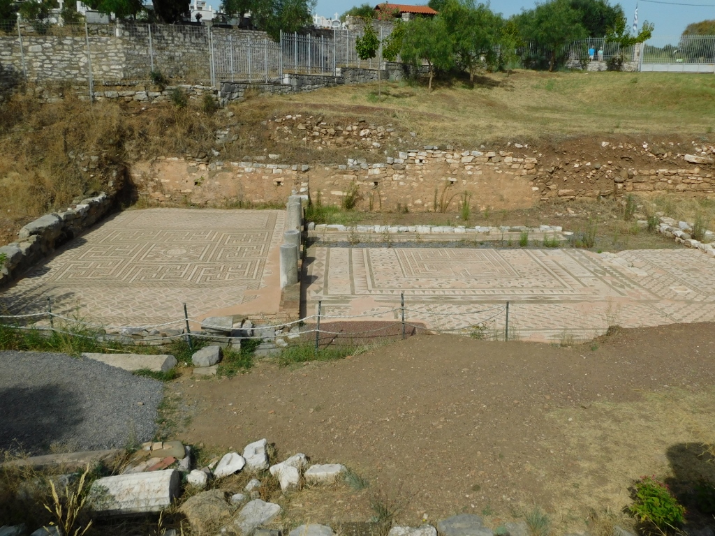 Archaeological site of Ancient Messene, a detail
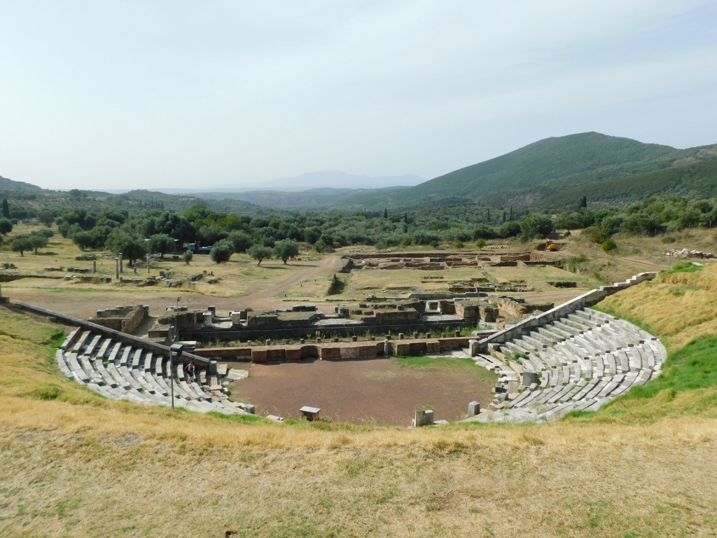
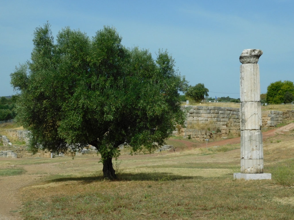
Practically right from the very beginning, you reach an area that offers a spectacular view of the site, with the theatre prominently in the foreground.
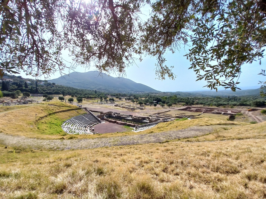 Archaeological site of Ancient Messene
To start with, I circled around the top of the theatre with the intention of making my way down after exploring some other areas.
 Archaeological site of Ancient Messene, a detail
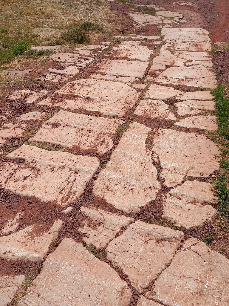
For now, I descended along the remains of the paved street towards those other areas.
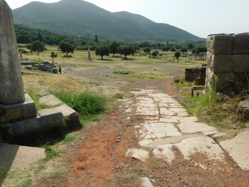 Archaeological site of Ancient Messene, a detail
The stone slabs laid down at the bottom of the street already show the advanced culture of urban living. These slabs have ridges that are oriented perpendicular to the direction of movement. The entire settlement is situated on a slope, so when it rains, these slabs can become slippery. The ridges helped prevent slipping for both people and carts.
 Archaeological site of Ancient Messene, a detail
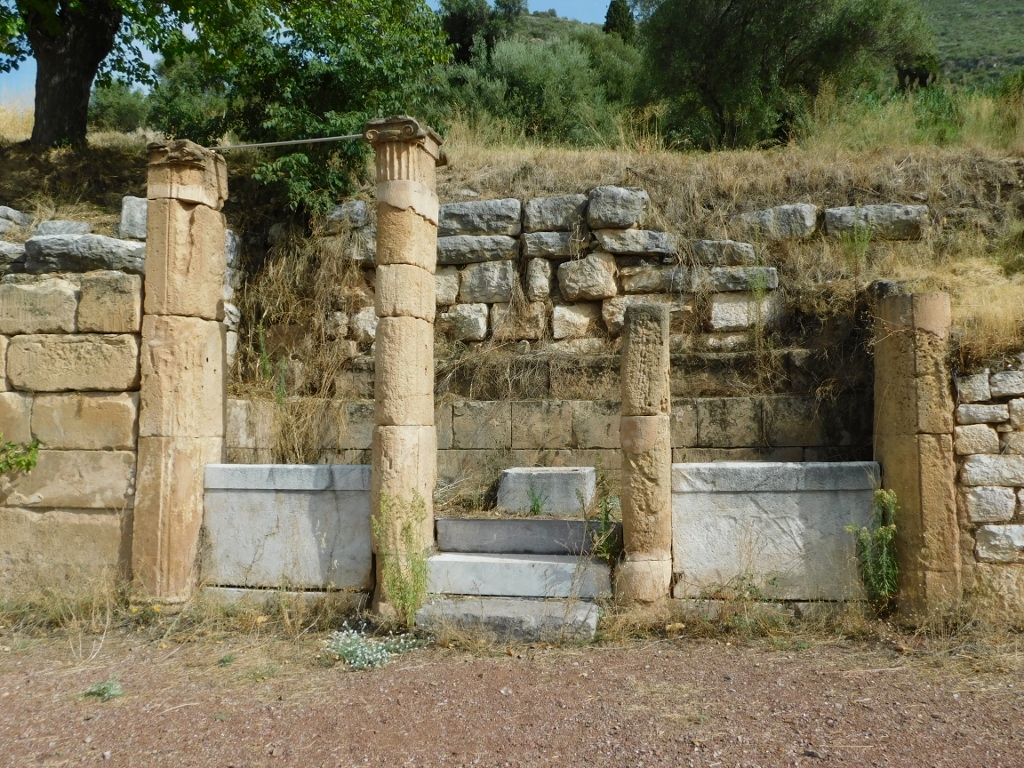
The first structure you come across is the Arsinoe Fountain House, named after a character from Greek mythology. According to tradition, Arsinoe was the daughter of the Messenian king Leucippus and she was also believed to be the mother of Asclepius in the region of Messenia. As a reminder, Asclepius was the ancient Greek god of medicine and I mentioned him more when writing about the Sanctuary of Asclepius at Epidaurus (see: https://svudapodji.com/en/peloponnese-6/).
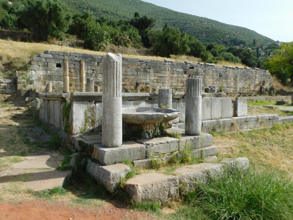 Arsinoe Fountain House
The fountain was connected to a spring and the house also had a cistern that was 40 m long. The last recorded renovations to the fountain and the associated structure were made in the first half of the 6th century.
 Arsinoe Fountain House
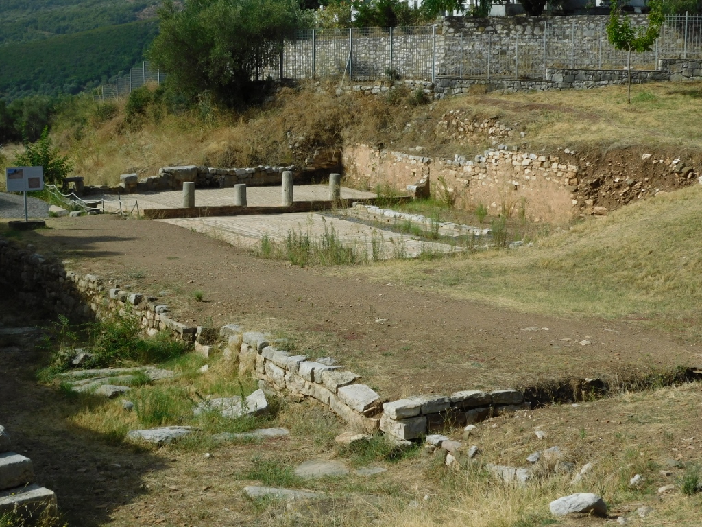
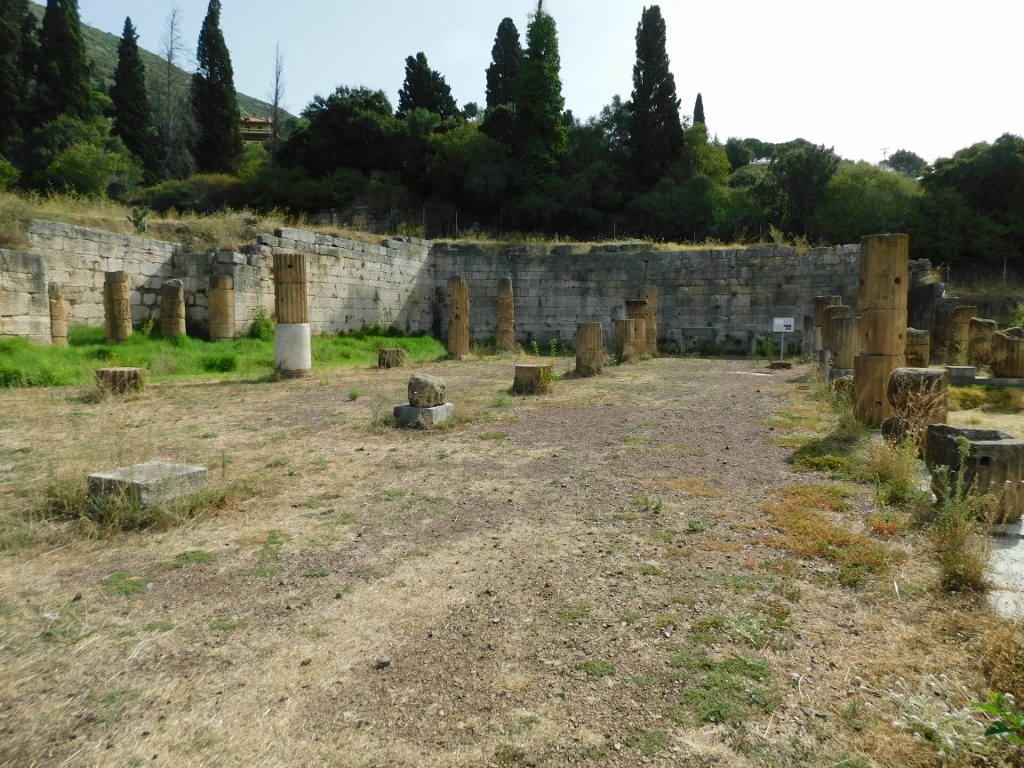
In the continuation is the northern part of the agora, a spacious marketplace, in the form of the North Stoa. In Greek architecture, stoas were long porches with an open front supported by a row of columns, while the other three sides were enclosed. This one in Messene, which had two stories, was 196 m long and 19.80 m wide, divided into three long and narrow sections by two Corinthian colonnades. The front colonnade consisted of Doric columns, which is typical for stoas.
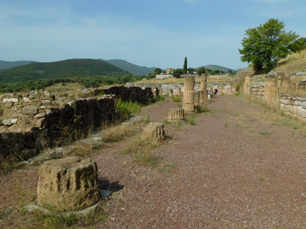 North Stoa
Although it was built on the northern side of the agora, the North Stoa was not used for trade; instead, it served as a space for recreation and strolls.
 North Stoa
There are also several picturesque details here that caught my interest, so I made sure to capture them in photos.
 North Stoa, a detail
 North Stoa, a detail
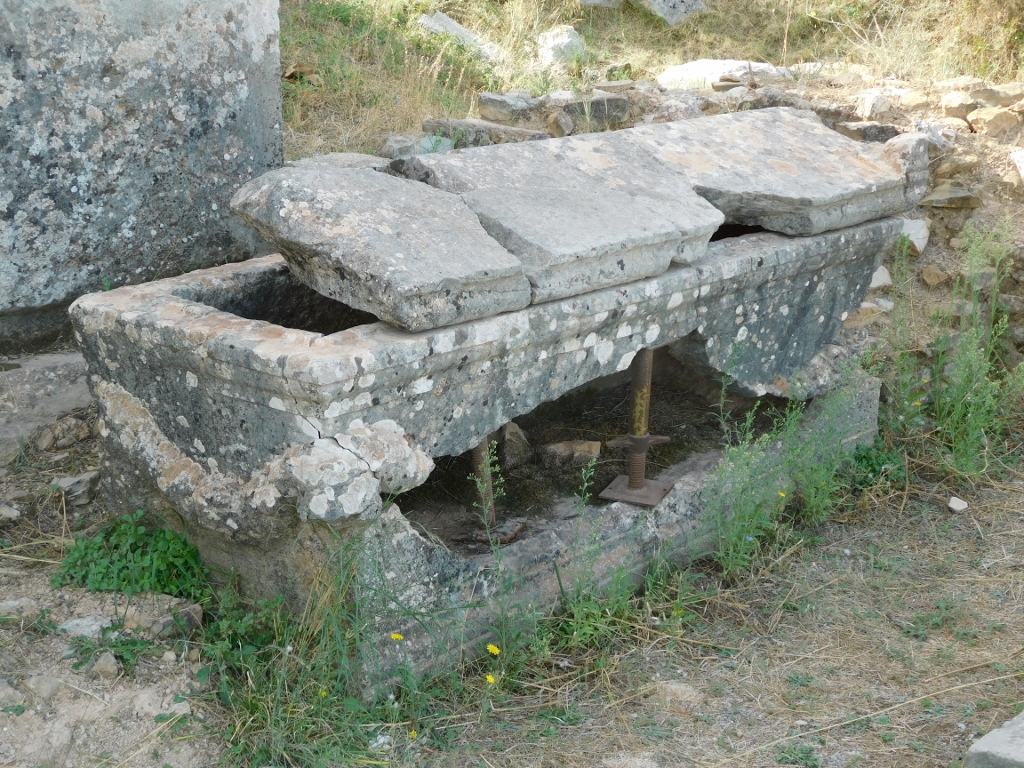
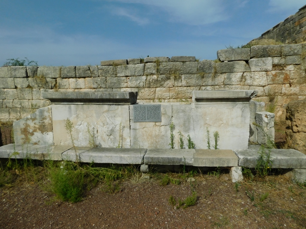
I was particularly fascinated by the three stone tables that were used for measuring grains and liquids.
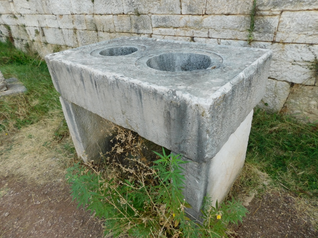 North Stoa, a detail
And then I continued my stroll around the site, aiming to go first to the theatre.
 Archaeological site of Ancient Messene, a detail