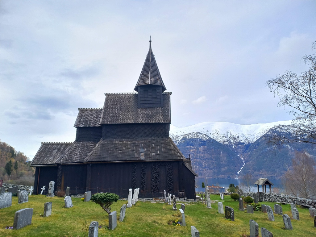
In the previous part of my travel story about the visit to Norway, I have already mentioned that I knew the Urnes Stave Church, or the Wooden Church in Urnes, would be closed when I arrived, but that did not discourage me in the slightest and so I arrived here. At no point did I regret it.
 Urnes Stave Church
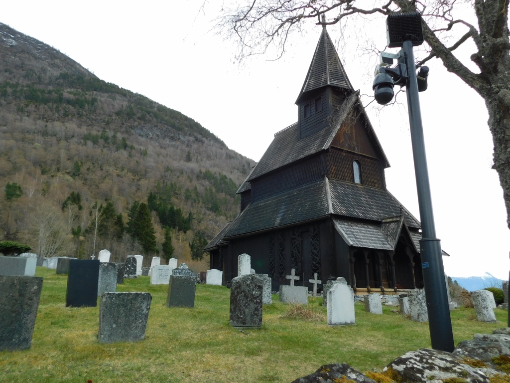
I reached the gate, but it was locked, so I could only walk a little around the wall that surrounds the courtyard, which, besides the church, also includes the local cemetery. The church is part of the village called Urnes, although sometimes referred to as Ornes.
 Urnes Stave Church
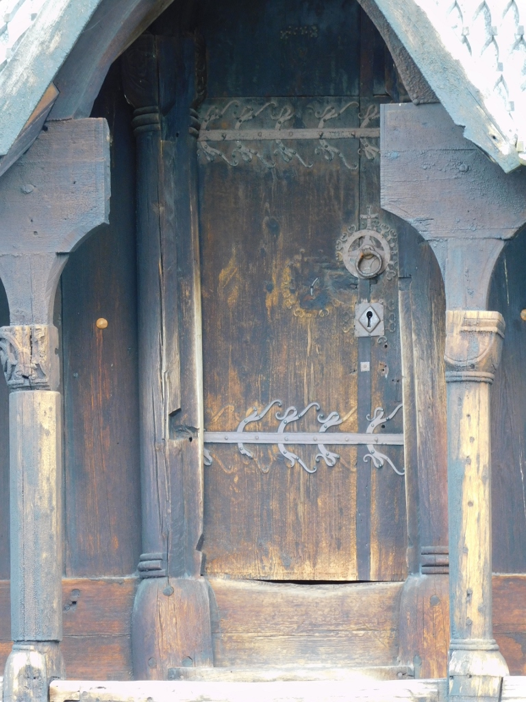
In any case, the only thing I managed to do was use my camera to zoom in on the door and see some details.
 Urnes Stave Church, a detail
Since I couldn’t get closer to the church, I started walking around the fenced courtyard.
 Urnes Stave Church
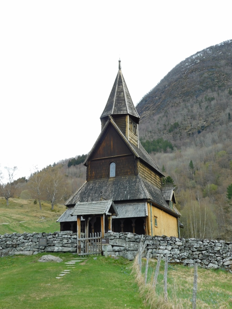
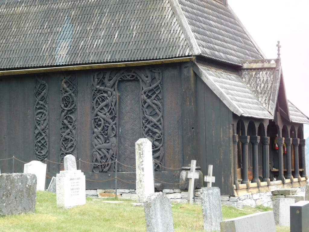
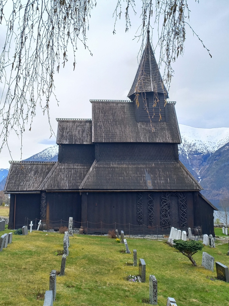
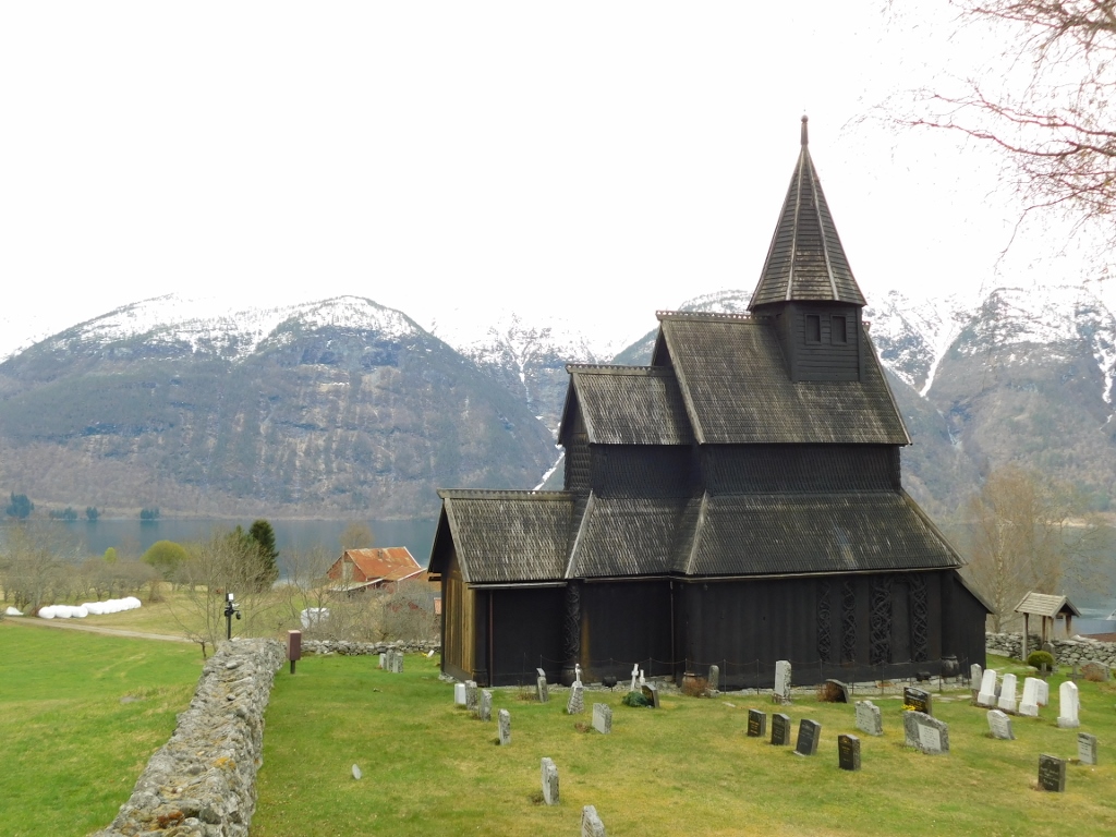
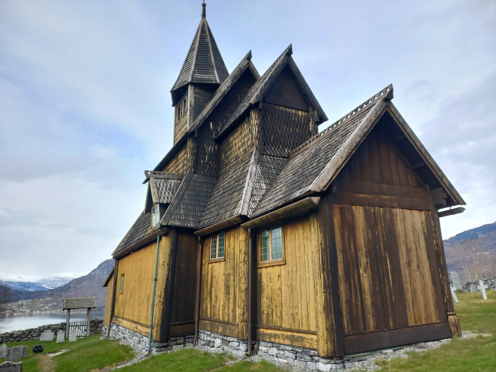
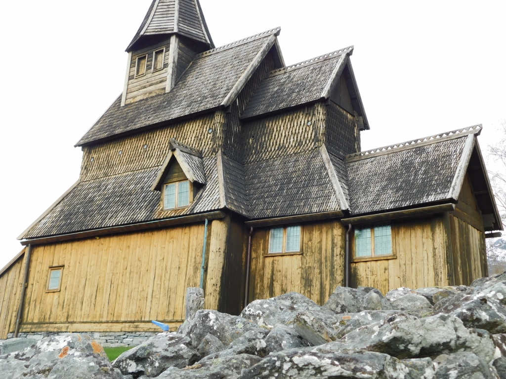
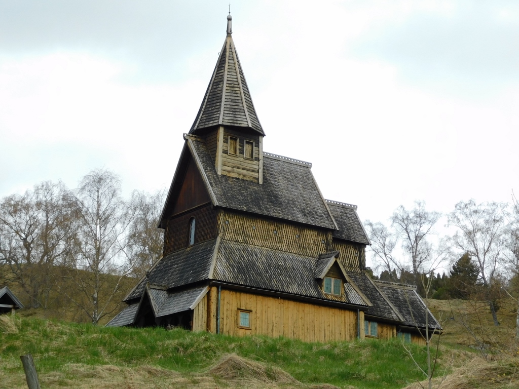
Out of the 28 old wooden churches that have survived to this day, the Urnes Stave Church is considered one of the oldest, having been built around 1130.
Today, it is on the UNESCO World Heritage List. Not only because it is one of the oldest stave churches, but also because its interior is exceptionally richly decorated. I absolutely knew that the church would be closed and that I wouldn’t be able to see the rich decoration to my great regret, but I still wanted to get to the church.
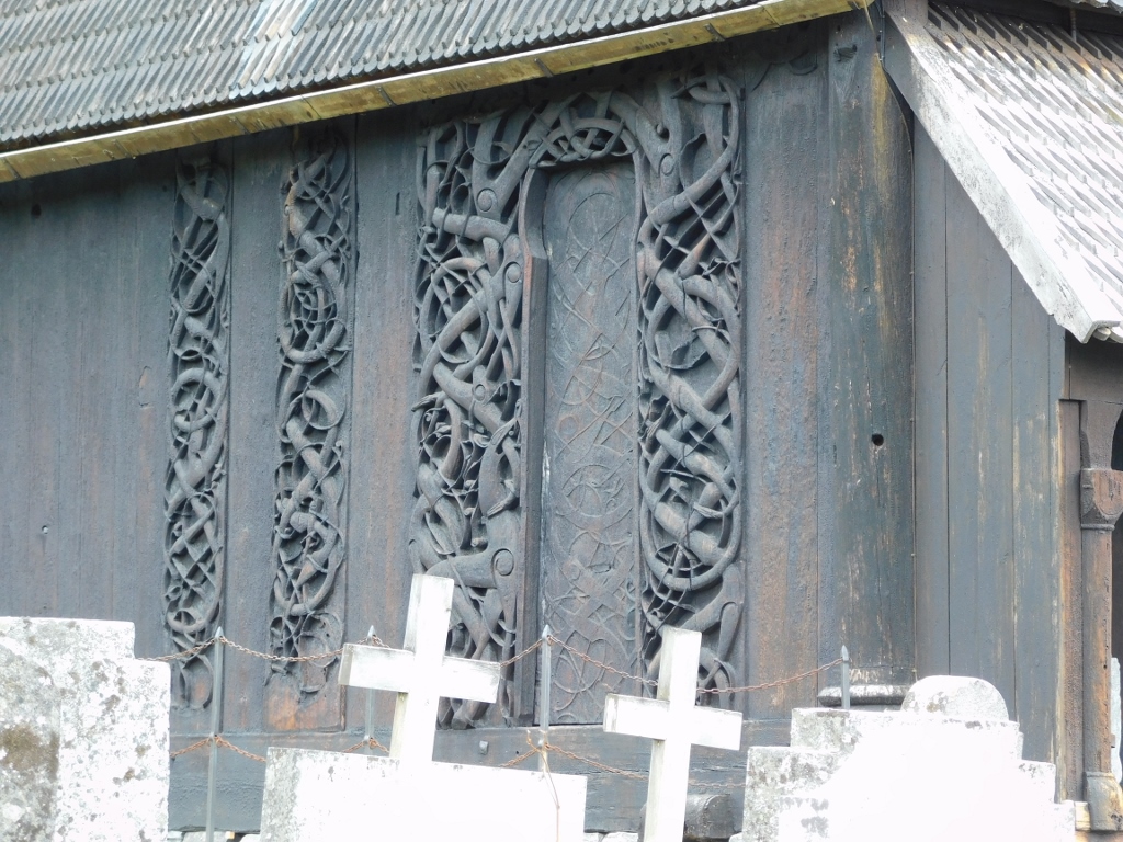
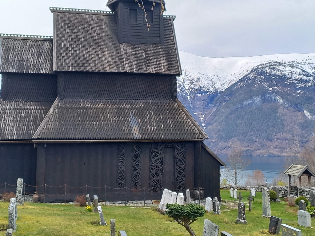
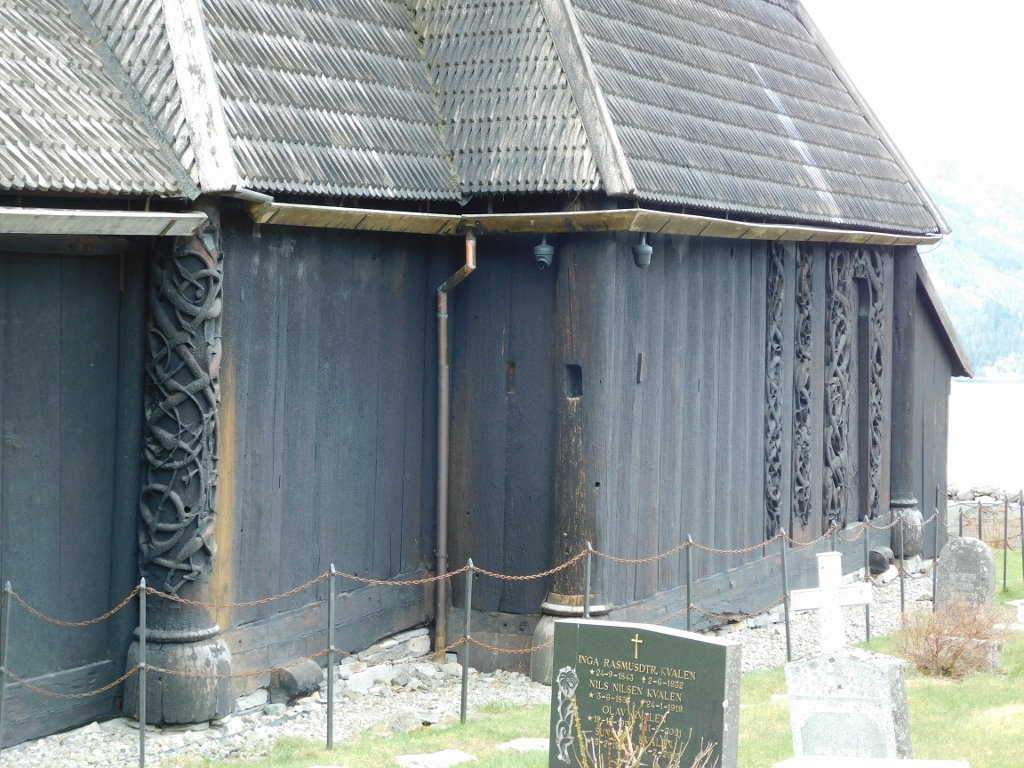
It appears quite simple at first glance, but a significant part of its value can also be seen from the outside – specifically on the northern wall, near the northern portal.
 Urnes Stave Church, a detail
Owing to the excessively bright, though cloudy sky, the contrast between the external light and the dark colour of the wood was too great for my camera, so the photo is a bit washed out. However, this beautiful wood carving might be better seen in the following photographs.
 Urnes Stave Church, a detail
The northern portal of the Urnes Stave Church, including the beautiful relief panels carved in wood, was created in 1170 and features stylised animal figures. As I’ve read, it depicts a lion fighting a serpent, which symbolically represents the struggle between Christ and Satan. I must admit that I find it hard to discern all the details, but that’s not as important. What is interesting is that the battle between the good and the evil also appears in Norse mythology, while the entire church represents an exceptionally skilful blend of Celtic art, Viking motifs and tradition, and Christian architecture.
 Urnes Stave Church
I simply walked the entire way around the courtyard and then took photos as well. Some details are repeated, but while writing the story, it was hard for me to decide which photos to include and which to leave out.
 Urnes Stave Church, a detail
 Urnes Stave Church
 Urnes Stave Church
 Urnes Stave Church, a detail
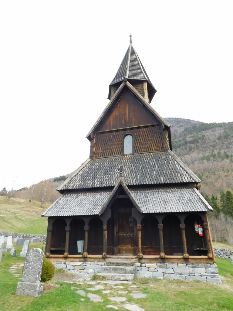
The eastern and southern walls are extremely simple, which is perhaps why the shingle roof stands out more.
 Urnes Stave Church
 Urnes Stave Church
Now I descended to a dirt path and noticed an interesting wooden cabin whose purpose I don't know, but it intrigued me for two reasons. The first is that it is elevated above the ground and set on a stone foundation. I’ve mentioned before that this is necessary for wooden structures to last longer, preventing them from rotting due to contact with the earth.
 Detail from the surroundings of the Urnes Stave Church
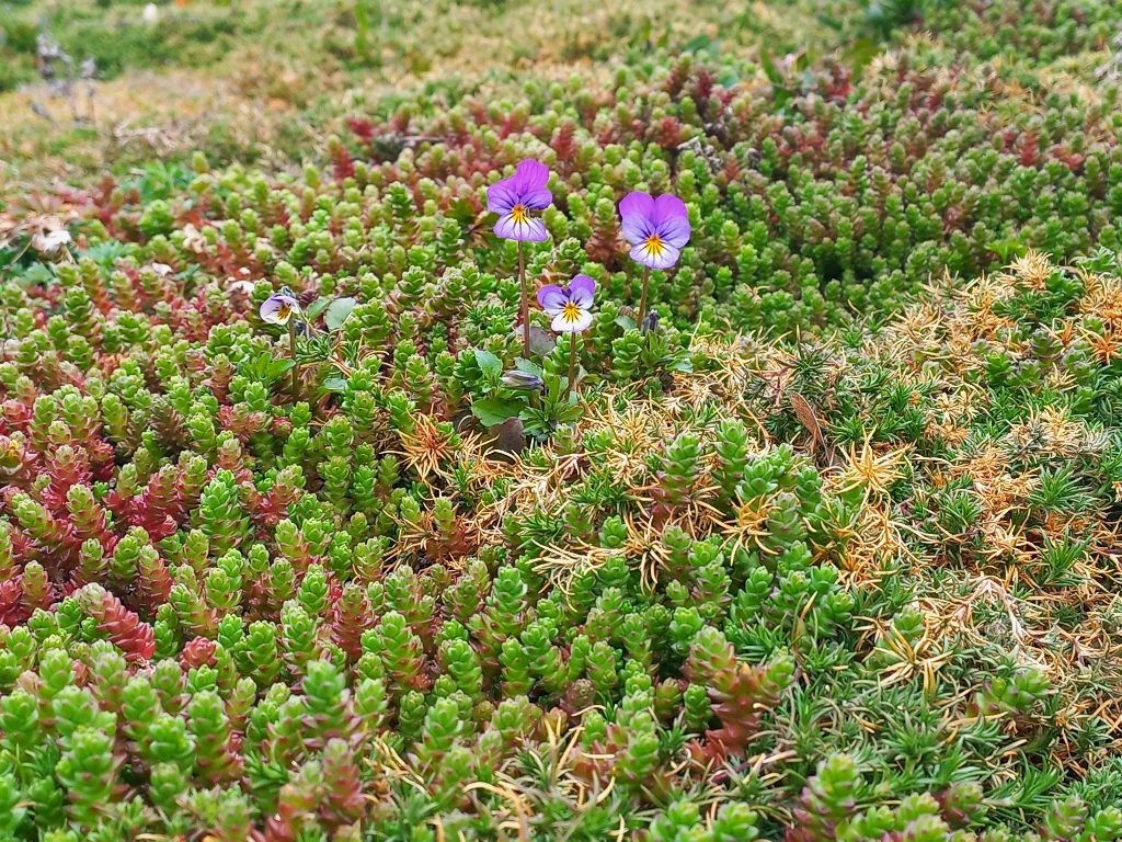
The second reason this smaller structure, which is definitely used for agricultural purposes, caught my interest is that its roof had started to bloom at the time of my visit. Literally.
 Detail from the surroundings of the Urnes Stave Church
I looked back once more to view and photograph the Urnes Stave Church, then got into the car and drove down to the fjord shore where the ferry terminal is located.
 Urnes Stave Church
I have already mentioned before that I received the ferry schedule from a very friendly guide at the Borgund Stave Church, so I arrived at the small terminal about 15-20 minutes before the scheduled departure. At that moment, my car was the only one in the boarding line, but that wasn’t a problem. A much bigger issue was that I needed to use toilet and there was absolutely no one at the terminal except for me. There was a small building and I walked around it, trying every door handle I saw, but nothing was open. And there was no one around to ask for help. To make matters worse, I couldn’t see a single ferry anywhere.
I wondered if this place even functioned. What if the ferries don’t run? Which way should I go next? Would I still be able to achieve what I had planned for the day?
I tried to find any information and noticed a few papers on a bulletin board. Everything was, quite logically, in Norwegian, which I don’t speak. On one paper, I managed to recognise words that looked like days of the week, so I thought that maybe ferries, even if they do run, don’t operate at the same times every day and that this changes from day to day.
And I still needed to use the toilet. More and more. No wonder, with water all around me. Ugh!!!
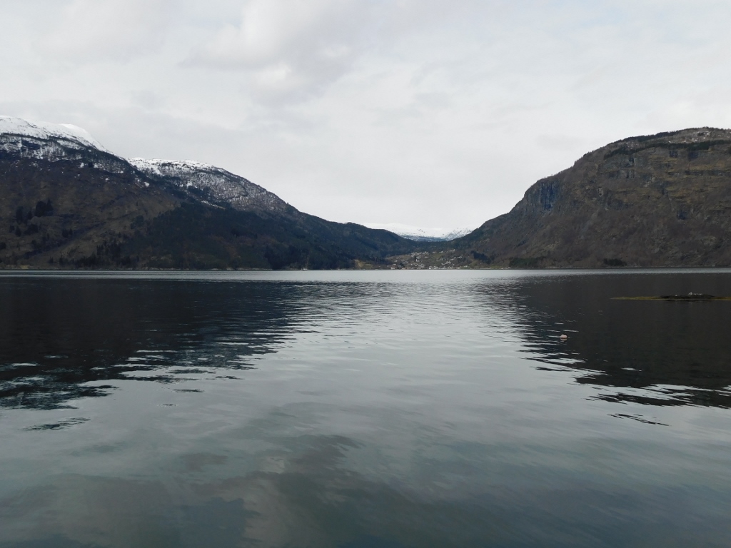
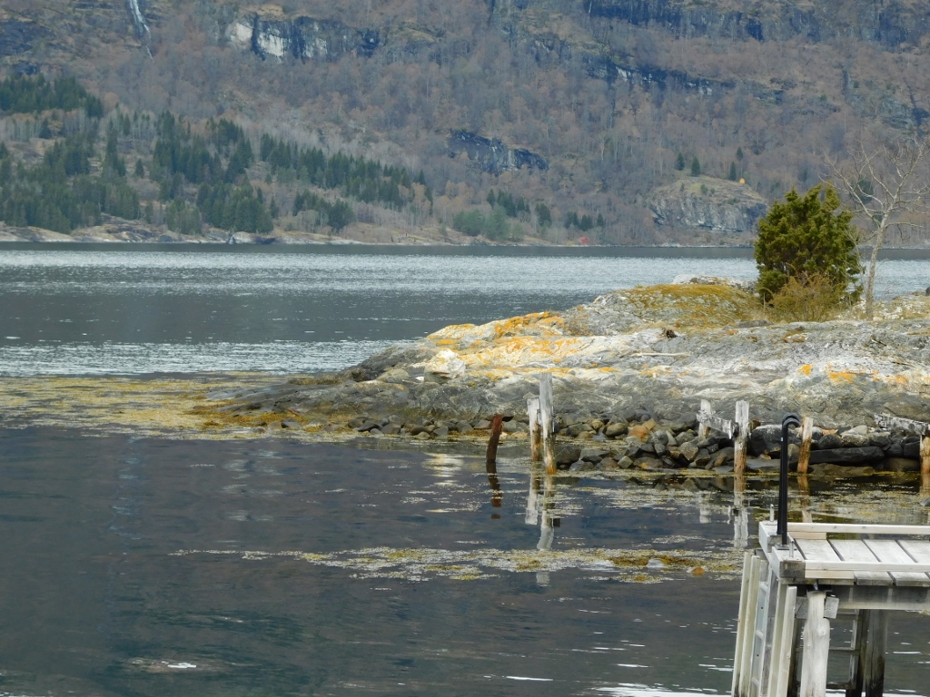
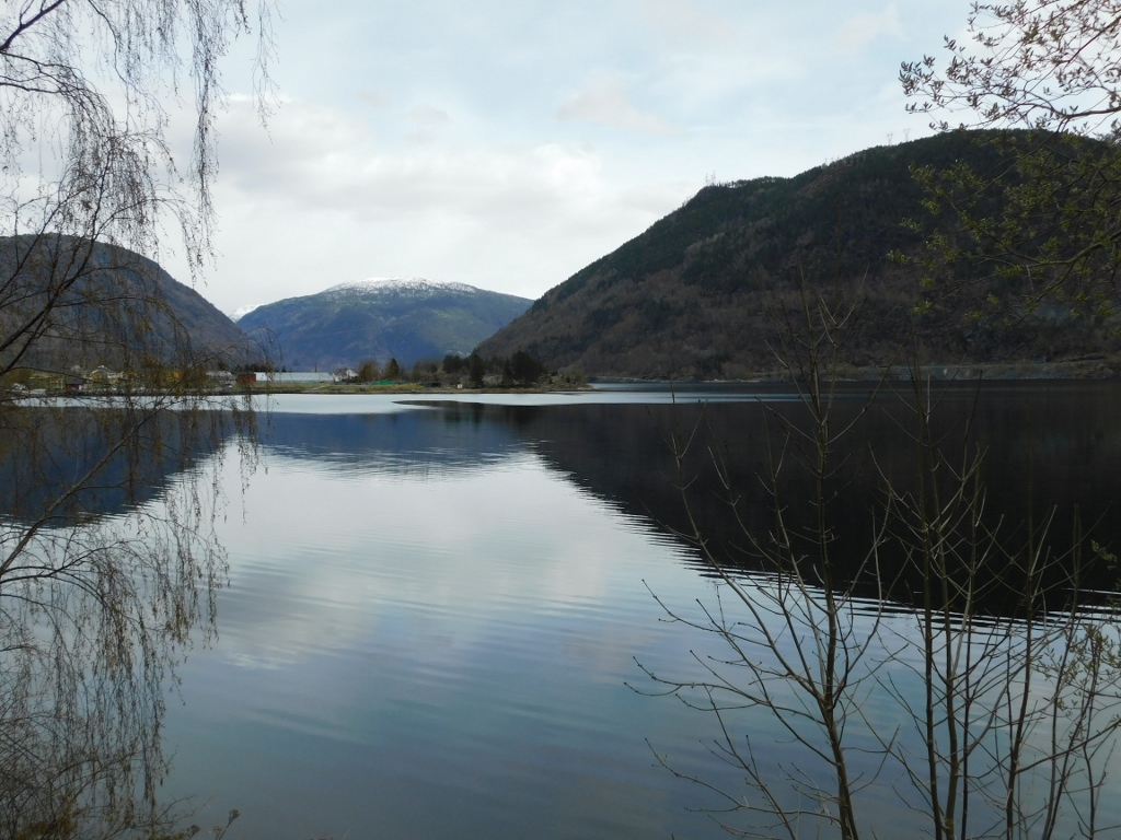
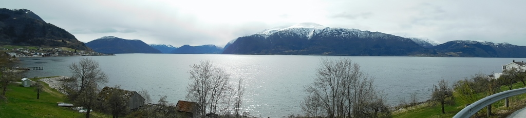
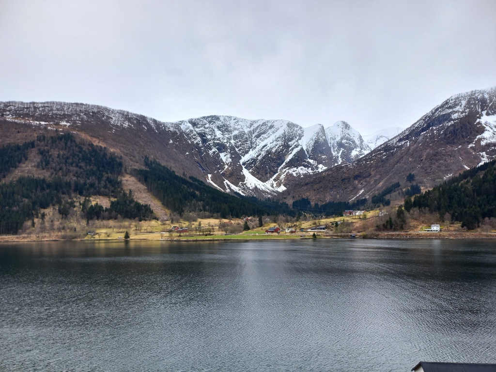
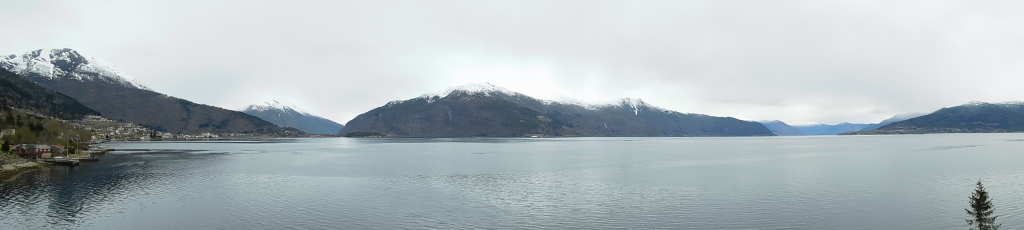
On the other side of the Lustrafjord, I looked longingly at Solvorn that was now my destination.
 Lustrafjord and Solvorn
I tried to distract myself from thinking of my bladder that felt as if about to burst. I even considered going behind the small building at the terminal to take care of what everyone naturally does, but it felt awkward. If it had been in the forest, it might have been a different story, but here, where there was some semblance of civilisation, it didn’t seem right.
In my attempt to think about other things, I even took a few photographs.
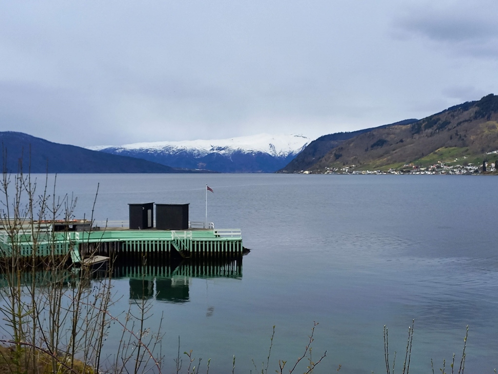
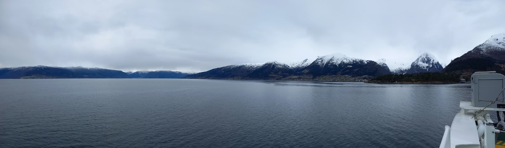
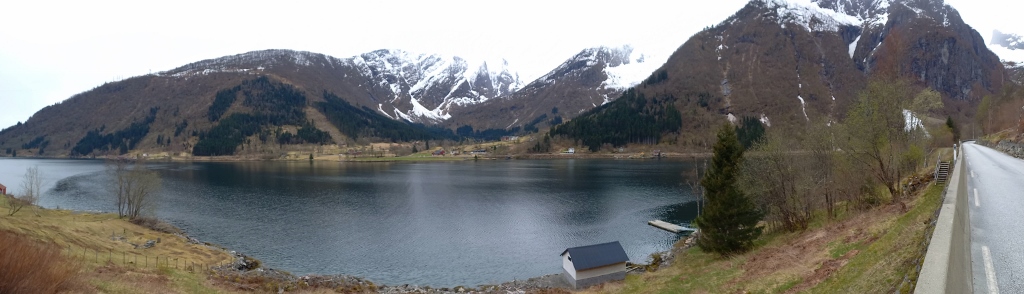
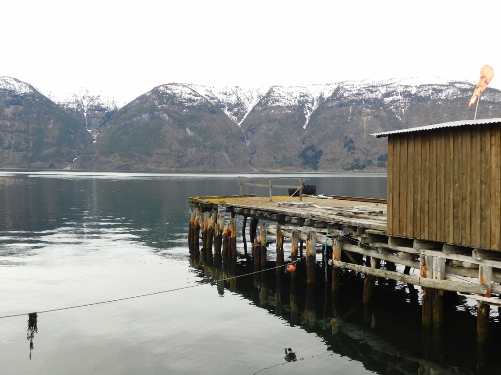 Lustrafjord as seen from the pier in Urnes
 Lustrafjord as seen from the pier in Urnes
Then, finally, seemingly out of nowhere, a small ferry appeared and a few more vehicles also arrived (I thought it was a good thing I hadn’t gone behind that building to take care of things). There were a few formalities to handle for positioning the vehicles (boarding was done in reverse), but I eventually made it to the toilet on the ferry, which was a huge relief.
Of course, it was also a great relief not to have to spend an hour and a half driving around the Lustrafjord, but at that particular moment, the priority for relief was definitely my aching bladder.
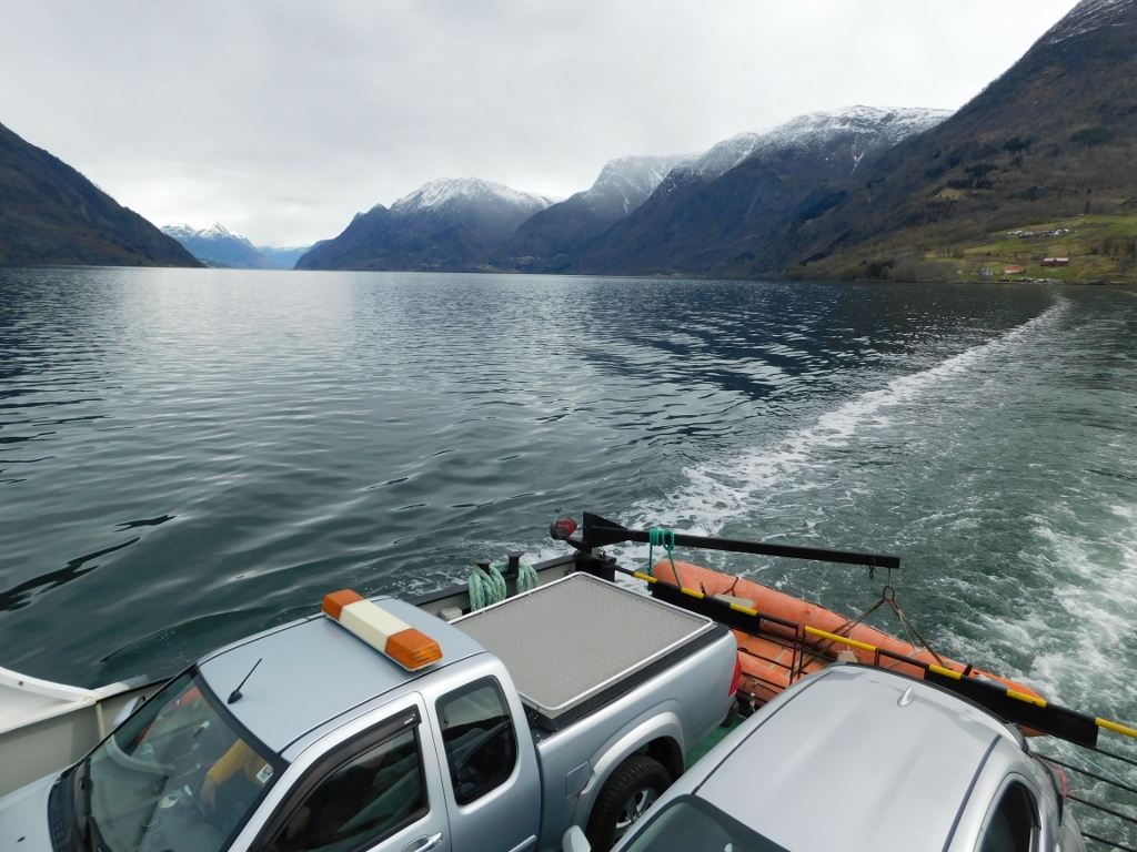
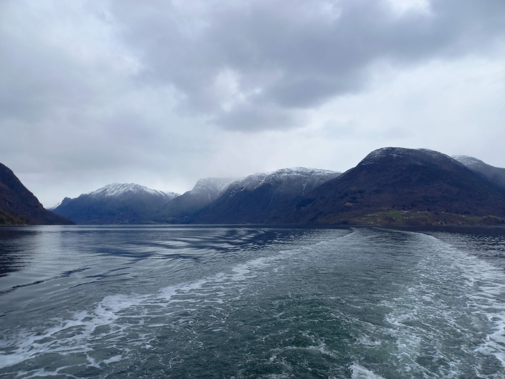
Once I took care of that, and it was done in a flash, I was able to go up to the passageway near the captain’s cabin to take photos of the surroundings. I first used the video camera while we were just leaving the dock and later switched to taking photographs.
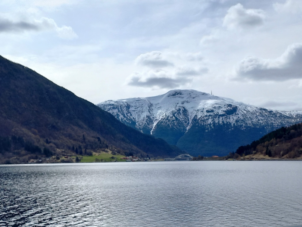
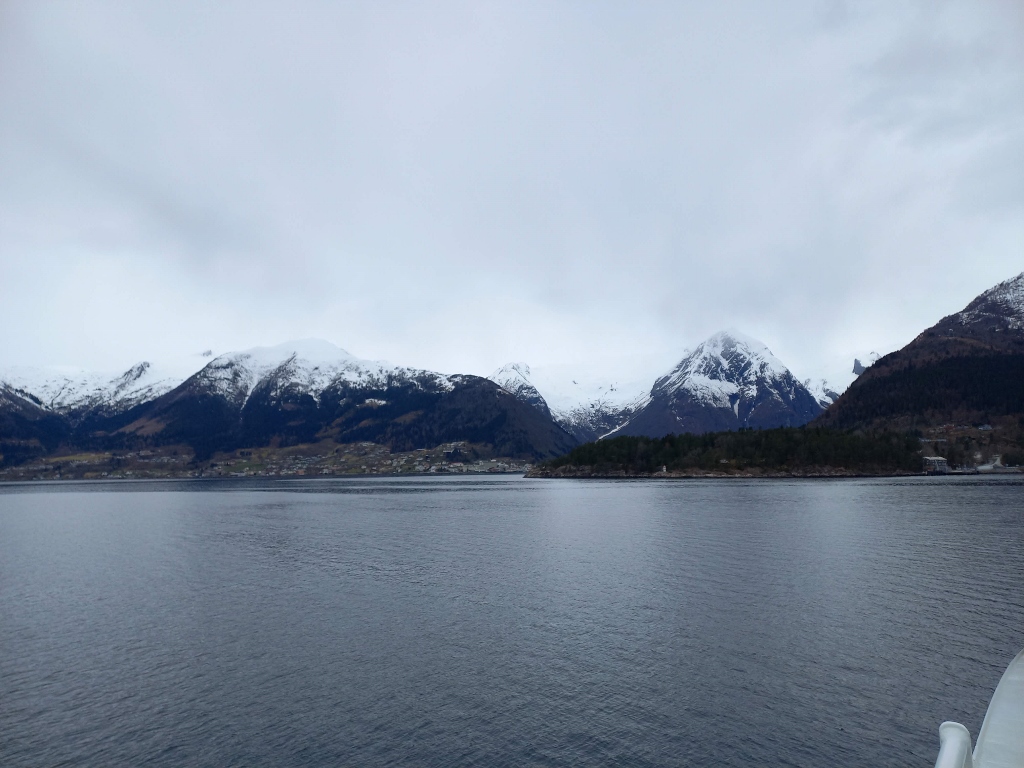
 View at the village of Urnes
 View at the village of Urnes and the Urnes Stave Church
Here, I was crossing the Lustrafjord, which is a branch of the Sognefjord, the largest and most famous fjord in Norway. I should also mention that this was the only ferry where I had to pay for the ticket personally and directly. On all the other ferries, I boarded as if I owned them – no one asked me anything, I just drove onto them and, when we arrived, I drove off without anyone questioning me. Of course, there should be no doubt – I paid for all those ferry crossings, but in Norway, in the 21st century, it mostly happens automatically.
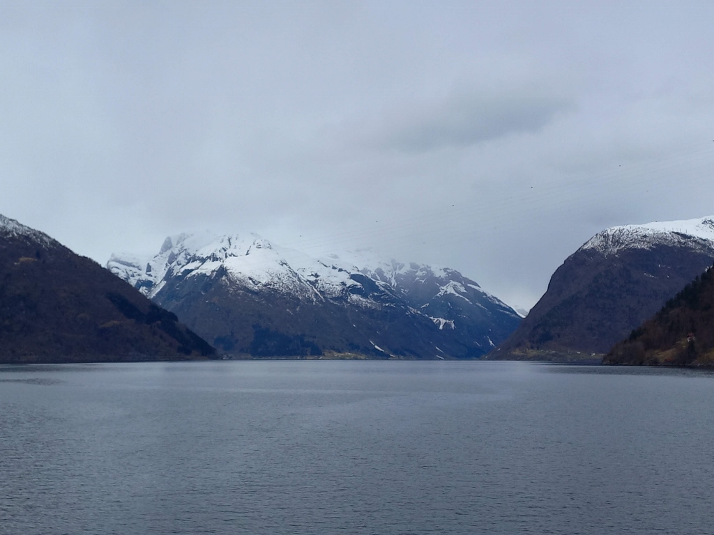
 Lustrafjord
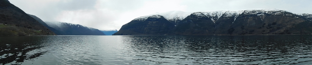 Lustrafjord
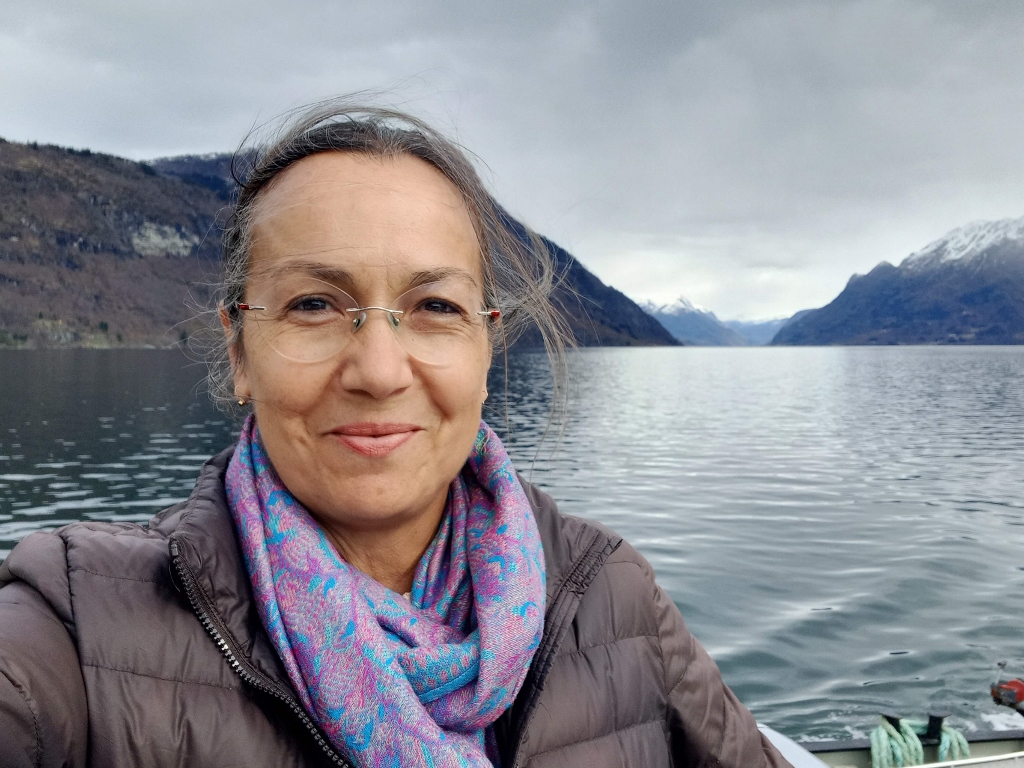 Selfie while crossing the Lustrafjord
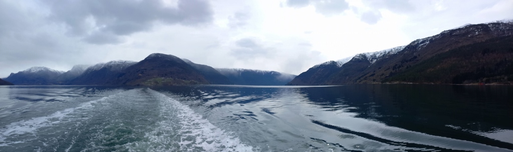 Lustrafjord
 Lustrafjord
As we approached the other shore, I could see some houses. Everything still looked quite deserted.
 Lustrafjord
 Lustrafjord
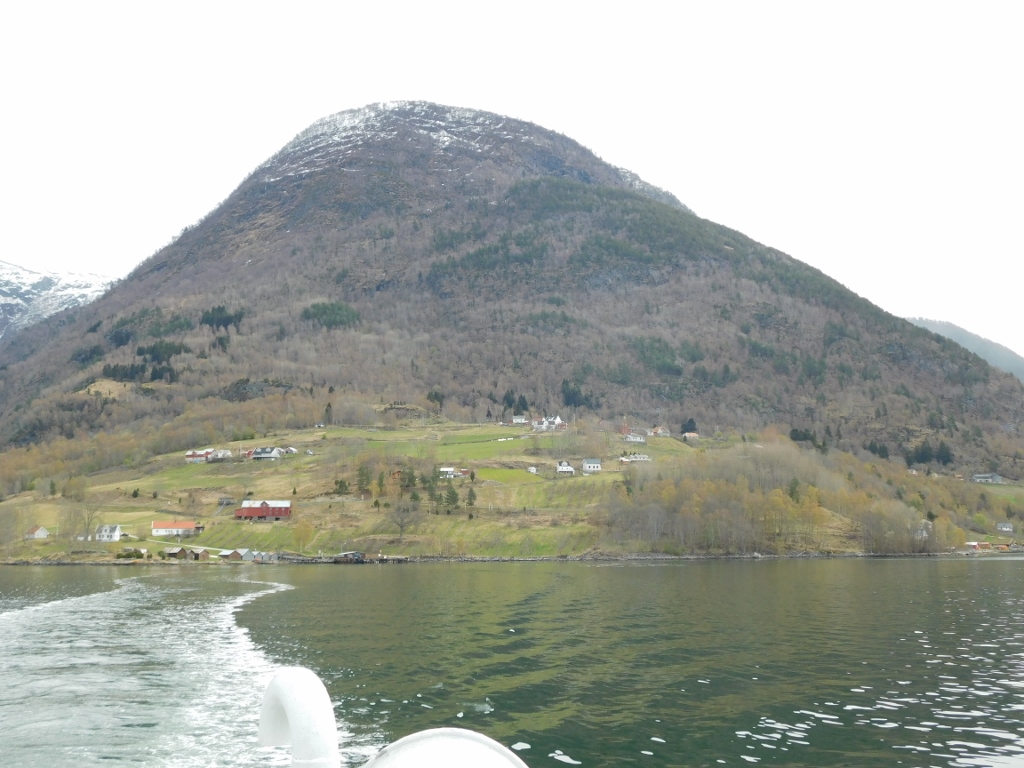
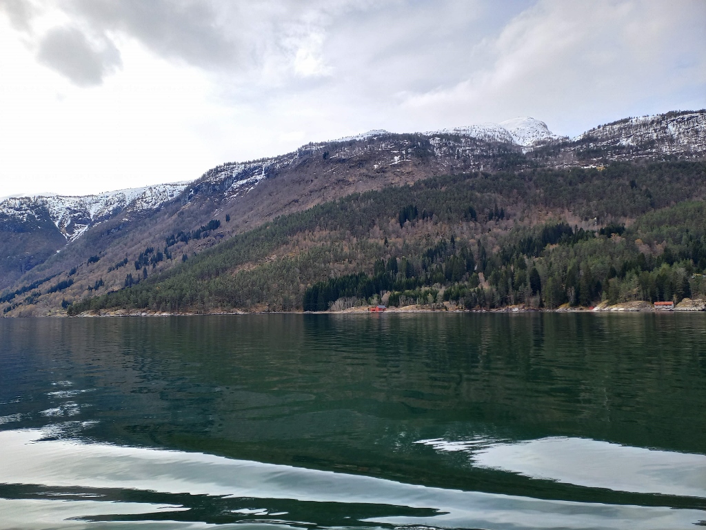
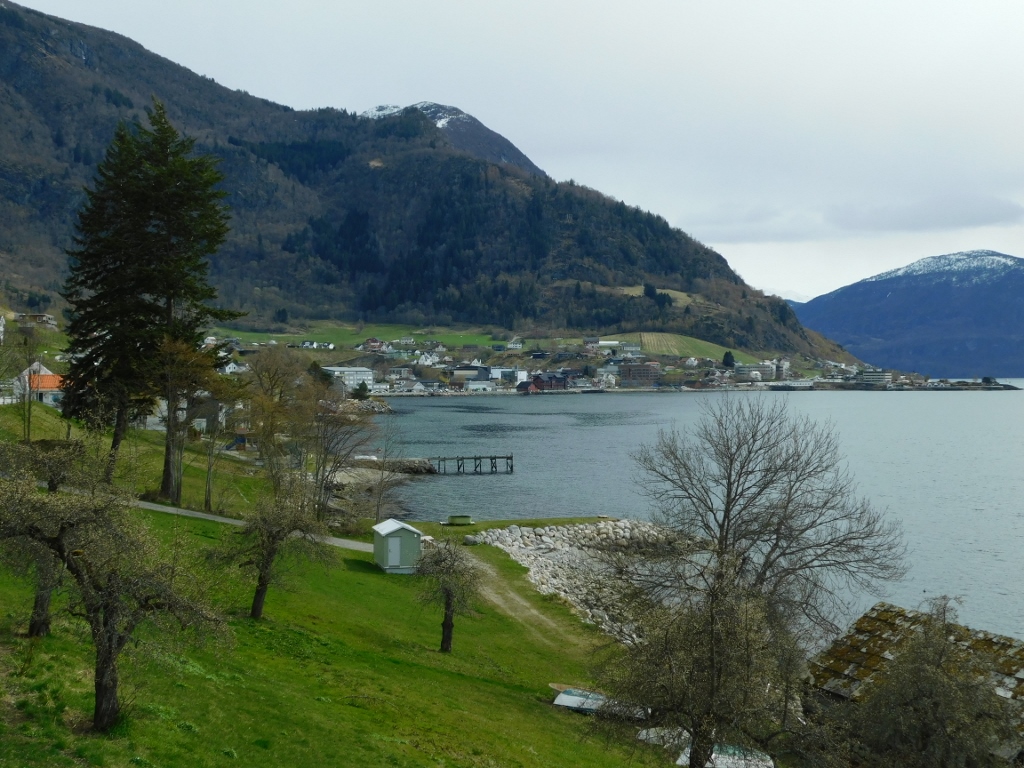
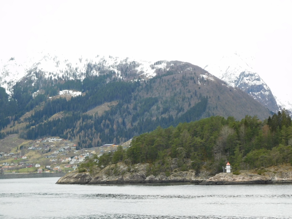
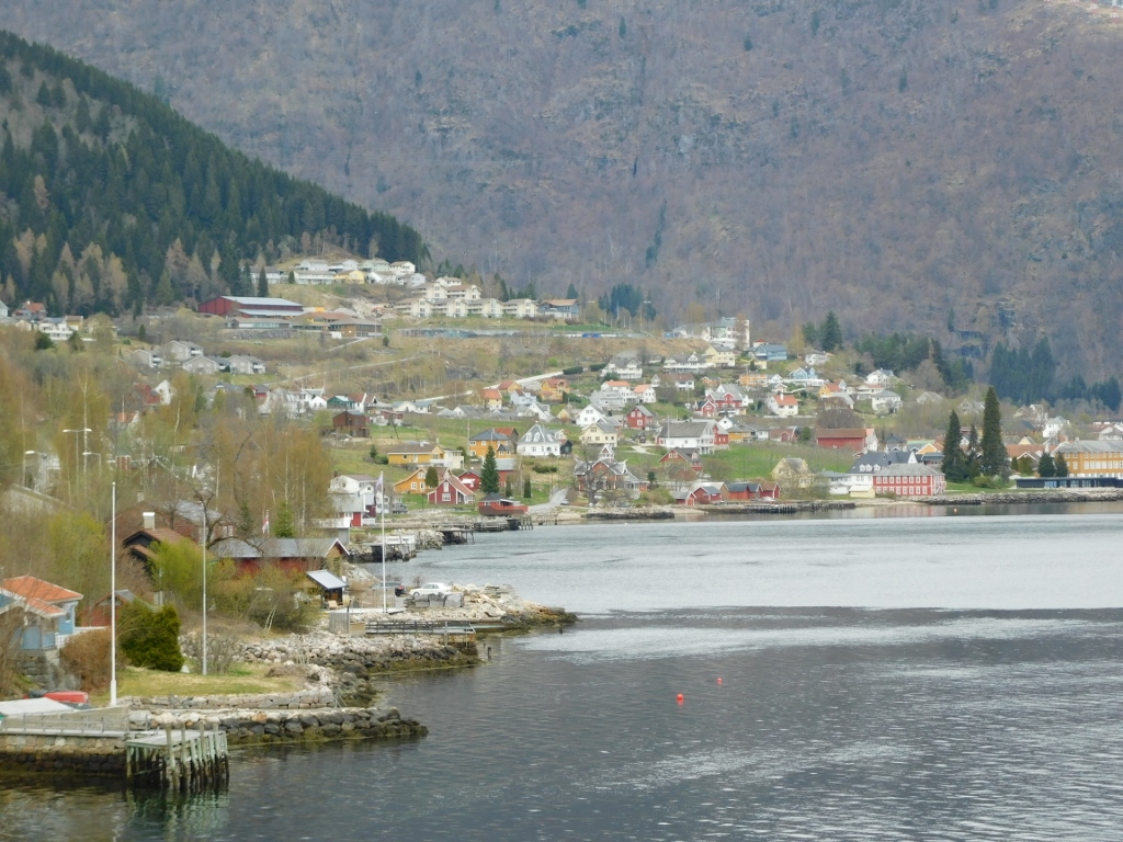
Then we reached the coastal part of Solvorn and although there were still no visible people, there were more houses, so it could be assumed that there is indeed some life here.
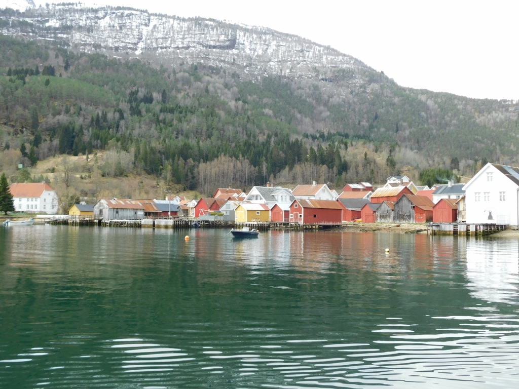 Solvorn
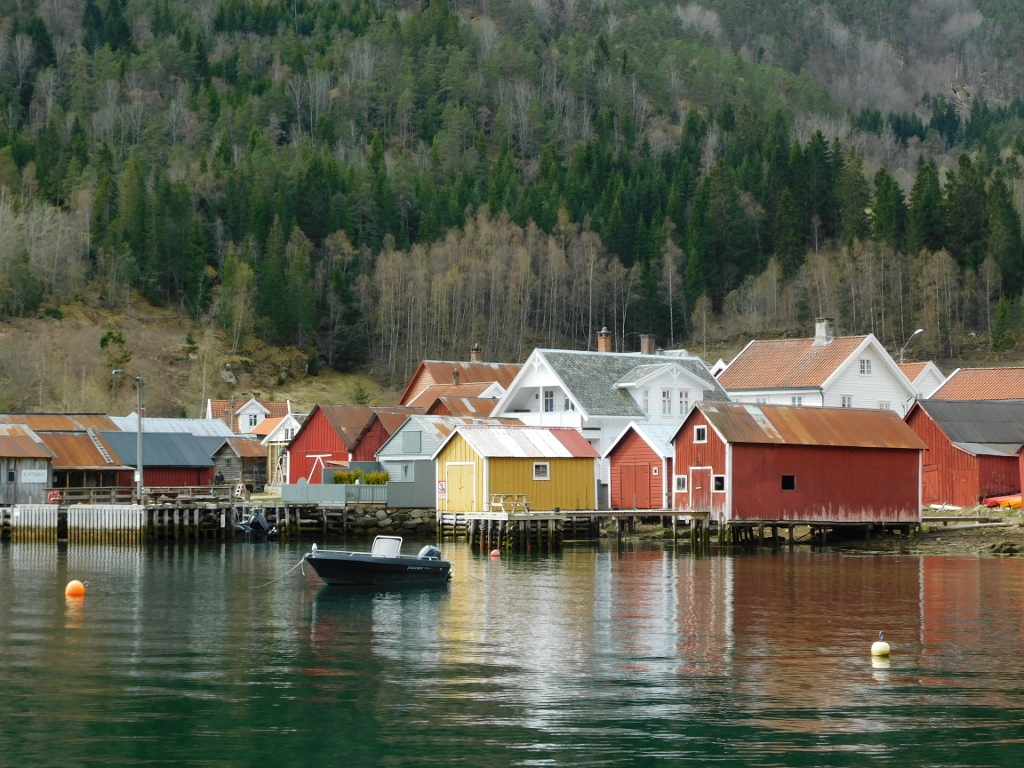 Solvorn
After driving off the ferry, I passed through the small town and then drove uphill to the main road that follows most of the northern coast of the Sognefjord, which is also known as the King of the Fjords in Norway, being the largest and deepest fjord in the country. It stretches from the ocean to the small town of Skjolden, which I mentioned in the previous part of the story, and is about 205 km long. On this trip, I travelled nearly its entire length, almost to the ocean, and took the ferry across it several times. Admittedly, a few times across its branches, but certainly once across the main fjord, i.e., the Sognefjord.
By the way, due to these fjords and the intricate coastline, Norway is the second country in the world by the length of its coastline, including its islands – 83,281 km. Only Canada has a longer coastline, at 202,080 km. These numbers become even more interesting when comparing territorial size. Canada is about 30 times larger than Norway, but only has 2.5 times its coastline length.
As for the countries in third and fourth places – Indonesia and Russia – Indonesia is six times larger than Norway but has 1.5 times less coastline. Russia has 2.2 times less coastline but is nearly 54 times larger than Norway.
But, going back to my journey through this beautiful, rugged Scandinavian country, here is the map showing where I travelled on this day:
To start with, I had to return to the town of Sogndalsfjøra. Before I arrived there, I took some more photos of the landscape and the bridge over the smaller arm of the main fjord that I had crossed a few hours earlier.
 Smaller arm of the huge fjord and the bridge near the town of Sogndalsfjøra
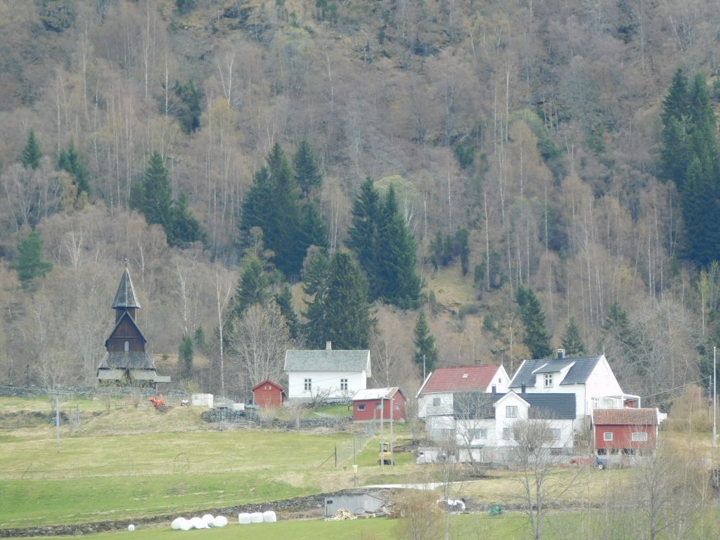
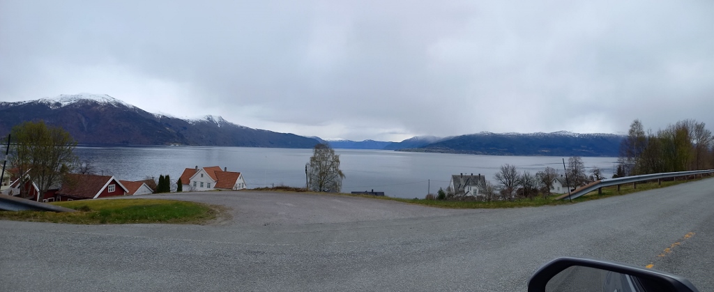
From Sogndalsfjøra, I simply continued on to Hermansverk, occasionally stopping to take photos of the things I liked along the way. In fact, there were many more details that I found appealing, but I neither had enough safe places to stop nor enough time. I wasn’t in a particular rush; the day was long enough, but I couldn’t overdo it either.
 On the way from Sogndalsfjøra to Hermansverk
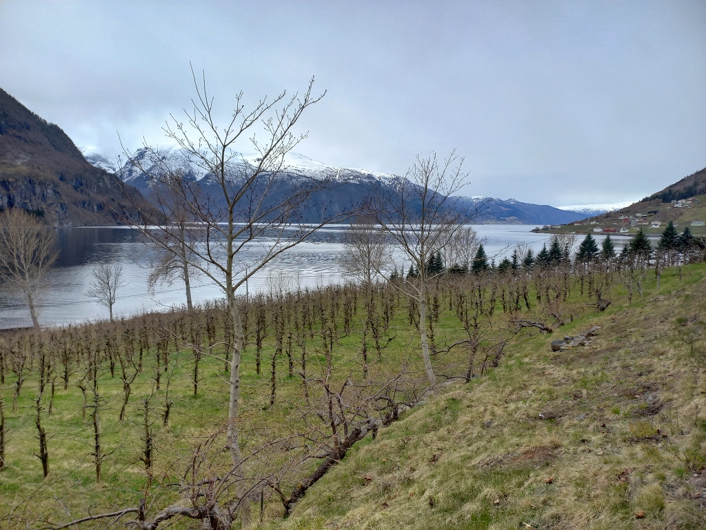 On the way from Sogndalsfjøra to Hermansverk
 On the way from Sogndalsfjøra to Hermansverk
 On the way from Sogndalsfjøra to Hermansverk
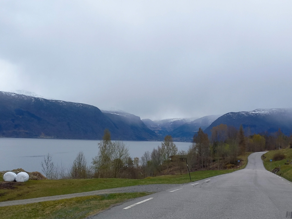
Once I drove past the town of Hermansverk, I stopped at a parking area to take a few more photographs and then I continued for about 16 km to the Hella ferry dock.
 On the way from Hermansverk to Hella ferry dock
 On the way from Hermansverk to Hella ferry dock
When arriving at the Hella ferry dock, it’s crucial for the driver to be well-focused and know where they’re going and to do so in time in order to line up in the correct lane. Ferries from this dock go in two directions: one crosses the Sognefjord to Vangsnes, reaching the southern side of the main fjord. The other route goes to Dragsvik and continues to the town of Balestrand, all on the northern side of the main fjord. The reason for this second route is evident on the map – two long arms of the Sognefjord extend from the point where the ferries operate and it would be impractical to build a road there. It’s much simpler and significantly faster to travel by ferry, even if there’s a bit of waiting involved.
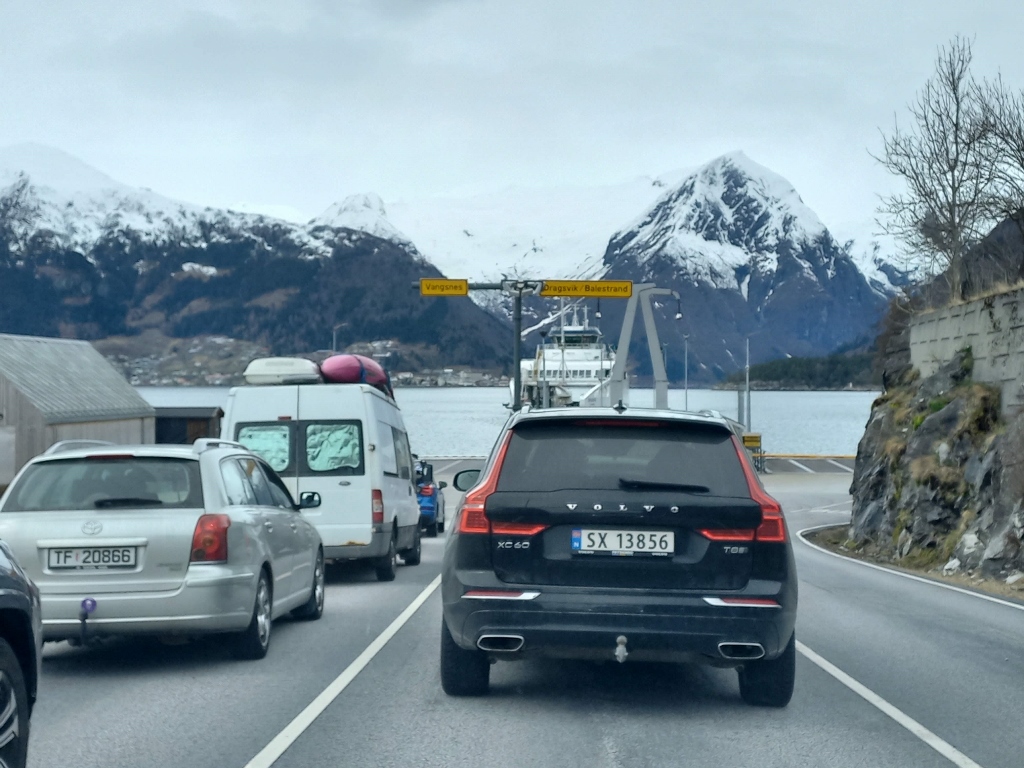 Waiting for the ferry at the Hella ferry dock
Namely, the distance between the two docks, Hella and Dragsvik, is less than 2 km, but I still found it interesting to film and take photos during that short crossing.
 Between Hella and Dragsvik Ferry Docks
 Between Hella and Dragsvik Ferry Docks
 Between Hella and Dragsvik Ferry Docks
 Between Hella and Dragsvik Ferry Docks
By the way, as I’ve mentioned earlier, I didn’t pay for these ferries on the spot, which greatly simplifies their use. You just wait your turn, the ferry staff directs you on where to go to board and the same happens when you reach your destination, where the crew provides instructions on who disembarks when. It’s all standard, but here it was further simplified by not having to buy tickets in person or figure out where to do so. On the other hand, you don’t speak a single word with anyone. Does this lead to complete alienation? Perhaps.
In any case, after disembarking at the Dragsvik dock, the road took me along a small arm of the main fjord, but the scenery was just as beautiful. Although there weren’t many vehicles on this part of the road, I fortunately came across a pull-off area where I could easily stop and take photos of what I wanted, such as the small village of Ese on the opposite shore.
 View at the small arm of the main fjord and the village of Ese
 View at the small arm of the main fjord and the village of Ese
Near the end of this small fjord, I saw a small seasonal "glacier" that descended like a river of ice towards the waters of the narrow bay, practically extending over the road I would soon travel. Of course, the road was cleared, so there were no issues.
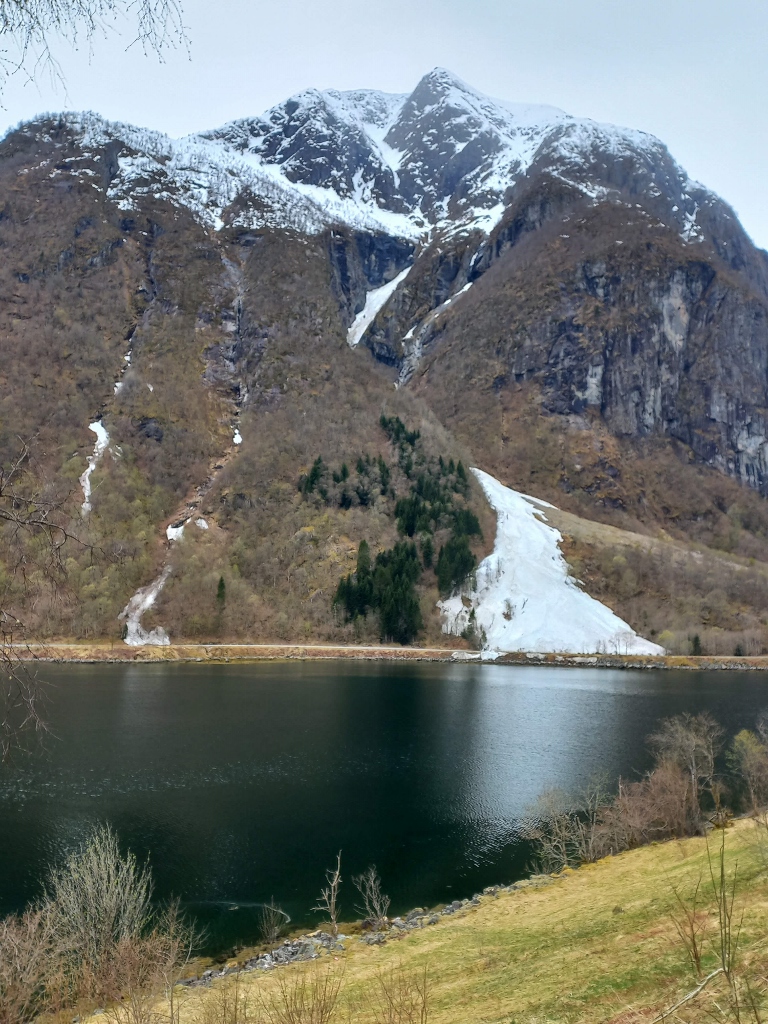 Norwegian landscape in April 2024
When the road reaches the end of the fjord, it loops around it, following the shoreline, and this curve almost forms a horseshoe shape. The view of the fjord itself is also quite interesting.
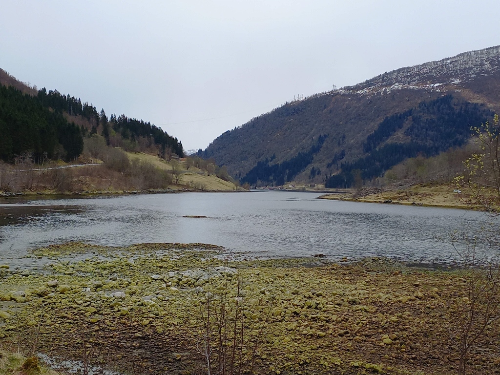 End of the smallish fjord
Soon, I arrived in Balestrand and passed through it. I was actually ready to stop for a coffee, but I didn’t notice any places open along the road. I wondered if Norwegians even drink coffee while travelling. There were signs indicating that there were catering establishments in places like Balestrand, but I would have to venture into the settlement itself for that.
Although no settlement here was large, I considered that it would be a waste of time, so I stuck to the main road, which generally runs along the edge of the settlements. I had all the necessary food and drink in the car. The question of having coffee along the way was more of a ritual than a real necessity.
Moreover, the day was certainly long enough, the sun was due to set late, but with my frequent stops for photography and the uncertainty regarding the ferries, their schedules and travel times, I thought it was better to stick to the main road. And that’s what I did.
As for photography... Since there were very few vehicles on the road, I could occasionally stop quite safely even in my lane, though rarely. Sometimes I was reluctant to get out of the car, although this constant getting in and out had turned into serious physical exercise, which was probably good for me and my body. Still, I thought it was best not to overdo it even with the good things.
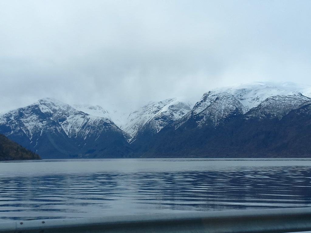
 View at the Sognefjord
 View at the Sognefjord
 View at Balestrand
 View at the Sognefjord and the empty road