After an exceptionally fulfilling visit to the Borgund Stave Church, I continued my drive westwards since I had a hotel room reserved about 30 km away in Lærdalsøyri.
However, since the day was long, meaning the sun was setting later, I wasn’t in a rush. Moreover, before the trip, I discovered a few interesting places worth seeing along the way. Both are related to water.
I followed the valley of the Lærdalselva River, which, in one part, as it flows along a wider riverbed, encounters a narrow passage between larger rocks, almost resembling a small canyon. The result is a waterfall called Sjurhaugfossen. Admittedly, having seen it in person, I wouldn’t exactly call it a waterfall, but technically, the water does drop – about 10 metres in total.
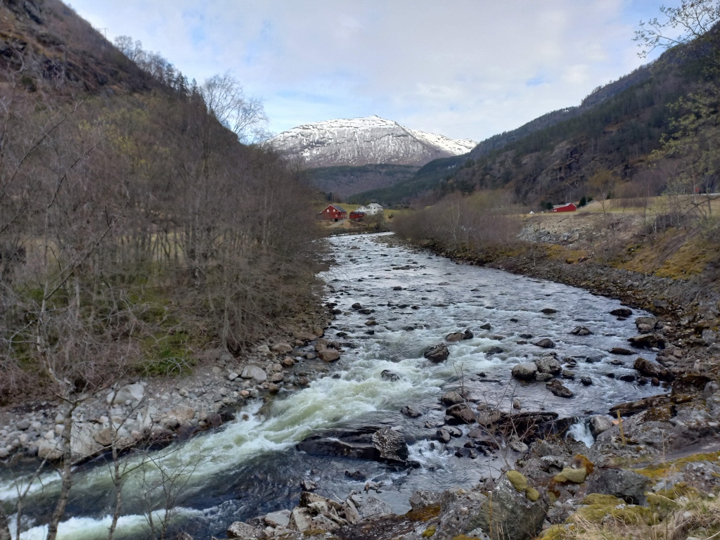 The Lærdalselva river
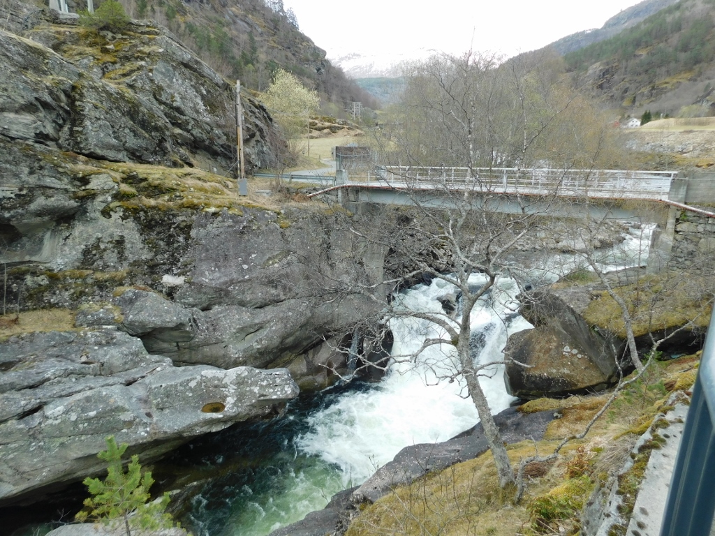 Sjurhaugfossen
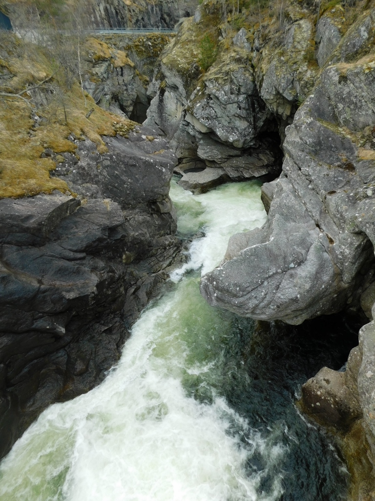 Sjurhaugfossen
Not far from here, less than 2 km away, there is a parking area from which you can view a much more impressive waterfall. However, this parking area is not on the main road but is accessed via a detour. That was my plan. However, as it turned out, there was a barrier with clear signs indicating that traffic was not allowed on that detour road. I assume the road was either being repaired, or there was a landslide, or something similar. Well, if it’s prohibited and not possible, that’s fine. Although 2 km isn’t a huge distance, I didn’t even think about attempting to walk, so I just got back in my car and continued on the main road towards Lærdalsøyri.
However, a few kilometres down the main road, I came to an intersection and realised that this was where the detour road reconnected with the main road. Since there were no signs here, I turned onto the detour road, hoping to reach the waterfall from this side. However, I soon encountered another barrier, so I completely gave up.
I’m sorry I couldn’t see the waterfall known as Soknifossen or Galdanefossen. The second name comes from a nearby farm that operated from the 17th century until the mid-20th century, where you can still see a few houses from the early 19th century today. As for the waterfall, it consists of a series of high cascades as the local river falls down the side of the mountain from a height of about 400 metres.
The only thing I could do was to photograph the Lærdalselva River, along the riverbed of which runs the detour road, and then I returned to the main road and continued through the beautiful Norwegian landscapes.
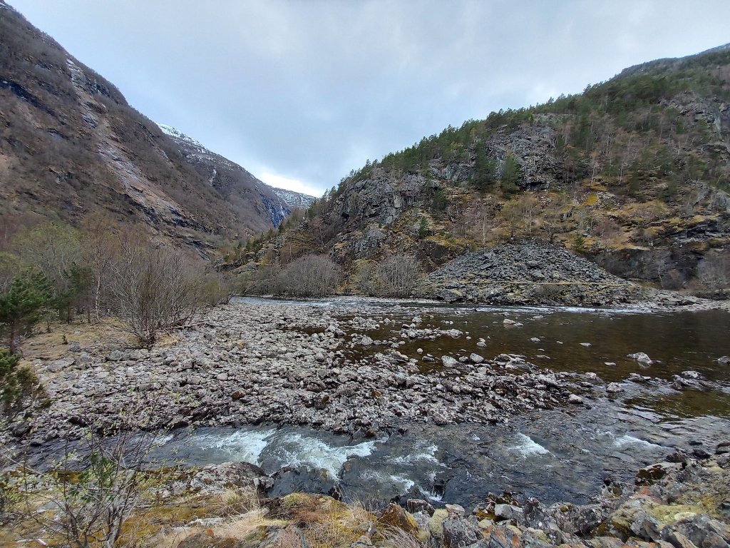 The Lærdalselva river
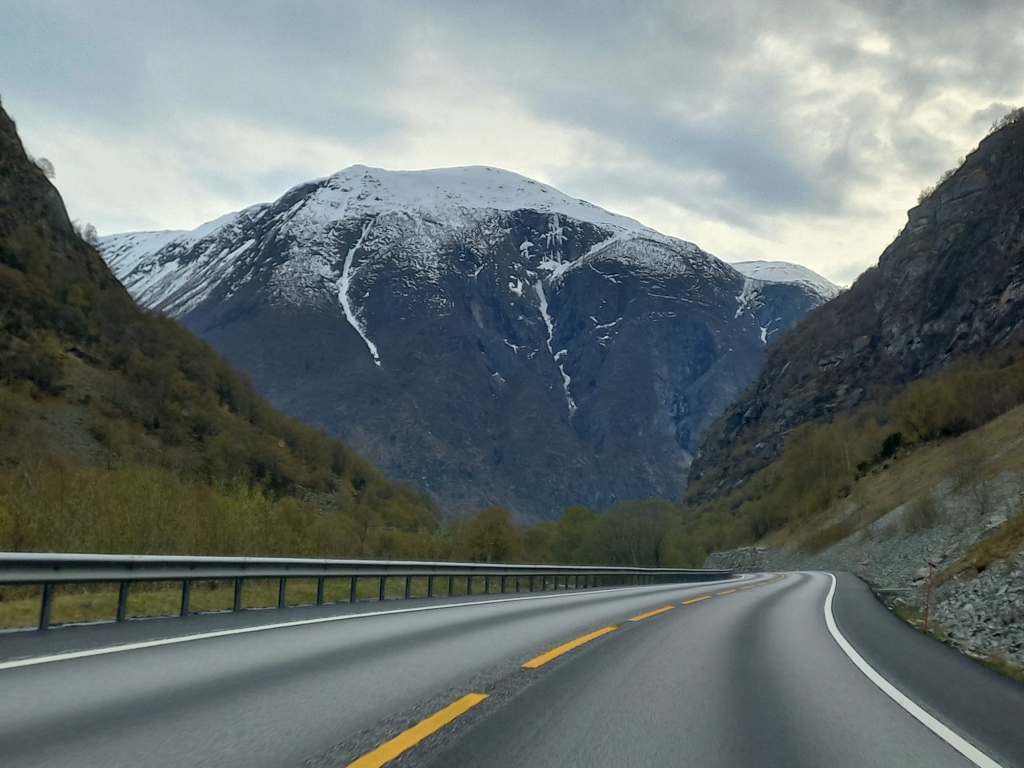 On the road to Lærdalsøyri
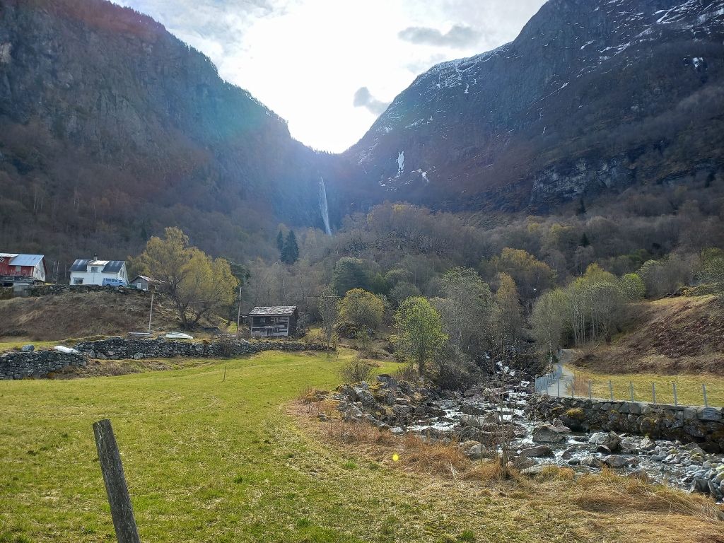
Before I entered the town, I saw a couple of waterfalls. It was clear to me that in this whole region, and certainly throughout Norway, there are likely many waterfalls because the mountains are high, there is a lot of snow in winter and its melting in spring creates streams and small rivers, which in turn create waterfalls.
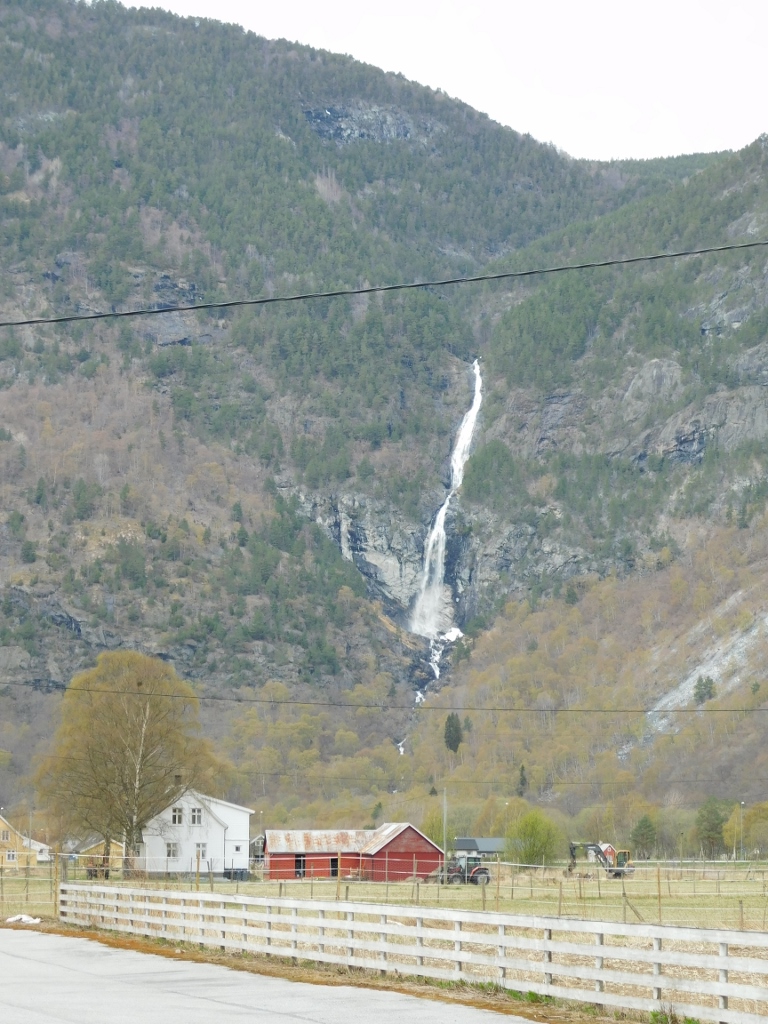 Waterfall near Lærdalsøyri
 Waterfall near Lærdalsøyri
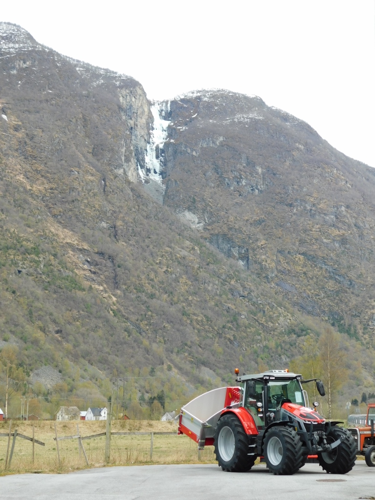
But not all the whitish and vertical features were waterfalls, at least not at the moment when I took the photograph, and certainly not the one visible in the previous picture with the tractor. Here, it’s almost certain that water did flow at some point, but when I passed by in mid-April 2024, this would-be waterfall was completely frozen.
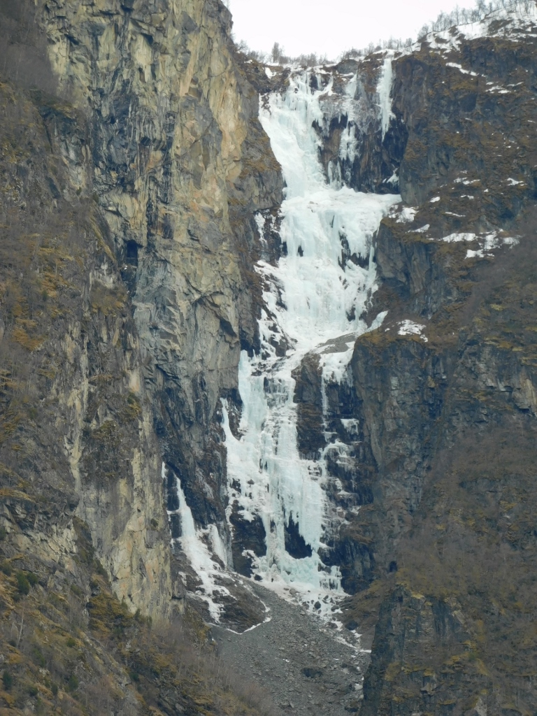 Frozen “waterfall”
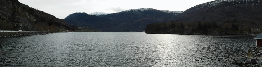
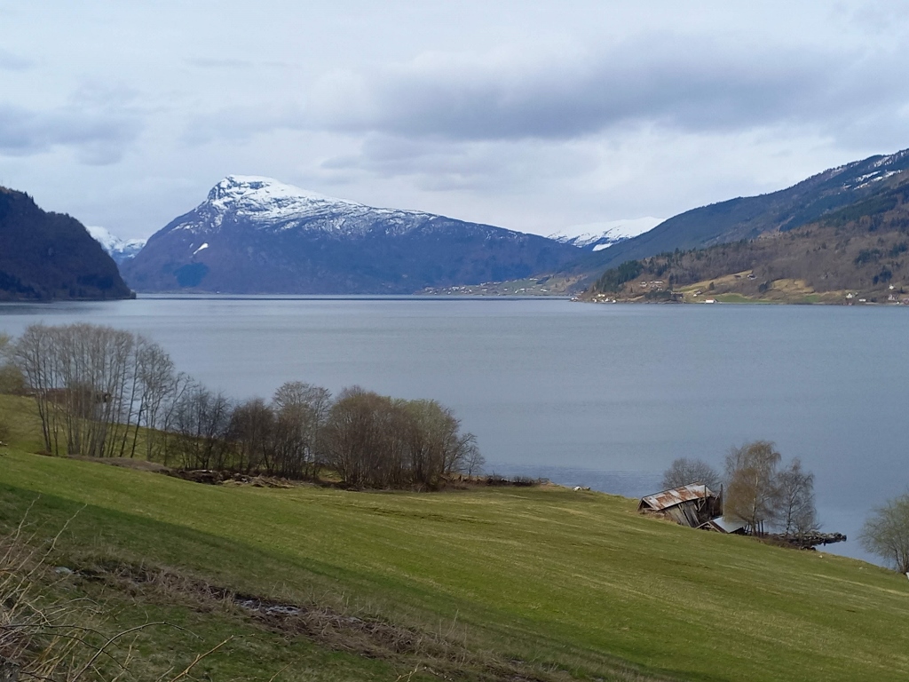
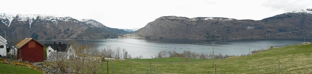
Soon, I arrived at the hotel where I had booked a room for the night. It was located at the end of the town, right on the edge of the fjord. This fjord is the Lærdalsfjord, a branch of the main fjord in this part of Norway, which is the Sognefjord. Moreover, the Sognefjord is actually the largest and most famous fjord in all of Norway and is also the longest fjord in the world that isn’t covered by ice (since two fjords larger than it are ice-covered).
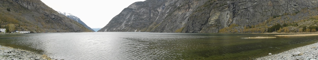 Lærdalsfjord
The hotel I chose seemed like a sort of resort for families with children, as I saw playgrounds and similar amenities. It’s likely much more pleasant here in the summer, with many people around. However, at the time when I took a stroll along the fjord, there was practically no one else around except for me and a few seagulls.
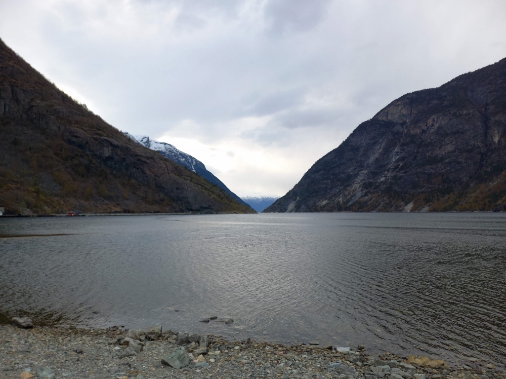 Lærdalsfjord
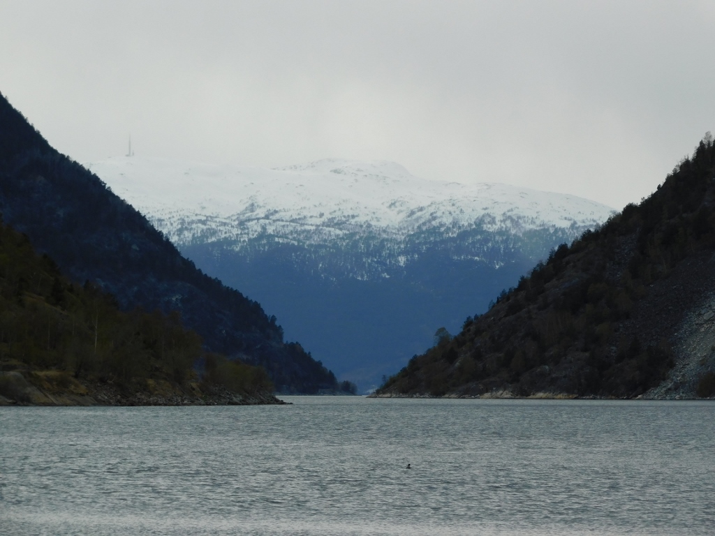 Lærdalsfjord
The hotel was also somewhat "spread out" – there was a small central building, surrounded by pavilions and smaller rental cottages. I had planned to get something to eat, but I wasn’t very hungry, so I went from the pavilion where I was staying to the reception to inquire if they had food and what they offered. They offered me a full meal, but first, I wasn’t sure what it would be like since there was no one else in the small and modest restaurant, which seemed more like a dining room. Secondly, I wasn’t actually hungry enough for a full formal meal.
So, I decided to "pop" over to the supermarket in the centre of the village, which was still open. There, I bought some snacks and... beer. I knew it would be nice to have it when I returned to my room later.
For now, I took a short walk around the village, which felt like a ghost town.
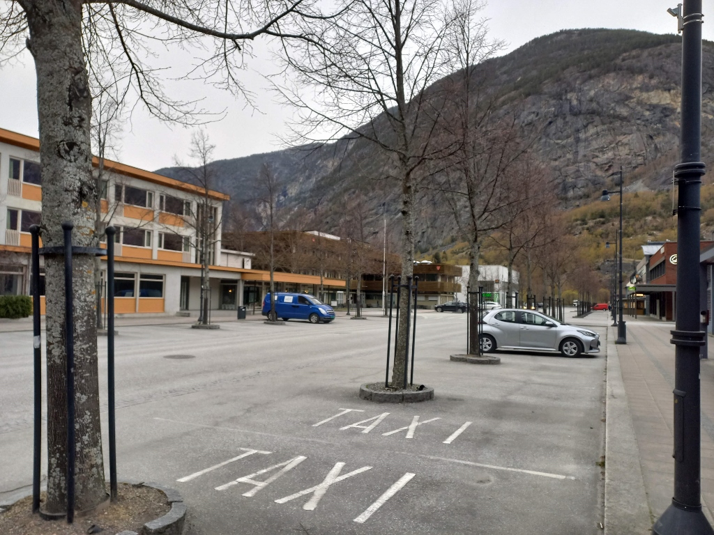 Lærdalsøyri at the end of the day
Aside from the possibility that, culturally, Norwegians may not be accustomed to walking around the streets of smaller settlements in the early evening on weekdays, it is a fact that Norway has a relatively small population spread over a relatively large territory.
According to the data I found online in mid-2024, Norway, with a territory of 385,207 sq. km, has about 5.5 million inhabitants, which is slightly less than 15 people per sq. km.
In comparison, Serbia covers an area of 88,499 sq. km, making it four times smaller than Norway, but it has 1.1 million more residents, which amounts to about 85.7 people per sq. km.
By the way, Norway has only about 2% of arable land, while Serbia has about 30%.
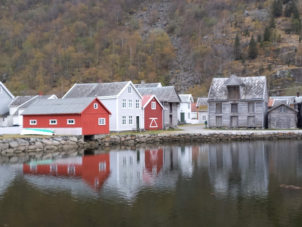
But back to my short stay in Lærdalsøyri. On my way back to the hotel, I noticed a charming part of the settlement, so I stopped to take a picture. There were no people here either.
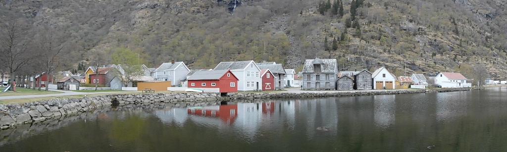 Lærdalsøyri, a detail
 Lærdalsøyri, a detail
After a good night’s sleep, I woke up relatively early, got down to my parked car and drove off. The drive wasn’t far at all – just under 10 km from the hotel’s parking lot. There, I reached the end of the road where I had to wait a bit to board a ferry. This was just the first in a series of ferries I would use that day, all of which transported me across the Sognefjord, which, as I’ve mentioned, is the largest and most famous fjord in all of Norway.
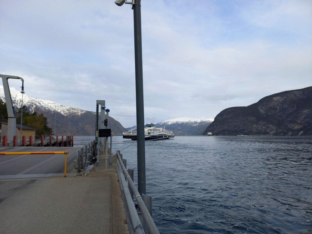 Waiting to cross the Sognefjord
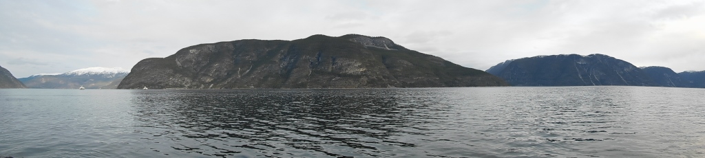 Sognefjord
The principle here was very simple: two ferries operate and while one crosses from the southern shore to the northern shore, the other one goes in the opposite direction.
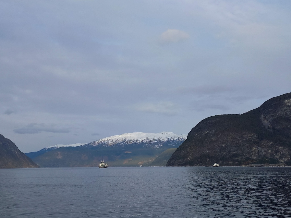 Car ferries in Sognefjord
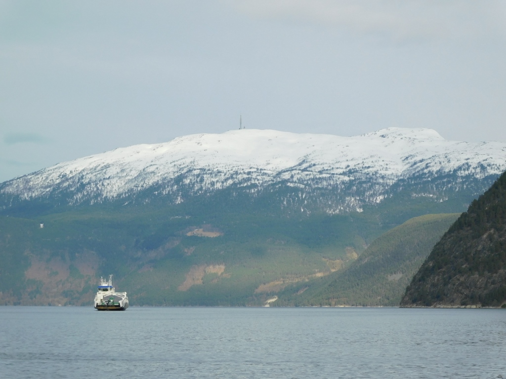 Car ferry in Sognefjord
Norway certainly has an extensive and well-developed road network, but given the country's topography, with its many high mountains and numerous islands and fjords, as well as its sparse population, there are certain "problems" or at least challenges in maintaining efficient and timely transportation. The solution to this issue is found in the continuous construction of new tunnels through these mountains and the intensive use of ferries to cross from one shore to another, whether it’s between the mainland and islands or across fjords. Of course, in the case of fjords, bridges are often built as well, but this is not always feasible, especially for large fjords like the Sognefjord.
During this first ferry crossing of the Sognefjord, both the starting and ending docks were outside of populated areas and when I crossed the fjord, I saw that the road leading from the ferry terminal quickly entered a tunnel after just a few hundred metres.
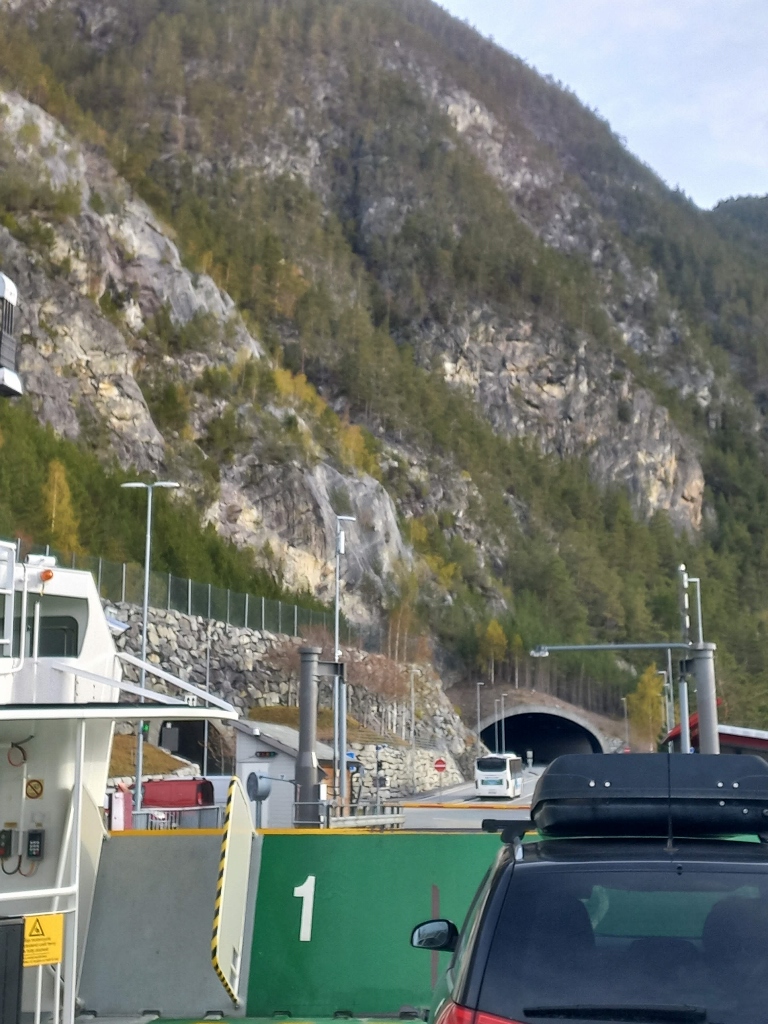 Tunnel on the north shore of Sognefjord
It was particularly important for me to know how the tickets were charged. Well, I was in highly developed Norway and the trend in the modern world is for everything to be automated, including ferry tolls, and road and tunnel tolls. Since I was driving a rental car, it was quite straightforward – the rental car company had my card number and they had already charged me some money "just in case." All the ferries (except one), as well as the roads and tunnels, have devices that capture the license plate number and everything is processed automatically so that the money is deducted from the account. I mean, except for the relatively short wait for the next ferry, everything went very efficiently.
So, after passing through the tunnel and arriving in Sogndalsfjøra, I turned right, heading north-northeast, with the intention of later following the innermost arm of the Sognefjord, known as the Lustrafjord.
The reason I chose this route was simple for me. I wanted to visit the Urnes Stave Church and it is quite remote. My original plan was to catch a ferry at Solvorn and cross to the other side of the Lustrafjord, but that friendly guide in Borgund pointed out that this particular ferry doesn’t run frequently as it serves very small communities and since it’s all quite remote, the church was still not open for the season.
The fact that I knew that the church wouldn’t be open didn’t discourage me at all. Although all the old wooden churches in Norway are beautiful in their own way, while the one in Borgund is the most picturesque from the outside, the one in Urnes is listed on the UNESCO World Heritage List. Not only because it is one of the oldest stave churches, but also because its interior is exceptionally richly decorated. I absolutely knew that the church would be closed and that I wouldn’t be able to see its rich decoration, much to my regret, but I still wanted to visit it. Moreover, as I have mentioned several times in my travel writings, I really enjoy setting myself a “task” while in a foreign country. Here, the task was to reach the church by driving around the Lustrafjord and then return to the other side of the fjord by ferry. That friendly guide found the ferry schedule on his phone and I noted it down, so I knew my target time.
Here is a map showing the route I took on this day:
Actually, I didn’t even enter the town of Sogndalsfjøra; instead, I drove across a bridge and then immediately turned in the desired direction just after the bridge. A bit further on, I stopped to take a look at a smaller arm of the Sognefjord and the bridge that spans the narrow part of this fjord.
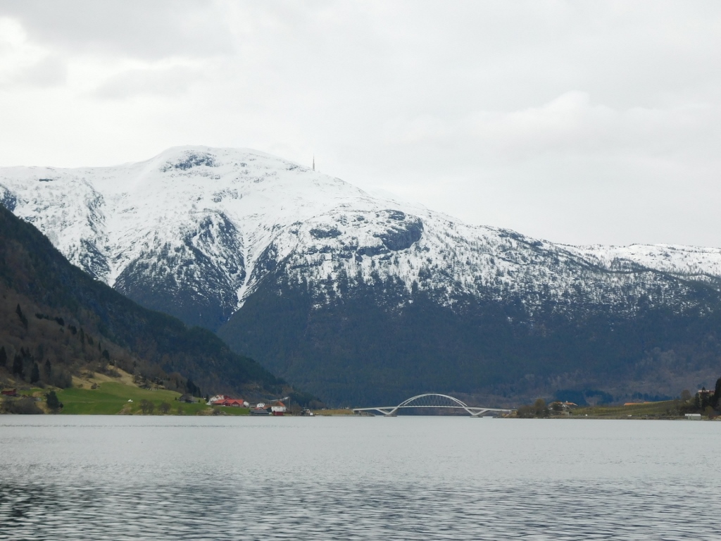 Smaller arm of a huge fjord and a bridge near the town of Sogndalsfjøra
First, I drove alongside that smaller arm of the Sognefjord and everything seemed exceptionally beautiful and impressive. I was looking for a safe place to stop quickly so I could take some photos. Fortunately, I encountered very few vehicles, so I didn't have any issues with stopping.
 Smaller arm of a huge fjord; you can see the islet of Øyna on the right-hand side
When you reach the end of this smaller arm of the fjord, the road then curves inland and there, on the left side, I could see Lake Hafslovatnet, which, with an area of just under 6 sq. km, was completely covered in ice by mid-April 2024. I didn’t find a convenient parking spot here, so I used my newly developed skill of taking photos with my mobile phone without looking at the screen (since I was driving, albeit very slowly). Experience in photography certainly helps, although in the end, many of the shots ended up in the "recycle bin."
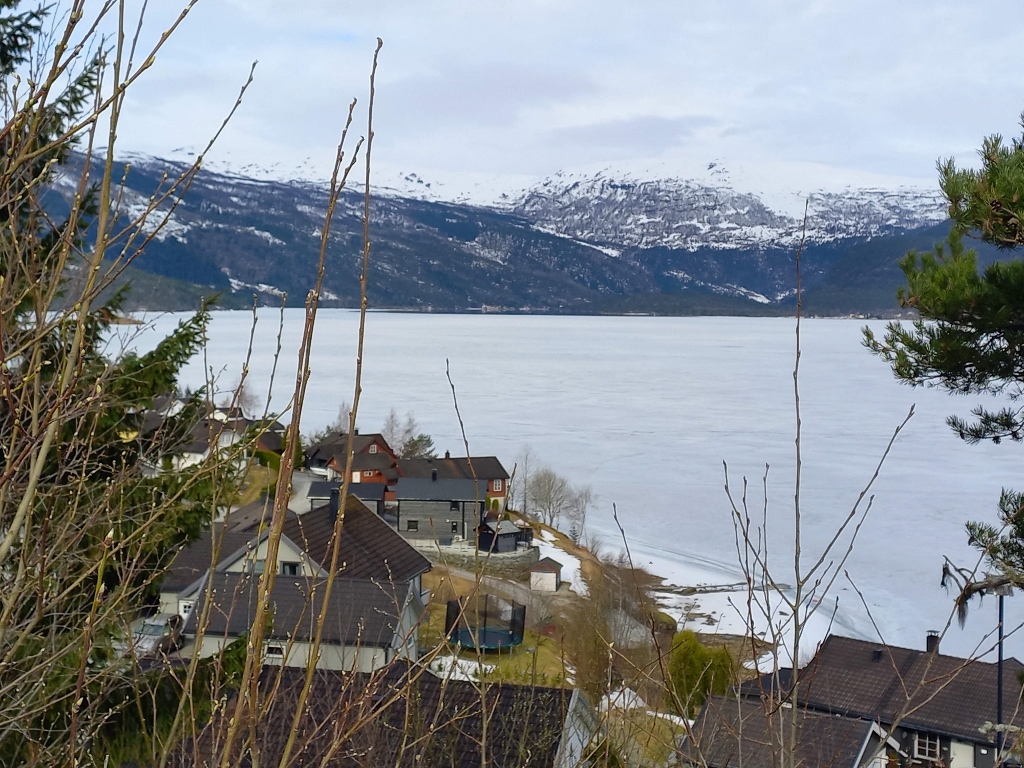 Lake Hafslovatnet
 Lake Hafslovatnet
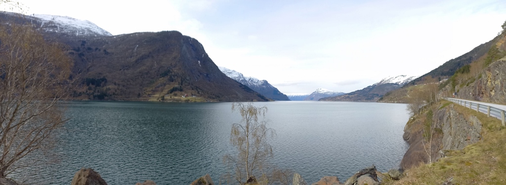
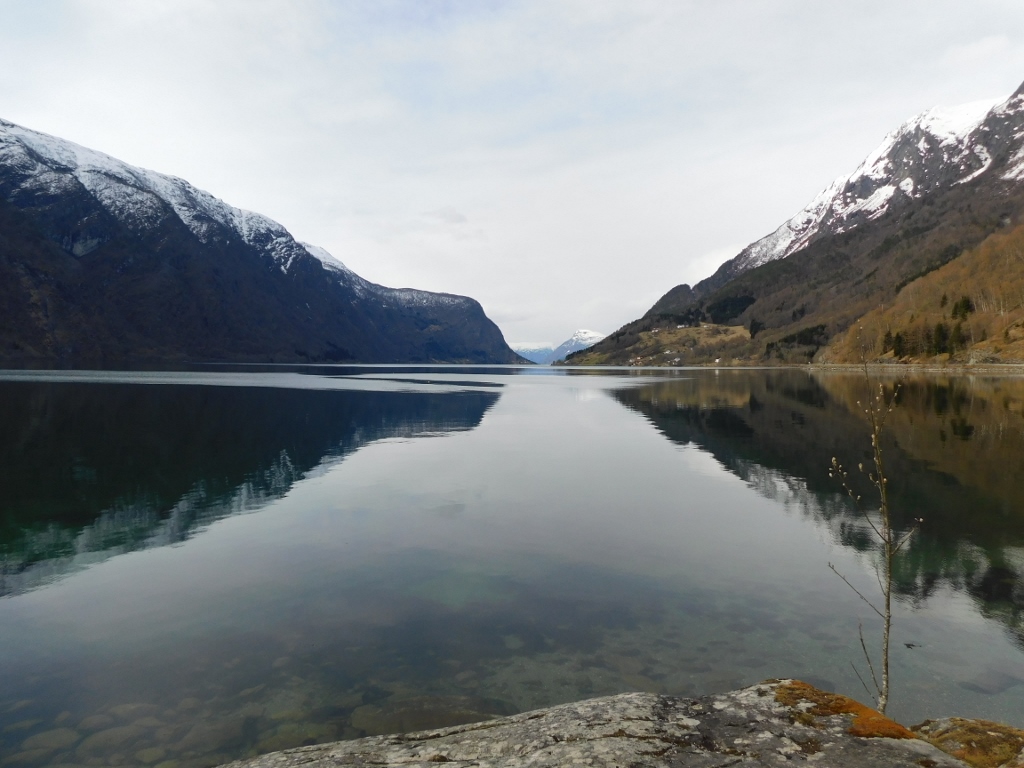
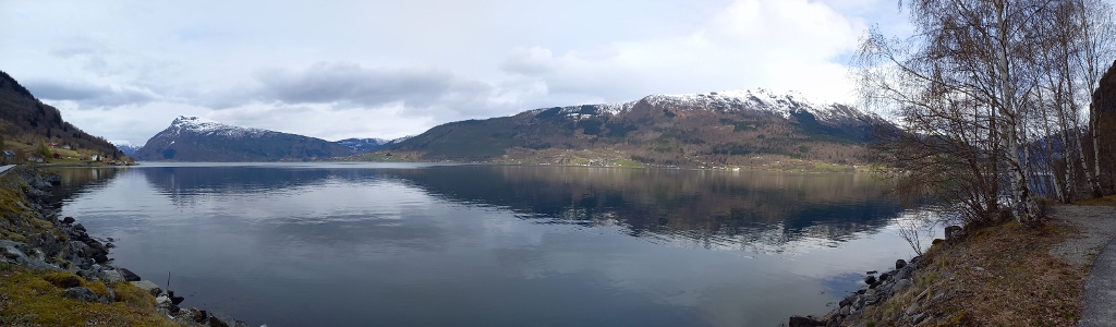
Soon after, the road emerged on the northern side of the Lustrafjord, so I continued driving around the fjord, occasionally stopping to photograph the beautiful landscapes I was passing through.
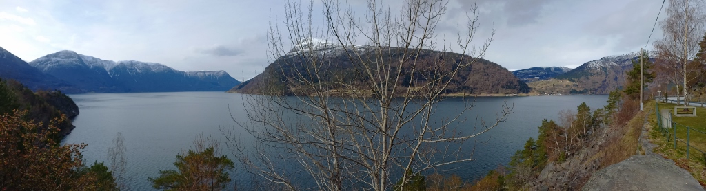 Lustrafjord
 Lustrafjord, a detail
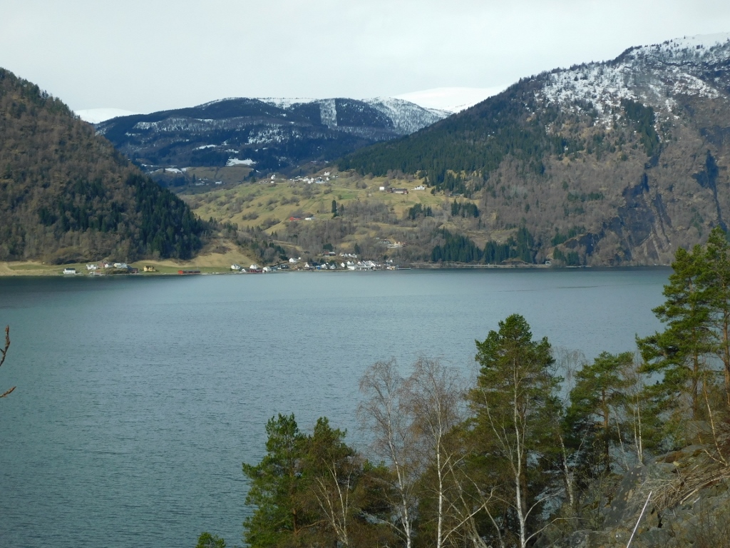 Lustrafjord, a detail
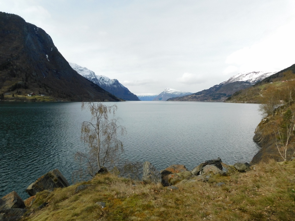
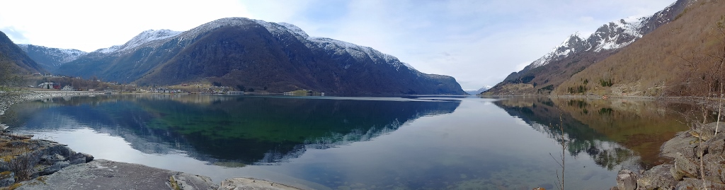
The sun was trying to break through the clouds and occasionally it seemed like it might succeed, but in the end, it turned out to be the worst day in terms of weather during the entire trip.
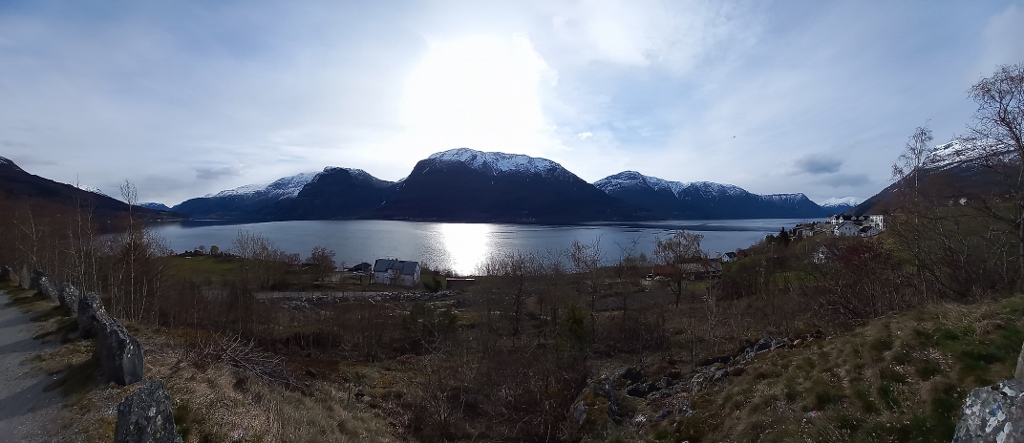 Lustrafjord
 Lustrafjord, a detail
 Lustrafjord, a detail
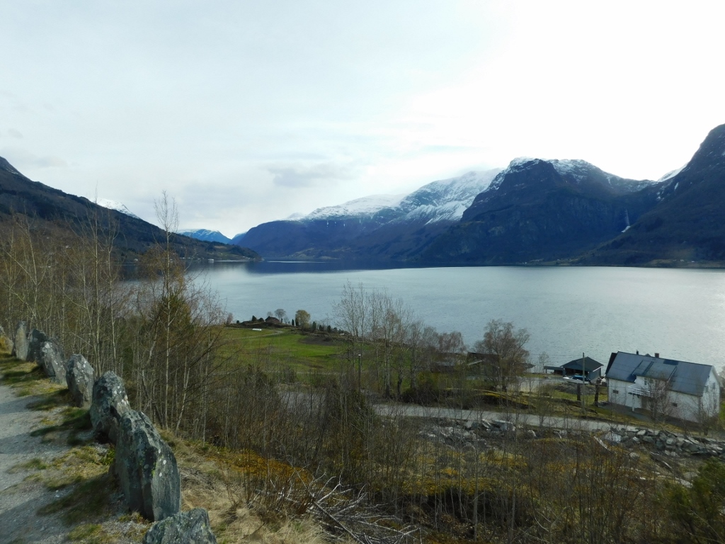
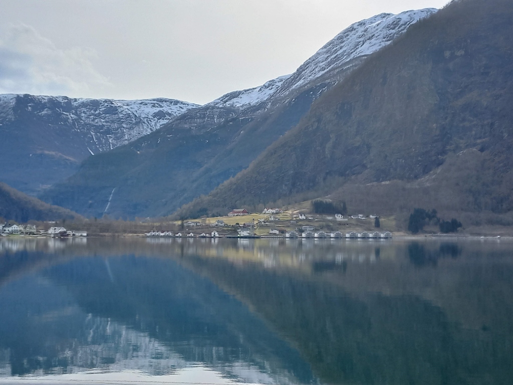
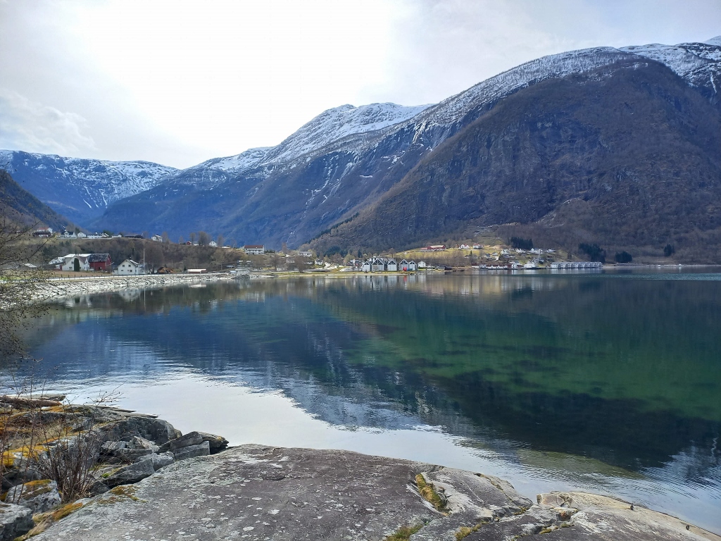
In some spots, I took photos from the same position with both my camera and mobile phone. Although the photographs might be similar, they are still interesting to me because they highlight certain nuances in the appearance of the landscapes.
 Lustrafjord
 Lustrafjord
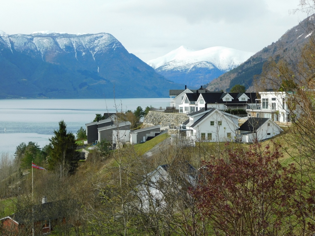
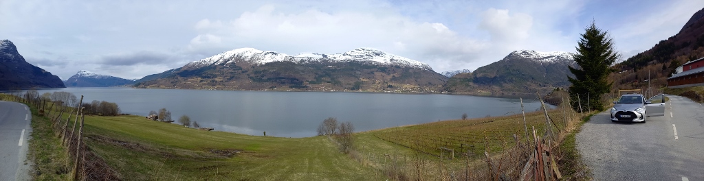
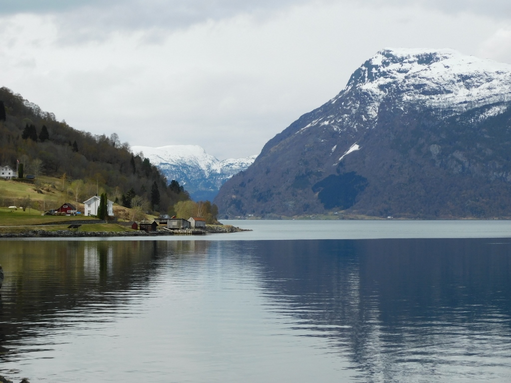
And so, I reached the very end of the Lustrafjord, where the town of Skjolden is located. Even as I approached the town, it was clear that I would have to stop a few times. The views were superb!
 Village Skjolden and the surroundings
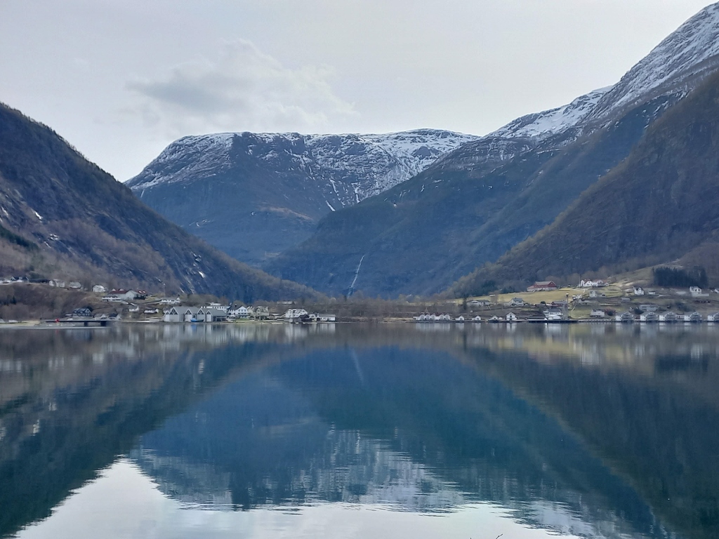 Village Skjolden and the surroundings
And the view along the Lustrafjord was outstanding, too.
 Lustrafjord
 Village Skjolden and the surroundings
 Village Skjolden and the surroundings
I came here based on the recommendation of that wonderful young man from Borgund who was my guide there. It wasn’t just about the local ferry schedule, although that was certainly important, but he also told me that the landscapes here were very beautiful and that you could drive around the fjord to reach the church on the other side. I am very grateful to that young man (whose name I don’t know) because this turned out to be another wonderful experience in Norway.
However, despite the beauty of the surroundings, I couldn’t linger here, as I needed to get to the Urnes Stave Church and catch one of the few ferries in that part of the fjord.
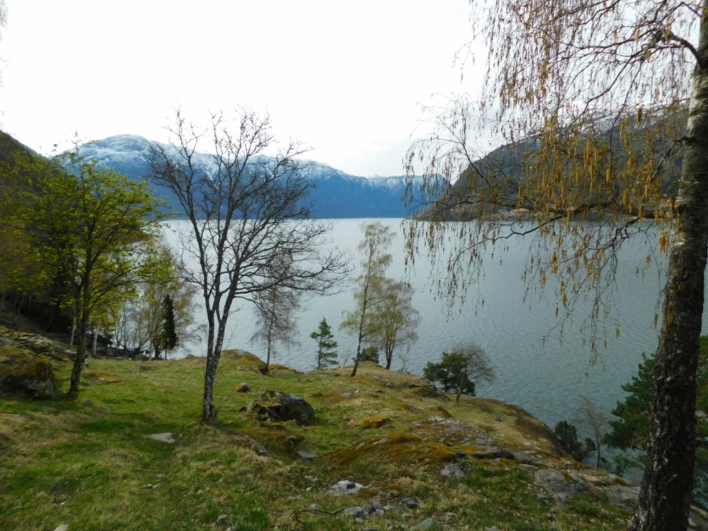
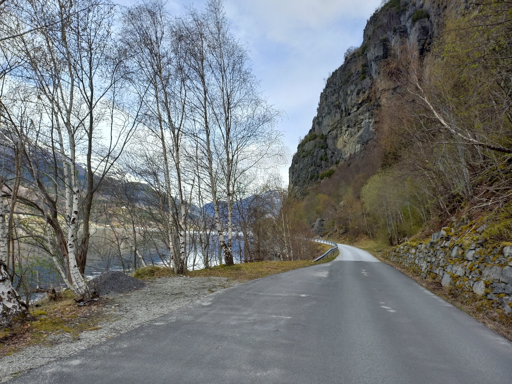
So, after taking the previous photos, I simply continued on. The road along the southern side of the Lustrafjord, from Skjolden to the Urnes Stave Church, was quite narrow and of a lower category compared to the road I had travelled on the northern side. As for the landscapes, they were no less impressive.
In the next photo, you can see both the landscape and the rental car, and more importantly, the road. My car is parked on a pullout beside the road, which is actually wider than the road designated for two-way traffic. Fortunately, on this approximately 30 km stretch of the road, I didn’t encounter anyone – no cars, no people – though I did pass by some houses and properties here and there. Yes, indeed... Norway is truly sparsely populated.
 Lustrafjord, the south side
 Lustrafjord, the south side
 Lustrafjord, the south side
 Lustrafjord, the south side
 Lustrafjord, the south side
 Lustrafjord, the south side
Where the road was especially narrow and there were many curves, I was very careful with my driving. I also made sure to pay attention when passing by any pullouts in case someone came from the opposite direction and I needed to reverse. Fortunately, I didn’t come across such situations. At one point, where everything was more visible, I dared to record a short video. This was definitely not an option in places where the road was very narrow or particularly winding.
Although I was very happy to be driving on this side of the fjord, I was also aware that I often had to drive quite slowly, all the while keeping the visit to the church and the ferry schedule in mind. In the end, everything went well and I reached the village of Ornes or Urnes. I drove up to the pullout in front of the gate where the famous Urnes Stave Church is located. First, I passed by the (seasonally closed) Visitor Centre and from that elevation I had a beautiful view of the Lustrafjord. I could also clearly see the village of Solvorn on the other side of the fjord, where I planned to arrive later by the ferry.
 Lustrafjord, the south side
For now, I went to take a walk around the Urnes Stave Church.
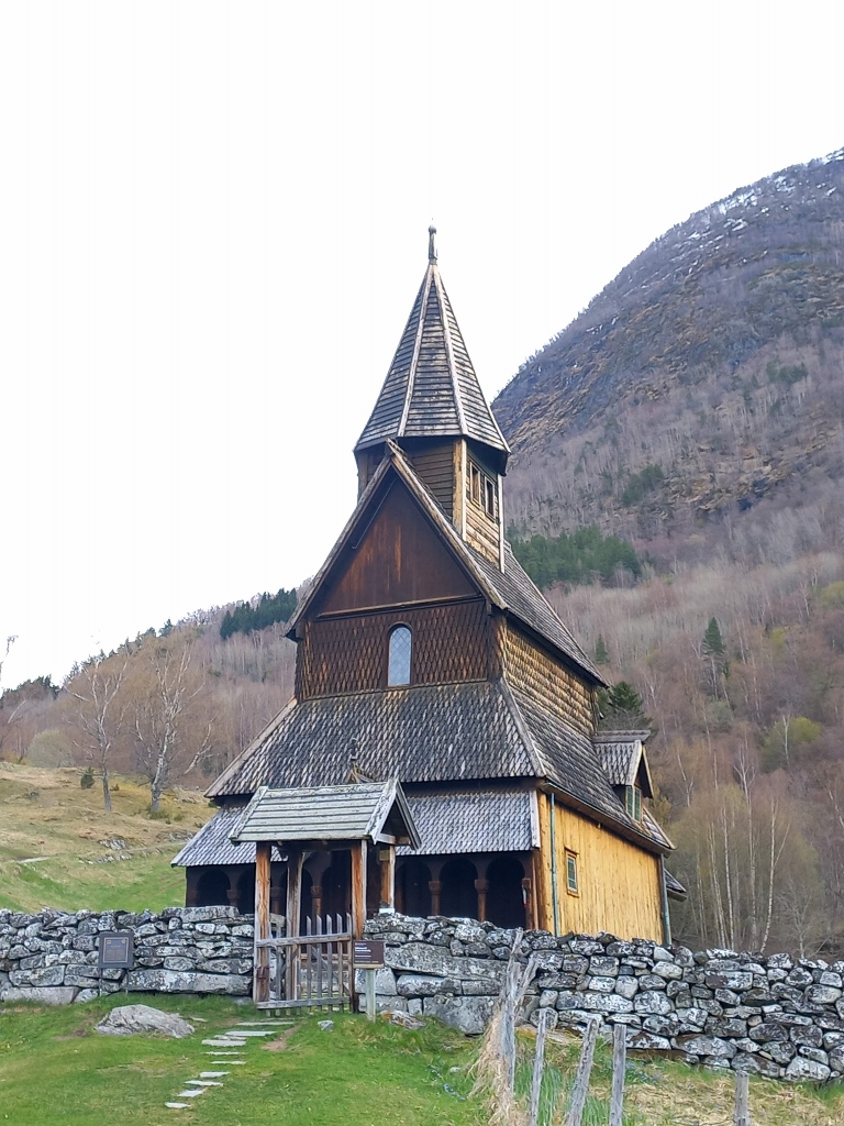 Urnes Stave Church