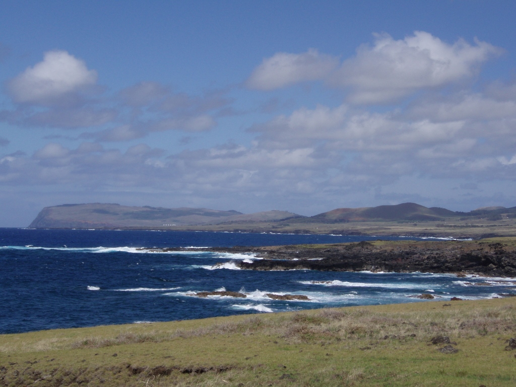
The following day I went to Hanga Roa with the French guy who was staying at the same place as I. From there, we both went to the bay of Tongariki which was almost the most distant point from the place where we lived with the idea to come back on foot.
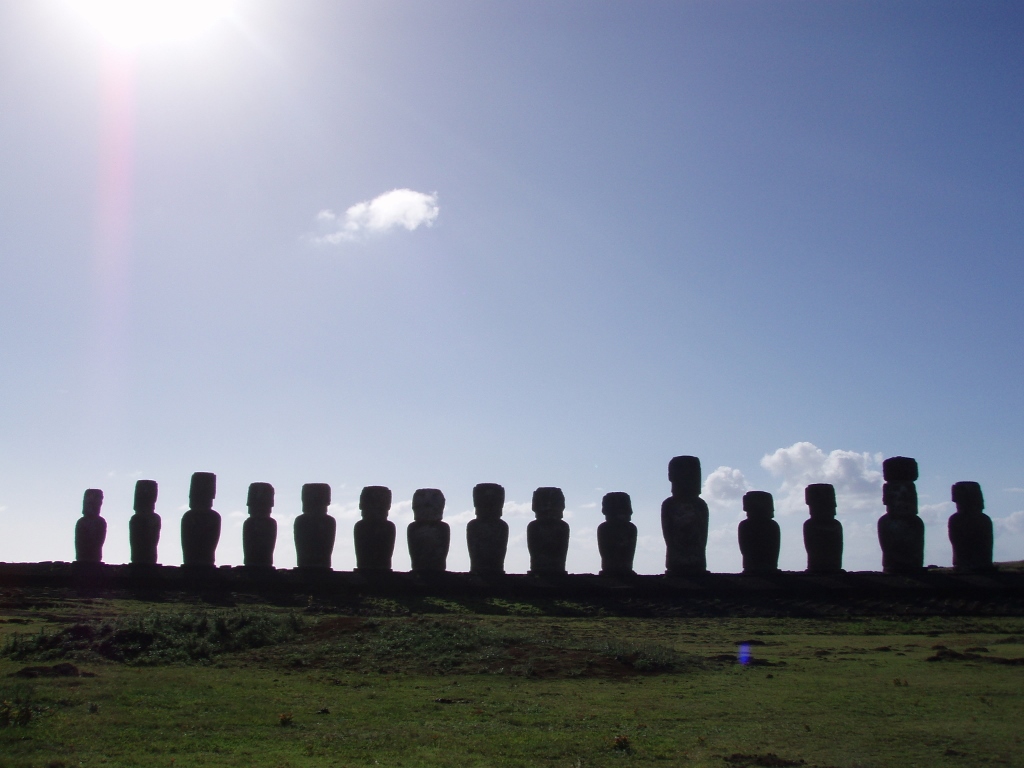
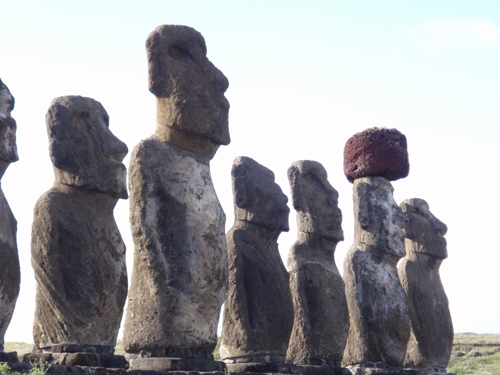
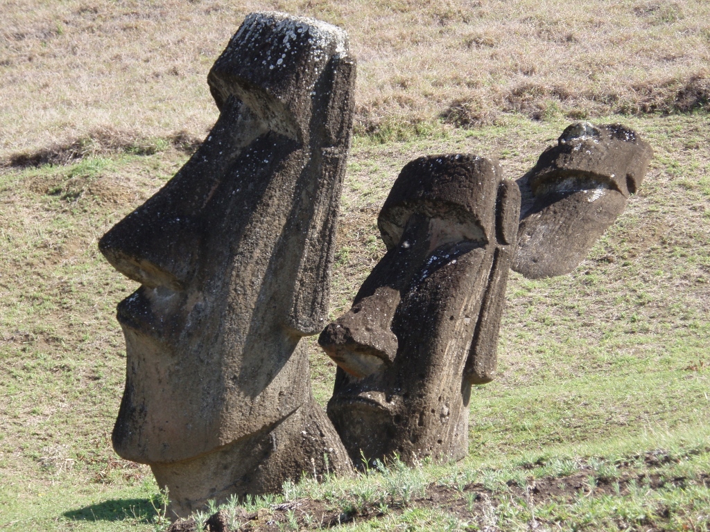
Ahu Tongariki is located near Poike peninsula in the north-east of the island. This is the biggest ahu on Easter Island. It had already been in disarray when in 1960 a large tsunami pushed the moais even farther from the place where they originally used to be, but in 1992 the ahu was reconstructed thanks to a Japanese corporation.
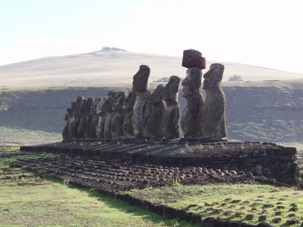 Ahu Tongariki with the summit of Maunga Pu A Katiki volcano in the background (400 m a.s.l.)
 Ahu Tongariki
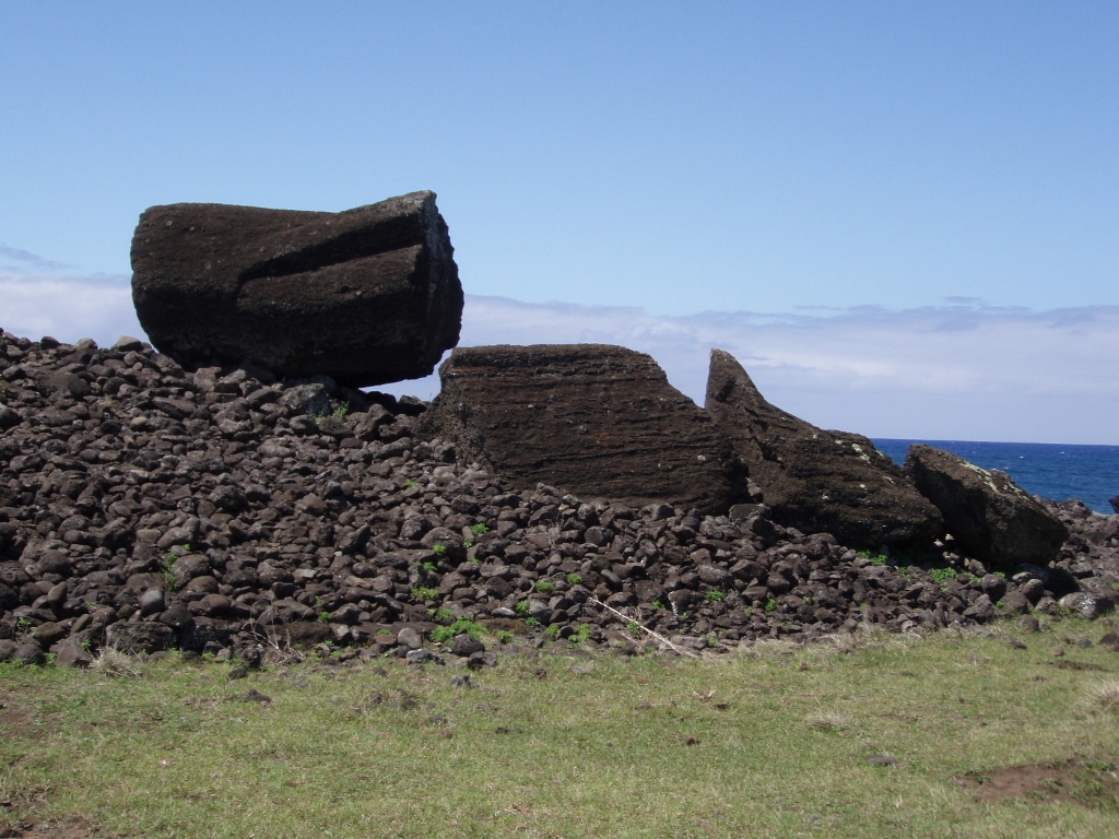
There are 15 moais on Ahu Tongariki and they are all supposed to have red hats, called the pukao, but it is the case only with one of the moai. That is, the red bonnet has been placed back only on one of them, while there are still more pukaos scattered across the surrounding terrain.
 Ahu Tongariki
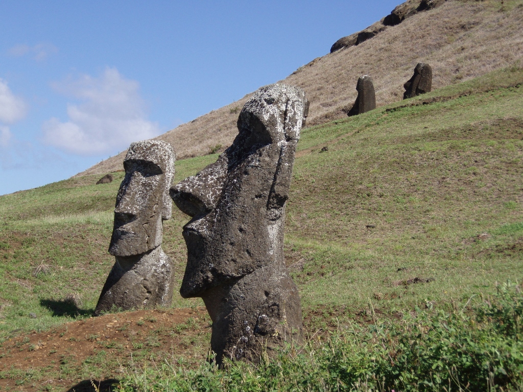
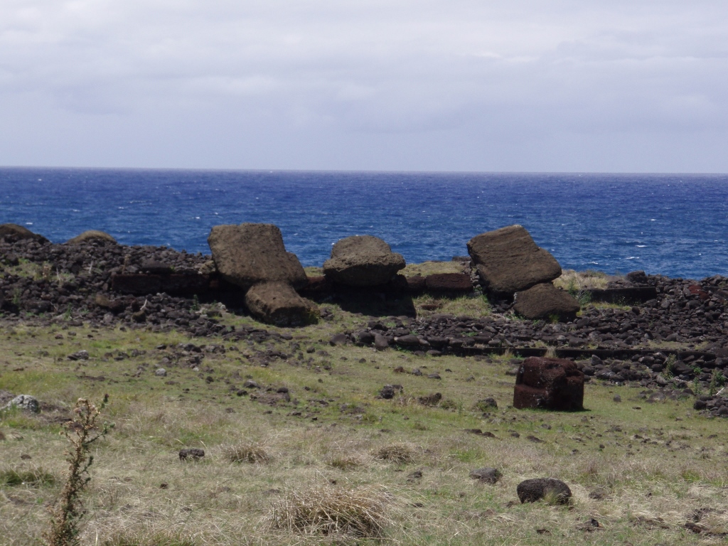
In the vicinity there are also parts of other moais, some with a missing head, some broken in another way, but they are lying there. There is also one standing up and alone not far away from here.
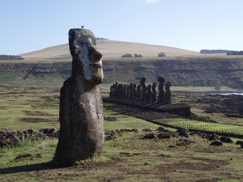 A lonely moai near Ahu Tongariki
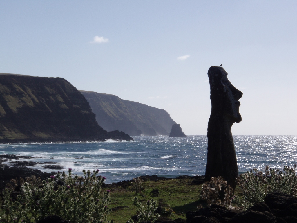 A lonely moai near Ahu Tongariki with Motu Marotiri, a rock-islet sticking out of the water
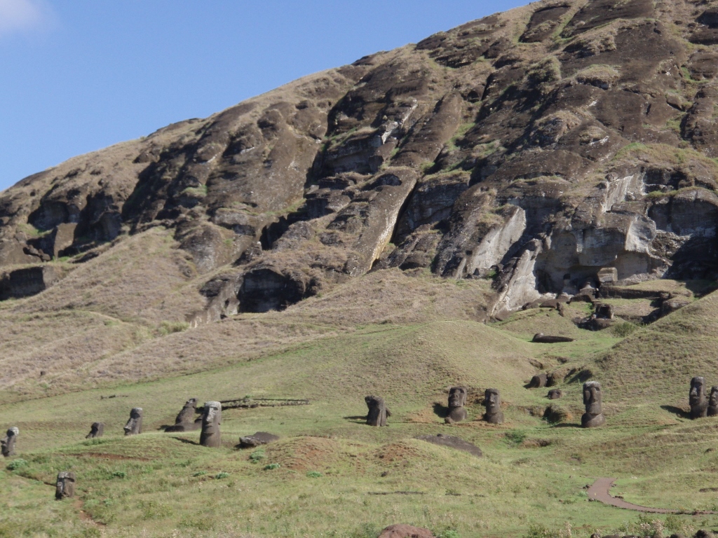
Near Ahu Tongariki there is a grassy elevation which eventually extends into a cliff. That is Rano Raraku, called the nursery. This is the place where the moai used to be made, i.e., where they were chiselled out of the rocks and nowadays there is a myriad of apparently scattered and simply completed, but untransported moais. Some, however, have never been completed.
 Rano Raraku
If the ahus and the moais arranged on them generally puzzle both scientists and laypersons, this place is additionally confusing. There is a huge number of the moais here that simply cover this entire slope. When you come closer to the rocky parts, you realize that they used to have a proper production line here. Even today, it is possible to see several moais in making lying there one next to the other.
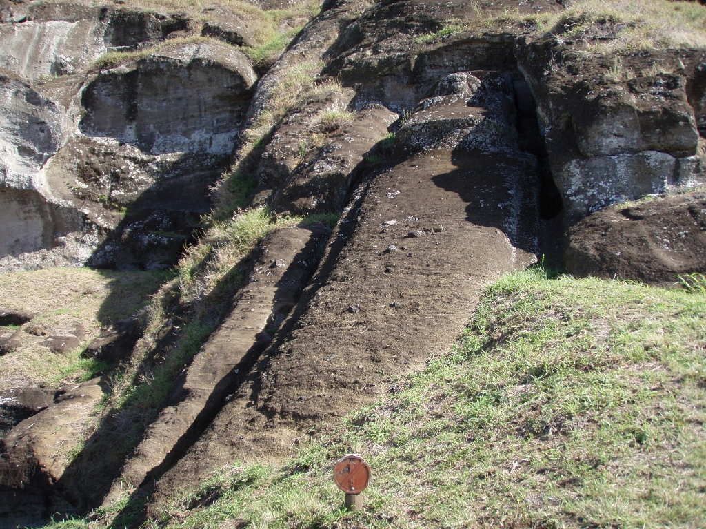 Rano Raraku, a moai in making, chiselled from the front, but with the back still not separated from the base
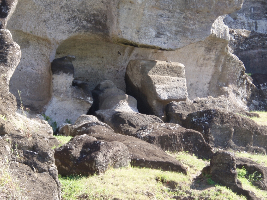 Rano Raraku, more moais in making
The official version says that the Rapa Nui transported all these moais around the island using the logs made of the toromiro tree as rolls over which they moved these huge stone statues and that this was how they managed to cut all the trees on the island. Of course, it all comes down to theories and every now and then there is a new one with the goal to provide the final solution. It is unlikely they will ever get to it. The Rapa Nui do not have their writing, that is, they have certain glyphs that may be found in some places, but so far nobody has managed to decipher them. Their legends particularly mention the birdman and it is also possible to see on the petroglyphs in Orongo some figures that are half-man half-bird, but little more than that is known.
 Rano Raraku, completed, but untransported moais
 Rano Raraku, completed, but untransported moais
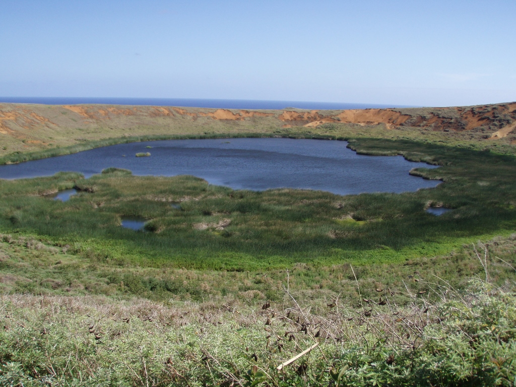
Rano Raraku is in fact yet another volcano and the quarry or the nursery as they call it is situated on one of its exterior sides. Within its crater there is the island’s other reservoir of fresh water, but it is significantly smaller and less impressive than Rano Kau. However, what is interesting is that the moai may be seen scattered also on the interior slopes of Rano Raraku crater where they protrude from the grass.
 Crater of Rano Raraku volcano
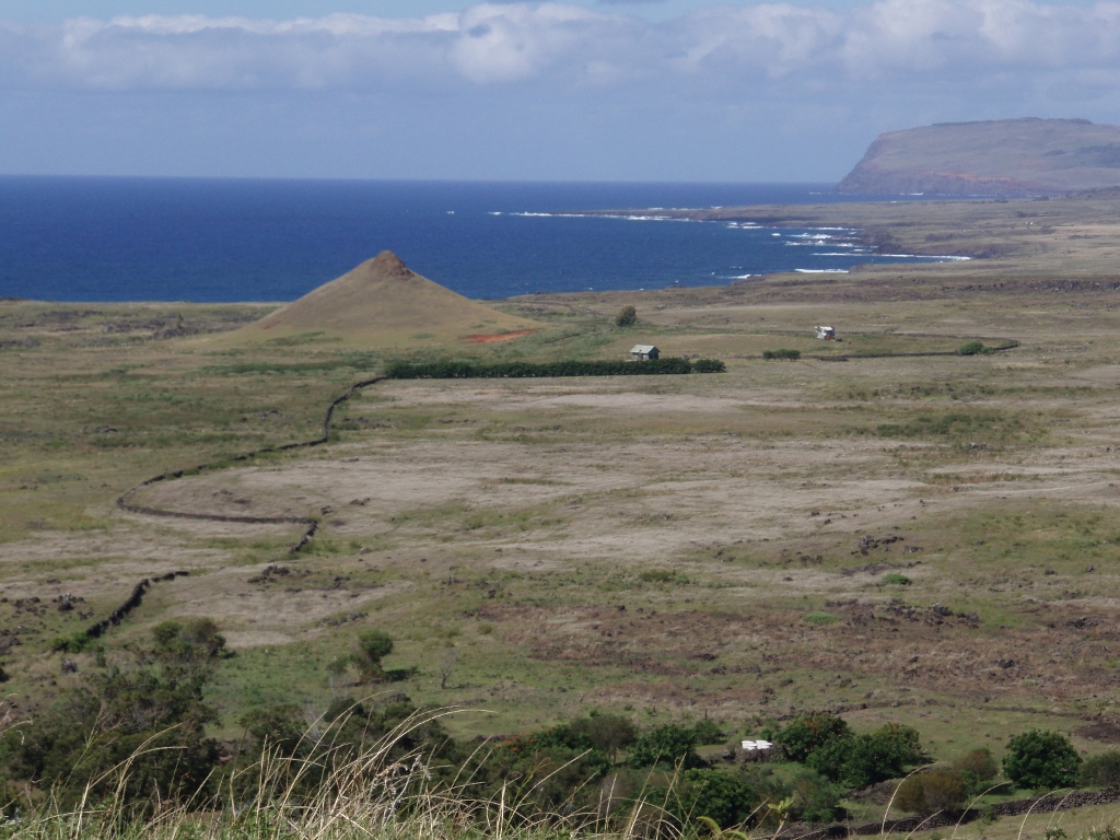
All the volcanoes on Easter Island are extinct. From where I stood near the crater of Rano Raraku there was a nice view towards the other part of the island with Rano Kau volcano, while the lowland filling up the space between these two larger volcanoes also had numerous smaller cones, which are in fact remains of smaller extinct volcanoes.
 View from the slopes of Rano Raraku with Rano Kau volcano in the right upper corner
After walking along a trail that leads among the moai standing on the slopes of Rano Raraku, the French guy and I headed for Hanga Roa. Our plan was to walk this distance of some 20 kilometres and to visit a few more ahus standing along the way. One of them is Ahu One Makihi. You can see the ahu and there is a moai there, but it was toppled, so we didn’t stay there for long.
Although we walked to the coast as well and across the land, sometimes closer to the road and sometimes a little farther away from it, that walk was very monotonous and the sun shone fiercely, regardless of the hat I was wearing to protect myself.
 The landscape in which we walked visiting a few ahus. In front of us, to the left, there is Rano Kau volcano
On the other hand, no matter how uninteresting the nature was there, flat terrain, some grass, rocks here and there, with a road to Hanga Roa leading through all of it, it was still magical when we would come across a moai which seemed to have come there from nowhere. Thus, in the middle of the apparent wasteland we came across a lonely moai. The poor thing was lying there on its belly and face, with his nose stuck in the ground. Perhaps somebody had given up pulling or pushing it towards the intended destination, thus leaving it midway. But, there were also a few ahus whose moais, broken and toppled, lay there around the by now almost shapeless pile of stones that used to be their platform in the past. One of such ahu was Ahu Hanga Tetenga where we came across a larger group of tourists.
 Ahu Hanga Tetenga
Then we reached Ahu Akahanga. There were several moais there, but they were all toppled over face down, with some of them on their backs. There I could also see red hats that were broken or just lay scattered near the ahu. Very close to this one, there is yet another larger ahu with toppled moais, Ahu Ura Uranga Te Mahina.
 Ahu Ura Uranga Te Mahina
The theories as to the reason why all the moais were toppled by the second half of the 19th century go from clan fights to earthquakes. Still, looking at all of this, so many ahus and even more moais, I also came up with a theory of my own concerning what actually went on here.
Easter Island is small. Its surface area is around 165 square kilometres (this is the official estimate, although it is unclear to me taking into consideration the length of its coast). Its maximum length is around 25 km (!!!) and the neighbours are nowhere to be seen. The people here actually wanted to die of boredom! Their problem was that they didn’t think of a theatre. It was invented by ancient Greeks for the same reason – to kill the time. This did not occur to these guys here and as they didn’t know what to do with themselves, somebody came up with the idea to start chiselling these statues. If they had had their neighbours closer, as the Greeks did, and if they had had who to pass their sculpturing experiences to, nowadays perhaps the people on the entire planet who have cultural aspirations would have been making moais. This way, they go to theatre. That is the only logical explanation for their huge numbers.
The next on our way was Ahu Vaihu or Ahu Hanga Te'e. There were 8 toppled moais there, as well as more red pukaos. However, by now all the ahus in this part of the island started practically to look alike. That’s why my companion and I eventually decided to stop walking from one destroyed ahu to the next, as there was actually nothing much to be seen there. For this reason, at some point we managed to hitch a small pickup truck, climbed into its cargo bed and so we successfully reached Hanga Roa.
The following day I wanted to go to Anakena beach, but it rained in the morning and I gave up the beach and thought I would spend a completely easygoing and leisurely day. For this reason, I slowly got up, although quite early, had a good breakfast and headed for the centre of Hanga Roa and an internet café. There I stayed for a while and then I decided to move in the direction of Ahu Akivi. In the meantime I was also caught up in a modest shower, but I was well prepared, since I had a plastic poncho, so that was alright. There was no more rain after that, but the clouds did pile up from time to time before they completely cleared up in the afternoon.
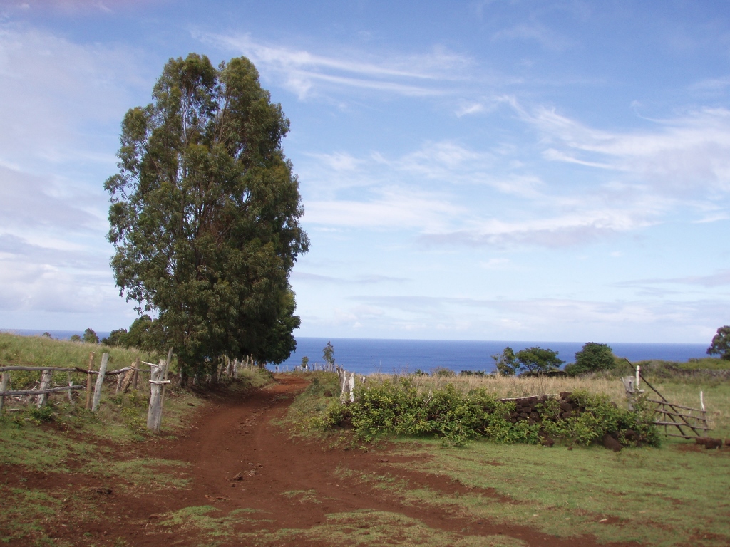
I left Hanga Roa just like that, with no particular plan and only along the way I decided to go all the way to Ahu Akivi. After the brief shower, the sky partially cleared up and I realized it would be silly to go to a café and spend the rest of the day inside. So, I first followed a dirt road which led me outside the settlement and soon enough there were no other people around me at all.
 The dirt road outside Hanga Roa
The road then disappeared slowly, but I continued following a roughly estimated direction towards Ahu Akivi and it seemed occasionally that I was lost for I was walking outside any paths or trails across rocky and grassy patches of land, but it was in fact all very beautiful. I saw it all as a part of an adventure and I just had a very general supposition in which direction I should be moving. There was nobody there to ask for assistance.
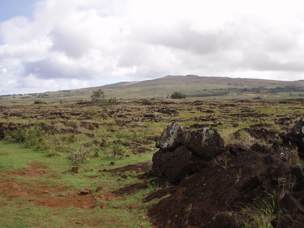 On my way to Ahu Akivi
I even thought that it would be really bad if I twisted an ankle or something worse, as there was not a soul in sight, but it all went well in the end, I did not get lost and after a while, feeling very proud with myself on account of my great sense of orientation, I came across a well-worn path and soon after to the “main road” which I then followed in order to reach Ahu Akivi.
It is interesting that close to Ahu Akivi I passed by a couple of well cultivated fields, one of which had nicely-growing maize. It was a relatively rare sight, since the land is intensely filled with volcanic rocks, thus being unsuitable for cultivation. On the other hand, the soil of volcanic origin is very fertile, so that crops can grow well, at least as far as their base is concerned.
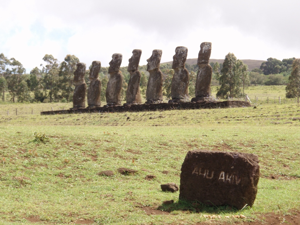
Ahu Akivi is a particularly important ahu. There are seven moais standing on it. The legend says that these are the seven warriors whom Hotu Matu'a, the first tribal chief on the island of Rapa Nui, sent to find a place where they would all live and later he came here as well. Namely, according to this legend, the first inhabitants of Easter Island came by boats from Polynesia. This does make a lot of sense, since in addition to the anthropological similarities with the Polynesians, there is also a very clear and strong linguistic connection.
 Ahu Akivi
In addition to this, Ahu Akivi is special because it is located relatively deep in the interior of the island and it is the only one on which all the moais face the ocean. So, on all other ahus, regardless of where they are and regardless of the points of compass, the moais were placed with their backs turned towards the ocean, facing the island. The fact that these moais here are turned with their faces in the direction of the ocean has led some scientists to a supposition that this was more because there was some ceremonial place in front of them than that they looked out towards the vast ocean.