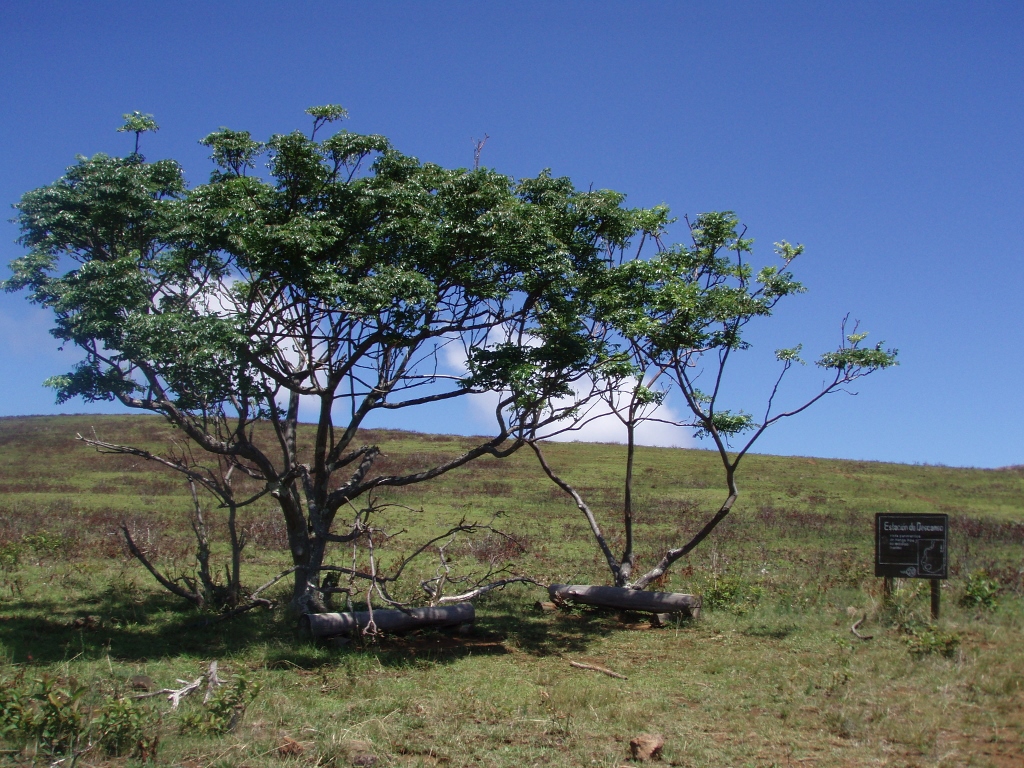
The following morning I woke up a little before 8, which was enough sleep, but with some pressure in my head – probably from too much sleep actually or my body and blood pressure just needed some time to adjust to the new time zone, the new climate, space and circumstances. During my breakfast, I had a great chat with the Polish guy from the boarding house and I also had three cups of coffee, quite unusual for me, but my head did clear up a little. I went for a leisurely walk to the tourist information centre, then to the market where I bought additional water, then I visited some souvenir shops and went to an internet café and a post office to send postcards, but I also ate some tuna and cheese empanadas, which seemed like too much. Still, on my way back to my room, I stopped at a café with a nice view and had a guava juice there.
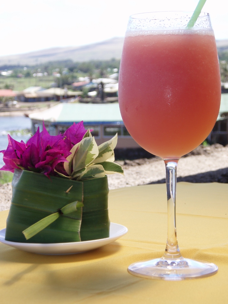 Guava juice
While I was relaxing at the café near the ocean and the weather was ideal, since the sky had completely cleared up and it was not too hot, I enjoyed watching local guys practicing surfing on the waves that were breaking in front of Hanga Roa. These were not big waves, but it was quite clear to me that even those small ones required considerable skill.
The point is that this morning I was in no hurry whatsoever. Namely, I came to the island for a whole week, so I thought I had plenty of time to see everything well and thoroughly, as well as to take it easy, as was the case.
For that afternoon, I planned to go for a nice walk to volcano Rano Kau and the ceremonial site of Orongo, in other words, to the very south-west corner of the island. I started early in the afternoon and first went again through the fishing village, Hanga Piko, but all the time looking at the Pacific and the waves I was passing by. I had difficulty detaching myself from the scenery, because each second and each angle of watching filled me up with enjoyment.
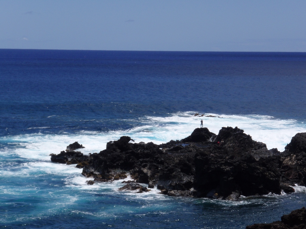 Pacific and the Easter Island coast (do you see the apparently little guy fishing?)
Still, I was a woman with a mission, so I kept going. It takes around 4-5 hours of leisurely walk to reach Orongo from Hanga Roa (taking the museum as the starting point), since it is some 8 km away, a little across the flat terrain and then uphill.
However, I did not go immediately uphill, but rather I went closer to the ocean and there the views were again fantastic. I was standing on the edge of the soil part which stood above the water and from there I could nicely see the entrance into a huge cave called Ana Kai Tangata. From the other side of the deep “bay” of the Pacific which goes towards the entrance into the cave, it was even better to see how the cave was covered by rocks over which there was soil and grass, but it still all seemed quite solid and durable. Those caves are created from the so-called lava tunnels, when there is a lava flow which is of different composition in comparison to the surrounding rocks. If that flow is of a more porous composition than the surrounding one, it collapses over time and a tunnel remains instead of it. Well, in this case, what was left was a cave.
 Easter Island’s shore, the “bay” of the Pacific under the point where I’m standing leads directly into the cave
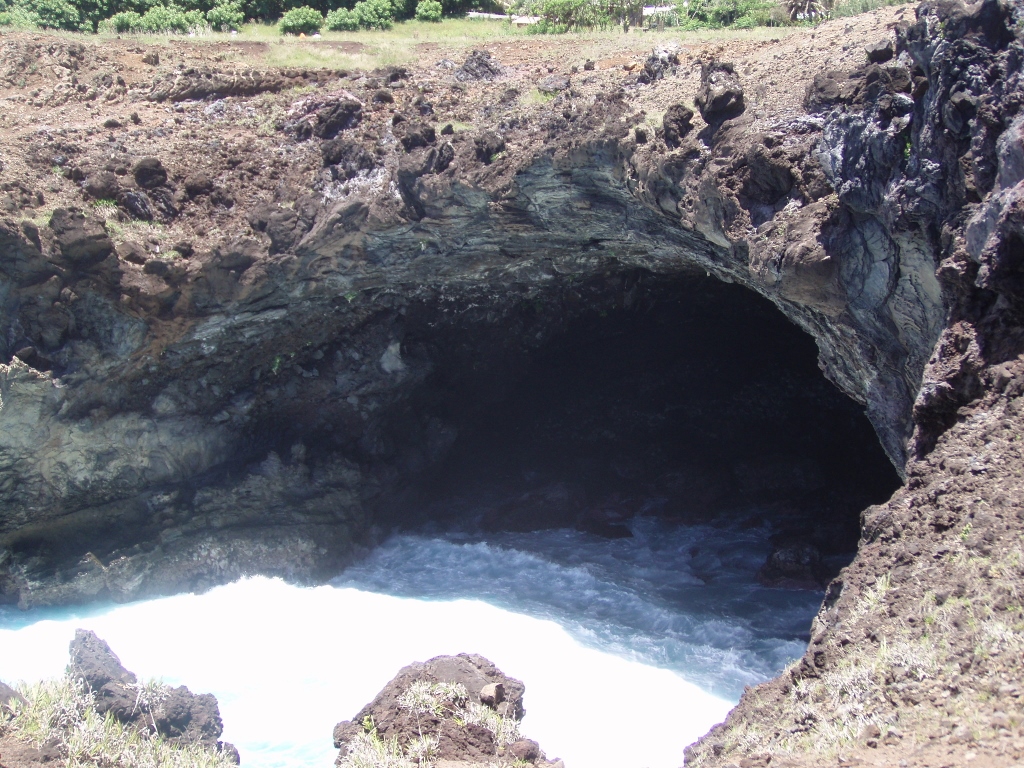 Ana Kai Tangata cave
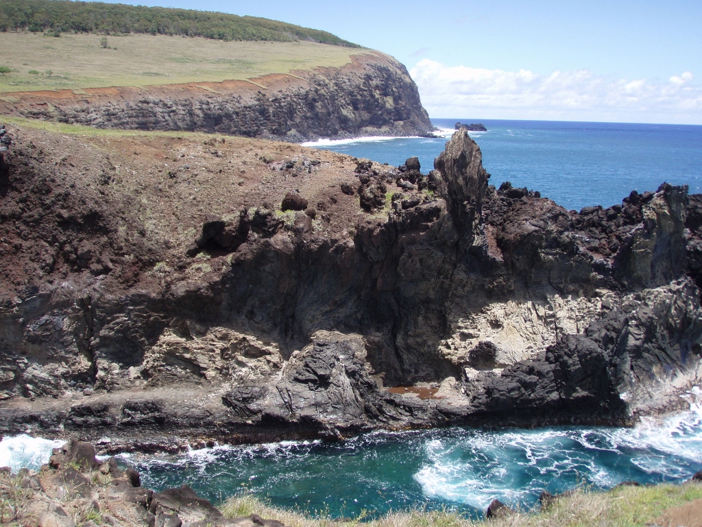
When talking about lava and rocks on Easter Island, let me say that the shore of the island consists mostly of black volcanic rocks which come up to the surface from the great depths of the ocean, with very little coral, although there are a couple of adorable small sand beaches.
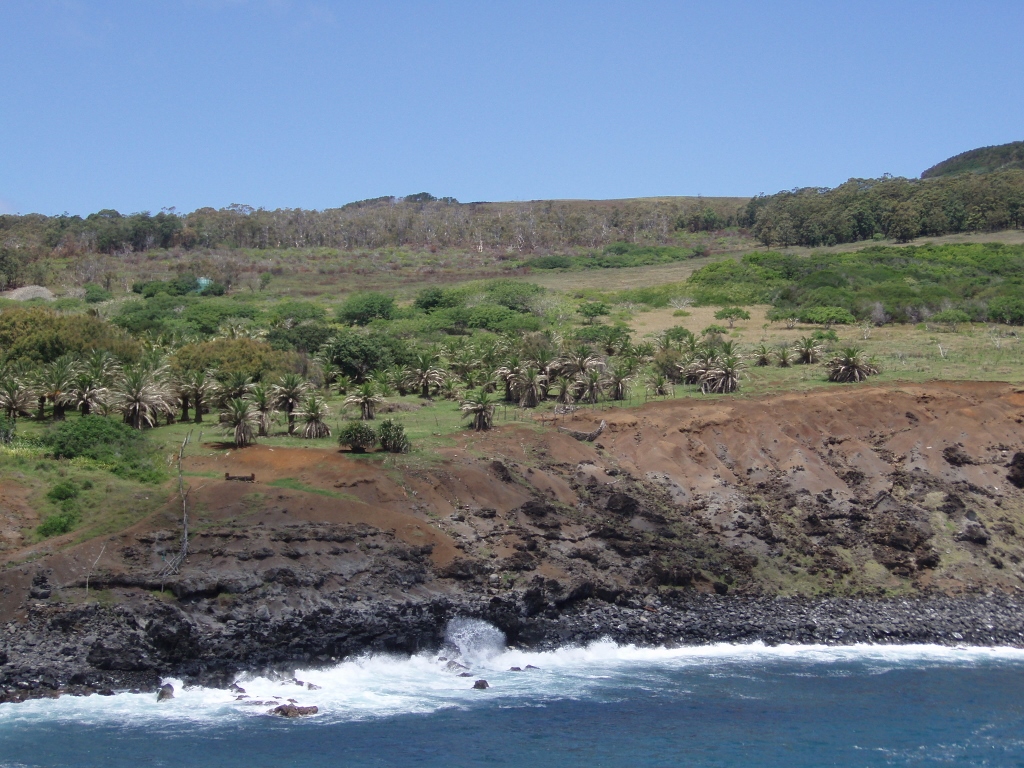 Black volcanic rocks constituting the shore of Easter Island and the slope leading up to the summit of Rano Kau volcano
After the cave, the trail led me to Ahu Rei Inga Peta, which in the past used to be an altar place with arranged moais of different sizes. Nowadays, among the grass, it is possible to see only remains of broken rocks.
The next stop was at the Manavai Exhibition Garden, a centre in which there are structures made to show how the local population used to grow crops for food. Namely, the Rapa Nui used to arrange stones in a circle up to the height of almost 1 metre, while the thickness of the wall was almost half a metre, and in the middle of this construction they grew crops. These structures are called the manavai. The reason for making the manavai is that the wall protected the plants from the wind and the sun, in addition to which the moisture was retained there for a while longer and the fertilization was improved. This technique made a significant difference in the yields obtained from within the manavai and what could be grown out in the open. At this centre, a botanical garden of a kind, within the scope of some projects, they are working nowadays on the recultivation of the endangered tree (Latin name: Sophora toromiro). This is an endemic tree which used to grow naturally only on Easter Island and which the indigenous population practically eradicated. At one point in time, this tree species could no longer be found in nature at all and there were only a few specimens left at the Botanical Garden in Gothenburg, Sweden.
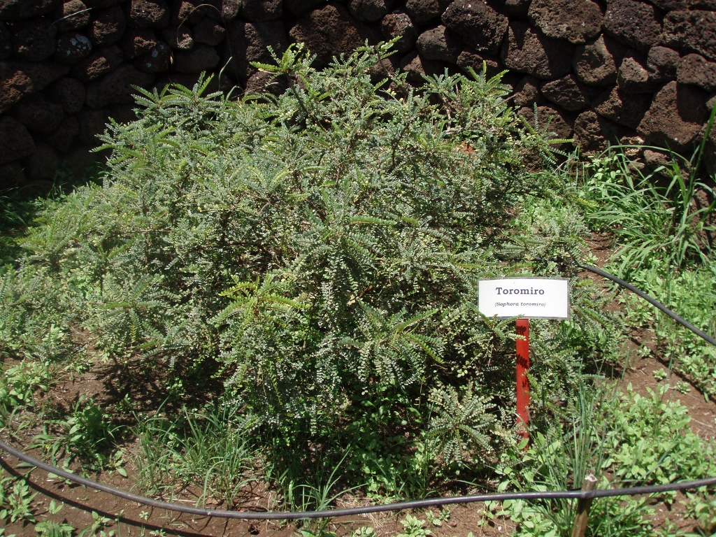 A young sapling of the toromiro tree grown in a manavai
The north side of Rano Kau volcano, and that is the sunny side since Easter Island is in the south hemisphere (!), is nowadays forested quite a lot up to a certain height and that forest consists, among other species, of palms, eucalyptus trees, cypresses and acacias. A trail leads between the trees and it was very pleasant to walk in the shade created by the trees.
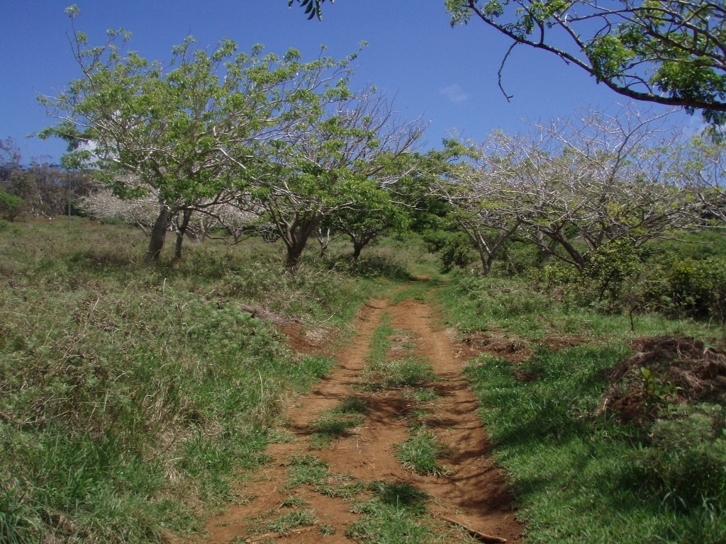 A trail leading up Rano Kau volcano
From that shade and from the height I had a very nice view towards Hanga Roa. As I’ve said, that is the only proper settlement on the island, although there are scattered houses here and there. Between Hanga Roa and Rano Kau volcano it is possible to see the airport strip. Still, this is no ordinary airport strip, but a specifically long one, made especially so that even a space shuttle could have landed on it. Namely, while this NASA programme was operational, it was necessary to ensure that in a case of an emergency the space shuttles could land in different parts of the world. Due to the size of the Pacific, there was a certain “hole” in this plan with alternative landing and then the Americans and the Chileans agreed and in 1987 made a huge airport strip here. The local population kept protesting, but with no effect. Now they don’t have to worry any more – the space shuttles no longer fly.
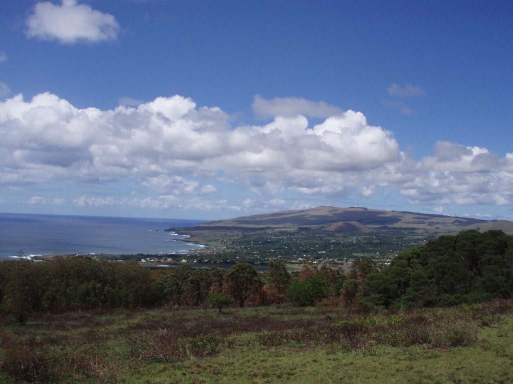 View at Hanga Roa and the rest of the island from the slopes of Rano Kau volcano (324 m a.s.l.)
Since I’m mentioning local population here let me share some of my thoughts. Although the Magallanes region, and that is the far south of Chile, has some ideas regarding its independence and although there is a great mixture of people and races of different origin throughout the country, one still gets an impression that there is a national unity. On the other hand, in the case of the Rapa Nui this cannot be noticed and as I’ve mentioned they are not thrilled about being a part of Chile and talk about it as if it were some foreign body from which they want independence. I even heard from a guy in the continental part of the country, without asking him for his opinion, that he “would give them their independence.” On the other hand, with the desire to maintain the unity of the country that covers such vast distances, the time difference between Easter Island and the continental part of the country is only two hours, while it should be four.
After leaving that forested belt, one gets to a clearing and there is an ascent which is not great, but is constant. By the way, this hiking trail is called Te Ara O Te Ao, which approximately means the “Road of leadership” (El Camino del Mando) and it evokes memories of the rituals from the past which had their peak in the place called Orongo.
This constant climbing took my breath away occasionally, but the people making the trail and putting some information boards along the way had thought of everything. Namely, at one point there was a rest stop, with a couple of trees providing a shade and with a couple of logs that served as benches. Perfect thing! From there, I had again a wonderful view at Hanga Roa, the island and seemingly endless ocean. I didn’t encounter anyone along my way, but every now and then I saw a couple of people in the distance. I should also mention that the summit of the volcano may be reached by a car following a dirt road, but this makes sense only if one comes here for a day or two.
 The rest stop on the slopes of Rano Kau volcano
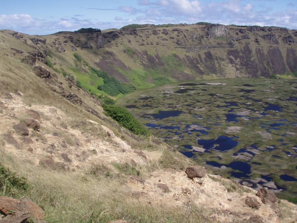
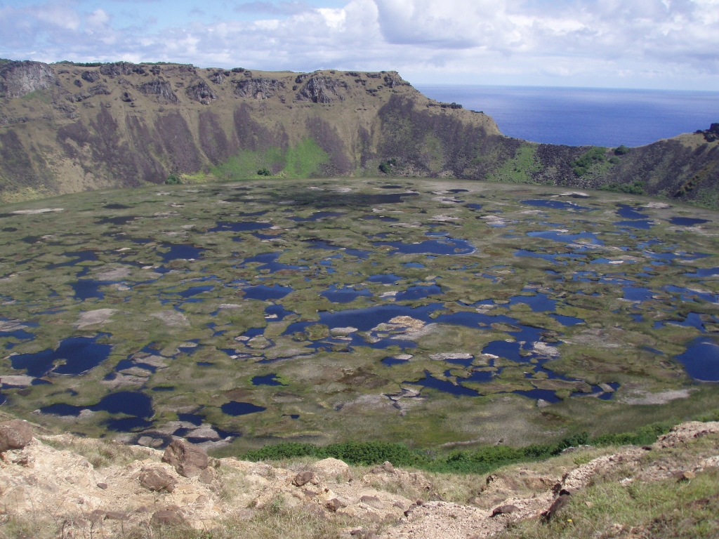
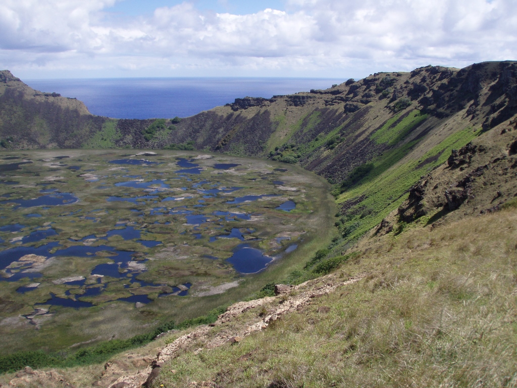
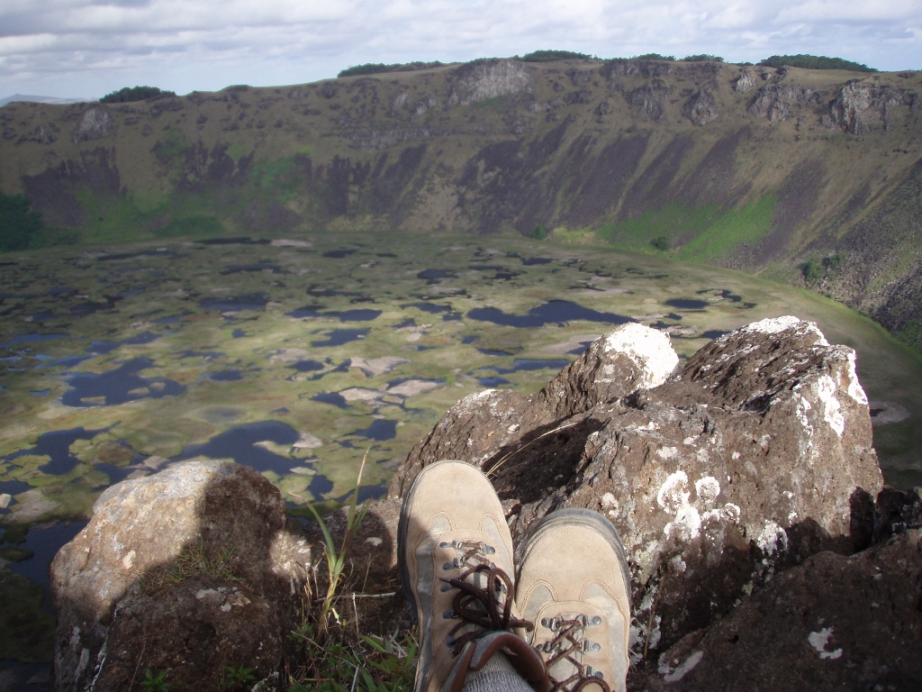
Although walking uphill may be tiring, it gets its perfect sense when one reaches the top, for there is a surprise waiting. And that is a stunningly beautiful scenery. It concerns a volcano crater with the diameter of 1600 m and depth of 200 m. As you are approaching the edge, thus seeing more and more of the crater, your breath is just leaving you. The crater contains water with a myriad of islets covered in grass, while the water in-between reflects the perfectly blue sky making everything blue and green. The point to which the trail leads is called simply the Rano Kau Viewpoint (Mirador Rano Kau). However, the path does not end there, but I first sat down in order to enjoy the truly stupendous view. In addition to the crater, as well as the ocean, when you turn around you can nicely see the rest of the island including a volcano on Poike peninsula on the other “corner” of the island.
 Rano Kau volcano’s crater
 Rano Kau volcano’s crater
 Rano Kau volcano’s crater
At the time when I was on Easter Island, I didn’t have a photo-camera that could make panoramic photos. Still, thanks to my friend Velislav, now you can see what it looks like when the above three photos are merged into one. Here it is:
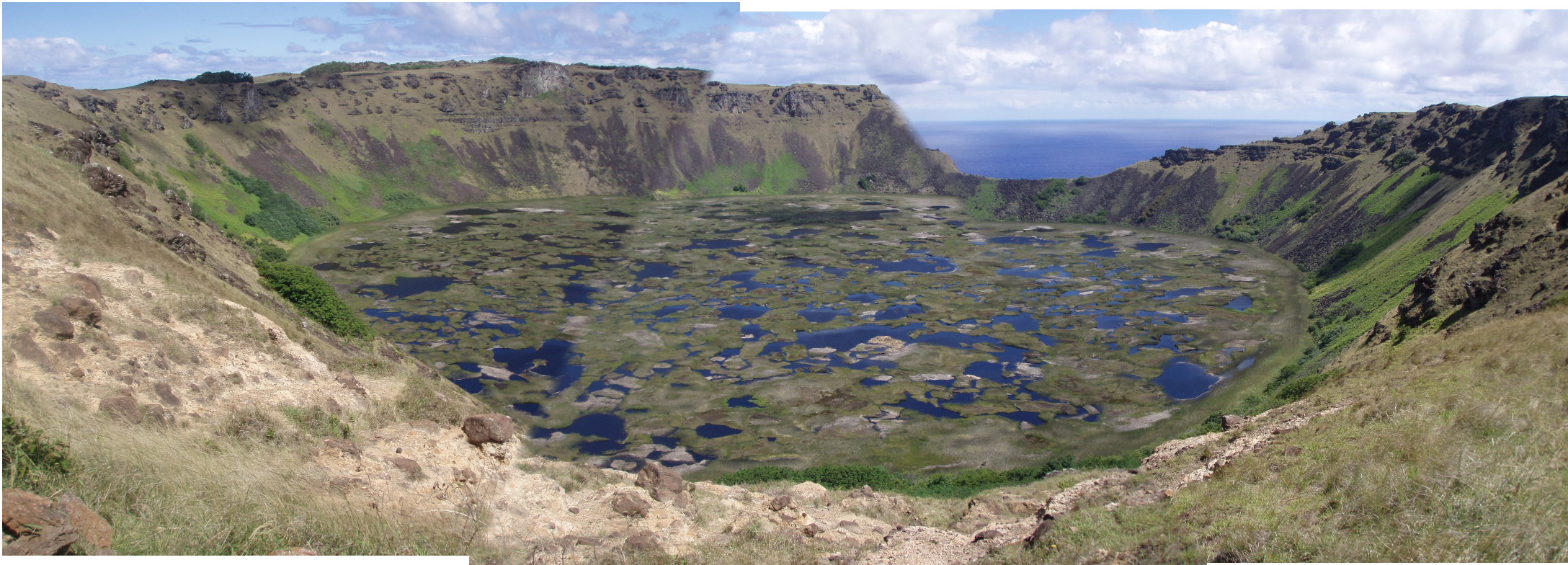 Rano Kau volcano’s crater
It is precisely this “lake” in the crater of Rano Kau volcano that constitutes one of the two natural reservoirs with fresh, i.e., potable water and this is where the local population used to get their water in the past.
Walking further along the rim of the crater, I soon saw three islets (motu) Nui, Iti and Kao-Kao. They are exceptionally important for the Rapa Nui and in the past it was here that young men used to show and prove their abilities. The biggest one (in relative terms) is Motu Nui. The islands are the nesting ground for wild birds and since 1976 they have been protected as nature reserve. The one closest to the shore is Motu Kao-Kao, which is in fact a huge sharp rock coming out of the ocean like a 20-metre high giant needle. It is particularly interesting that these islets are summits of large underwater volcanic mountains the foot of which is some 2000 metres under the surface of the ocean.
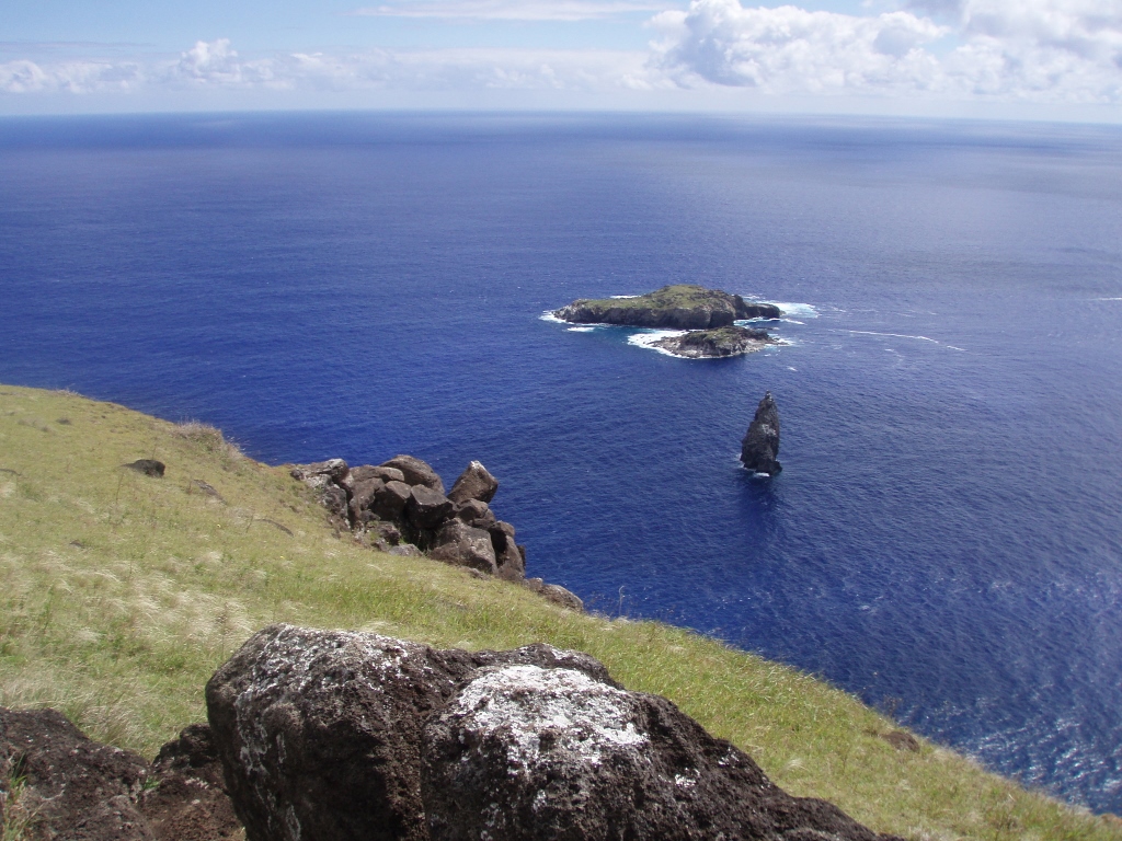 Motu Nui (the biggest), Iti (in the middle) and Kao-Kao (needle shaped)
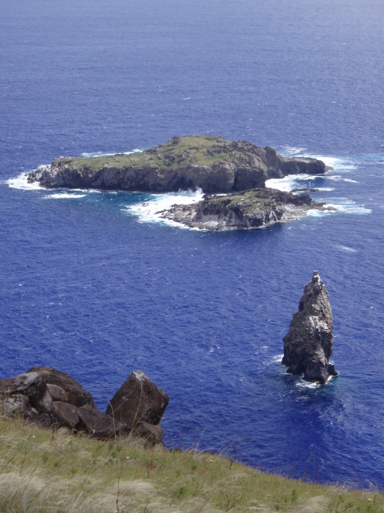 Motu Nui (the biggest), Iti (in the middle) and Kao-Kao (needle shaped)
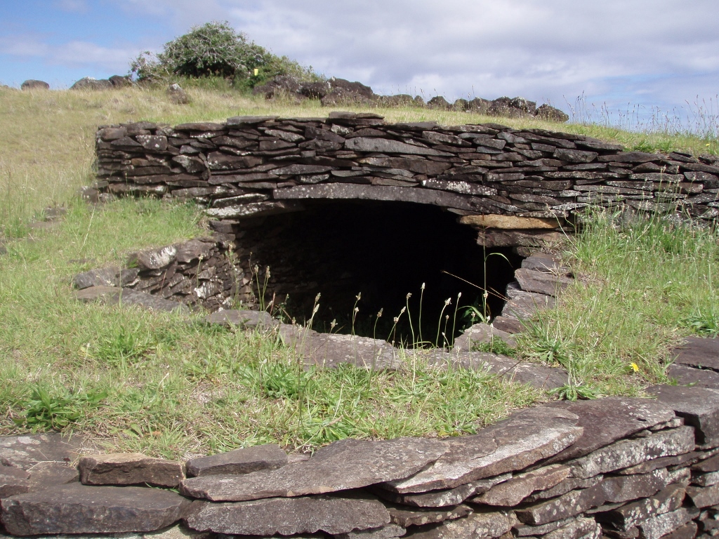
Right opposite of these islets, on the top of the crater, there are some structures like dugouts made of stone and this is where those rituals used to take place. This entire section is called Orongo, which is the name for the ceremonial village. Namely, Orongo used to be the centre of a cult in the middle of which there was the birdman. In the past, it was here that an annual race was organized for young men who had to climb a few hundred metres down to the ocean, then they had to swim to Motu Nui, get from there the first laid egg of the sooty tern and bring it undamaged back to Orongo. This was very dangerous and it often happened that the young participants got killed by falling off the cliffs. And the young people of today think that they have some issues they complain about?
 Orongo
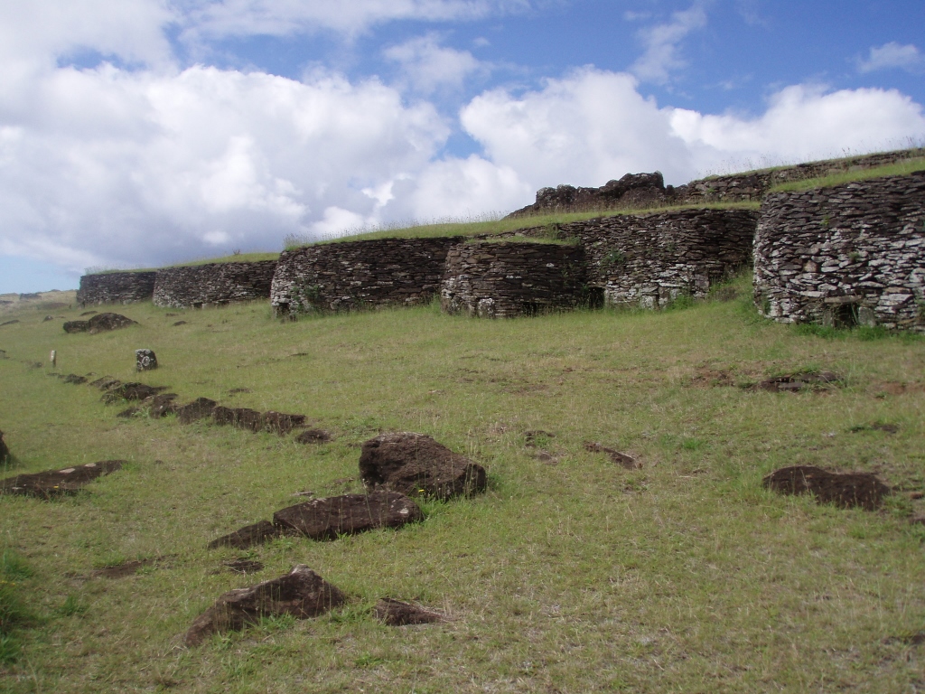 Orongo
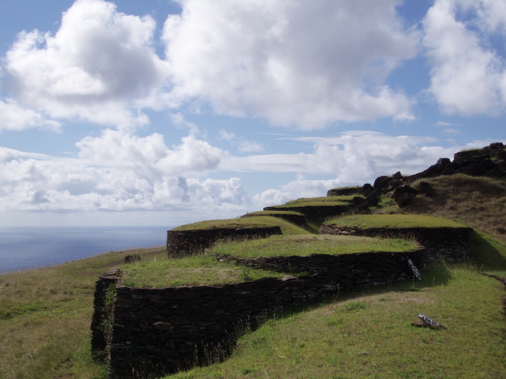 Orongo
When approaching Orongo, I even passed by some tourists, but before long they left and I was again on my own visiting the site. But, not completely alone. Namely, there I soon came across a guard with whom I started to chat and it was all very interesting, for he was a pure philosopher. He also advised me where to step outside the trail in order to get a better photograph and yet to be safe from plummeting into the ocean. Then he escorted me to the top, the end of Orongo, where a holy place is located which is fenced. There is a small dugout there and it is supposed that this was the place where priests used to stay at since there is a perfect view at the three islets from there. That “viewpoint” is surrounded by rocks that are all carved out and it is possible to see numerous petroglyphs there that mostly depict that birdman.
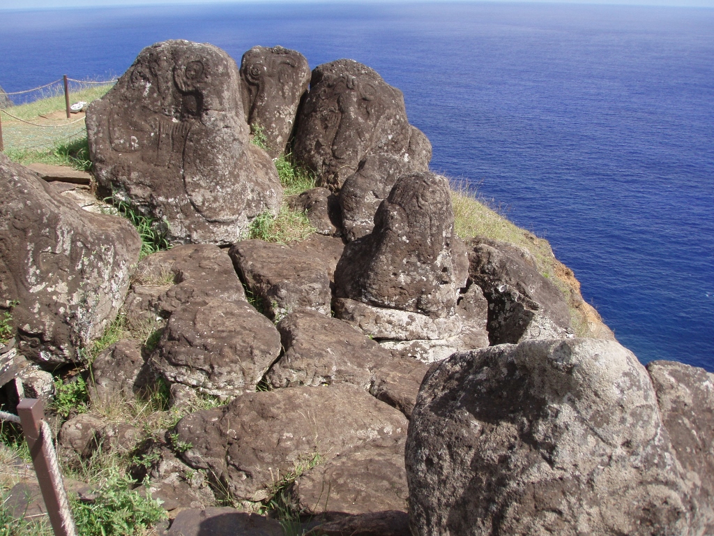 Orongo, the petroglyphs
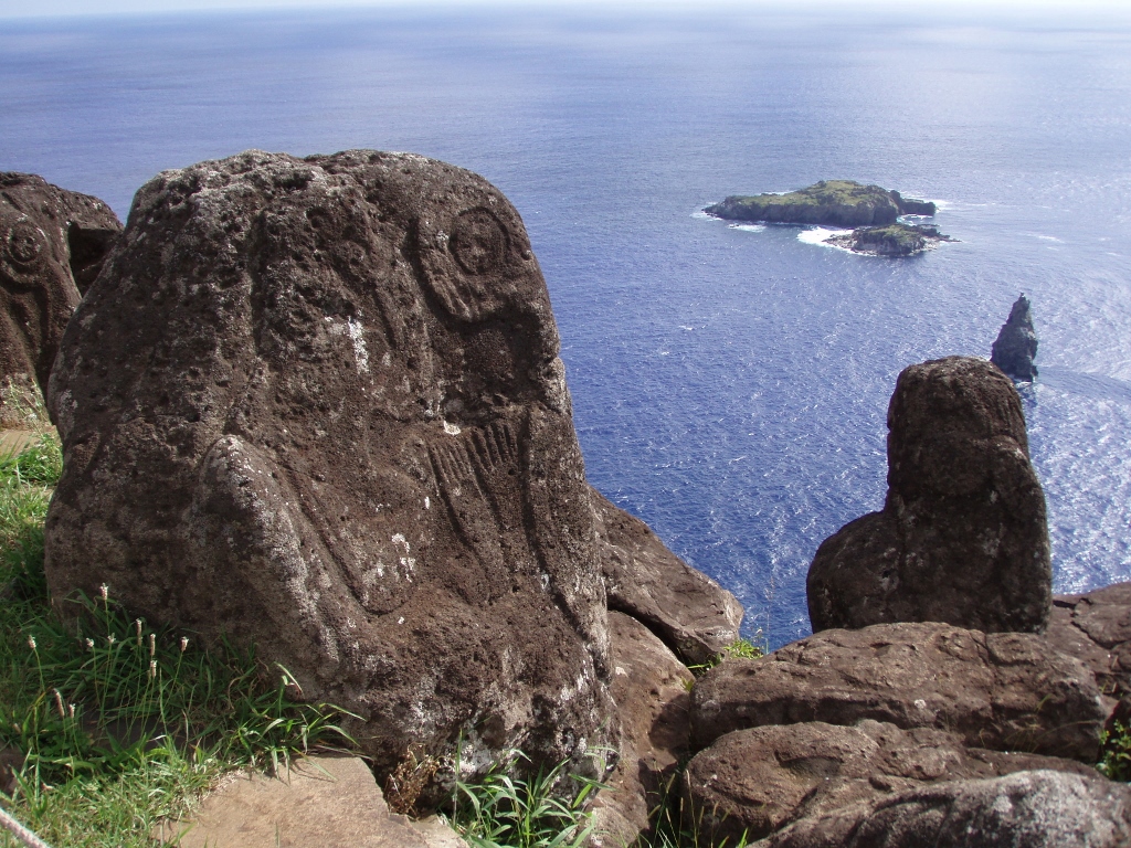 Orongo, the petroglyphs and the view towards the islets
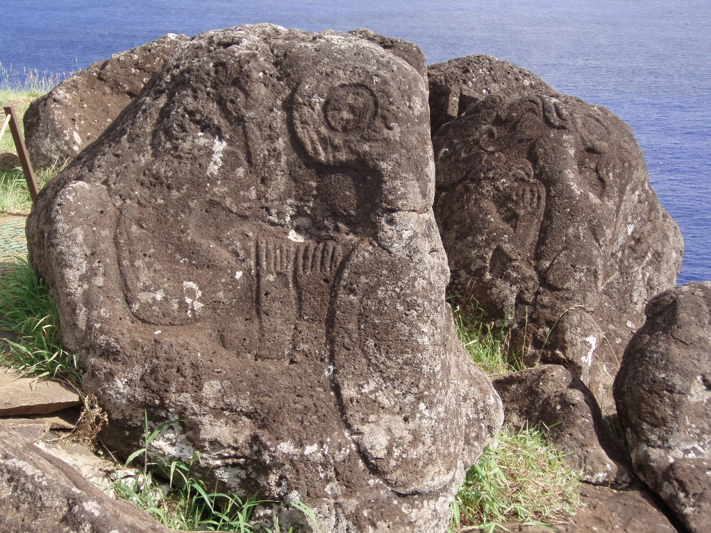 Orongo, the petroglyphs
After the visit to this part, I slowly headed back while still chatting with the guard, but this time I was more focused on the crater which I was looking at again. There are even some trees growing on the slopes within the crater. In the past there were some attempts at growing different crops there, but nothing caught on. The water in the crater comes from rainfall, but nowadays it is no longer used for drinking on account of health safety measures.
As we walked, the guard also told me a story about how a few years earlier his own mother who was an elderly lady at the time came to the crater, went down into its interior and then the next day she was found dead there. As he claimed, ever since her death, he had been sensing the spirit of his mother being there. Then he also allowed me to go down the crater a little bit and even showed me the best spot for I wanted to do a meditation there. It was certainly great, but then again everything was great about this place.
 Ready to do a meditation within the Rano Kau volcano’s crater
It is interesting that some time later I saw this man on TV in Serbia, in some English programme filmed on Easter Island, so I cried out: “Hey, I know this guy!”
So, after the successful meditation, on my way back to Hanga Roa, I followed the same trail, but by then the sun had gone significantly down and everything had a different hue, while the sunrays were no longer as strong as earlier.
And then, as if the day had not already been sufficiently great and successful, back “home” I was greeted by live music. Namely, the son of my landlady had his band and they played on the porch of the house, with loudspeakers and all, while a few girls danced. Have a look: