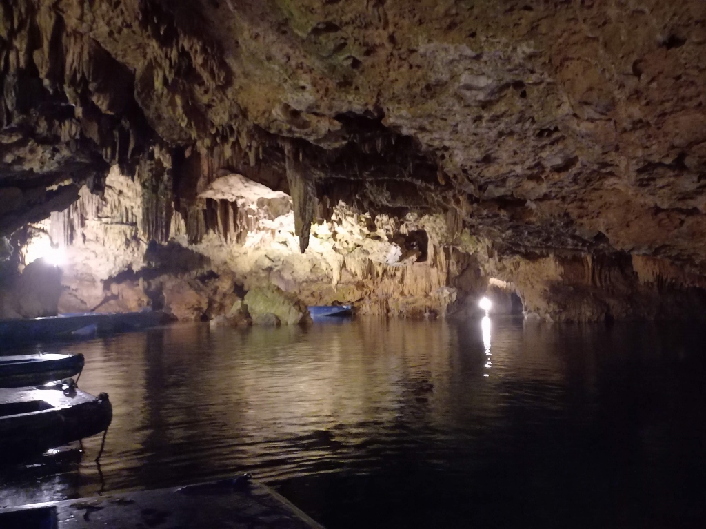
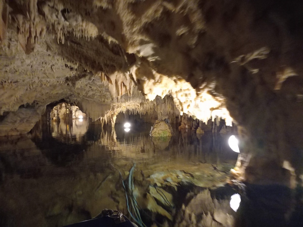
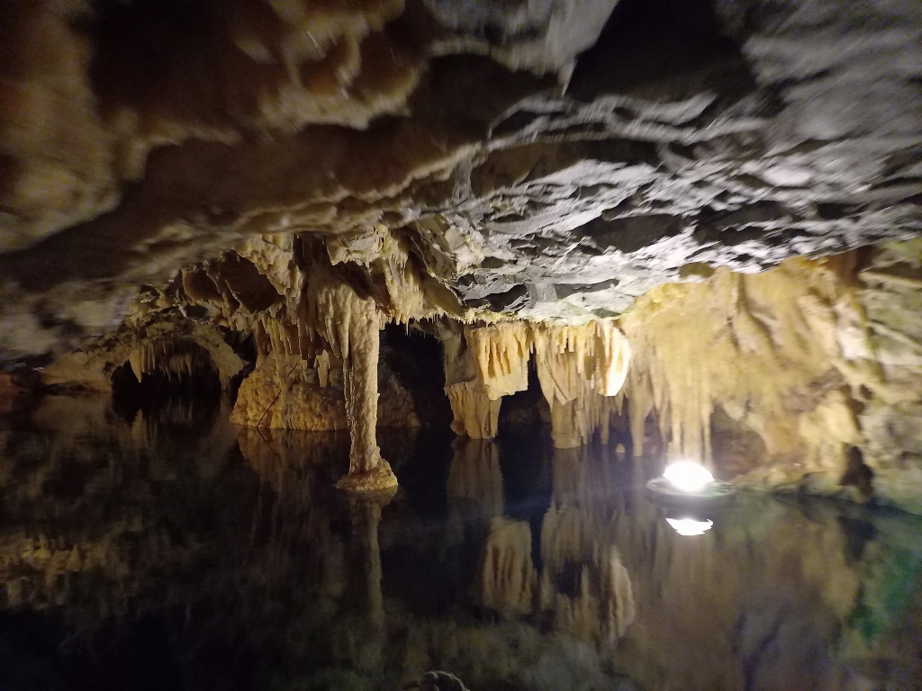
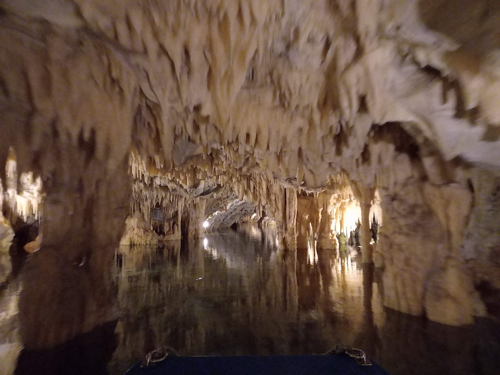
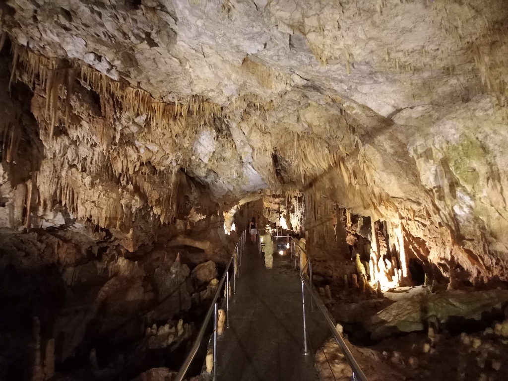
The Diros Caves are located on the southern side of the bay of the same name, on the western coast of the Mani Peninsula.
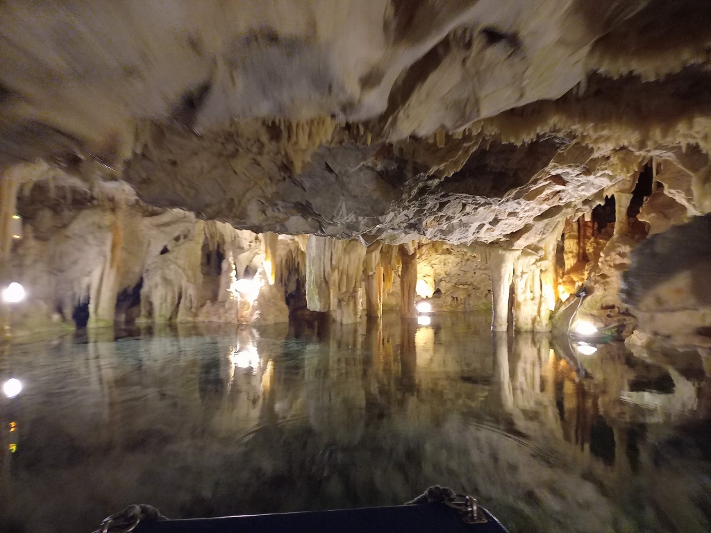
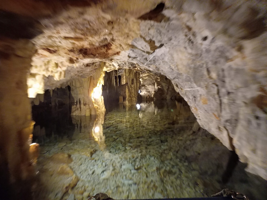
They consist of a series of halls filled with cave formations that have been carved by a river flowing underground through the limestone of the Mani Peninsula on its way to the sea. Today, this is one of the popular tourist spots in this part of Greece and everything is quite well organised. You purchase a ticket and then descend a set of stairs to a spot from which boats depart, after which you take a leisurely boat tour through about 2 km of the caves.
 Diros Caves, a detail
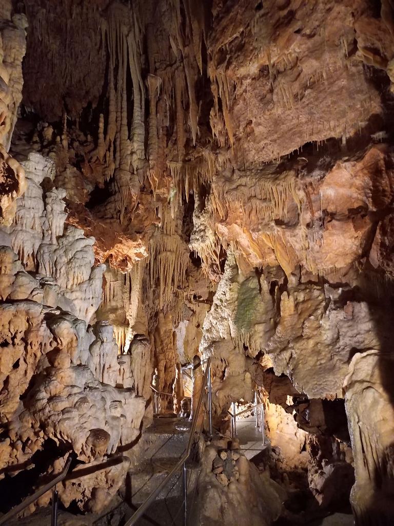
The water depth reaches up to 15 m, with the temperature of 12 degrees C. The air temperature ranges from 16 to 20 degrees C, which was certainly pleasant refreshment in September when the outdoor temperature was around 30 degrees C.
I must admit I was quite enchanted by this experience and the boat ride through the caves, so I've posted several photos and a video here.
 Diros Caves, a detail
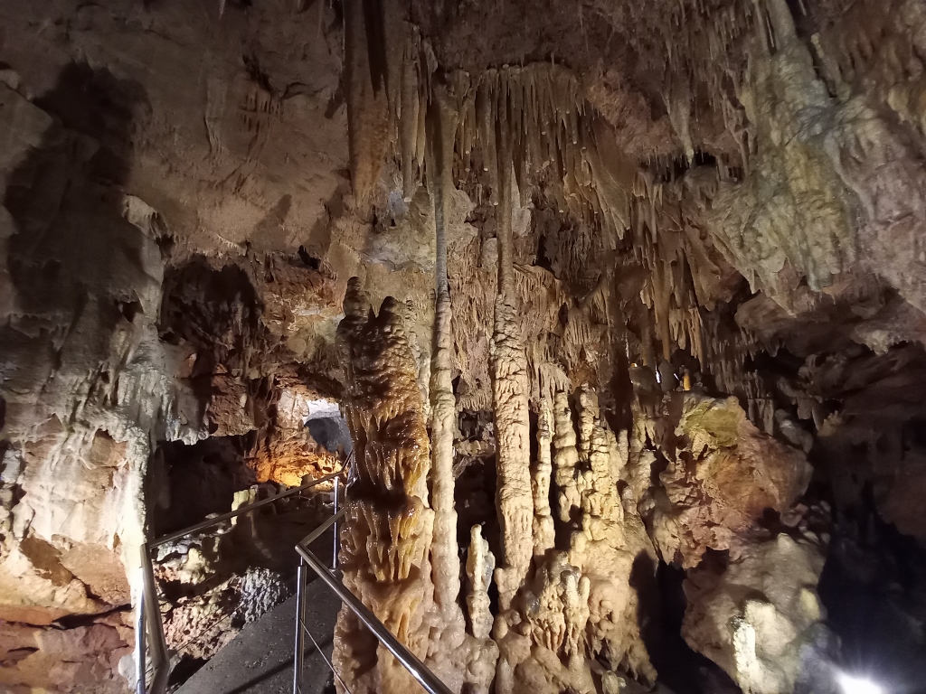
 Diros Caves, a detail
 Diros Caves, a detail
 Diros Caves, a detail
 Diros Caves, a detail
 Diros Caves, a detail
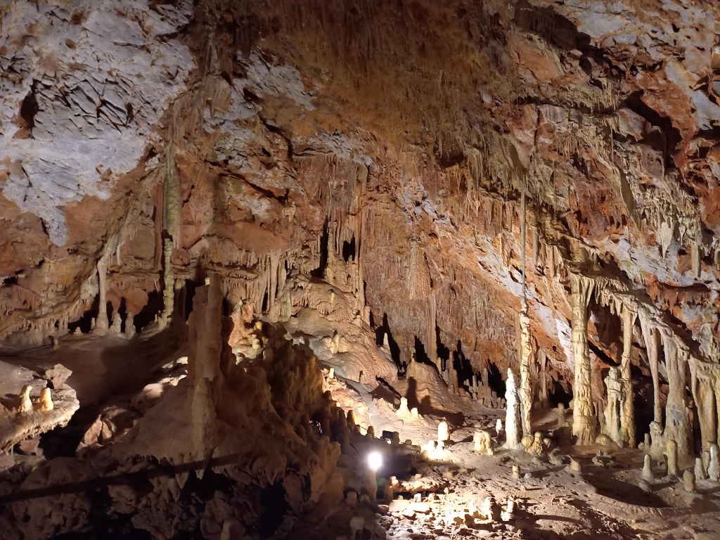
As for the video, anyone who understands Greek will be able to learn something about these caves from the local guide's commentary. I have to admit that it wasn't important for me to learn anything about the caves. I simply enjoyed what I saw and that was quite enough for me.
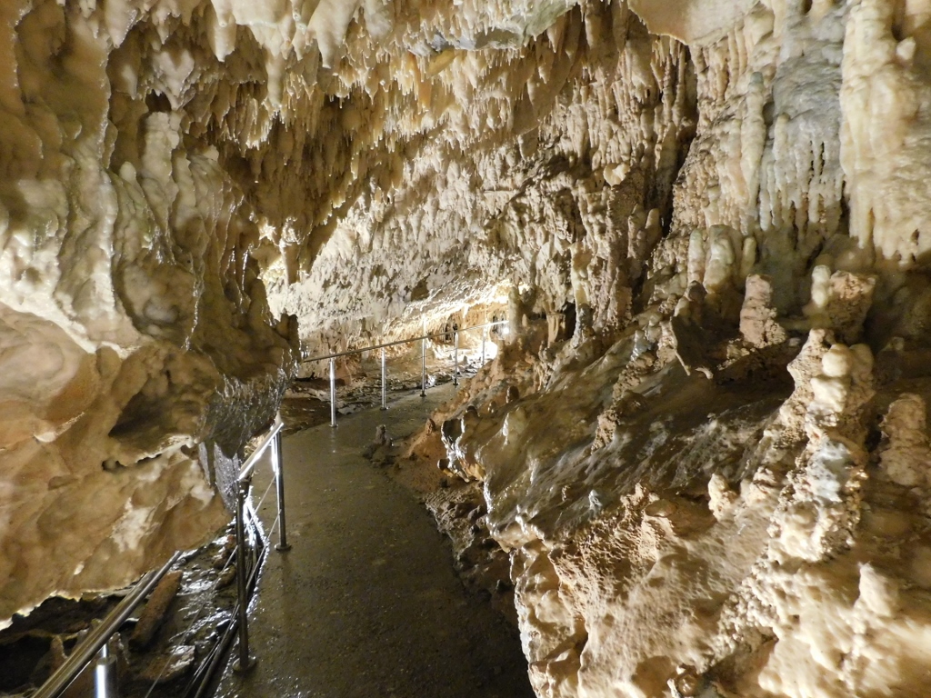
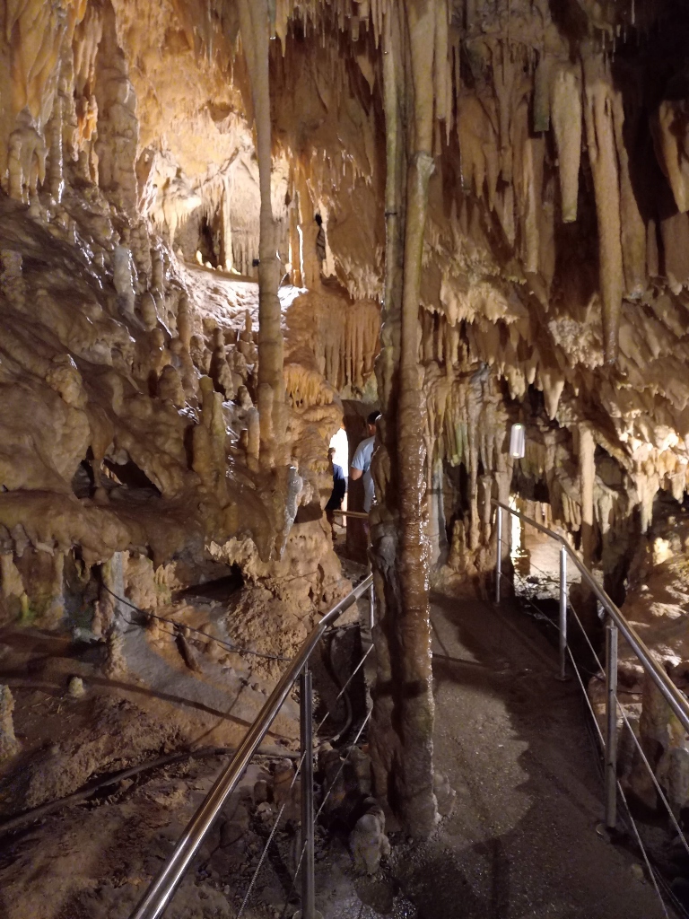
In the end, you exit the boat and then walk through another section on foot. That was a lovely experience as well.
 Diros Caves, a detail
 Diros Caves, a detail
 Diros Caves, a detail
 Diros Caves, a detail
 Diros Caves, a detail
 Diros Caves, a detail
The exit from the cave opens up to a stunning spot where you can enjoy the beauty of the Diros bay and beach.
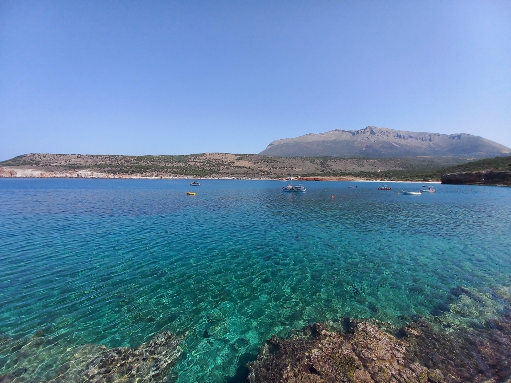 Diros bay
On my way back to the parking lot, I stopped at another spot and once again admired the beauty of this lovely bay.
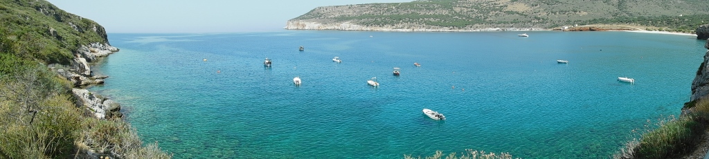 Diros bay
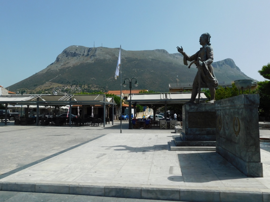
The next stop on my tour of this part of the Peloponnese was the town of Areopoli. Interestingly, the name of the settlement means "City of Ares," with Ares being the ancient Greek god of war and courage (his Roman equivalent is Mars). The town received this name in 1912, likely because the Greek War of Independence (1821-1829) began here on 17 March.
At the time the war for liberation started, Greece was part of the Ottoman Empire and it was here, in what is now Areopoli, that the last bey of Mani, Petros Mavromichalis, led a revolt in the spring of 1821, rallying his fellow countrymen, the Maniots. The Maniots, who are a Greek ethnic subgroup, claim to be descendants of the Spartans, which makes this connection all the more fitting.
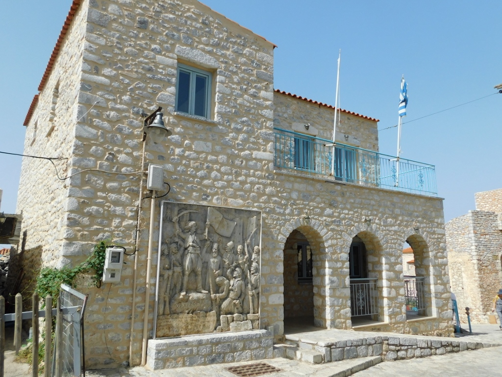
In the spacious square you first encounter when entering the town from the main road, there stands a monument to the "Hero of the Immortals," Petrobey Mavromichalis.
 Areopoli, a detail
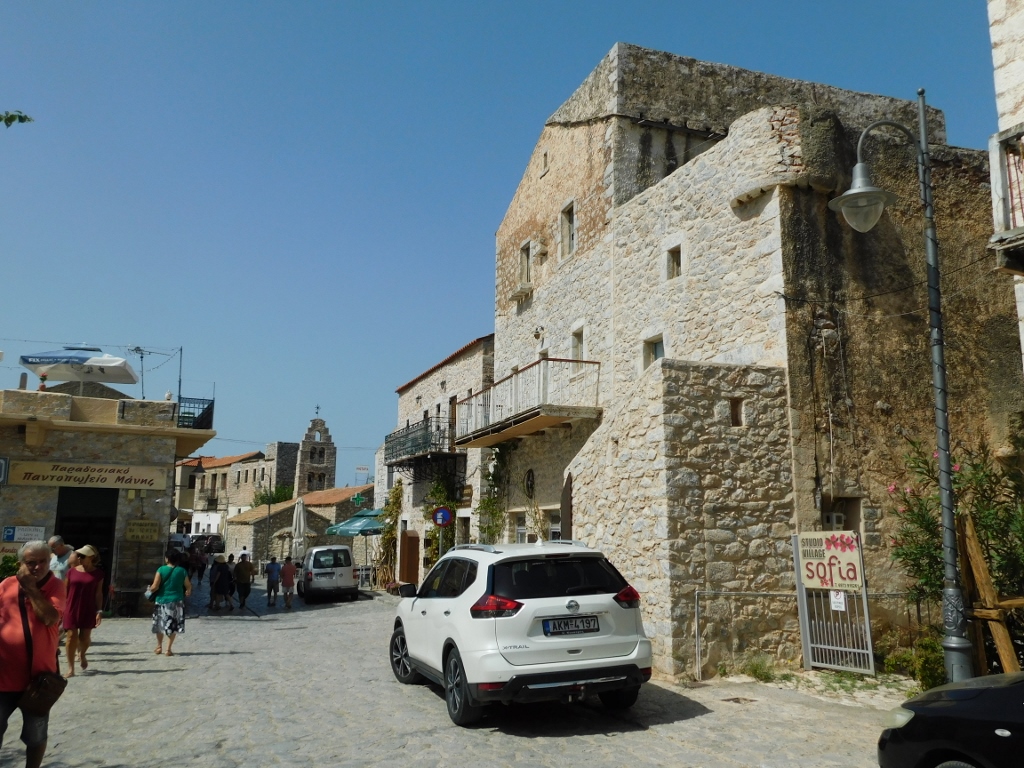
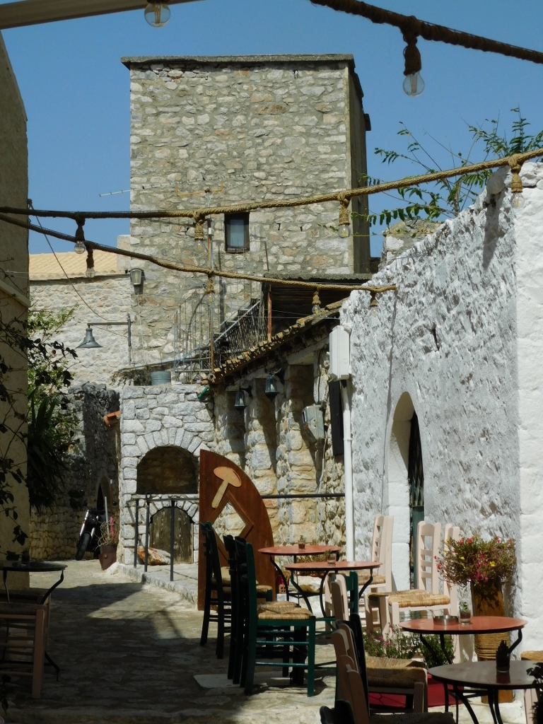
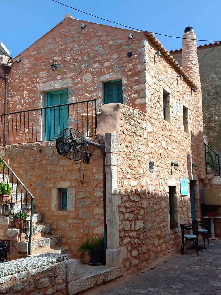
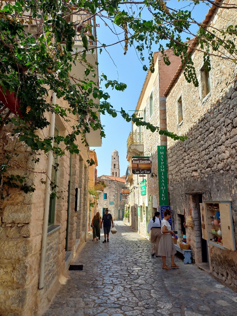
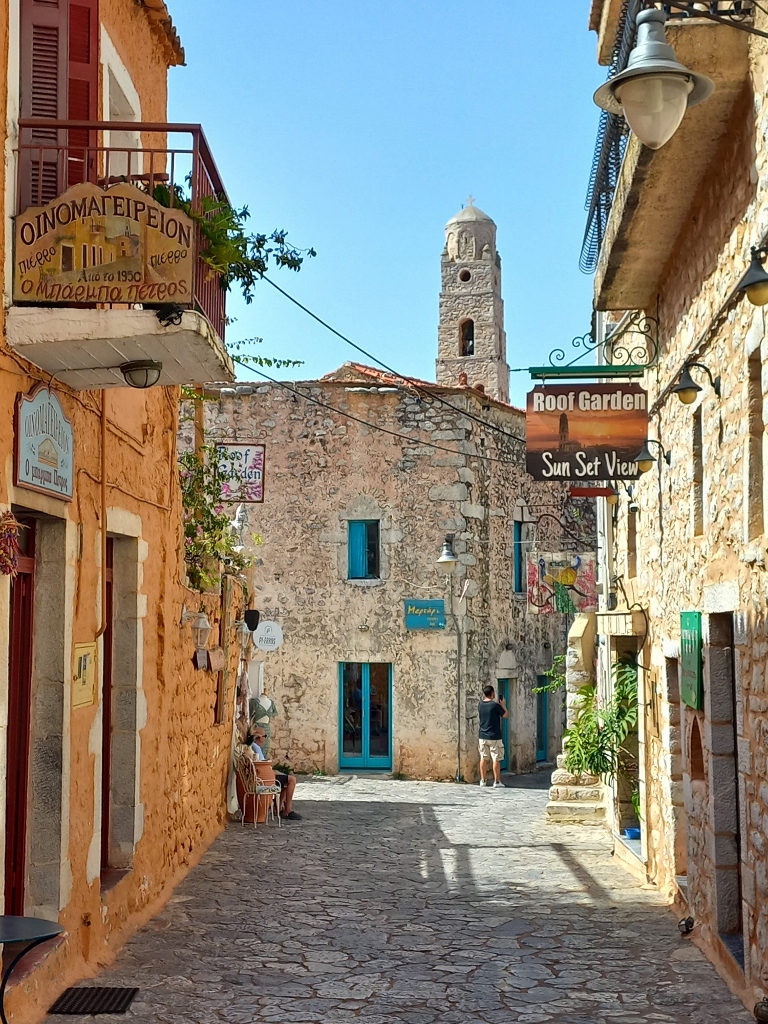
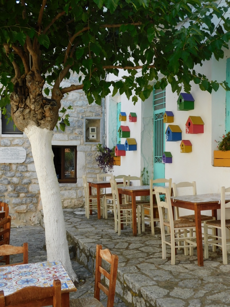
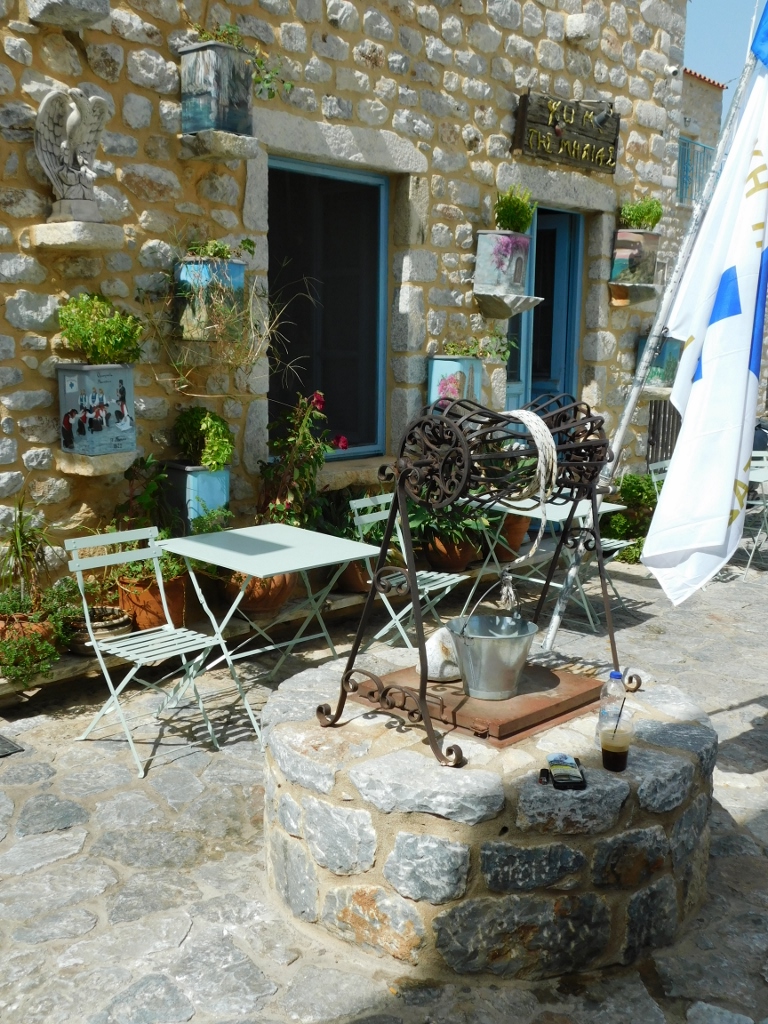
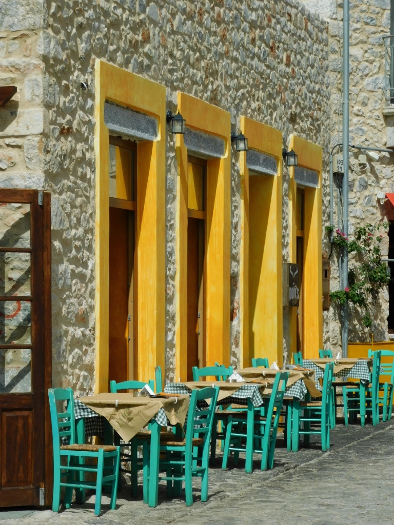
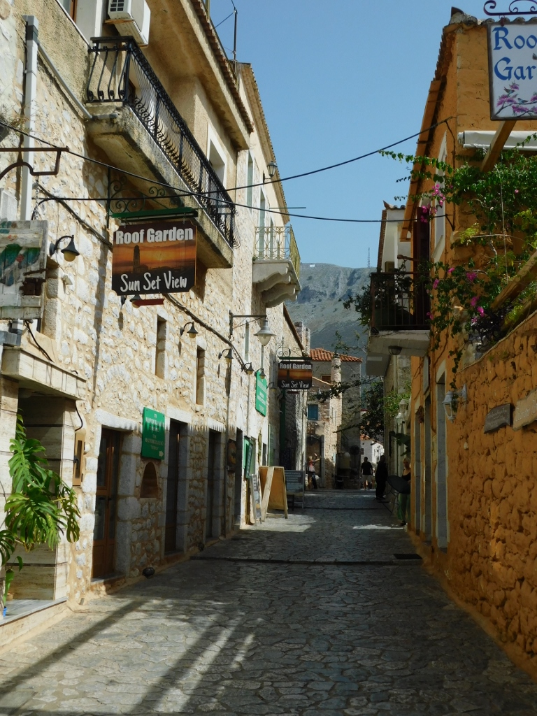
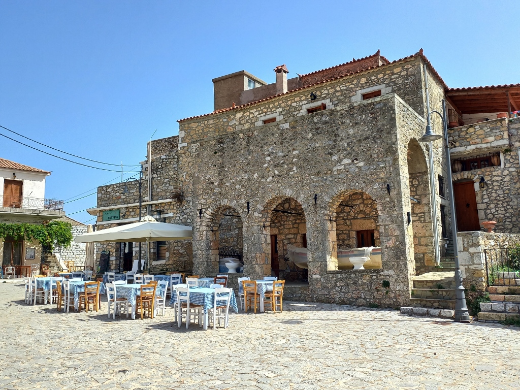
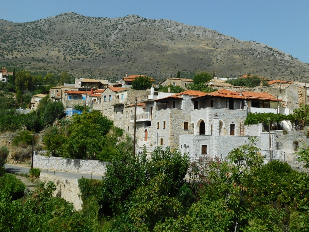
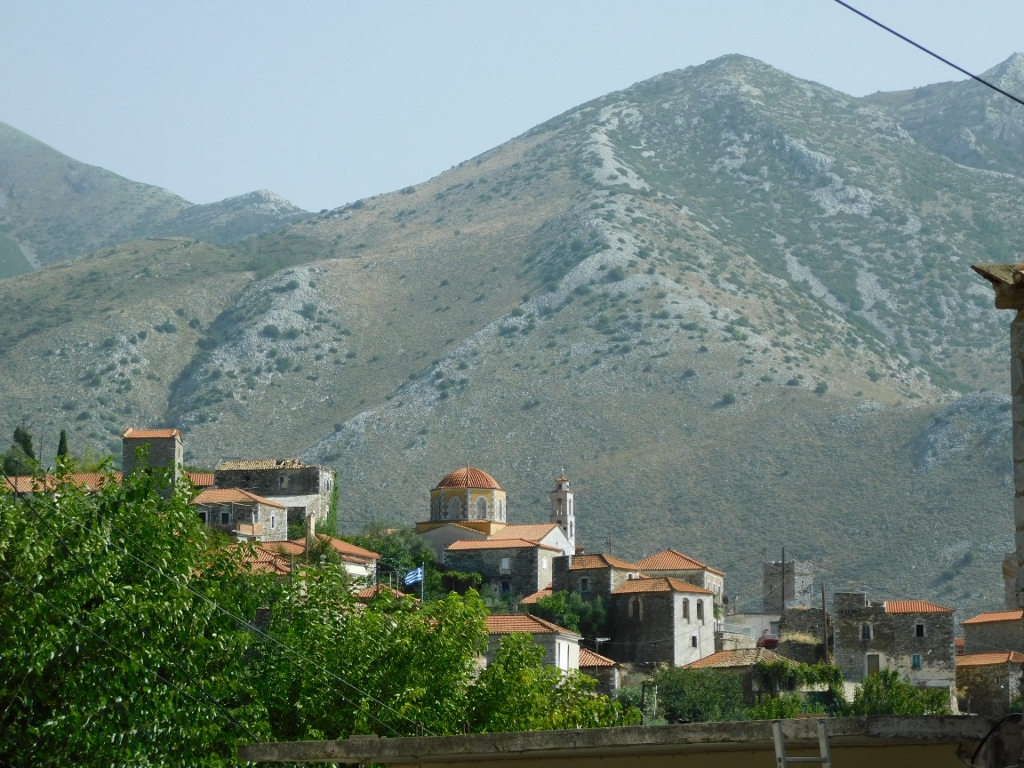
I came here with the intention of taking a leisurely stroll through the town. Areopoli is characterised by its stone houses, stone towers that can often be seen throughout the Mani Peninsula, and stone churches. So, there were none of those picturesque blue-and-white houses typical of Greece. However, the ones in Areopoli were no less beautiful and I thoroughly enjoyed my walk.
 Areopoli, a detail
I also passed by the Church of St. Charalambos, but it was closed. No problem; I just continued my stroll through the picturesque streets of Areopoli.
 Areopoli, a detail
 Areopoli, a detail
 Areopoli, a detail
 Areopoli, a detail
 Areopoli, a detail
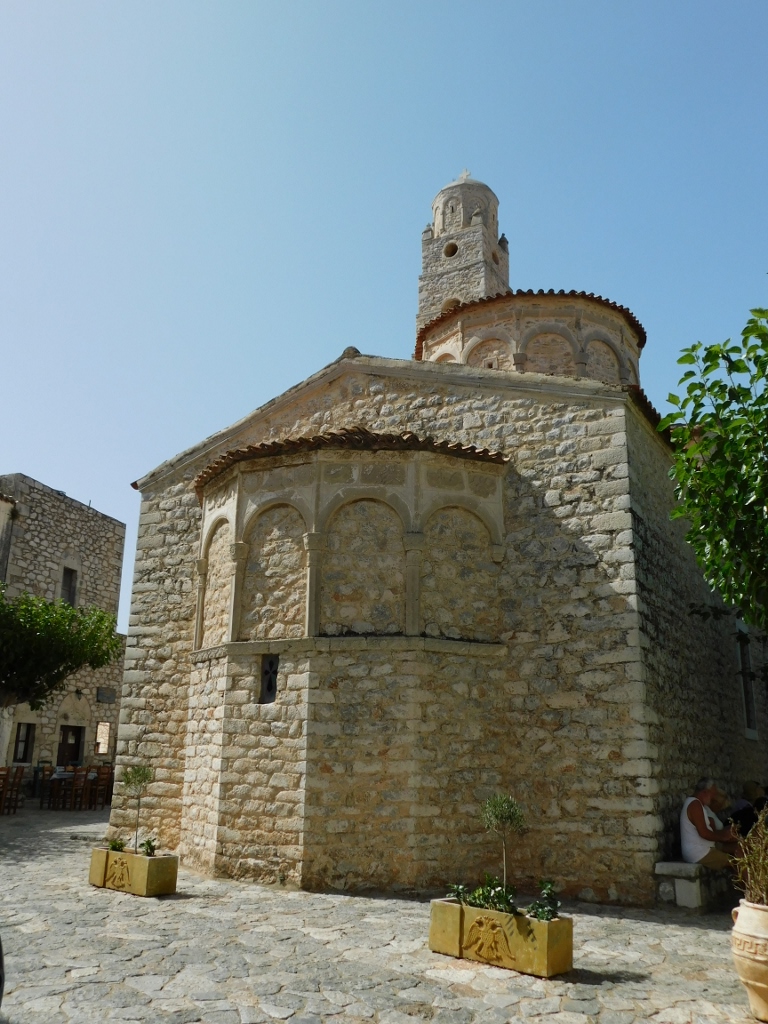
And then I arrived at the Church of Saint Taxiarches, dedicated to Archangels Michael and Gabriel. This 18th-century church has some interesting details on its facade, such as zodiac signs on the apse and intriguing decorations above the side doors.
 Areopoli, a detail
 Areopoli, a detail
 Areopoli, a detail
 Areopoli, a detail
I have already mentioned that there are houses resembling towers here, plus you can definitely see details in several places that reflect the glorious history of this place.
 Areopoli, a detail
 Areopoli, a detail
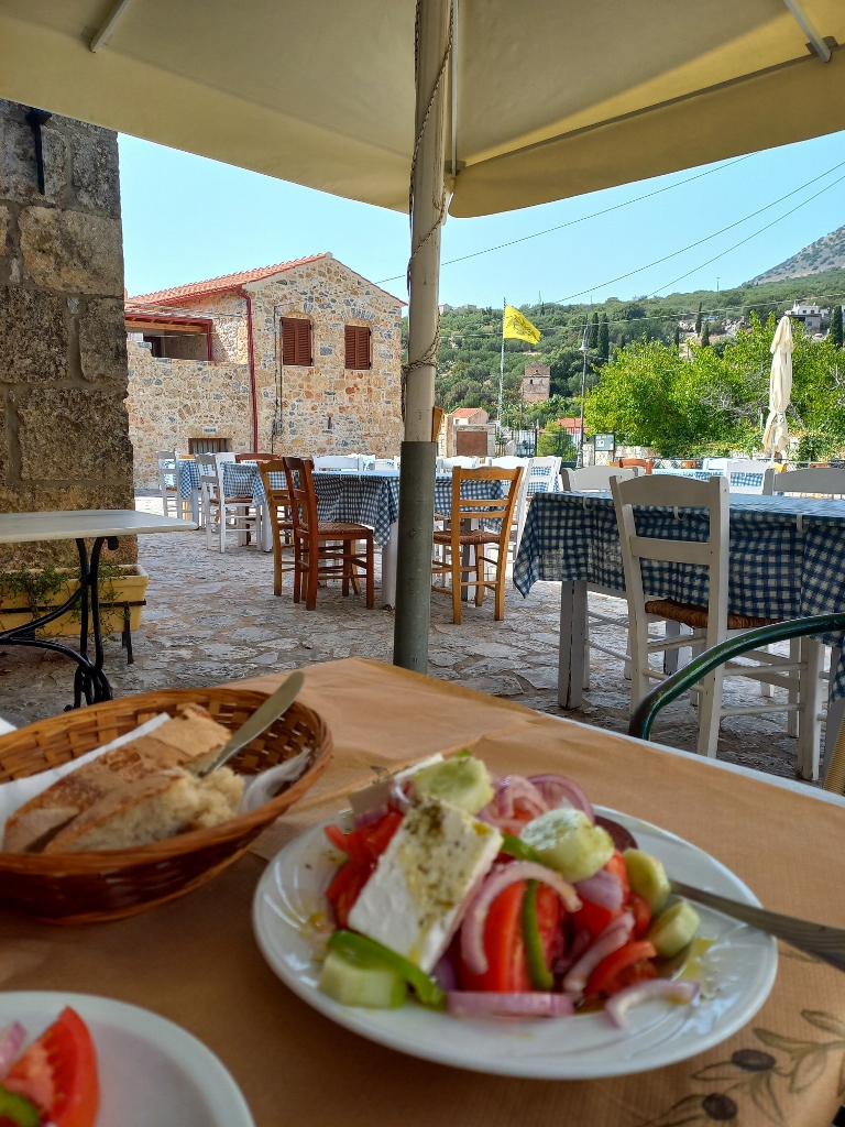
Perhaps even more noticeable are the lovely spots where you can sit down to rest and enjoy something to eat or drink. Or maybe I was just really thirsty! At one point, I decided to stop at a café that had plenty of shade, and I enjoyed a refreshing fruit juice there.
 Areopoli, a detail
 Areopoli, a detail
 Areopoli, a detail
 Areopoli, a detail
Then I continued to wander the picturesque streets of Areopoli, where there were many stone houses and charming details, like the outdoor staircases.
 Areopoli, a detail
 Areopoli, a detail
 Areopoli, a detail
At one point, I "got lost" and stumbled upon a church that I couldn't identify or figure out where exactly it was. No matter – I went inside since it was open and enjoyed a moment of special tranquillity.
 Areopoli, a detail
 Areopoli, a detail
Based on some materials I’ve read, the part of the Mani Peninsula south of Areopoli seems quite interesting, but the roads are very winding, so I would definitely need a whole day to visit several small picturesque towns and Byzantine churches that can be found there. On the other hand, my plan was to head north along the peninsula, which also included visits to some old churches, so I felt that this was perfectly fine for how I like to travel. Admittedly, I did visit two places in that charming southern part of the Mani Peninsula: Areopoli and the Diros Caves.
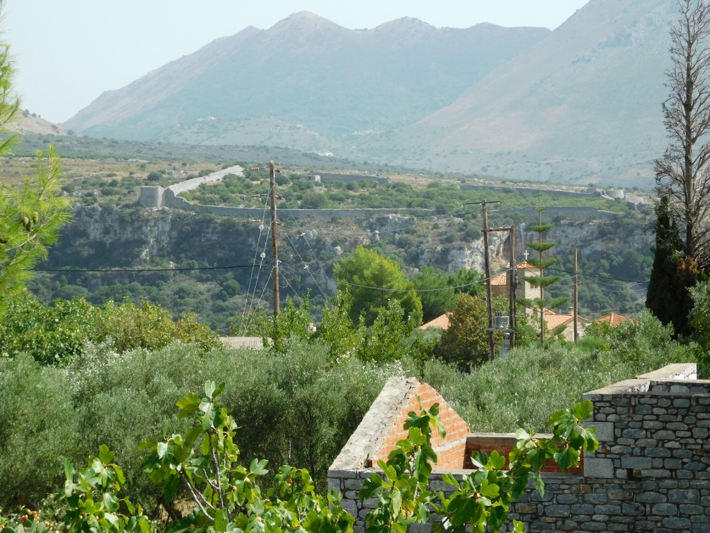
From Areopoli to the city of Kalamata, you travel along the coast of the Messenian Gulf, part of the Ionian Sea, which is considered a particularly magnificent area. The road mainly winds along the slopes of the southern arm of the Taygetos mountain range, occasionally dipping down near the beaches. Along this route, you can also see and visit lovely villages, stone towers, and small Byzantine and post-Byzantine churches.
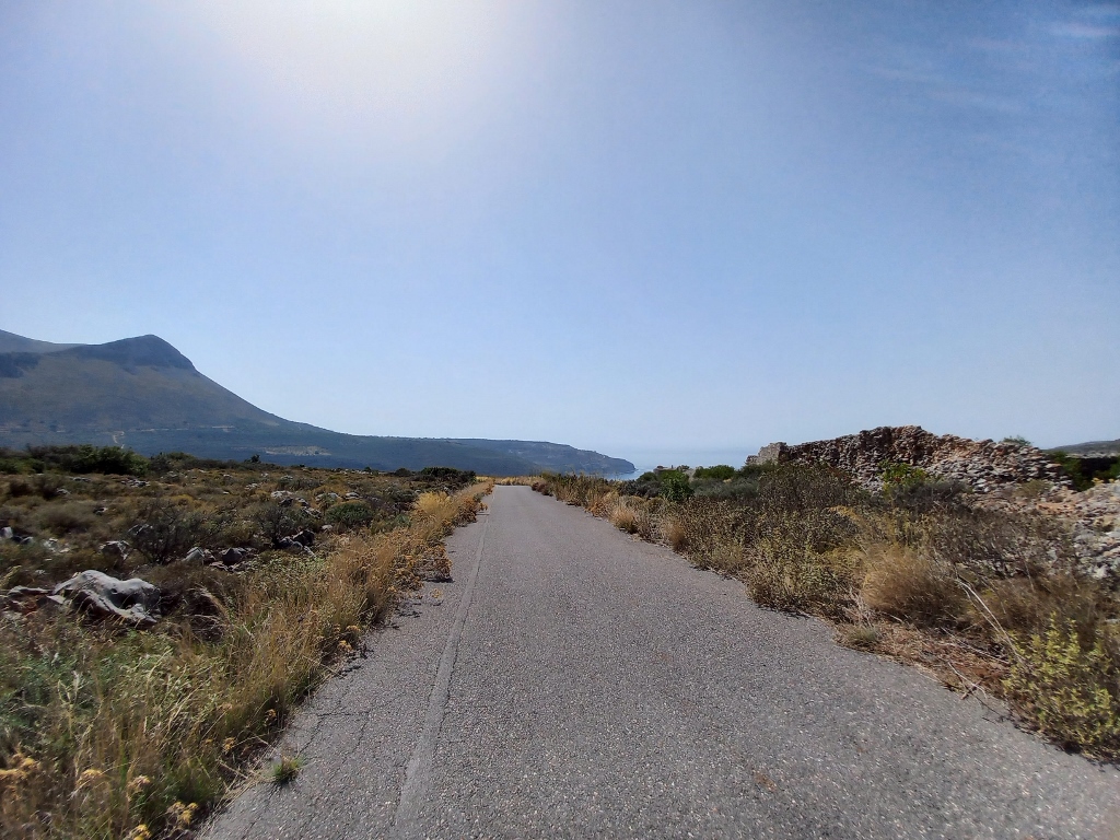
So, I set off in this direction and first headed to a somewhat unusual place, leaving the main road and taking a side road where there was absolutely no one else but me. Sometimes I think I might be a bit too adventurous and wonder if it's normal for me to think like this, but for now, I’m not giving up.
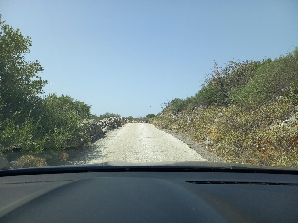 Roads less driven on
What interested me now was the Kelefa Castle, which got its name after the nearby village (or perhaps it was the other way around).
I approached the site of the castle from above, coming from the direction of the village of Kelefa and I stopped at one spot in order to capture the landscapes I was passing through first.
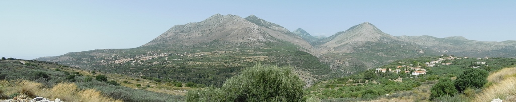 Surroundings of Kelefa village
 Surroundings of Kelefa village
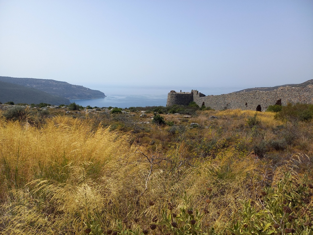
From that same spot, I could also see the outlines of the citadel itself.
 Kelefa Castle
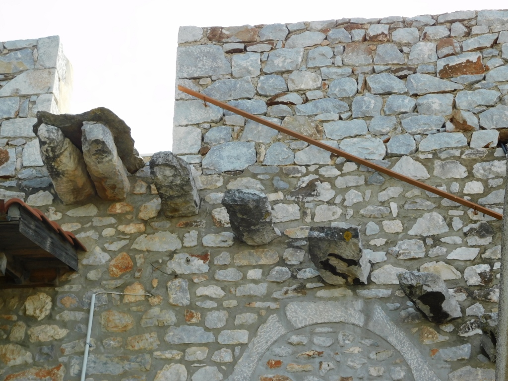
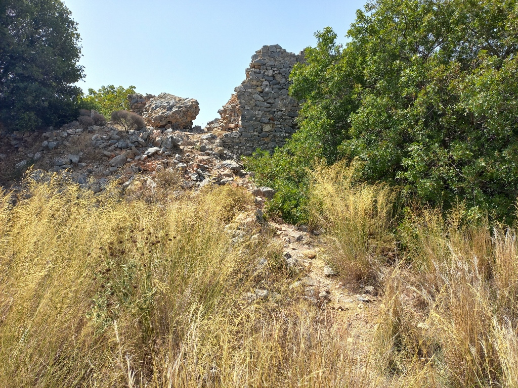
It’s a massive Turkish fortress built in the 16th and 17th centuries, but as it turned out, aside from the walls, or rather their ruins, there was nothing else there. So, I just climbed up to one spot and peeked into the centre of the fortress remains.
 Kelefa Castle, a detail
 Kelefa Castle, a detail
Everything seemed overgrown with vegetation, so I didn't feel like venturing further in that area.
 Kelefa Castle, a detail
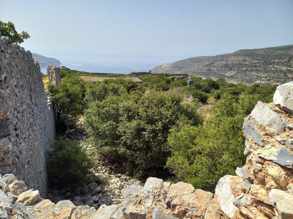
I stopped at another spot to capture the outer walls and the remains of the bastion, and that was about it.
 Kelefa Castle, a detail
From there, I descended along the winding roads to the main one and continued on, but I didn’t go far. The next settlement I wanted to visit was Oitylo, just about 4.5 km from where I joined the main road. However, I first wanted to stop by the 16th-century Dekoulou Monastery, located on the slope leading from Oitylo to the beach of the same name.
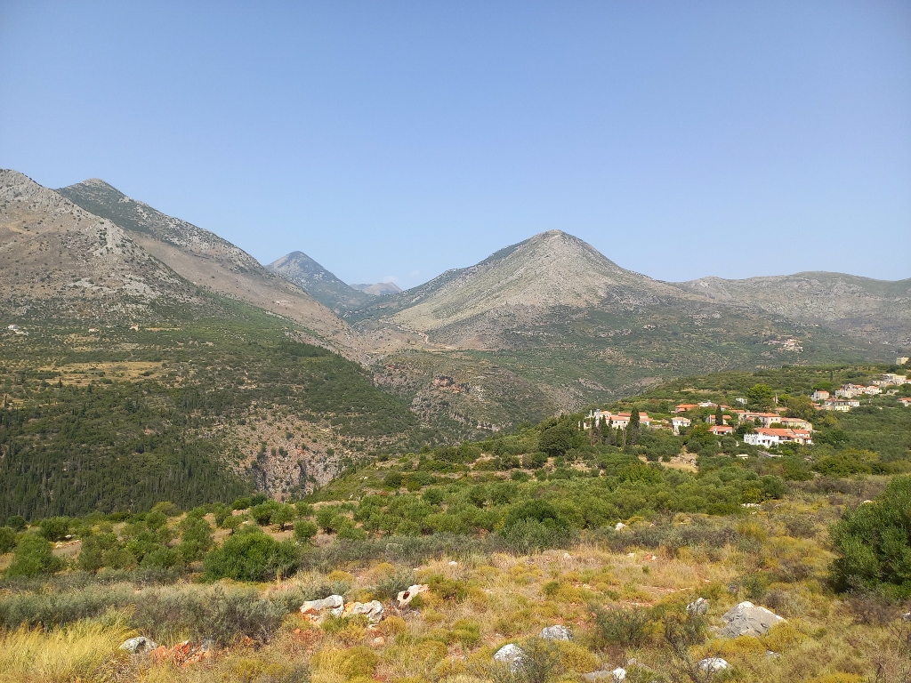
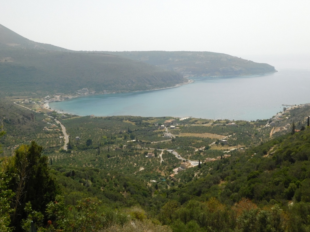
Before I reached the monastery, as the road climbed back up, I stopped and got out of the car in order to capture the view. It was spectacular!
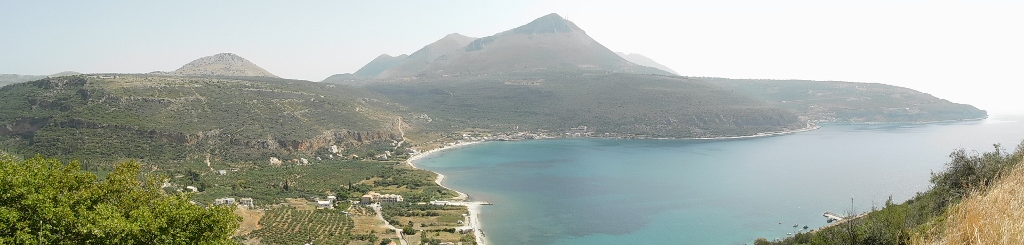 View at the Oitylo beach and bay
 View at the Oitylo beach and bay, and the surroundings
In the previous photo, you can glimpse Kelefa Castle on the elevation in the middle, while on the left side, you can also see the Dekoulou Monastery that I was heading towards.
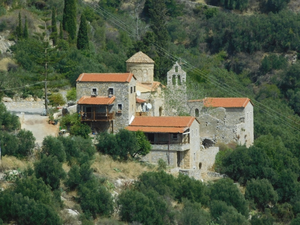 Dekoulou Monastery
I soon arrived at the monastery, but to my great disappointment, it was closed.
 Dekoulou Monastery
The monastery is known for its very beautiful frescoes, but since everything was closed, I couldn't see them. I even took a little walk around the monastery and peeked into the garden area, but I didn't spot anyone. The only thing I could do was take a photo of the three niches above the gate, where small and quite faded frescoes can be seen.
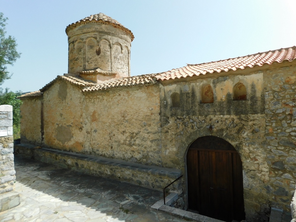
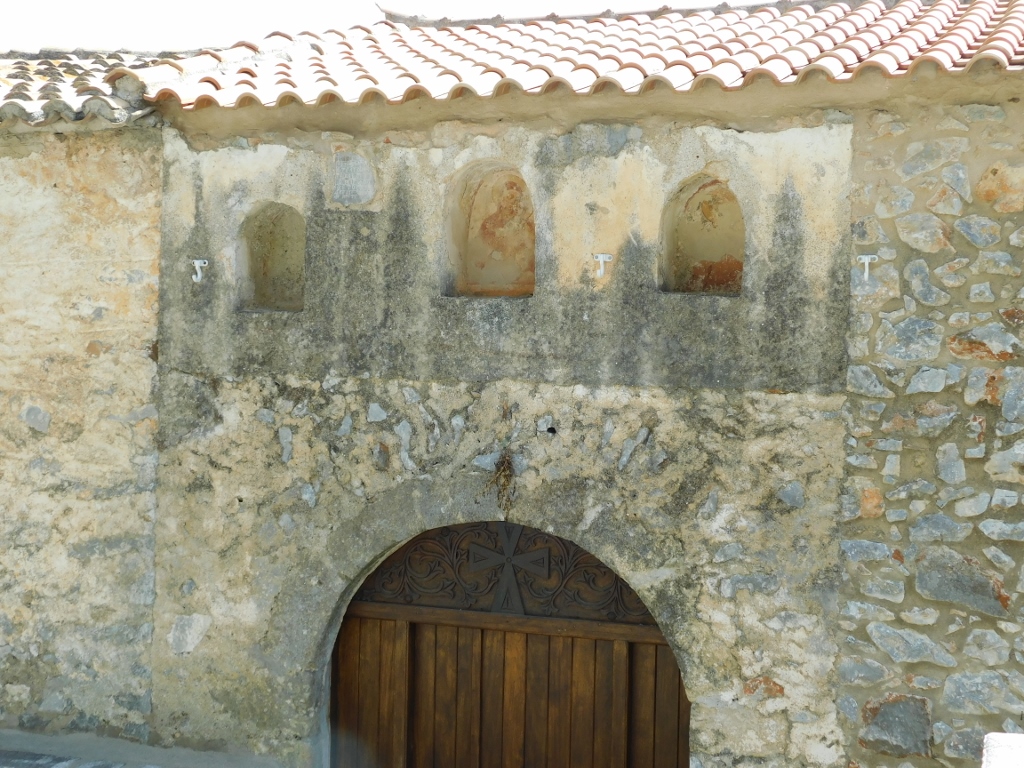 Dekoulou Monastery, a detail
 Dekoulou Monastery, a detail
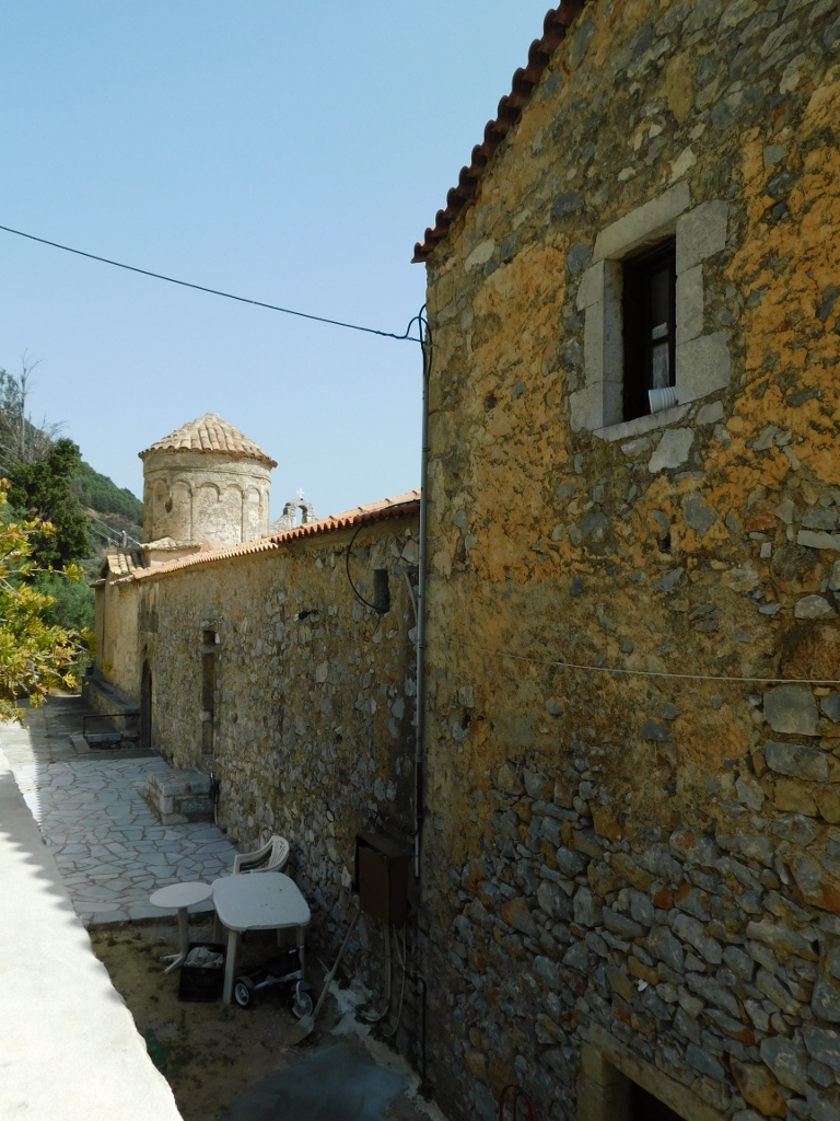
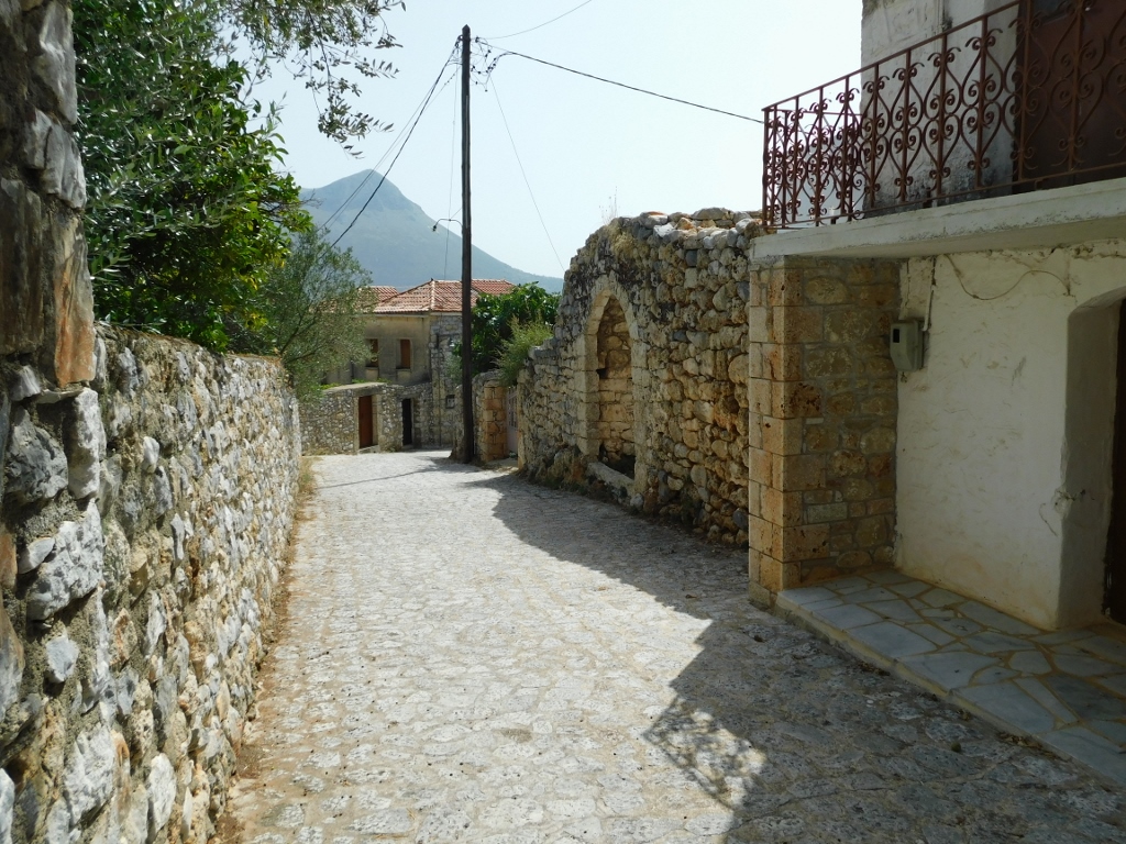
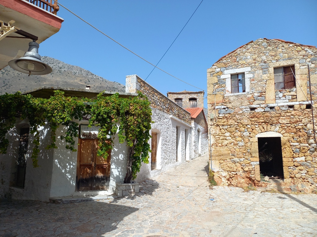
Now I moved on to the village of Oitylo. I parked the car and started to stroll around. Here, the houses are also made of stone and all of that looked very picturesque.
 Oitylo
 Oitylo
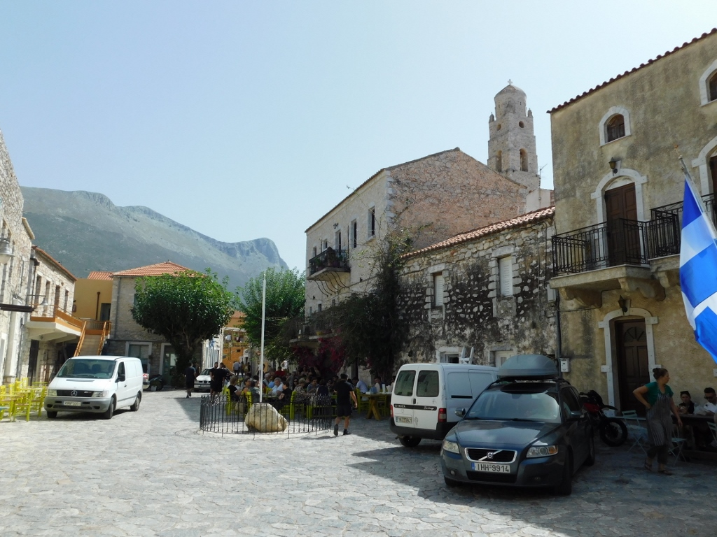
Oitylo is one of the oldest settlements on the Mani Peninsula and is even mentioned in Homer's Iliad. I found it interesting to read that this was once one of the main hideouts for pirates and even Napoleon docked in the bay at the foot of this village on his way to Egypt in 1798. Today, Oitylo is known as a centre for wine production. I, of course, wasn’t thinking about wine since I was driving, but I thought it would be nice to take a short break here, especially when I reached the main square of the village.
 Oitylo
Then I decided it would be nice to have something light to refresh myself. In Greece, that’s never a problem!
 Oitylo
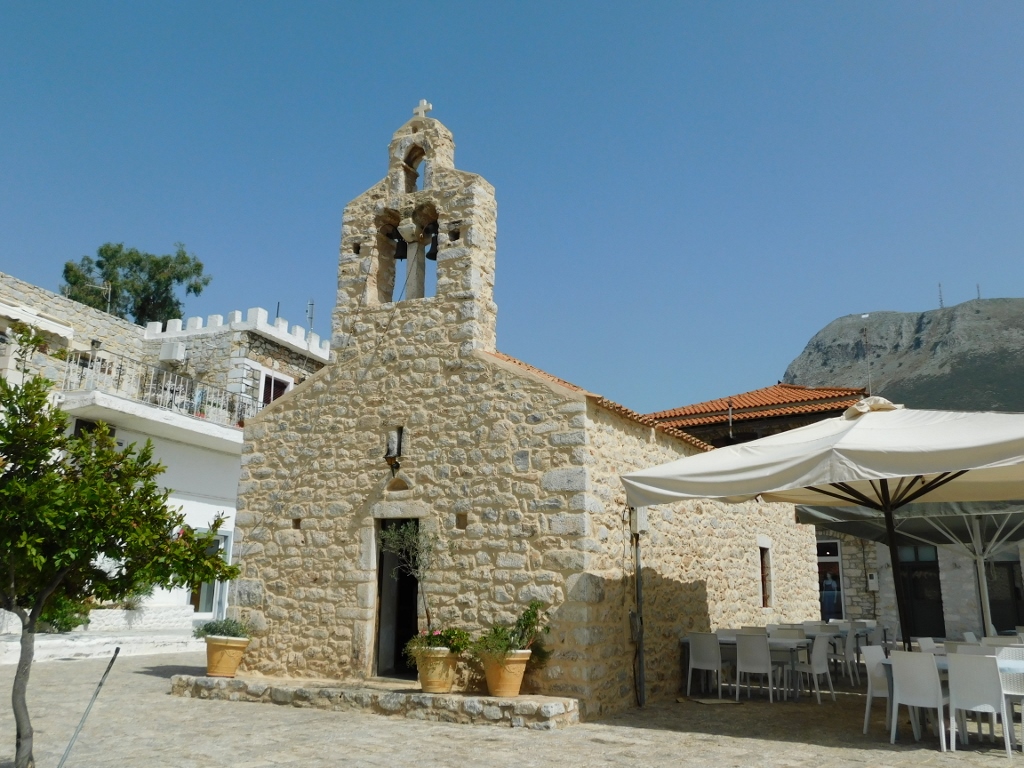
After finishing my meal and relaxing, I took a stroll to the nearby Church of the Assumption of the Theotokos.
 Church of the Assumption of the Theotokos in Oitylo
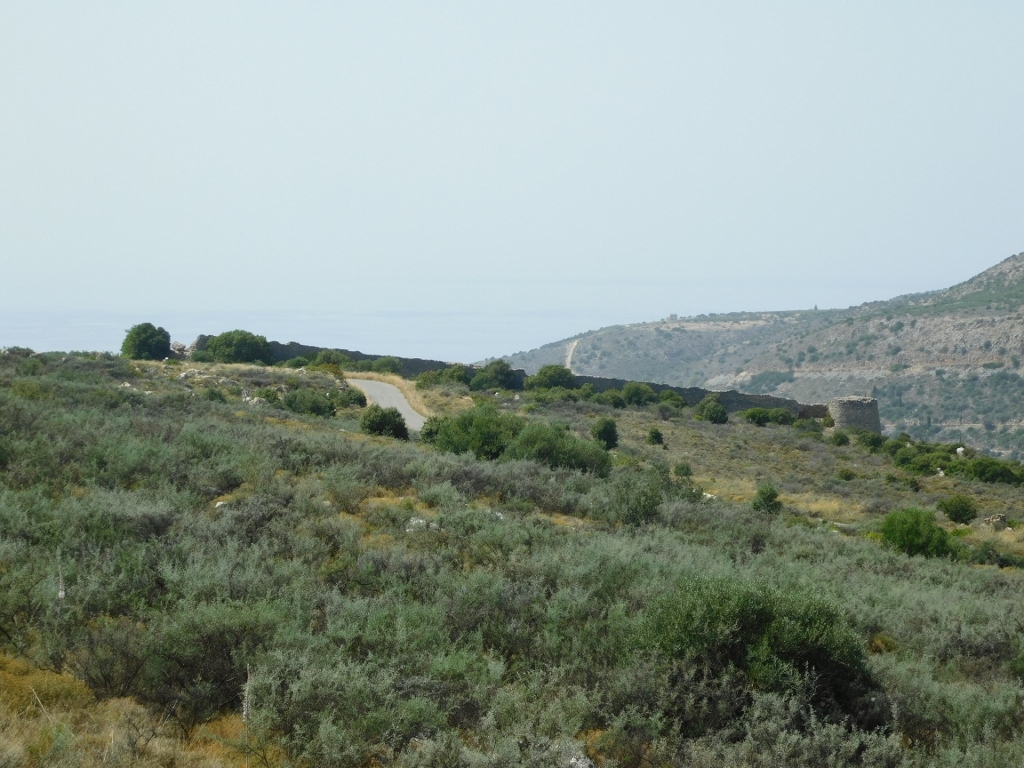
The church was closed, but it was definitely worth reaching the church and the plaza in front of it, as there is an outstanding view in all directions from there.
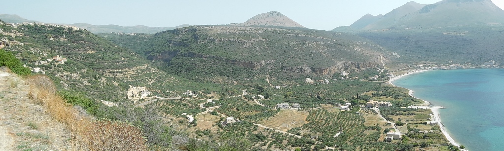
 View at the Oitylo bay
 View at Oitylo
 Kelefa Castle
Then I returned to the car and continued north. My next destination was the small village of Lagada, about 13 km away from Oitylo.
I really enjoyed the drive, as I found the landscapes to be stunning. However, the road, while the main one in this part of the Peloponnese, was quite narrow, so I had to be careful about the traffic, even though there were very few cars on the road. Fortunately, I came across a pull-off area, so I stopped there and got out of the car to take pictures of the scenery I was travelling through.
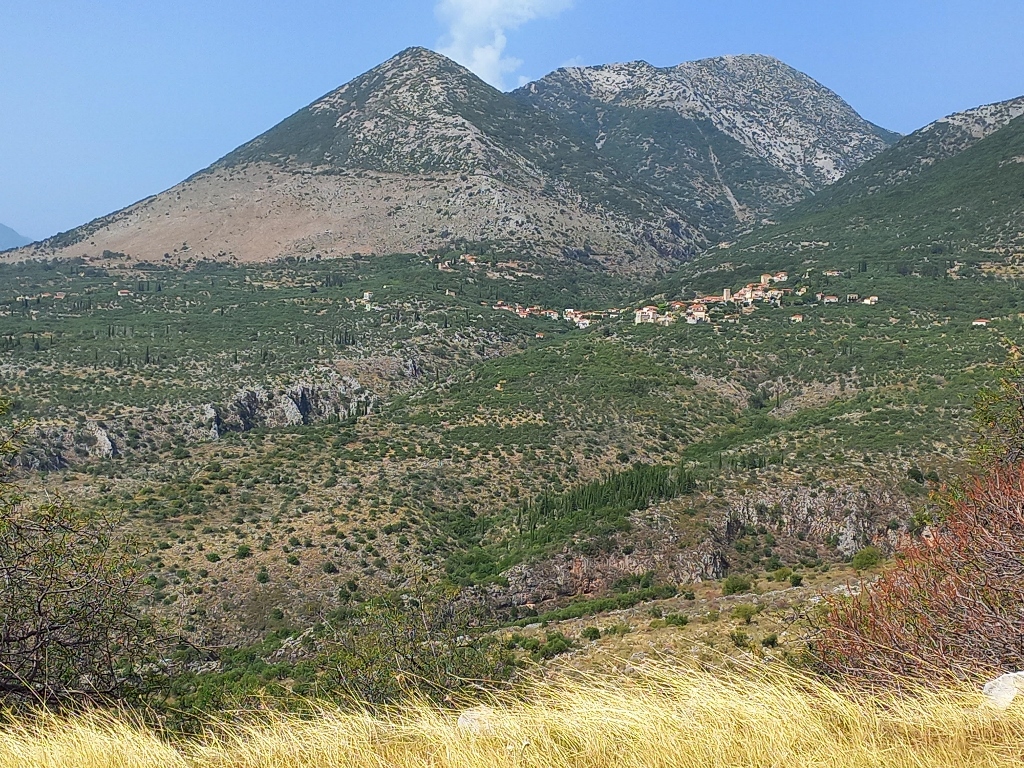 On the way to Lagada
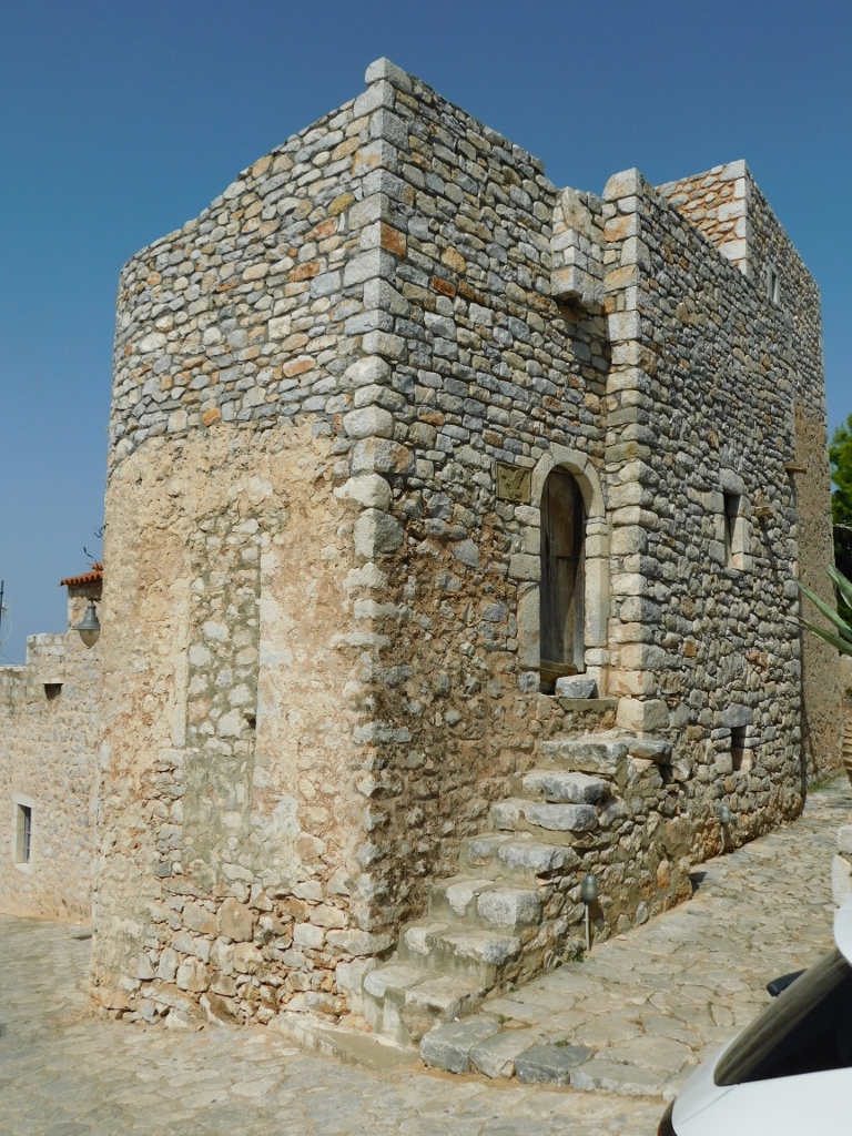
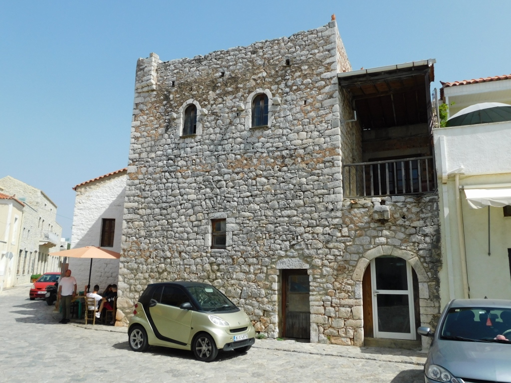
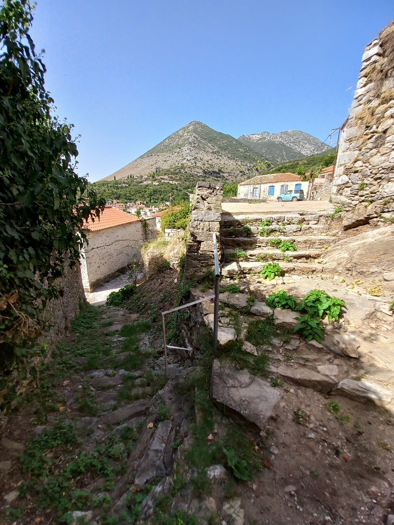
The entire Mani Peninsula is known for its tall stone towers. The Maniots built these towers to control the surrounding area and to protect their lives and property. There are about 800 of these towers on the peninsula, some reaching up to 20 m high and consisting of 3 to 5 stories. In other words, these are traditional high-rises. The construction of these towers was most intense between 1770 and 1830.
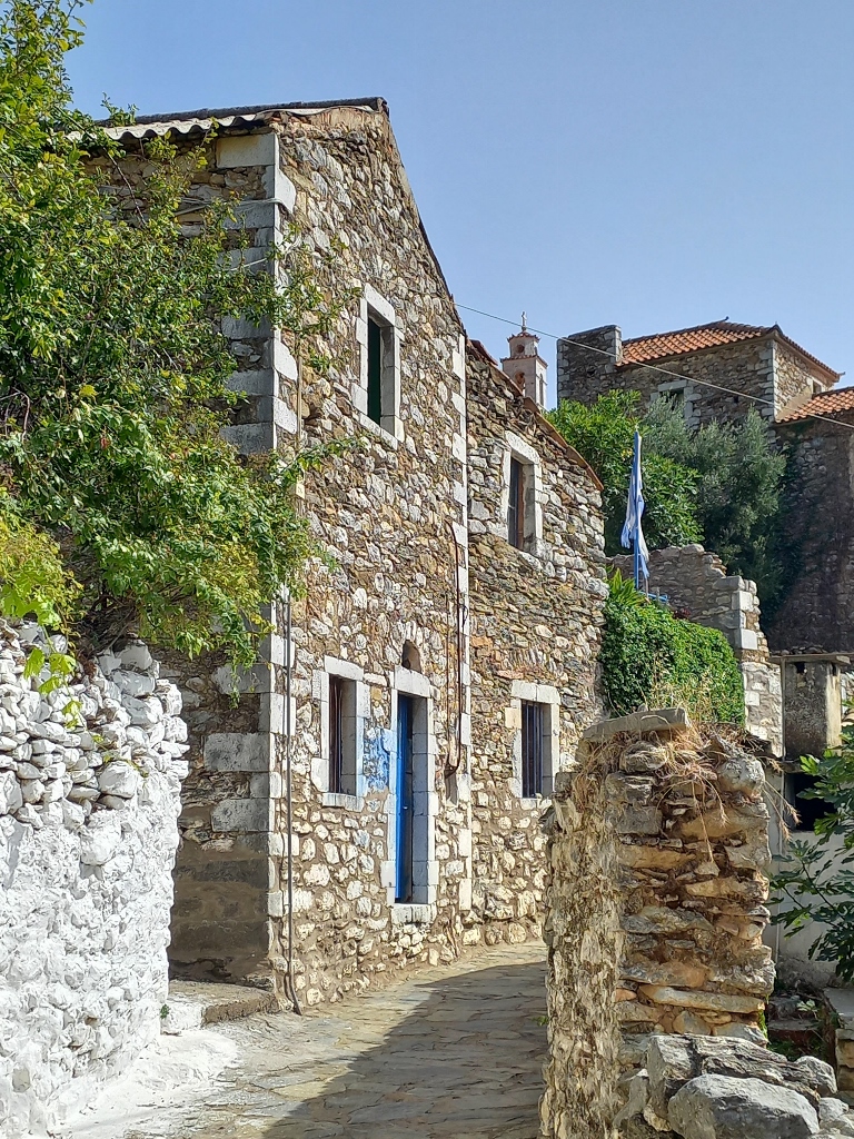
One of these towers, which is in fairly good condition, can be seen in the small village of Lagada and is easily noticeable from the road. I found a convenient spot to park my car, then set off on foot. The village, like all the villages on the Mani Peninsula that I had passed through, was exceptionally charming and picturesque.
 Lagada, a detail
 Lagada, a detail
And then I arrived at the Kapitsinou Tower.
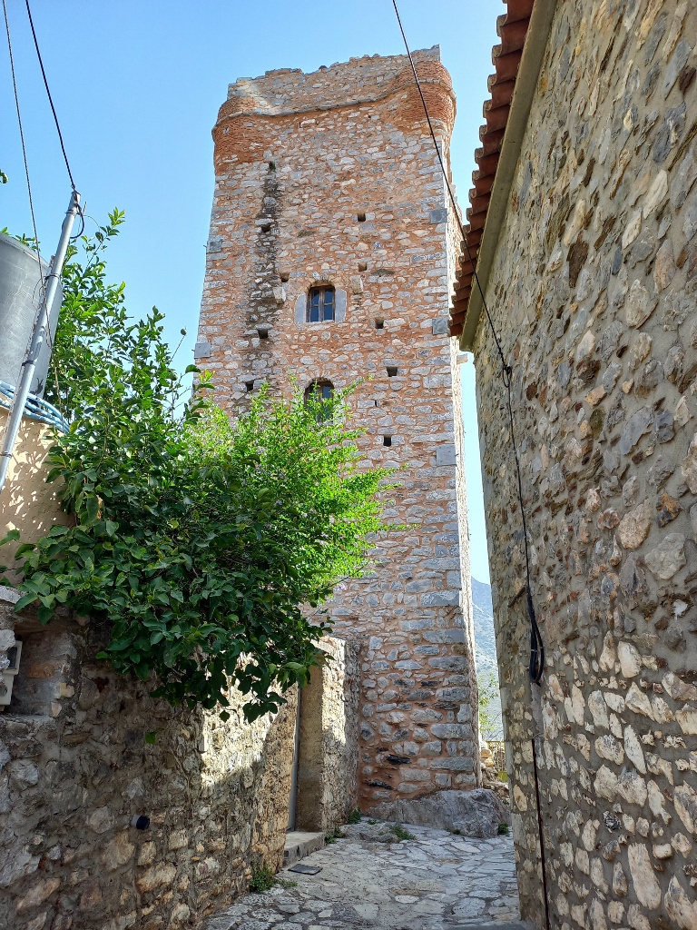 Kapitsinou tower
The Kapitsinou Tower, restored in the early 21st century, was built in the 19th century and is an excellent example of the war towers from the pre-revolution period (Greek War of Independence, 1821-1829).
The tower has five stories and, on the top, there is a roof with a high parapet that protected the warriors.
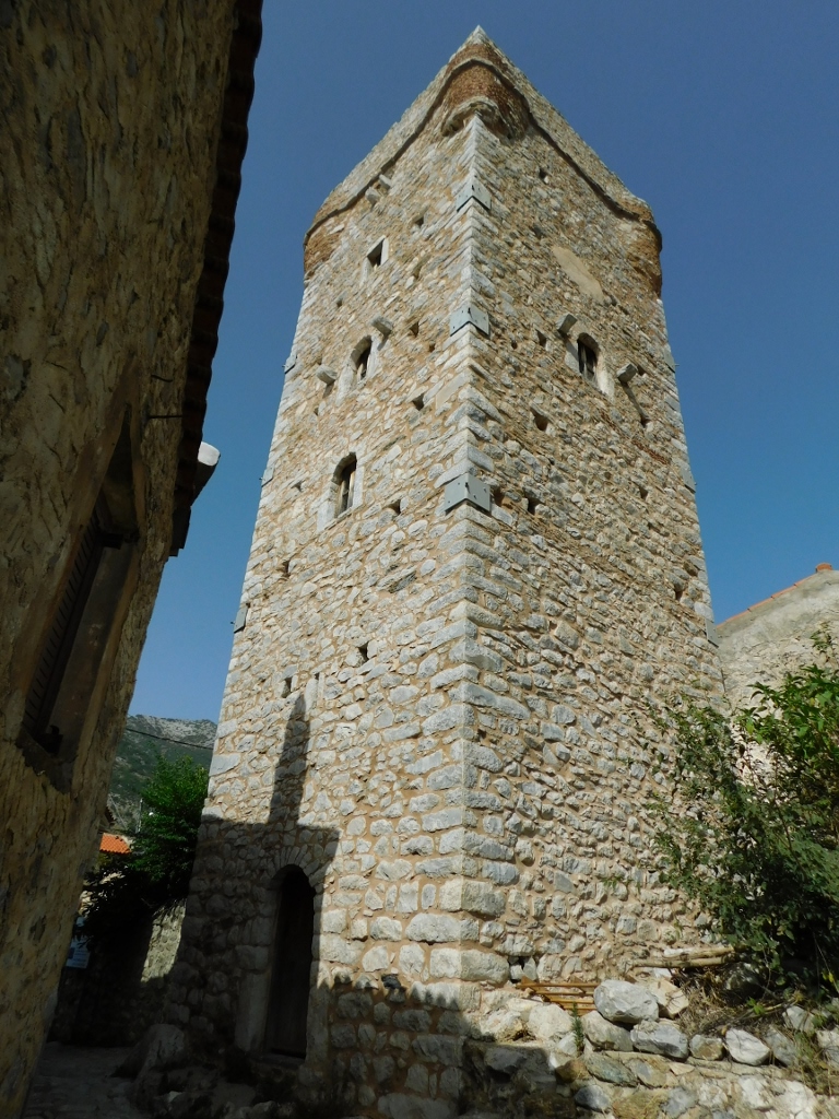 Kapitsinou tower
Interestingly, in this small village, there is another warrior tower – the Economea Tower – located near the Kapitsinou Tower. Built in 1857, it has three stories, but half of the tower is in ruins. Despite this, it is classified as a historical monument, as it also represents an example of traditional architecture and the abundance of towers on the Mani Peninsula.
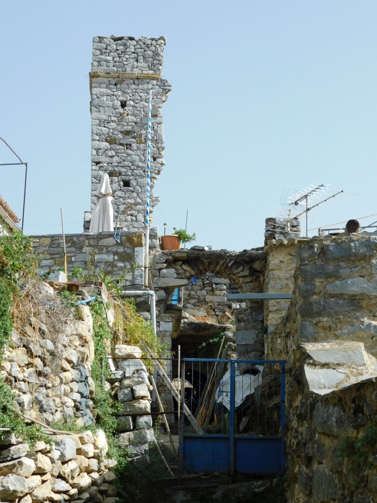 Economea Tower
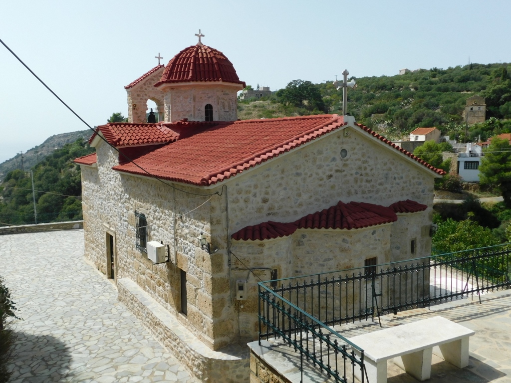
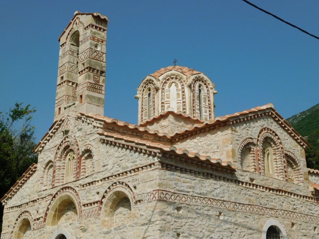
In the northern part of Lagada, just a couple of minutes from where I first parked, there is another significant cultural monument right by the road. This is the Church of Christ the Saviour, which is dedicated to the feast of the Transfiguration.
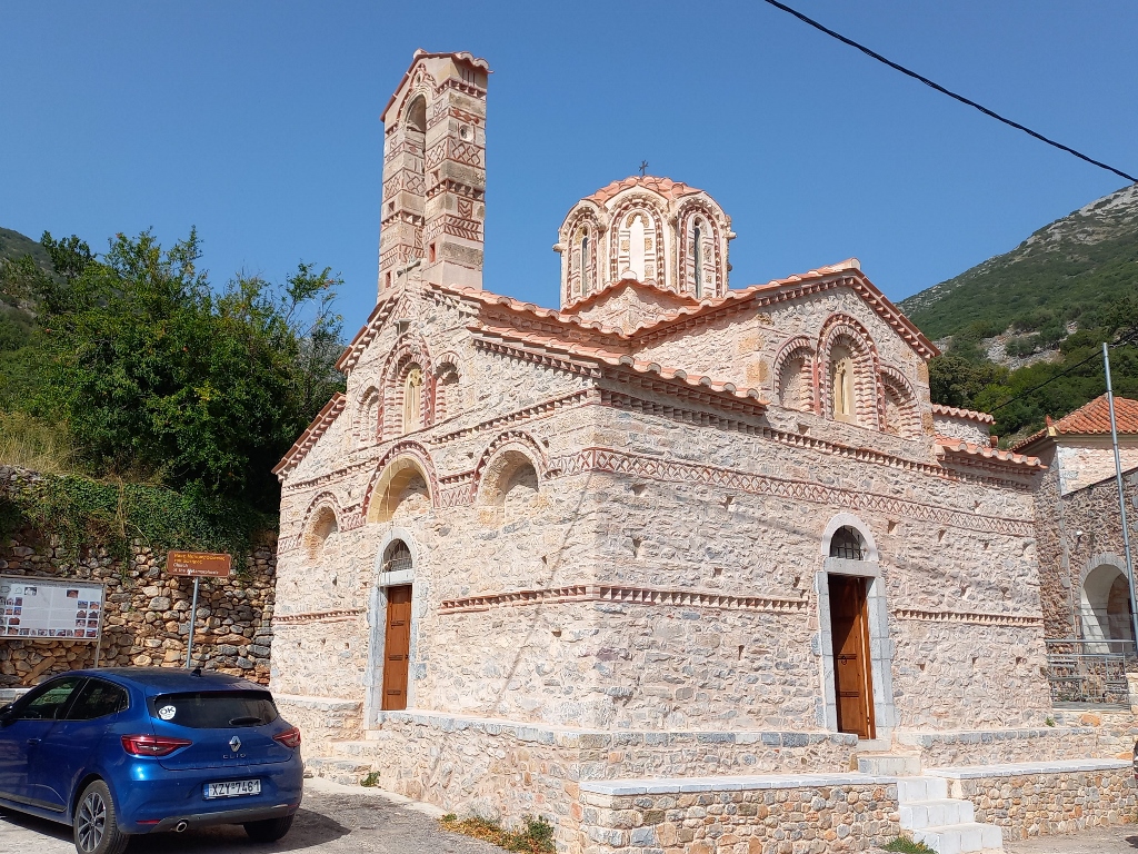 Church of the Transfiguration of Christ
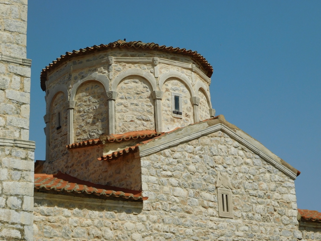
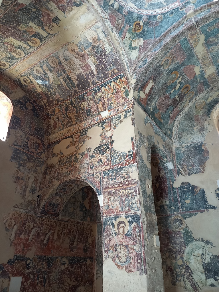
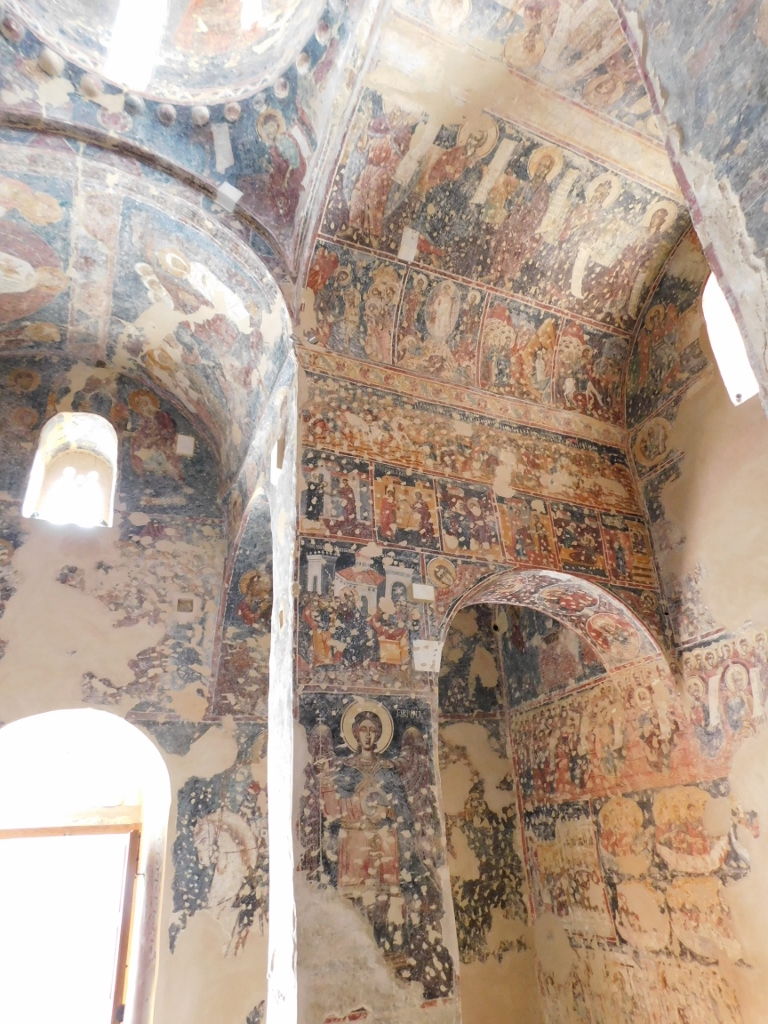
The church was built in the 14th century and is the most significant church on the Mani Peninsula constructed during the late Byzantine period (1204-1453). Some parts of the original structure are still present, but there were also additions made in the 17th century. The church features a cross-in-square plan.
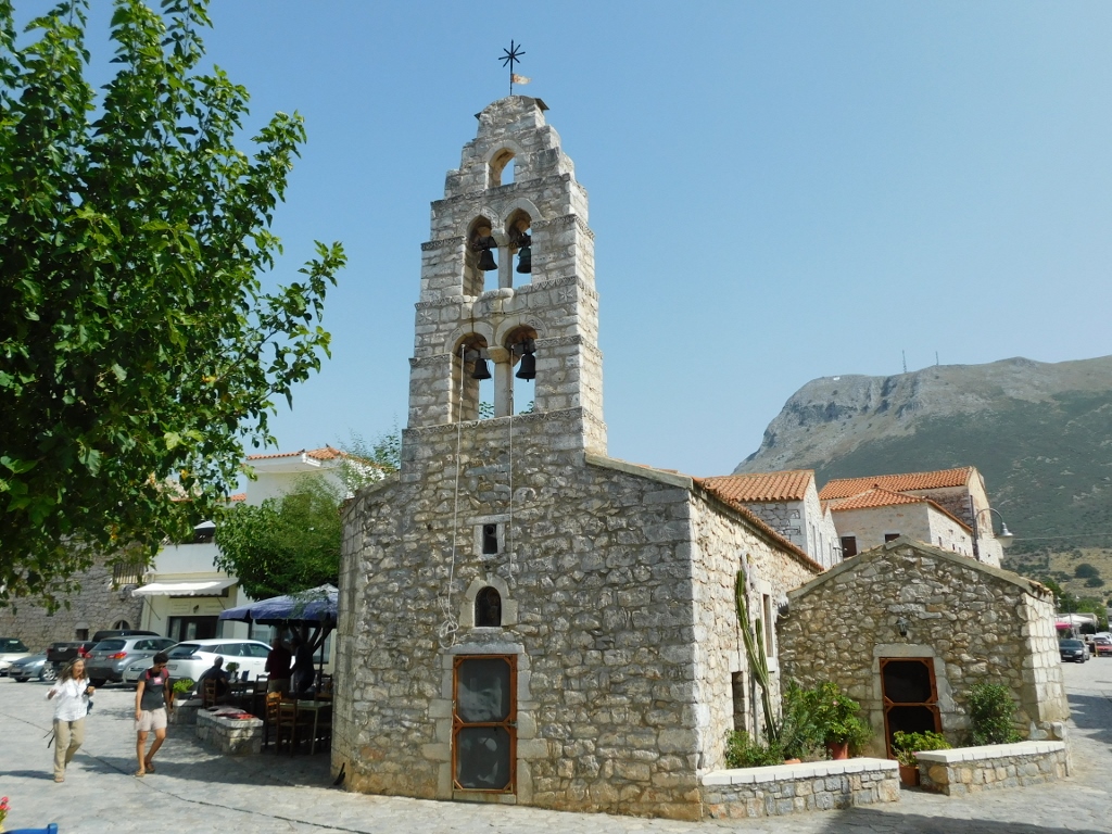
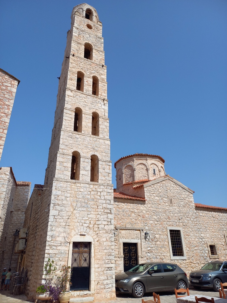
From the outside, one of the most striking elements is the exceptionally elegant belfry, which is considered the most beautiful in the entire region.
 Church of the Transfiguration of Christ, a detail
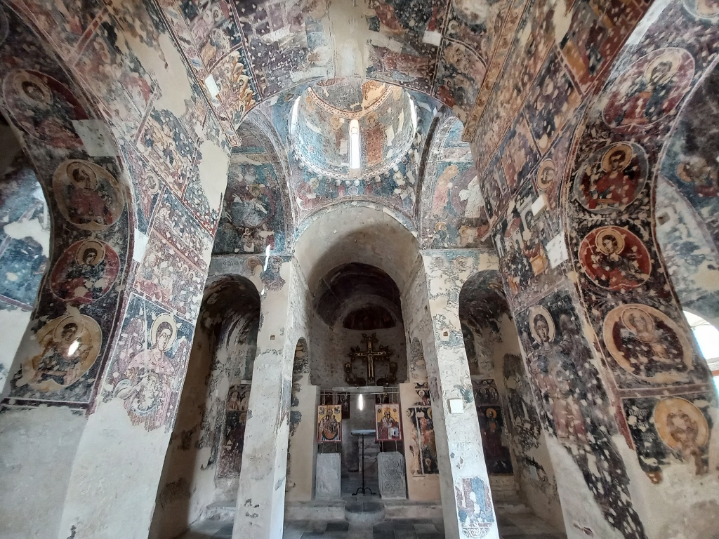
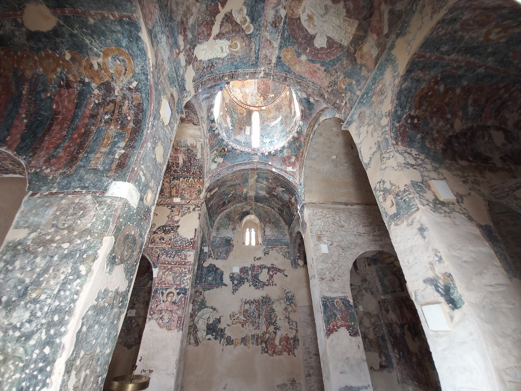
In the 19th century, the church's façades were covered with plaster, but this was removed at the end of the 20th century, revealing the original building material (although, as I’ve read, some mistakes were made during this process, leading to damage in certain areas).
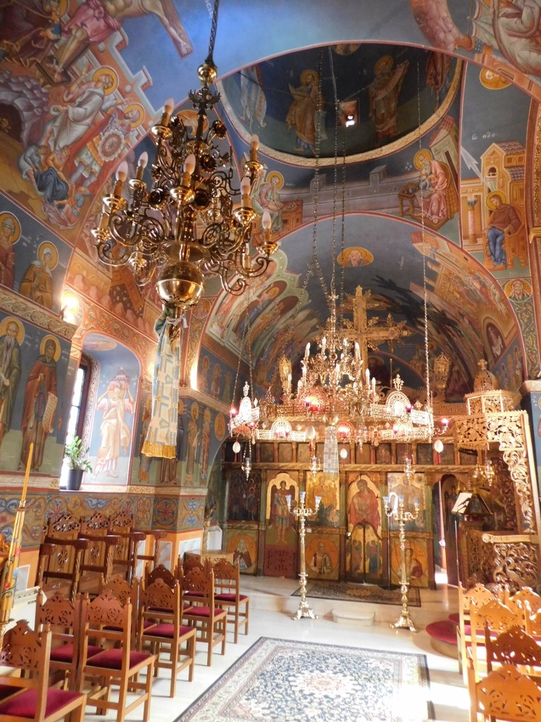
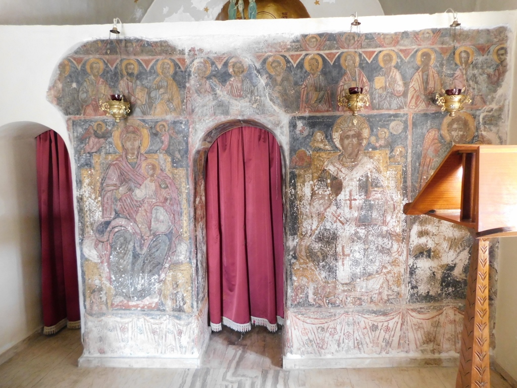
As for the interior, I was completely taken aback by the beauty and abundance of the frescoes. They are clearly damaged, but still remarkably beautiful.
 Church of the Transfiguration of Christ, a detail
 Church of the Transfiguration of Christ, a detail
 Church of the Transfiguration of Christ, a detail
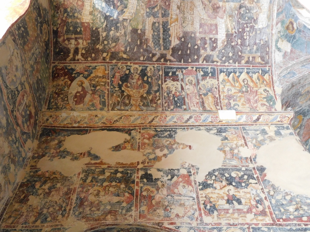 Church of the Transfiguration of Christ, a detail
 Church of the Transfiguration of Christ, a detail
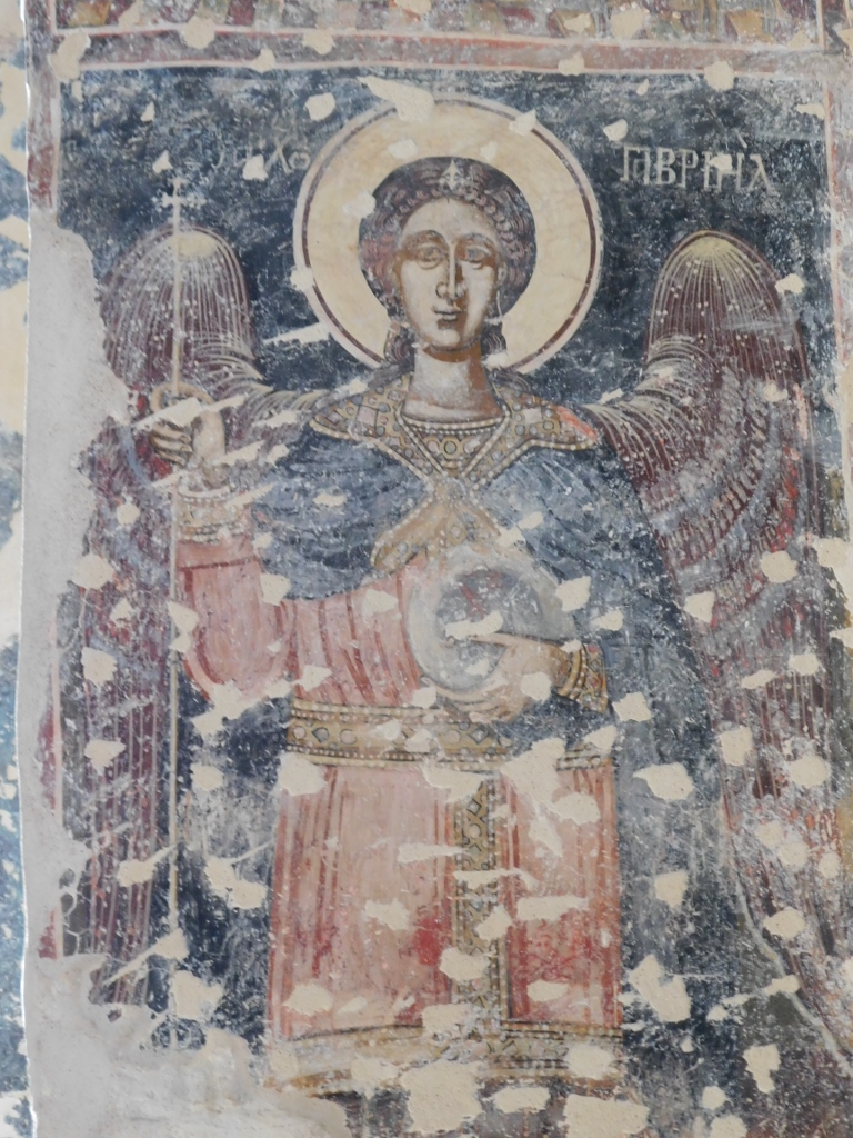 Church of the Transfiguration of Christ, a detail
I was extremely pleased with my visit to this church and when I stepped outside, I took a moment to look back at the southern parts of Lagada. There, among other things, I could see the top of the Kapitsinou Tower.
 View in Lagada
I took a photo of that, then got back in the car and drove just under 1.5 km to the neighbouring village of Thalames, where I continued my sightseeing of the Mani Peninsula.
Here's a reminder and a map showing all the places I visited during my stay in the Peloponnese and southern Greece in September 2023.