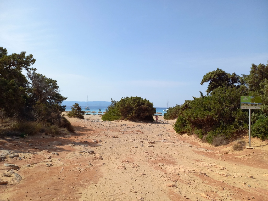
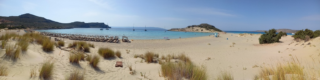
Simos Beach on the southeast coast of Elafonisos island is quite large and consists of a couple of different sections, so you can access it from several sides. I initially wandered a bit, but then I found a convenient spot to park my car, which was at the far “left,” or the southern part of the beach, as it was also closest to a small peninsula connected to Elafonisos by a rocky-sandy isthmus. In any case, you first need to walk through the sandy dunes and vegetation.
 Access to Simos Beach
By the way, all of this takes place in the Laconia region, on the southeast side of the Peloponnese. Here’s a reminder and a map showing all the places I visited during the two weeks I spent in this beautiful part of Greece in September 2023.
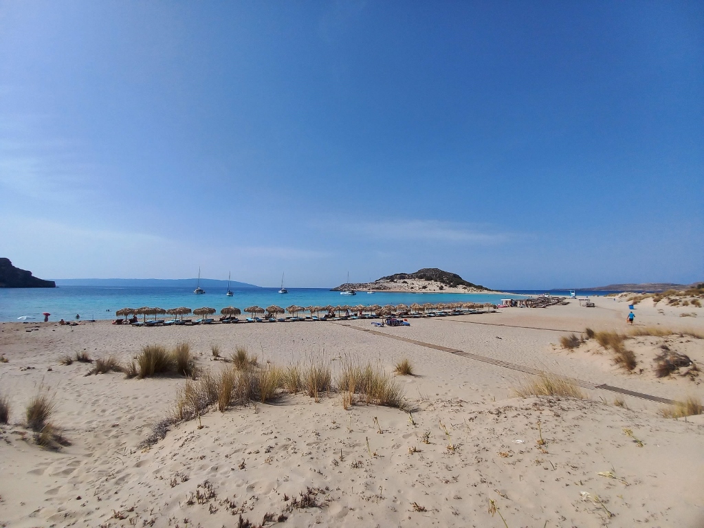
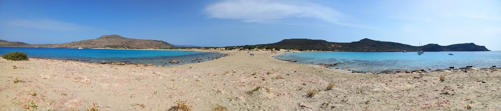
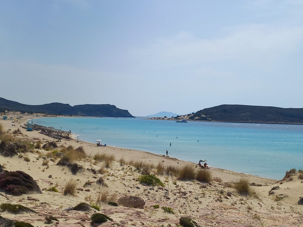
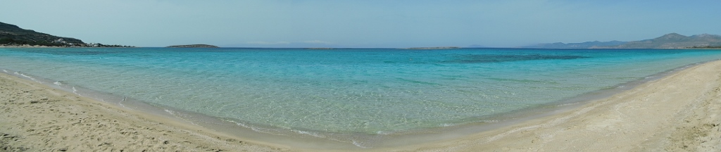
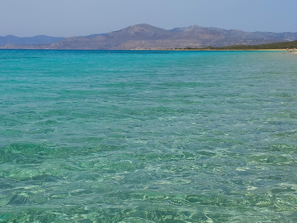
When you step onto the beach, you start to understand what it's all about. The main part of Simos Beach stretches for nearly 1.5 km from north to south. At the southern end, the beach is interrupted by a narrow rocky-sandy isthmus that leads to the small peninsula. (That is the elevation visible on the right side of the next photo.) From that isthmus, which runs east to west, there is a smaller section of Simos Beach that is just under 0.5 km long. This is the part I reached and it can be seen in the following picture.
 Simos Beach
And yet, I first climbed up some sandy dunes here. On the one hand, I found it interesting and wanted to get a better look at some of the flowers growing there, while on the other hand, it allowed me to have a better view of the southern segment of Simos Beach.
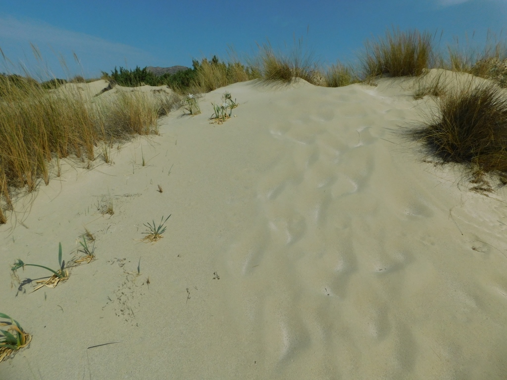 Sand dunes on Simos Beach
Here, on the sandy ground, beautiful sea daffodils (Pancratium maritimum) are growing.
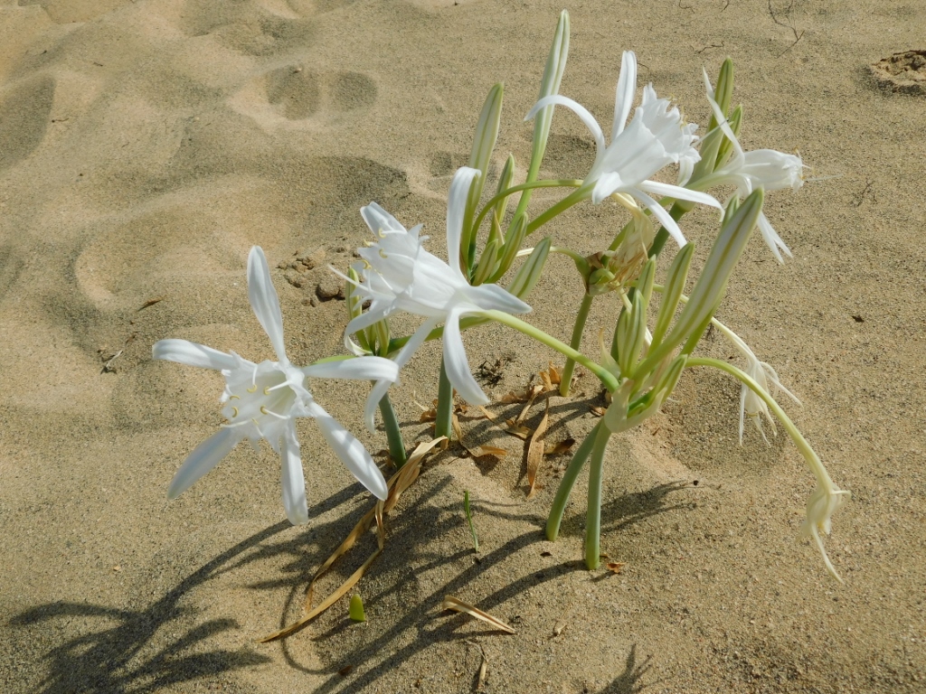 Sea daffodil
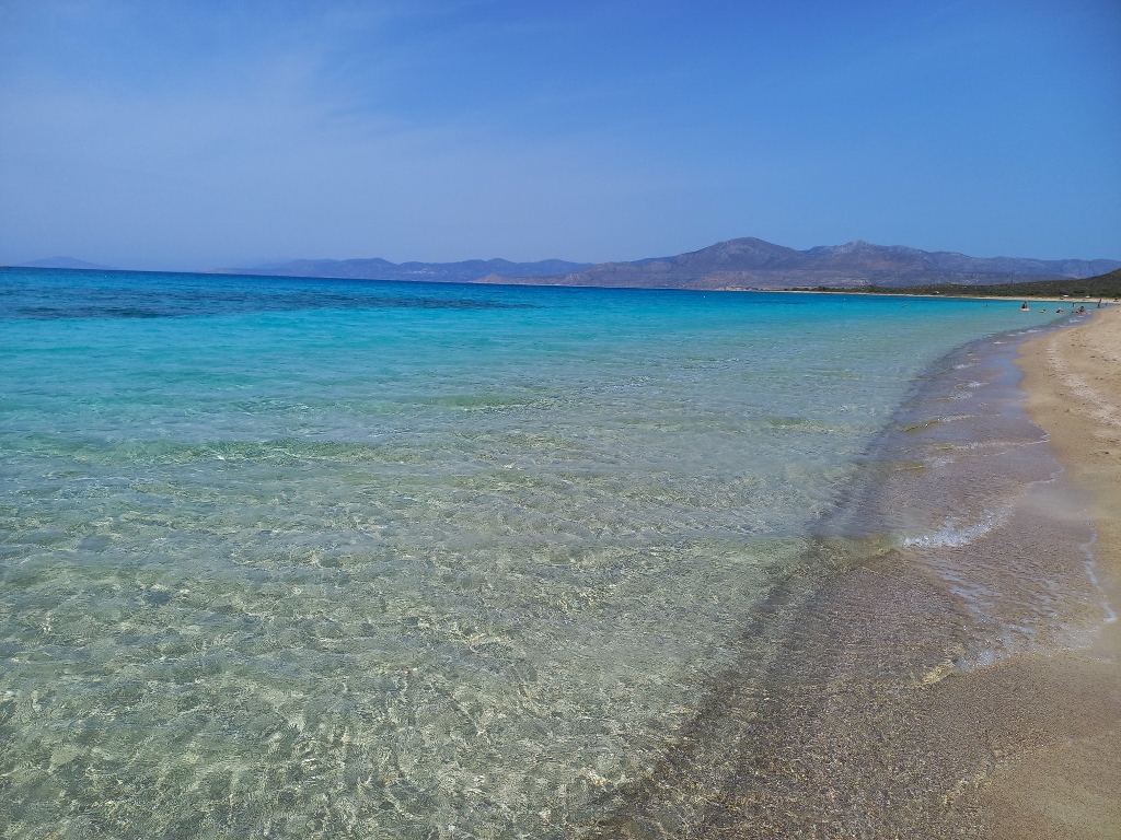
As for the view, well, it was quite nice.
 Simos Beach
 Simos Beach
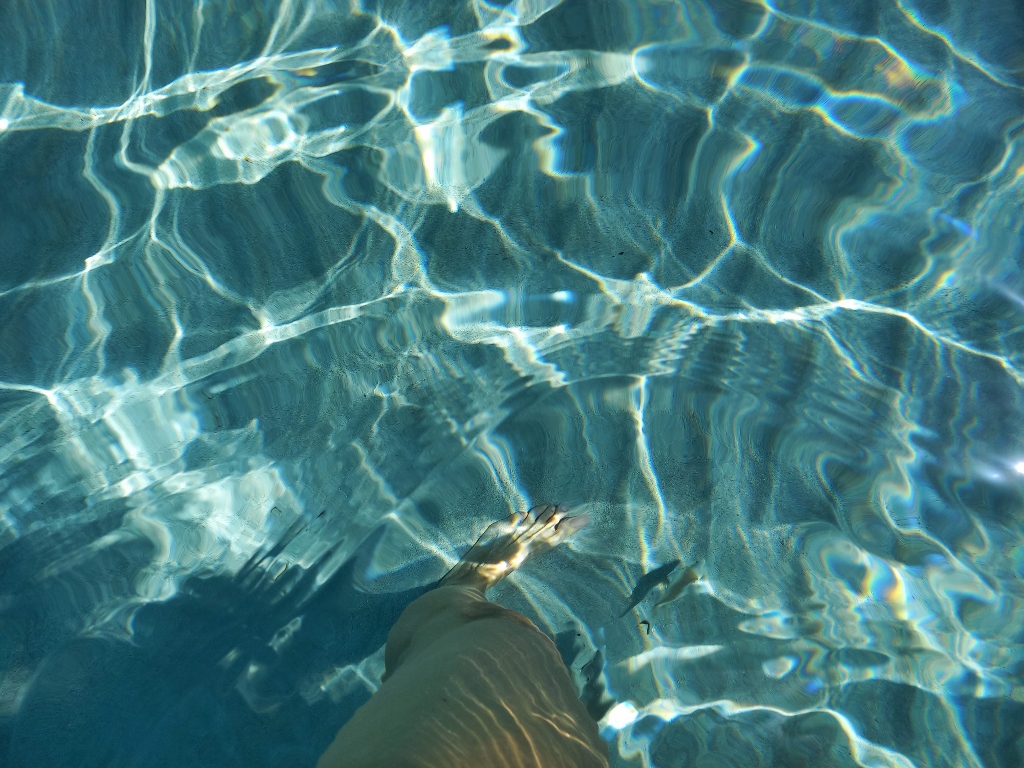
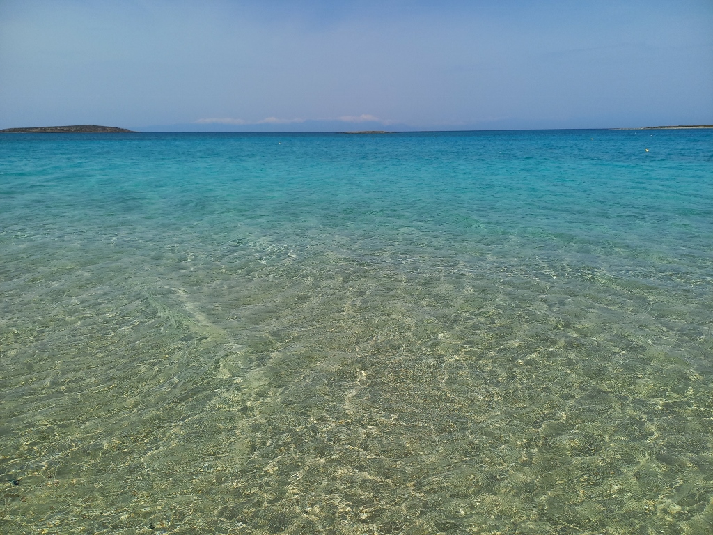
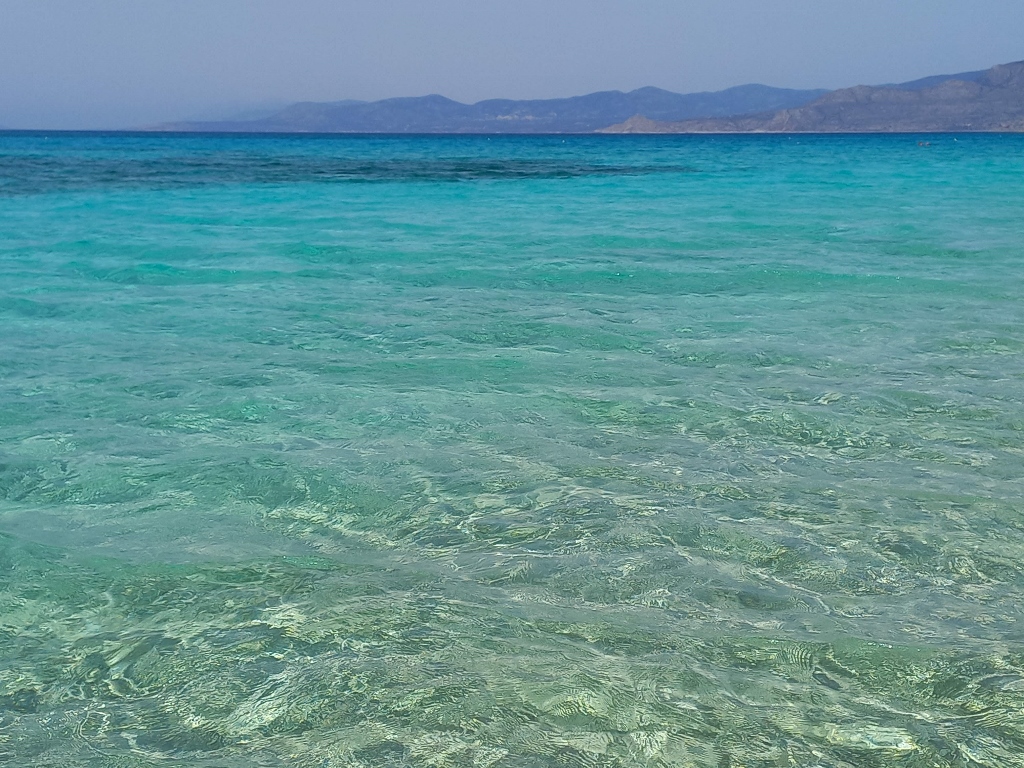
But, the best bit was when I reached the water.
 Simos Beach
From what I've read, "Elafonisos" or "Elafonisi" roughly translates as "island of the deer." However, I'm almost certain that this is a translation error and that it actually means "spectacularly beautiful beach." Anyone who doesn't believe me should keep reading and looking at the pictures from Elafonisos, as well as check out the photos from my story about visiting Elafonisi Beach in Crete (https://www.svudapodji.com/en/crete-10/).
 Simos Beach
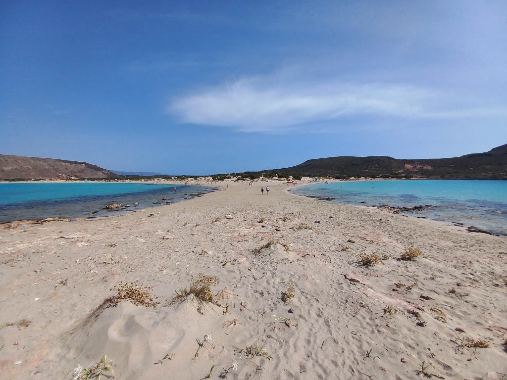
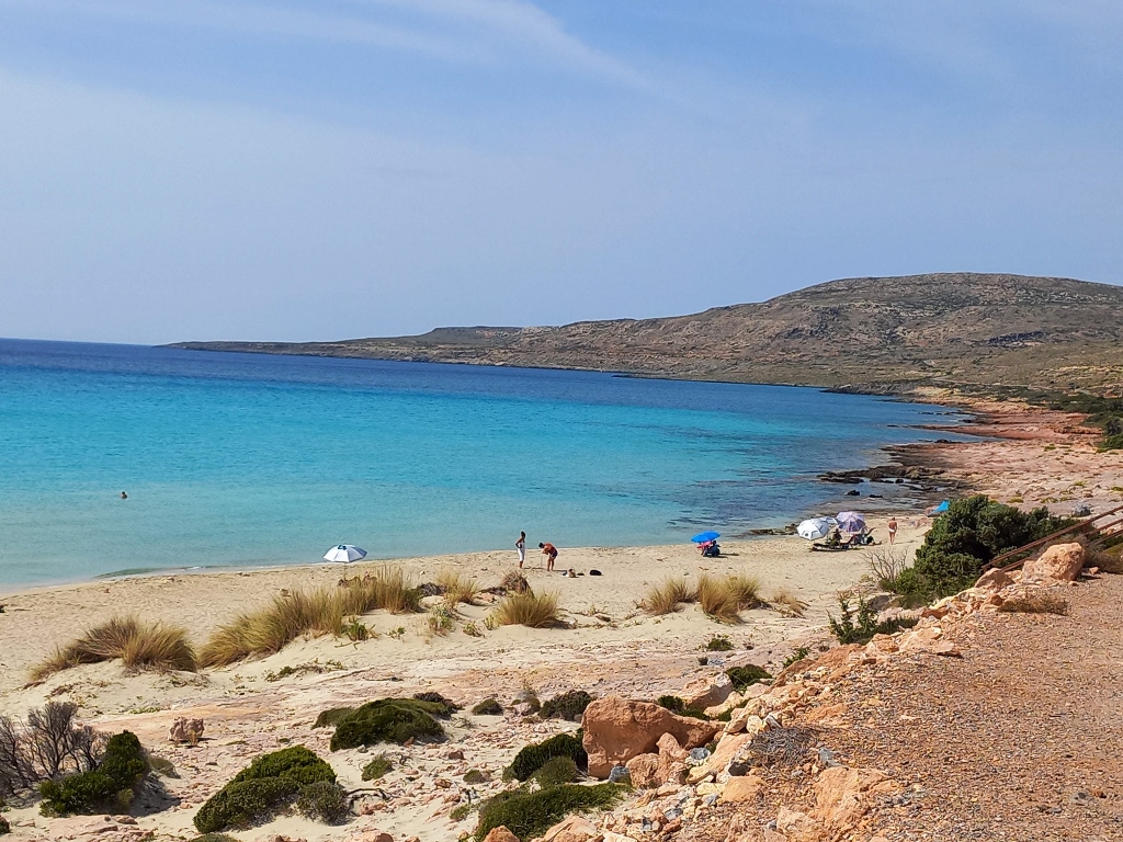
I first took a walk to the isthmus and started to climb up the elevation, mostly to get a better view for photography rather than to explore the area.
 Simos Beach
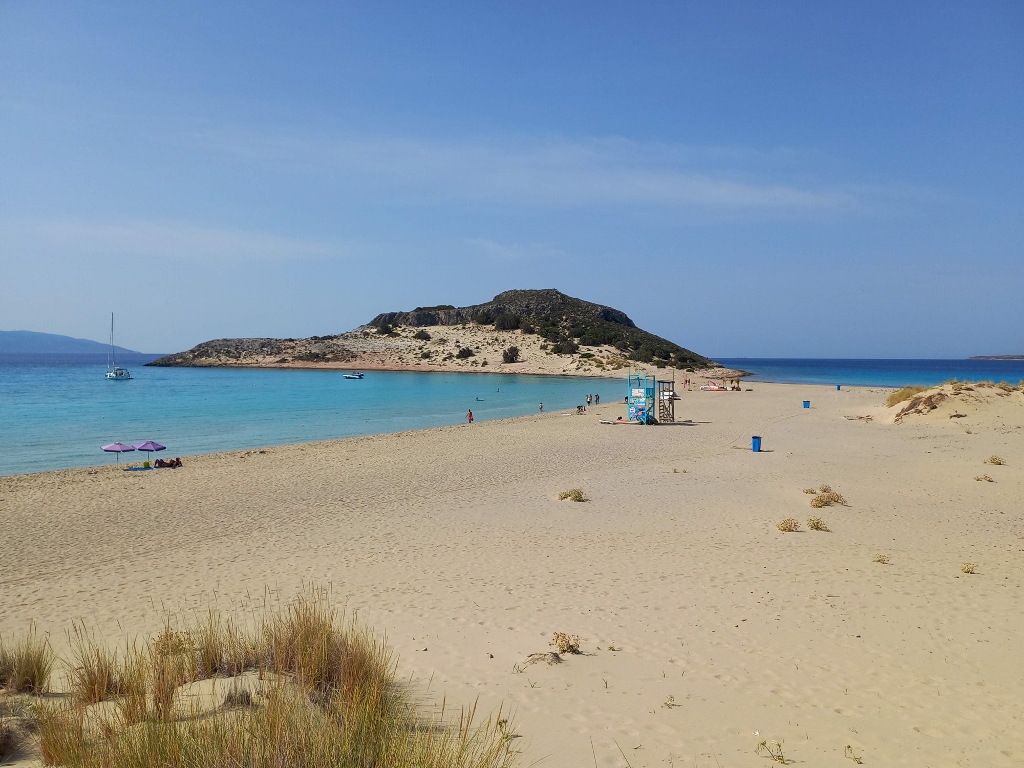
In the previous photo, you can see the longer section of Simos Beach on the left and the shorter one on the right. My intention was to swim in this shorter section.
 Simos Beach
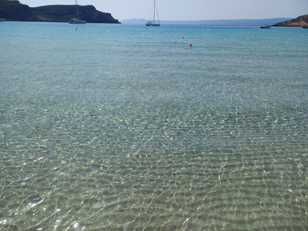
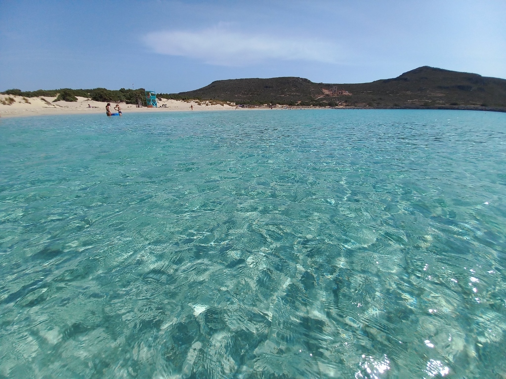
Then I found a nice spot to leave my things and went into the water. It was wonderful.
 Simos Beach
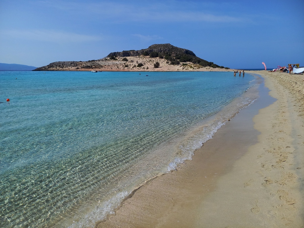
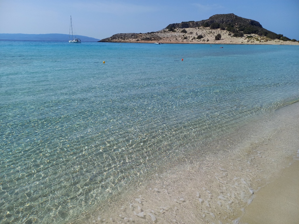
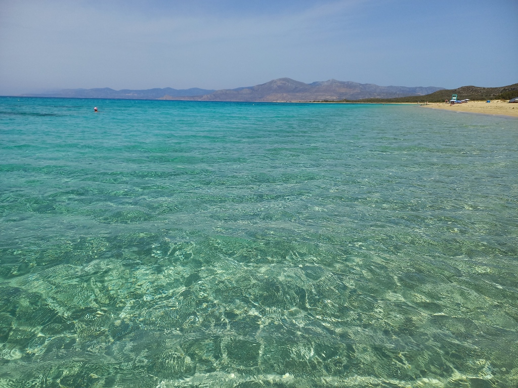
I enjoyed for a while swimming or just sitting peacefully in the water and I also took some photos. I have to emphasise that the colours and the overall impression were much better in person than what the photos can convey. However, they are still quite good and beautifully illustrate the crystal-clear water.
 Simos Beach
 Simos Beach
Still, at some point, it was wise to move from there. First, I didn’t have any parasol, tent, or shade from a tree, while the sunrays were very strong, even though I already had a nice tan.
Additionally, I wanted to visit another famous beach on the island, so it didn’t make sense to rent a sun lounger under one of the umbrellas lined up in the central part of the beach.
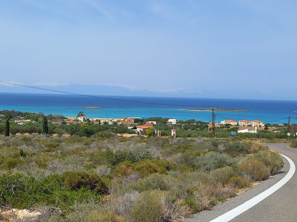
To start with, I drove close to the longer segment of Simos Beach, where I stopped briefly to take a few photos.
 Simos Beach
 Simos Beach
Luckily, before going to Elafonisos, I saw that there was a road that goes around the island. If I had followed the GPS in the car, I would have first returned to the main settlement and then gone to the other beach, which would have been quite pointless. This way, I ended up making a complete loop around this small island, which has an area of 20 sq. km and I was very glad about that.
As for the other beach, it's called Kato Nisi Beach and as I got closer, I could see the houses. In the winter, less than 500 people live on Elafonisos, but during the summer months, there can be over 3,000 visitors here.
 Getting close to Kato Nisi Beach
When I arrived at the beach, I could see that it was also a sandy like Simos Beach, but the sand was a slightly different colour and had a different grain size.
 Kato Nisi Beach
 Kato Nisi Beach
However, this didn’t affect the beauty of the beach or the water at all, so I wanted to swim again.
 Kato Nisi Beach
It turned out, however, that there was a bit of a stronger breeze here, which didn’t affect the water or the feeling when you got in, but it did cool you off quite a bit when you came out. Not enough to be uncomfortable, but just enough. So later, while I was waiting for my swimsuit to dry before getting back in the car, I took some pictures of the beach by wading into the water up to my thighs, but I didn’t fully immerse myself again.
 Kato Nisi Beach
 Kato Nisi Beach
 Kato Nisi Beach
Once I had taken enough photos and my swimsuit was dry, I got in the car and continued to drive around Elafonisos, eventually returning to the main settlement where I had lunch as I had planned.
I often find it challenging to choose a restaurant. In places like this, there are usually several options, but how do I know which one is good? Maybe they’re all good or maybe just a few. From experience, I know that ratings and reviews found online are relative, so in the end, I just make a decision and see how it turns out.
This time, I listened to the restaurant owner who recommended the fish soup because it was made from fresh fish. I usually don’t order fish soups, but this one was truly excellent and quite plentiful. In the end, I also got some fresh figs for free, which I enjoyed immensely. I didn’t take a picture of them, but here’s the soup and the main dish (some freshly caught fish).
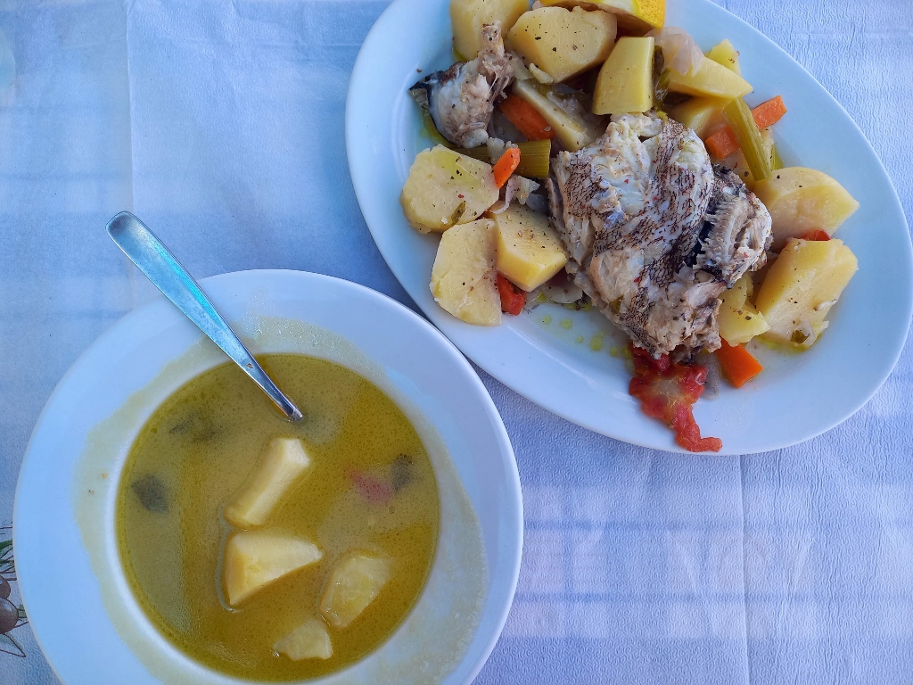 Lunch in the town of Elafonisos
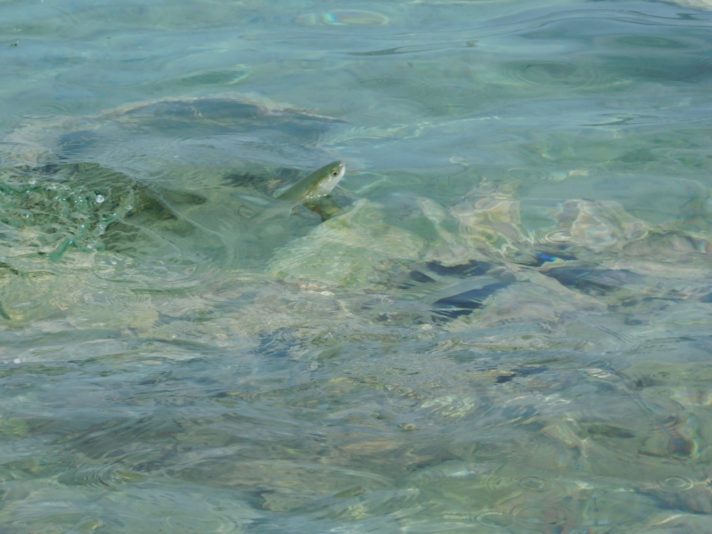
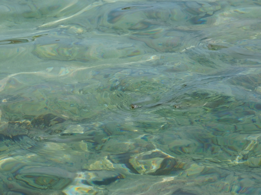
I stayed there for a relatively long time, feeling wonderfully relaxed, occasionally watching the fish in the shallows that were behaving strangely, at least to my eyes – often poking their mouths out of the water as if they were breathing. Later, I learned that these were flathead mullets (Mugil cephalus). I was so fascinated by their behaviour that I had to include a couple of photos to illustrate it all better.
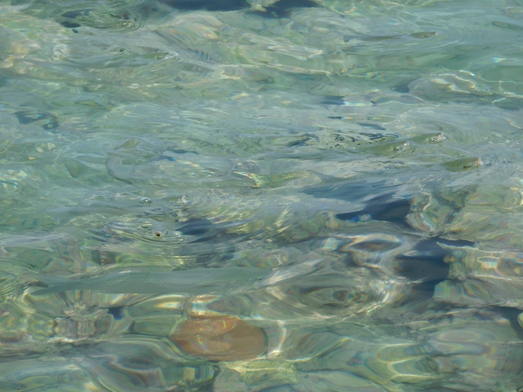 Flathead mullet in the shallows
 Flathead mullet in the shallows
 Flathead mullet in the shallows
When I had spent enough time relaxing, I returned to the car and then drove to the nearby ferry, where, as I’ve mentioned earlier, I boarded in reverse. I was very pleased and proud of myself. I spent the short trip to the mainland higher up on the ship in order to get a better view and enjoy the beautiful colours of the Greek sea.
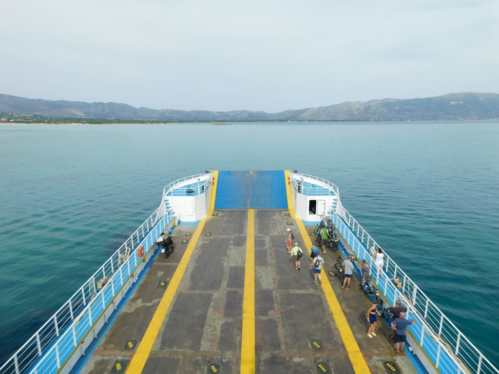 Ferry from Elafonisos to the land
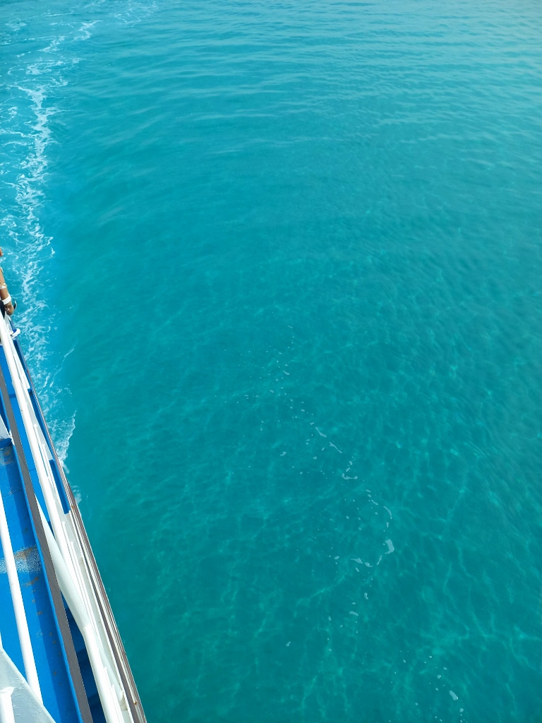 Sea in Greece
Now I was heading back to Monemvasia and wondered whether I should take the main road that actually goes around and is 15 km, but only 10 minutes longer. I assumed it was that new, wider, "normal" road. However, I decided to return the same way I came.
It was only later that I realised I had taken different routes over the mountain. On the way there, I had turned somewhere I shouldn’t have, making that route a bit longer, but both versions of the road were narrow and full of curves.
Still, I felt somewhat more relaxed now and there was practically no one else on the road except for me. On my side of the road, there were a few places where it widened, so I took advantage of that to stop briefly and take some photos.
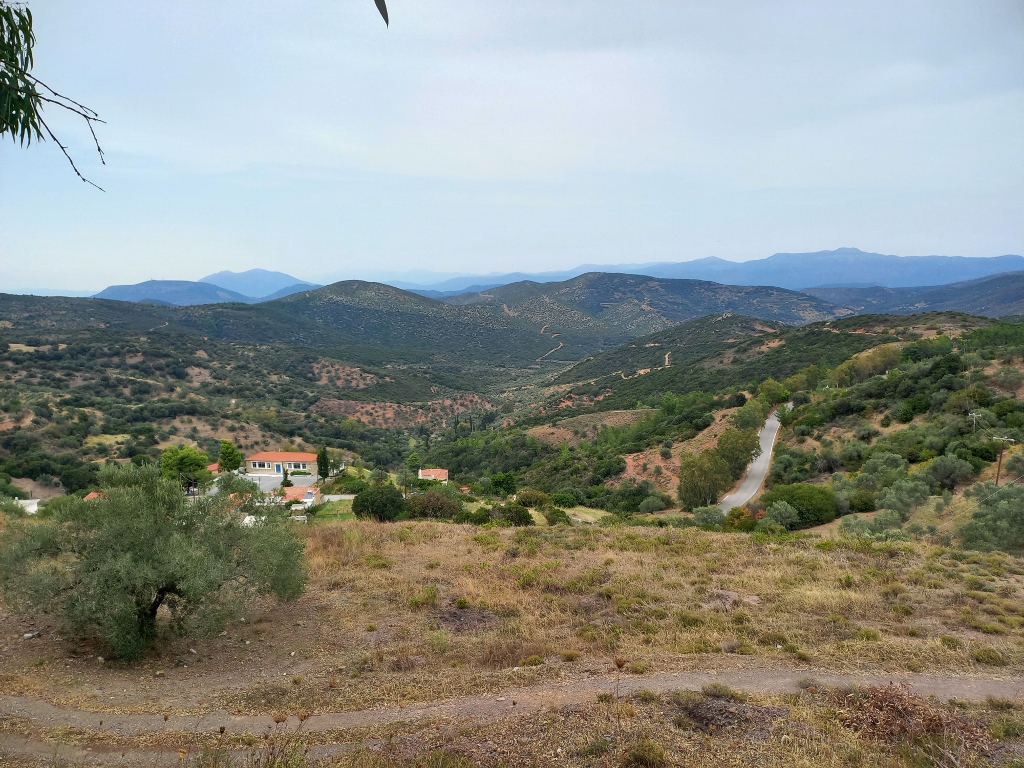 Mountain landscapes in the southeast of the Peloponnese
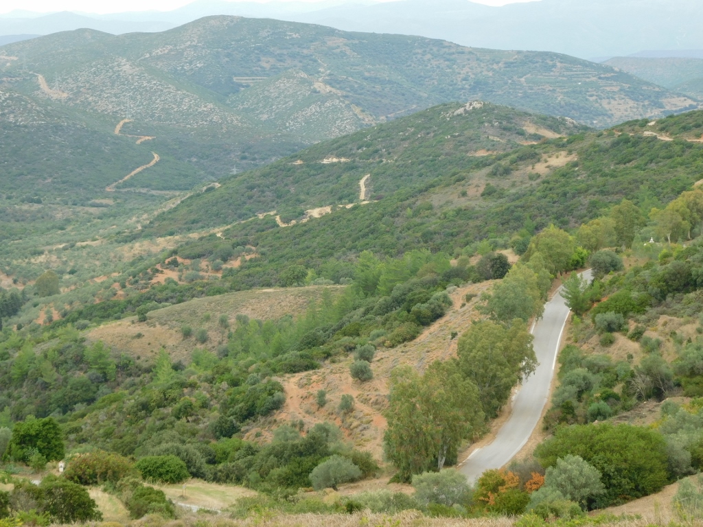 Mountain landscapes in the southeast of the Peloponnese
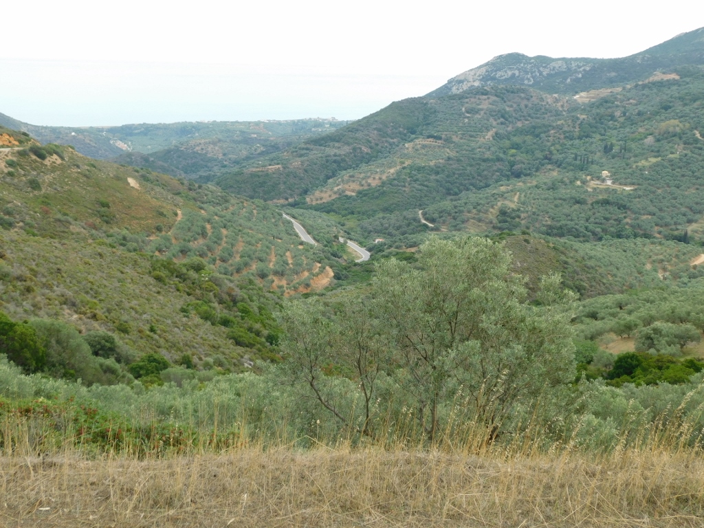 Mountain landscapes in the southeast of the Peloponnese
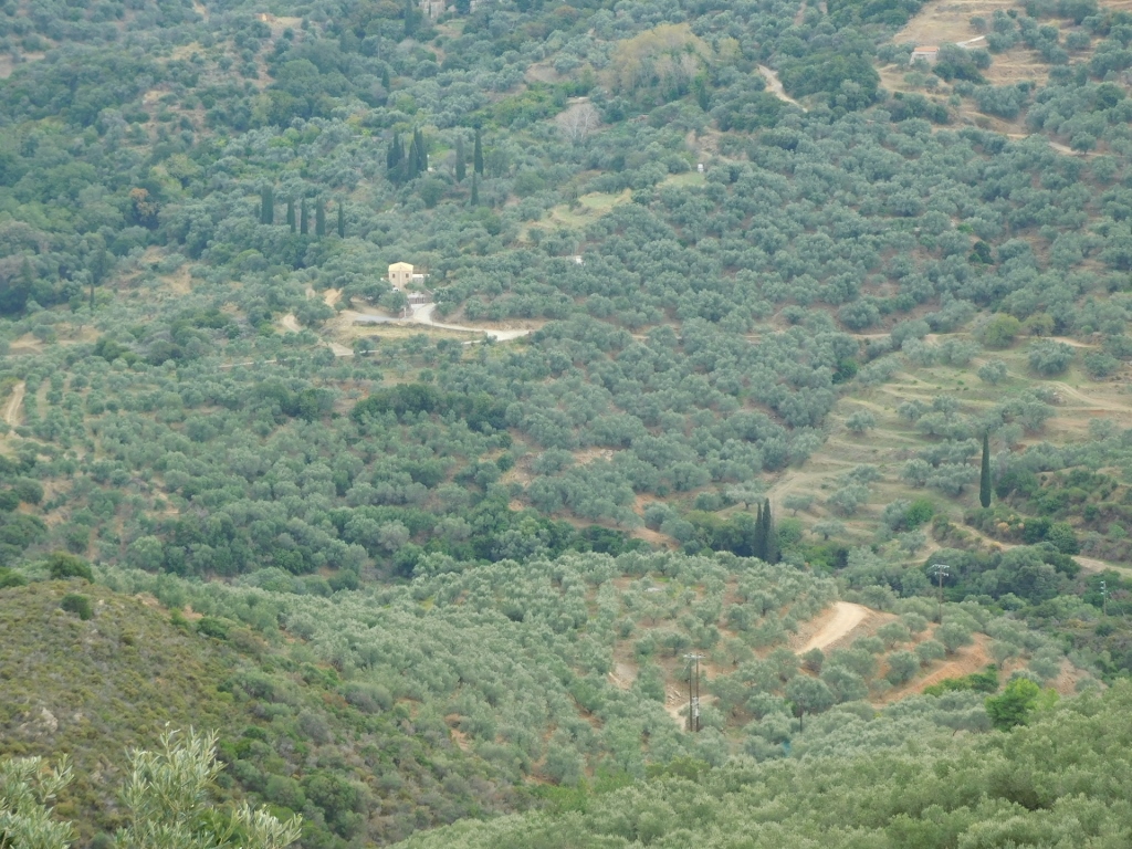 Mountain landscapes in the southeast of the Peloponnese
I stopped briefly as I approached Monemvasia because I saw a large white sailing ship docked there. As I later realised, it was a modern cruise ship designed to look like a sailing vessel. It looked very beautiful and only enhanced the view of Monemvasia even more.
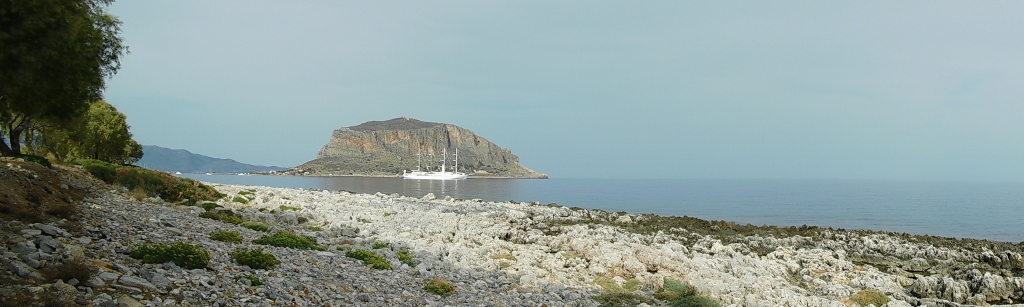 Picture perfect Monemvasia
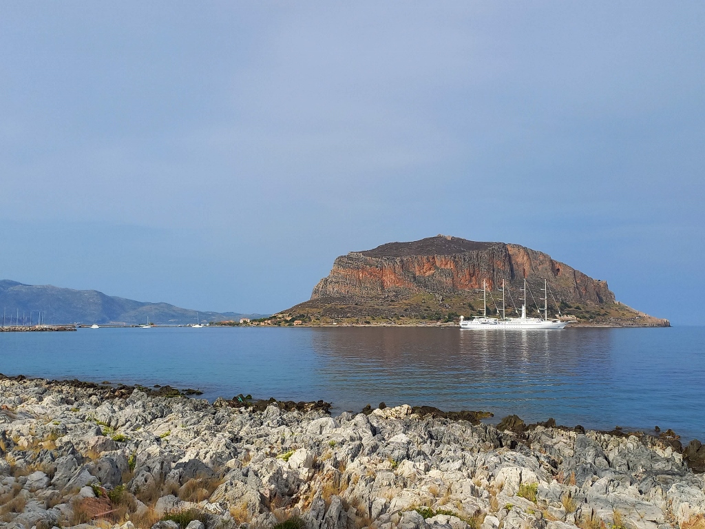 Picture perfect Monemvasia
From here, I also had a great view of the western walls of the town of Monemvasia.
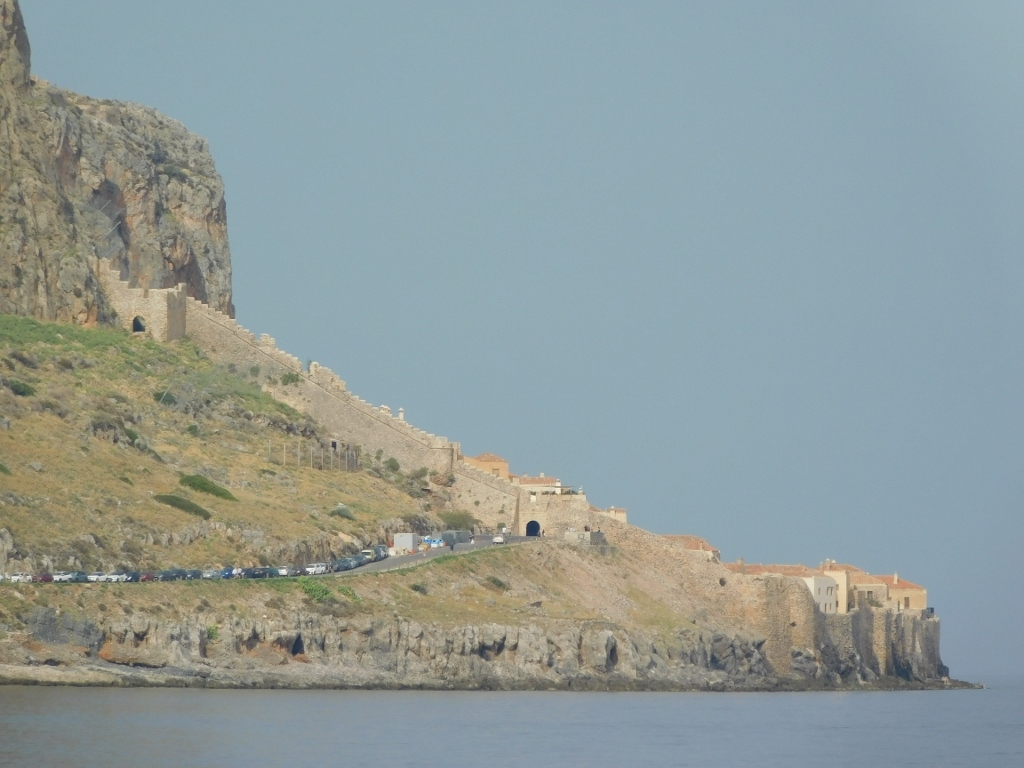 Picture perfect Monemvasia
Together with me, a great cormorant (Phalacrocorax carbo) was also admiring the view.
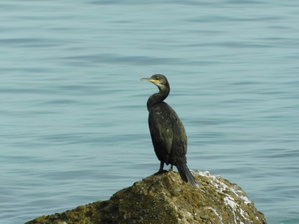 Great cormorant
Upon returning, I parked the car and immediately went for a refreshment. Once again, it was a nice local beer.
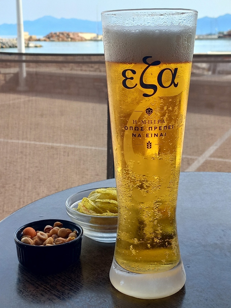 Local beer in Gefira
Then I took a short walk and finally went to my room to take a shower.
While sitting on the balcony, letting my hair dry, the day was drawing to a close, while I enjoyed reading a very interesting and beautifully written book.
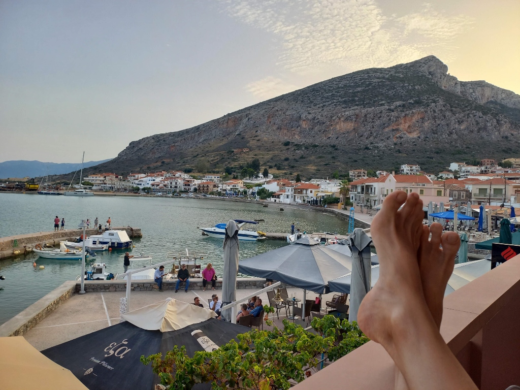 Leisure time in Gefira
When it became too dark, I moved back to my room, where I spent some time planning the next days, visits and activities.
Although I had a lot of sightseeing planned, since I had only about 90 km to my final destination of the next day, I didn’t rush in the morning. Instead, I went down to a restaurant and had a fresh fruit cocktail. It was good.
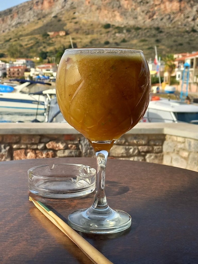 Part of the breakfast in Gefira
Of course, that wasn’t my whole breakfast (I had some pastries as well), but it was refreshing. Once I finished, I packed my things into the car, got in and drove to Sparta, the capital of the Laconia region.
Although Ancient Greece essentially represented a unified cultural area, there were city-states, known as poleis (singular: polis), in this territory. Ancient Sparta existed already during the Mycenaean era, this was the place ruled by King Menelaus, the husband of Helen of Sparta, whose abduction led to the Trojan War. King Menelaus was also the brother of King Agamemnon, who ruled in Mycenae and led the Achaeans. I’ve already written about this in: (https://svudapodji.com/en/peloponnese-2/).
However, Sparta gained its fame as a city-state that reached its peak from the 9th century to the 4th century BCE. Sparta was ruled by two kings, who were essentially military leaders, assisted in governance by a council of 28 elders. Spartan society was divided into three classes: Spartans (the warrior class) who were also landowners, the class of free people who worked as merchants, artisans and farmers, and finally the serfs, who were practically slaves.
What particularly distinguished Sparta and made it famous was its military culture – everything was subordinated to the warrior mentality and upbringing. Spartans were forbidden to engage in any work and although they were essentially slave owners, they spent most of their time in military "camps" preparing for battle and practicing athletic and military skills.
Boys began rigorous physical training as early as at the age of 7 and they even practiced stealing various items, but only on the condition that they wouldn’t get caught. When they turned 20, young men went through various initiations and trials, including receiving beatings with a whip or a stick, sometimes to the point of death, after which they were left somewhere in the field to fend for themselves.
Girls didn’t have a better treatment; it was just tailored to their gender. They also had to train rigorously, while married women were not required to be faithful to their husbands. The only important thing was to bear children.
On the other hand, Spartans did not tolerate any weakness, fear or indecision.
All of this led to Spartans being extremely disciplined, I would say even harsh, certainly raised with a strict approach to life, but they were ready to give their lives (in battle) without a moment's hesitation, which was considered the highest virtue in their culture.
This was so striking, impressive and unique – even within the context of the ancient Greek culture – that even today, after 25-30 centuries, the adjective "Spartan" is used to denote austerity, as well as the absence of comfort and luxury.
One of their most famous kings and military commanders was King Leonidas (b/r 540/489-480 BCE), who gained fame in the Battle of Thermopylae in 480 BCE, where he also perished.
So, upon arriving in Sparta, I first went to the monument dedicated to this renowned king.
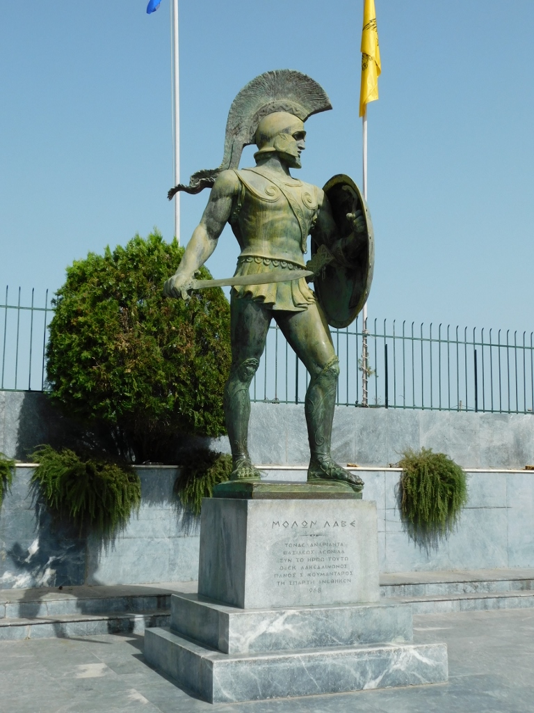 Monument to King Leonidas in modern-day Sparta
Although ancient Sparta was already in a state of decline, in the 4th century BCE it lost a battle that is considered the end of this city-state. However, the area was later inhabited by the Romans and then the Byzantines. Over time, a significant city called Mystras began to develop near the ancient polis, while old Sparta continued to gradually fade away. The modern city of Sparta has nothing to do with its ancient predecessor, but the Archaeological Site of Sparta is located there, which I wanted to visit and see.
Today, what can be seen at this site are the ruins of the Agora (the public city space) and the Acropolis (the citadel), where the main activities of life in Sparta took place from the 8th century BCE until the Roman and Byzantine periods. Although Sparta and Athens were in direct conflict from 431 to 404 BCE during the Peloponnesian War, where Sparta even emerged victorious, there are no archaeological remains here that survived the later conquests and outright thefts, unlike in Athens.
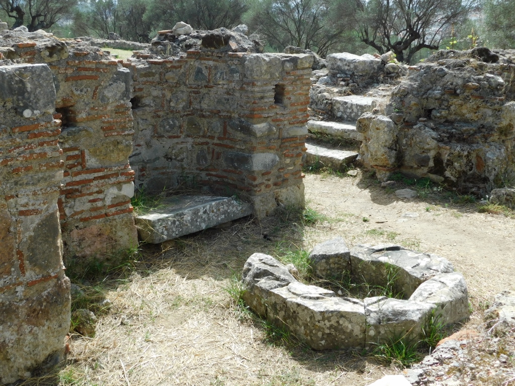
When entering the site in Sparta today, you first encounter the remains of a Roman stoa from the first half of the 2nd century CE, followed by the so-called "Round Building," which was constructed around a natural earth mound, as well as modest remains of a Byzantine church from the 10th century CE.
 Archaeological Site of Sparta, a detail
 Archaeological Site of Sparta, a detail
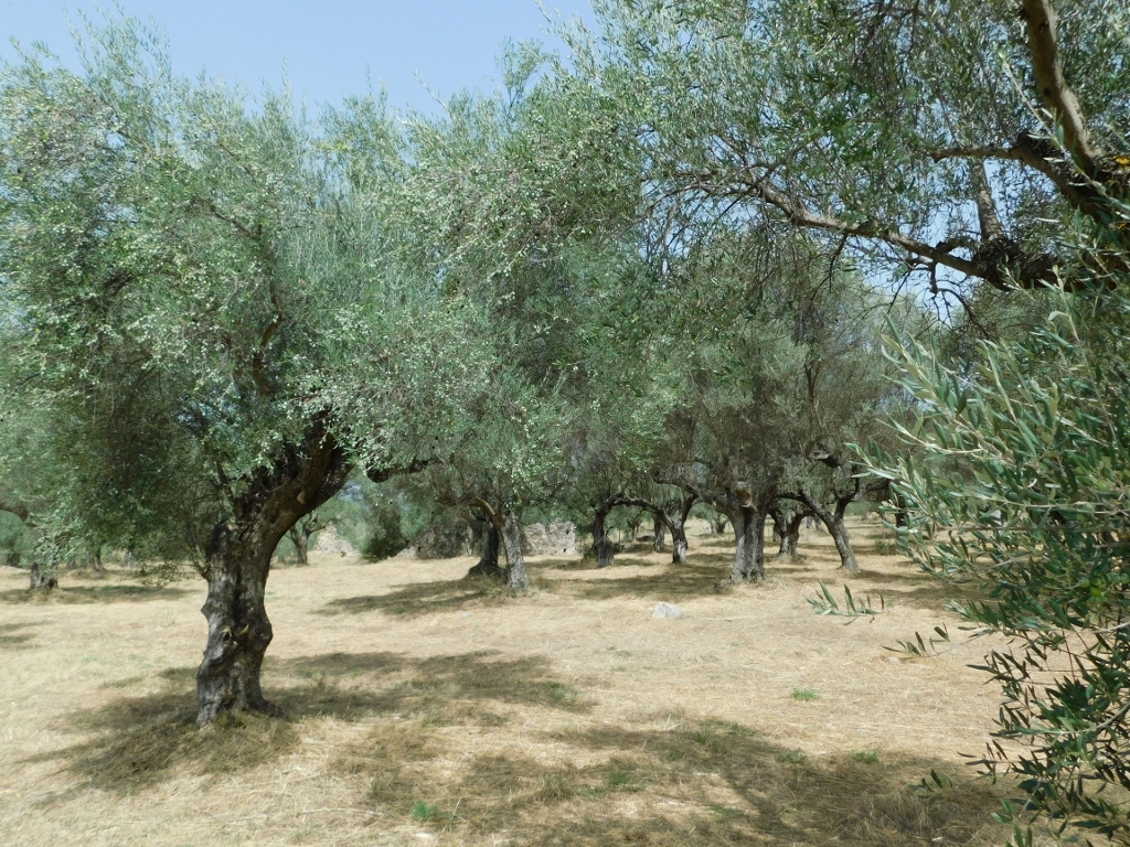
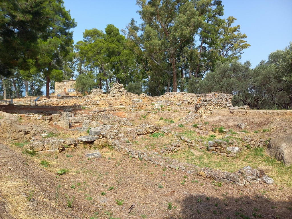
Then I took a walk to the structure known as the Agora. The situation there wasn’t much better either and for untrained people, like me, it takes a lot of imagination to envision the former buildings that once stood here.
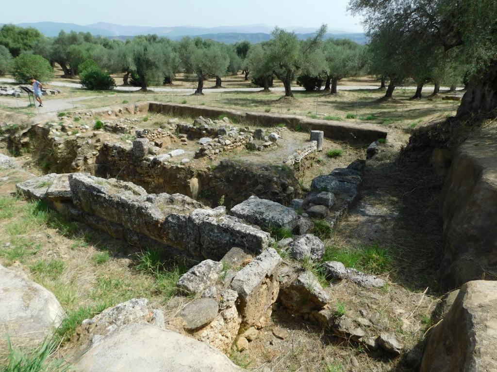 Archaeological Site of Sparta, a detail
According to researchers, this structure was built in the 4th or 3rd century BCE.
 Archaeological Site of Sparta, a detail
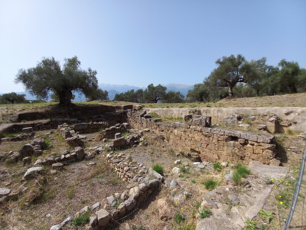
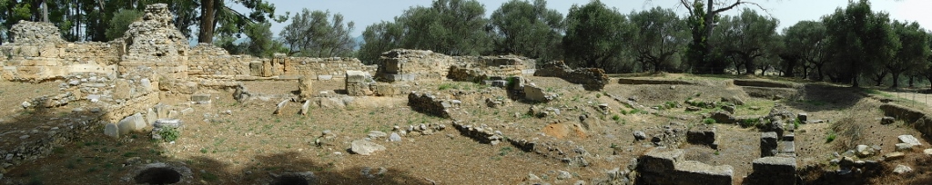
Today, amidst the remains of these ancient structures and shapeless ruins, there are olive trees that have clearly been intentionally planted here.
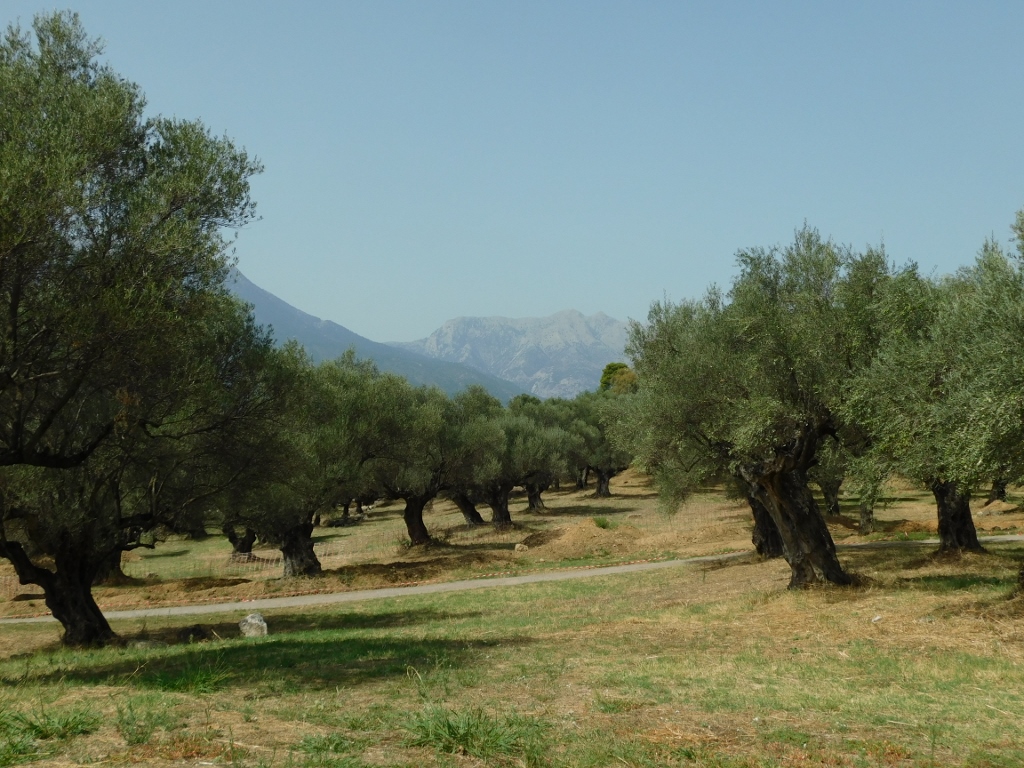 Archaeological Site of Sparta, a detail
 Archaeological Site of Sparta, a detail
As I walked along the paths between the olive trees, I reached the remains of the Byzantine Basilica of St. Nikon, which is located within the ancient Acropolis of Sparta.
 Archaeological Site of Sparta, a detail
It is presumed that the church was built in the second half of the 6th century or the early 7th century CE.
 Archaeological Site of Sparta, a detail
 Archaeological Site of Sparta, a detail
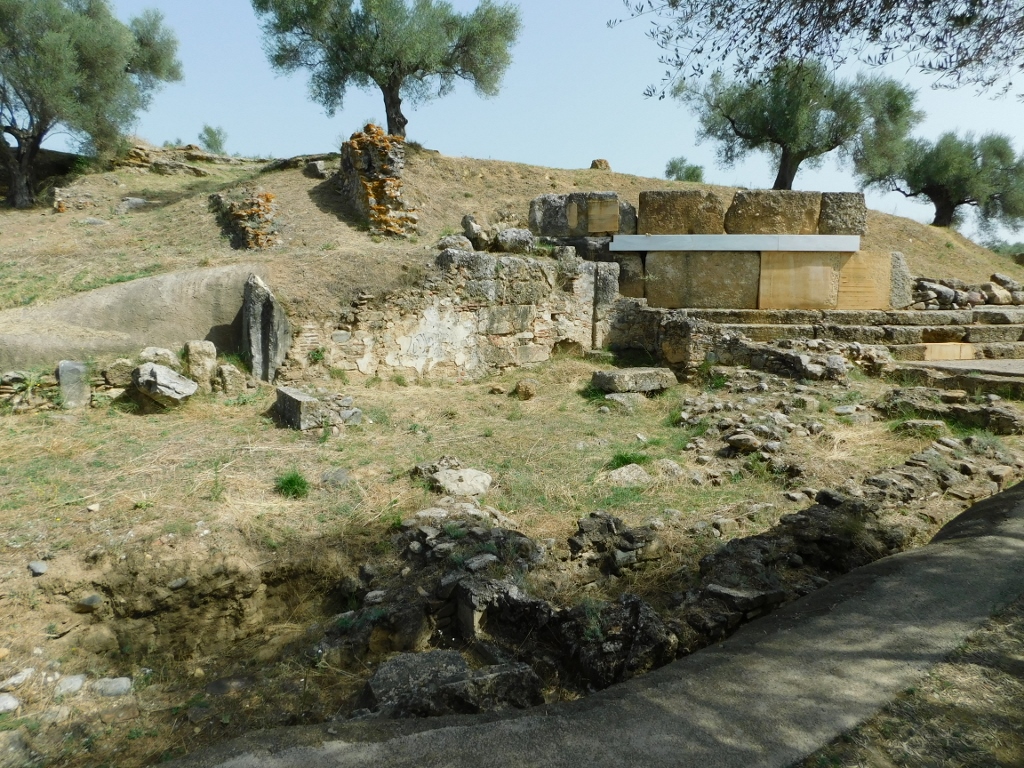
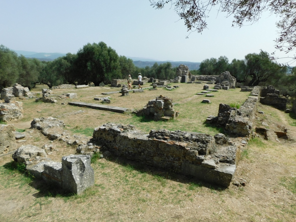
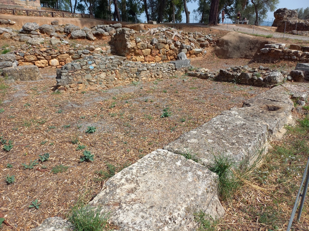
After the basilica, the path leads past the remains of the "Two-niched Building." This is quite a large structure (31 x 14.5 m). It is believed that the building was constructed in the 4th century CE and that it remained in use until the end of the Byzantine period.
 Archaeological Site of Sparta, a detail
 Archaeological Site of Sparta, a detail
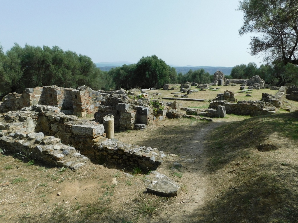
Not far from it there are also remains of the Archaic Stoa, 11 x 3.50 m.
 Archaeological Site of Sparta, a detail
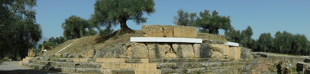
Right next to this stoa there are also the very modest remains of the Sanctuary of Athena Chalkioikos. This is the oldest and most important sanctuary in Sparta dedicated to the city's patron goddess. Research has shown that the sanctuary functioned since the Mycenaean era, but the cult of goddess Athena began to develop on the Spartan Acropolis in the 8th century BCE. The cult reached its peak in the 5th century BCE, followed by a gradual decline, leading to the abandonment of the sanctuary in the 4th century CE.
The temple was the centre of public and military life in the city, where older soldiers would gather, while young men had to undergo endurance tests right here.
 Archaeological Site of Sparta, a detail
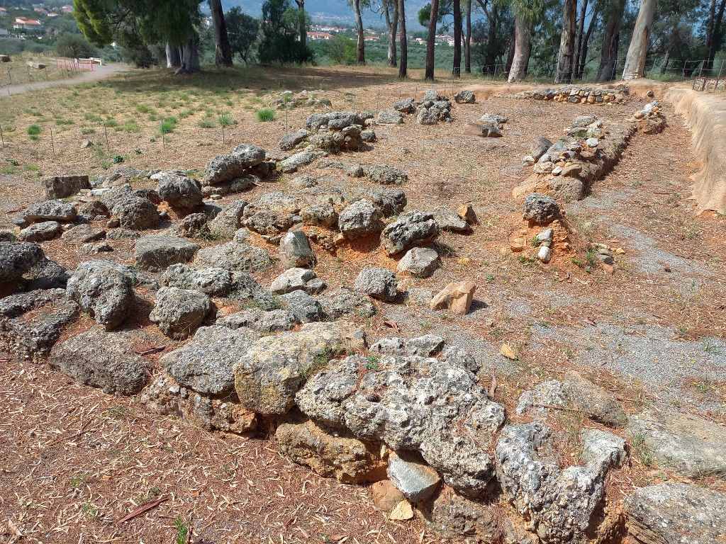
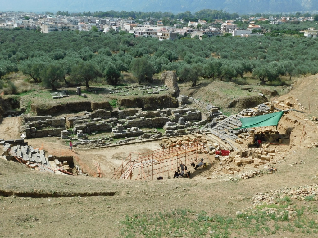
Across from the previously mentioned structures, on the slope leading towards modern Sparta, there are perhaps the most picturesque remains: the Ancient Theatre of Sparta.
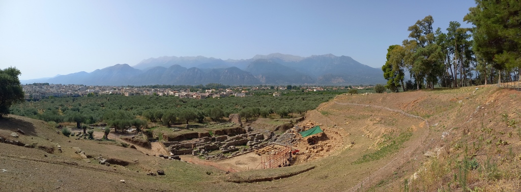 Archaeological Site of Sparta, a detail
Although a theatre existed in Sparta as early as the 5th century BCE, the remains visible today were built in the late Hellenistic or the early Roman period, around 30-20 BCE. It could once accommodate 17,000 spectators, while local white marble was used in its construction. The theatre was, of course, intensively used during Roman times until the early 4th century CE. After that, the structure was abandoned and when Byzantium ruled the area, houses were built on the site of the theatre, utilising the marble from the theatre itself. Unfortunately, the marble was also looted for the construction of modern-day Sparta, which was founded in 1834.
 Archaeological Site of Sparta, a detail
Here, I finished my tour of the ancient remains of Sparta and my plan was first to head to the centre of modern Sparta and later to my final destination for the day, which was the village of Mystras, near the significant Archaeological Site of Mystras.
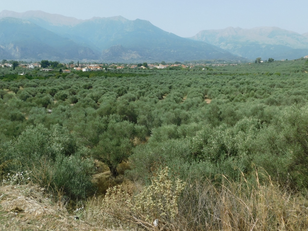
For now, I stood on the hillside where the Spartan Acropolis once was, looking out over the lush olive groves, where the ruins of the fortified town of Mystras could be clearly seen in the distance.
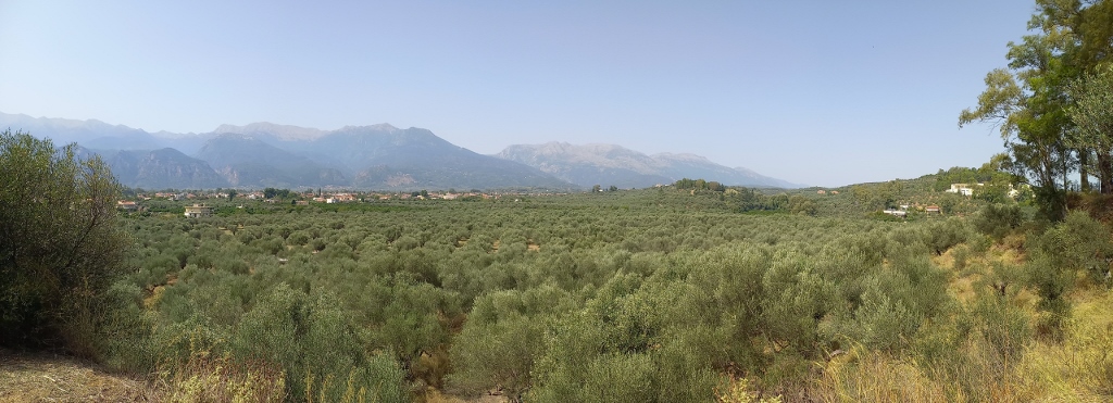 View in the direction of Mystras
 View in the direction of Mystras
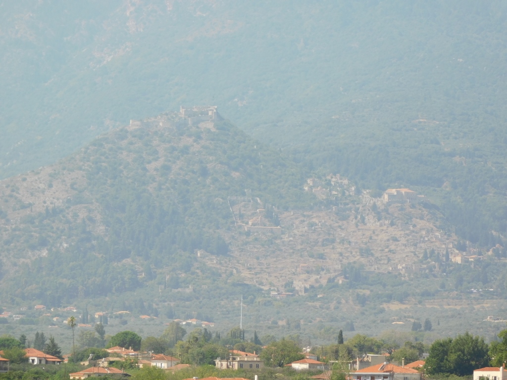 Archaeological Site of Mystras on a hill above the namesake village