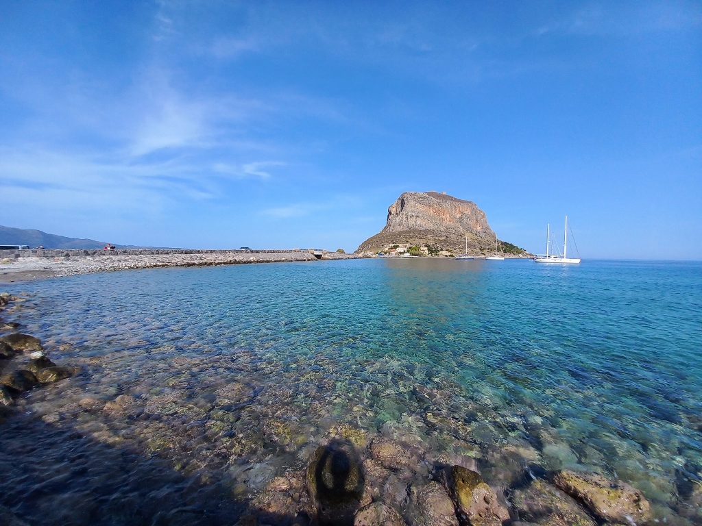
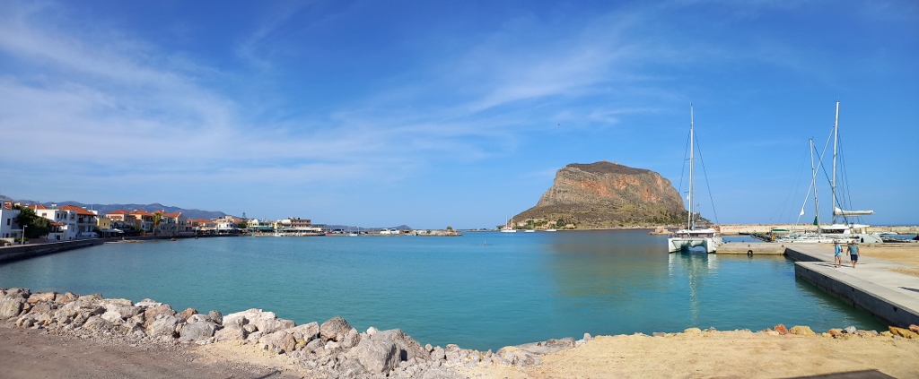
On the eastern coast of the Peloponnese, which stretches along the Myrtoan Sea, there is a small island about 1 km long and 300 m wide, in the middle of which rises a huge rock with a peak that stands about 300 m above sea level. The island is only about 200 m from the mainland but is connected to it by a narrow causeway. On the island, there is an ancient picturesque village called Monemvasia, while directly across on the mainland is the town of Gefira, where I had booked a hotel room for two nights.
I couldn’t find anywhere what the island itself is called, as Monemvasia is clearly used as the name of the settlement. However, to simplify my story, I will also refer to the island by that name.
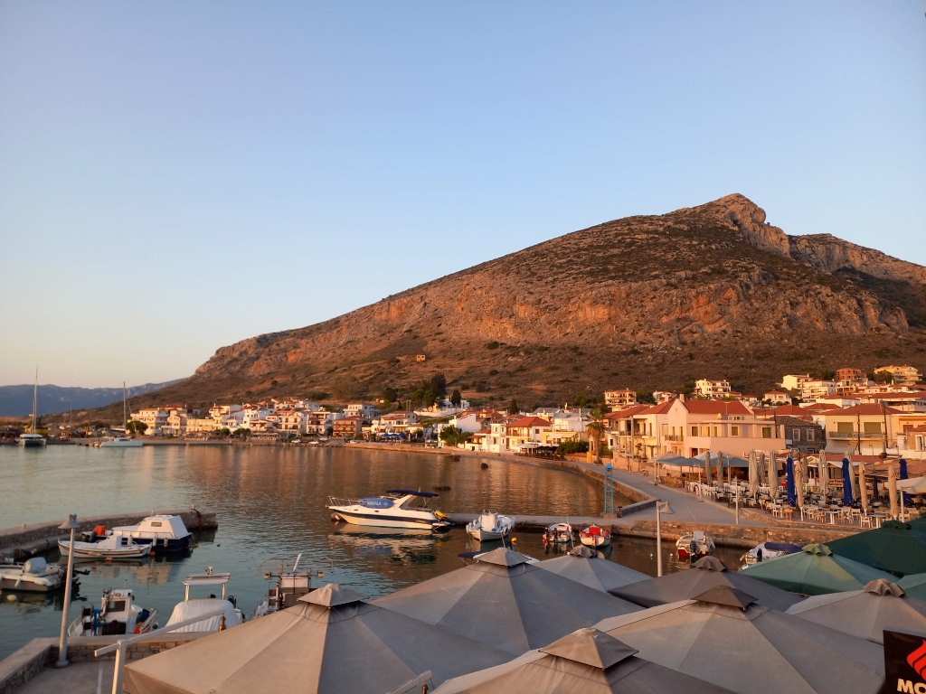
When I arrived in Gefira on the first day and left my things in the room, I immediately went outside with the intention of taking a walk to Monemvasia. But first, I needed to deal with my dehydration, which was still troubling my body to some extent. So, I first strolled along the coast south of the causeway, where the harbour is located, admiring the beauty of the area, and then I sat down there and had a local beer.
 View at Monemvasia
 View at Monemvasia
Since Sparta is located just about 90 km northwest of where I was at the moment, the choice of beer was quite fitting.
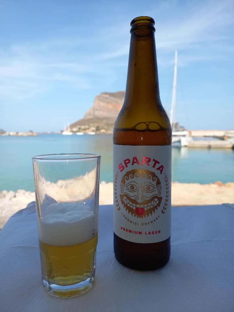 Sparta beer in Gefira
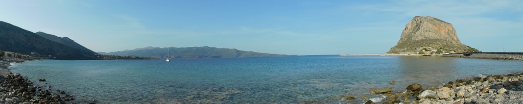
Then I went to the part of the coast north of the causeway where the beach is located and from there I took the paved road leading to Monemvasia.
 View at Monemvasia
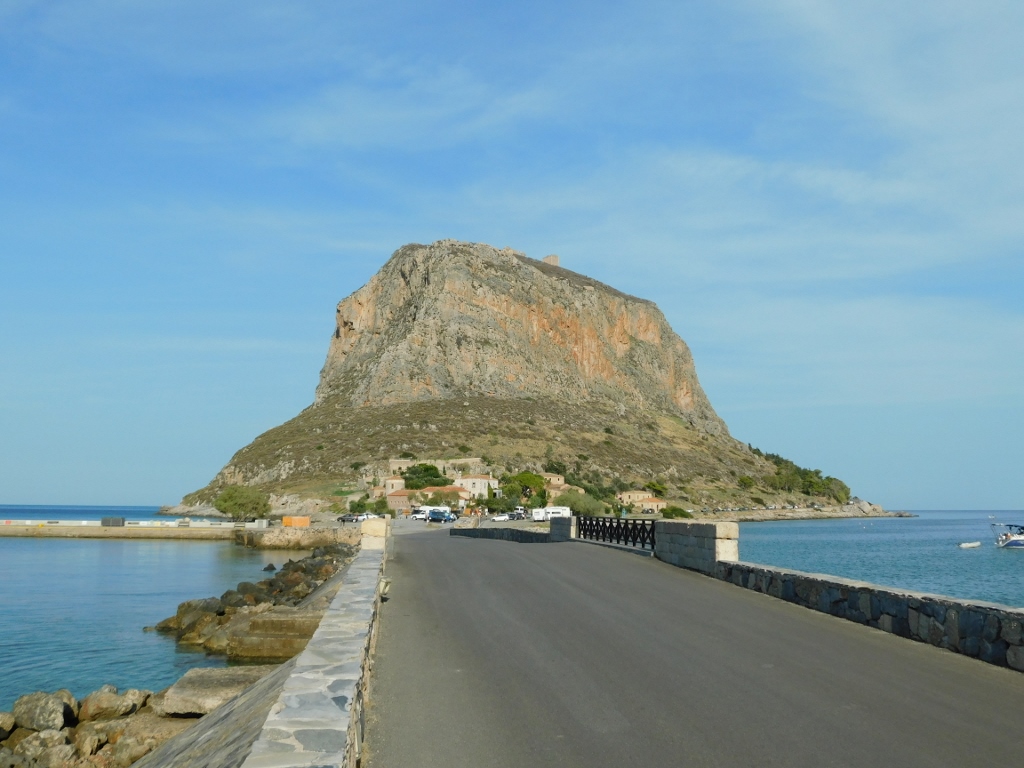 Causeway and Monemvasia
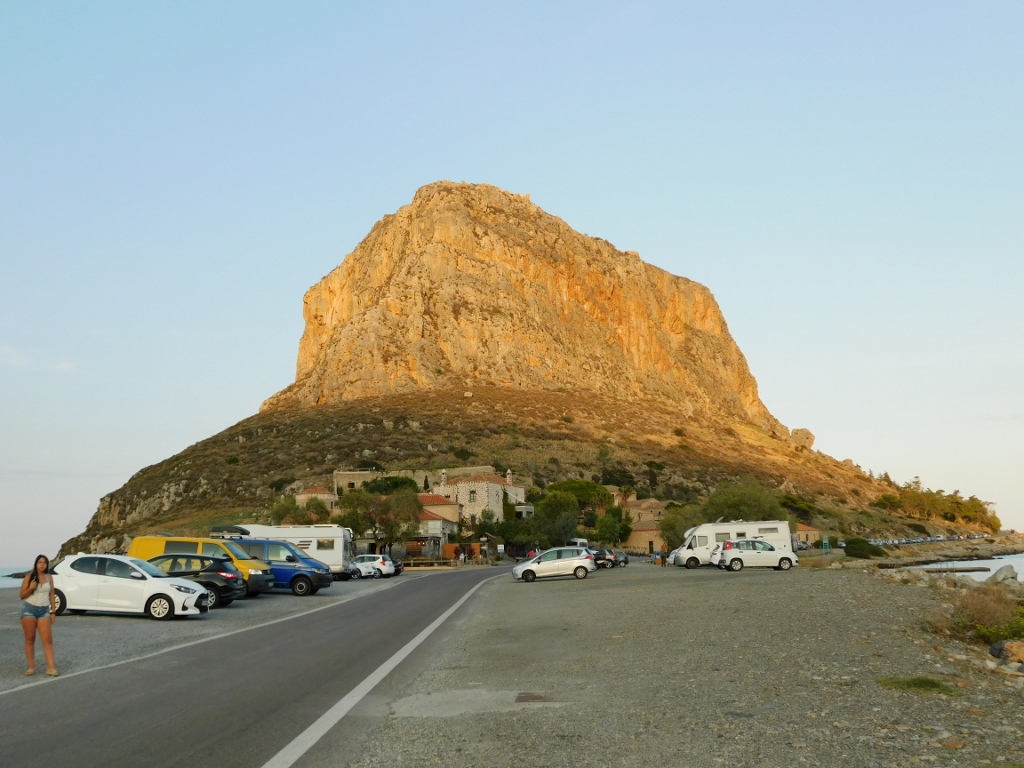
You can also reach Monemvasia by car, but finding an available parking spot, especially closer to the entrance of the settlement, can be a big problem. In any case, I preferred to walk because it allowed me to observe my surroundings better.
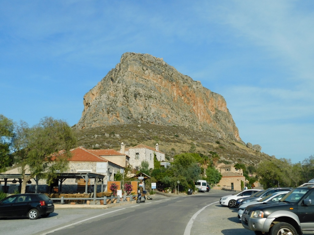 Monemvasia Islet
At one spot, a small plateau has been created near a rock where you can go swimming. I believe it’s a lovely experience, but this time I was a walker, not a swimmer.
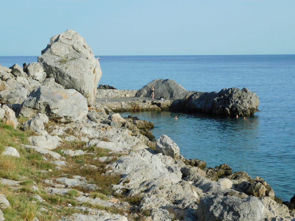 Monemvasia Islet, a detail
And so I soon arrived at the walls that surround the settlement, where the main entrance is located.
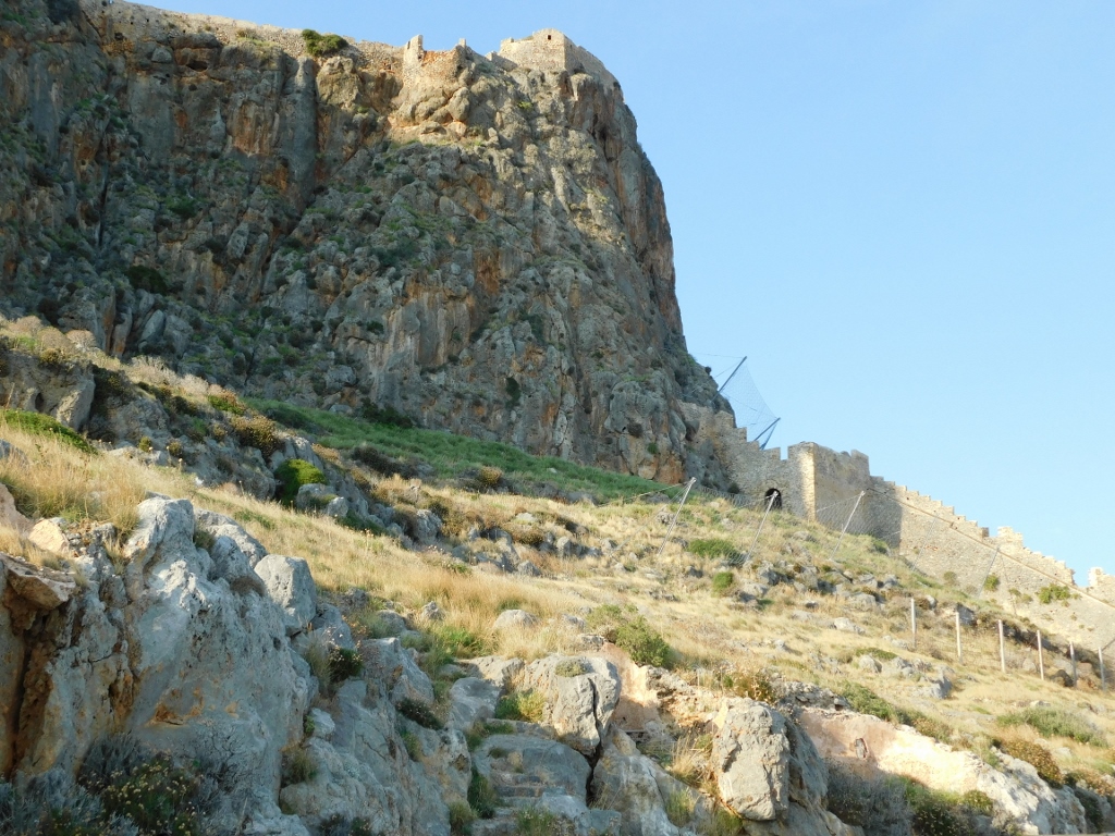 Walls of Monemvasia can be seen on the slope to the right
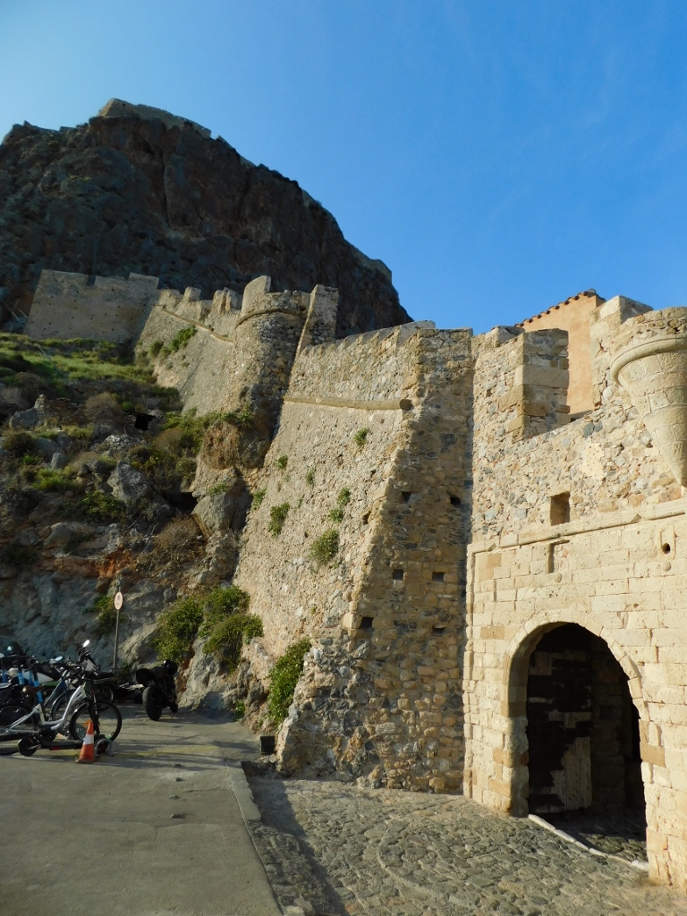 Walls of Monemvasia
The settlement of Monemvasia was founded in the 6th century CE during the reign of the Byzantine Emperor Justinian and over the centuries to follow it managed to maintain its status as an important commercial and cultural centre due to its strategic position along maritime routes. Over time, it was briefly ruled by the Franks, while after the fall of the Byzantine Empire in 1453, Monemvasia changed hands among various rulers like a ping-pong ball, until it came under Venetian control at the end of 1463. However, with the Ottomans ruling much of the region, it was only a matter of time before Monemvasia fell into their hands, which happened in 1540.
This was not the end of its story and it’s almost incredible how many great powers fought over this small island. Naturally, its strategic position was the reason for this, so the Venetians returned in 1690, only for the Ottomans to regain control in 1715. This situation continued until 1821 and the Greek War of Independence.
Monemvasia consists of an upper town, which sits on the flat top of the rock, and a lower town accessible by the modern paved road. The upper town, uninhabited since the second Venetian rule, still shows the remains of the citadel and various structures, including houses and public buildings, with the Church of Holy Wisdom or Agia Sofia being particularly significant. I should mention right away that I didn’t climb up there.
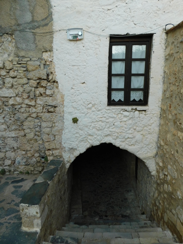
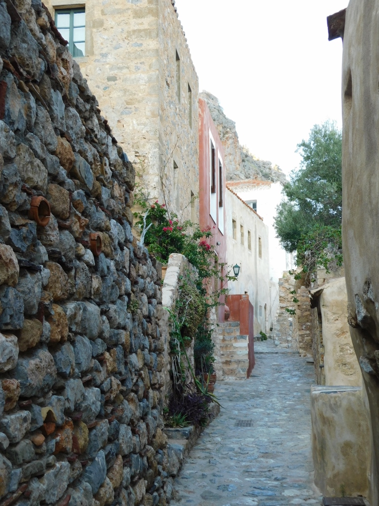
Instead, I decided to take a nice and detailed walk through the lower town, that is, the settlement of Monemvasia. Once you pass through the gate in the western city walls, it almost feels like stepping into a time machine.
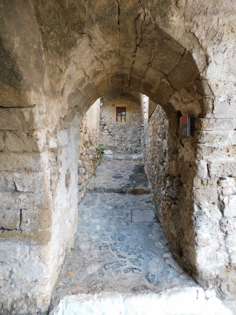 Monemvasia, a detail
 Monemvasia, a detail
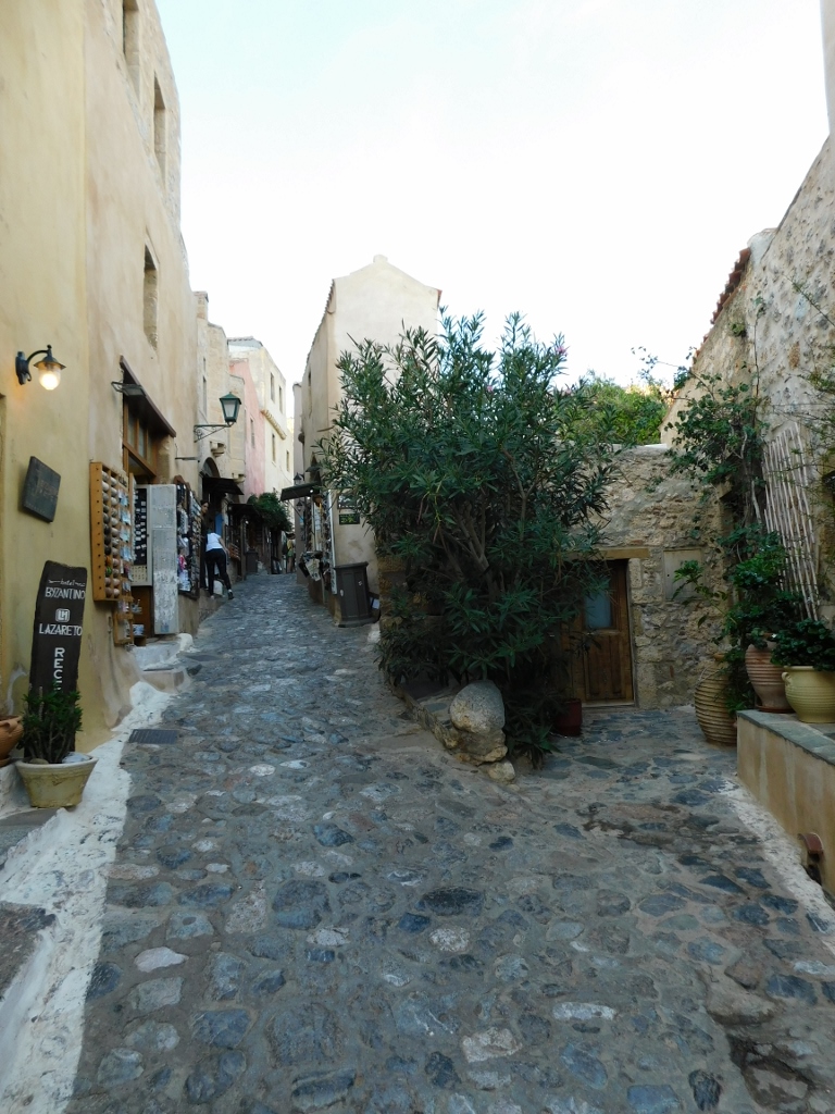
However, it doesn’t take long to encounter shops, cafés and restaurants, making it clear that this is a popular tourist destination of the 21st century.
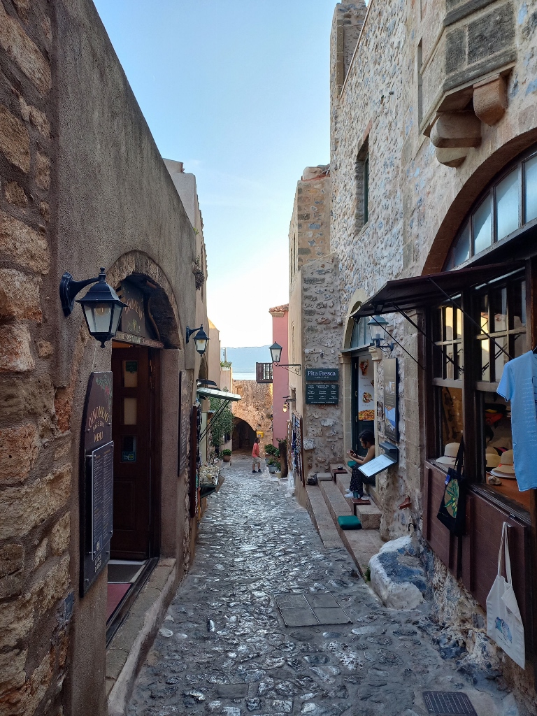 Monemvasia, a detail
 Monemvasia, a detail
 Monemvasia, a detail
 Monemvasia, a detail
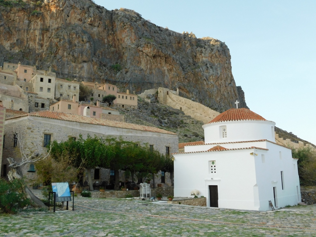
I wasn’t particularly interested in that, except for occasionally taking some photos. I just walked straight down the main street until I reached the Central Square, where several interesting buildings can be found.
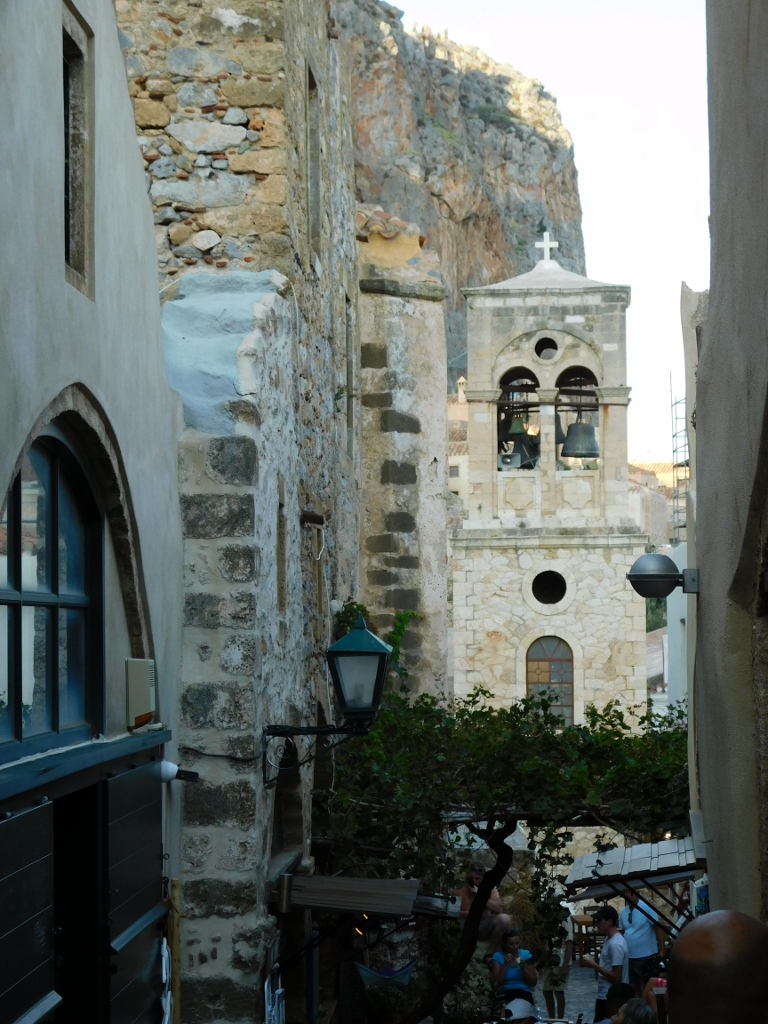
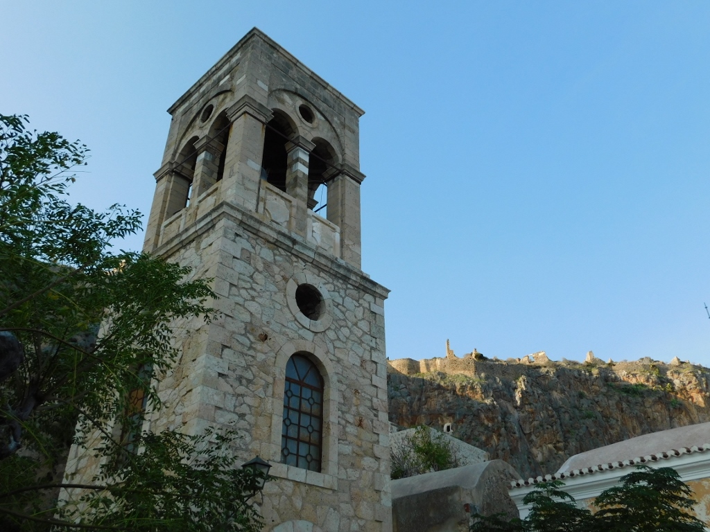
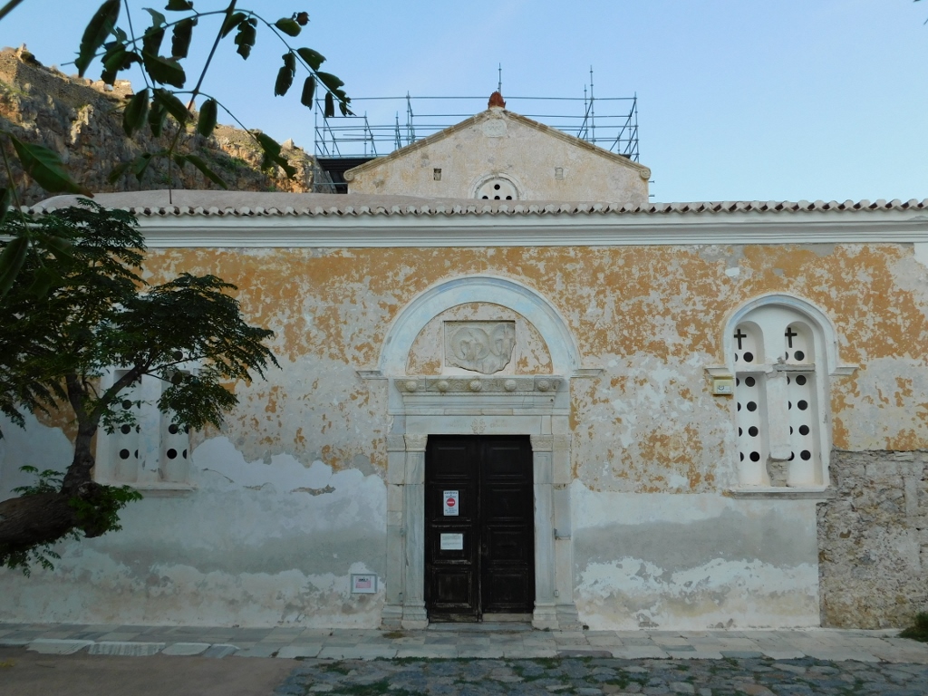
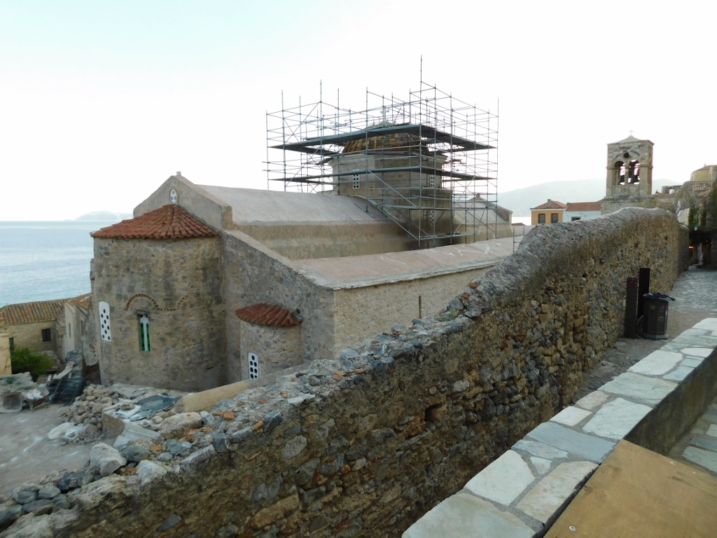
To start with, there’s a cannon from the 18th century in the square, along with one of the many underground cisterns. What stands out the most is the Church of Christ in Chains, which was built in the 6th or the 12th century (different sources provide different information) by the Byzantines and later expanded by the Venetians in the 17th century. The church also features a free-standing bell tower.
 Monemvasia, a detail
 Monemvasia, a detail
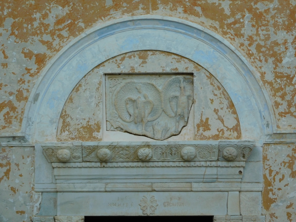
At the time of my visit, the church was closed, but there is a detail that particularly stands out on its façade and it is a relief depicting peacocks. This was once a part of a Byzantine sculpture, but was later repurposed for the decoration of the façade.
 Monemvasia, a detail
 Monemvasia, a detail
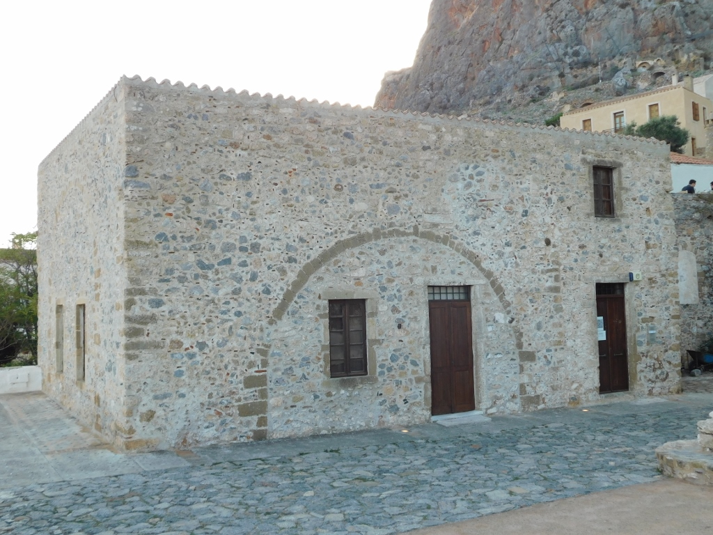
Directly across from the church is a former small church from the 10th century dedicated to St. Paul that was later converted into a mosque by the Ottomans. Today, it houses the Archaeological Collection of Monemvasia, but the museum was also closed.
 Monemvasia, a detail
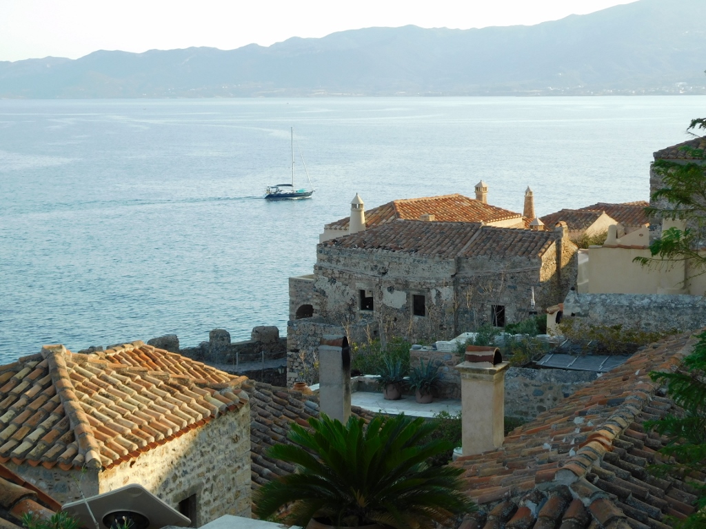
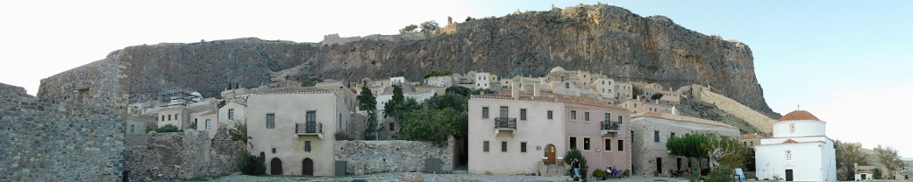
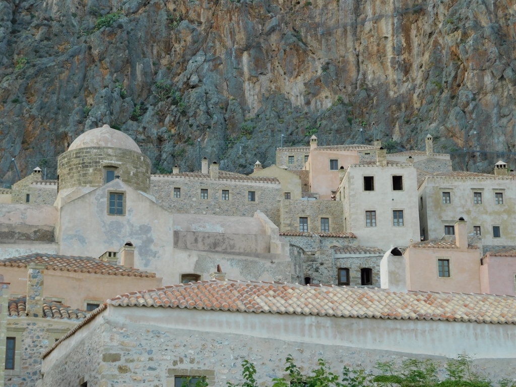
It was probably an issue that I arrived in the late afternoon, so various potentially interesting places were closed, but I didn't worry about it. Instead, I enjoyed what I could see, which at that moment included the rooftops of Monemvasia and parts of the southern city walls.
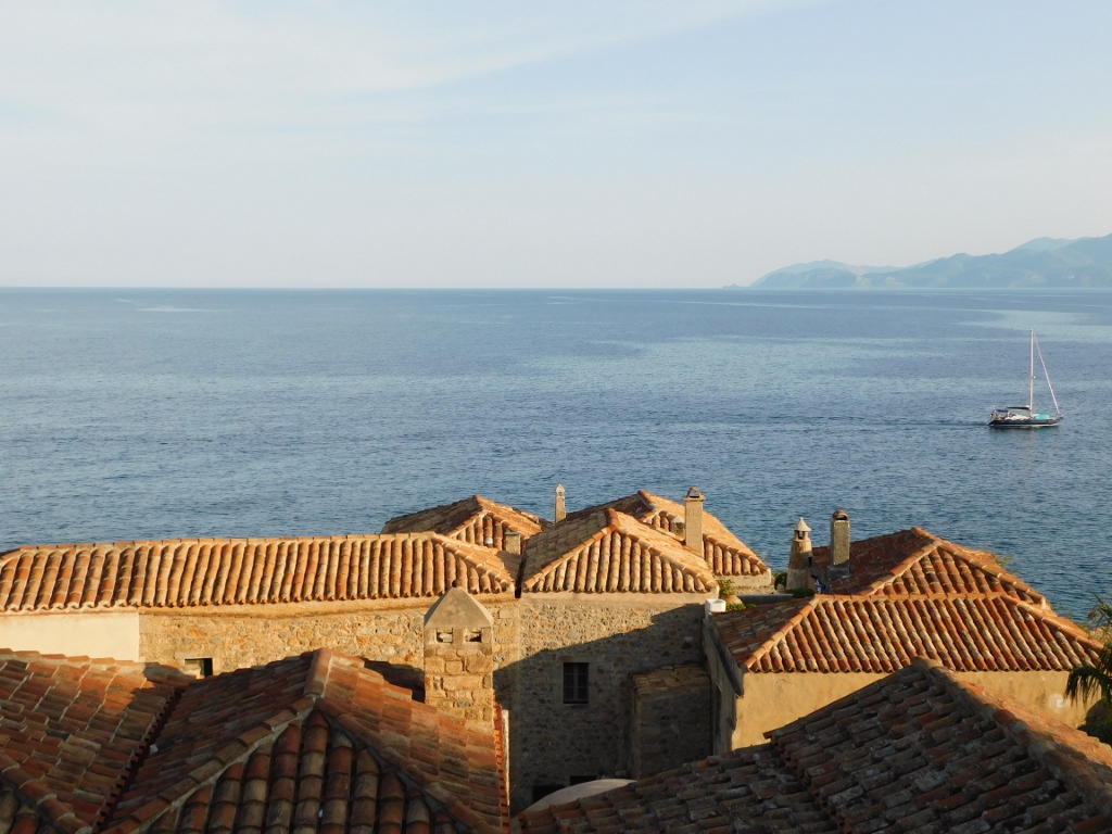 Monemvasia, view from the Central Square
 Monemvasia, view from the Central Square
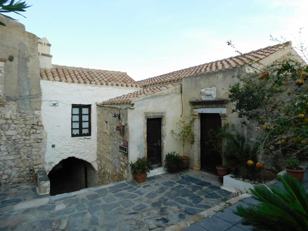
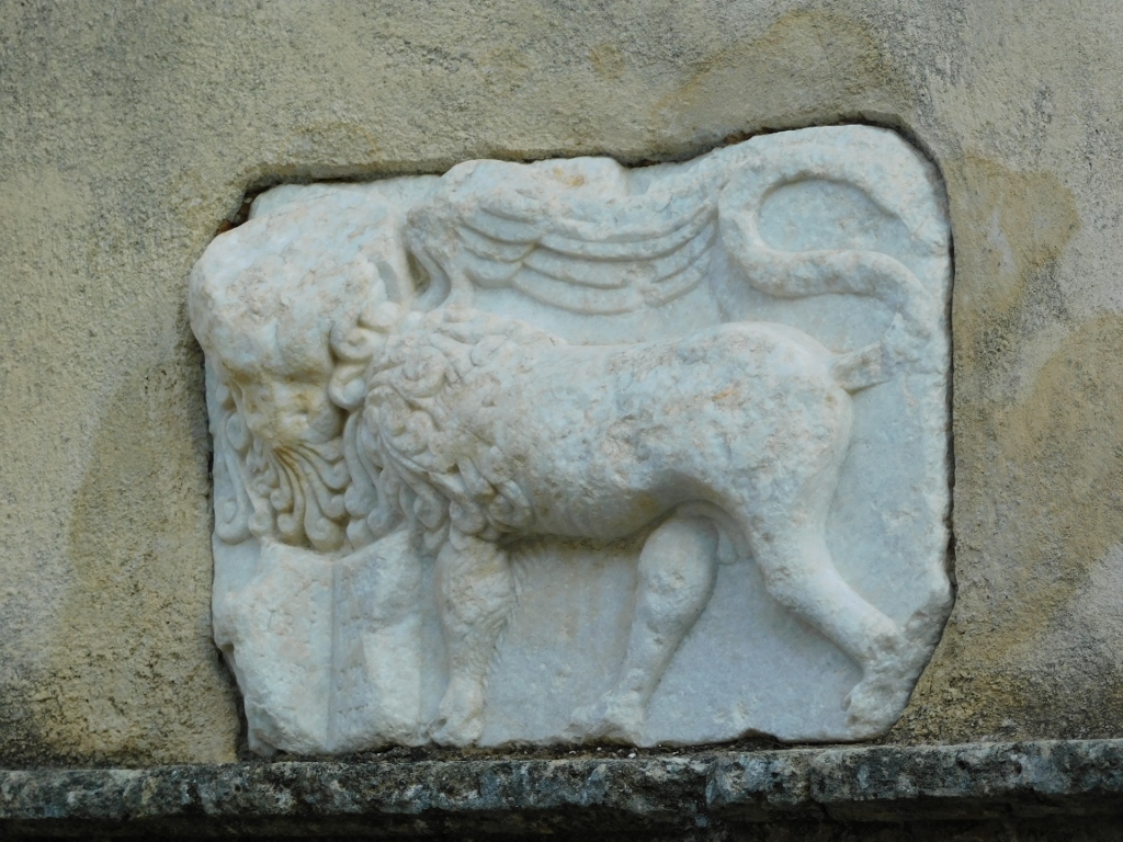
In one corner of the Central Square, you can see a house that was the residence of the Metropolitan of Monemvasia. Its most interesting feature is the marble relief above the lintel depicting the winged lion of St. Mark, a well-known symbol of Venice.
 Monemvasia, a detail
 Monemvasia, a detail
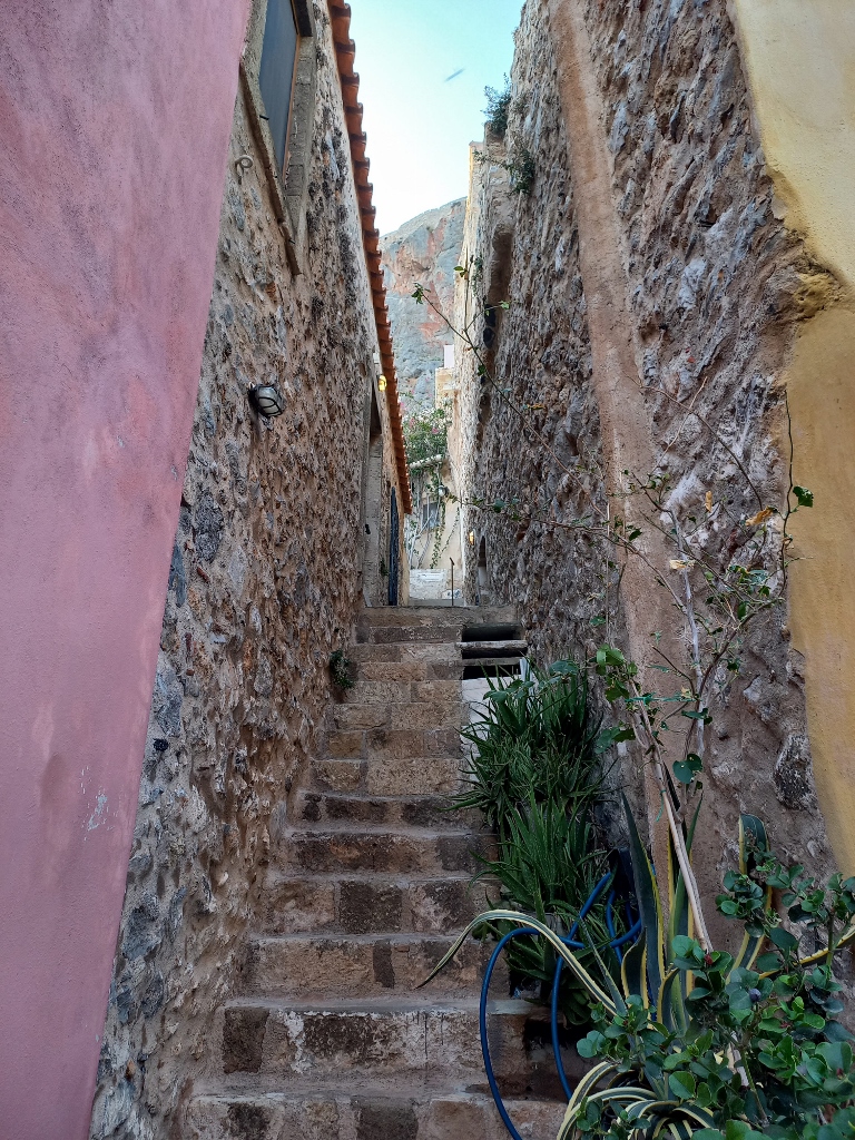
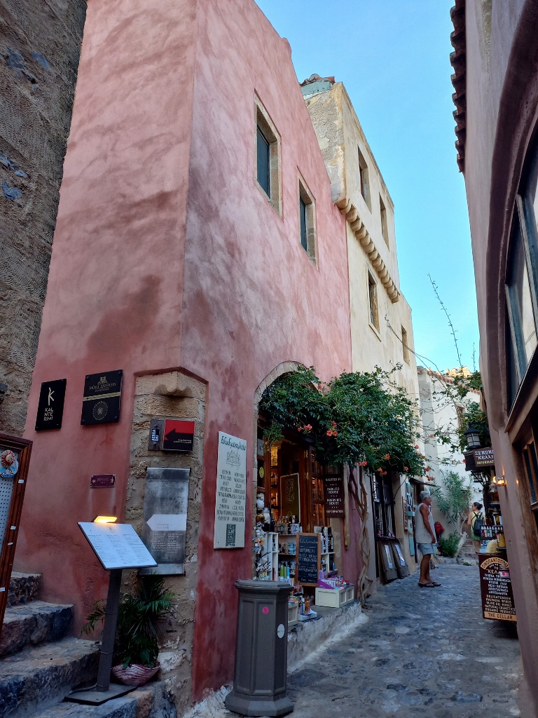
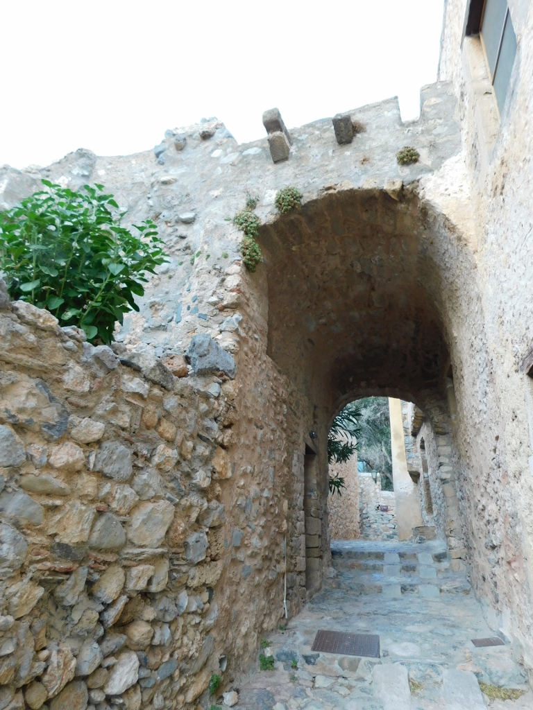
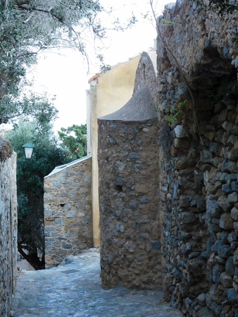
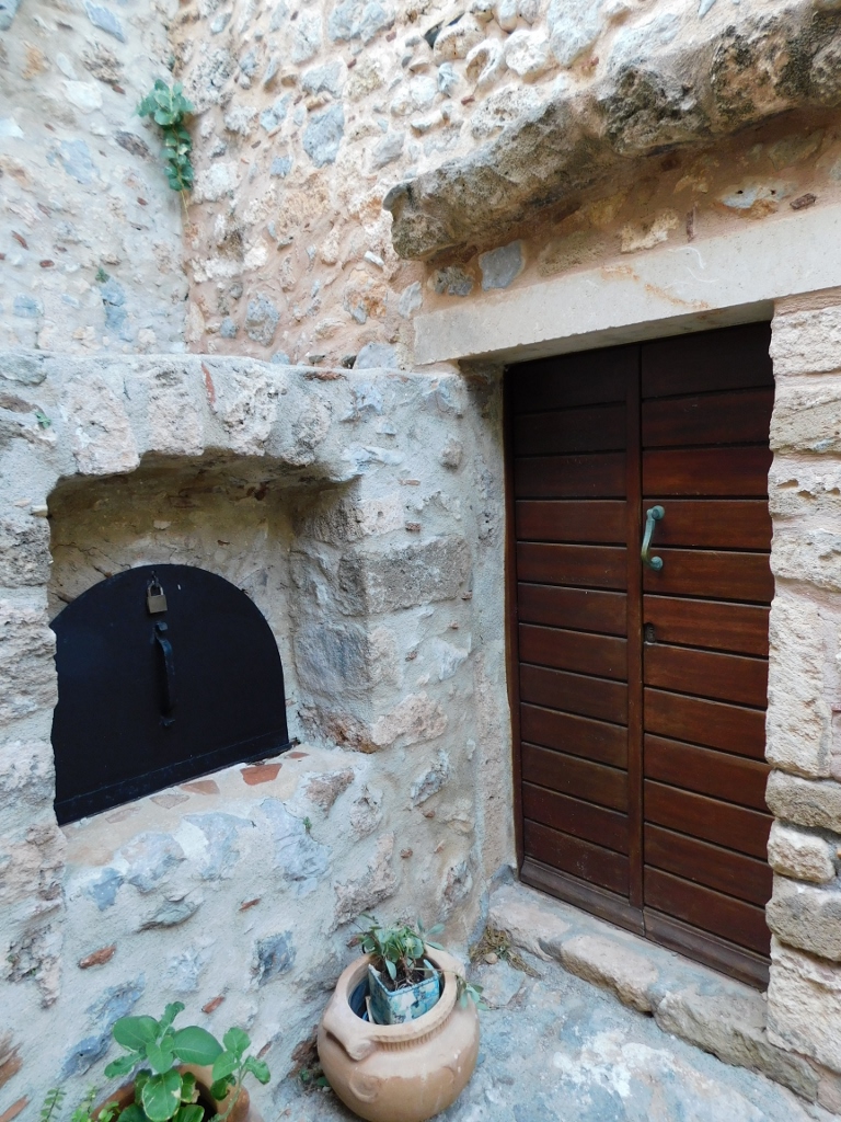
Then I continued with my stroll through the charming streets of this picturesque place, where visitors can easily “get lost.” In any case, you can’t wander too far and sooner or later you’ll find yourself at some notable spot, allowing you to reorient. In the meantime, it’s important just to enjoy the experience.
 Monemvasia, a detail
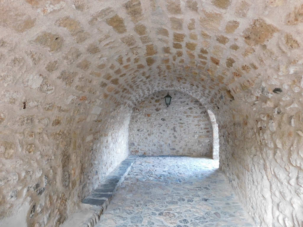 Monemvasia, a detail
 Monemvasia, a detail
 Monemvasia, a detail
 Monemvasia, a detail
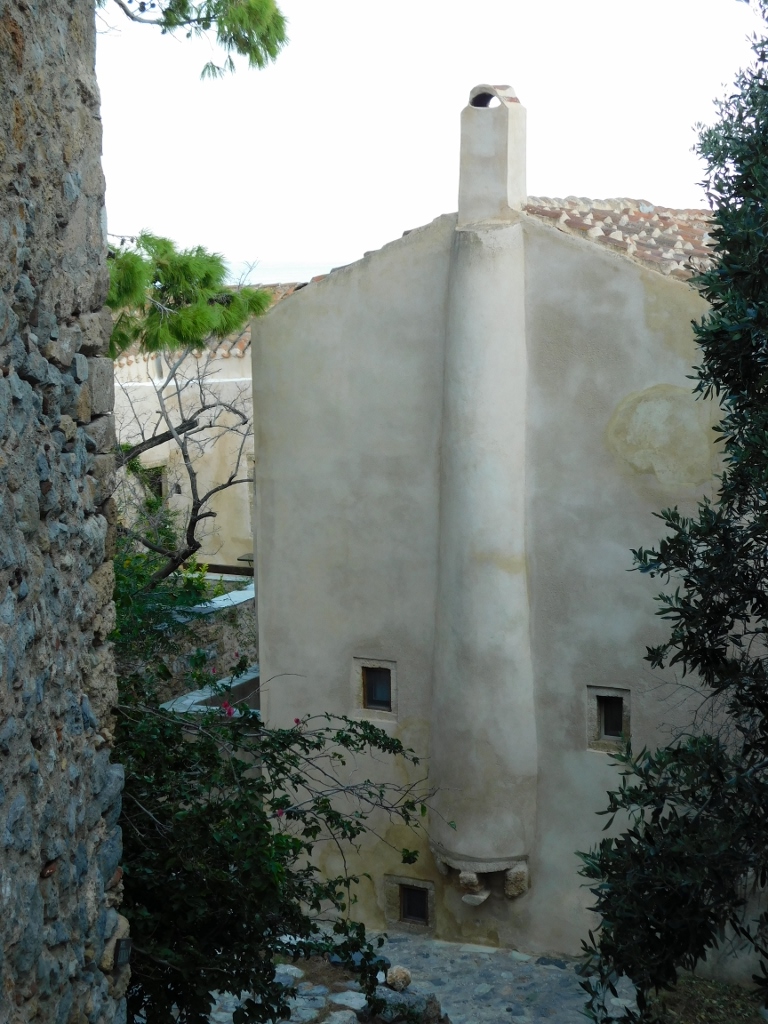 Monemvasia, a detail
 Monemvasia, a detail
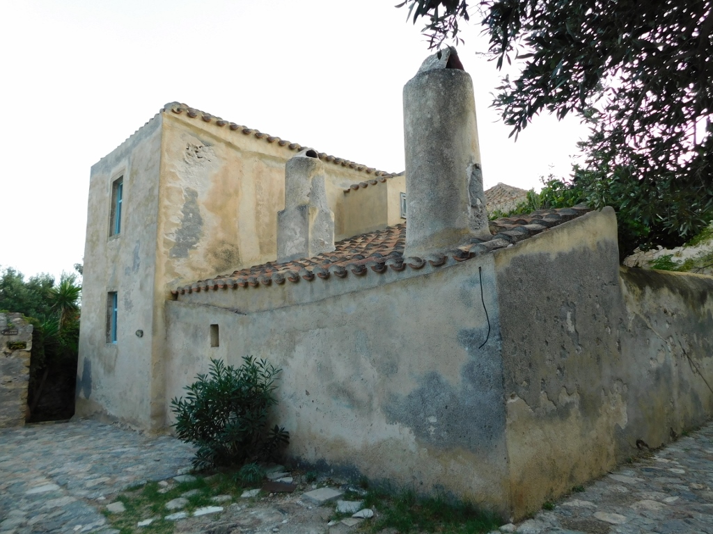
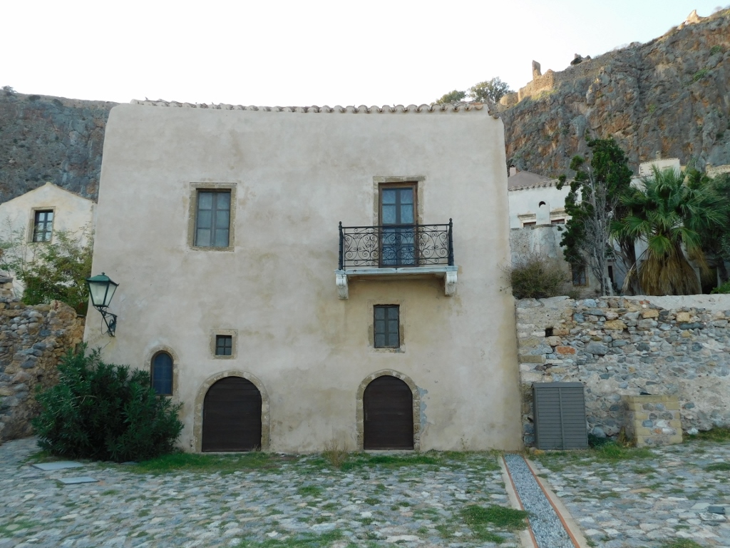
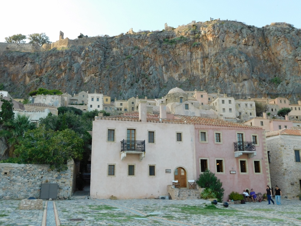
And so I came to another spacious square, one side of which directly abuts the southern wall.
 Monemvasia, a detail
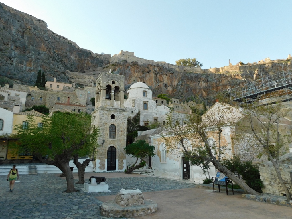
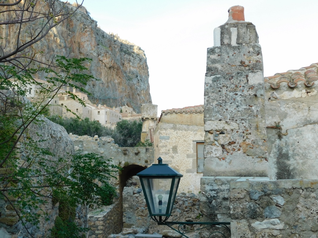
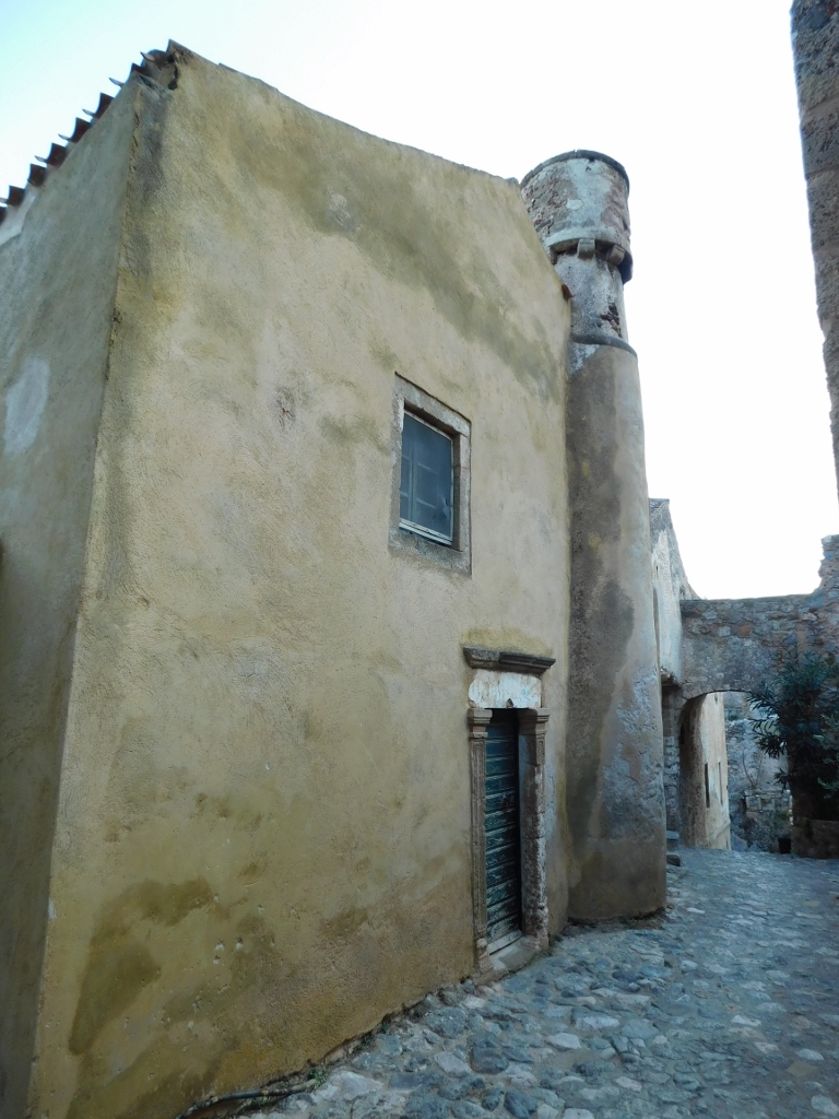
However, I found the square itself and some of the buildings visible both on the square and uphill to be much more interesting. Additionally, from here, you can see parts of the upper town, or the citadel at the top of the hill. After that climb in the heat to the Geraki Castle, I definitely wasn’t planning to climb anywhere else!
 Monemvasia, a detail
 Monemvasia, a detail
 Monemvasia, a detail
 Monemvasia, a detail
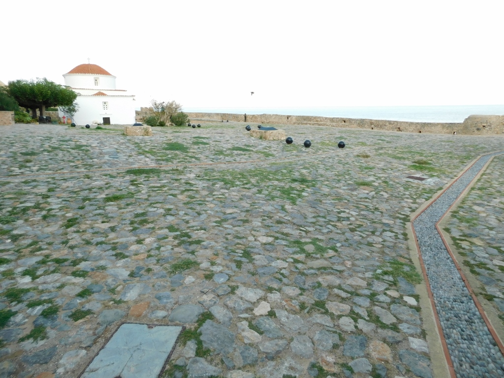
On the eastern side of this spacious square, which was once used for parades, stands a small church called Panagia Chrysafitissa, or Our Lady of Chryssafa, named after a village in the Laconia region of the Peloponnese. The church was built in the 16th century.
 Monemvasia, a detail
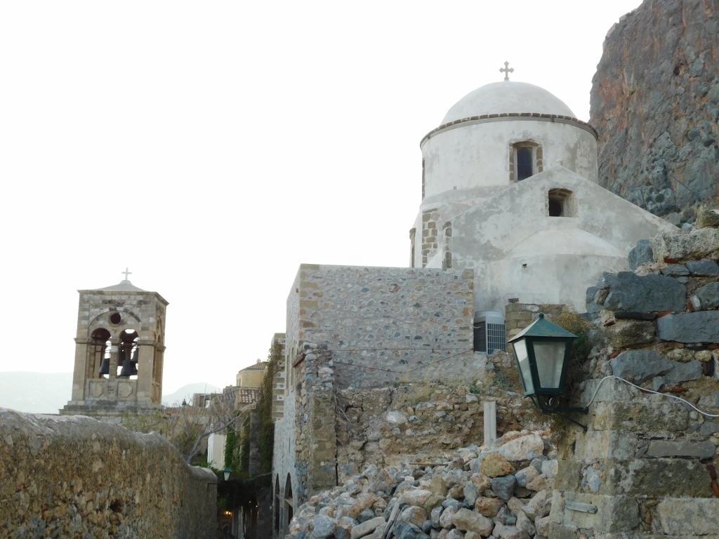
Then I made my way up to the Church of St. Nicholas, whose top and dome can be seen in one of the previous photographs. This church was built in 1703.
 Monemvasia, a detail
From here, I practically began my return to the exit of Monemvasia, but I took a different route than the one I had taken on the way in.
 Monemvasia, a detail
 Monemvasia, a detail
 Monemvasia, a detail
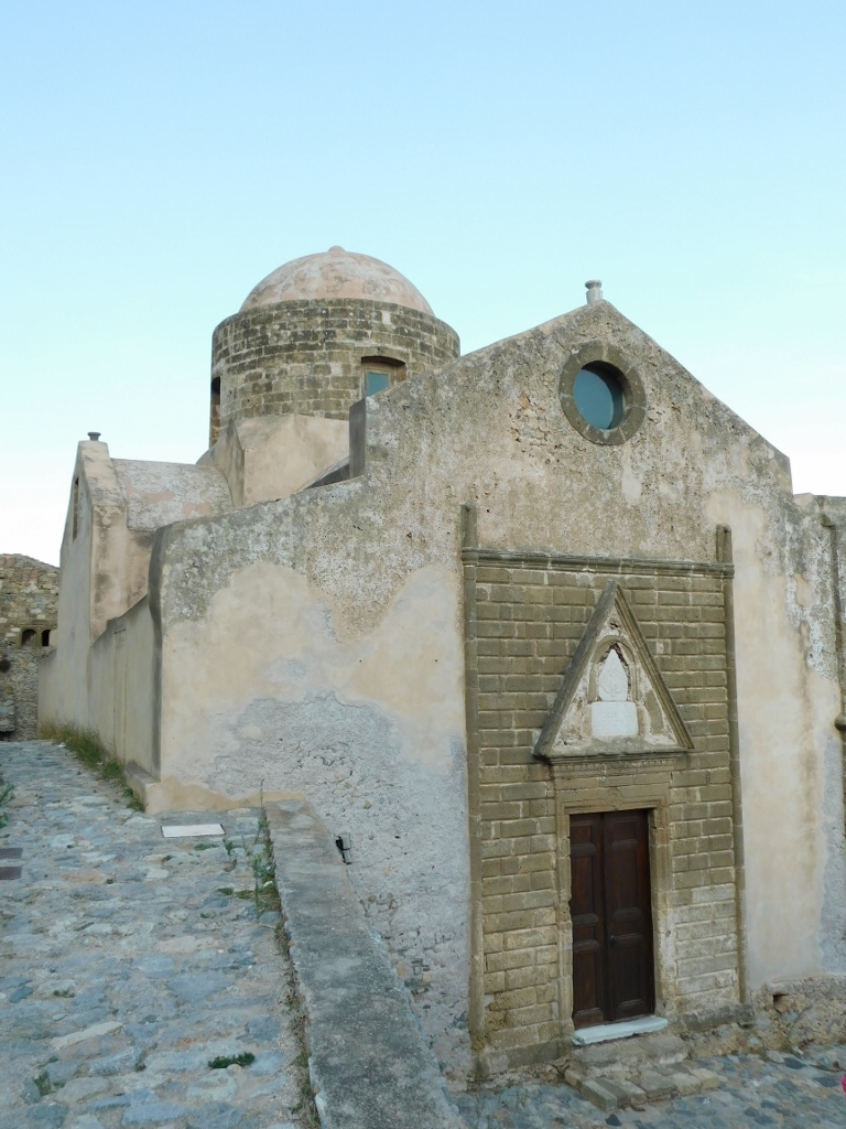
And so I passed by the Church of Panagia Myrtidiotissa, or Our Lady of Myrtle, which is believed to have been built in the 13th century when the Franks briefly occupied the area. By this point, I was quite tired and it was clear that all the churches were closed, so I didn’t climb up to it, but simply took a photo from a side street.
 Monemvasia, a detail
Admittedly, I did climb a bit uphill to get a better view of the Church of Christ in Chains, but that was about it.
 Monemvasia, a detail
As I left the area of the settlement, I occasionally glanced back to capture some parts of the island illuminated by the late afternoon sun. Although there were still, I would say, too many cars, at least here and there I could see a few available parking spots.
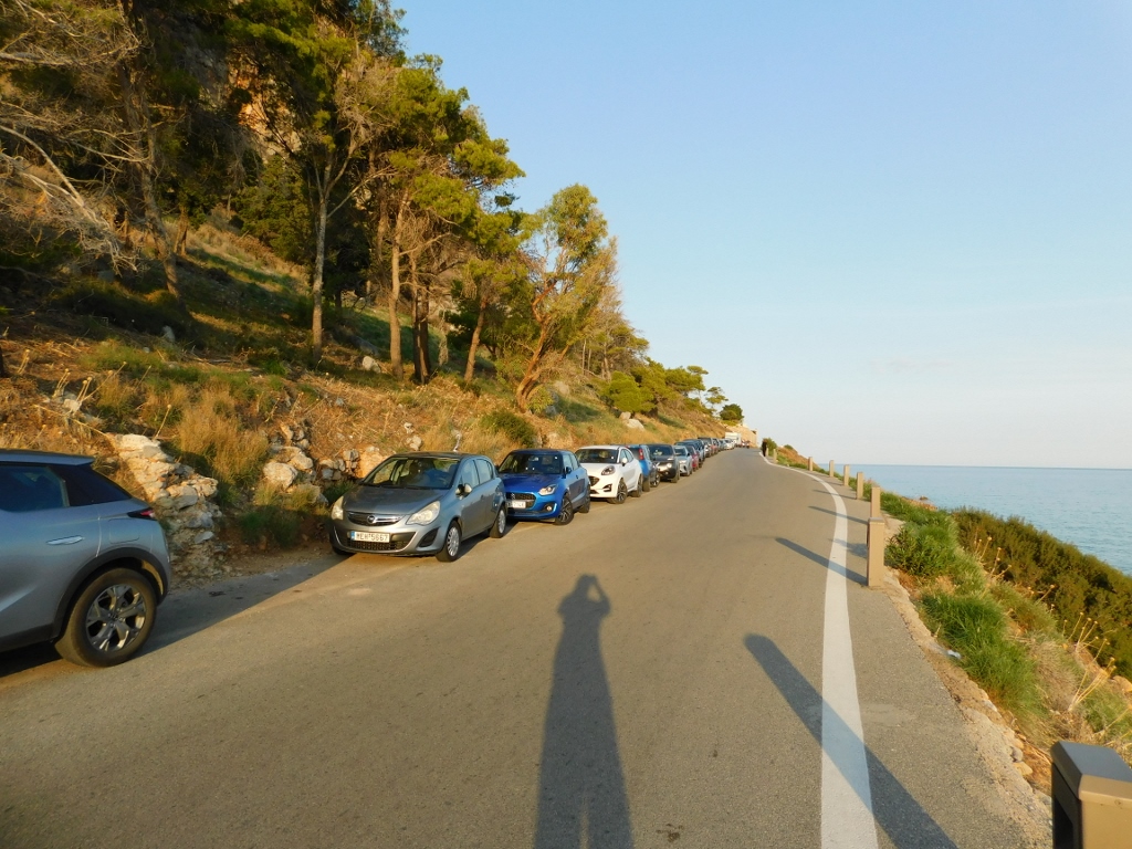 Monemvasia, a detail
The parking situation was somewhat better in the flat area before reaching the causeway.
 Monemvasia
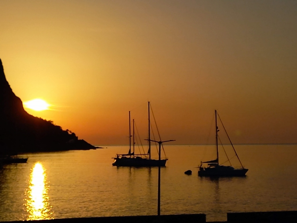
By the time I reached the bridge that is a part of the causeway, the sun had already started to set over the hills to the west.
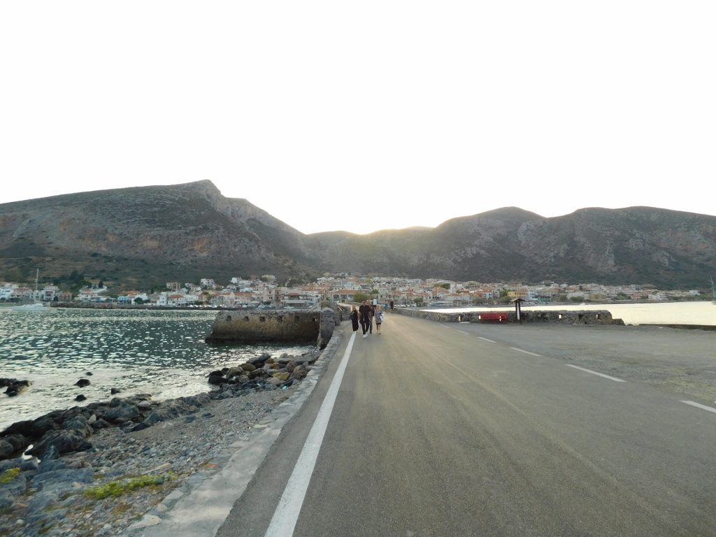 Returning to Gefira
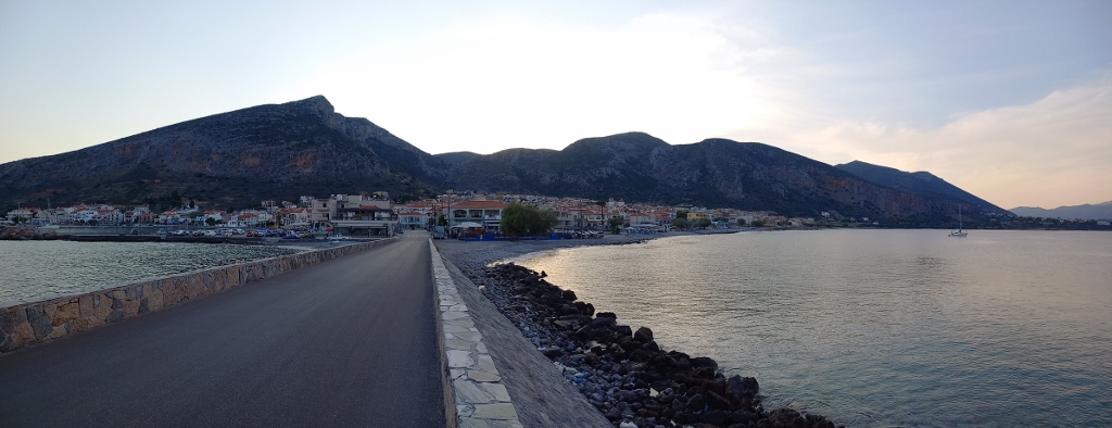 Returning to Gefira
Once back in my room, I first took a shower and rested a bit on the balcony. Later, I strolled around the town for a little while, but not for too long, as I wanted to make sure I got a good rest.
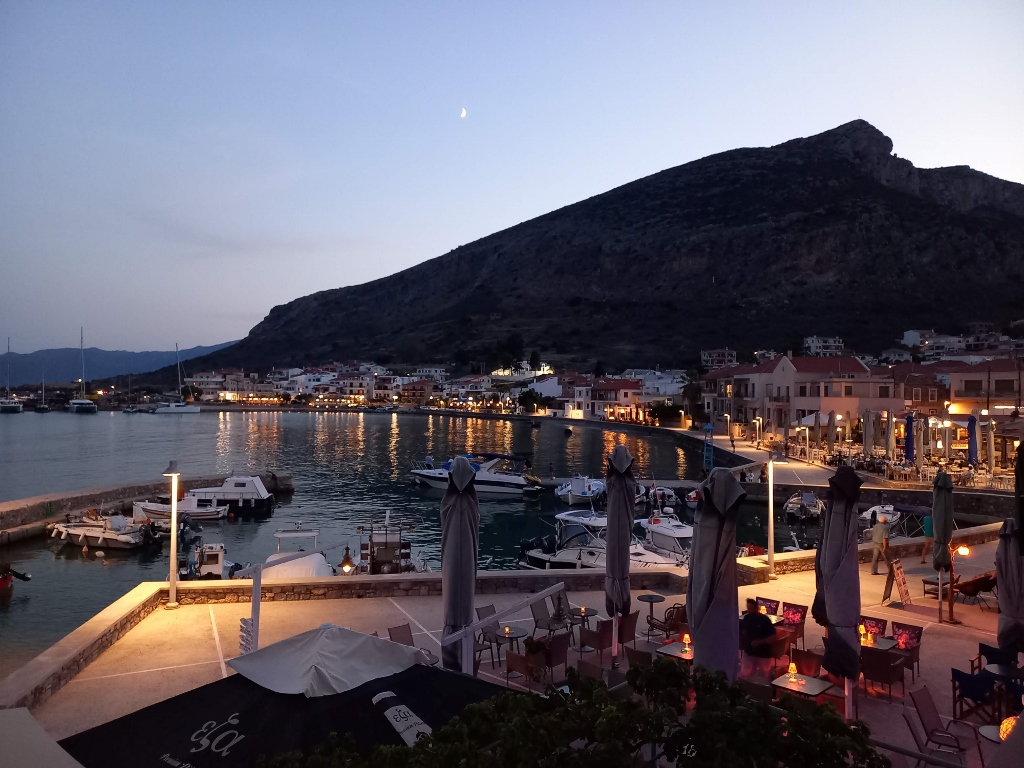 Dusk in Gefira
After a good night’s sleep, the next morning started off very nicely and quietly, early in the day, as the sun was just beginning to rise behind Monemvasia.
 Early morning in Gefira
 Early morning in Gefira
I had a spacious balcony overlooking the harbour, but you glance at the harbour for a minute or two and there is no need to keep staring at it. So, I made myself a coffee, sat on the terrace, propped my feet up on another chair and read while the day slowly began to unfold in all its splendour. It was wonderful...
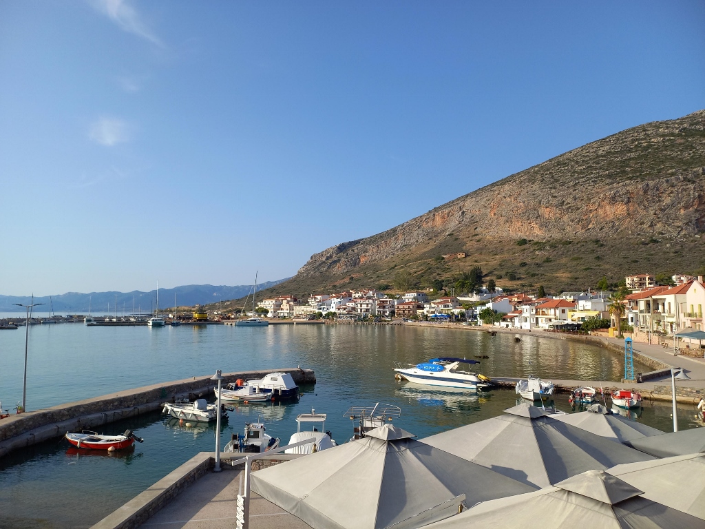 Morning in Gefira
However, even though I had designated this as a free day, it didn’t mean I would spend the entire day on the balcony. Soon, it would get too hot there anyway. I gradually got ready and then drove less than 40 km to a port where a ferry goes to the small island of Elafonisos, which has a settlement with restaurants and two beautiful beaches. My plan was to check it all out and also take a swim, as the forecast predicted temperatures over 30 degrees C. It was the second half of September, but I was in the very south of Greece.
The drive was, to say the least, “challenging.” I followed the route suggested by my car’s GPS, which meant going directly over the mountains. In fact, all the suggested roads went through the mountains and were quite winding. It’s illustrative to say that it takes about an hour to cover a distance of less than 40 km.
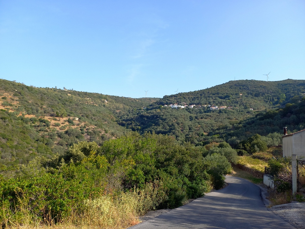 On the way to Elafonisos
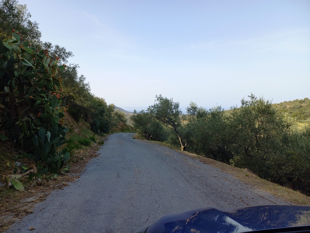
That wasn’t particularly problematic, but the GPS had a tendency to choose shortcuts that seemed quite suspicious to me – narrow, local roads carved through olive groves that only their owners seemed to know and use. In the end, it was a good thing, as there was no traffic on the road – I hardly passed any cars in either direction.
However, these narrow roads were very interesting, but in the tightest and most winding parts, I obviously had no safe place to stop and illustrate that. I think I did stop for a couple of seconds at one spot to take a photo of the surroundings with my mobile phone, but that was about it.
 On the way to Elafonisos
At one point, I finally emerged onto a main, wide and regular road, and I headed towards Elafonisos, the small island I was visiting. Of course, the road doesn’t go directly to the island; it leads to a settlement near the coast and Pouda Beach, specifically to a ferry terminal.
I must admit I was quite nervous – I had never driven onto a ferry before and I wondered if I would know how to manage it. It always makes me laugh, once it’s all over, how I worry about things that are so ordinary. But that’s what “not knowing” or rather “lack of experience” brings. In such situations, I usually consciously face the challenge because I believe that life is meant for making a collection of various experiences.
So, on this day, I got to see what it’s like to drive onto a ferry, but I can immediately report that later that day, on my return, I had an additional “lesson,” which was backing onto the ferry. I managed both lessons with flying colours!
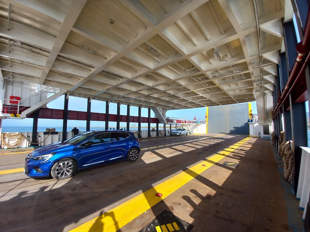 My rented car is the blue one
During the crossing of the narrow strait, I took photos of the island of Elafonisos, as well as of the main settlement that shares the same name as the island.
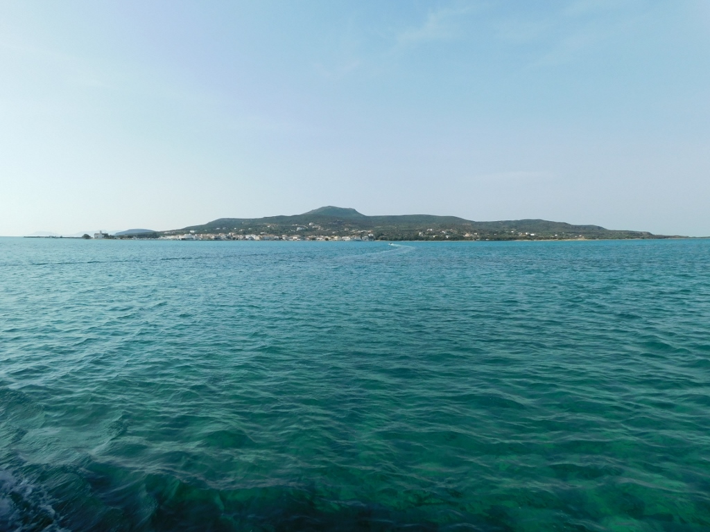 On the way to Elafonisos
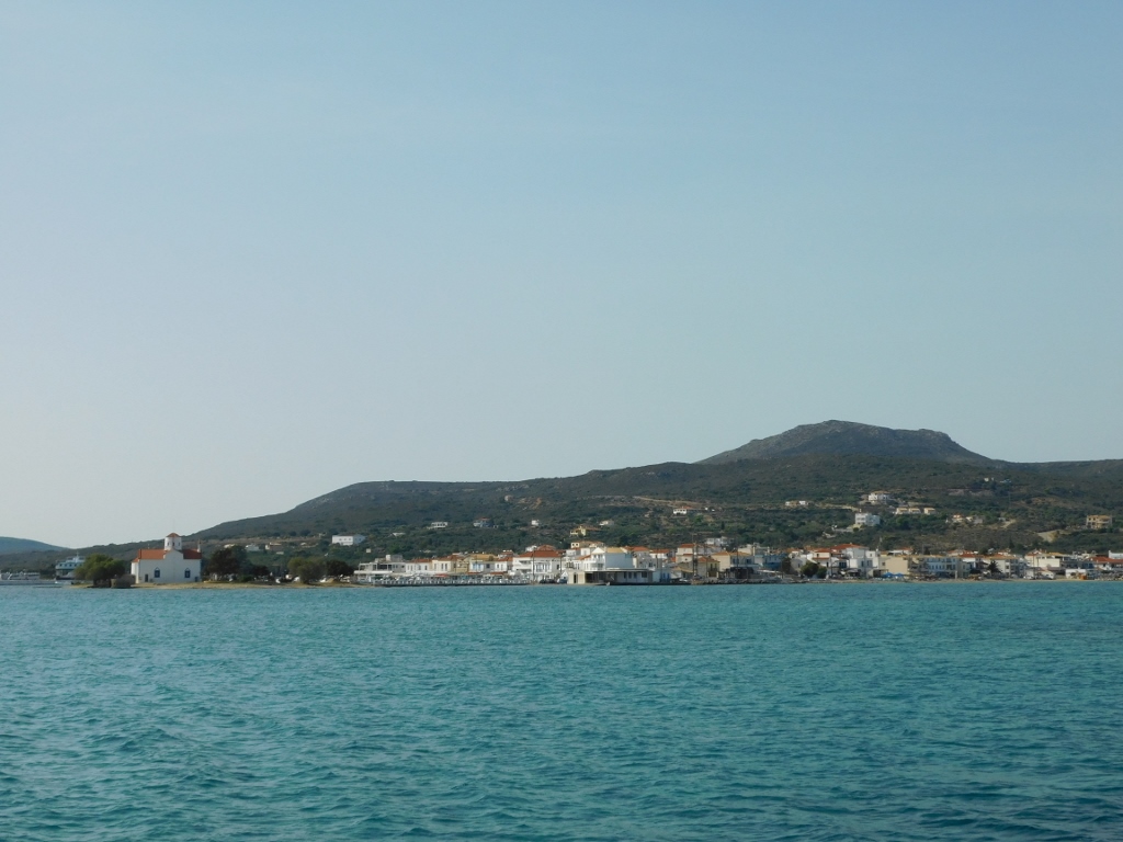 On the way to Elafonisos
After disembarking on the island, I first found a convenient parking spot near the main settlement, and then I went for a little walk and to find a place to have a coffee.
Along the way, I admired the charm of the Church of Saint Spyridon, the patron saint of Elafonisos.
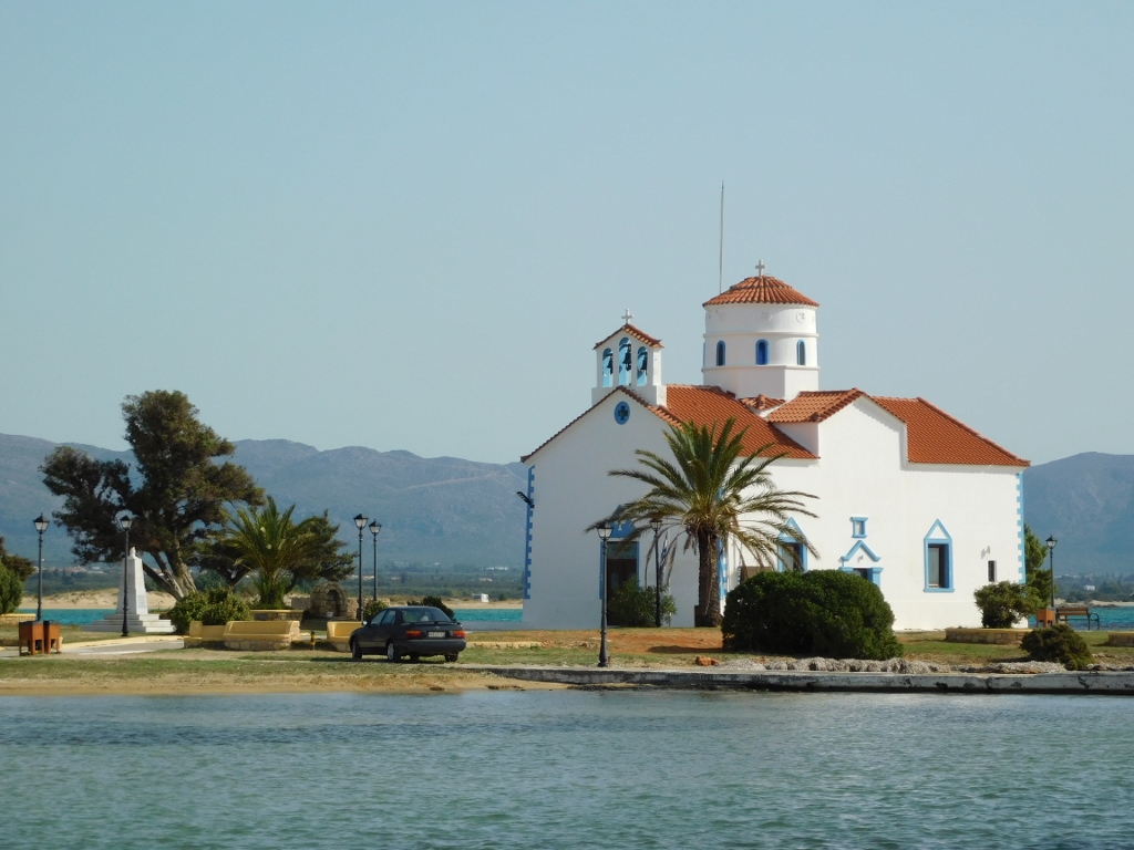 Church of Saint Spyridon
I found a nice and peaceful spot at Kontogoni Beach, although soon a bunch of kids arrived with their teachers. One of the teachers apologised for the noise, but I told her it was not a problem. I asked what they were doing, as I noticed everyone putting on surgical gloves. The teacher explained that they had come to collect trash from the beach. That was really nice! I hope they’re also being taught that littering in the first place is not acceptable, except when litter is disposed in designated bins, but this was still a commendable effort.
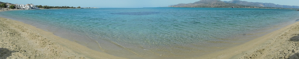 Kontogoni Beach
I enjoyed my time there and it was actually quite peaceful since the kids eventually moved on. After a while, I left, returned to my car and then drove to Simos Beach.