The mountain that has particularly remained in my memories because of its beauty and hiking challenges, and perhaps even more because of its wonderful, albeit picturesque, inhabitants at whose mountain huts we stayed is Komovi. It actually consists of two distinct sections Vasojevicki Kom and Kucki Kom. Kucki Kom, on its part, consists in fact of three peaks (South, Middle and North ones), one of which can be climbed only by alpinists (the Middle one), while the other two can be reached by hikers, i.e., by walking although it was necessary for us to use all four limbs from time to time. The South peak is also known as Kucki Kom (the name both for the peak itself and for the part of the massif) and it is the highest with 2487 m, while the North peak (Ljevorecki Kom) is 2469 m high.
I was first there with a tour that lasted for four days. During those four days I climbed everything that I could without alpine props and that was all nice and fine, but I said to myself I would never go there again, especially not on Kucki Kom, i.e., on its two peaks. Namely, not only that this hiking was not easy at all, I also got an impression that everything, from a small pebble to a large bolder, shakes and may easily fall off, which is exceptionally dangerous in mountains, whether this is the rock you are standing on or the one on which somebody going in front of you is standing.
Still, the mountain is so beautiful that I returned there several times. The transportation from the railway station would bring us to Tresnjevik, a mountain pass with a local tavern. There we would make a break with a merry conversation with our host and then we would walk for an hour along a dirt road until we reached Stavna, a clearing at which there was a katun (informal seasonal mountain settlement used by families who graze their cattle there, a seter), where we slept at Ziza’s friends’. As we came out of the forest and onto the clearing, we would be faced by the breathtaking view at the Komovi massif.
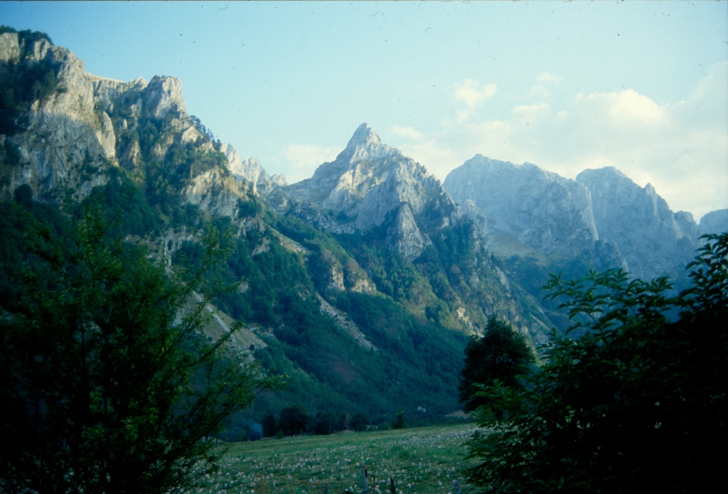
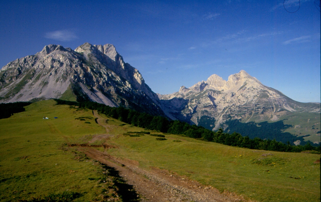 Komovi – Vasojevicki Kom is to the left and Kucki Kom is to the right
Hiking to the top of Vasojevicki Kom (2460 m) was always demanding, among other reasons because of the constant steep ascent. As we were in no hurry when I was on Komovi the first time, we dedicated an entire day to Vasojevicki Kom, so there were enough breaks even for a short nap on the warm ground.
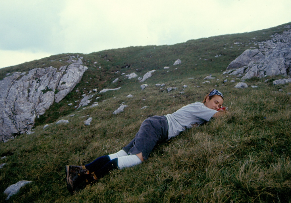 Taking a nap on Vasojevicki Kom
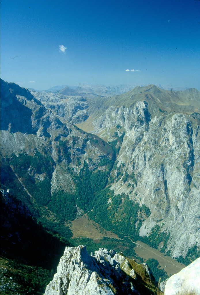
From Vasojevicki Kom, there is a beautiful view at the entire surroundings.
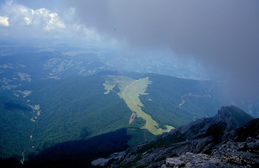 View at the clearing where Stavna katun is located
I can see that nowadays there is some eco-katun at Stavna which is a proper contemporary high-tech version in comparison to where we used to stay. When I used to come to Komovi, there was no electricity or running water except at a natural water spring that was in the forest a little lower than the huts, but none of that mattered a single bit and as a matter of fact it only added certain appeal to all the other wonderful things that existed and happened around us. Before the first hut was made for hikers at Stavna, we used to sleep at two families’ that traditionally spent summers there taking their cattle to the heights for grazing. One of the two families had three adult sons and none of them was married in the period when I was there for the first time. When we got to them, each one of us carrying his own large backpack, one of those sons approached me and offered to help me with my backpack, but I thanked him and said I could manage, while he seemed truly impressed that I could carry such a large load.
Once I went with a daughter from the other family at which I slept to pick up herbs for teas. When afterwards I came to visit this family with three sons, the mother asked me where I was and with whom I went, and after I told her, she said: “Why didn’t you tell me? I would have found you a better company!”
Still, the favourite anecdote which Ziza and I retold with lots of laughter each time Komovi were mentioned, when Ziza would purportedly reproach me for not trying harder making sure that our hiking club got a hut for free, was the following one.
On the third day of our stay in Komovi, we had the entire afternoon free and we all kept idly roaming around the huts. It occurred to me that we would better spend the time playing klis. This is a game that must have been invented by shepherds while their cattle grazed on meadows and it can also be seen as a rudimentary predecessor of baseball or cricket type of games, although neither of these sports is linked to the Balkans. What you do here is to get a longer thin wooden pole that serves as a bat and a shorter and straight piece of wood. Both requisites should have around 2-cm diameter. Then you make a hole in the ground which resembles a boat shape and using the longer stick you either project the shorter one or hit it while it is in the air. As it had occurred to me to play the klis, I got down into the forest, found suitable branches and using knife I cleaned them up a little bit. Having explained the basic rules and the technique to my friends, a few of us started to play and have fun with this. In the meantime, Ziza was sitting in a hut talking with one of the sons and, as he later told me, at some point the two of them started to wonder “what the youth was up to.” As Ziza would put it: “The two of us looked through the door, we saw you positioning yourself over the hole and then you hit the klis so strongly that it flew sky-high. Aco just uttered: “Wow, this one would be good for cocking the hay!””
Still, nothing eventually came out of my getting married and staying on Komovi and the hikers had to pay for a wooden hut to be there for those who have to spend the night when visiting the mountain.
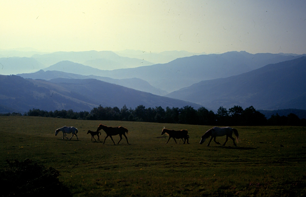 Komovi, horses at the Stavna katun
My last visit to Komovi was on a sad occasion. Namely, a very dear friend of mine died during his attempt to climb the Cho Oyu peak in the Himalayas and as he was born in this part of Montenegro, a memorial plaque in his honour was placed just under the very peak of Vasojevicki Kom. The first year when that plaque was laid down, a large group of hikers, myself included, led by Ziza climbed onto Vasojevicki Kom and went to the plaque to pay their respect to Pavle Milosevic, a wonderful man who is no longer amongst us.
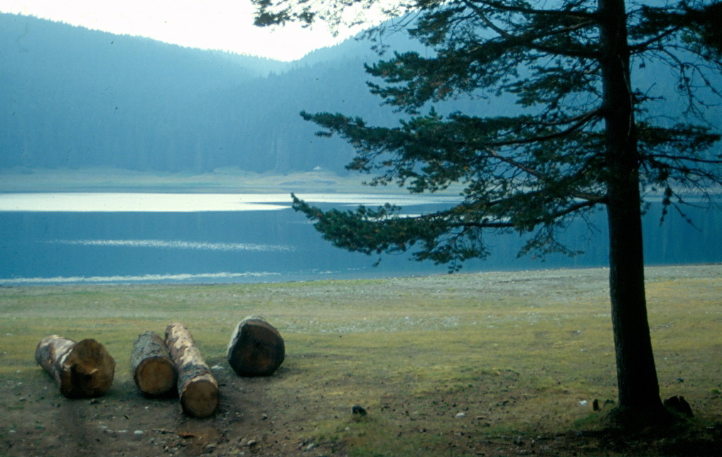
As opposed to Komovi, where I had an impression that rocks were unstable, the rocks on the mountain of Durmitor always seemed very solid and reliable. Durmitor is the most famous mountain in Montenegro and it is in fact a large mountain massif with a National Park of the same name that is on the UNESCO’s World Heritage List. The highest peak of Durmitor is Bobotov Kuk, 2523 m, but other that this one, there is a number of other peaks on Durmitor, as well as 18 mountain lakes.
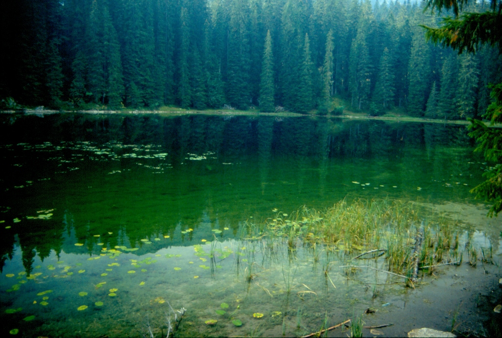
The best known lake is Crno Jezero (Black Lake) and it can be reached easily along an asphalt road, although it is much better to walk to it from the small place of Zabljak. There is a nice walking path leading around the lake and I really recommend this.
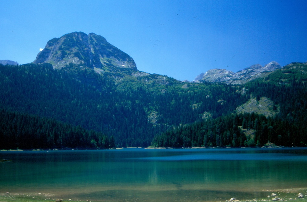 Durmitor, Crno jezero and the Medjed peak (2287 m)
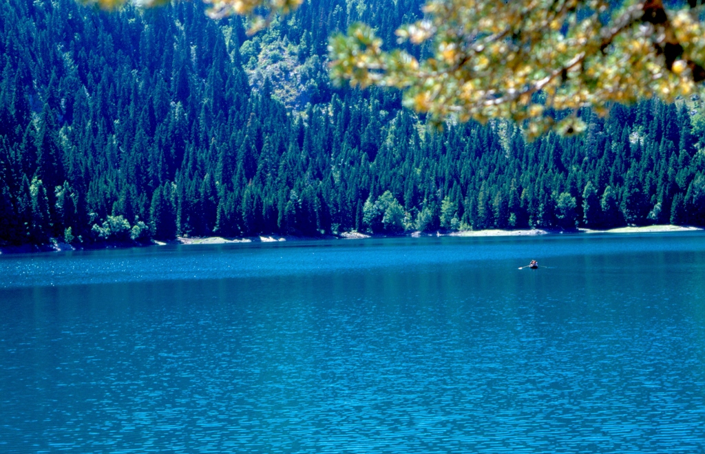 Durmitor, Crno jezero
 Durmitor, Crno jezero
Still, my favourite is Zminje lake which can also be easily reached on foot, albeit with a certain more or less mild ascent. Zminje lake is quite small and it always seemed to me as if somebody had cut a hole in the tall and dense conifers that surround that part and filled it up with water. On a couple of occasions I went to the lake completely alone and then I would find a nice place to sit down, enjoying the wonderful silence for a while which at some point I would break myself by singing my lungs out. Nobody complained and I didn’t really care. But, Zminje lake is also a very nice place to have a dip in, provided one is ready to enter the frosty lake. A couple of times I did dare have such an adventure and the water was always truly cold, but it was all worth every second spent in the lake.
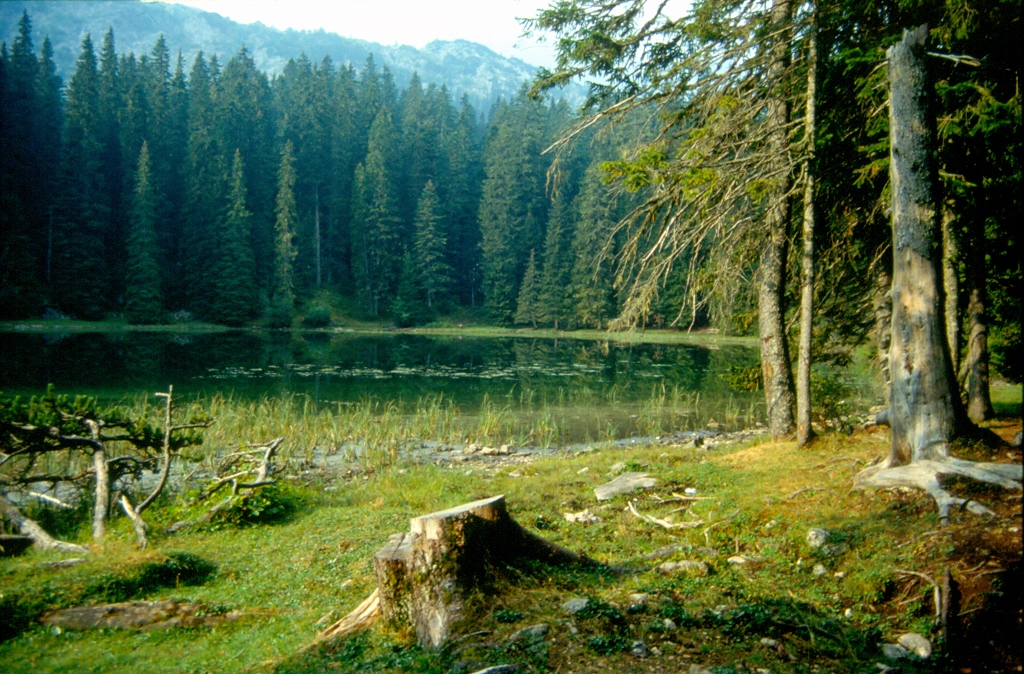 Durmitor, Zminje lake
 Durmitor, Zminje lake
One may go to Durmitor any time of the year and always enjoy it. When there is no snow, it is a wonderful place to walk around and enjoy different fair-weather activities, while in winter there is always a lot of snow and then it is an ideal place for winter sports.
As I’ve said, the highest peak of Durmitor is Bobotov Kuk (2523 m) and one may reach a mountain saddle near the peak from different sides, but from that point on one needs to follow a narrow trail which zigzags from the saddle to the peak itself.
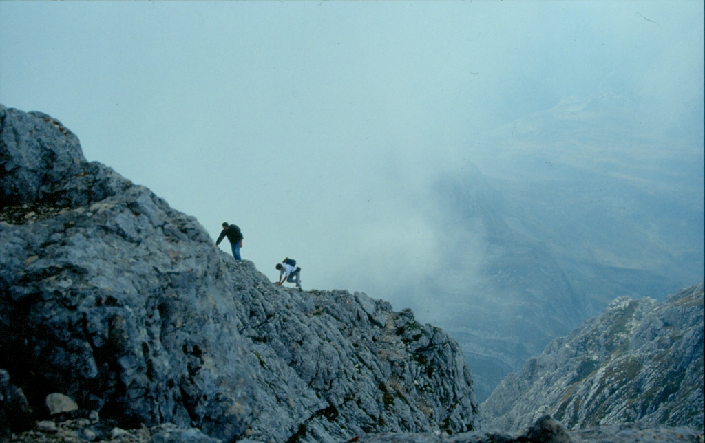 Durmitor, climbing to Bobotov Kuk
When I first climbed Bobot, that narrow trail which was occasionally only half a metre wide, with a steep slope on its one side and a huge “hole” containing Skrcko lake on the other, filled me with trepidation, but over time with more experience I got to realize there was nothing to be afraid of and that the peak may be reached easily. Provided you are fit enough and that you don’t have a problem with heights.
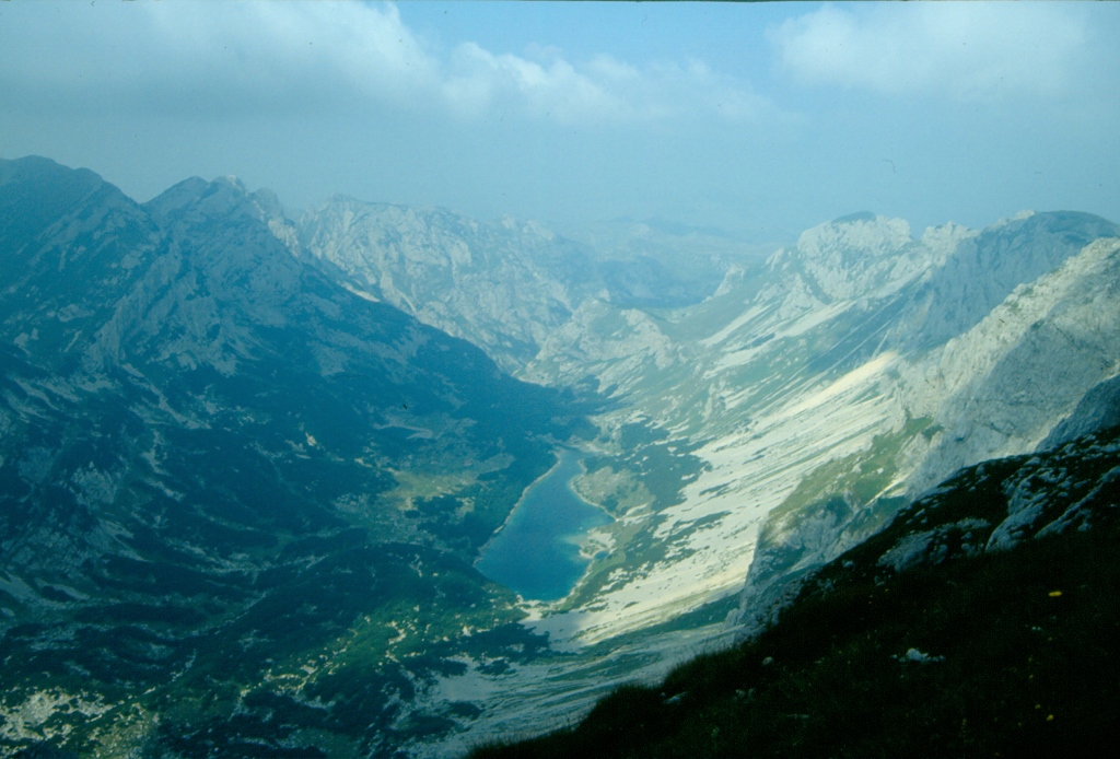 Durmitor, view at Skrcko lake from the trail leading to Bobotov Kuk
When on Durmitor, it is also possible to visit Ledena pecina (Ice Cave). Many years ago, a fellow hiker who was a graduated geographer told me that this was a relatively rare phenomenon. Namely, this is in fact a spacious inclined hole on a side of the mountain that is in the shade, so when icy air gets into it during winter, it simply does not get out on account of pure physics and the fact that cold air (or water, for that matter) always goes down, while warmer parts take up higher levels. The water drops which fall to the bottom of the cave during warm months then turn into ice because of the low air temperature, thus creating icy stalagmites.
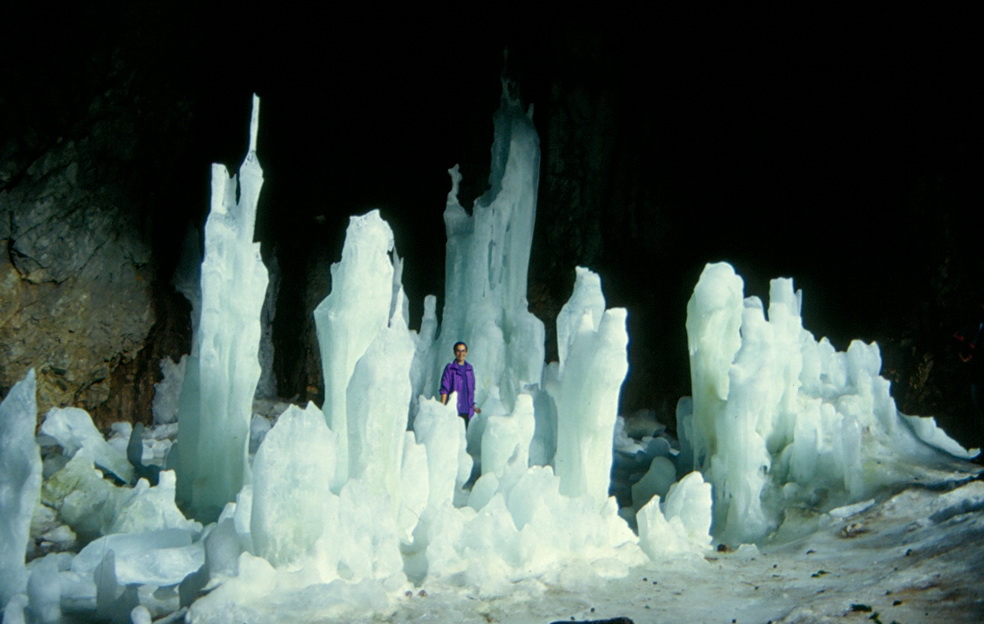 Durmitor, the Ice Cave in September with a 1.81m-tall referencing object in it
I’ve been to Durmitor numerous times and every time I managed to find something new, but I also enjoyed revisiting some places. One of my regular hiking walks was to Curevac viewpoint from where there is a fine view of the Tara Canyon which is one of the deepest in Europe. I personally like this place in particular because right across Curevac there is an area where a broad family I know come from. It all started because my best childhood friend, nowadays my “oldest” friend, lived literally a couple of flats away and as we spent a lot of time at each other’s, I practically grew up along her entire broad family and even today I address all of the uncles of my friend the same way she does, “uncle so and so.” My dearest friends from New York are also members of this broader “clan.”
![]() Durmitor, view at the Tara river from the Djurdjevica Tara bridge
Durmitor, view at the Tara river from the Djurdjevica Tara bridge
The mountain massif which is particularly interesting for “serious” hikers and alpine climbers is Prokletije. I was there only once, but at the time I was very fit and could really enjoy the magical beauty of the landscapes. The Ocnjak (Canine) peak (2185 m) is particularly noticeable and well known, and it is very near a mountain hut at which we slept.
 Prokletije, Ocnjak. The meadow in the bottom of the photo is covered by multitude of mountain flowers.
 Prokletije, Ocnjak – view at the valley from the peak
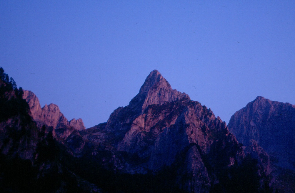 Prokletije, Ocnjak at dusk
The second day we went to the mount of Trojan (2190 m) that also belongs to the mountain chain Prokletije. First we went up directly from the mountain hut to the Popadija peak (2057m) and then following the ridge we continued to Trojan. It is interesting that this is where the border between Montenegro and Albania is. At the time when the borderline was drawn, numerous boundary stones were placed and the border actually goes in a straight line from one stone to the next not following the natural wavy line of the ridge. The border guard who accompanied us told us that during the reign of Enver Hoxha it was inconceivable to walk along the ridge because every now and then it formally passes onto the Albanian territory for at least a dozen metres (in the same way it passes onto the territory of Montenegro, for that matter), but one had to follow strictly the imaginary borderline. Nowadays, this is no longer the case and things are much simpler. The Albanian border guards are not angry because of this occasional “trespassing” over their territory, so we walked along the ridge simply to avoid constantly going up and down following that unnatural imaginary line.
 Prokletije, the ridge on the border between Montenegro and Albania, with Trojan in the distance
And finally, with Ziza we did not visit only the mountains of Montenegro. Once I joined a group he led which on the first day went for a boat trip on Lake Skadar, the largest lake in south Europe, also on the border with Albania. During the trip, we passed several small islets where we saw remains of different buildings, including a small church.
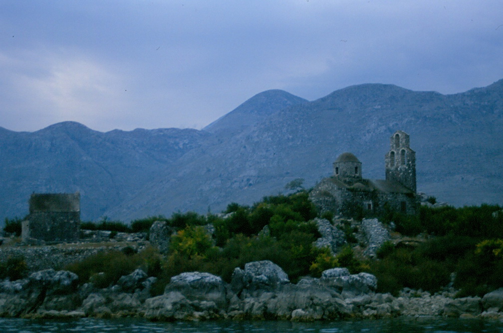 An island on Lake Skadar
Still, our main destination on this occasion was the Monastery Ostrog, a famous pilgrimage site that belongs to the Serbian Orthodox Church. The monastery is dedicated to Saint Basil of Ostrog, who is buried here and who is widely believed to be a miracle-worker, which attracts throngs of people here. We spent the night at a big visitors’ dormitory located between the lower and the upper monastery. The upper monastery is the one that is visited in order to pray and bow before the relics of this saint.
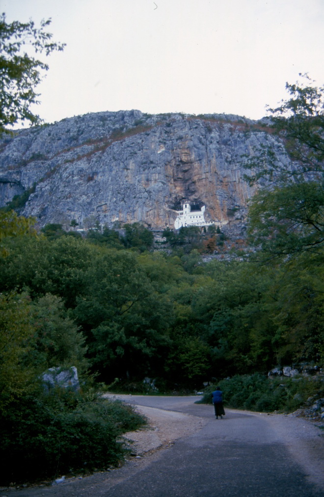 Monastery Ostrog, the upper monastery
As I was more as a “tourist” there, I didn’t go up very early because I didn’t want to contribute to a crowd and bother people who had been brought there by some grave difficulties in their lives. When I finally did get to a small plateau in front of the monastery with a few hikers, there was still a huge line of people waiting to go in. Ziza suggested that in the meantime a few of us went to visit a woman-hermit who lived in a rock shelter above the monastery. She was born in Kosovo and lived and worked in different places before coming here to live as a hermit. Have a look...