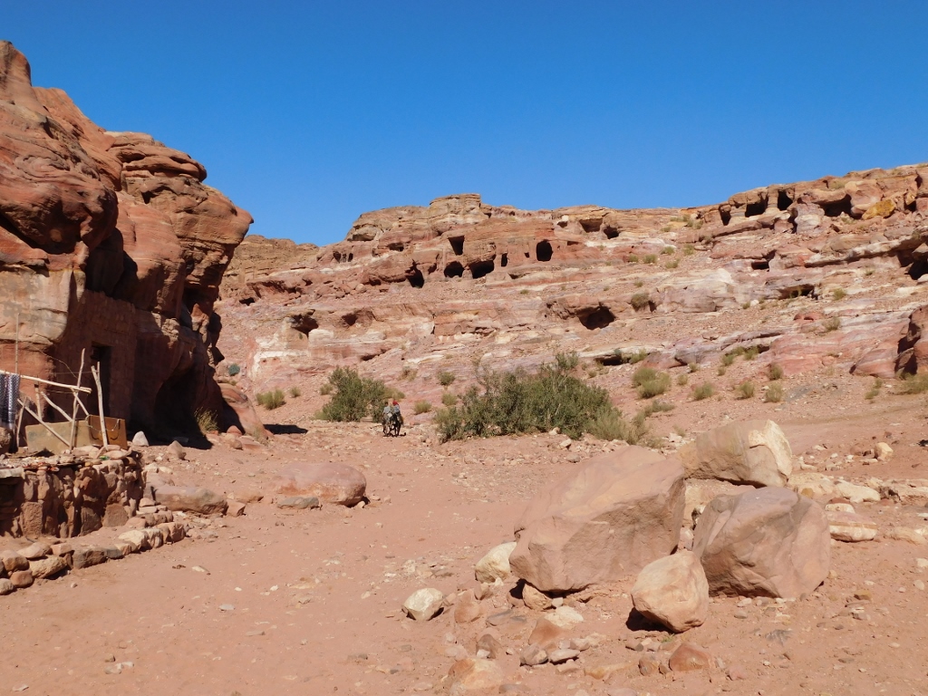
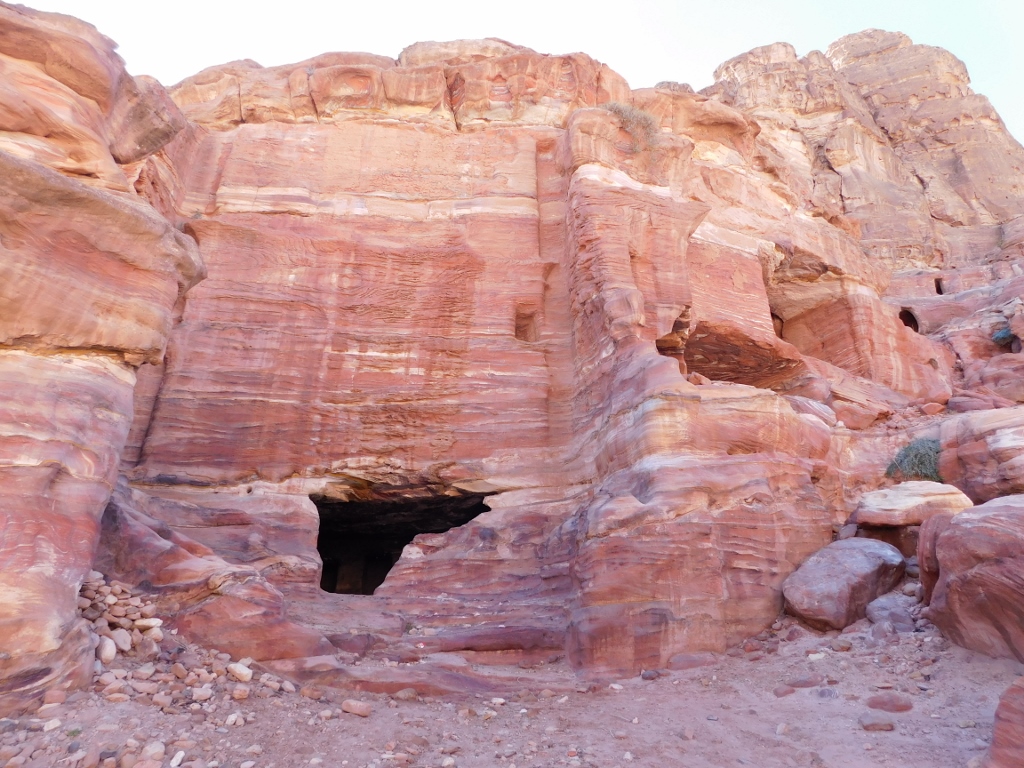
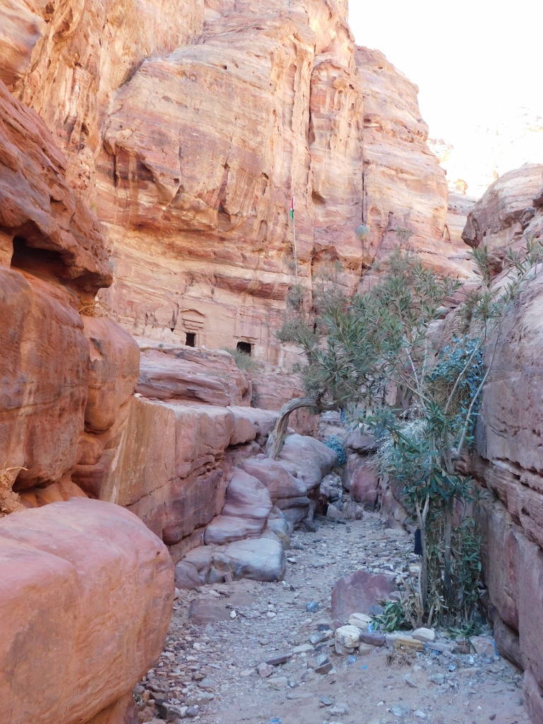
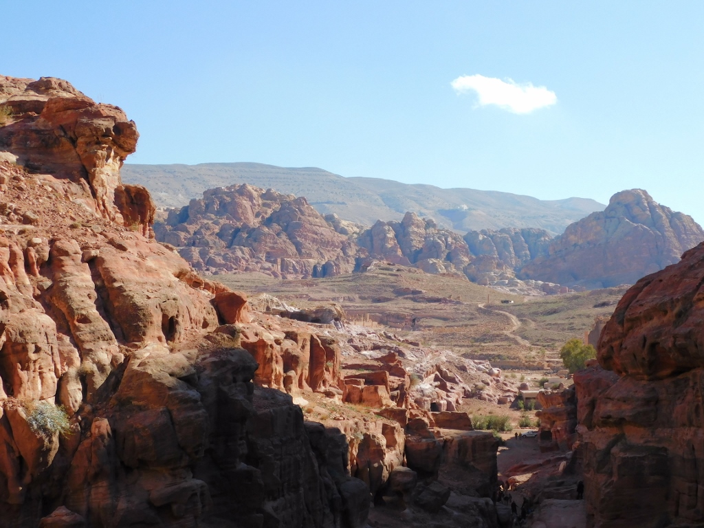
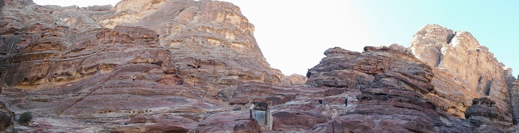
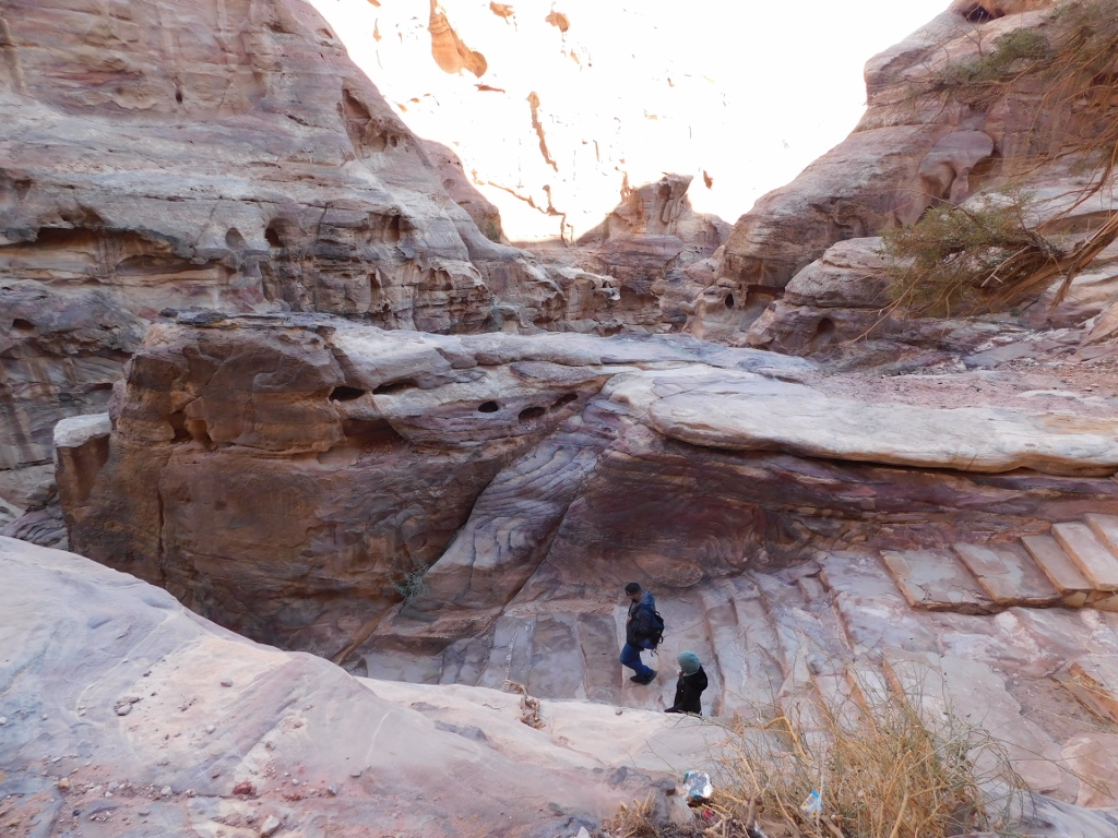
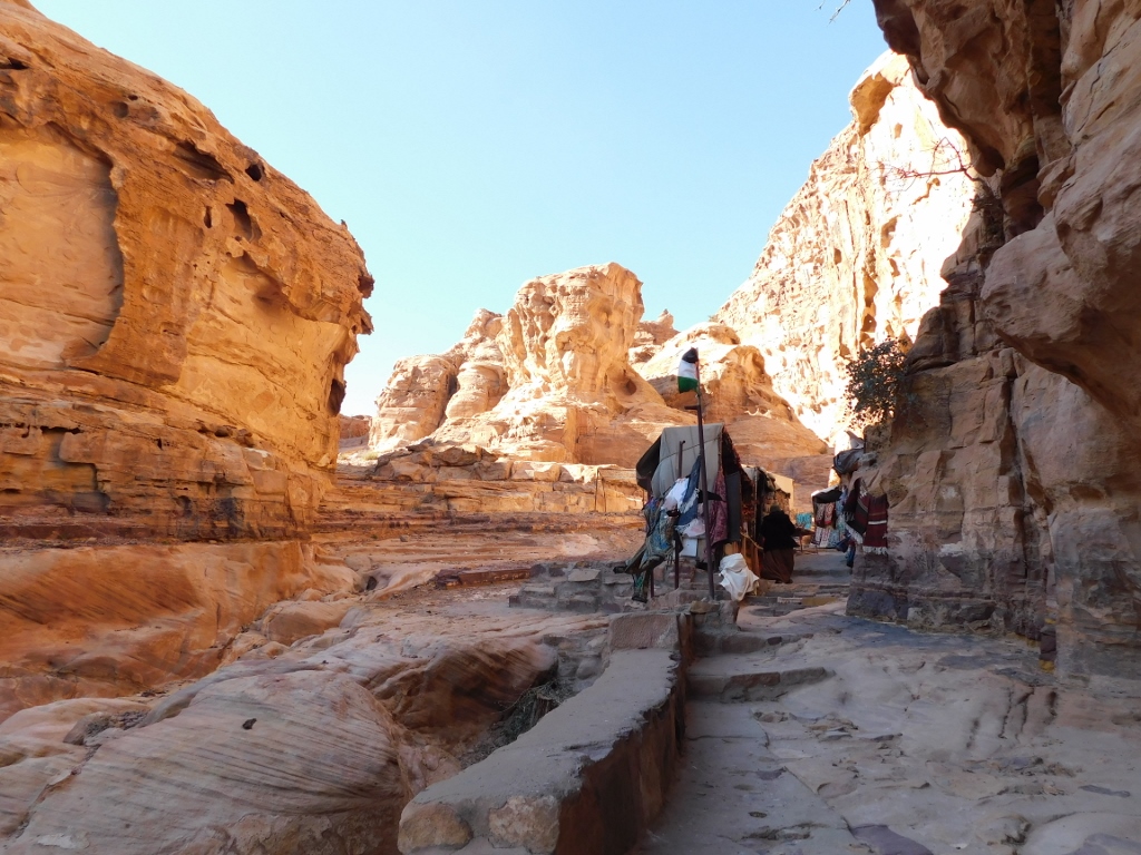
After the nice break on the terrace of a restaurant/café in the centre of ancient Petra, I was ready to face the Ad-Deir trail, named like that after an exceptionally impressive structure that is located almost on the top of one of the numerous rocky massifs in this area. The name Ad-Deir means “monastery,” but I will say more about it a little bit later. For the time being, I had to start walking along the trail that at first seemed quite nice. When I say “nice” I mean – flat.
 Beginning of the Ad-Deir trail
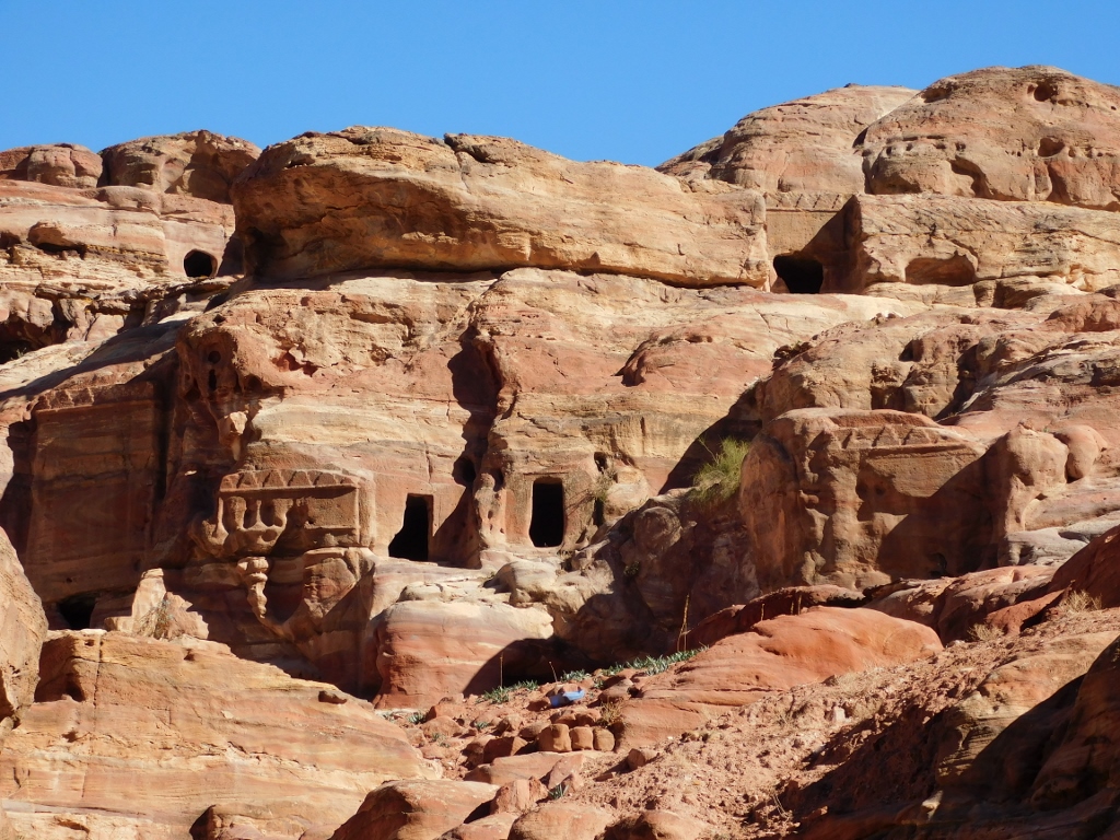
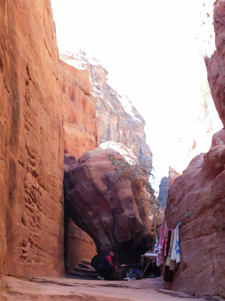
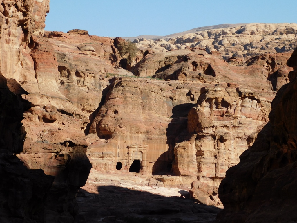
Of course, everywhere, both to the left and to the right from the trail, one can see caves carved out by the Nabataeans in order, I presume, to live in them.
 Beginning of the Ad-Deir trail
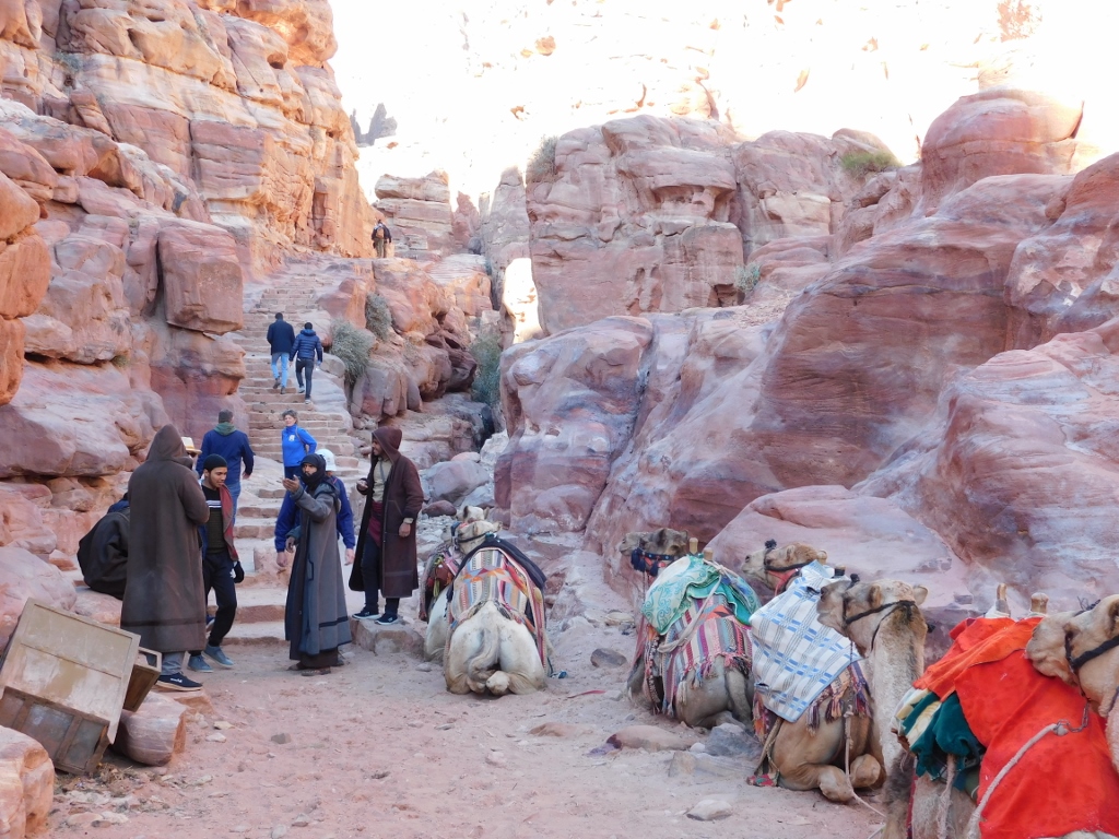
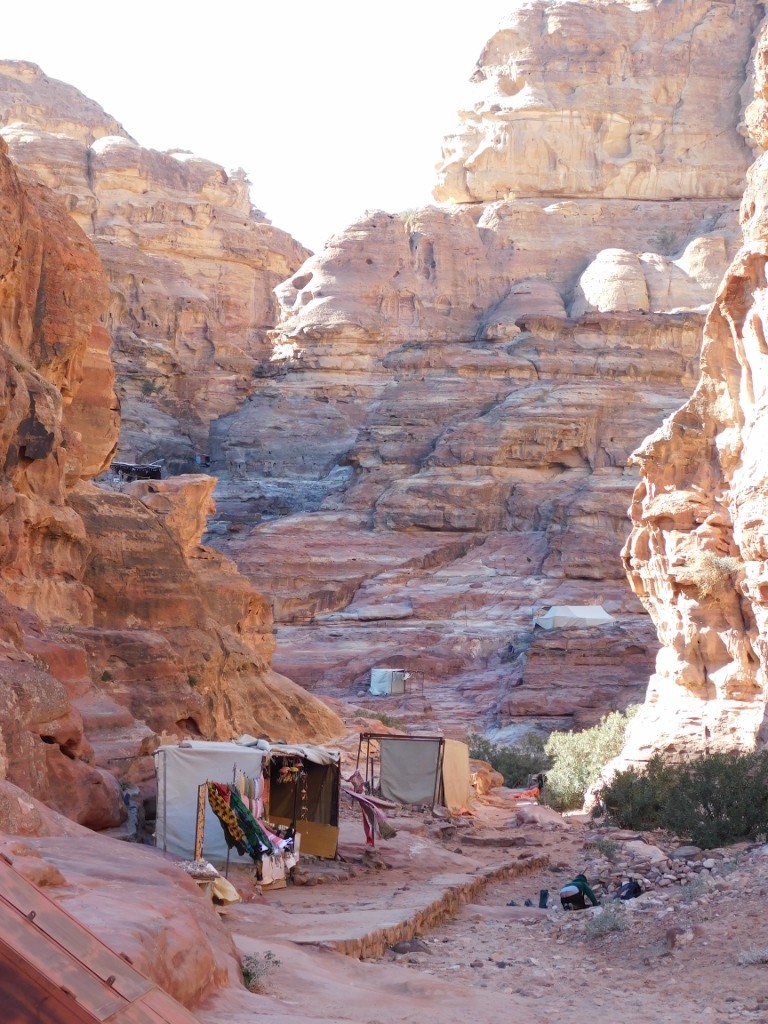
In the clearing of the Temenos Courtyard, you can usually see a large number of Bedouins with camels and donkeys offering to take visitors to the Monastery in this way. I wanted to go on foot here, so I was not interested in this, but I must say that nobody ran after me trying to convince me that I should hire an animal. What I want to say is that they were all very discreet and unobtrusive. Quite contrary to what I had read about them and I did prefer it this way.
On the other hand, since I was going on foot and do not have personal experience about this, I can only talk about what I saw and that was that the camels went only along the flat section in the beginning and not further, while along the trail, all the way to the Monastery, every now and then I saw donkeys with tourists on their backs led by the local guides. My conclusion was that whoever wanted to have “transport” to the top should select a donkey and not a camel.
This theory of mine is corroborated by the photo below that shows “parked” camels at the end of the initial flat section of the trail.
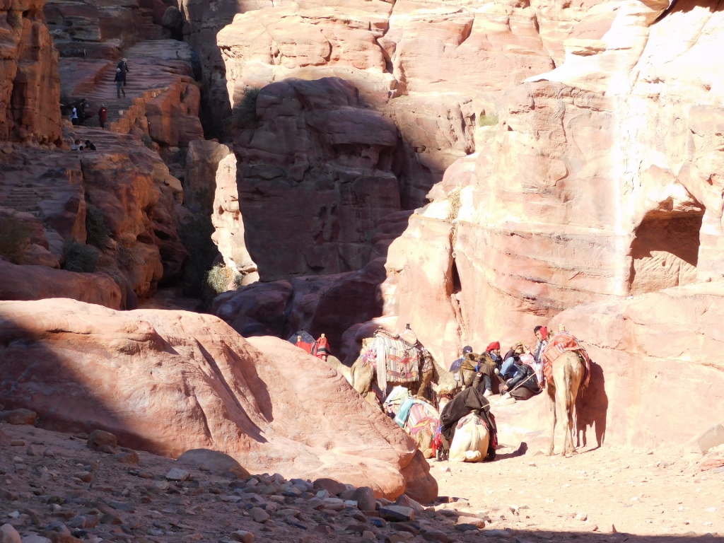 Camels at the beginning of the Ad-Deir trail
The previous photo also shows, in the shade on the left-hand side, the beginning of the steps that lead to the Monastery. Here it is again, but zoomed in.
 Steps at the beginning of the Ad-Deir trail
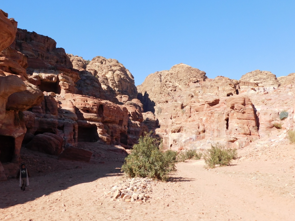
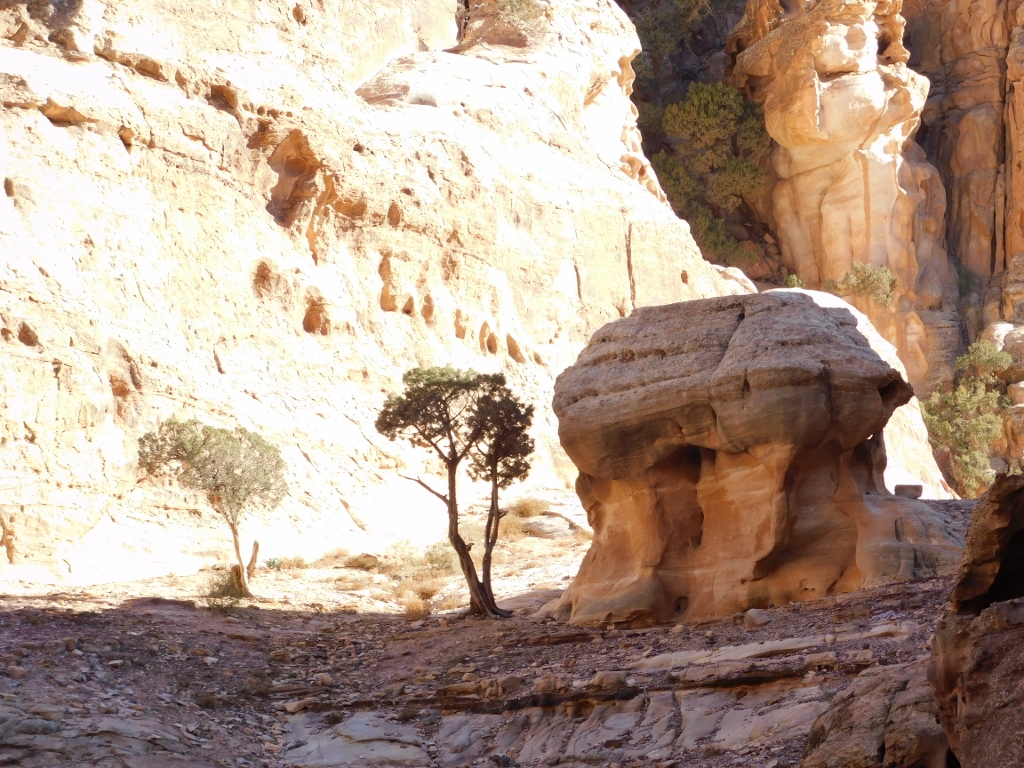
Although the Ad-Deir trail is marked as the difficult one, on account of the elevation gain and the length, what facilitates the ascent are numerous breaks that the visitor can, and should, make. Simply, the surroundings of the trail are stunning and I think it is really good for one to make a stop every now and then, look around and enjoy. I certainly overdo it inspired by my need to take photos (or perhaps this is just an excuse to stop often and catch my breath), but I must say that I cannot understand people who care only about the destination and how to get there as quickly as possible. So much can be easily missed in this way.
Here, for instance, you can see on both sides numerous tomb facades, niches with betyls (holy stones), shrines, rock chambers and similar places that have survived from the Nabataean or the Byzantine periods to the present times, admittedly at a different state of preservation primarily because of the erosion action.
 Ad-Deir trail, eroded tomb facade
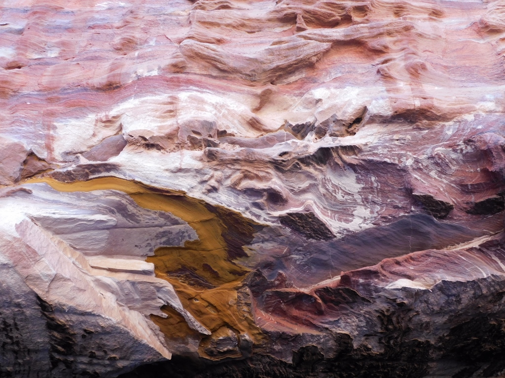 Ad-Deir trail, fantastic colours of the sandstone in a tomb
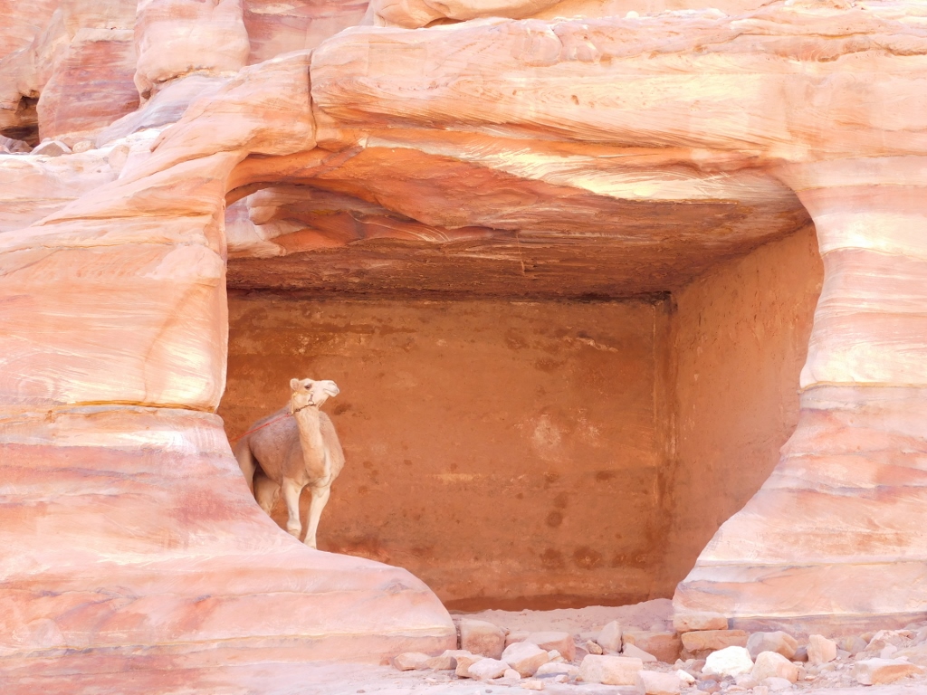
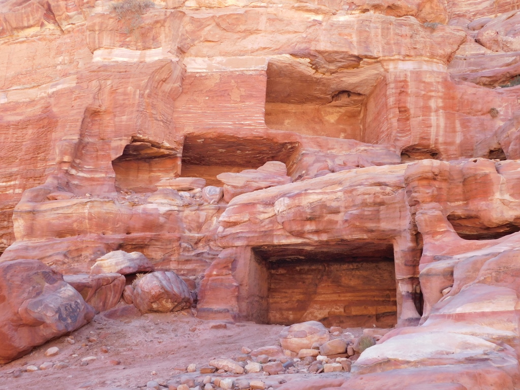 Ad-Deir trail, different rock chambers
Some of these chambers are used even today. For instance, in order to park animals here.
 Ad-Deir trail, a detail
 Ad-Deir trail, wherever you look, the details are impressive
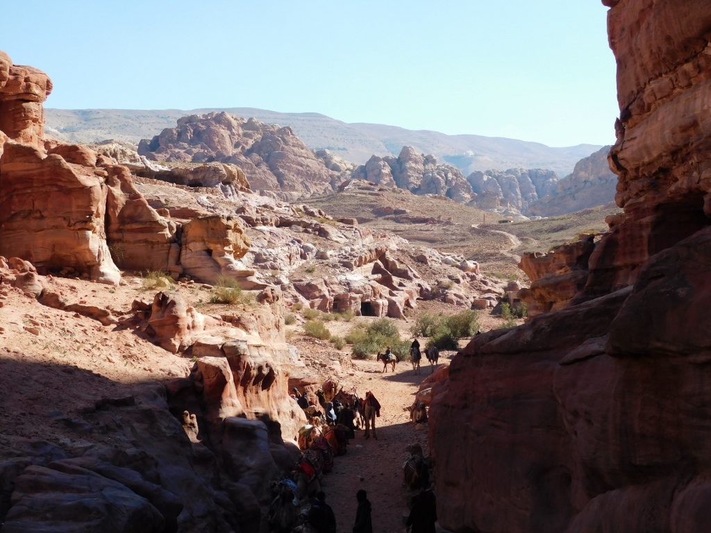
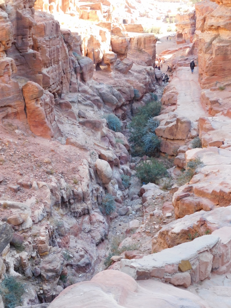
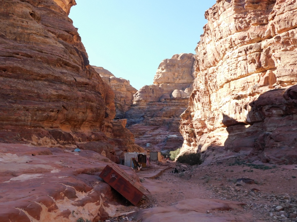
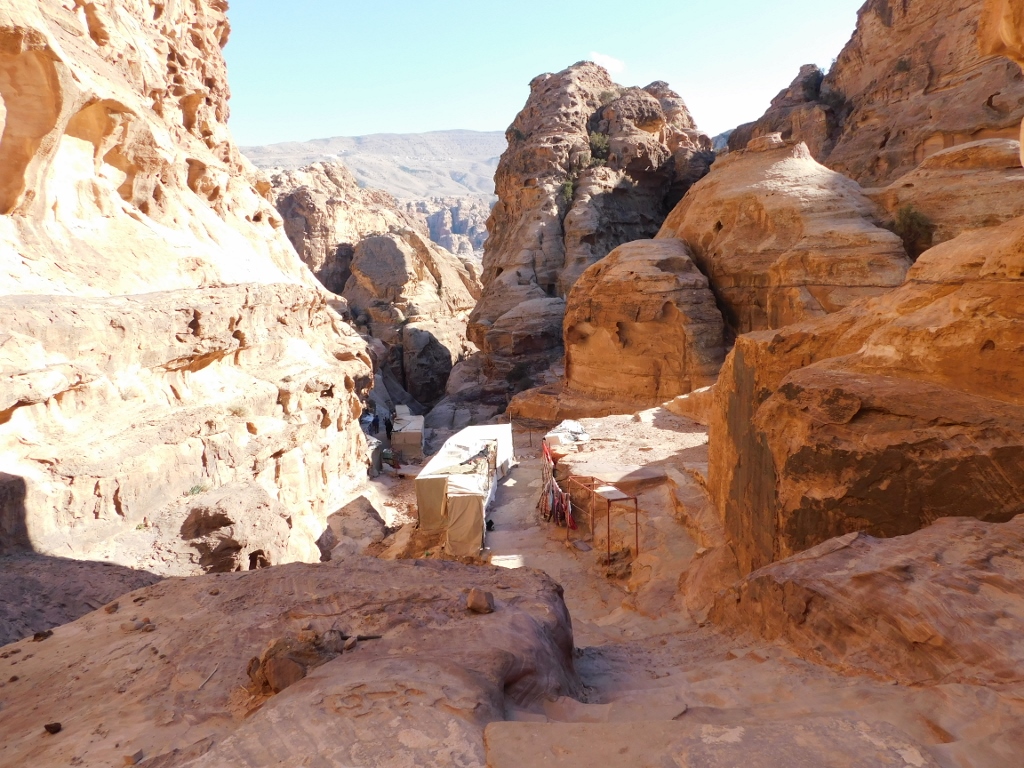
And then you get to the end of the flat section which is practically the dry riverbed of the Wadi Ad-Deir. This is where the steps begin.
 Ad-Deir trail, a detail
When you walk here, you should not only look in front of you or to the left and right; you should also look back. This is important because, although you are going to return the same way, the colours can be significantly different on account of the angle of the sunlight.
 Ad-Deir trail, beginning of the ascent
 Ad-Deir trail, you can see nicely the small canyon with the dry riverbed
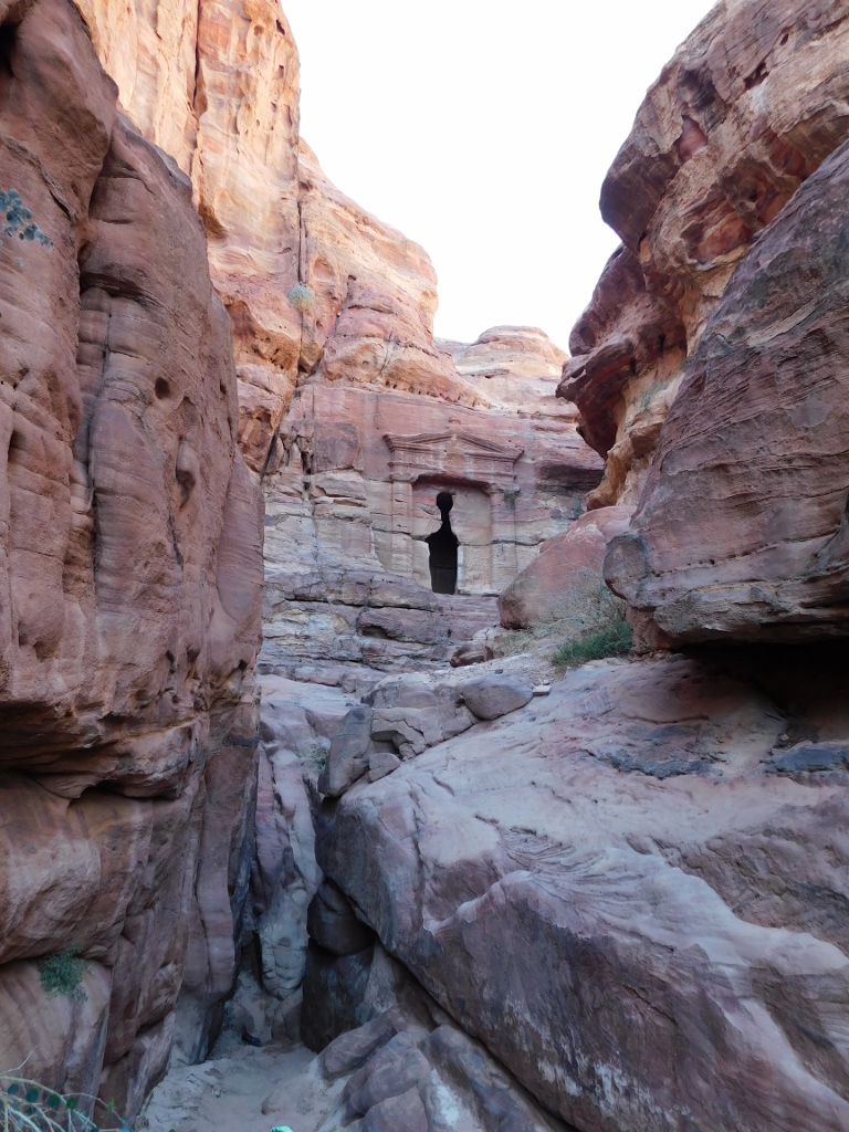
Relatively soon, you reach the place from which a very short and relatively narrow side gorge starts on the left-hand side. There is also an info-board, so it is not a bad idea to make this turn. Namely, at the end of that gorge there is the Lion Triclinium. I have already explained before that triclinium in Ancient Rome signified a dining room with three chaise longue around a small table. In Petra, this term is used for rooms linked to tombs where ritual banquets were held. In other words, they were used for the Nabataean version of honouring ancestors or deities. This is a good piece of information for all those who think that eating and drinking at cemeteries is not “urban” enough and is a backward custom. In other words, there is nothing new under the sun.
 Ad-Deir trail, narrow side gorge; remains of a Nabataean necropolis can be seen in the cliff
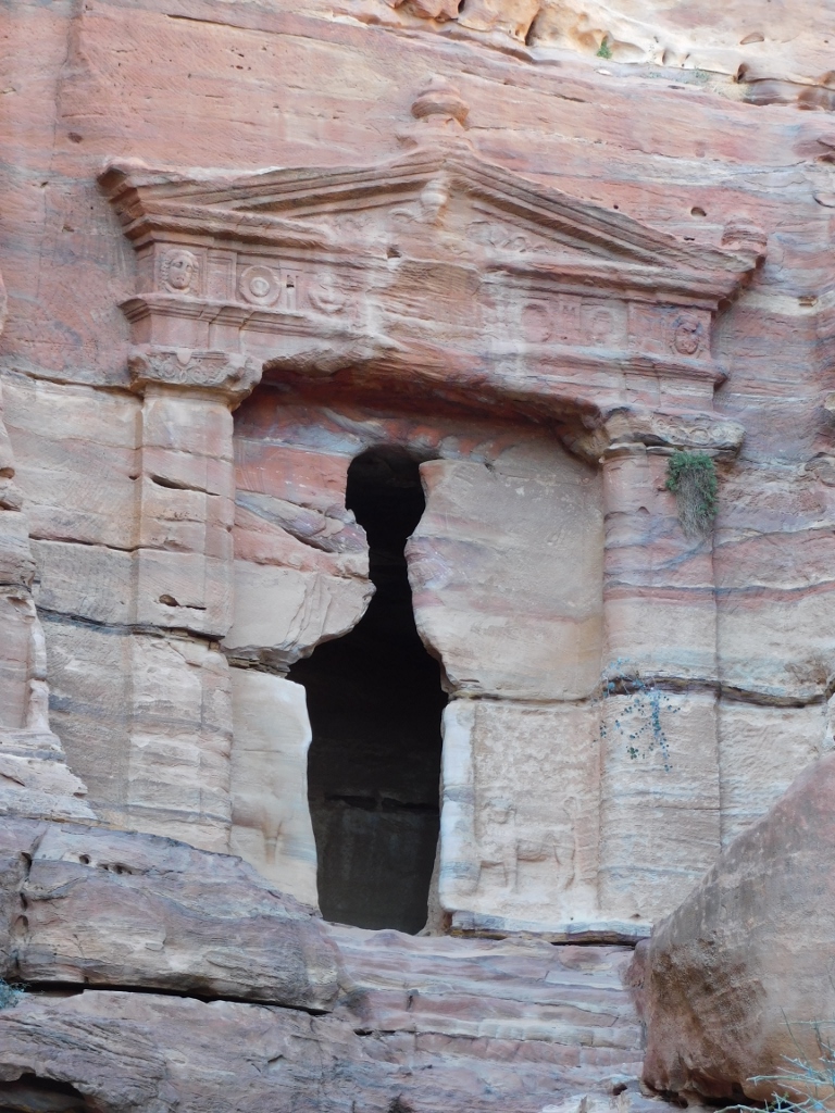
 Lion Triclinium
This concrete triclinium, from the 1st century CE, got its name because of the relief depictions of lions on both sides of the doorway. The facade is also decorated with a frieze at the ends of which there are heads of Medusa. Inside, there are three stone benches, which means that this was a proper triclinium. If you look at the photo above a little better, to the left from the entrance you may notice a betyl (sacred stone) chiselled in the shape of a shallow niche.
If the visitors are keen enough, they can climb here in order to get to the triclinium, but I contented myself with taking a photo from afar. The following photo shows only the end of the niche with the betyl on the left-hand side, but it does show well the lion reliefs close to the bottom of the facade (between the doorway and the pilasters), the Nabataean capitals with floral ornaments on the top of the pilasters, as well as the frieze with Medusa heads.
 Lion Triclinium
After this I returned to the main Ad-Deir trail and continued to climb up, but only after I had admired the surroundings first.
 Ad-Deir trail, a detail
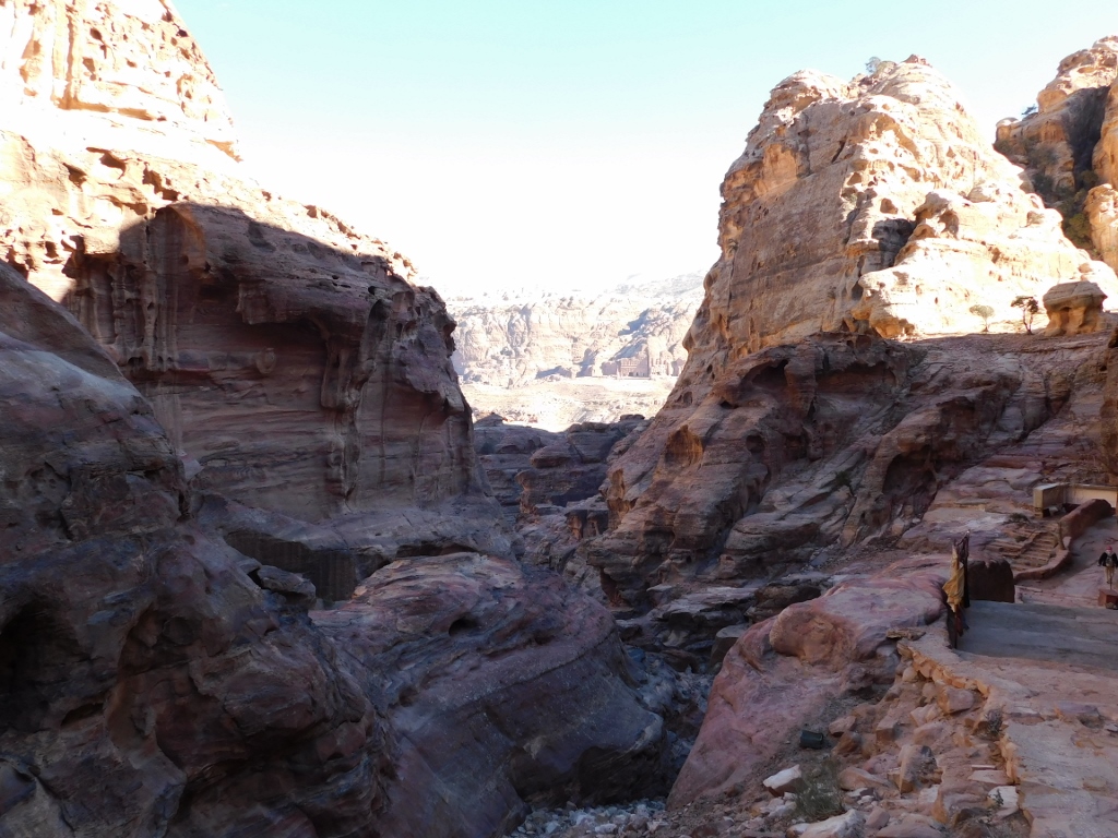
 Ad-Deir trail, view at the central segments of ancient Petra
Further climbing was filled with effort, breaks in order to catch my breath and/or take photos and intensive enjoying in the beauty of the place where I was.
 Ad-Deir trail, a large boulder resting against a cliff, with the trail passing under it
 Ad-Deir trail, a detail
 Ad-Deir trail, a detail
 Ad-Deir trail, a detail
In the early afternoon, the trail was mostly in the shade, but some other segments were lit by the sun. Thus, I also had a lovely view at a not too far classic Nabataean tomb the facade of which is decorated by pilasters with Nabataean capitals and a triangular pediment.
 Ad-Deir trail, a detail
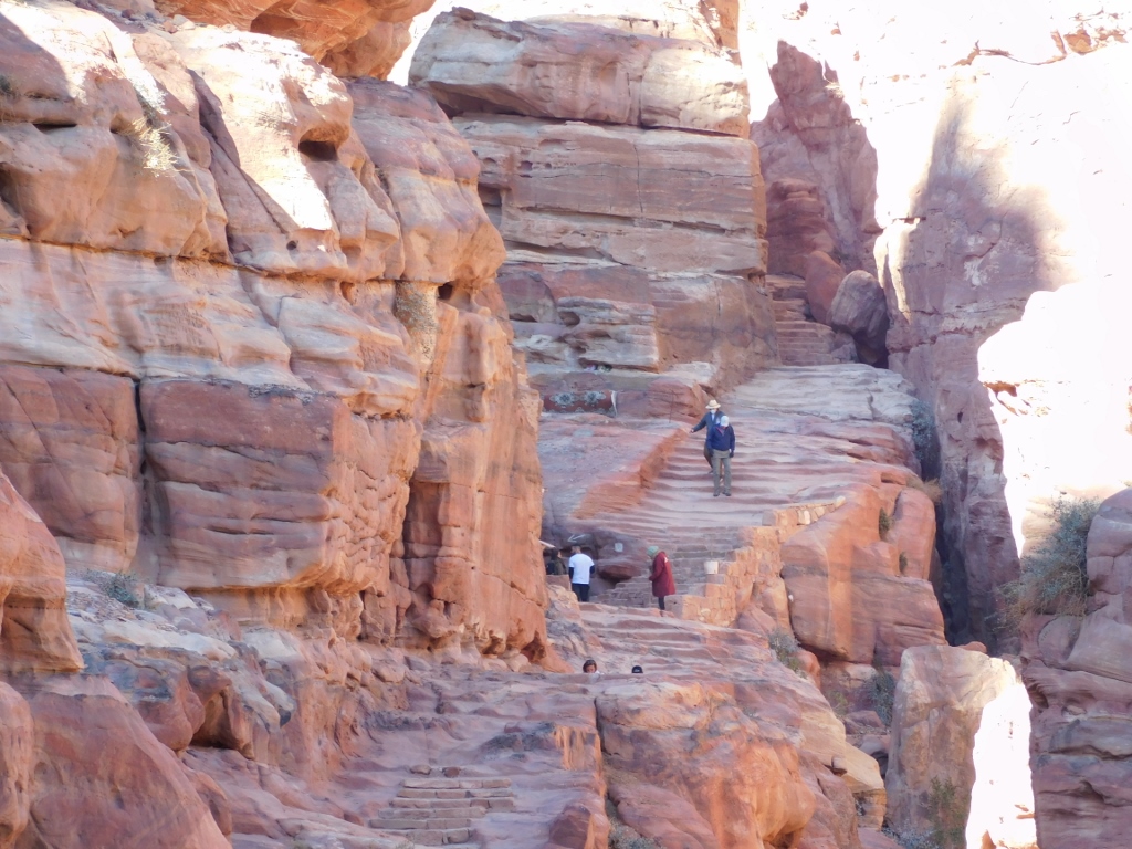
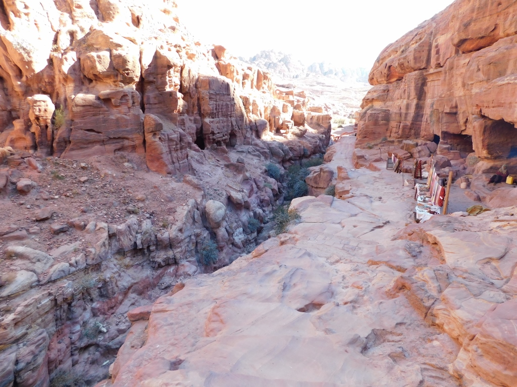
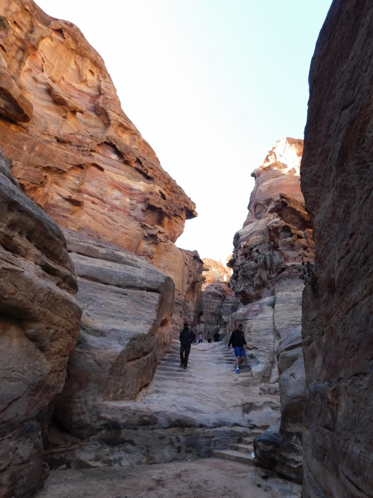
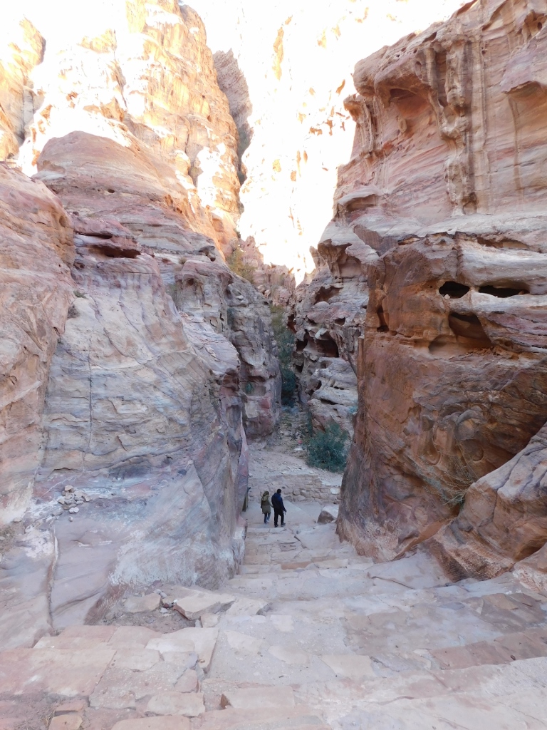
But, I had to focus more on the trail and the ascent. In addition to different parts of the trail, the following photos show that the people I met were actually going back. At this time of the day, I was the only one going up the hill, but I was not alone here. In many places along the trail there are stands with souvenirs sold by local Bedouins. Although it was the low season, some of them kept sitting patiently by the goods they offered.
 Ad-Deir trail, a detail
 Ad-Deir trail, a detail
 Ad-Deir trail, a detail
From the same point from which I took the photo above, I noticed to the right a structure on an almost a plateau which I believe was an eroded djinn block.
 Ad-Deir trail, a detail
From that same point, there was a wonderful view at the surroundings and the central areas of ancient Petra. I have already mentioned before that I do not know how to take photos so that you see equally well the parts that are in shade and those that are lit by the sun. But, if one is aware of a shortcoming, one should then either try to remedy it or avoid it. Here in Petra, there was nobody to teach me how to take good photos (under supposition that my photo-camera can do this), so I solved the problem by focusing my camera on different points, using the zoom in the process. I am very pleased with the result.
Thus, in the following photo, you can see well the area through which the Ad-Deir trail goes. On the right-hand side, you can notice steps going down, while above them, next to the very edge of the photo, you can see the detail from the previous photo, i.e., what I believe to be the eroded djinn block. In the middle, quite far away, there are the pale segments of the centre of ancient Petra.
 Ad-Deir trail, a detail
When I started to zoom in and focus my photo-camera differently, some details started to appear beautifully from the paleness visible in the photo above – such as the rocky Jabal al-Khubtha massif with a couple of Royal Tombs, as well as the contemporary town Wadi Musa that practically serves the archaeological site of Petra and that is seen in the next photo above the central rocky massif.
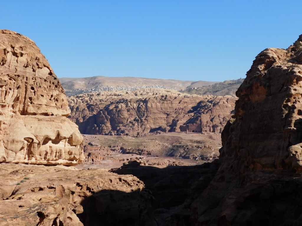 View at the rocky Jabal al-Khubtha massif and Wadi Musa town
And then I zoomed in on the sight a little more, which led to a fabulous view at the Palace Tomb and the Corinthian Tomb.
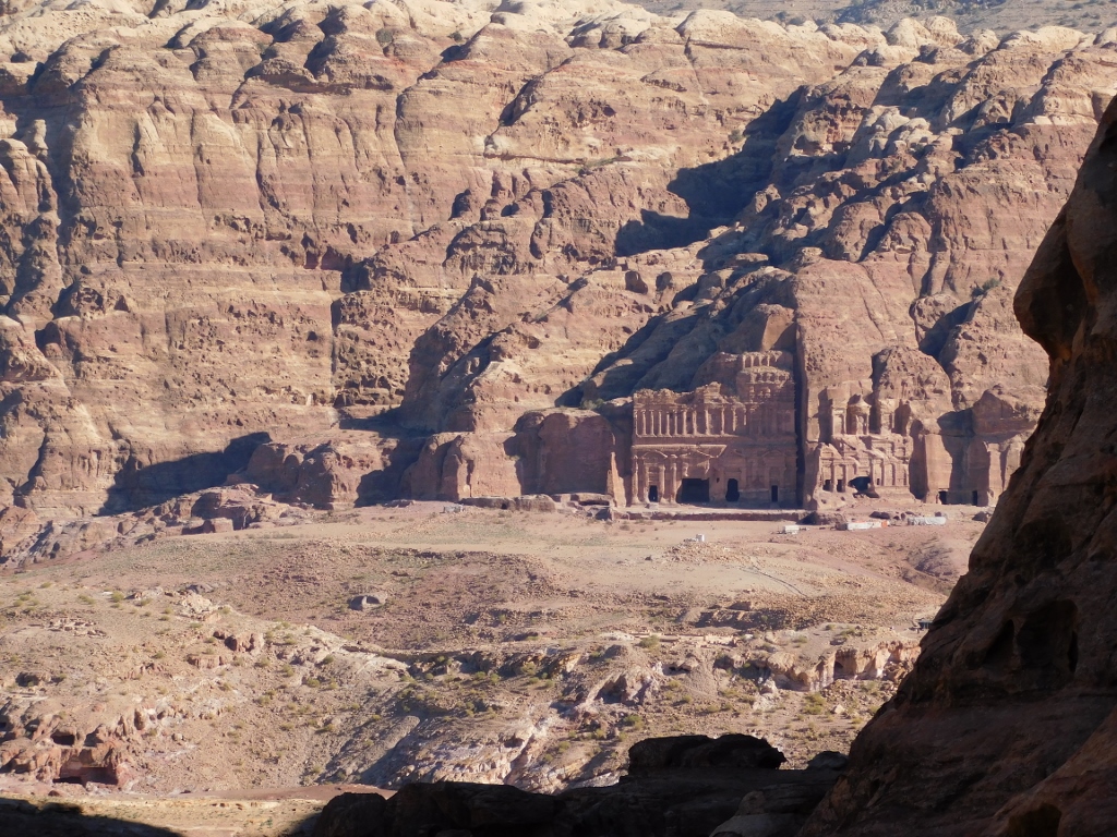 View at the Royal Tombs
After this break, I continued to climb up and soon I became aware I was getting close to the end of the trail, since the cliffs were significantly lower.
 Ad-Deir trail, a detail
I walked a couple of minutes more and then I looked back again and could only confirm to myself that I had climbed quite nicely, judging by the line of the horizon.
 Ad-Deir trail, a detail
When the trail reaches its highest point, first it goes flat for a short while and then it descends thus leading the visitor to a spacious rather flat plateau in front of Ad-Deir or the Monastery.
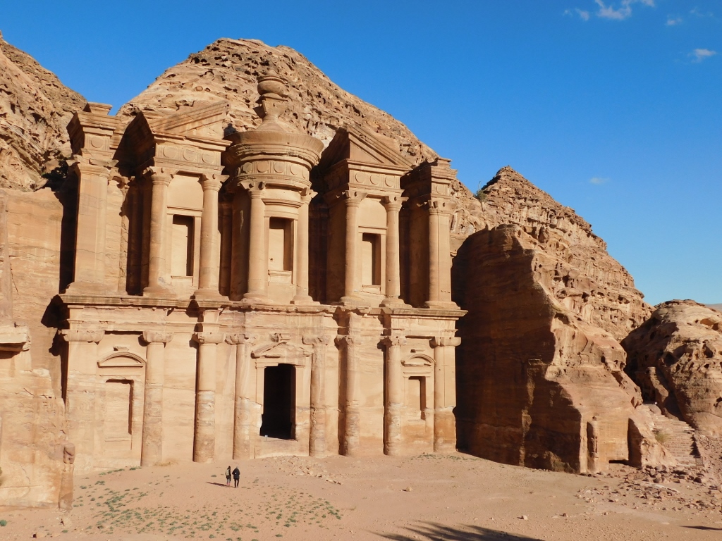
I got here in incredible 1 hour and 15 minutes, which was a true miracle for me since I made a lot of breaks. On the other hand, the time of my arrival was ideal, since the afternoon sun shone perfectly at the facade of Ad-Deir. As I was here in January, it was clear I could not stay here for too long, since I needed to descend safely and later get back to Wadi Musa.
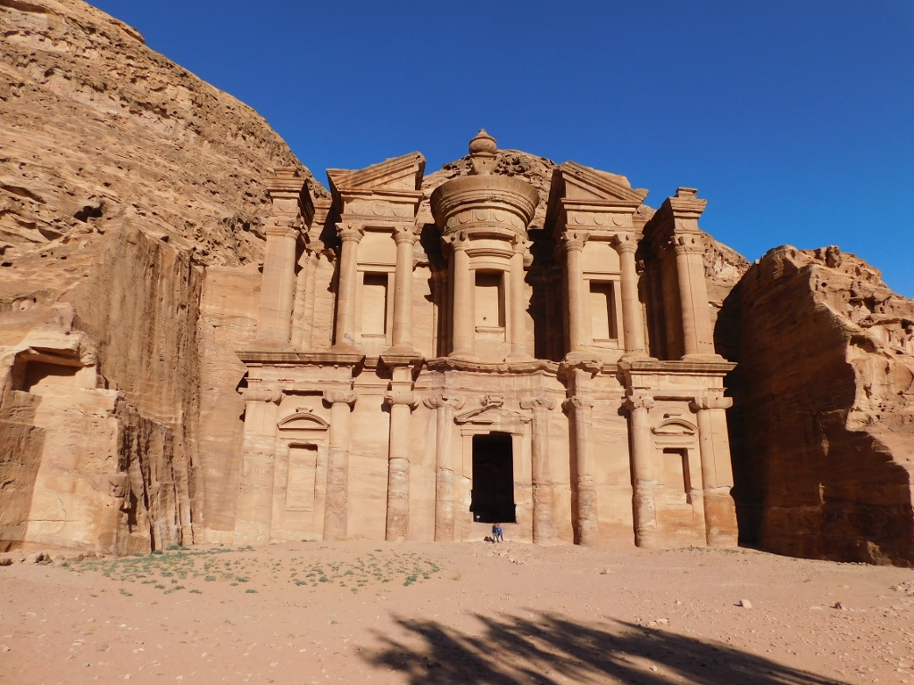
That is why I started right away to take photos and pay attention to the details of the Monastery or Ad-Deir in Arabic; hence the two names that appear in relation to this structure. The name was given by local Bedouins on account of some crosses written on the back wall of the interior during the Byzantine rule, while the structure was carved out of the cliff around the middle of the 1st century CE.
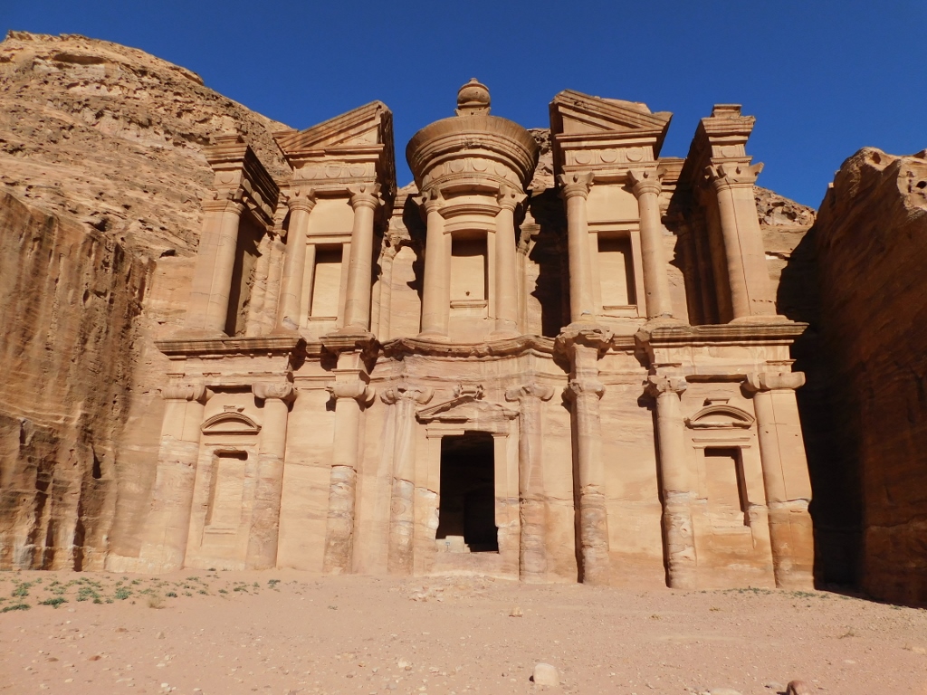 Monastery or Ad-Deir in Arabic
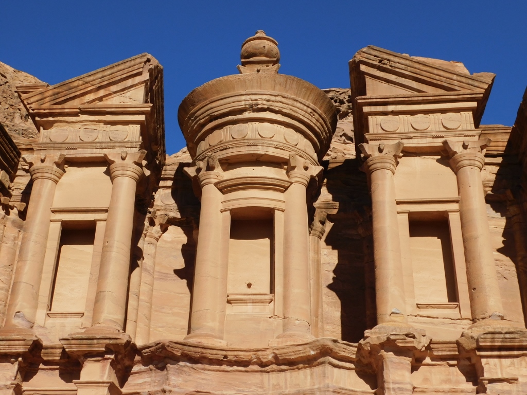
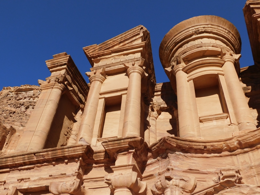
The facade is 48 m wide and 47 m high. This scale cannot be seen well in the photo above because of the angle of the photograph and the perspective.
At first sight, it may seem that this facade carved out of the rock is reminiscent of the facade of the Treasury, but it is not the case. Although it has its ornamental elements, Ad-Deir is much less decorated than al-Khazneh.
The similarity with the Treasury is reflected in the basic elements of the upper zone – in the middle, there is a round tholos, while to the sides there are broken pediments, but it is all less adorned in comparison to the Treasury.
 Monastery, a detail
All half- and 3/4-columns on the facade have Nabataean capitals.
 Monastery, a detail
The tholos has a conic roof and on top of it there is an urn placed on a Nabataean capital. It sounds completely incredulous that the urn, together with the capital on which it stands, is 9 m tall! The urn and the Nabataean capital are seen a little better in the next photo.
 Monastery
It is presumed that the two lower and the three upper niches originally contained statues.
The doorway is 4 m wide and 8 m high, and it leads into a chamber with an almost square plan, 11.20 m x 12 m. The chamber is some 10 m high and in the back wall there is an arched niche.
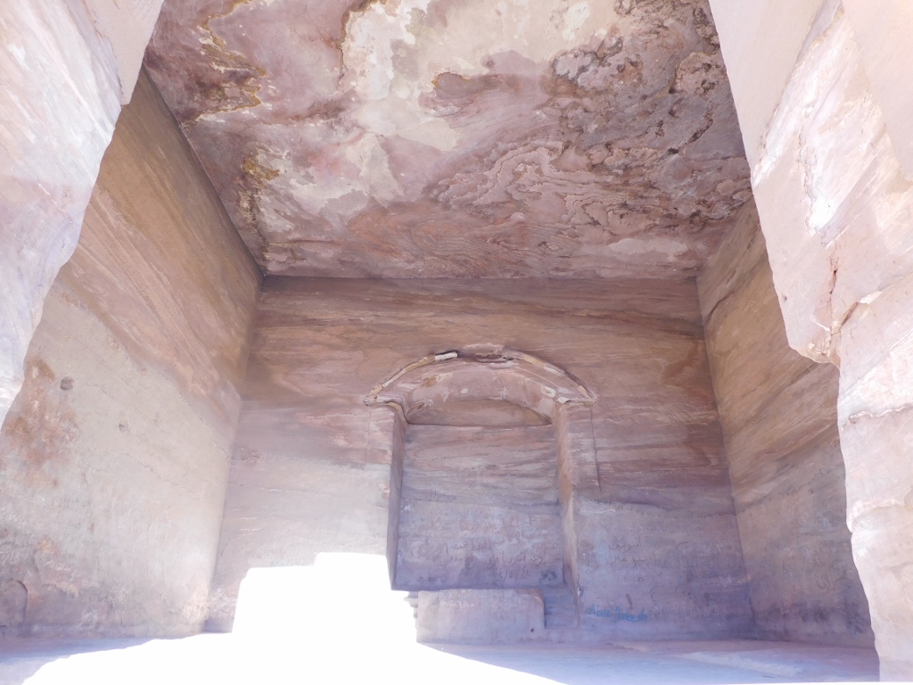 Monastery, the interior
Since no graves have been found in the interior of the Monastery, it is clear that this was not a tomb. In addition, close to Ad-Deir an inscription was found that suggests that this was the place where Nabataean King Obodas (one of several of them, not clear which one) was honoured here, since he was deified after his death and thus his cult was celebrated at this venue. The plateau in front of the Monastery is not natural, but was man-made. This additionally suggests that the Monastery was used as a temple, since the plateau was made in order for worshippers to be able to gather there.
As for the measures that I mention in connection with different segments of the Monastery, they may sound completely incredible at first, especially when the photographs of the facade do not contain any reference object. I personally prefer having photos of the structures of this kind without humans, but here I took advantage of the presence of a couple of visitors (who obviously came here earlier), so I asked them to take a photo of me. Then I reciprocated.
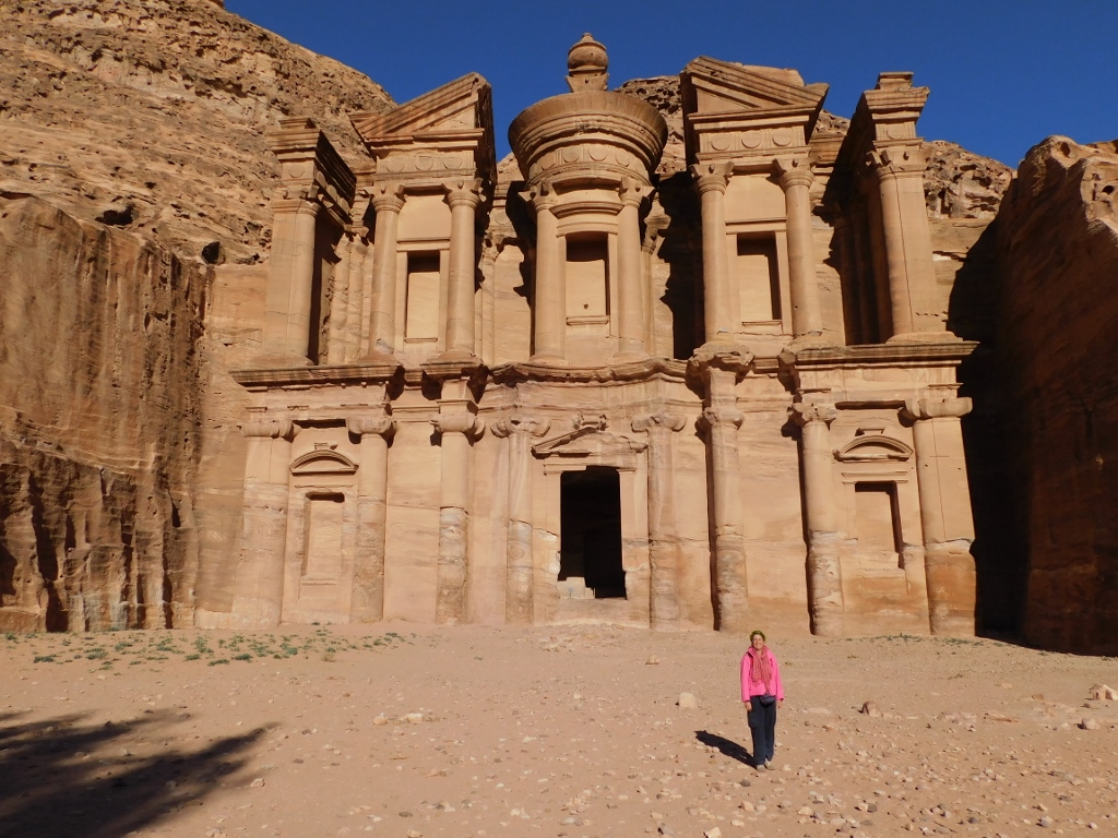 Posing in the plateau in front of the Monastery
First, you can see that I have my wind-jacket on, but it needs to be said that underneath I had another one, made of goose down. What I want to say is that the sunlit facade and the blue sky create a very wrong impression. It was very cold. After all, it was January.
Second, the photo above in fact does not provide a good representation of the scale and the size of the Monastery, since I stood far enough. It is only in the next photo, where I caught a couple of people who got to the very doorway leading into the Monastery, that one can have a more realistic picture about the size of this structure.
 Monastery, people beside the doorway as reference objects
Now I went for a brief walk around the area. The next photo shows how much of the mountain had to be removed in order to make this facade.
 Monastery
In addition, on the left-hand side of the photograph, it is possible to discern, above the board, an altar that was made on that rocky terrace at the bottom of the large rock that flanks the Monastery.
Also, one can see hewn out steps on this rock, more towards the top. They lead to the “roof” of Ad-Deir. In the past, the access was permitted here, but at some point a tourist fell off the urn (I don’t know why people feel the need to climb to the places like this – it can only contribute to the decay), so now the access is blocked, but even if it weren’t, I would certainly not go there.
On the cliff to the side, north, from the Monastery, there are numerous carved niches, cisterns and caves.
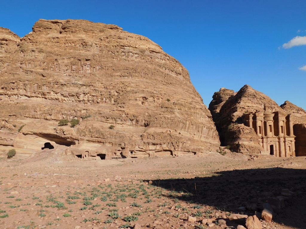 Monastery, surroundings
I was now, however, more interested in getting to some parts from where I could admire the beautiful vista at the rocky mountainous area.
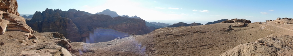 View from a plateau close to the Monastery
Having enjoyed the spectacular view, I returned towards the Monastery.
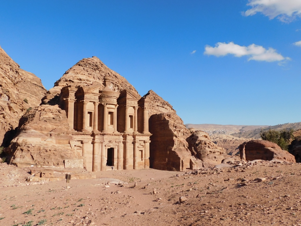
 Monastery or Ad-Deir
Around the Monastery, there are some other structures that can be visited, but to start with I was so taken by Ad-Deir that I felt the need only to admire it. On the other hand, I had to keep in mind the return. This was very important not only because of the time of the day, it was around 3 pm and I still had the time, but I was incredibly tired and fully aware that the return would be difficult.
 Monastery or Ad-Deir
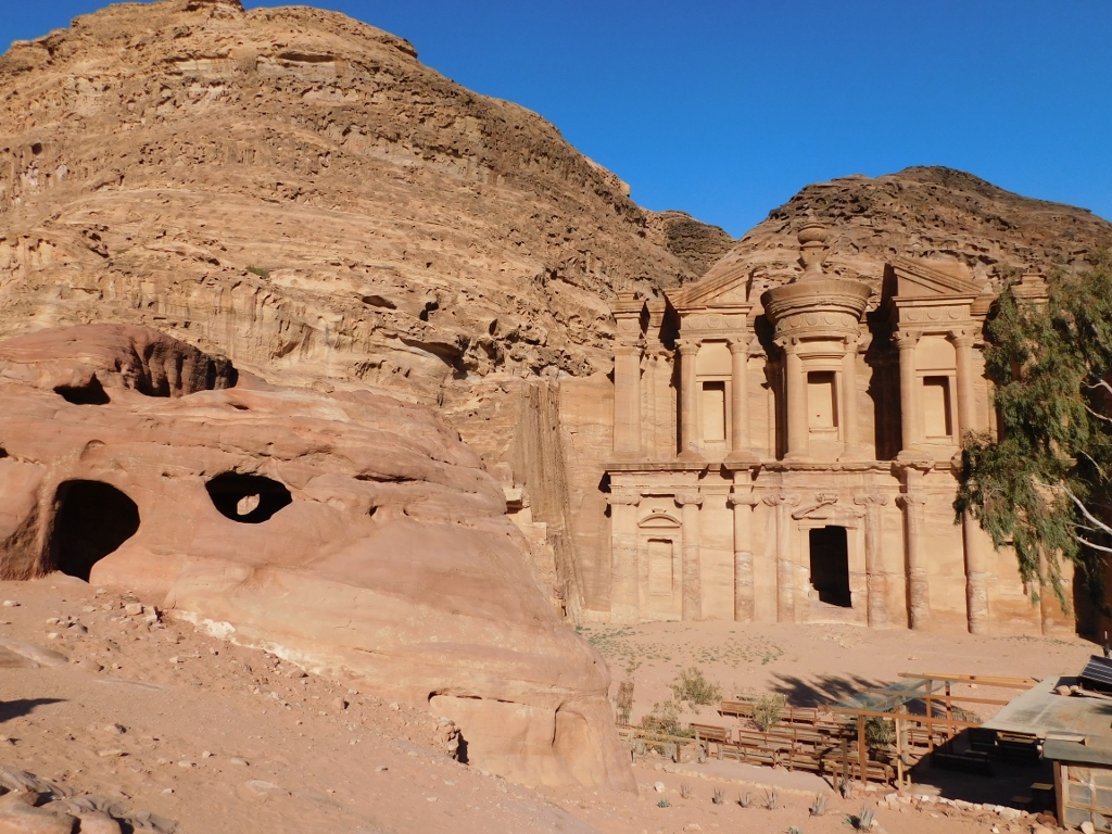
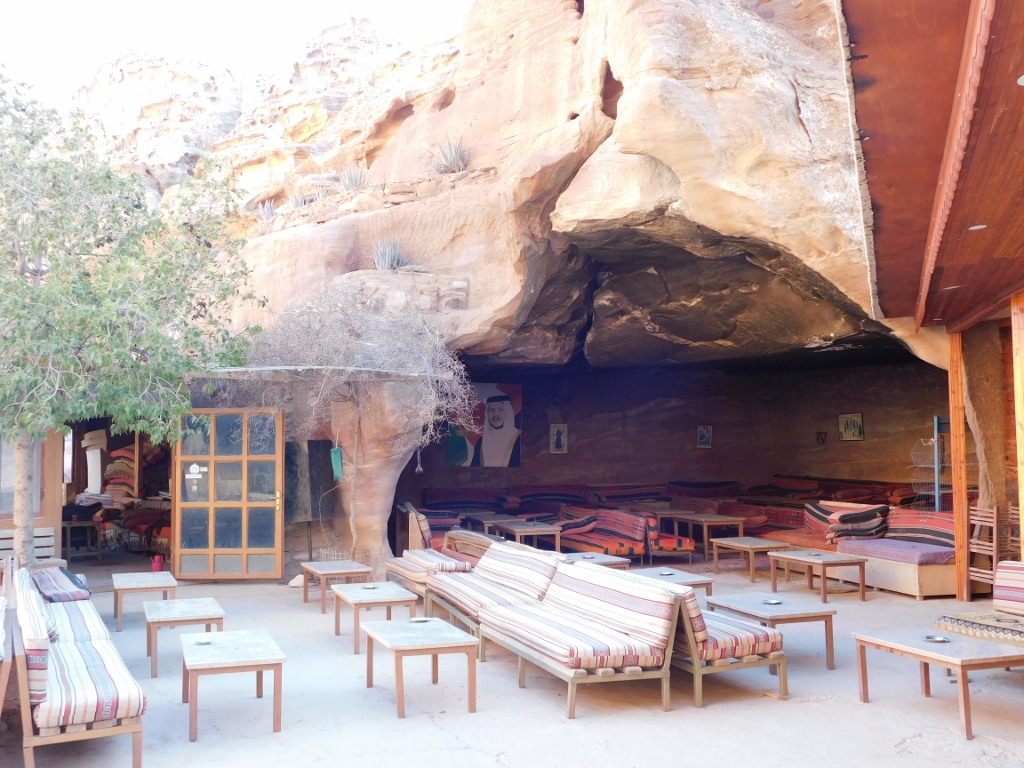
In the photo above, down and to the right, you can see some benches that belong to a restaurant/bar that operates here. Already at the very beginning of my stay here, I sat there and quickly ate and drank something I had in my small backpack (since the restaurant was already closed for business), all the time looking directly at the Monastery. A part of that restaurant/bar are the tables and sitting areas nicely tucked under the rocky eave. It must feel very good when on hot days one sits here in the shade.
 Detail from the direct proximity of the Monastery
After this, all I had to do was to start walking back. But not before taking a selfie with the Monastery in the background. I was extremely tired, but exceptionally happy and content.
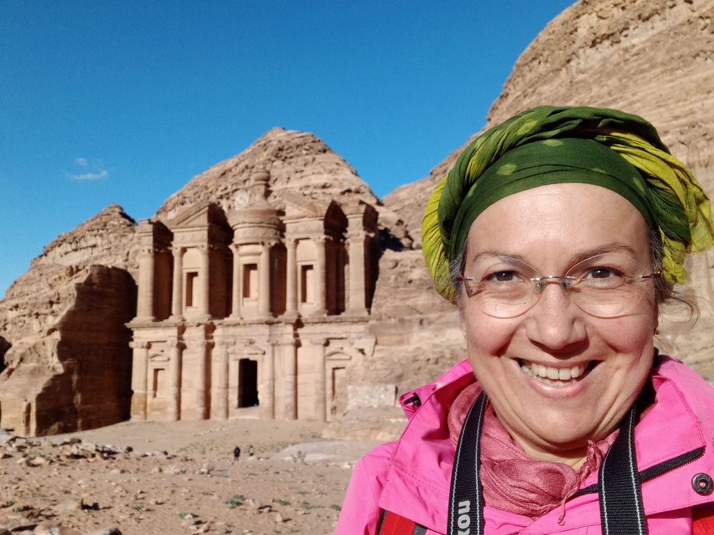 Selfie by the Monastery
Now I could finally follow the same trail that had brought me here.