When I finished with my visits to the Royal Tombs in Petra, I continued to walk in the same direction around the Jabal al-Khubtha massif since I wanted to have a look at a couple of other facades I had read about.
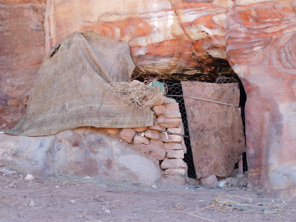
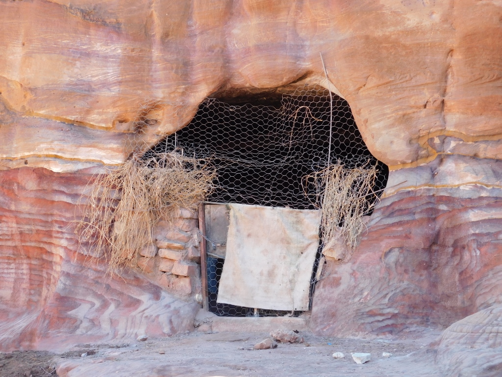
Along the way, I passed by several “caves” carved out in the past which apparently found their contemporary use – for instance, as a part of a Bedouin household. I wanted to peep a little, to see what was inside, but I did not like in the least the barking of the dogs that were obviously in the caves and that were guarding the property of their owners. I contented myself by taking photos of these places from a certain distance.
 Petra, a detail
 Petra, a detail
Although there are parts of Petra that are more famous and thus they are the main focus of the visitors, it needs to be kept in mind that this was a large, rich and a long-lasting city, with a lot of inhabitants and thus there was a need not only to make the living space for them, but also numerous tombs and here, for obvious reasons, rock tombs reigned supreme. And so, a little farther away I saw a group of smaller tombs and even farther up on the hill parts of a contemporary settlement (a village close to the town of Wadi Musa). During these couple of days, I stayed in a hotel precisely in Wadi Musa that is the main urban centre from which Petra is visited. Of course, there are also numerous daily excursions to Petra either from Amman or from Aqaba, since Petra is the main tourist product of Jordan.
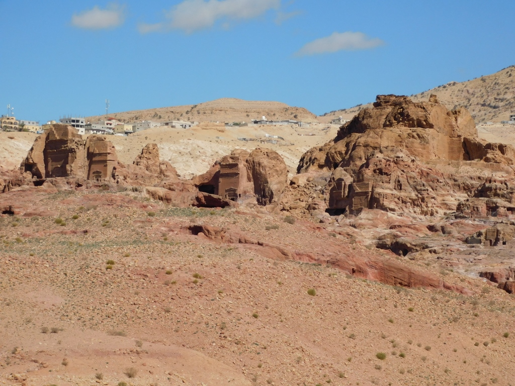 Parts of Petra and a little farther parts of Wadi Musa town
I have already mentioned before that the Roman Empire annexed the Nabataean Kingdom in 106 CE. Still, the life went on in the usual way. The people lived here, they worked and they died. However, after the Roman annexation the burials in the centre of Petra were prohibited and so even the tomb of one of the first governors of the Roman Provincia Arabia, Sextius Florentinus, was located a little farther from the centre. The tomb was commissioned by his son and this is the only tomb for which it is known exactly that it was made in 129 CE.
 Sextius Florentinus Tomb
Although the facade of the tomb has eroded significantly, it is still possible to discern different architectural and decorative elements. There are several zones and each one of them has interesting elements, whether these are pilasters, half-columns, pediments, arches, reliefs or something else, but it is certain that there is a mixture of Nabataean and Roman influences.
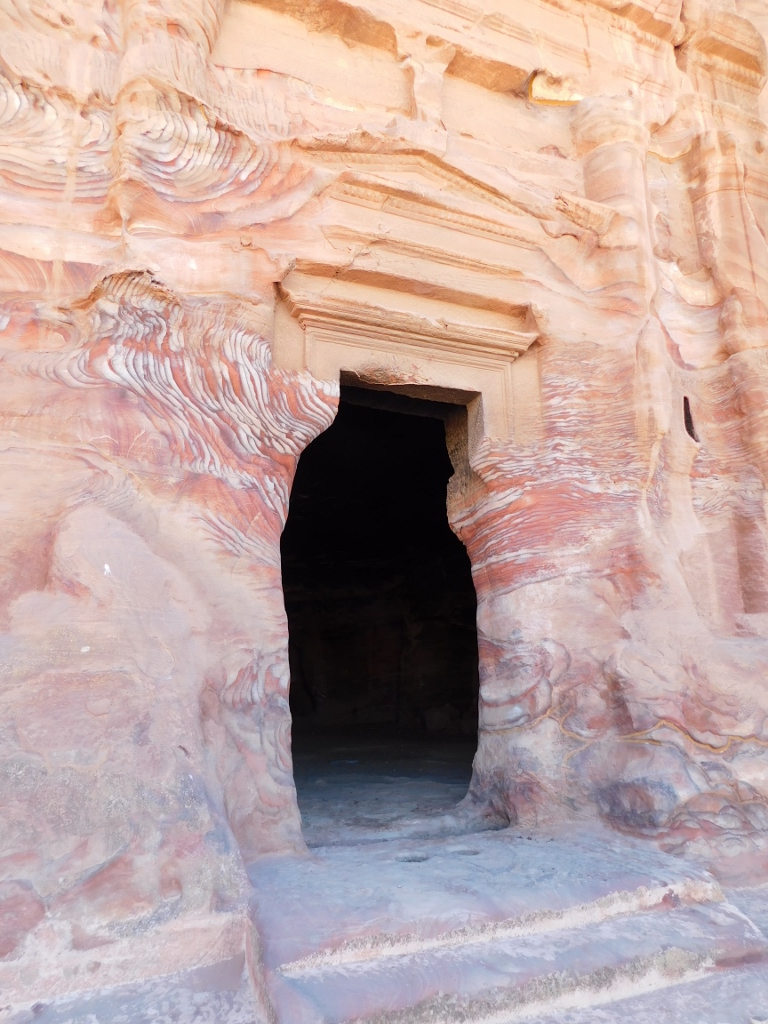 Sextius Florentinus Tomb, the entrance
In the photo above, there is an interesting detail in the shape of a narrow cut in the rock to the right from the entrance. Apparently, it served to provide light in the interior of the tomb, although I don’t find this explanation plausible.
On the other hand, I was again enchanted by the beauty of the sandstone that was so prominent in the parts where the wind has destroyed the facade, for instance, to the left and right from the doorway. I have already mentioned that Petra is often referred to as the Rosy Red City. It is completely clear why.
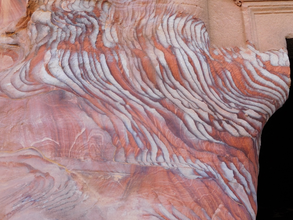 Sextius Florentinus Tomb, the rock to the left from the entrance
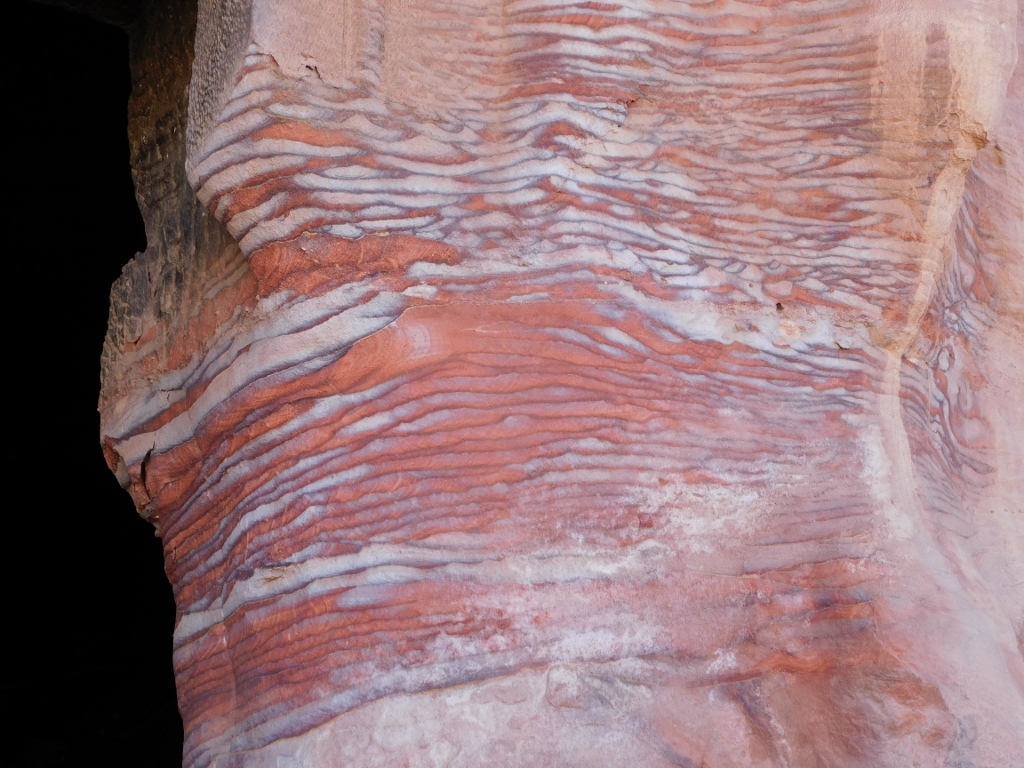 Sextius Florentinus Tomb, the rock to the right from the entrance
At the very entrance into the tomb, there are some small indentations made in the rock on the floor, but I could not find anywhere what this was used for.
 Sextius Florentinus Tomb, a detail
Inside, in the back wall, there are five loculi (deep burial niches), while on the right-hand side there are a couple of wide burial chambers.
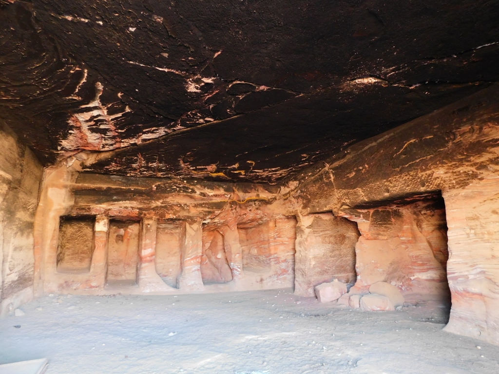 Sextius Florentinus Tomb, a detail
I decided to walk some more in the same direction and that was practically further through the area called Wadi al-Mataha, thus moving away from the centre of Petra for a short while, but sticking to the part close to the cliffs of the Jabal al-Khubtha massif.
To start with, I looked back once again at Sextius Florentinus Tomb. The next photo shows nicely in what kind of rock the tomb was chiselled in.
 Sextius Florentinus Tomb, the facade and the entrance are on the right-hand side of the photo
What can also be seen in the photo is yet another “cave” used by local Bedouins as a part of their household. The photo below shows it even better, although “the curtain” was drawn.
 Petra, cave used by Bedouins is up and to the right
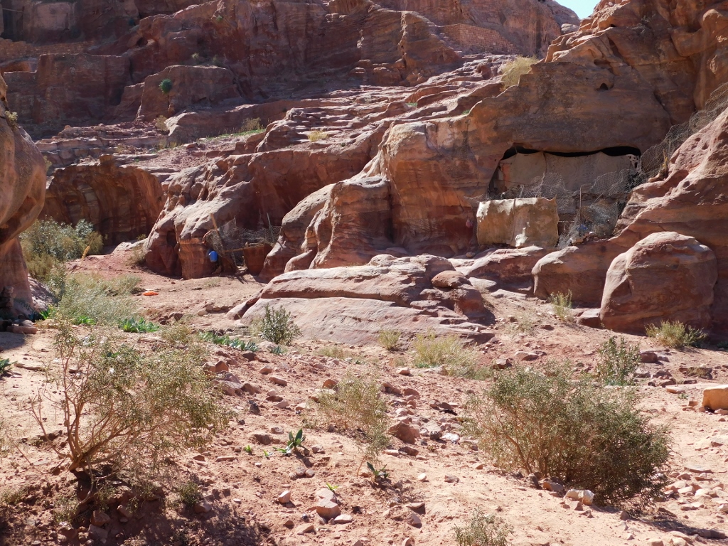
Right across this cave there were some other spaces carved out of the rock, but this time without any facade.
 Petra, a detail close to Sextius Florentinus Tomb
So, here I was already in the area belonging to Wadi al-Mataha. The next photo shows, on the left-hand side, on the hill the previously mentioned numerous tomb facades, as well as some “caves, while on the right-hand side, in the shade, in the cliff belonging to the Jabal al-Khubtha, you can mostly see some “caves.”
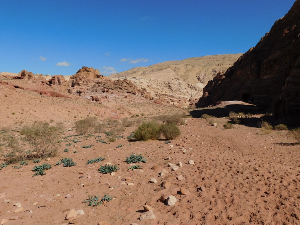 Wadi al-Mataha
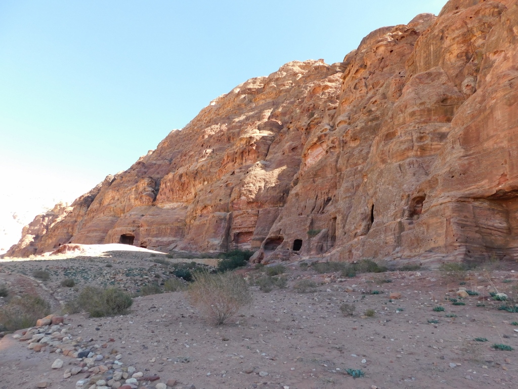 Wadi al-Mataha, the cliff belonging to the Jabal al-Khubtha massif
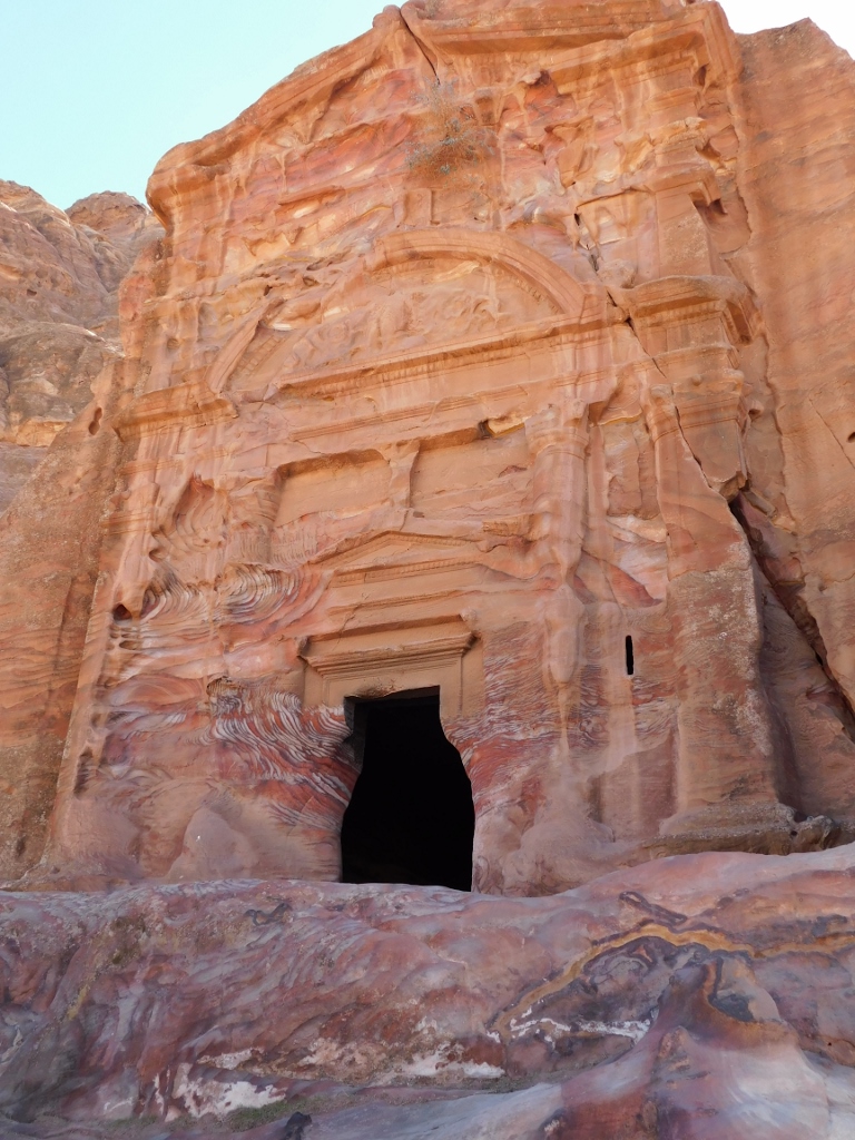
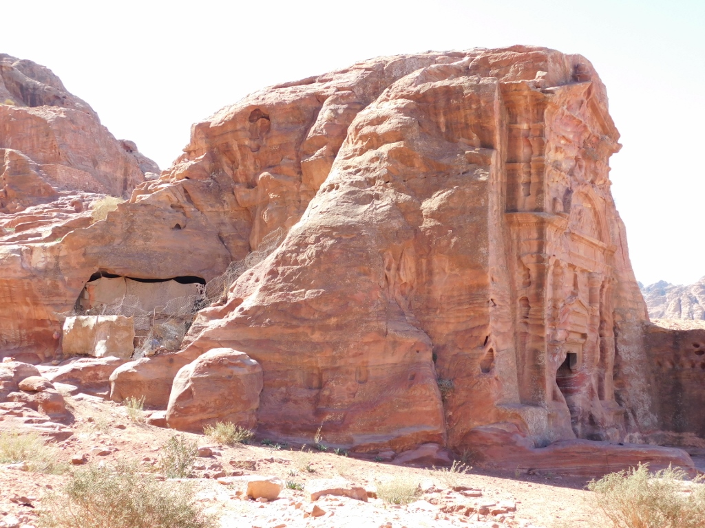
If you look a little better at the photo above, right in the middle was my next destination – the Carmine Tomb. Here it is again, from up close; I took the photo when I reached it.
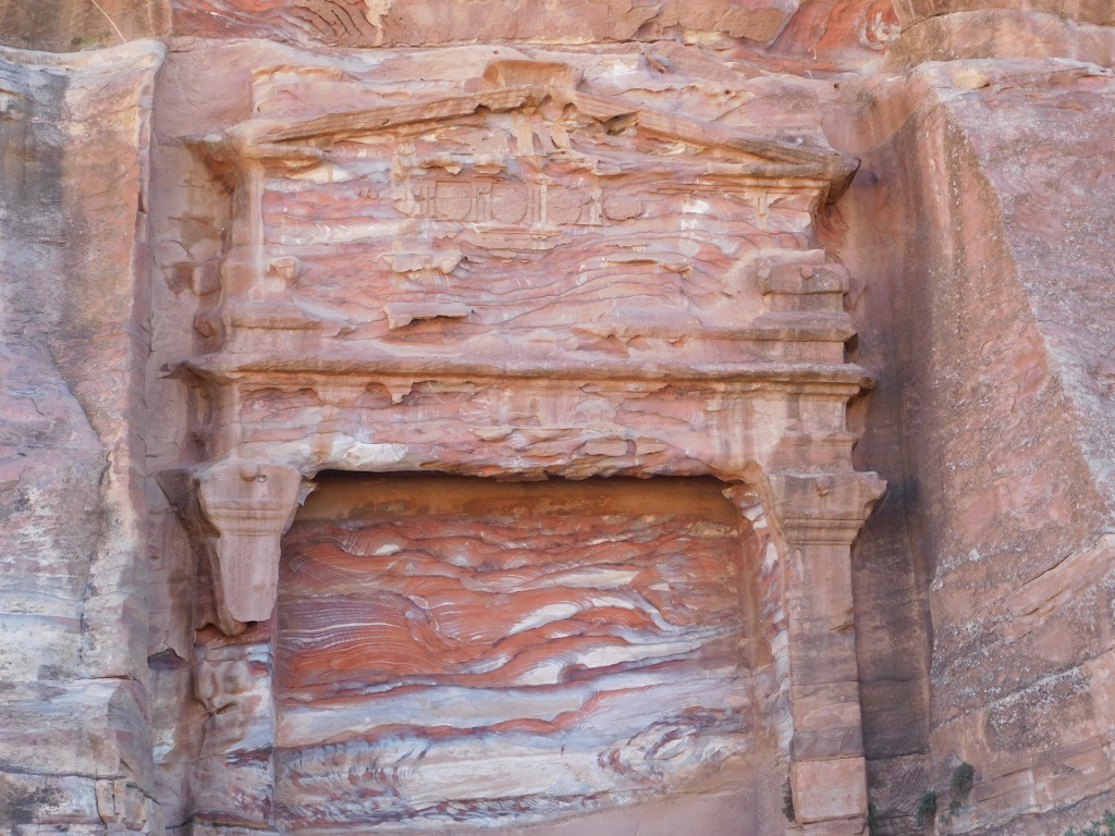 Carmine Tomb
This tomb got its name because of the strikingly red segment seen here and apparently the tourists visit this place rarely because it is somewhat farther away from the main attractions in Petra. I was not sorry at all for coming all the way here. Moreover, walking in this area, I just could not stop admiring the magnificent creativity of nature, this time expressed through those fascinating rocks.
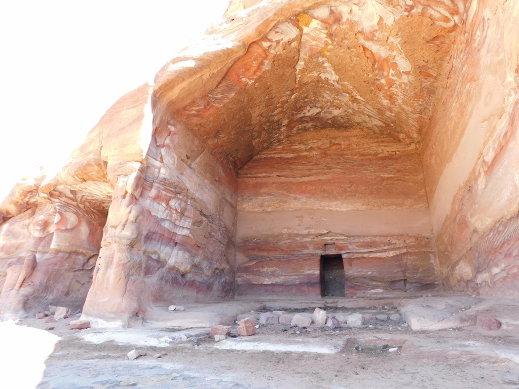
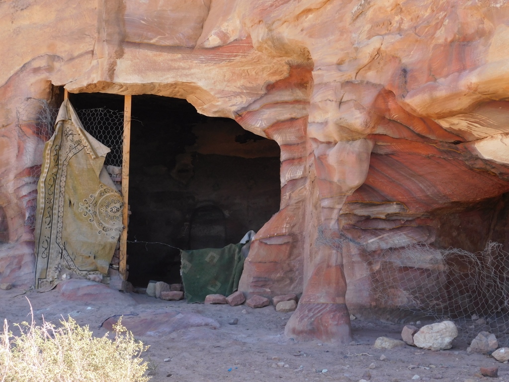 Petra, a part of a Bedouin household
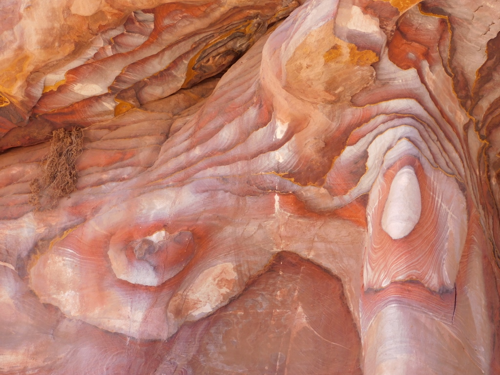 Petra, a detail photographed on the northwest side of the Jabal al-Khubtha massif
After this, I started to go back towards the centre of Petra. First I followed the trail made to go in parallel to the cliffs of the massif, but then I just turned and headed straight in the direction of the centre, not following any particular trail at all. There was nobody around anyway to possibly tell me it should not be done like that. And why would anybody?
After a while I had a gorgeous view at the Royal Tombs group from afar.
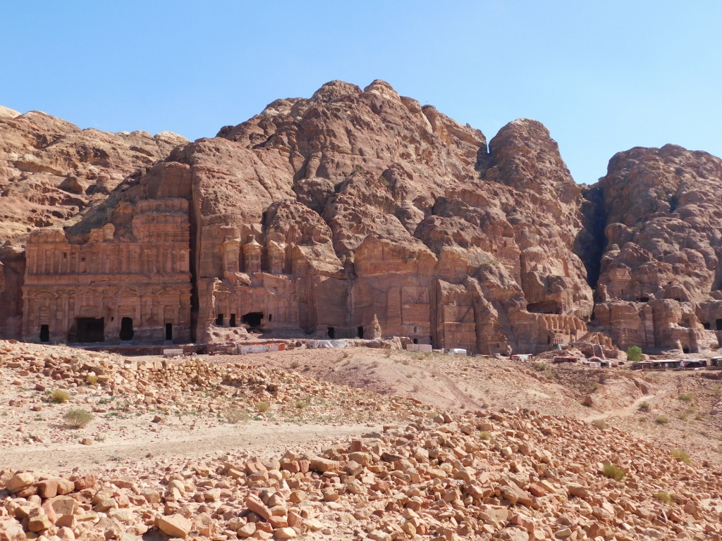 Royal Tombs
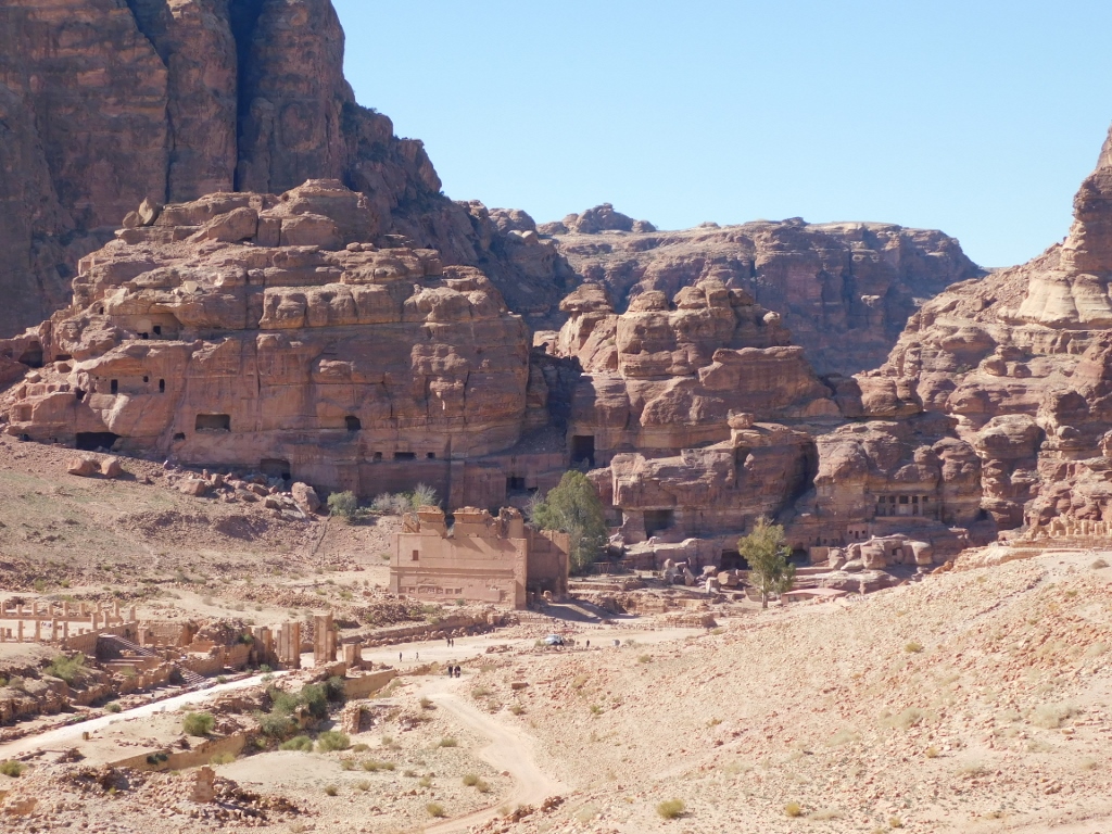
From this point, I also had a nice view at the part of Petra from which you walk to the centre, as well as at the centre of Petra itself.
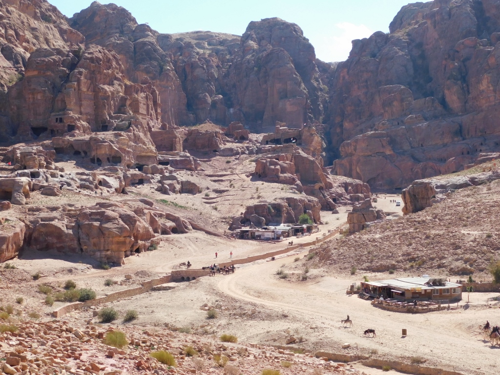 Petra, wide visitor path coming from the Street of Facades, as well as the bed of the seasonal Wadi Musa stream
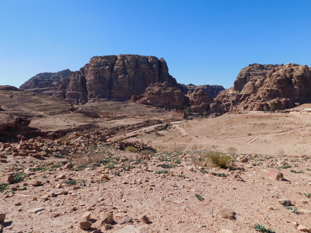 Petra, the centre
And here are some sections of the centre, when zoomed in:
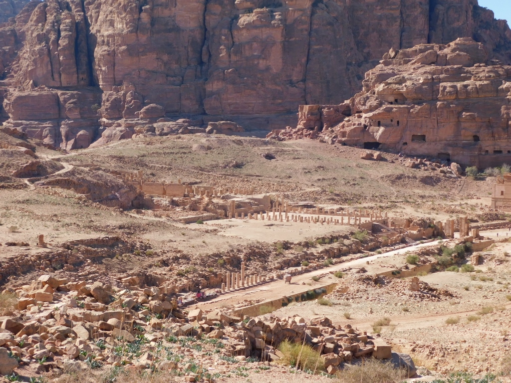 Petra, Great Temple and the Colonnaded Street
 Petra, Qasr al-Bint temple is in the middle, while the Temenos Gate can be seen in the street
Walking further across the wide valley, Wadi Mataha, I could also see some other sights – such as a Bedouin tent.
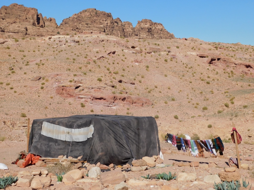 Bedouin tent in Wadi Mataha
Namely, irrespective of the fact that this is the archaeological site of Petra, inscribed on the UNESCO’s World Heritage List, this is also the place where Bedouins have lived for centuries. Members of the largest Bedouin tribe in Petra, B’doul, claim to be the descendents of the Nabataeans. Today, a lot of them live in the nearby village Umm Sayhoun built on an elevation north of Wadi Mataha, although some of them prefer the traditional approach to housing – living either in tents or in caves.
Be as it may, even though they are unquestionably the natives here, over time they have left the semi-nomadic life style and most of them are nowadays linked to tourism and tourists, whether they work in hotels or at the site itself, as guides, camel and horse drivers, souvenir vendors, etc. When you look at this landscape and try to imagine the hard life of the local inhabitants in the case of the traditional life-style, no wonder they prefer to work with tourists.
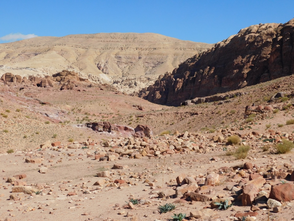 Wadi Mataha
On the other hand, I must admit, that I often tend to be quite suspicious of the “sad stories” about the local population working in tourism. Not that it mattered here, because I wanted to do the sightseeing on my own, since I prefer it that way, I had my guidebooks and I wanted to walk around Petra and not ride a camel, donkey or horse. And, I did it all as I pleased.
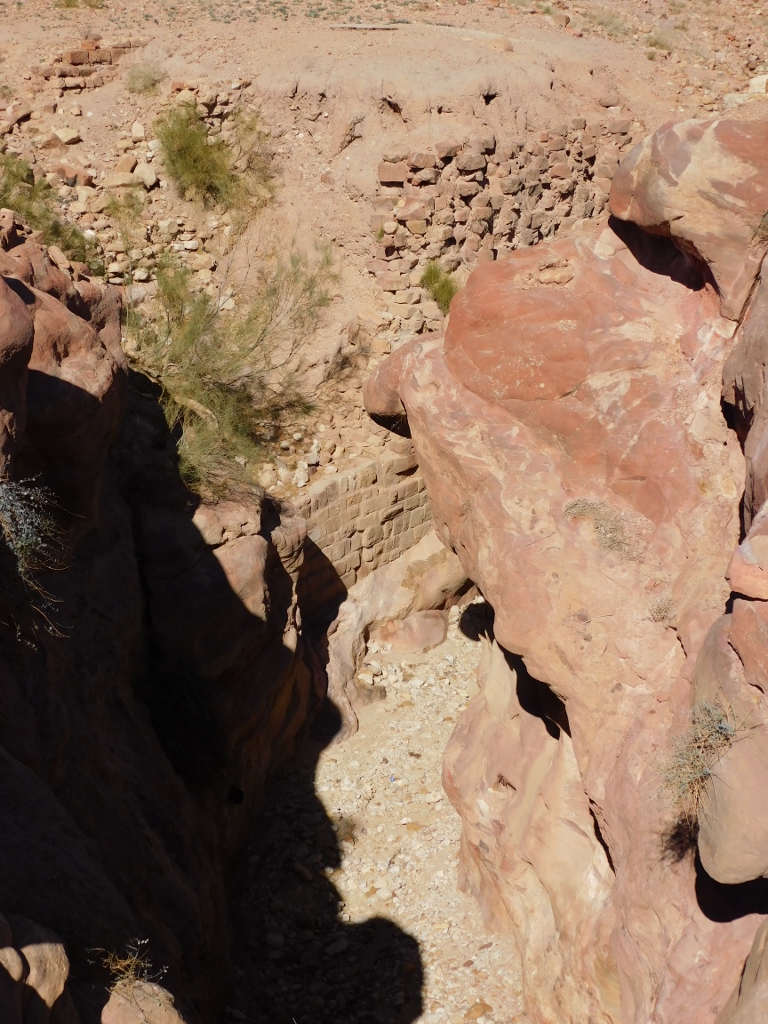
Walking at first almost randomly across Wadi Mataha, but in the good general direction, at some point I came across a trail, so I continued along it. This was quite by accident and then it led me to a very interesting place – a bridge over a tiny canyon that goes through Wadi Mataha.
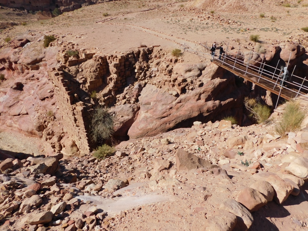 Canyon in Wadi Mataha
You can see remains of a built wall here and I can only presume that this is what is left from a Nabataean dam, since this canyon as a part of the broad valley Wadi Mataha (as I mentioned in part 27) served in fact as one of the channels for bringing the water down to the centre of Petra.
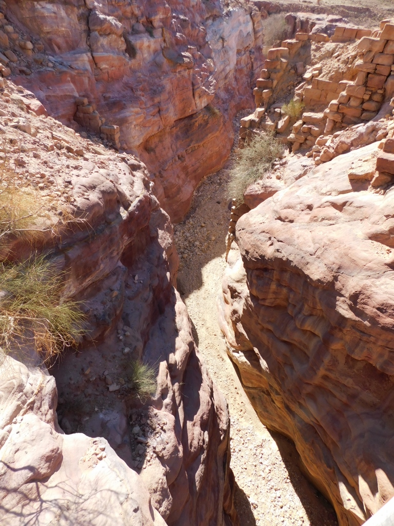 Canyon in Wadi Mataha, “downstream” from the bridge
 Canyon in Wadi Mataha, “upstream” from the bridge
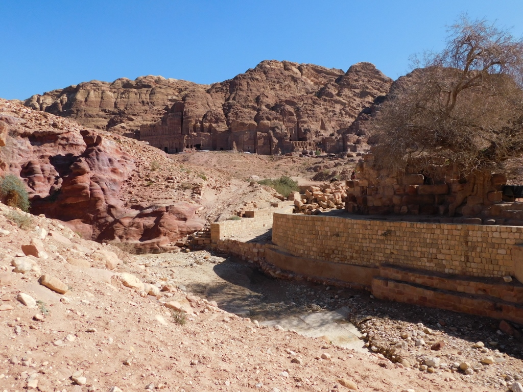
And just as I wrote in the above-linked sequel of my travel stories, this channel for seasonal water flows led right to the Nympheum which I now approached from the back side. The following photo shows the Nympheum (right) with its pistachio tree that people claim is around 450 years old, while in the distance, carved into the cliffs of the Jabal al-Khubtha massif, there are the Royal Tombs.
 Petra, a detail
Here I practically reached the Colonnaded Street that I continued walking along towards the centre of Petra.
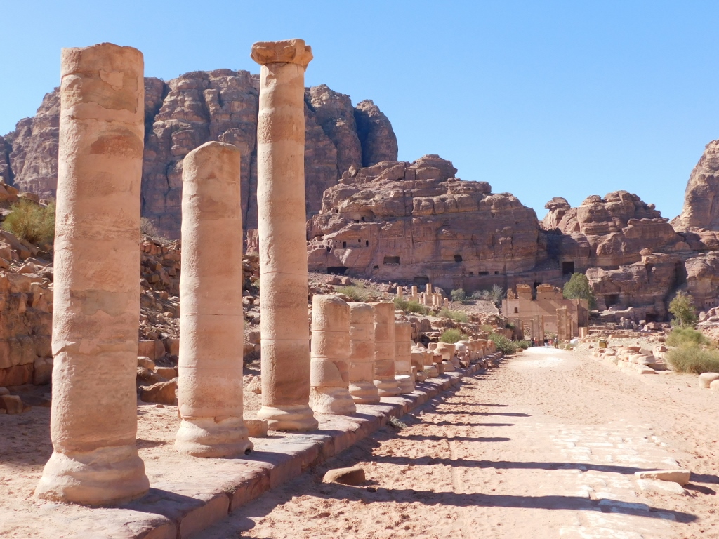 Colonnaded Street
I also walked again through the remains of the Temenos Gate, which originally marked the entrance into the holy part of Petra.
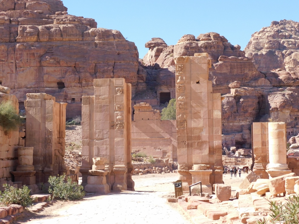 Temenos Gate
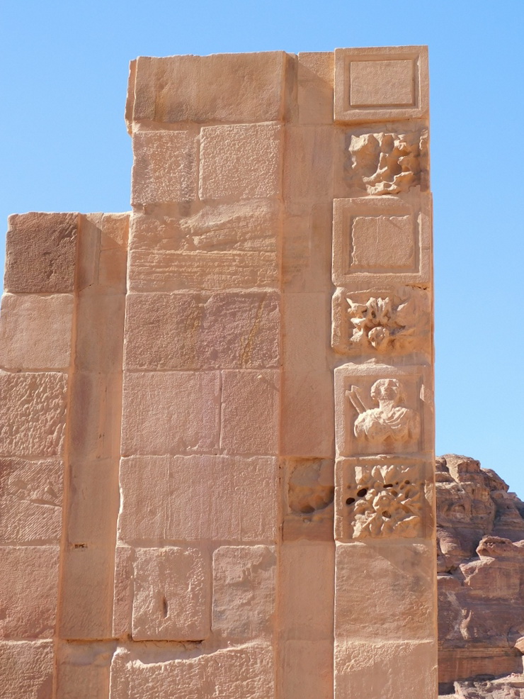 Temenos Gate, details
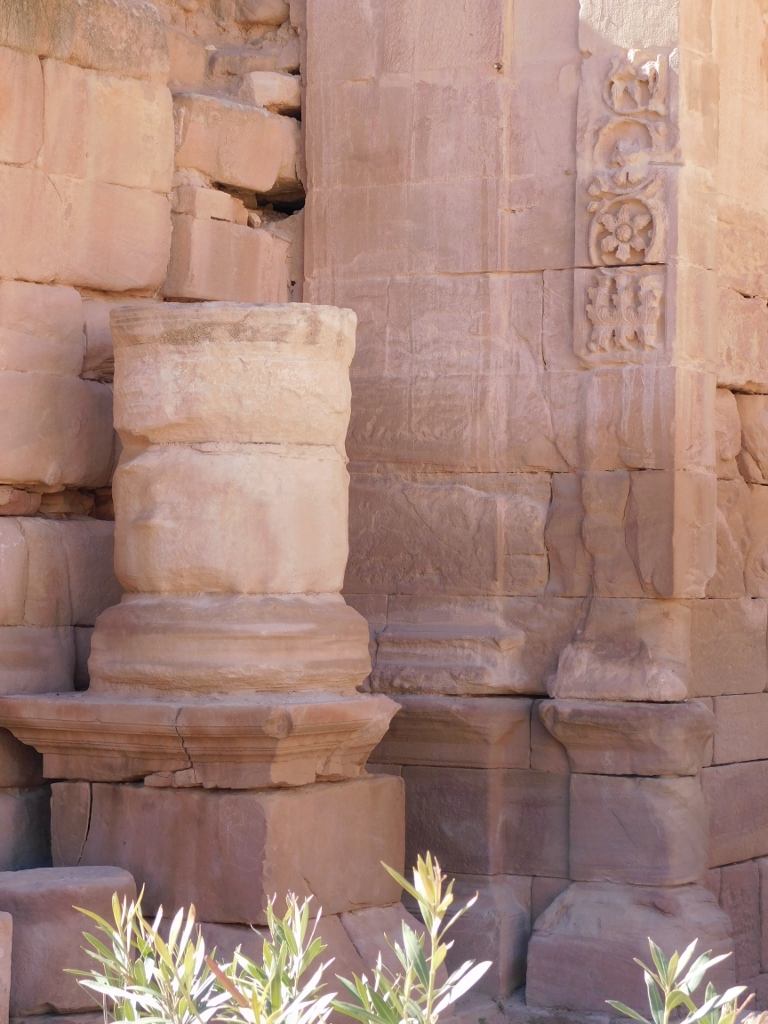 Temenos Gate, details
And then I reached the clearing in front of the Qasr al-Bint temple called the Temenos Courtyard, because it is presumed that this was where the Nabataean and later Roman worshippers used to gather. I came across a comparatively large number of people with donkeys and there were also Bedouins with camels and carts for tourists. Some had probably just arrived from somewhere and some others were getting ready to go.
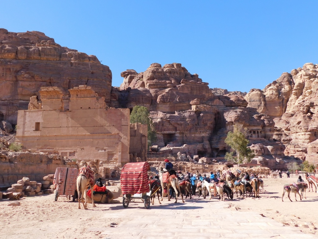 Plateau in front of the Qasr al-Bint temple seen on the left-hand side
As for the Qasr al-Bint temple, it was built in the first half of the 1st century CE and this is the best preserved free-standing structure in Petra.
Its name means “Palace of the Pharaoh’s Daughter” and it comes from a local legend. Namely, that same pharaoh who apparently hid large treasure in the urn on the top of al-Khazneh, i.e., the Treasury, put his daughter here and said that he would give her hand in marriage to whoever succeeded in bringing water to the palace. Apparently, several water channels have been found in the surroundings, which means that there must have been some bitter fights about the princess’s hand. However, this actually suggests that this was a temple dedicated to the supreme Nabataean deity – Dushara.
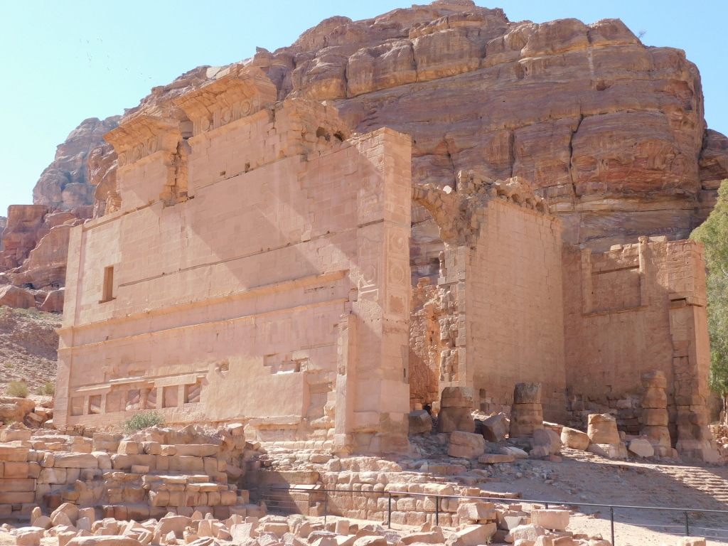 Qasr al-Bint temple, view at the east, the best preserved, facade
The temple was built on the top of a platform reached by a marble staircase, while the ground plan had an almost regular square shape. The height of the temple is nearly 23 m and its front facade was decorated by four pillars arranged between two pilasters on the corners. It was a typical temple with a mixture of Greco-Roman and Nabataean elements, and only the priest was allowed access to the temple, while the worshippers remained in the square (the Temenos Courtyard) where they offered sacrifice.
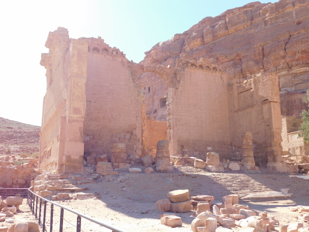 Qasr al-Bint temple, view at the front side of the temple
It was not possible to enter here, so I just continued to the nearest restaurant/café where I got some coffee and a refreshing beverage, sat on a terrace, took my shoes off and put my feet up on a chair in order to rest well before the efforts I was yet to face. I really enjoyed this break and was very content. The day was perfect for sightseeing, primarily in terms that it was sunny, since it had snowed a few days earlier and such weather was forecasted for the following days as well. It is then no wonder that I was dressed quite well, including also the scarf that I wrapped well around my head, since I lost my woollen cap the day before and without any headwear I would be cold.
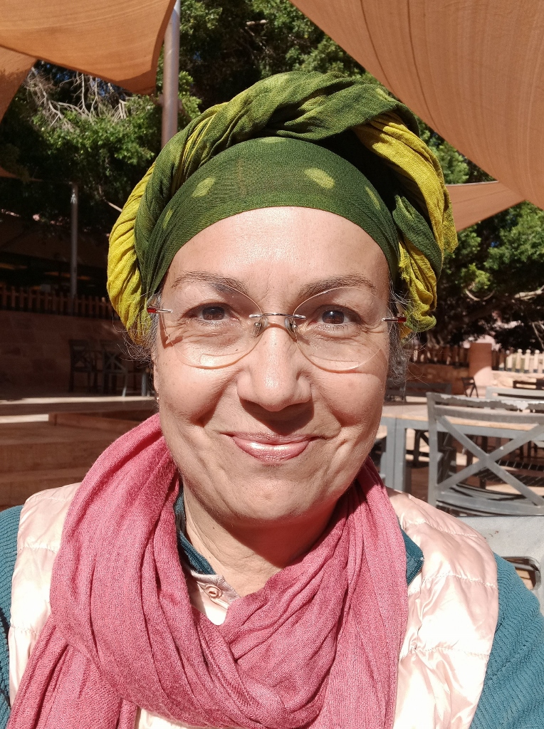 In Petra, on the second day, without a cap
Right across the terrace, I could see the entrance into yet another one of the numerous canyons in Petra.
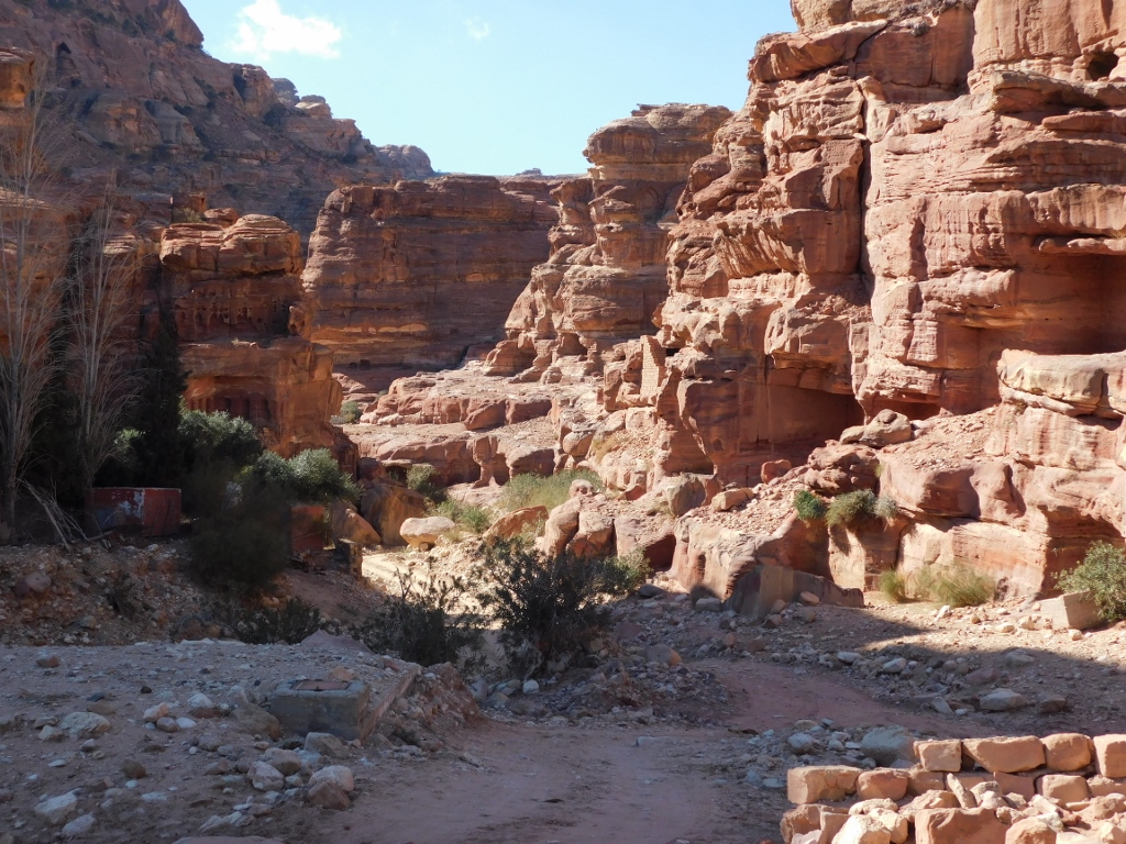 Canyon in Petra
I would very gladly venture along this canyon, but I did not have the time, since I still had to go to Ad-Deir (meaning Monastery), one of the most important structures within Petra.
The trail to Monastery is considered difficult. It is 1.6 km long and has the elevation gain of around 200 m, which is not that much, but one needs to cover around 800 steps. On the other hand, the trail does not consist of steps alone, but there are also comparatively flat sections, not necessarily horizontal. It takes on an average 2.5 to 3 hours to get from the centre of Petra to the Monastery and back. Taking into consideration that it was already past 1 pm, I realised I would have to leave soon in order to be back before the closing of the site and, much more importantly, significantly before the night started to fall. Because, after the return to the centre of Petra, I still had to cover another 6 km of distance and the elevation gain of 370 m in order to get back to the hotel.