After the nice breakfast, I stopped by the hotel room to get my things and then I went down to the reception and out in the street since there was a rented car with driver waiting for me there. I got the same, very nice and kind driver as the day before. He was very happy that I gave good feedback on him to the hotel (that’s how I organised the cars and the drivers), so I didn’t even need to ask – we stopped at the same place as the day before to get our morning Turkish coffees. Namely, this day as well I was going to the north of Jordan, but only as far as the site of Jerash that is some 50 km north of Amman.
Unlike the previous day that was cloudy, on occasion with fog and rain, this one was beautifully sunny, without a speck of a cloud, as seen in the photo below. Still, the appearance may be deceiving. Namely, it was so cold this morning that the Jordanian government declared some kind of national emergency and so the working hours did not start at 8 am, but at 10 am. That also meant that there were no traffic jams along our way.
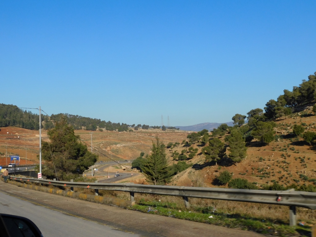 On the way to Jerash
I must admit that before coming to Jordan I had not even heard of Jerash. I actually don’t know why people don’t talk more about different sites across Jordan, talking almost exclusively about Petra. I guess because there are so many of them and because so many of them are spectacular, which means that the human attention span cannot keep up and so the indisputably breathtaking Petra has made its way to the top as the main archaeological representative of Jordan.
And Jerash... Well, that is an enchantingly beautiful archaeological site. This is one of the best preserved Roman cities in the region of the eastern Mediterranean. This was also one of those ten ancient cities in this area known under the joint name of Decapolis.
I have already mentioned before, but let me reiterate the main points. Ever since the times of Alexander the Great (356 BCE –323 BCE), a group of some ten cities in the Levant started to connect amongst themselves and thus they got a Greek name Decapolis meaning “ten cities.” Classic authors, however, did not agree about the accurate number and which cities exactly comprised this group. Thus, different sources mention different places and the Gospels of Mark and Matthew use the term Decapolis to denote an entire area.
As for Jerash itself, although there were settlements here already during prehistory, the city the remains of which can be seen here today, under the name of Gerasa, was founded by Alexander the Great and Perdiccas, one of his generals, around 331 BCE. During the Hellenistic period, this was a small place and little has survived to date. Later came the Romans, of course, and from the 1st century BCE the city started to develop reaching its heyday already in the second half of the 1st century CE. Today, it is considered one of the biggest and the best preserved sites with ancient Roman Architecture outside Italy.
After the Romans, it was the Byzantines who ruled Jerash and they also left their trace. They were followed by the Muslim forces and so the city continued to thrive during the Umayyad Caliphate. The Crusaders were here as well for a short while and later there were settlements that were a part of the Mamluk Sultanate and eventually the Ottoman Empire. And finally, there is a record from 1838 that speaks of the ruins of the old city.
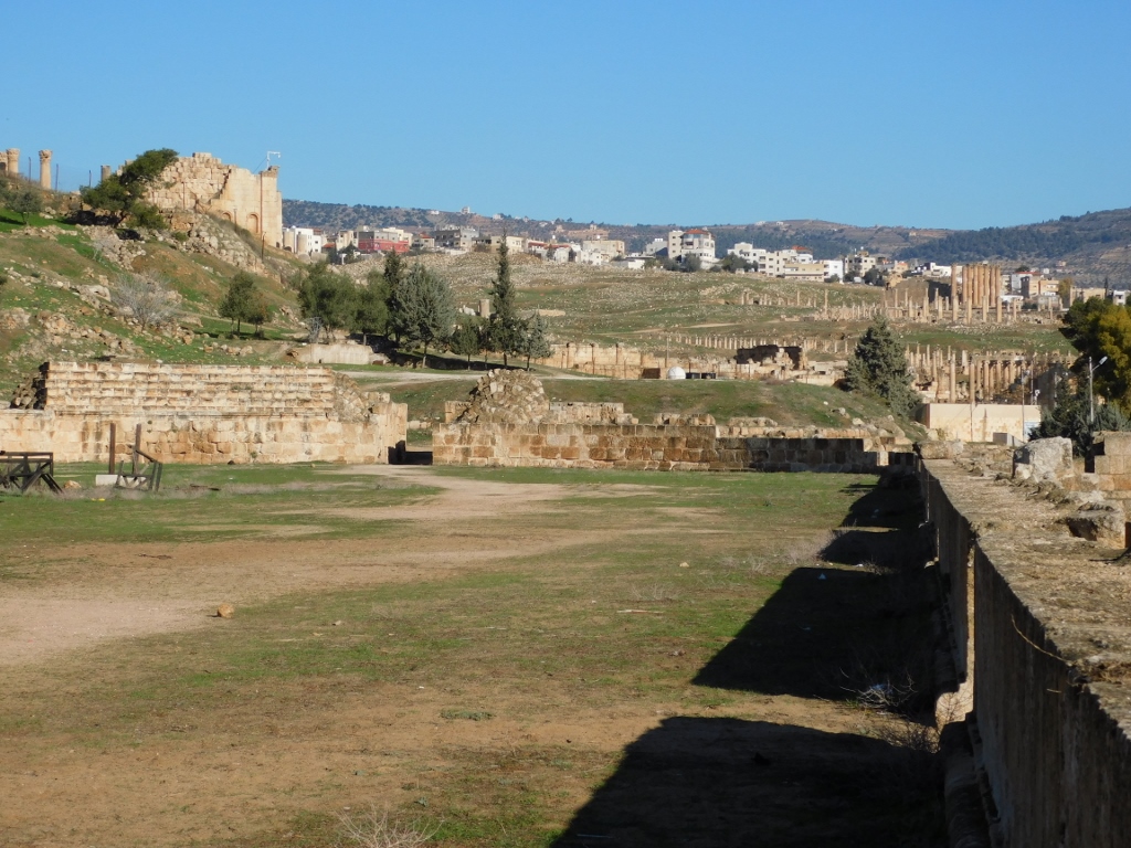
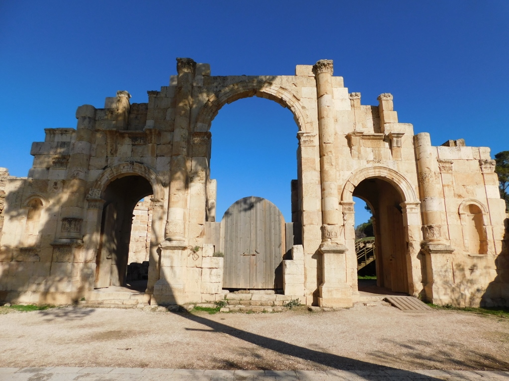
In order to visit the archaeological site that is surrounded from all sides by the contemporary city of Jerash with over 50,000 residents, one first needs to buy the ticket, which is a rather common occurrence. Then you go through a tourist bazaar, a large area full of shops with different goods usually bought by tourists. I went through rather quickly, since I don’t like buying souvenirs, plus I wanted to start with my sightseeing as soon as possible taking into account that already while I was approaching the site by car I could see the impressive and imposing Hadrian’s Arch.
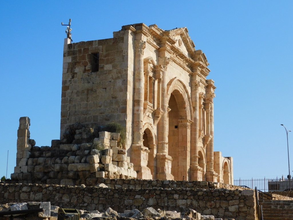 Hadrian’s Arch
The Roman Emperor Hadrian stayed in Gerasa (from now on I will mostly used the contemporary name of Jerash) in 129-130 CE and this triumphal arch was built in order to honour his visit.
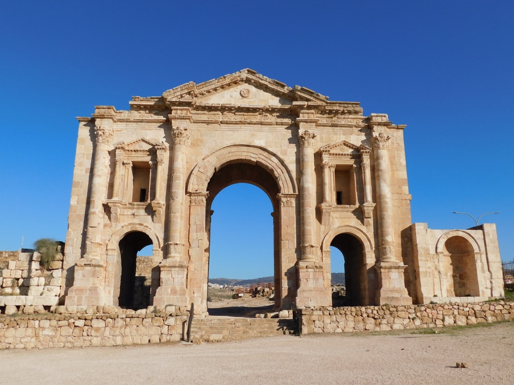 Hadrian’s Arch
This triumphal arch is 11 m tall and has three arched passages. It is presumed that the reason why it was built some 400 m away from the city walls was because there were plans for the city’s development. This, however, never took place and the arch remained almost isolated in this place. It was restored at the beginning of the 21st century and now it is possible to enjoy some of its splendid details, such as the blind niches done above the flanking passages.
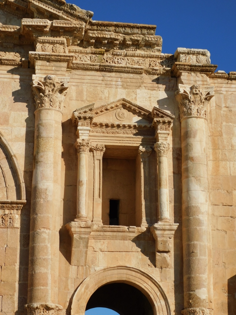 Hadrian’s Arch, a detail
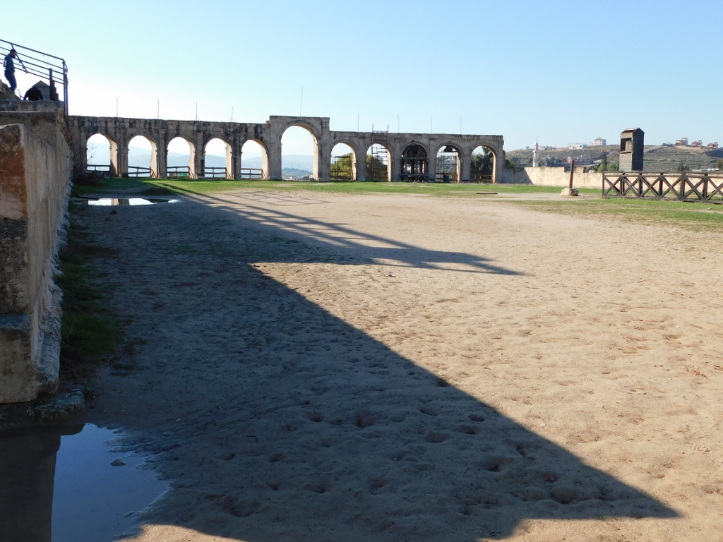
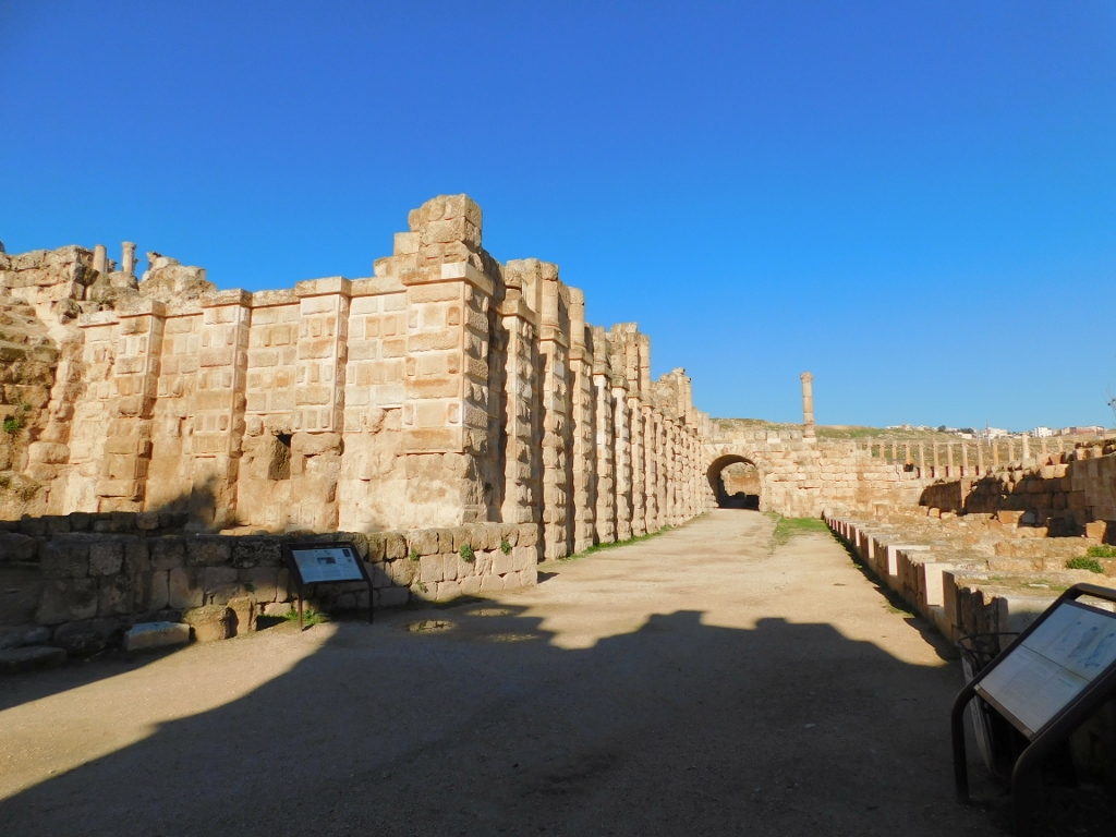
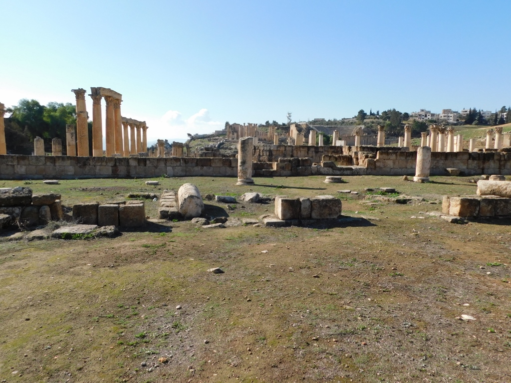
When I say that Hadrian’s Arch is almost isolated in this place I have in mind that right next to it there is the Hippodrome. This large Roman arena has the ground plan in the shape of a very elongated horseshoe that is laterally enclosed at its ends. It was precisely one such part that I could see from the outside, west of the Hadrian’s Arch.
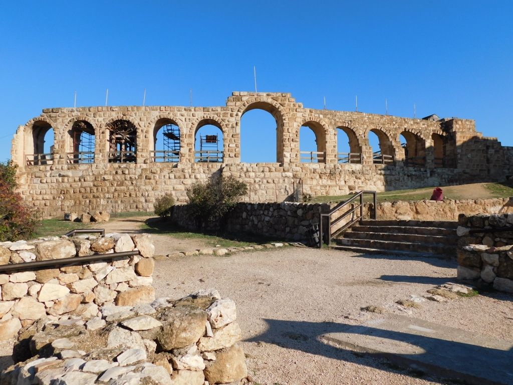 Hippodrome, a detail
The Hippodrome in Jerash is 245 m long and 52 m wide, and it could hold some 15,000 spectators. It was mostly used for chariot races, as well as for other sports. It is presumed that it was built in the second half of the 3rd century CE. Although it seems that this was one huge hippodrome, especially for a city the size of Jerash, one should keep in mind that the Circus Maximus in Rome could hold almost ten times as many spectators.
 Hippodrome, a detail
I got to the Hippodrome by climbing the stands first, but then I went down to the level where even today costumed chariot races are organised for tourists every now and then.
 Hippodrome, a detail
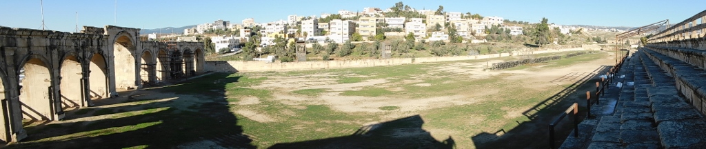
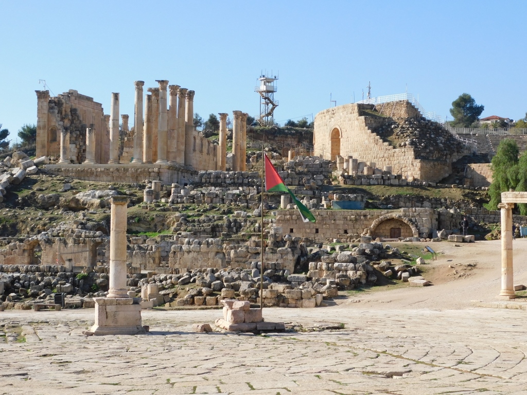
The previous photo shows again the almost straight frontal wall with 11 arches, while on the opposite side there is a semi-circular ending that cannot be seen clearly from the ground level. But the next photo showing that end of the Hippodrome is interesting nonetheless because it is possible to see in it a large number of columns and other remains of the ancient city behind the Hippodrome, after which come parts of the contemporary city further up the elevation.
 Hippodrome and parts of the archaeological site of Jerash
Then I climbed again to the top of the stands in order to move to the exterior side of the Hippodrome where a wide path leads to the main section of the site, but before that I also took a photo of a few ancient shops arranged alongside the Hippodrome. On the basis of the floor covered in mosaic that can be seen in the following photo, it may be assumed that the other shops had the similar solution, which is truly impressive. The photo also shows a part of the rather ruined Byzantine Church of Bishop Marianos from 570 CE.
 Shops along the Hippodrome and parts of the ruined church up and right
Following the wide path, I headed for the South Gate of Jerash which is approximately 400 m farther.
 South Gate
The South Gate was the main entrance into the ancient city. People still have to go through this gate in order to get to the very core of ancient Jerash. When you pass the gate, you get to the South Street on the right-hand side of which there are ruins of a, presumably, Hellenistic settlement, while on the left-hand side there is a support wall of a complex topped by the Temple of Zeus.
 South Street
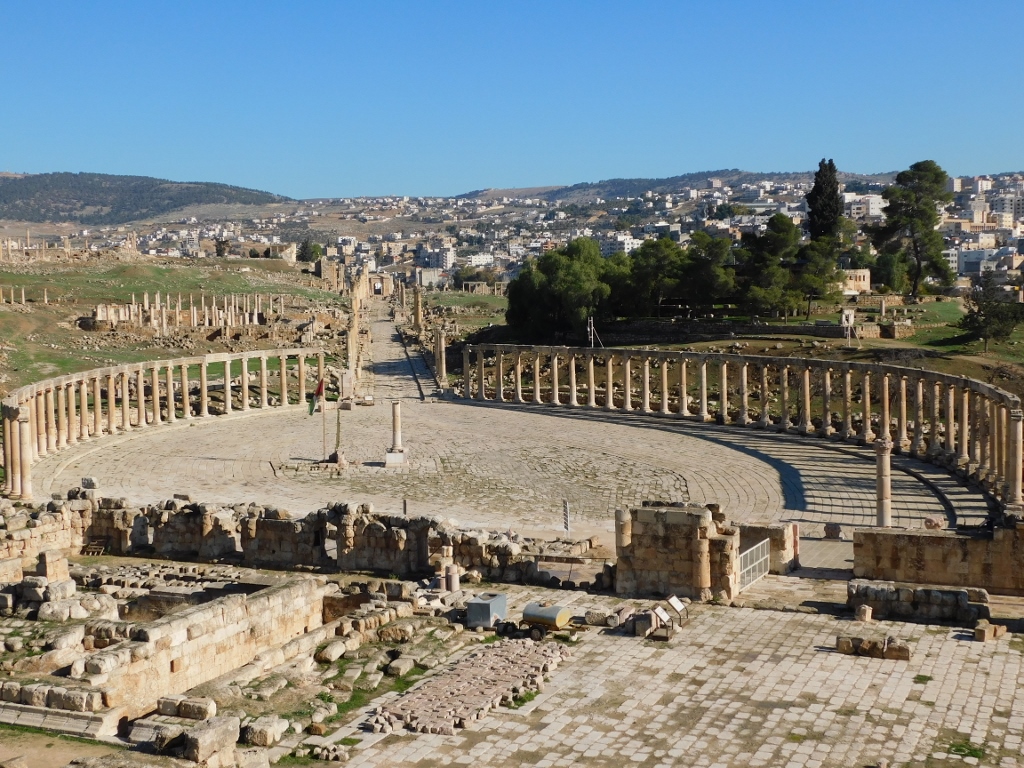
The street leads directly to the impressive Oval Plaza that I concentrated on more a little later, although I took a photo of it right away.
 Oval Plaza
What I wanted to deal with first here was that Temple of Zeus and the South Theatre that are located southwest of the Oval Plaza.
 View at the Temple of Zeus (left) and the South Theatre (right)
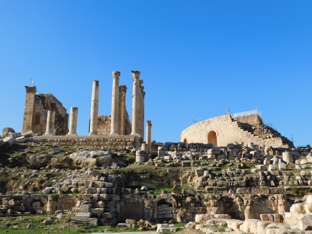
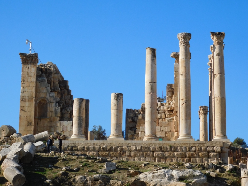 Temple of Zeus
 Temple of Zeus
First I went to the South Theatre.
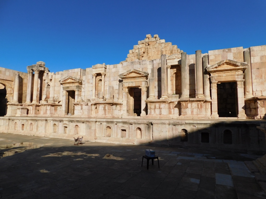 South Theatre, the stage
The South Theatre is the biggest one in Jerash (out of three). It was built around the year 90 CE and it is estimated that it could hold around 3000 spectators. The stage had an opulently decorated back and it is presumed that it had at least two floors with Corinthian columns. Parts of the theatre were destroyed in the 749 earthquake and at the end of the 19th century the local population started to use the material from here in order to build their houses. Still, a lot has been saved and reconstructed.
 South Theatre, the stage, a detail
The theatre still has excellent acoustics and is sometimes used for concerts. I took the opportunity so I gave myself a mini-concert involving a shortened Mozart aria and although the performance was too squeaky at times, I can vouch that the acoustics was spot on.
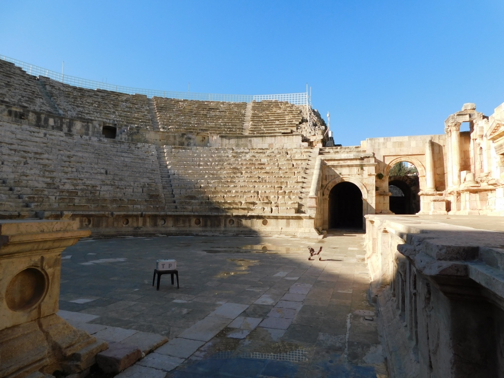 South Theatre, the audience, orchestra and stage
Then I also walked to the nearby Temple of Zeus.
 Temple of Zeus
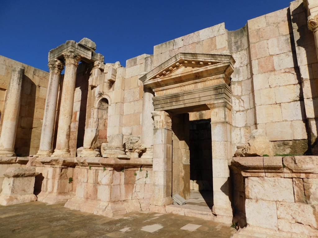
The temple was built in 162-163 CE and it was originally surrounded by 15 m tall Corinthian columns. The structure the remains of which can be seen here today was built on top of the foundations of the previous structure from the 1st century CE, which in turn was built over the remains of a temple from the 2nd century BCE. I entered the temple through a side entrance above which there is a whole series of pretty blind niches.
 Temple of Zeus, the side entrance
Nowadays, the interior is quite modest and rather uninteresting, except that it shows that this was indeed a large temple.
 Temple of Zeus, the interior
In front of the main entrance there used to be columns that were toppled in that earthquake from 749 and that have been reassembled in the recent times using the remains that were found. It is presumed that a wide staircase led down, but today all one can see are ruins and a flat terrace below the level at which the temple was built.
 Temple of Zeus, reconstructed porch with columns
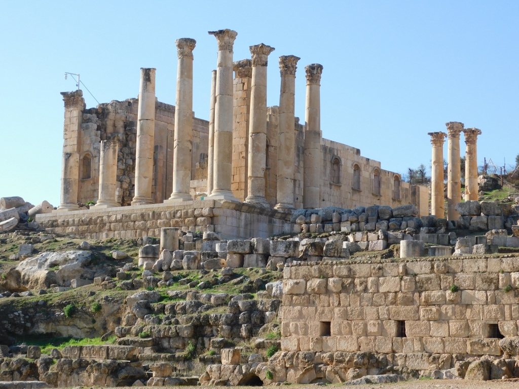
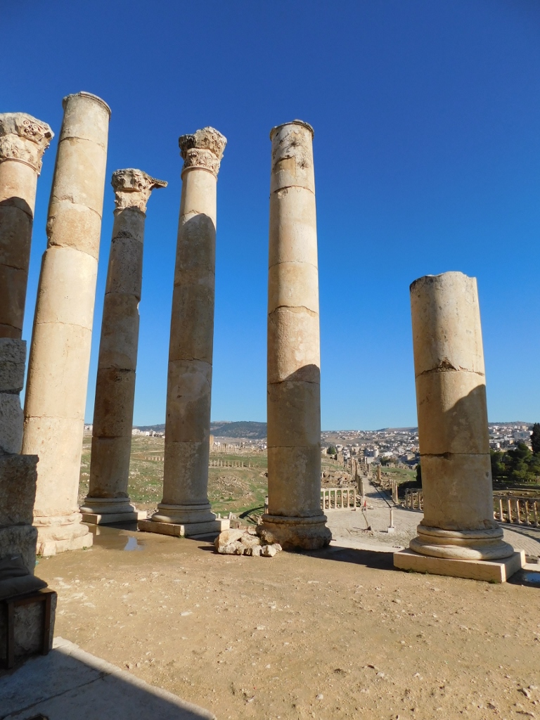
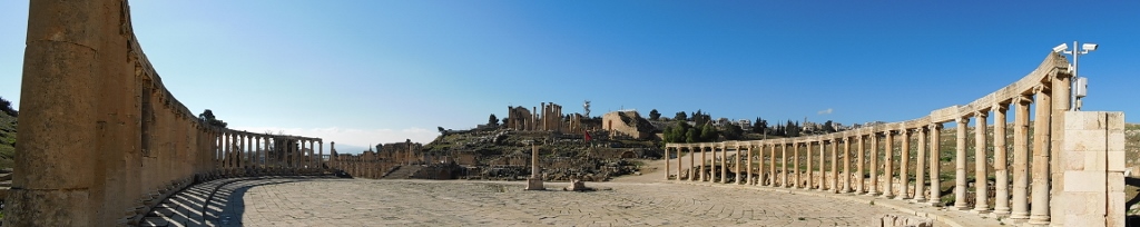
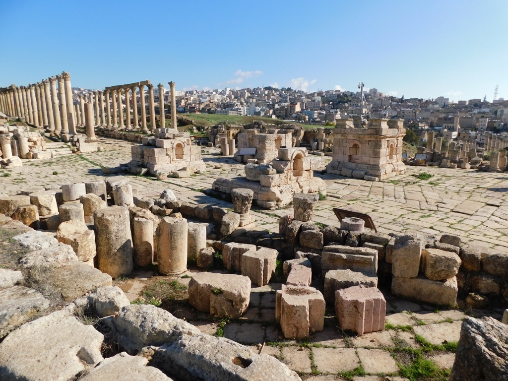
However, in addition to these remains that are a part of the Temple of Zeus complex, there is also a splendid view at the Oval Plaza and the Cardo street from here.
 In the foreground there are the lower positioned remains of the Temple of Zeus complex, then comes the Oval Plaza and straight from it leads the Cardo street
 Part of the Oval Plaza and the Cardo street
The time came for me to go back to the Oval Plaza and to continue from there with my sightseeing of the Jerash site.
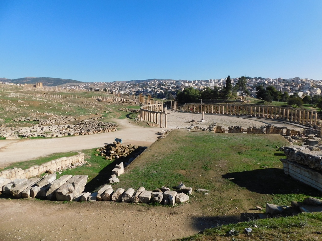 Oval Plaza and the archaeological site of Jerash
But, first I had to play with the taking of photos of the Oval Plaza from different angles.
 Part of the Oval Plaza and the Cardo
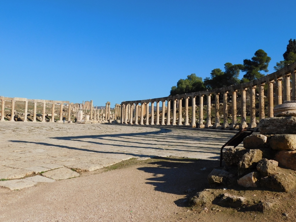
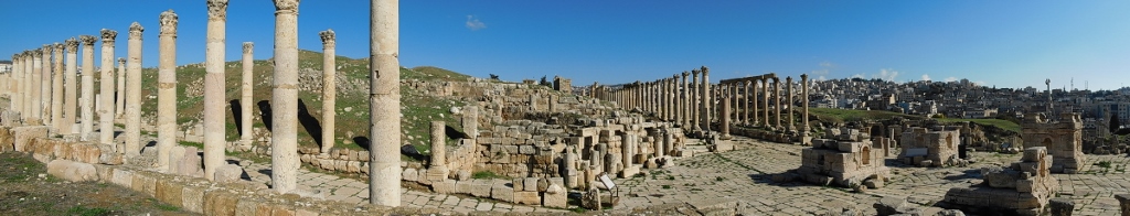
The Oval Plaza is one of the most beautiful and most impressive examples of the Roman town-planning. The name of the square comes simply from its shape – this paved plaza has on two sides slightly curved colonnades made of Ionic columns.
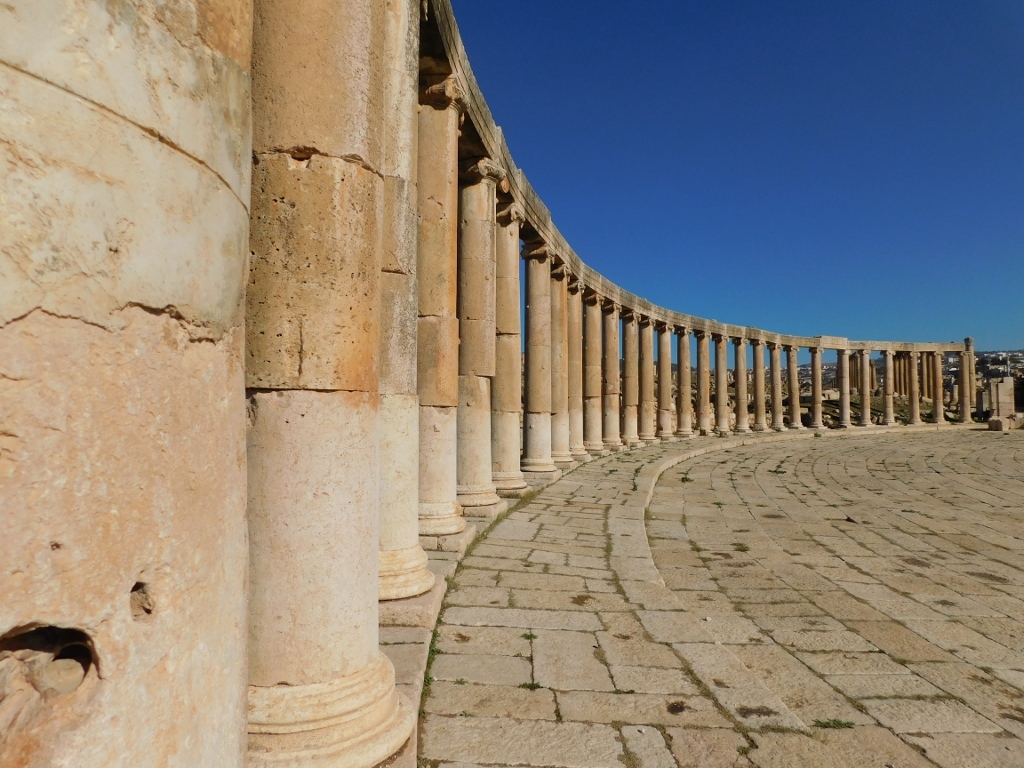 Colonnade on the Oval Plaza
The plaza is approached from the south side by the South Street (from the direction of the South Gate) or from the elevation where the Temple of Zeus and the South Theatre are, while on the north side starts the Cardo street. Before I continued along the Cardo, once again I looked back in order to admire the Oval Plaza, and the Temple of Zeus and the South Theatre on the small elevation.
 Oval Plaza
 Part of the Oval Plaza, the Temple of Zeus and the South Theatre
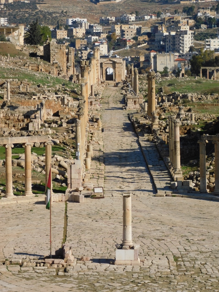
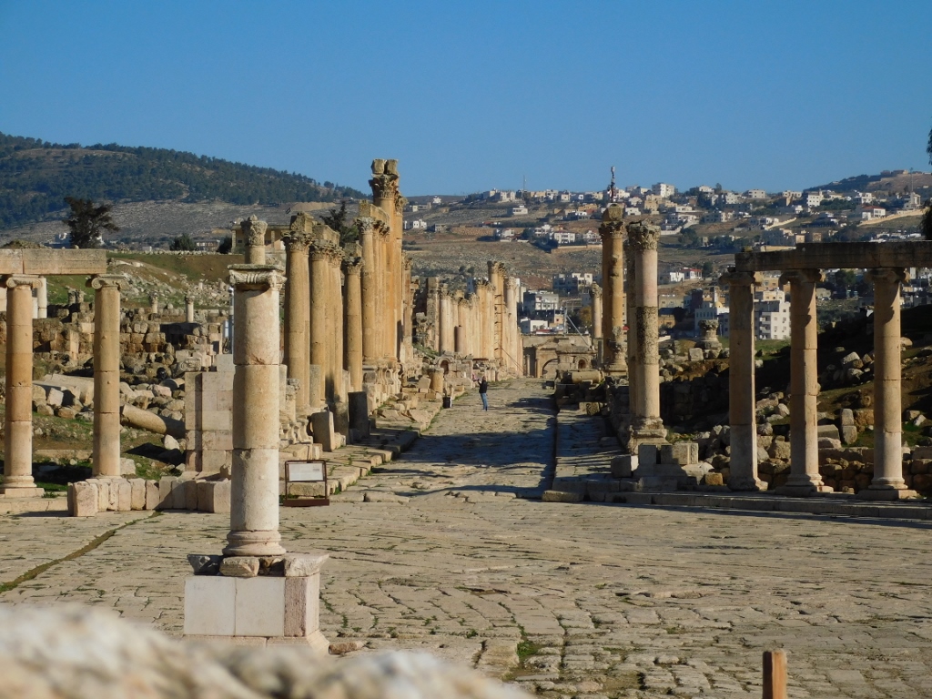
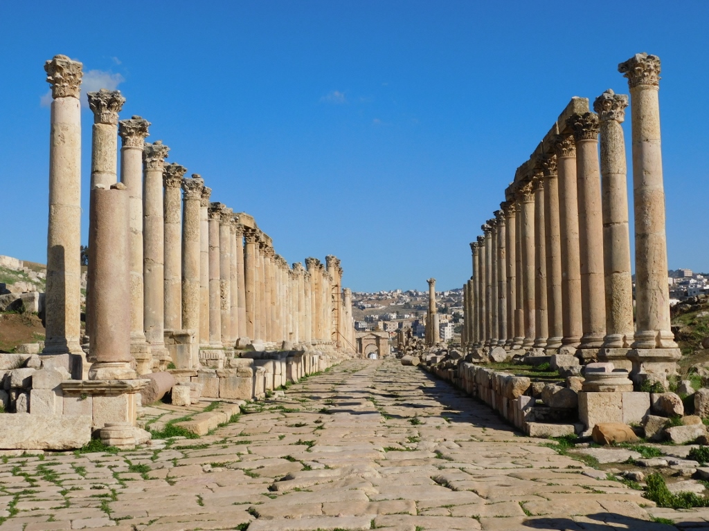
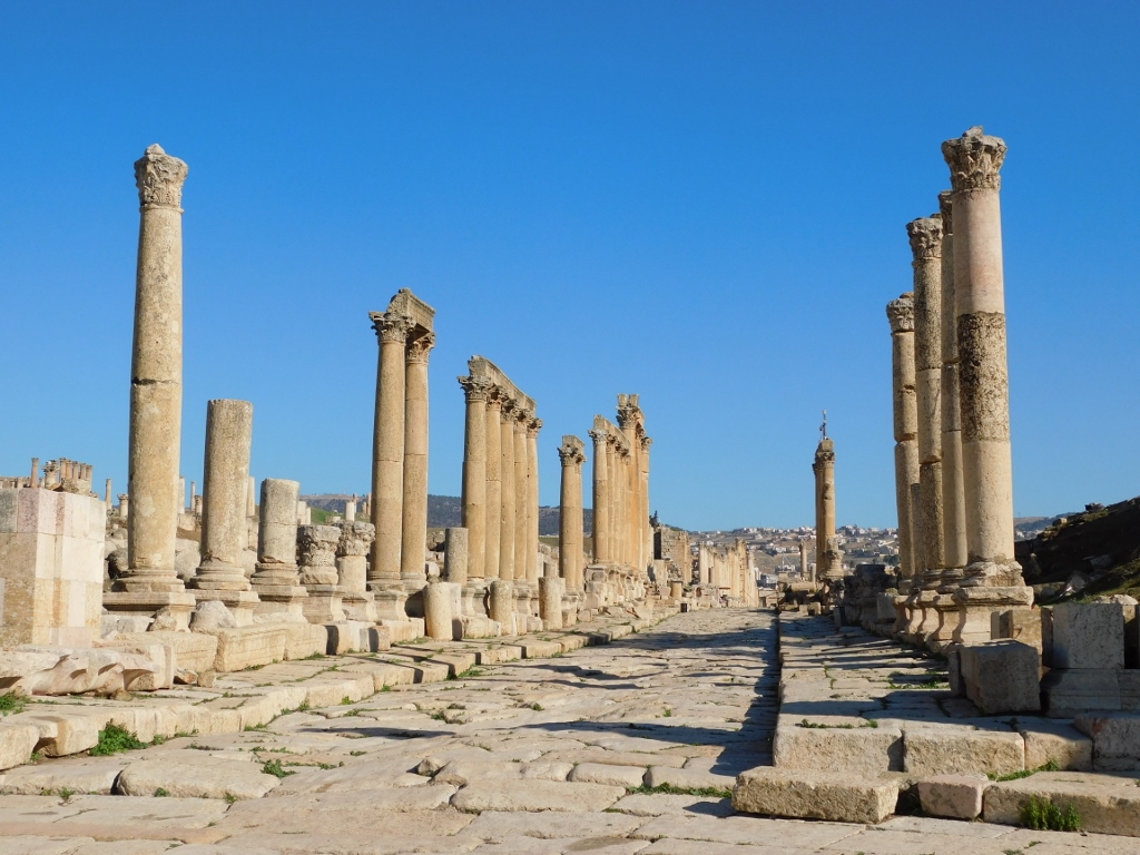 Cardo street
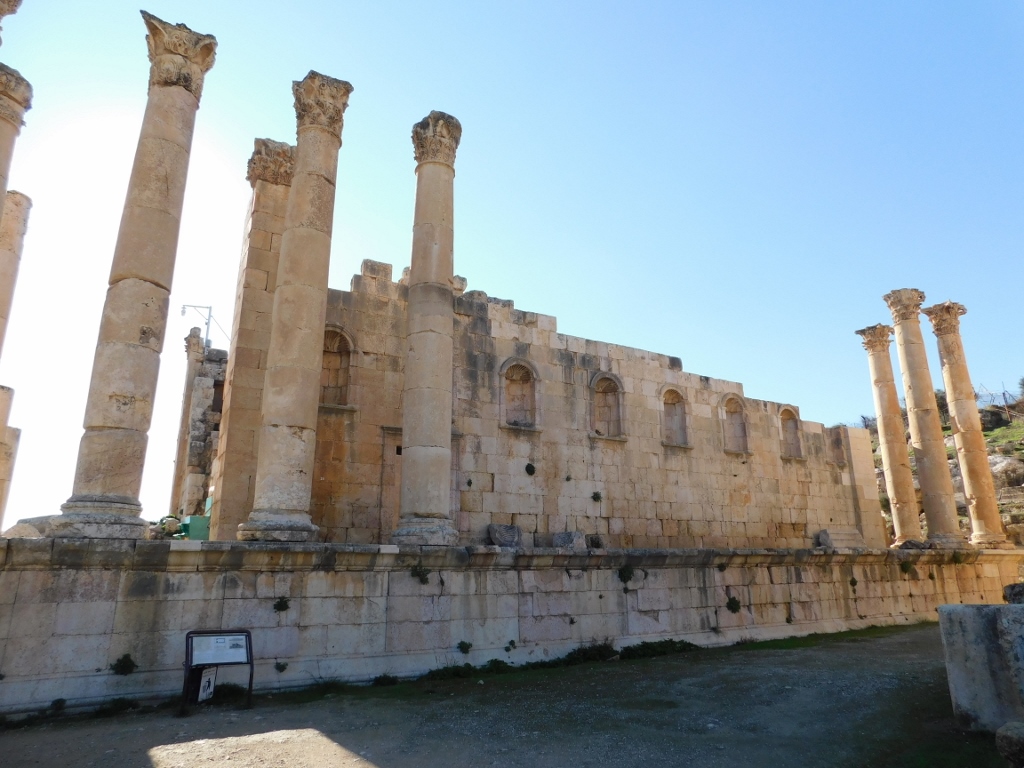
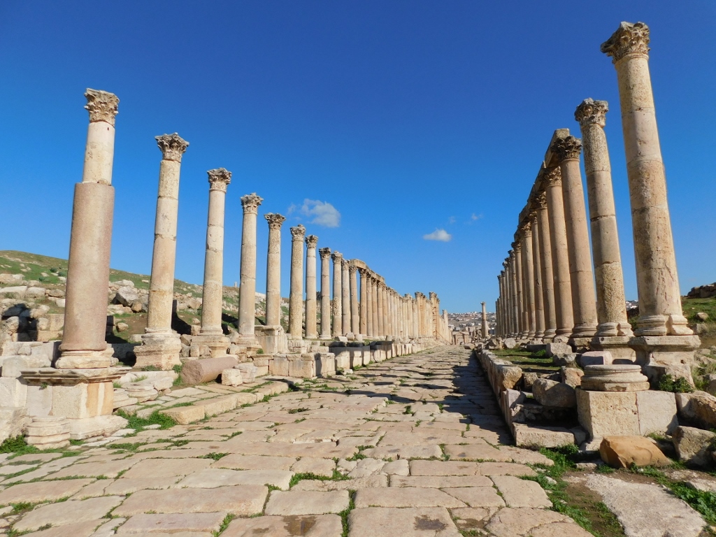
The Cardo (full name is Cardo Maximus) was the main street in Roman Gerasa from which the city spread further. It is a completely straight street, 800 m long, and it connects the North Gate and the Oval Plaza. The construction of the street started at the beginning of the 2nd century CE, taking into account the earlier urbanistic town plans, but over time it was expanded, changed and added to. Only a small number of the columns are originally Roman, while most of them were made during the reign of Byzantium.
When you walk along the street, in addition to the remains of the ancient city on both sides, it was also interesting to see the ancient grooves made in the stone by the wheels of ancient carts so many centuries ago.
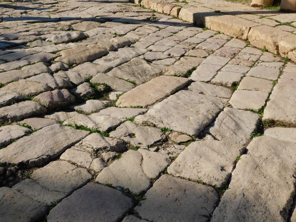 Cart grooves on the Cardo
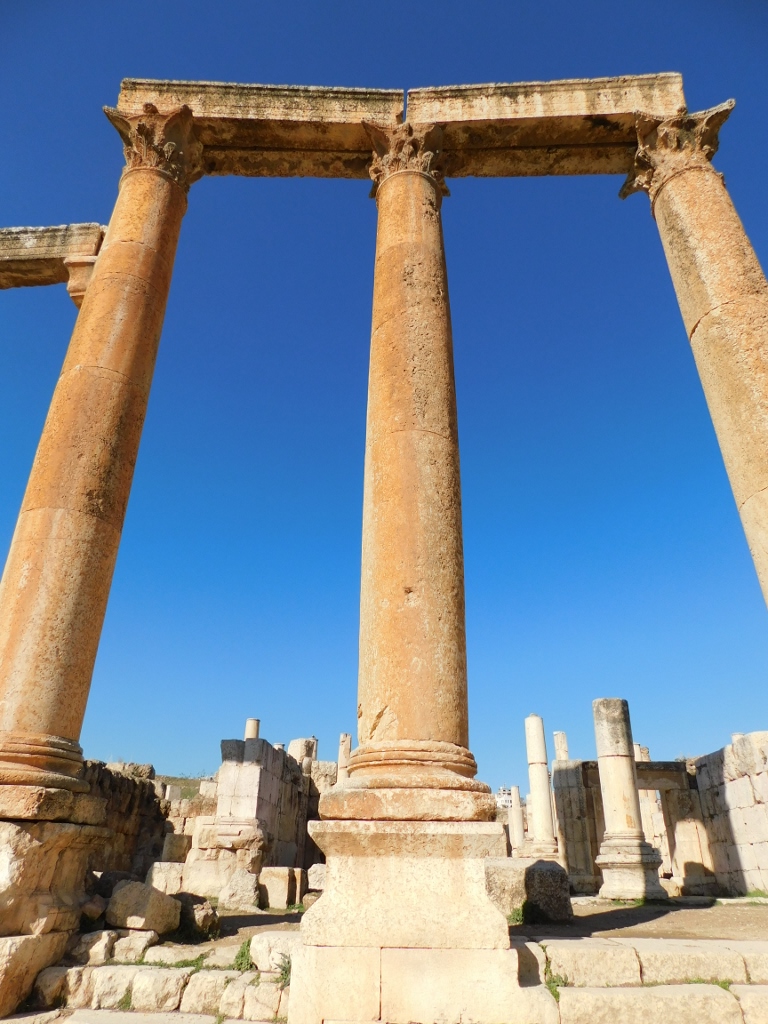
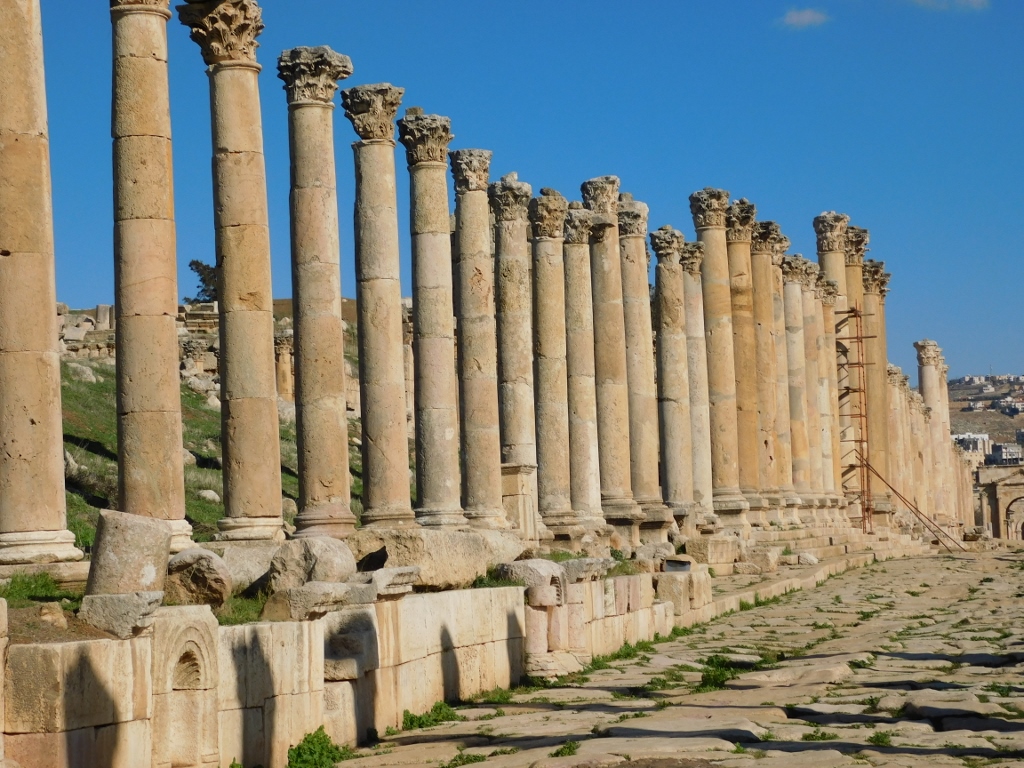
The columns that used to be arranged along the entire street are also very interesting. Some of them have survived or have been reconstructed.
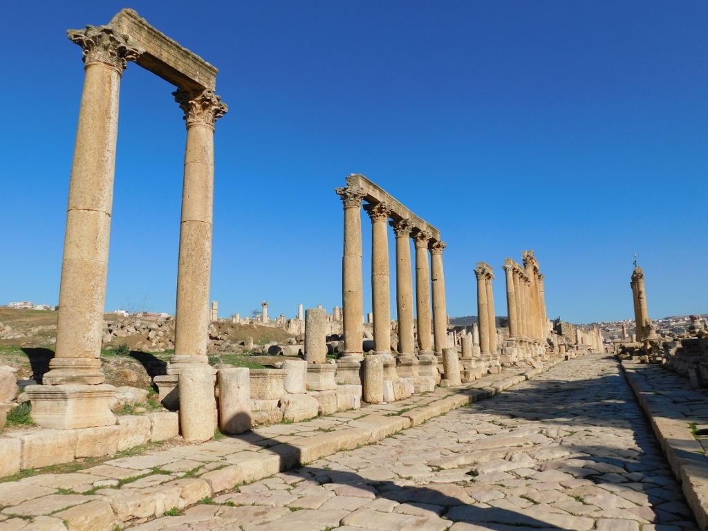 Columns along the Cardo
As the street rises ever so slightly and the columns were connected by an architrave placed over their top, it was necessary that each subsequent column was just a little shorter than the previous one in order for the architrave to be perfectly horizontal.
 Columns along the Cardo
Where the next column would be too short for the architectural proportion, the architrave stopped, was bracketed against the next column, while a new architrave would start at a higher level.
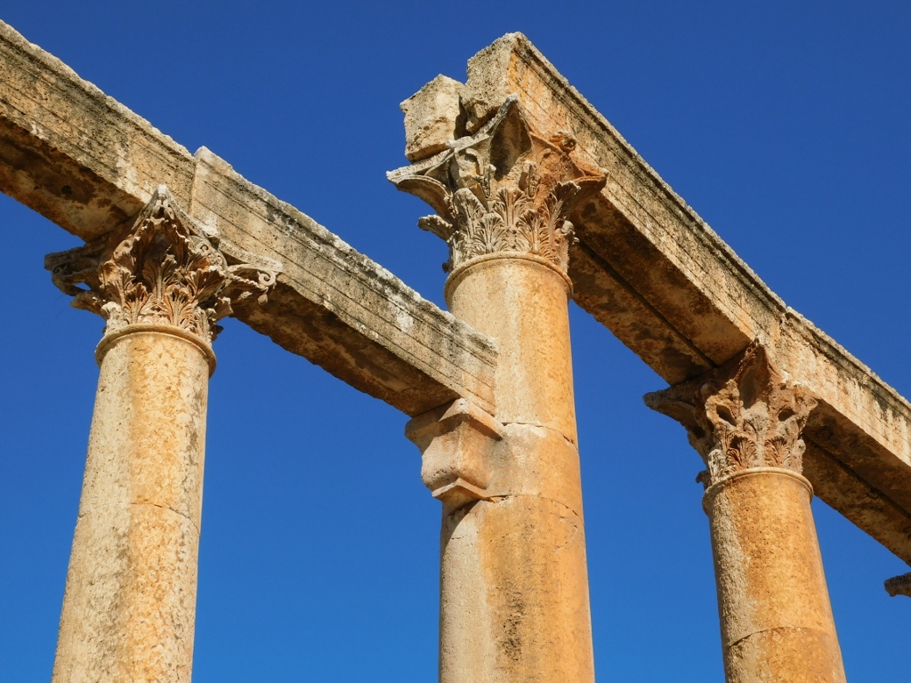 The columns and the architraves
It was precisely here, beside the columns where the new architrave started that I made a break in my walk along the street in order to venture in between the ruins.
 The columns, the architraves and the ruins in Jerash
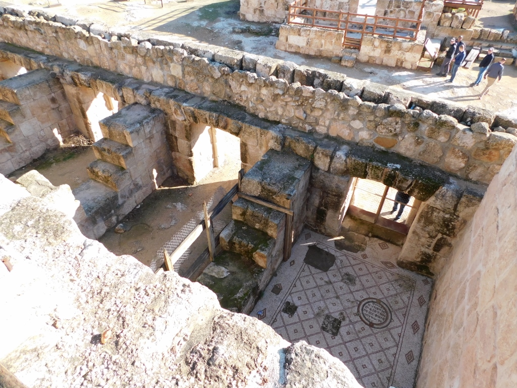
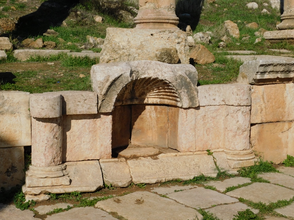
Namely, behind these colonnades along the street, there were very often different shops built and at this specific point there was also an indoor market (macellum). The most interesting part of the market is an octagonal inner courtyard around a central drinking fountain that was in turn surrounded by shops.
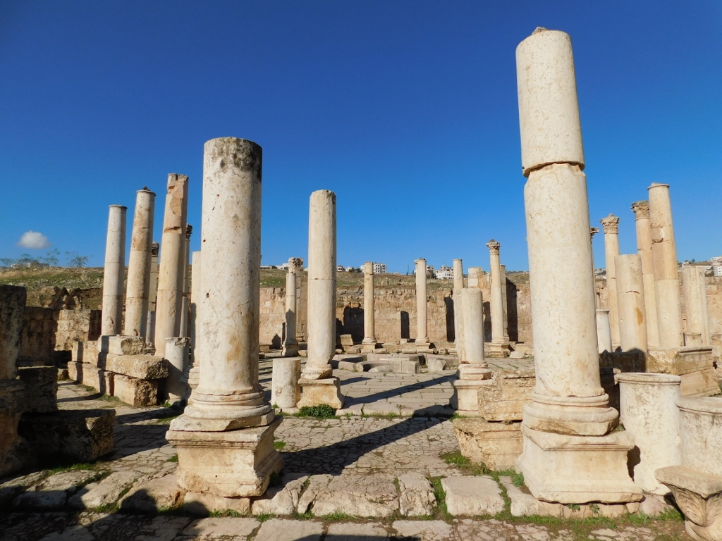 Remains of the ancient market in Jerash
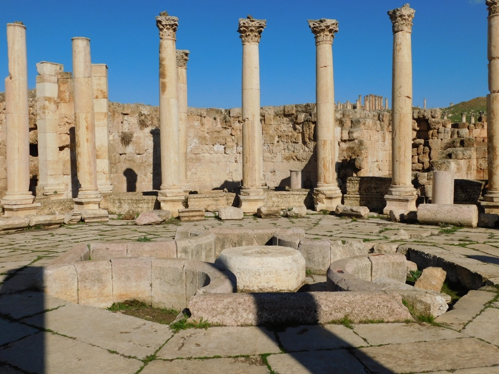 Fountain within the ancient market in Jerash
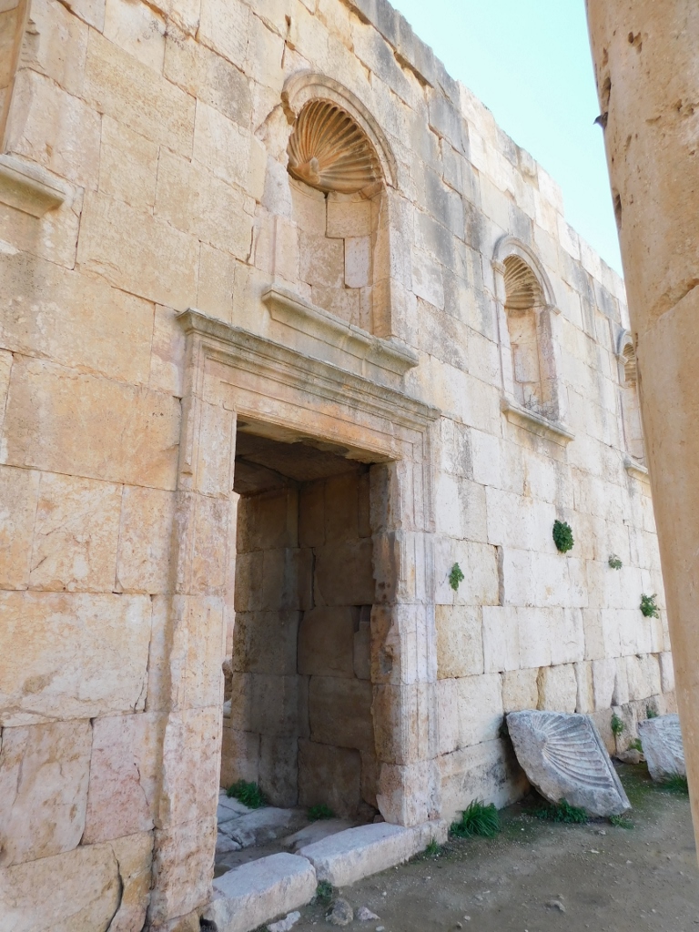
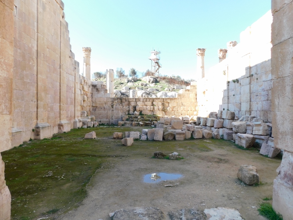
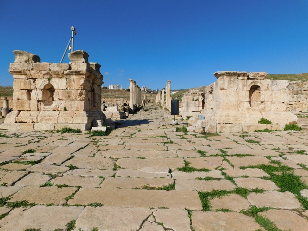
The next structure on the left-hand side of the Cardo, situated near the southwest corner of the South Tetrapylon, is the Umayyad/Abbasid Mosque or rather its modest remains.
Jerash fell under the Muslim rule around 635-640 CE by the city surrendering to the new conquerors. This helped avoid the destruction and it is presumed that in the beginning the majority of the population was Christian, but with time there were more and more Muslims which required the construction of a mosque. And so, in the first half of the 8th century, a mosque was built in the very centre of the city and it followed the typical plan – the central courtyard surrounded on three sides by porticos, while on the fourth side there was the entrance leading into the Prayer Hall. When I took the following photo, I was standing in the area of the inner courtyard, looking towards the remains of the Prayer Hall. Since there is no building here now, i.e., there are no walls, a little farther away one can see the columns and the market I have previously written about.
 Remains of the Umayyad/Abbasid Mosque
Although there is not much to see here, it is a good idea for the visitor to go up to the level of the floor of the mosque, since there is a fine view from there at the remains of the South Tetrapylon.
 South Tetrapylon
“Tetrapylon” is the term used for a type of a Roman structure built on four large posts, with a passage between the posts and it was usually built on crossroads, as is the case here. A little later I got to the North Tetrapylon that is an absolutely remarkable specimen of this type of structure. In the case of the South Tetrapylon, there are only remains, but even they are impressive enough.
In this place, the Cardo is crossed by South Decumanus. As a reminder, “decumanus” is the name used in the Roman town-planning for the main street going in the east-west direction, unlike the term “cardo” used for the main street running in the north-south direction. Here, at the crossroad of these two streets, a circular square with the tetrapylon in the middle and shops along the perimeter was formed.
 Main south crossroad in Gerasa: to the left is the South Decumanus, while the Cardo continues straight
 Colonnade along the west section of the South Decumanus street
 North section of the Cardo street; the North Tetrapylon can be seen in the distance
Here I went to the end of the east section of the South Decumanus street, for there is the South Bridge there, but it is behind the fence, as a part of the modern-day Jerash.
 End of the site, the South Bridge and parts of the modern-day Jerash
Then I turned around and headed again back to the remains of the South Tetrapylon.
 East section of the South Decumanus
 Remains of the South Tetrapylon
While I was standing near the remains of the South Tetrapylon, I noticed a couple of cute residents that stopped here for a moment and allowed me to take a photo of them.
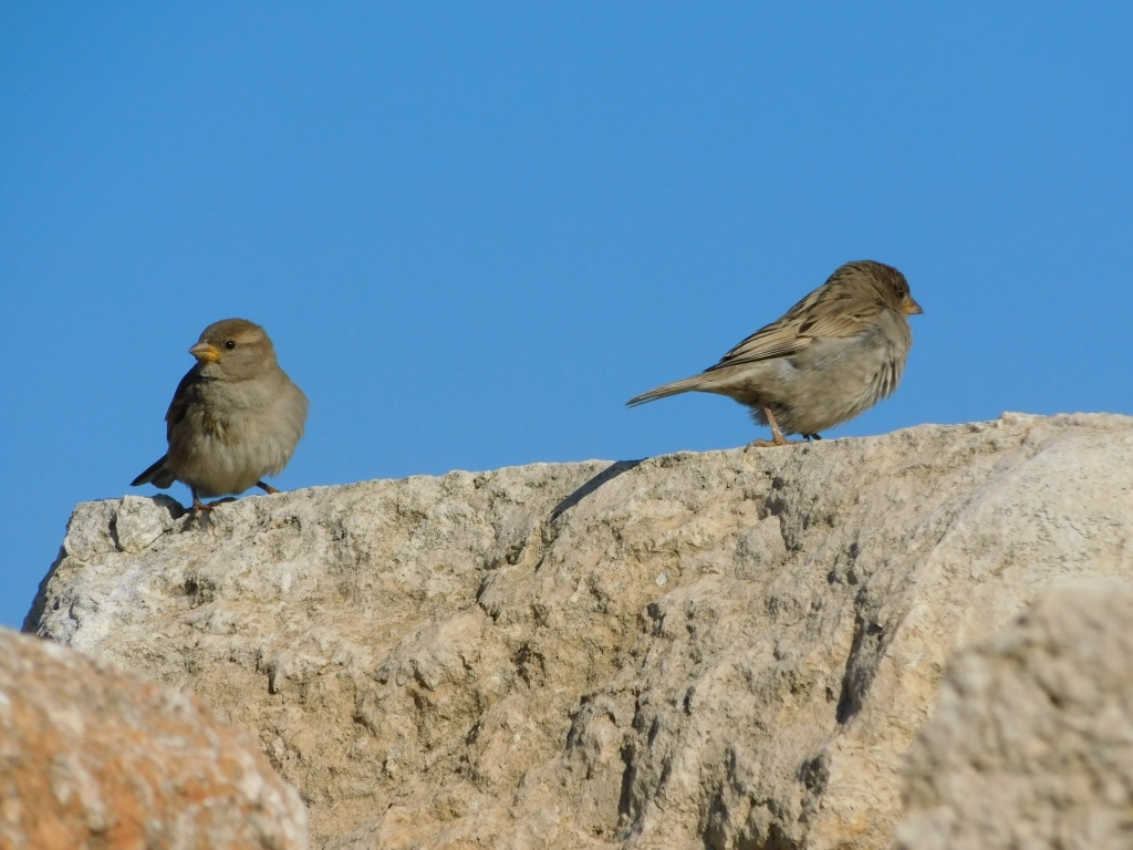 Sparrows
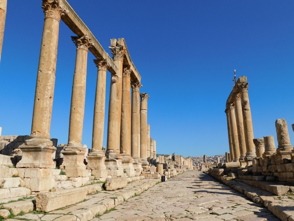
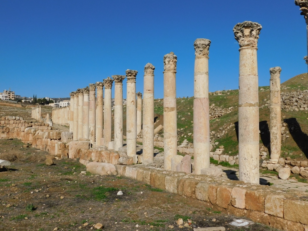
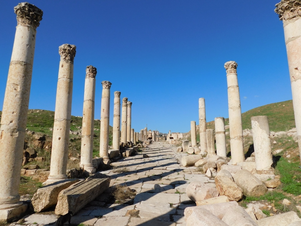
From here I continued in the north direction along the Cardo where on both side there are impressive colonnades.
 North section of the Cardo
 Colonnade along the north section of the Cardo
Again, one can see the grooves in the stone street, made by the continuous passage of ancient carts in the past, but it was also possible to see along the street a whole line of low niches. It is presumed that they were used either for the placement of small statues or, which is more likely, for the streetlights.
 Low niche in the Cardo