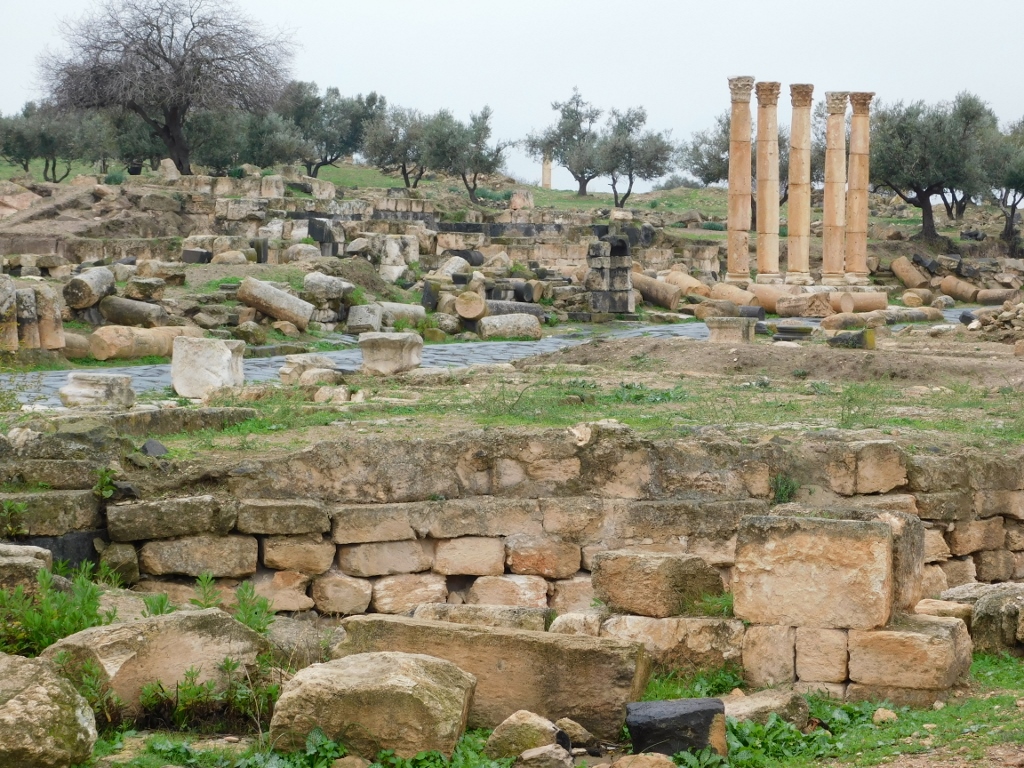
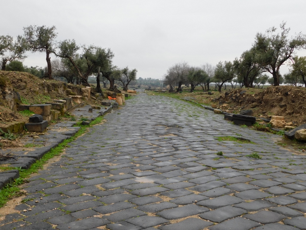
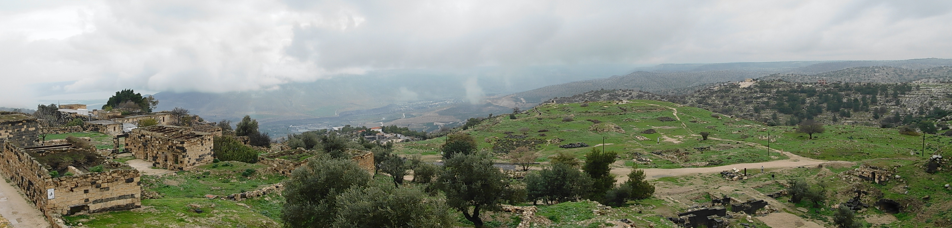
Visiting the impressive remains of the ancient city of Gadara in Jordan that are located beside the city of Umm Qais, at some point I started to move away from the “centre” following the main street Decumanus Maximus in the westbound direction, where the main gateway into the city originally used to be. Today, on both sides of the street there are numerous ruins and every now and then I would leave the street and venture between the remains of the ancient buildings. The next photo was made while I was standing among the ruins on the north side of the street, the paved Decumanus Maximus can be seen a little in the middle, while on the south side of the street there are also ruins, as well as five pretty columns.
 Decumanus Maximus
As a reminder, Gadara was the city mentioned for the first time during the conquests of Alexander the Great (second half of the 3rd century BCE) and it was abandoned in the 8th century CE. It was a part of the group of Decapolis, meaning “ten cities,” that was situated, as it would turn out later, across the eastern flank of the Roman Empire. Originally permeated by the spirit of the Hellenistic culture, these cities developed taking advantage of their excellent position along the main land trading routes and this was particularly prominent during the Roman period when Gadara reached its heyday.
When I was doing my sightseeing here in January 2022, there was literally nobody else at the site except for me. I must admit that I did not mind this in the least. Moreover, almost the entire time I felt very privileged in terms of having such historical and archaeological beauty all to myself. This is extremely rare nowadays. A partial problem lay in the fact that I used two guidebooks by different publishers, one in English, the other one in Italian, and even combined they did not offer too much information and detail. It was precisely because of this that I used my sense, as well as what I noticed from the street that seemed interesting, and then I would leave the wide spacious street and enter between the ruins. As it would turn out later, when I looked for some additional information on the internet, without any clear intent developed in advance, I actually visited the remains of some of the most important buildings in this part of Gadara. The reason why I don’t look for such information on the internet BEFORE I go to some places is that there is such multitude of sites on the internet (and to my mind not all of them are good and to the point) that it would take me months to explore this in advance. In this way, although there is always a risk I may miss out on something because of the lack of information, when I return home and write these stories of mine, I look up additional clarifications on the internet, but by this time I already have a clear idea of what I’m looking for and what I’m interested in. This then fits perfectly to my needs. And if I realised I left something out during my sightseeing, I feel sorry for a moment, but then I say to myself that I can rectify this “the next time I go there.” I’m not sure this is always feasible, but, as we in Serbia like to say – everybody comforts themselves the best way they know.
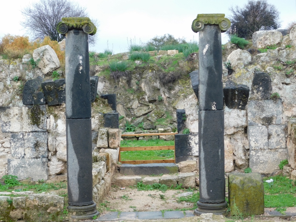
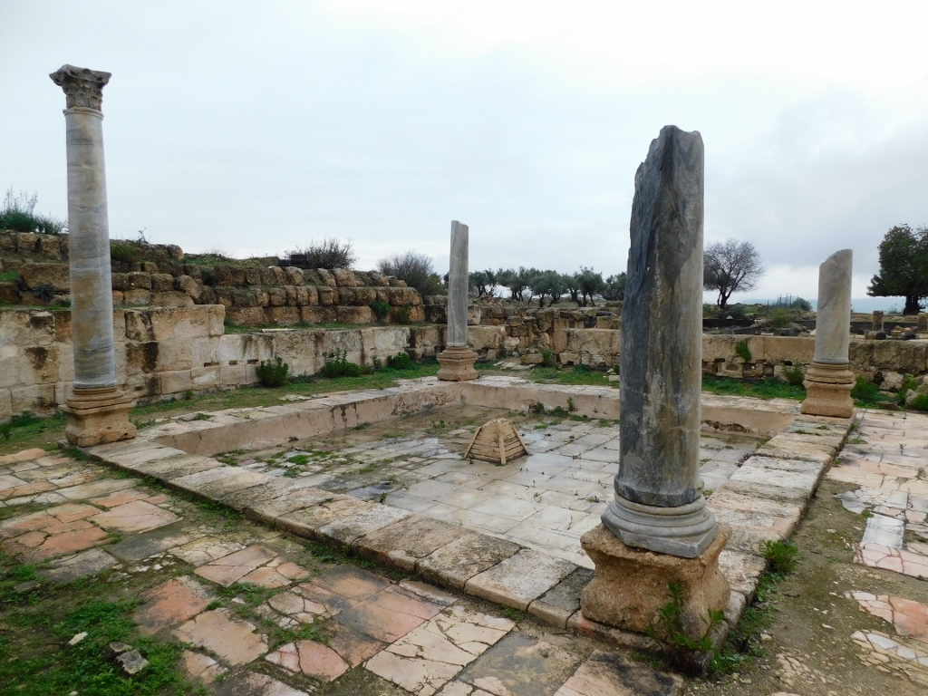
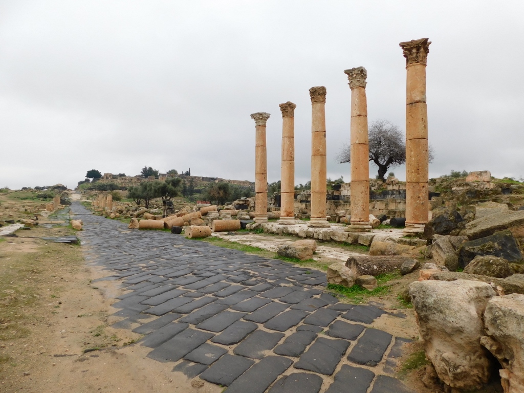
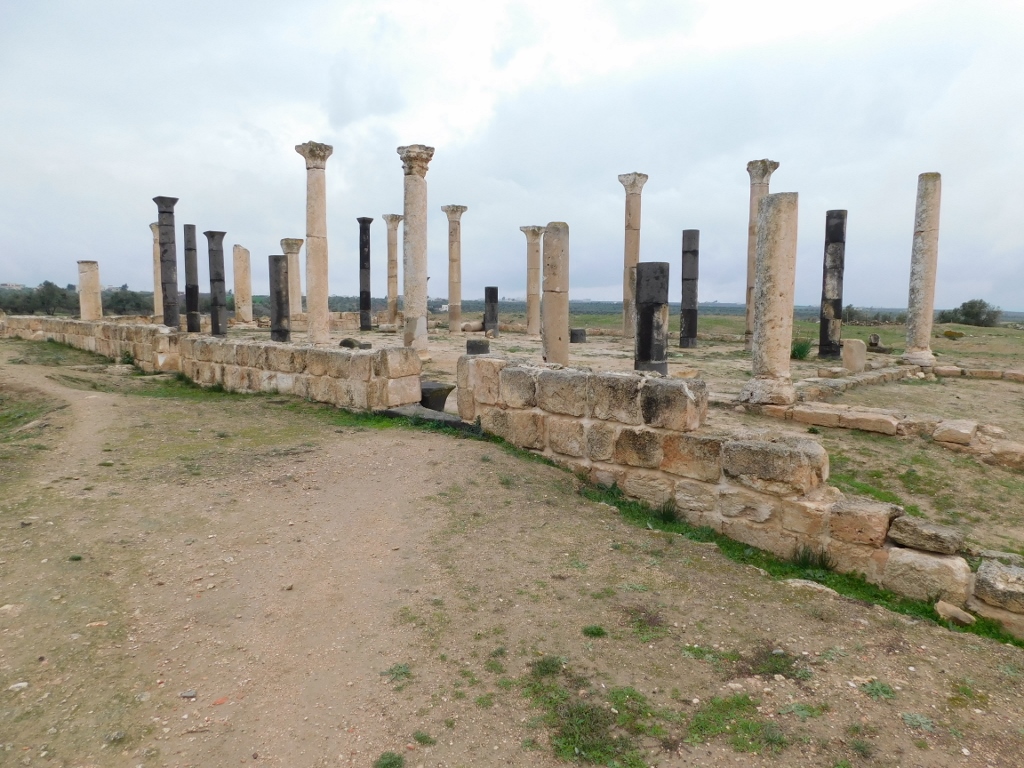
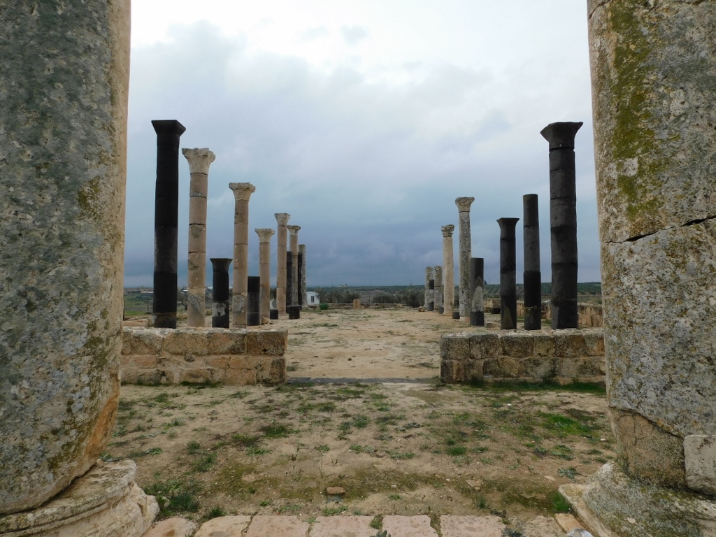
In any case, what can be observed very easily along the Decumanus Maximus street are five pillars that are believed to be a part of a propylon. In the ancient architecture, propylons were vestibules/entrance halls with pillars that lead towards the main building and that constituted a whole with it; something like a monumental gateway before the main entrance into the building. The tops of the pillars were linked by beams and in this way they constituted the front facade of the building.
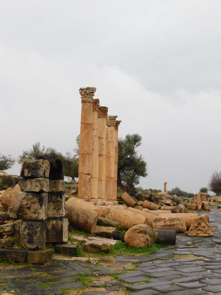 Remains of the propylon in the Decumanus Maximus street
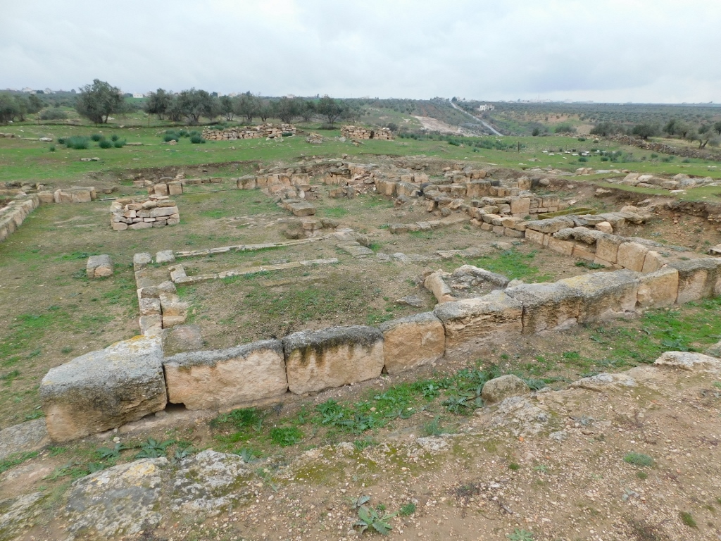
Then I got to a, so to speak, clearing between the ruins where I noticed an interesting stone-paved octagon, while numerous ruins around this place bear witness to the large size of this city.
 Remaining parts of the former meat market
As for these concrete remains, they clearly show that at the time when Gadara was an inhabited city, this was the place where the meat market or the macellum was. Namely, in Ancient Rome meat markets followed a standard structure that included a central courtyard and a tholos that was usually circular (it was octagonal here), that was surrounded by pillars and shops and roofed by a dome. It is also presumed that in this part of the city the shops that belonged to the market were arranged along the main street.
Not far from here I also noticed some interesting pillars and that made me go to them.
 Public bath complex Al-Qasr
Because of the massive limestone walls seen in the photo above, the building got its local name: Al-Qasr, which more or less translates to “the palace.” However, taking into account the excavated remains of water pipes, the archaeologists believe that this was in fact the public baths. What makes this structure stand out in comparison to the others in this area, and which actually caught my attention, are the restored basalt pillars with ionic capitals.
 Public bath complex Al-Qasr, a detail
I have already mentioned a few times that I was completely alone during my sightseeing visit to Umm Qais, but this was in fact not entirely true. This refers only to humans, but there were other living beings and so from time to time I managed to see some birds that would fly between the surrounded vegetation. I even managed to take a photo of one of them.
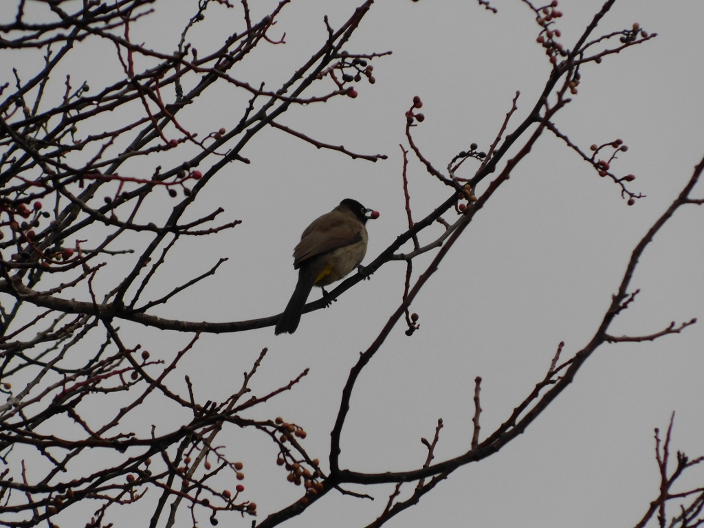 White-spectacled Bulbul (Pycnonotus xanthopygos)
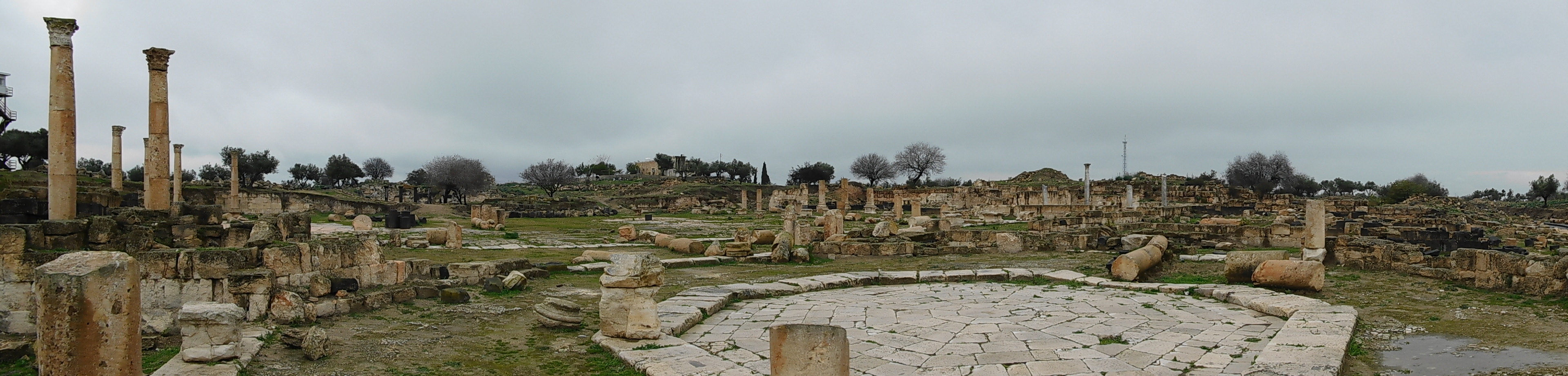
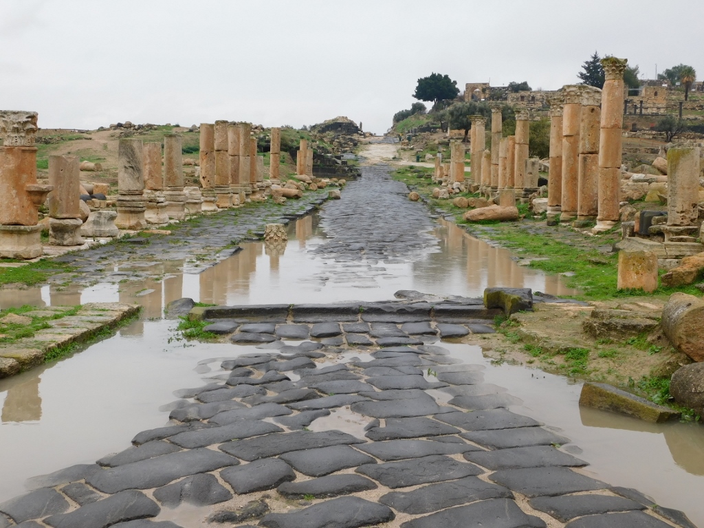
I went back to the Decumanus Maximus again and then I looked back to see where I came from earlier. The elevation seen in the distance in the photo below is the former Greco-Roman Acropolis, while now it is the Ottoman village (also former, but of a more recent date).
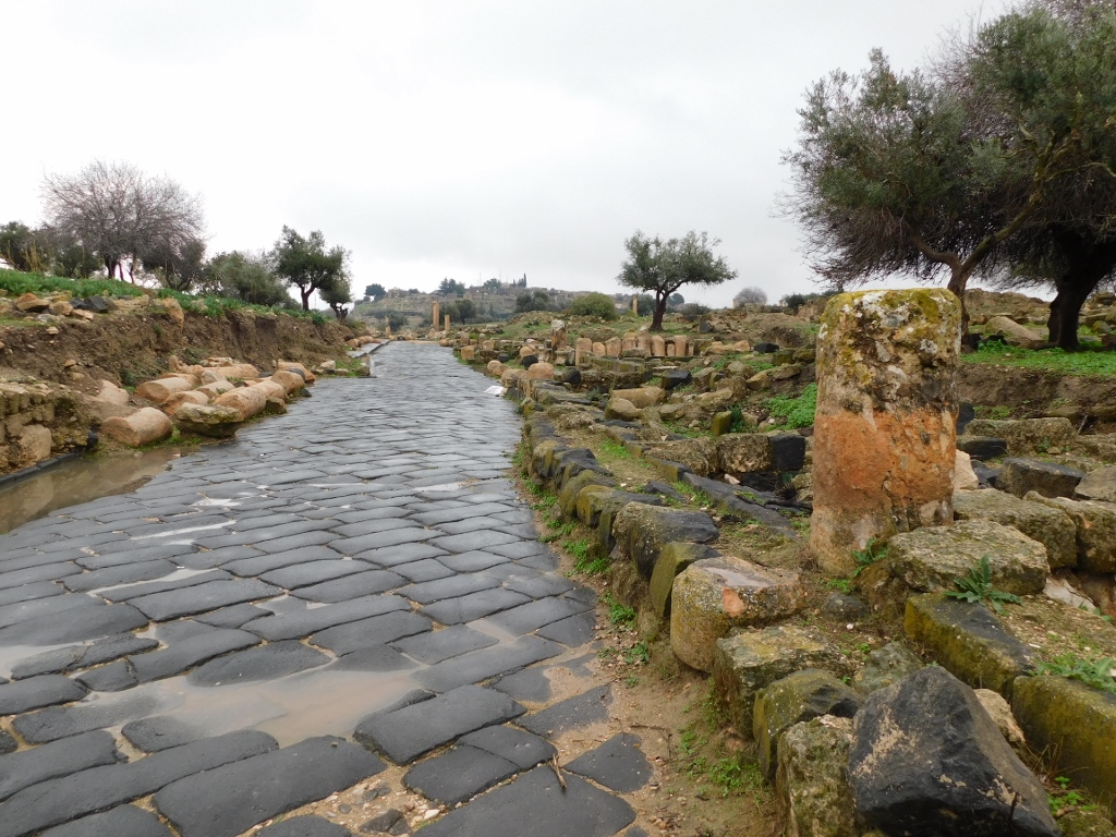 Decumanus Maximus and the surroundings
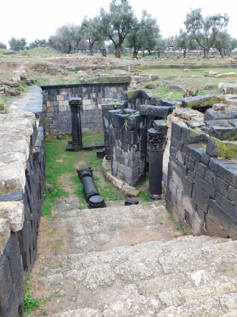
Still, soon enough I went among the ruins again and so I reached the remains of two important buildings. The photo below, on the left-hand side, shows a circular basis of a structure made of black basalt. This was the base of a tower that was a part of a monumental gateway that was used when entering the city. The gateway was called the Tiberias Gate, after the city of Tiberias in the present-day Israel. The gateway that had a shape of an arch spanned the Decumanus Maximus, there were two circular-plan towers on both sides of the street and it is presumed it was built in the second half of the 1st century CE.
 Remains of the Tiberias Gate (left) and a crypt (right)
The other important structure seen on the right-hand side of the photo above is a crypt. In the area that can be visualised, taking into account the photo above, there are very modest remains of the foundation walls of a five-aisled basilica, but this pales in comparison to the crypt itself.
Still, it needs to be said that the basilica was built in the second half of the 4th century CE and its central nave was directly above a mausoleum from the Roman times. Let me clarify: there was a necropolis in this part of the city during the early Roman Empire (1st or 2nd century CE). Later, during the further development of the city and the expansion in the west direction, the necropolis was destroyed, but this hypogeum (underground mausoleum) was left because, as it appears, it belonged to a local hero. Also, there is a possibility that the mausoleum was linked to the miracle of Gadara described in the Gospel of Matthew (8:28-32). The reason for such an opinion is that over time Gadara grew into an important place of pilgrimage.
In the 4th century, the hypogeum was expanded in the shape of a crypt built above the grave of a holy person, but today researchers may offer only theories about the identity of the deceased that was buried here. In any case, a basilica that was the biggest church in Gadara was built above the hypogeum and the crypt. The stairs leading into the crypt were added later.
 Stairs leading into the crypt
The spolia (parts of the older structures) from the Tiberias Gate were used in the construction of the church and the crypt, especially the curved blocks, because it is believed that the gate was destroyed in the 363 earthquake and was no longer important for the inhabitants of Gadara to restore it.
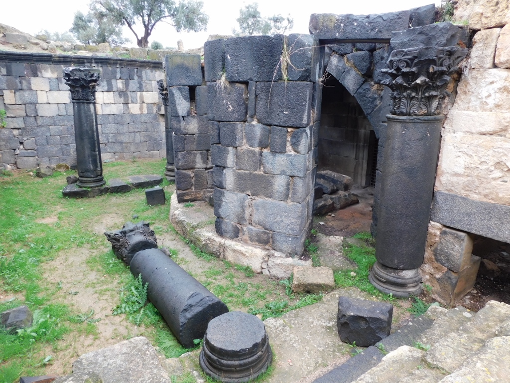 Access to the crypt
This is one of the best preserved graves in Gadara that I actually came across quite by accident. Needless to say, I squeezed in as much as I could, but I must admit that I had these thoughts that I had to be extra careful because if I were to trip or slip over the wet rocks, for instance, and then fall, there was absolutely nobody around to help me. It all went well.
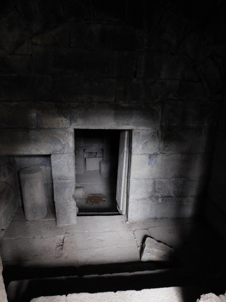 The crypt
Even when one leaves the crypt, the view and the structure were impressive.
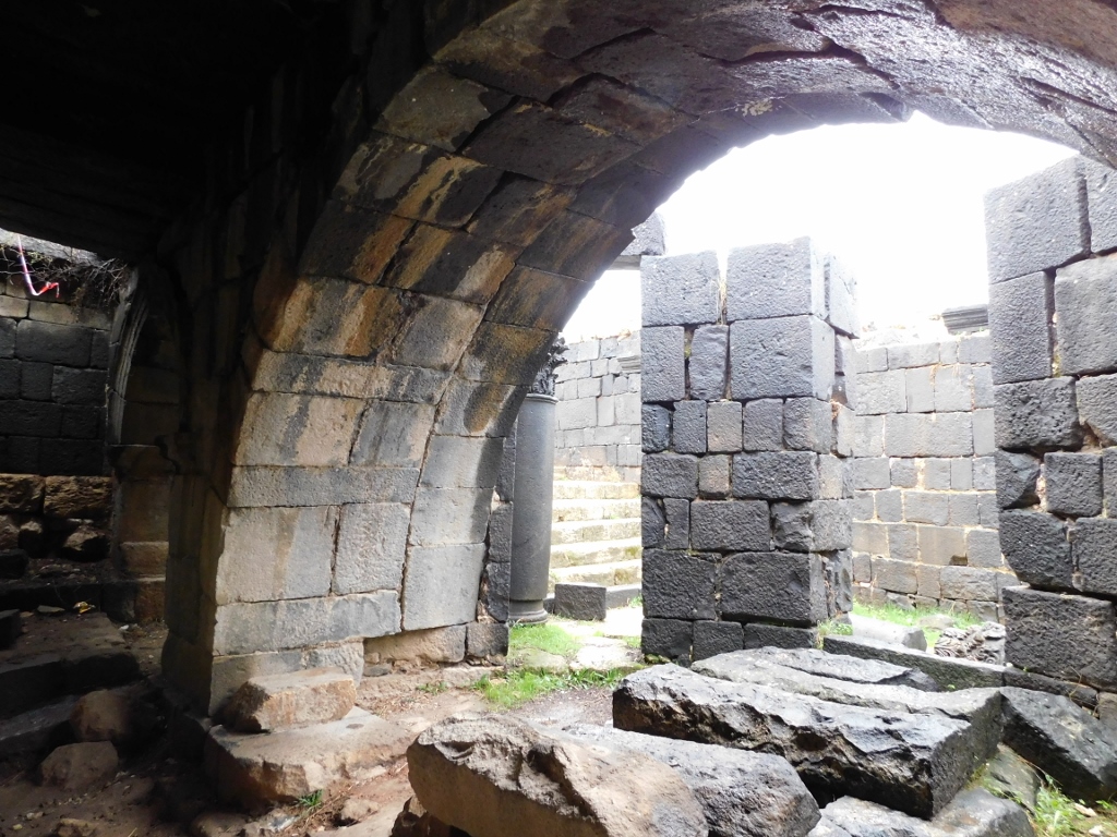 The crypt
I was very content with this visit, so I went back to the main street – the Decumanus Maximus.
 Decumanus Maximus
Since my plans for the day included a visit to yet another, smaller archaeological site, I decided to turn back, but before doing so, I left the main street once again because I noticed remains of some structure with interesting columns that drew my attention. Still, no matter how much I looked, I could not find any data about what this was. It doesn’t matter. It was nice anyway.
 Gadara, an unknown detail
Although this site is impressively large, it needs to be said that there are many structures that have not been excavated yet, so the archaeological site of Gadara will certainly continue to develop over time.
I was walking again past the propylon, when it started to drizzle.
 Remains of the propylon in the Decumanus Maximus street
 Decumanus Maximus
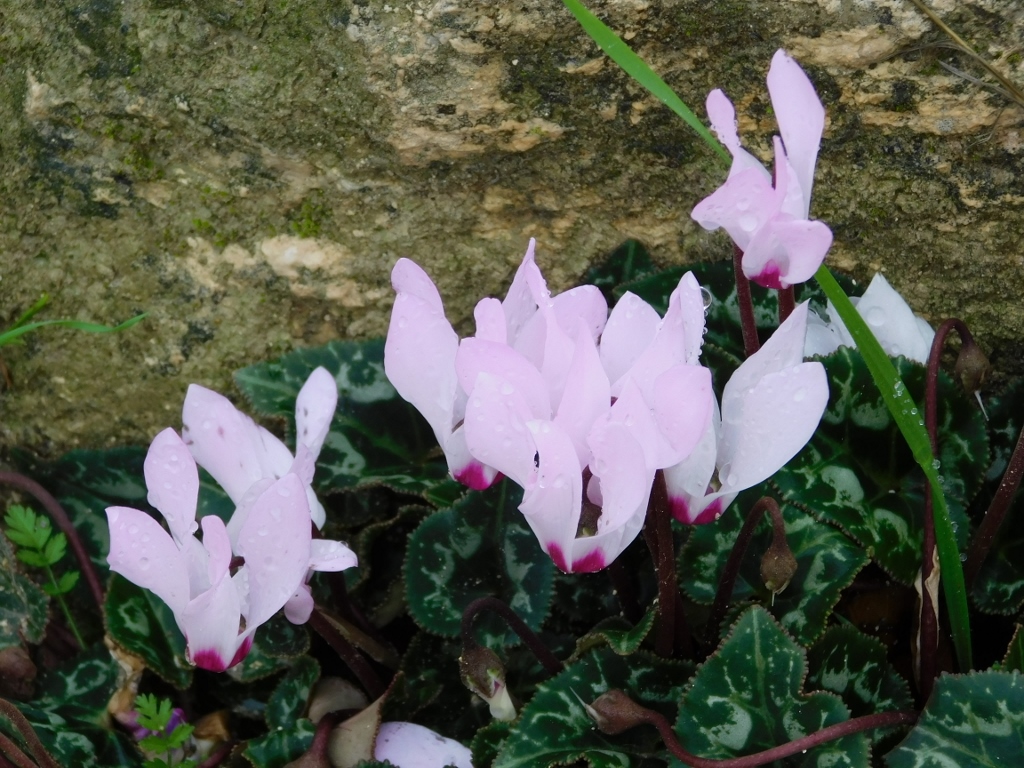
Across the Nymphaeum I followed some stairs to get to the Basilica Terrace and then farther towards the summit of the Acropolis. But, I had to make a sudden stop, because I spotted something very special – wild cyclamen growing between the steps. Aren’t they lovely?
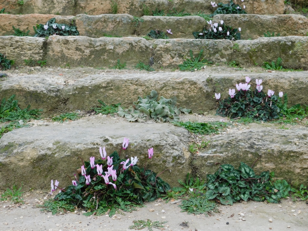 Wild cyclamen
 Wild cyclamen
From these stairs I had again a stunning view at the site and the surroundings. In the photo below from left to right: the Basilica Terrace, Decumanus Maximus, remains of the Nymphaeum, and in the distance (above the remains of the Nymphaeum): the Sea of Galilee, south section of the Golan Heights, the Yarmouk river.
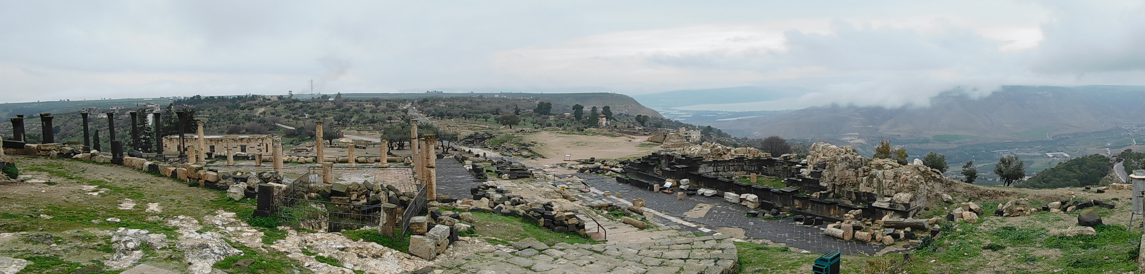 Stunning view in Gadara
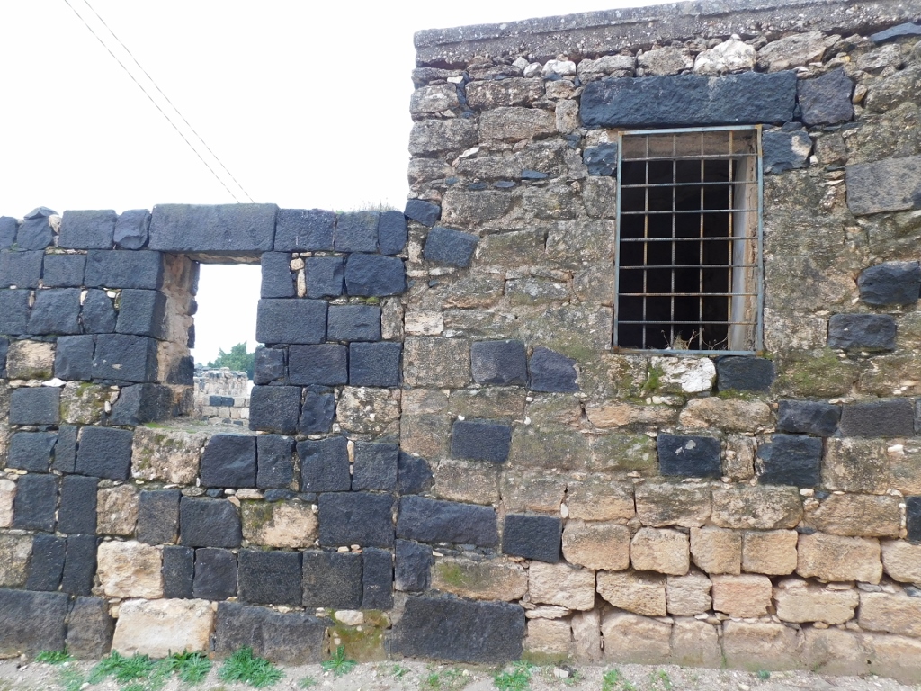
To start with, I followed the perimeter of the Ottoman Village and there I could see again how the former inhabitants used stone blocks in two colours (basalt and limestone) in order to build their houses.
 One of the houses in the Ottoman Village
The basalt blocks were taken right from the nearby North Theatre that is in a very sad state today.
 Remains of the North Theatre
The North Theatre was built between the 1st century BCE and the 1st century CE. Its width is around 85 m and it was built into a limestone slope. To be fair it was not as if the future residents simply came here at dismantled a perfectly preserved theatre. In fact, the theatre was already destroyed by the earthquakes that are more or less a regular phenomenon in this area, so the future inhabitants used this material for the construction of their houses.
As for me, I only had a visit to the Umm Qais Antiquity Museum left.
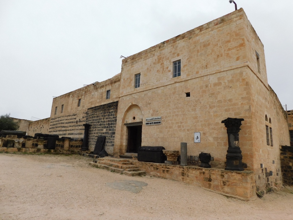 The Umm Qais Antiquity Museum
The museum is situated in the only two-storey house in the Ottoman Village that was built for a local governor from the late Ottoman period. There is a beautiful inner courtyard in the museum, while the exhibits are distributed both around the courtyard and in the surrounding buildings.
The photo below shows, on the left-hand side in the back, two basalt double doors that were carved in such a way that they imitate wooden doors. The left pair is from the Roman hypogeum.
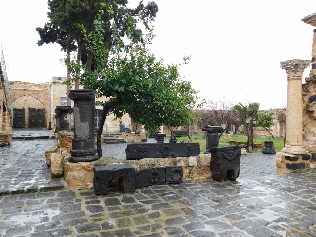 Inner courtyard
The next photo, also on the left-hand side and in the back, under the arch, shows a statue of Greek goddess Tychen (her Roman equivalent is Fortuna) found in the orchestra of the West Theatre and made of marble in the first half of the 2nd century CE.
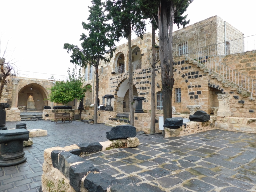 Inner courtyard
But, as it may be seen in the previous photo, there is a staircase here leading to a fenced terrace that again renders splendid views at the surroundings.
 View from the highest point in Gadara
Now I was completely ready to bring my stay in Gadara, i.e., in Umm Qais to the end and move on to another site. And that was the archaeological site of Abila.
But, getting to this site was not a simple matter. First, the site has several names, it is tucked away, quite small when looking on a map and it also appears very modest in comparison to Gadara/Umm Qais. Abila is nowadays often referred to as Qweilbeh, after a valley of the same name (Wadi Qweilbeh). In the past, it was called Raphana for a while and it is often referred to as Abila of the Decapolis, because it was indeed one of those ten cities that together led to the joint name – Decapolis. I have already written about it, so I will not repeat the whole story again.
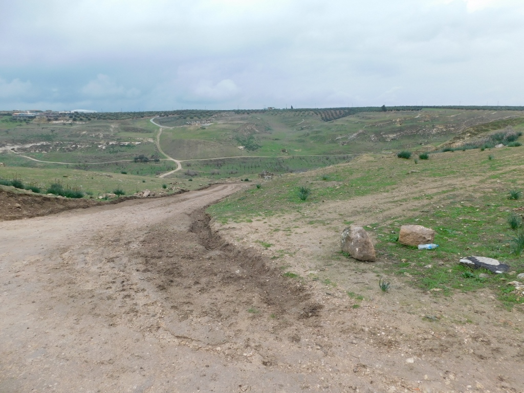
Another thing was that I reached by car (that also had its driver, since when travelling I mostly like to look out of the window and not at the road I’m on) a place where the asphalt road ended and then we continued along a dirt road coming right away across a large puddle through which the car literally crawled. If I had been the driver, I’m sure I would not have dared to drive along dirt roads while it was raining in a foreign country the language of which I did not speak and when there was absolutely no one in sight. This way – I did not have a care in the world. Admittedly, the very kind driver “told” me (he actually said his text into his mobile, while the voice of the automatic interpreter would say it in English) that he had never brought anybody here. Well, I was proud that as a true pioneer-adventurist I was paving the way for some future layman researchers. After the initial wet section, we got up to a higher ground and the situation with the dirt road was much better.
 Getting closer to the archaeological site
On the top of the hill I could see some ancient columns, so we headed that way. As it turned out, this site had not been developed at all, so I did not have to buy any ticket, for there was nobody here. On the other hand, I had very few information, so in the end it all came down to a walk around the site and by God I did walk quite a bit.
The columns I noticed on the top of the hill are remains of one of the numerous Byzantine churches built in the city, but I first paid attention to the remains of a structure that was next to the remains of the basilica. Although I do not know what this actually was, the photo serves as an illustration of a large number of structures and remains here, for this is a tiny bit of the overall archaeological site. Further down, you can see some more stone blocks.
 Abila, a detail from the top of the hill
Then I paid some more attention to the basilica from the 6th or the 7th century CE.
 Abila, remains of a Byzantine basilica
 Abila, remains of a Byzantine basilica
Beside the semi-circular apse I also noticed a beautiful plant which, despite the cold weather and the strong wind, even managed to blossom.
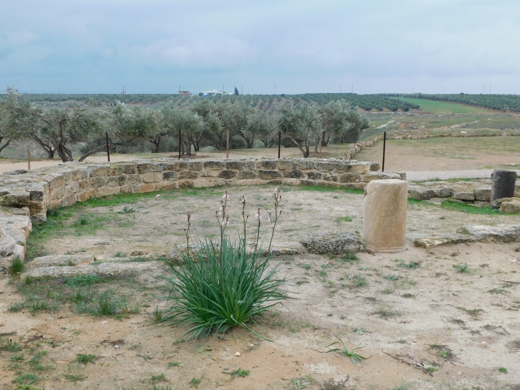 Branched Asphodel (Asphodelus ramosus) near the remains of the apse
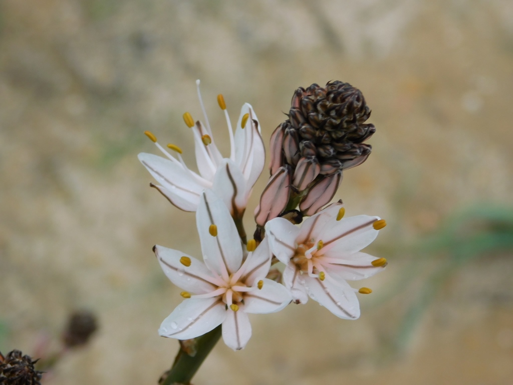 Gorgeous blossoms of the Branched Asphodel (Asphodelus ramosus)
The driver waited for me patiently by the car looking in my direction and I believe that he could not stop wondering about his client of the day. Not only did this woman ask to get to some out of the way archaeological site that nobody comes to, she also spent five minutes taking photos of a plant (in my defence, I was waiting for the wind to subdue so that the blossoms would be still). Luckily, I pay no attention to what other people think about me.
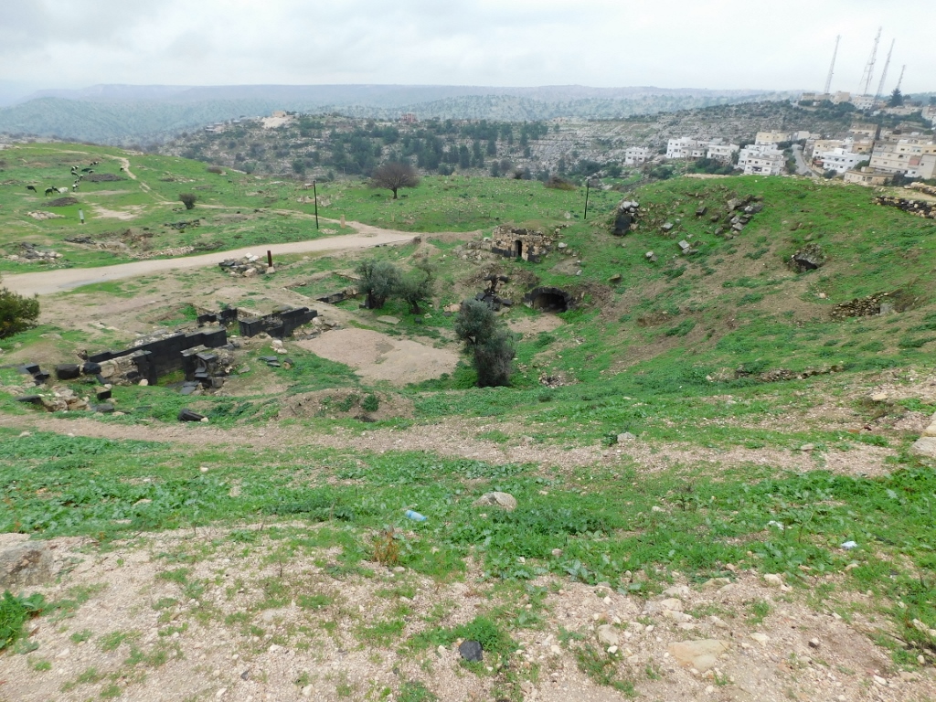
Having taken photos of the plant, I went back to the car, but I also saw from the top of that hill that down in the valley there were still some ruins of the ancient city of Abila. Since the dirt road went down a rather steep slope, I said to the driver that there was no need for him to try to go down by the car and that I would simply walk there on my own. The road was there.
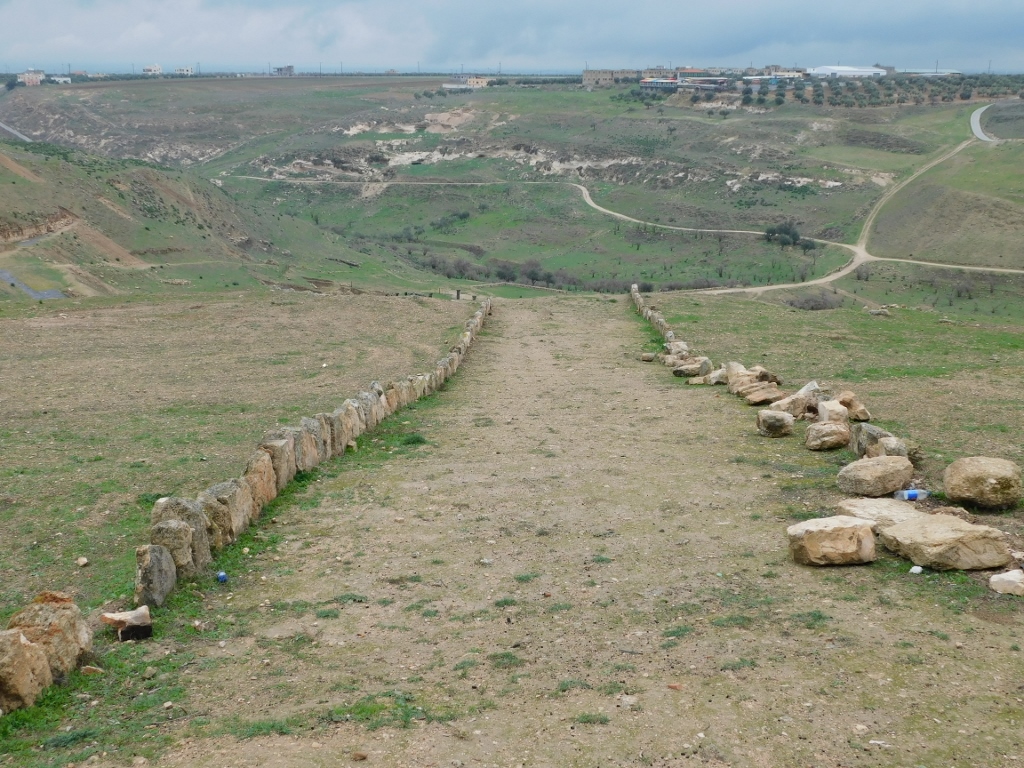 Abila archaeological site