When I got to archaeological site Umm Qais in the very northwest of Jordan, it turned out the weather forecast was right – it did not rain. But, everything was wrapped in fog. To start with I first laughed at myself. I chose to go to Jordan in January because in my mind I had the image of Jordan as a hot country. Clearly the winters here cannot be as hot as the summers, and that was the attractive bit, but I was not fully prepared for this. And yet, I had no choice, so I just bought the ticket at the office that was right next to the parking lot and started to go along the path that went slightly uphill.
First I went to the Visitor Centre, but there was nobody there, so with the help of my guidebooks and the maps of the site that they contained I started with my sightseeing tour completely on my own.
Umm Qais is the name of a contemporary city in the very northwest of Jordan, close to the border with Syria and Israel. The reason why I came here is that there are incredibly impressive remains of the ancient city of Gadara. Gadara was most likely founded as a military colony by Macedonian Greeks of Alexander the Great in the second half of the 3rd century BCE and it was populated until around 749 CE when it was struck by a powerful earthquake, after which the inhabitants moved away.
Gadara belonged to a group of ten cities from the Hellenistic and Roman periods that duly shared the common name of Decapolis, meaning “ten cities.” They were distributed on the territory close to the east border of the Roman Empire, more accurately on the territory that is nowadays a part of the Near East. Remains of two cities are today located on the territory of Syria (Damascus is one of them), two are on the territory of Israel (and only one of them is west of the Jordan river), while the ruins of the remaining six cities are situated on the territory of Jordan. One of them is Gadara or the modern-day Umm Qais. I have already mentioned another one and that is Philadelphia, i.e., the present-day Amman.
Even after the division of the Roman Empire, Gadara continued to be an important centre within the Eastern Roman Empire, i.e., the Byzantine Empire, only to fall under the Muslim rule in the 7th century. As I’ve said, it was abandoned in 749 CE.
The archaeological site of Gadara is truly impressive. One of the reasons is the size of the site, another one is its exceptional position that renders an excellent view at the north section of the Jordan river valley including also the Sea of Galilee, while the third reason are the interesting ruins that among other things also include structures built by using black basalt and light-colour limestone blocks.
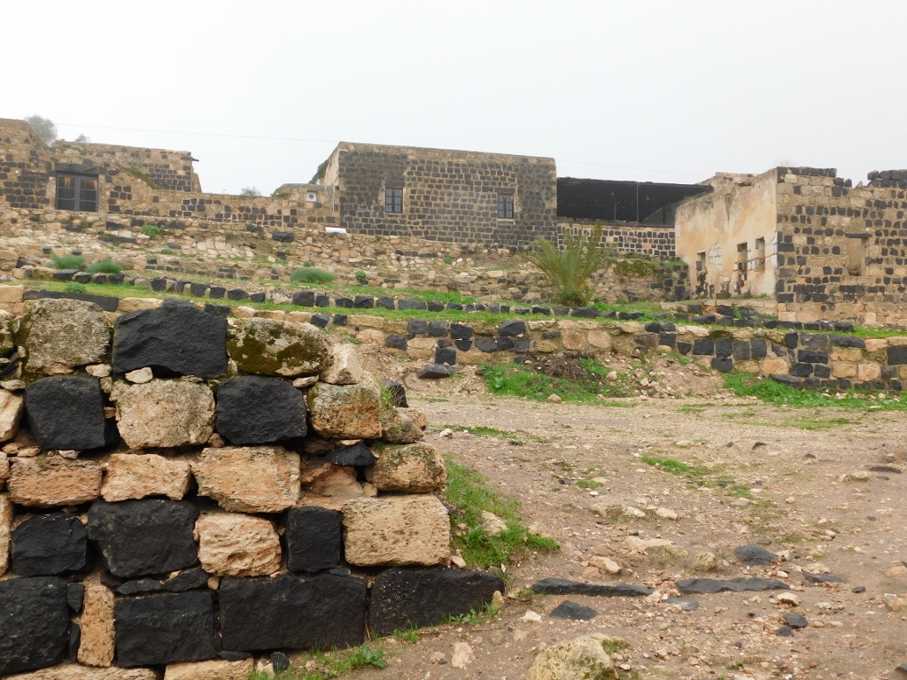
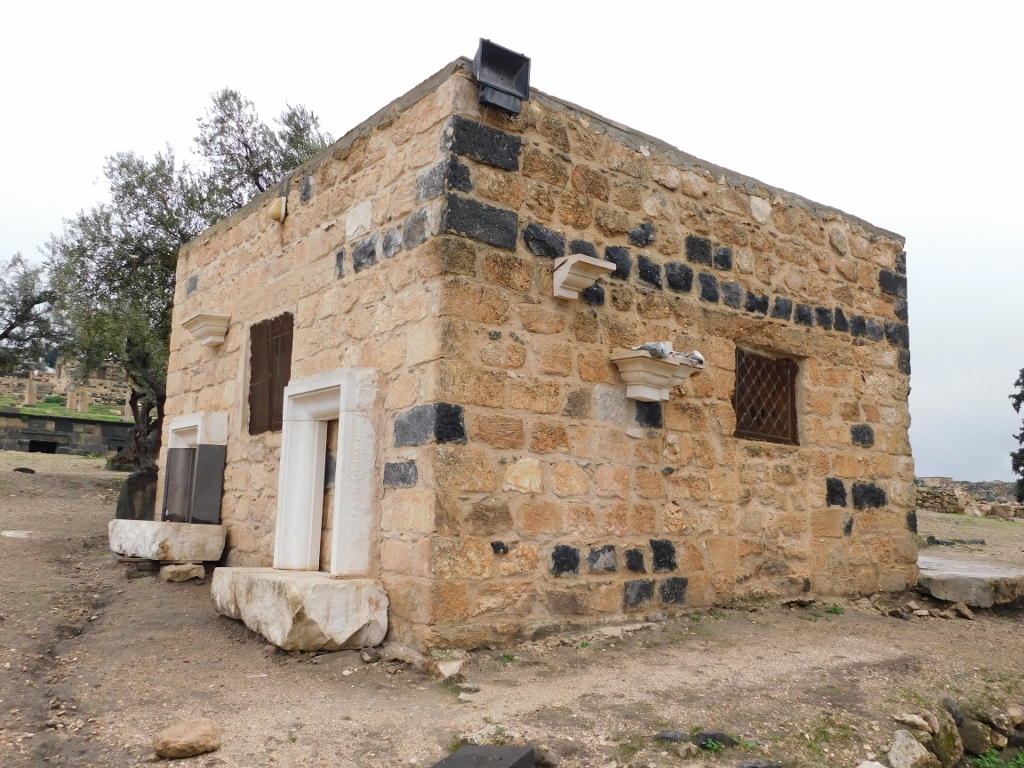
I started with my sightseeing tour from the Ottoman village that takes up the highest sections of the archaeological site. After Gadara had been abandoned around the middle of the 8th century, its remains were rediscovered at the beginning of the 19th century and from the 1890s, when the area was under the Ottoman rule, a village started to develop on top of the Roman ruins. The new residents used the construction material from the earlier structures for the building of their houses, mostly from the North Theatre, and it is precisely this combination of stone blocks that has led to such an interesting appearance of this village, i.e., of its houses. By the way, the village was a living one, i.e., people lived here up until 1986, when some 1500 residents were paid out by the state in exchange for their moving out in order for archaeologists to be able to study the site better. However, according to what I have read, the people did move, but the tourist concepts linked to the Ottoman village have partially changed.
Be as it may, in January 2022, everything was rather deserted, so I was completely alone when I entered the courtyard of a house that used to belong to Hajj Mahmoud al Rousan.
 Courtyard of the house that used to belong to Hajj Mahmoud al Rousan
Here in the courtyard (the Hosh), as well as in the part of the house for receiving guests called the Madafa, at a regional meeting held in 1920, 17 Arab leaders gathered in order to prepare their own version of an agreement, as a response to the British and the French plan linked to the division of the region after WWI. The British and the French had come up with a secret plan and had signed it in the shape of an agreement already in 1916, as a preparation in case of a division of the Ottoman Empire. Since the Ottoman Empire was on the losing side in WWI and soon dissolved, the agreement was the right thing at the right time for colonial powers such as Britain and France, and this authority of theirs in this part of the world is called the British and French Mandates. Needless to say, nobody asked the local population anything. So, their leaders gathered up here in 1920 and I don’t know what exactly they agreed, but we know from history that the British and the French ruled here formally until after WWII.
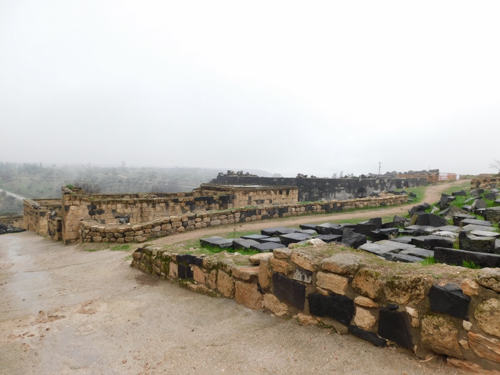
But, let me go back to my stroll around the remains of the ancient city of Gadara. Going through some narrow passages between houses I got out of the area of this smaller village on the top of the hill and continued to follow a dirt path leading around the site. Still, it was worth looking back at the architecture of the Ottoman village again. As a part of those different concepts for the development of the site that I have mentioned, some of these houses have been restored and conserved for some future use.
 View uphill towards the Ottoman village
In front of me though, I started slowly to discern parts of the West Theatre. In the following photo they are black and together with an orange fence they can be seen slightly on the right, as the line of the horizon.
 Gadara
Still, when I got to the enclosed part on the top of the West Theatre, I first took note of some other parts of the site where I was yet to go.
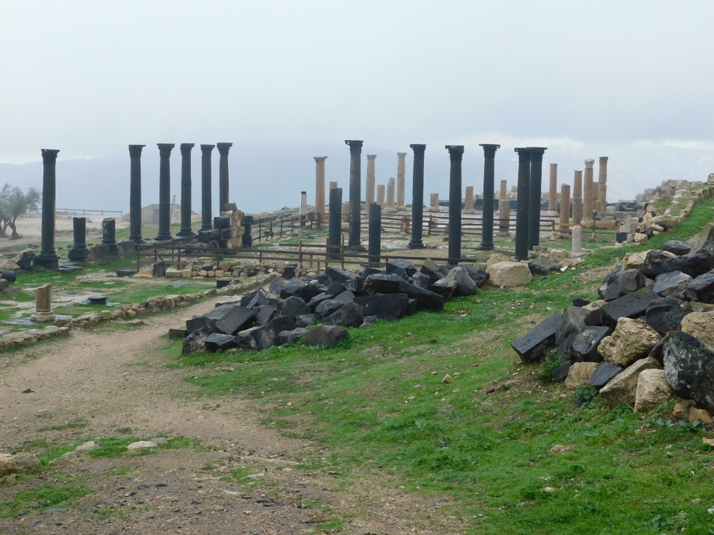
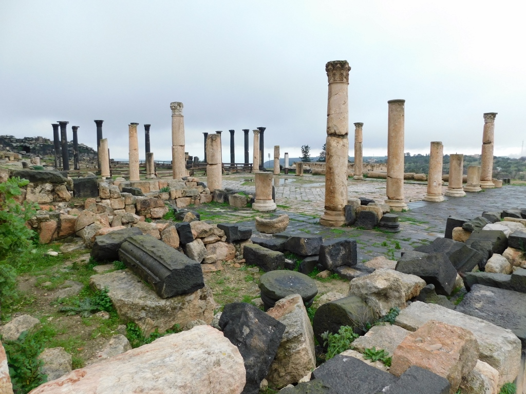
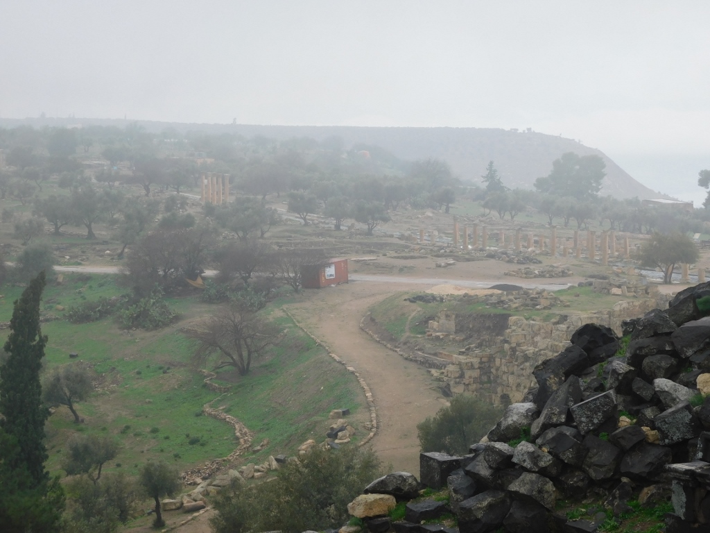 Gadara enwrapped in fog – note the columns arranged along the main street in the city –Decumanus Maximus
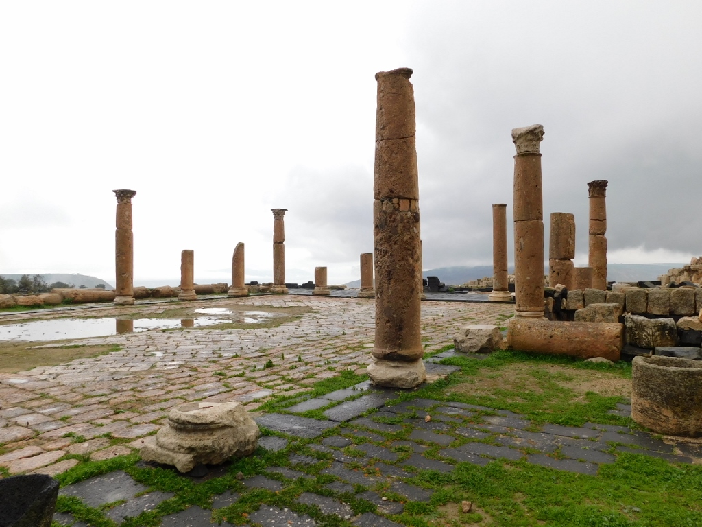
 Gadara – Basilica Terrace
And only then did I start to pay more attention to the West Theatre.
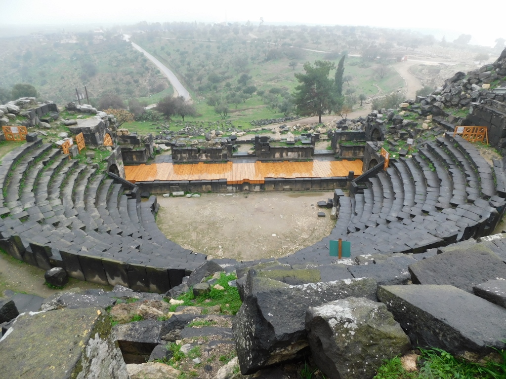 West Theatre, view from the top
The West Theatre was the smaller of the two theatres that used to exist in Gadara, but it is in a significantly better shape than the North Theatre the remains of which I saw a little later. This theatre here was built on a slope and it is fully open towards the surrounding area. It was made of hewn basalt blocks in the 1st or the 2nd century CE. The diameter of the theatre is 53 m and it could receive up to 3000 spectators.
The theatre could be entered in several places, but I opted for a passage that I found when going down alongside the theatre walls from the outside.
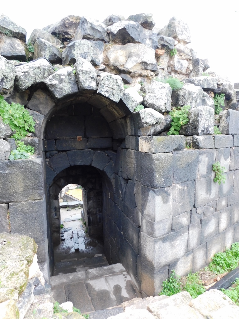 West Theatre, one of the entrances
When I entered the theatre, I came across an impressive row of seats made of basalt rock with nicely made high backrests.
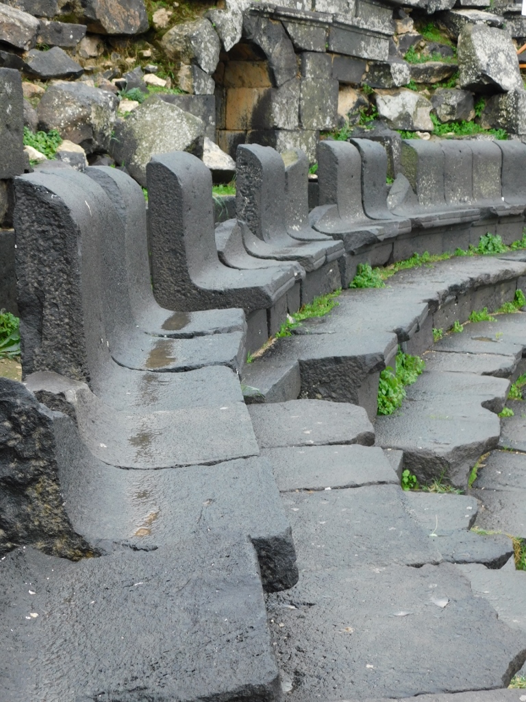 West Theatre, seats with backrests, while below there are seats without backrests
Needless to say, I had to go on the stage. I had read somewhere that the acoustic was good, so I tried it. I shouted a couple of times and the echo was superb. Then I gave a mini-concert to myself and sang a couple of songs in their shortened versions. When you are completely alone in places like this, you can fool around to your heart’s content, and I saw absolutely nobody else around. I must admit that this only added to the overall impression. I had all this beauty just for me, that is, without any hindrance whatsoever.
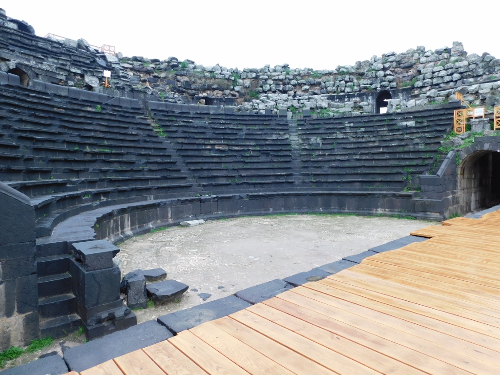 West Theatre
I left the theatre through a passage leading directly from the stage only to climb again to the top where the ancient street the Cardo was.
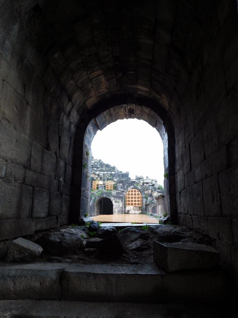 West Theatre, exit from the stage
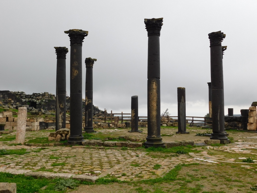
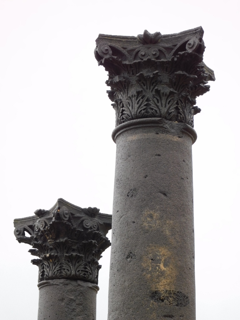
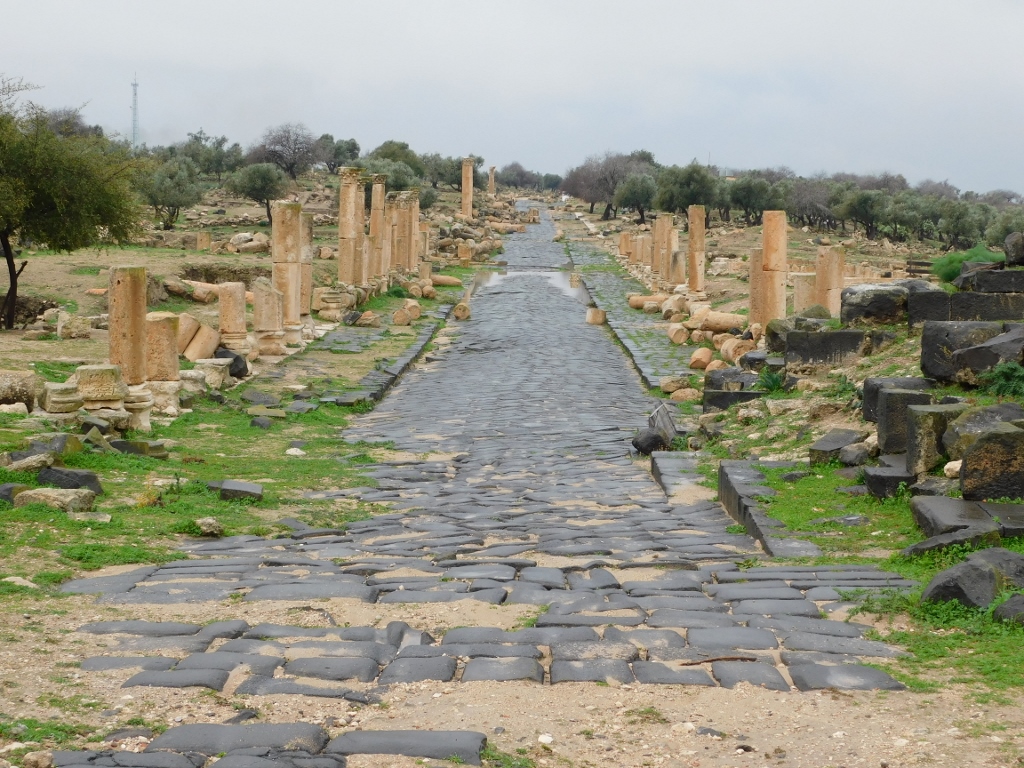
In ancient Rome, the Cardo was the name for a street running along the north-south axis, while the main street in that direction was called Cardo Maximus. Here the Cardo links the West Theatre and the main street in Gadara, going along the east-west axis, which is called Decumanus Maximus. The Cardo was usually the centre of the economic life of a Roman city and this is where shops were. This is precisely the case here. On the west slope of the Acropolis, there is a man-made plateau where during the Roman times there was certainly a public building, but over time it was turned into a Byzantine basilica. Below that plateau there was a line of shops that extended along one side of the street and that practically supported the above plateau with the basilica. The following photo shows pillars that are remains of the Byzantine basilica above, while the remains of the street with shops are below.
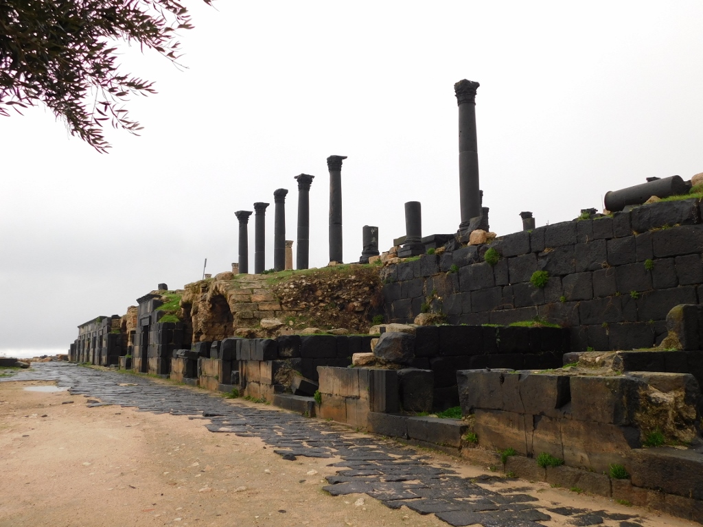 The Cardo
Just like the theatre, this part of the city is also believed to have been built at the end of the 1st and the beginning of the 2nd century CE. Although the photo above shows the remains of the street made of basalt slabs, the most interesting part are certainly the shops. There is a line of 17 shops that had a barrel vault made of limestone, while the facade was made of basalt. Not all the shops have survived in a good state to date, but the following photo shows well both the shape of the shops and how they were decorated by the basalt facade.
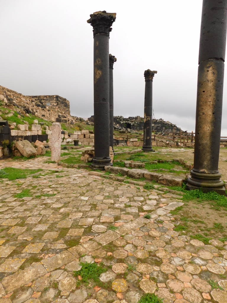
 The Cardo with the remains of the ancient shops
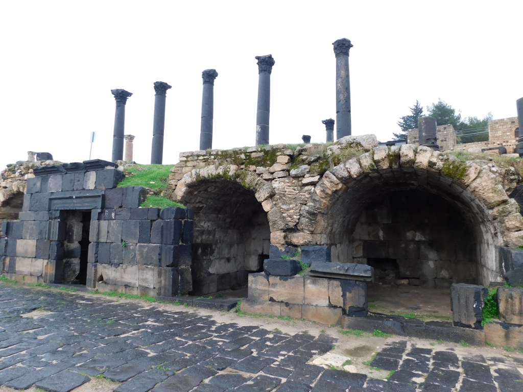
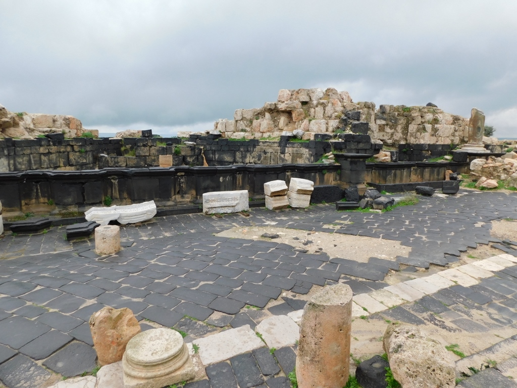
Then I walked to the Basilica Terrace. This is a platform that is some 37 m wide and around 99 m long. Having replaced the building from the Roman period, during the first half of the 6th century a complex of sacral buildings, including also a three-aisled basilica, was built here using the existing construction material. Today, in fact, very few remains of that basilica may be seen since it was destroyed in the 8th-century earthquake. What can be seen here and what seems most interesting is the forecourt in the shape of an atrium that is approached from the main street, i.e., from the Decumanus Maximus.
 Forecourt surrounded by pillars made of whitish limestone
 Forecourt surrounded by pillars made of whitish limestone
Between the remains of the forecourt and the basilica, there are remains of a building with a square plan that had an octagonal central hall which researchers presume used to have a dome.
 Remains of a building with an octagonal hall
What is particularly interesting here is the floor made of cut clay and stone slabs of different colours. In the photos it is also possible to see a modest remain of a pillar made of a reddish-whitish marble (left of the black basalt pillars).
 Remains of a building with an octagonal hall
 Building with an octagonal hall, a detail
When you go back from the Basilica Terrace to the main street, right across the street there are remains of the Nymphaeum, that is, of a big city fountain. In the Roman times these were usually large and opulently decorated structures with statues, niches, etc.
 Remains of the Nymphaeum
A little further down the main street there are also remains of the Public Baths – Thermae from the Roman times, but at this point the most interesting sight for me was the view I had down the main street – the Decumanus Maximus.
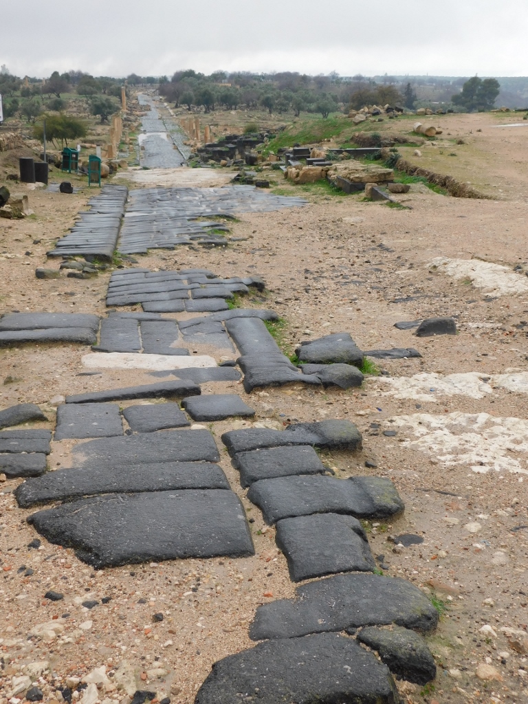 Decumanus Maximus
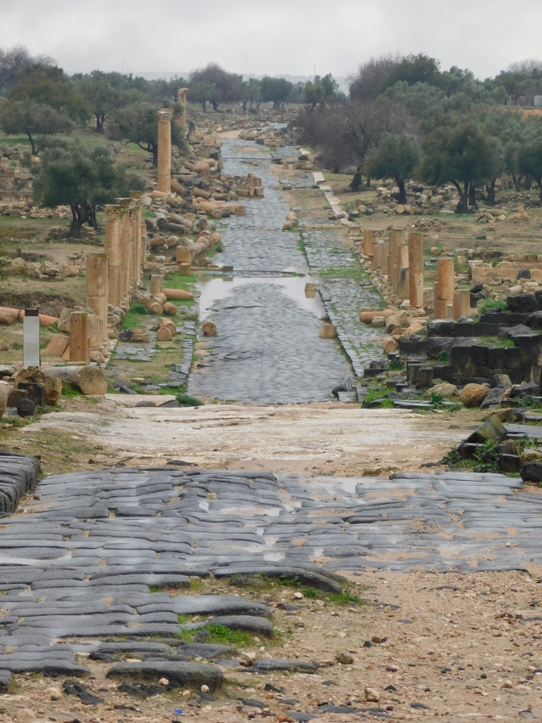 Decumanus Maximus
Still, before going down the street or stopping to see the remains of the Public Baths, I first went to a viewpoint from which there was a fabulous view.
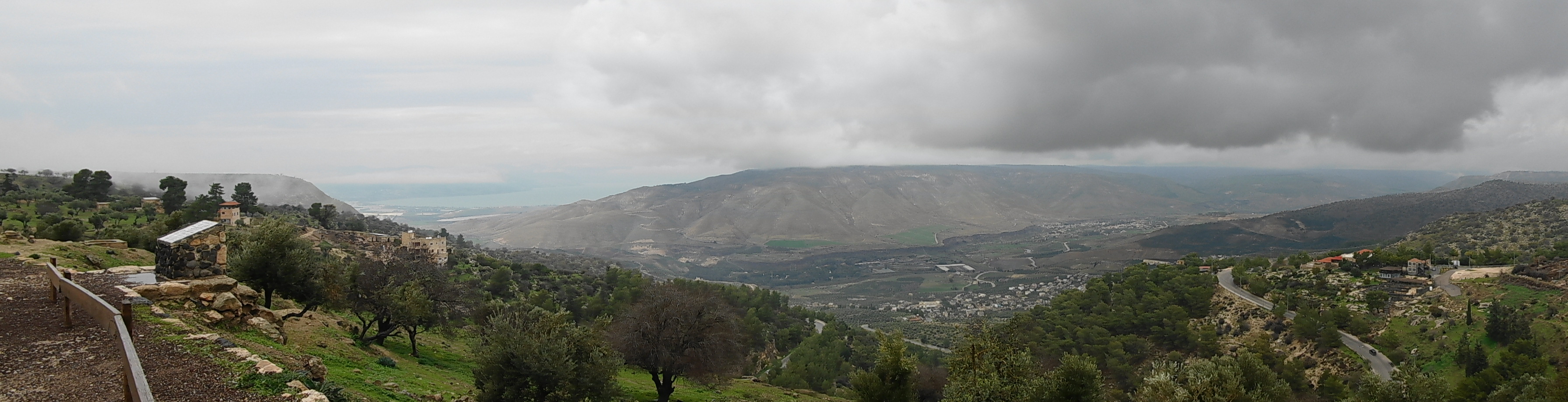 View from the archaeological site Gadara in the city of Umm Qais
As it may be seen in the photo, the fog had lifted in the meantime, but it was still cloudy. However, even with the gloomy weather, the view was spectacular.
What can be seen here is the Sea of Galilee (in the distance on the left-hand side), the south part of the Golan Heights (the middle), as well as the Yarmouk river valley (below the Golan Heights).
Since I’m mentioning these geographic terms, let me say something about them.
The Sea of Galilee is situated in Israel at around -212 m (MINUS!), i.e., below the sea level. This is the lowest positioned freshwater lake in the world and the second lowest lake in general (after the Dead Sea which is salty). It is precisely from this lake that the Jordan river flows out towards the south and the Dead Sea. Or, to put it more correctly, the Jordan rivers flows through the Sea of Galilee, since in the north it flows into it, while in the south it flows out of it.
As for the Golan Heights, they are officially recognised as the territory that belongs to Syria, but two thirds are under the Israeli occupation.
The Yarmouk river is the main tributary of the Jordan river.
Here is this magnificent area once again.
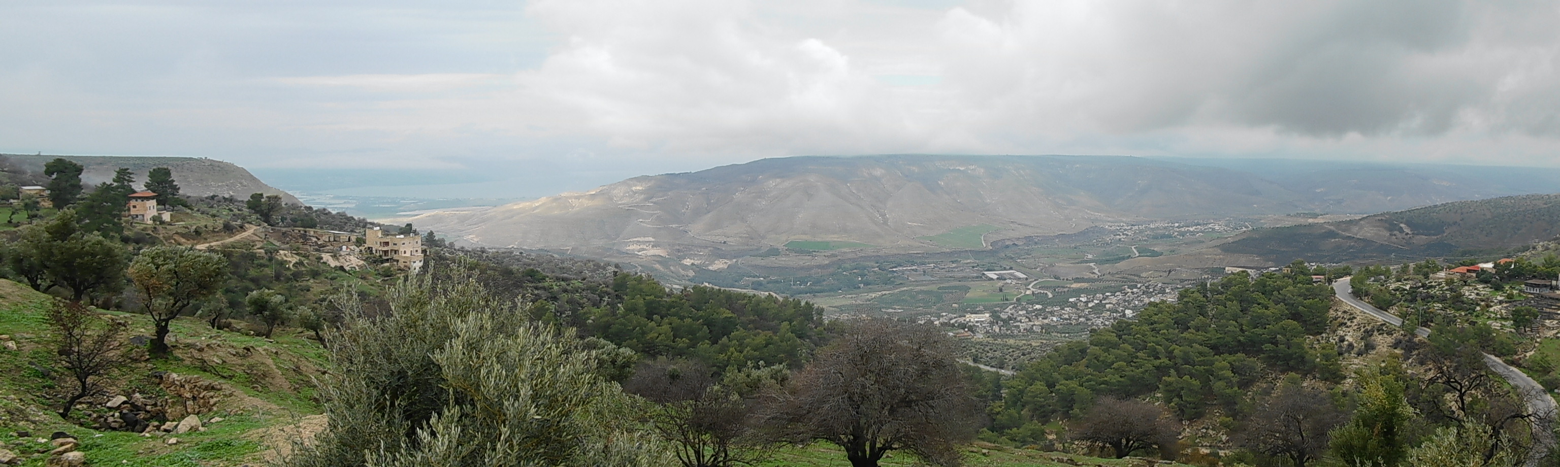 View from the archaeological site Gadara in the city of Umm Qais
In this spot I came across an information board with an interesting epitaph cut in the tombstone that was left by ancient philosopher Arabiouss from Gadara that could be translated like this:
“Whoever is passing through here...
the way you are now I was,
the way I am now you shall be,
enjoy life because you are gone.”
Interesting and certainly very true. Still, a lot of people tend to forget about the transitory nature of our existence, so I guess it’s not out of place to remind ourselves of this fact every now and then.
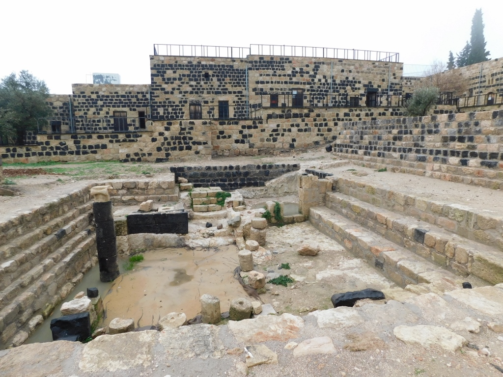
In any case, I walked to the part where there were basically modest remains of the Public Baths. There I came across a building that certainly appeared new or better said – reconstructed.
 Gadara, a detail
There was still nobody else at the site, so there was nobody to ask, but I saw some information boards and it was quite clear that there were some important segments of the Roman public baths here. In any case, the Public Baths date back to the 4th century CE. On the basis of the archaeological research it has been concluded that the facade of the whole structure was as much as 14 m high. This primarily illustrates how much attention the ancient Romans paid to their public life, since the public baths were not only the place to take care of personal hygiene, but also the place to conduct very rich social life. In addition, this also confirmed the reputation of Gadara as a city of culture.
I did not stay here for too long and soon I continued with my walk down the Decumanus Maximus. I cannot begin to describe how much I enjoyed this.
 Decumanus Maximus