Novi Beograd is the largest municipality in Belgrade, Serbia, in terms of population, although it is one of the smaller ones in terms of area. The reason for this is that Novi Beograd has a large number of multi-story residential buildings with numerous flats, so in the past this part of the city was often referred to as the “dormitory.” Times have partially changed – there is still a lot of construction of residential buildings, but there are also increasingly more office buildings, shopping centres and various other facilities. Additionally, over time, the once young trees have grown, so there are plenty of beautiful green areas between the buildings, although, if it were up to me, there would be even more of them.
The reason for this development is that much of the territory of Novi Beograd was predominantly marshland until about 80 years ago. It was only after World War II that the idea of establishing a new settlement on the left bank of the Sava River was conceived (Novi Beograd actually means New Belgrade), although Bežanija and Zemun were already located somewhat further away. Today, Bežanija settlement (see: https://www.svudapodji.com/en/belgrade-west-2023/) is a part of Novi Beograd, while Zemun, that was previously a town in its own right, is now another municipality of Belgrade.
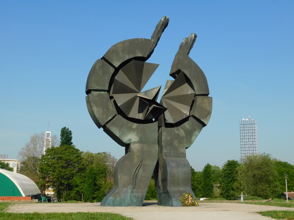
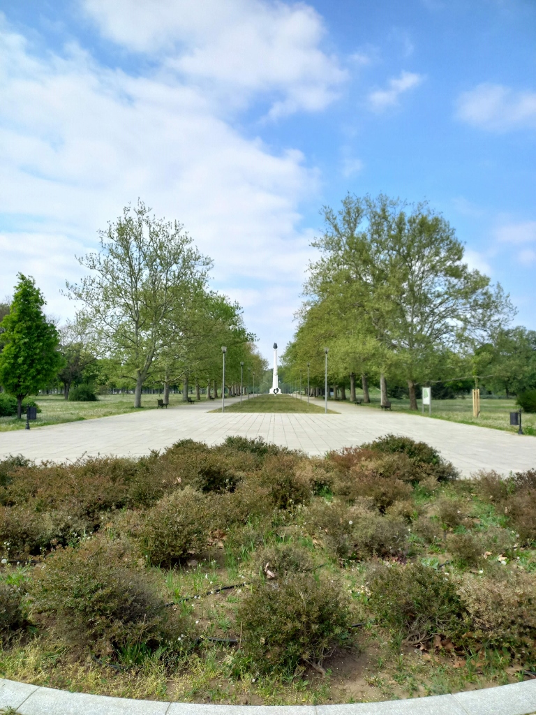
In accordance with the new plans, the construction began on 11 April, 1948, so this day is celebrated every year as the birthday of Novi Beograd. In this story, I’m using photos I took at different times of the year and in different years. By coincidence, the next photo, showing some kind of monument commemorating the decision to build the new part of the city on the left bank of the Sava River, was taken a few days after 11 April – hence the flowers.
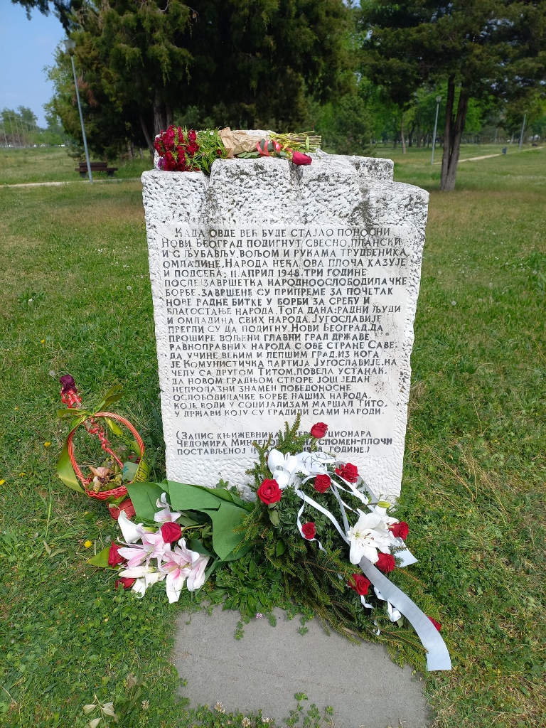 Memorial to the building of Novi Beograd
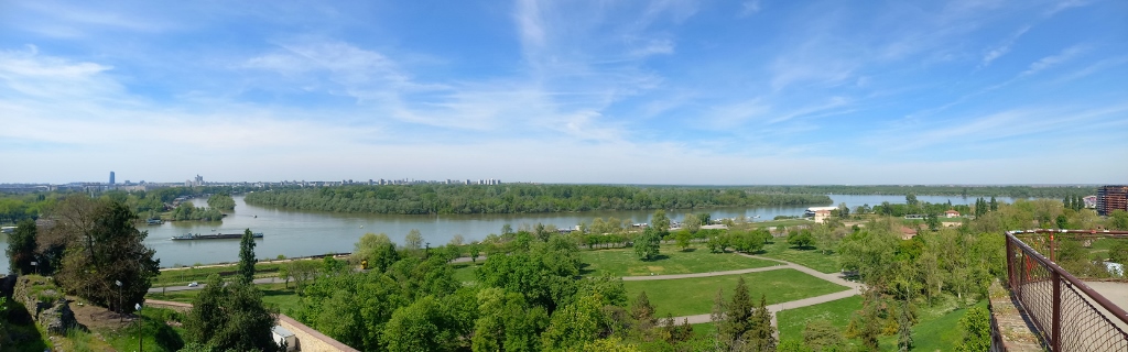
Today, Novi Beograd is located in an area bounded by two rivers – the Sava, which flows from the southwest, and the Danube, which flows from the northwest. These two rivers converge right beside Belgrade and above the confluence, on the side of “old” Belgrade, stands the Belgrade Fortress of Kalemegdan. From there, you can enjoy a magnificent view of the confluence, Novi Beograd and Zemun.
In the next photo, only a part of Novi Beograd is visible on the left side of the image and along the left horizon, on the other side of the river. Regarding the rivers, the Sava flows in from the left, while on the Danube, two islands can be seen – one small (more towards the left side of the photo) known as the Little War Island and the Great War Island (in the middle of the photo). Administratively, both of these islands belong to Zemun that is also discernible in the distance along the horizon line, more towards the centre of the photo.
 View from Kalemegdan at the confluence, Novi Beograd and Zemun
The next photograph shows more of Novi Beograd on the opposite side of the river.
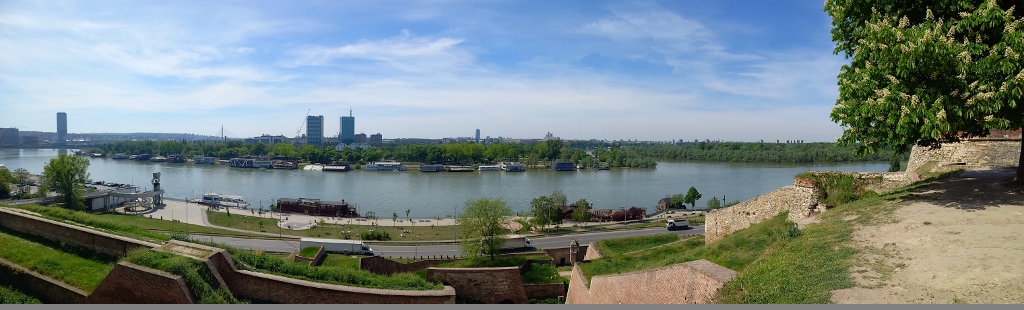 View from Kalemegdan at the confluence, Novi Beograd and Zemun
Since the plan after World War II was to create a new administrative and political centre for the country through the construction of Novi Beograd (hence the construction of the Palace of Serbia right in this part of the capital city, as mentioned in the previous sequel of my story), the government placed great emphasis on this project. Of course, the final solution was not reached immediately; it was a long-term project. A few years later, a new General Urban Plan of Belgrade was adopted and numerous competitions were organised in order to obtain professional solutions for the architectural and urban concept. Because of all this, the central zone of Novi Beograd, as a spatial, cultural and historic ensemble, is considered an immovable cultural heritage site.
The development concept for the new part of the city also included residential blocks bordered by main streets that represented almost small neighbourhoods. Even today, most residents of Novi Beograd refer to these blocks and their numbers for orientation, rather than street names. Thus, the first residential block was Block 21, which one encounters when crossing from “old” Belgrade into Novi Beograd via Branko’s Bridge.
 Block 21
Of course, I won’t start describing various residential blocks and listing their photos now. That’s not so interesting, but I just wanted to present a brief history of this part of the city.
However, not everything on the left bank of the Sava is new. In the 1930s, a road bridge was built over the Sava, connecting the centre of Belgrade and Zemun (at that time it was called the King Alexander Bridge, but it was demolished in 1941. Later it was rebuilt and continues to be used to date under the name of Branko’s Bridge). In this way, the left bank of the Sava became interesting to urban planners even before World War II.
Thus, in 1937, near this bridge, the first Belgrade Fair was established, covering an exhibition area of 14,000 square metres. The fair had a short life, lasting only until 1941 when, after the occupation of Yugoslavia by the Germans, all of its exhibition pavilions were converted into a concentration camp in December of that year. Initially, the camp was primarily used for the deportation of Jews and Roma, but later expanded to include ordinary people captured in other parts of Yugoslavia (after major offensives, such as at the Sutjeska and Kozara ones), partisans not only from Yugoslavia but also from Greece and Albania, as well as Italian soldiers after Italy’s capitulation in 1943 and captured Allied airmen.
Once beautiful exhibition space, this became the largest place of torture in Belgrade. By the end of 1941 and the beginning of 1942, around 11,000 Jews from Belgrade and other parts of Serbia were killed here. Over time, mass executions and burials were transferred to Jajinci (see: https://www.svudapodji.com/en/belgrade-21/) and other locations in the wider area of Belgrade (see: https://www.svudapodji.com/en/belgrade-west-2023/), but this camp continued to function by torturing and killing people here or sending them from here to do forced labour elsewhere. It is estimated that around 90,000 prisoners passed through it, about 40,000 of whom were killed, mostly in Jajinci. In May 1944, the Germans handed over the camp to the authorities of the Independent State of Croatia (a Croatian puppet state that collaborated with Nazi Germany and Fascist Italy). Later that year, the camp was closed because it was heavily damaged in the Allied bombings of Belgrade in 1944.
After World War II, this entire area went through various phases, from demolishing heavily damaged parts to using the remaining ones for temporary accommodation of some institutions or as housing for socially vulnerable individuals, while some parts were given for use to the Association of Fine Artists of Serbia. As time passed, different ideas emerged about what to do with the space of Staro sajmište (the Old Fairgrounds), as the complex is now called, because on one hand, it is a place of suffering for Serbs, Jews and Roma during World War II, and on the other hand, it was once an exceptionally well-designed urban space in the city of Belgrade. Moreover, because of all this, Staro sajmište has been declared a cultural monument in the meantime.
And yet, for years, if not decades, that part of the city has functioned as a rather shabby place, at least it looks that way when a visitor approaches it. Except for the brilliantly white and clean laundry that residents from these buildings hang outdoors.
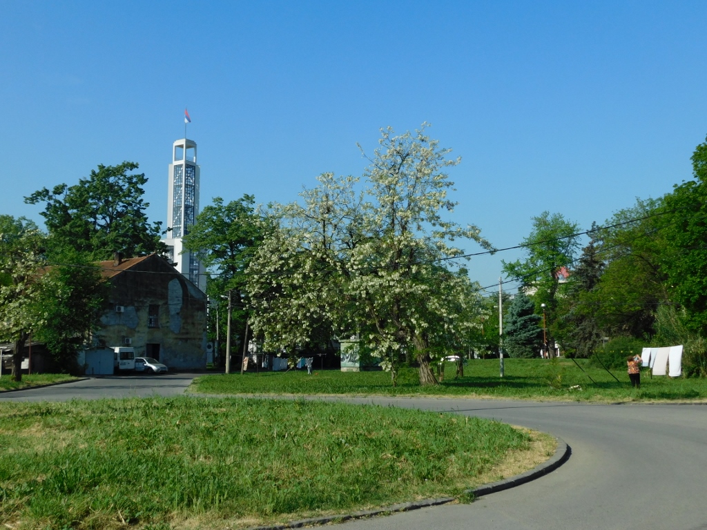 Staro sajmište
However, from what I’ve read, recently a decision was made to open a Holocaust Museum here and as I approached the Central Tower in Staro sajmište, I could see that the renovation announced a few years ago had indeed begun.
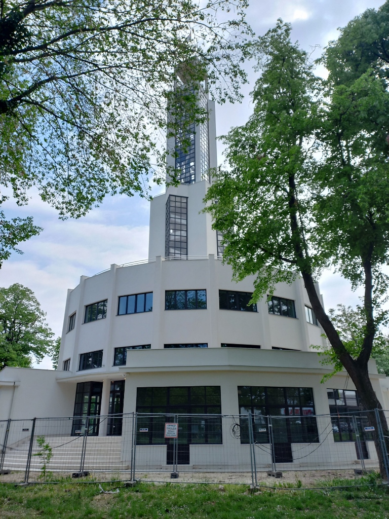 Staro sajmište, Central Tower
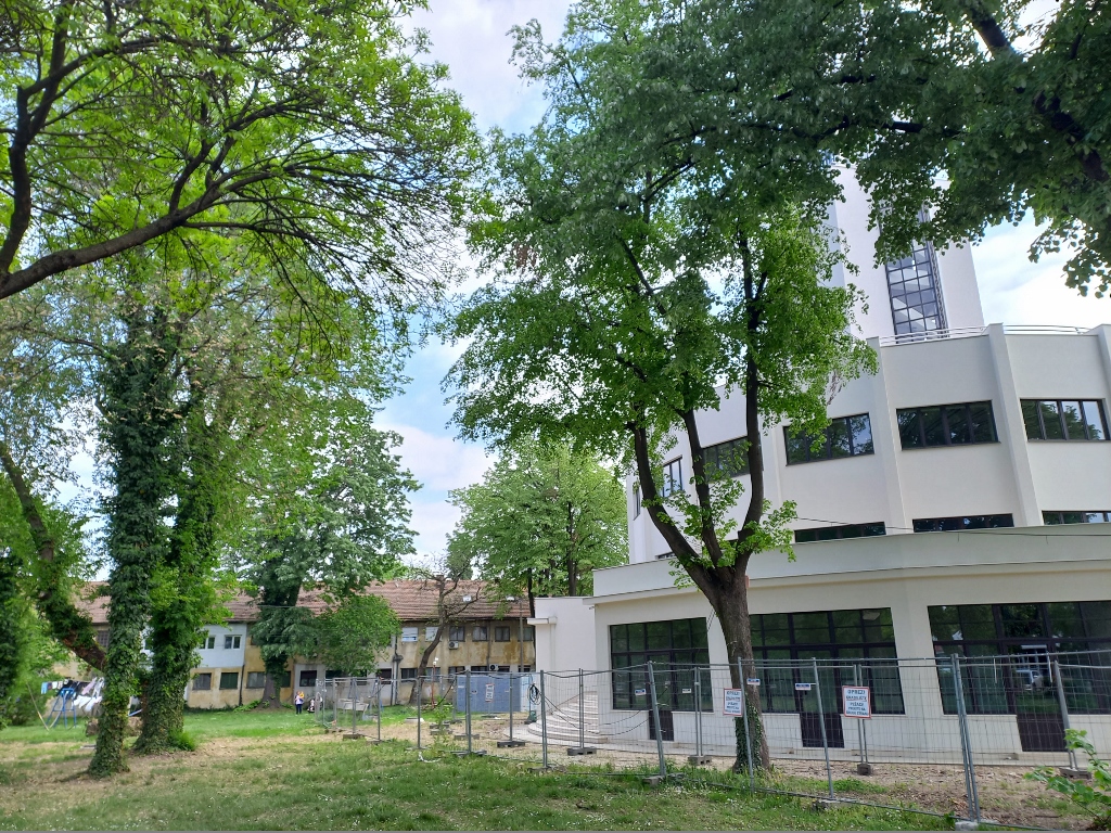
But there is still a lot to be done before this part of Novi Beograd regains some of its former architectural splendour, alongside its new purpose.
 Staro sajmište, a detail
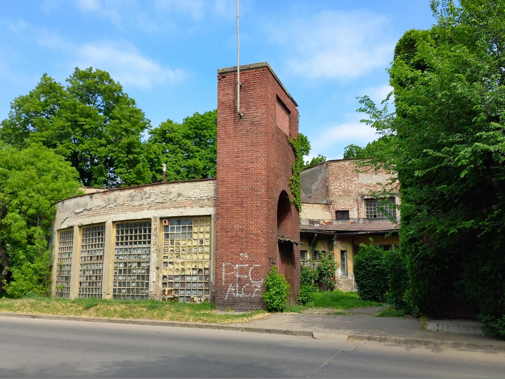 Staro sajmište, a detail
In the immediate vicinity of the Staro sajmište, next to the promenade that runs along the Sava River, there is also the Monument to the Victims of the Sajmište Concentration Camp.
 Monument to the Victims of the Sajmište Concentration Camp
As I’m mentioning WWII and this monument, let me also say that it is located between two bridges over the Sava River – one is the previously mentioned Branko’s Bridge and the other one is Savski most (the Sava Bridge). Although strictly speaking, these bridges are not exclusively associated with Novi Beograd, there is an interesting story about the second one.
Namely, as the King Alexander Bridge (the former name for Branko’s Bridge) was destroyed in 1941, there was a need for a bridge over the Sava that would connect not only parts of Belgrade but primarily central Serbia in the south and the region of Syrmia in the north. Thus, the bridge now called Savski most was built in 1942, during the German occupation. However, in October 1944, as the Germans had to leave Belgrade, they mined the bridge intending to blow it up in order to secure more time for their retreat and simultaneously slow down the advance of Yugoslav Partisans and Red Army units.
This is where Miladin Zarić (1889-1976), a teacher, that is, a civilian or an ordinary citizen, comes into play. By coincidence, Zarić had participated in the Balkan Wars and World War I, where he learned about demining. An even greater stroke of luck was that he lived in a part of Belgrade near the Sava River, so he saw that the Germans had mined the bridge intending to blow it up when they retreated to the left bank of the river. This retreat of the Germans happened in the early morning of 20 October, 1944, just as the Red Army troops reached the right bank. Zarić encountered a group of Soviet soldiers and he went with them to the bridge. As he was the only one who knew exactly where the detonator and wires were located, he personally went there and cut the detonator wire with a shovel, thus saving the bridge. Belgrade was officially liberated later that day, on 20 October, 1944.
According to what I have read, the Sava Bridge is the only major bridge in Europe that avoided destruction after the German retreat and Zarić received several decorations after the war for his heroic act.
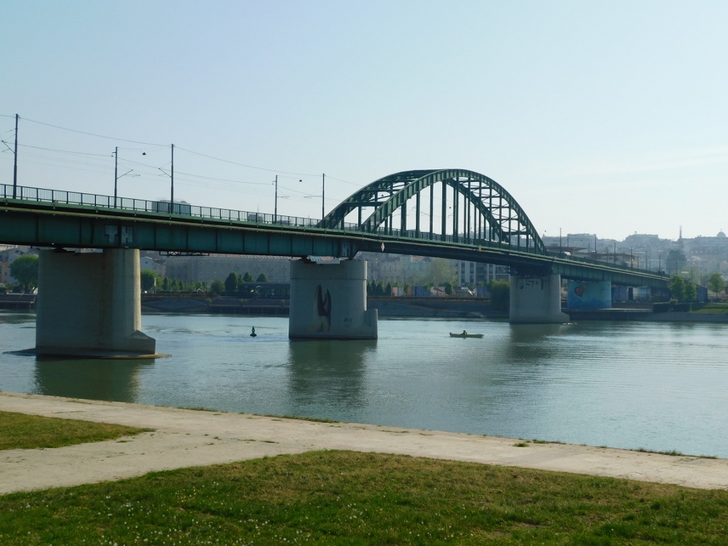 Savski most
In recent times, occasional stories and ideas have emerged about doing something with this bridge since Belgrade needs more bridges due to its chronic traffic problems. The bridge is old, trams and vehicles pass over it and it has limited traffic capacity, but due to its significance, it’s not appropriate just to demolish it outright. There are also ideas to relocate the bridge to another location, but so far, I haven’t heard of any particularly smart proposals.
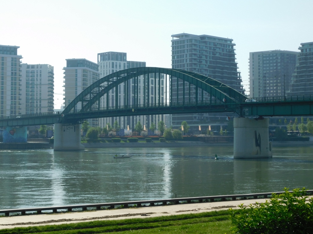 Savski most
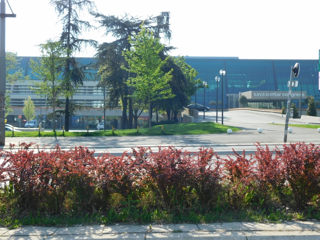
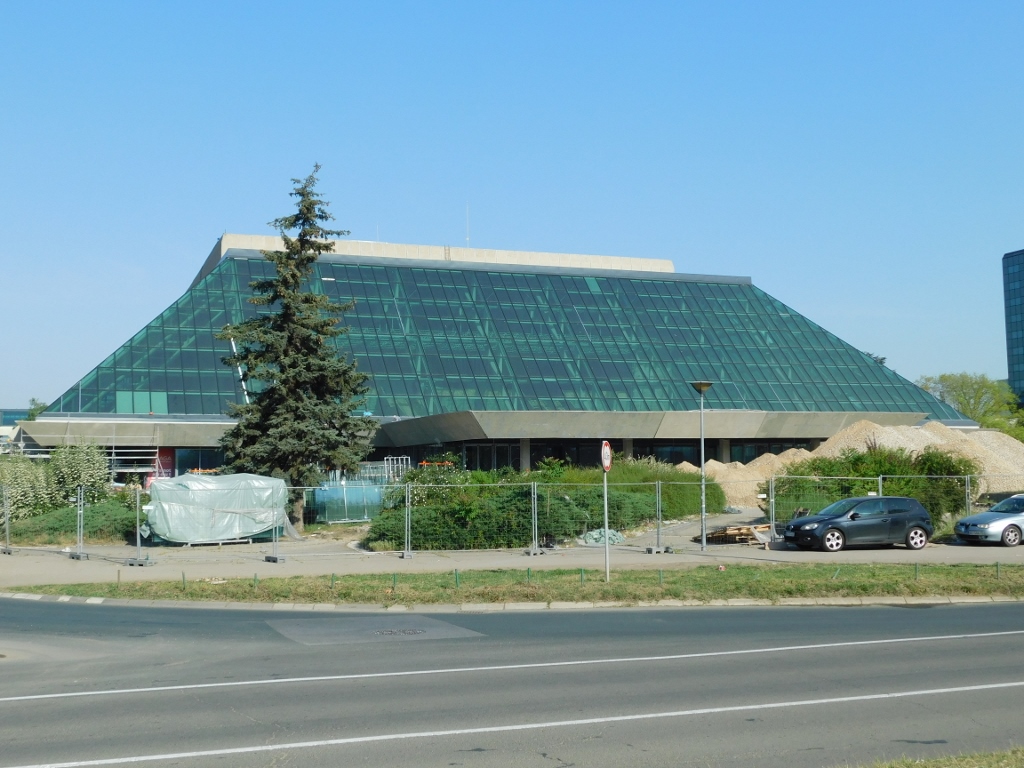
About 1.5 km farther, but also near the Sava River, on the Novi Beograd side, there is another cultural monument. It is the “Sava Centre.”
This is actually a complex of buildings constructed between 1976 and 1978, serving as an exceptionally large congress, cultural and business centre intended for various activities. The Sava Centre includes a congress-concert hall, a large office building with a number of smaller conference rooms and meeting spaces, a restaurant, shops and office space, along with a hotel that was previously part of the “InterContinental” chain (this has changed in the meantime).
The Sava Centre was constructed using a combination of reinforced concrete and steel frames, but it is particularly characterised by the use of green glass as a facade material, which is something that made it particularly distinctive back in the day. It was designed in the style of contemporary architecture from the 1970s and it is located right next to the international motorway E-75.
Over time, the complex has deteriorated significantly, prompting renovation efforts in recent years. As of the time of writing this (April 2024), the reconstruction of the congress-business section has been completed, while the part with the congress-concert hall will be finished by the middle of the year.
 Sava Centre, congress-business section
 Sava Centre, part with the congress-concert hall, the works are still in progress
As you continue to follow the E-75 motorway towards the airport, you inevitably notice and pass by another cultural monument that has earned this status due to its significance for Serbian architecture. This is the residential and business centre “Genex” that is probably the first prominent structure the people entering the city from the direction of Belgrade Airport see.
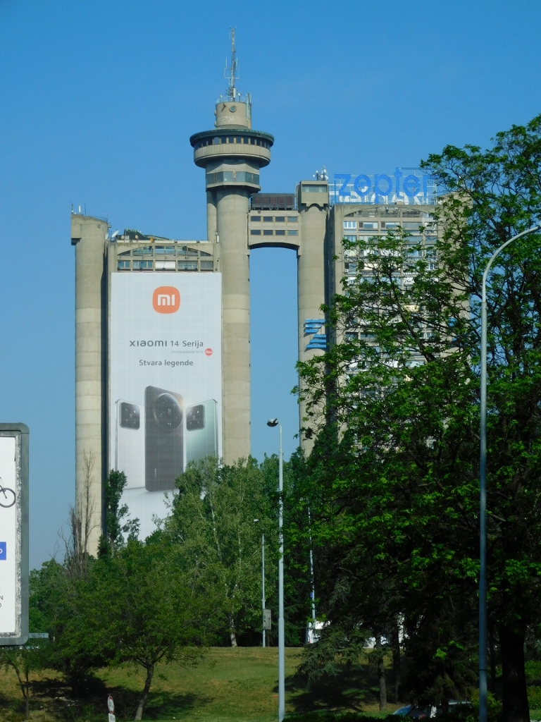 Residential and business centre “Genex”
This centre is also called the Genex Tower or the Western City Gate of Belgrade. It was built between 1970 and 1980 when it was the tallest building in the Balkans. It consists of two reinforced concrete skyscrapers (with 26 and 30 floors, respectively) connected by a bridge at the level of the 26th floor. Both towers have laterally positioned circular staircases, two each, going through concrete cylinders. The towers were intended for two separate functions – one for residential and the other for commercial purposes, housing offices and business spaces for Genex. Genex was once one of the largest and most successful companies in the former Yugoslavia and the name is a shortened version of Generaleksport, indicating the company’s core activities. The company certainly had a need for representation activities, so a rotunda was built at the top of one staircase in the commercial part of the centre, housing a restaurant with a panoramic view. What was particularly interesting about this restaurant was the revolving floor that slowly rotated, enhancing the scenic view. At least, that’s what was said, as I’ve never been to the restaurant myself and I have no idea how it actually worked.
Genex ceased to function a long time ago and I’m not sure what is happening with the commercial part of this centre, but it’s clear that it’s not fully operational since a significant portion of it is covered by advertising panels. In the other part, people still live as usual.
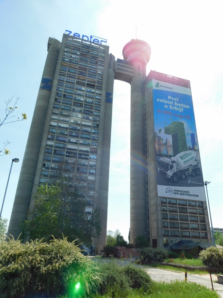 Residential and business centre “Genex”
Although residential buildings still dominate this part of Novi Beograd, just 1 km away is Airport City Belgrade, the first business park in Serbia. Until a few years ago, I used to go there relatively often to meet for coffee a friend who worked for a company with offices there and I always wondered why this business park was given that particular name. Finally, while delving into cultural landmarks in Novi Beograd, I came across the answer.
Namely, from 1926 to 1932, the first airport complex in Belgrade was built here, known as Dojno Polje Airport, named after the area between Bežanija and Zemun. It served both military and civilian purposes. The complex included several military barracks, six large concrete hangars, several prefabricated metal hangars, two grass runways, an air traffic control building, numerous aircraft maintenance facilities and a military aviation warehouse. Of all this, only a concrete hangar structure with annexes housing workshops has survived to this day. This building was constructed in 1929.
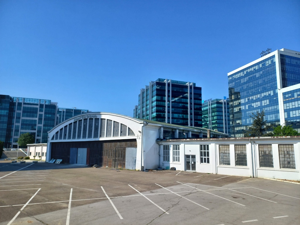 Old airport hangar in the middle of a business park
It is interesting that the airport complex was designed and supervised by Milutin Milanković (1879-1958), the famous Serbian mathematician, astronomer, engineer, scientist and academic. He is known for two major contributions to science: “Canon of the Earth’s Insolation” and the theoretical explanation of the long-term climate changes on Earth. In the case of this surviving hangar, Milanković applied an innovative approach to the construction of the roof structure, making it a rare example of its kind preserved in the world today.
And now with my story I’m going back to the expansive park that stretches along the Danube River, next to which there is the Palace of Serbia, as I’ve mentioned in the previous part. The park partially belongs to Zemun and partially to Novi Beograd. In the Novi Beograd part, there is also a building that was significant during the establishment and construction of Novi Beograd, clearly reflecting the era when it was built in 1961. At the time, it was the Central Committee Building of the League of Communists of Yugoslavia, abbreviated as CK (Centralni komitet). However, the building was seriously damaged during the NATO bombing in 1999, on two separate occasions at the end of April. There were no reported casualties as the building was empty at the time, so I assume the reason for targeting it was more of a marketing nature. Interestingly, the building was hit by as many as 12 Tomahawk cruise missiles, but the structure held, so the building was later sold and reconstructed with the addition of a few floors, making it 110 meters high today. Recently, another similar building was constructed next to it and now they are used as business spaces under the name of “Ušće Business Centre” (ušće means confluence in Serbian).
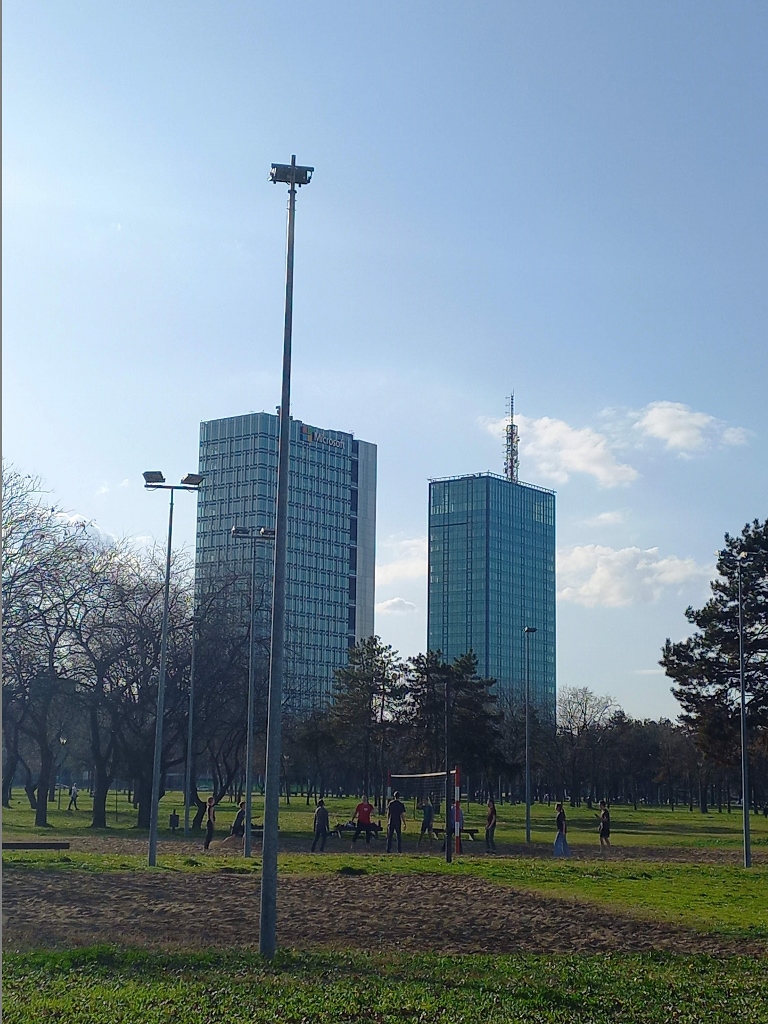 Ušće Business Centre (the former CK building is on the right-hand side)
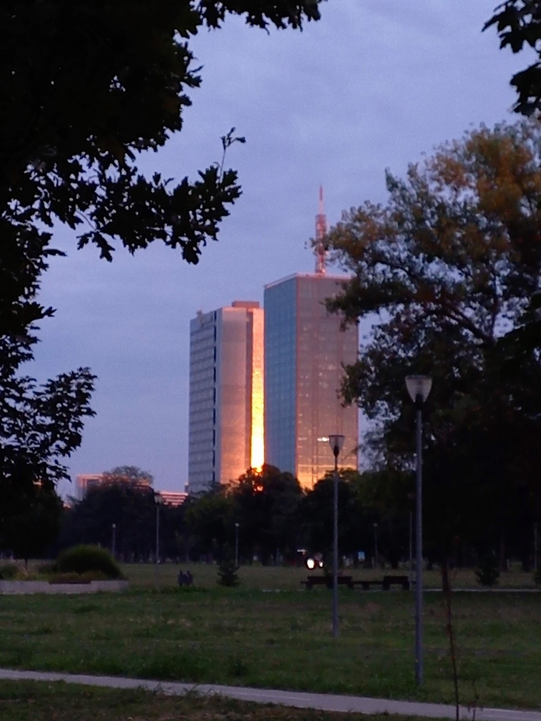 Ušće Business Centre at sunset
When mentioning the NATO bombing of the FRY (Serbia and Montenegro) in 1999, it is inevitable to reflect on the Chinese Embassy building located in Novi Beograd, not far from this large park by the Danube. Contrary to all rules of war and in violation of international law, NATO directly hit this building late in the evening on 7 May, 1999, resulting in the deaths of three Chinese journalists. China was outraged and the Americans apologised, claiming it was a mistake and that they actually intended to target a building about 450 metres away. Interestingly, that second building was not hit later and besides, anyone familiar with the history of Novi Beograd knows that nothing else ever existed at the location of the Chinese Embassy, so no map could show anything else there except the Chinese Embassy.
Be as it may, a memorial plaque was later installed there. I pass by there relatively regularly and for years I kept seeing flowers, as well as Chinese tourists who evidently don’t forget what happened and regularly come to visit the memorial. In the recent times, the Chinese Cultural Centre has been built at that location and two memorial plaques have been installed. Flowers and wreaths are still regularly placed there.
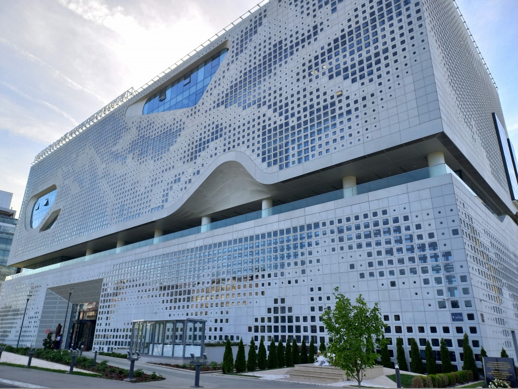 Chinese Cultural Centre in Novi Beograd (the memorial plaques are down on the right-hand side)
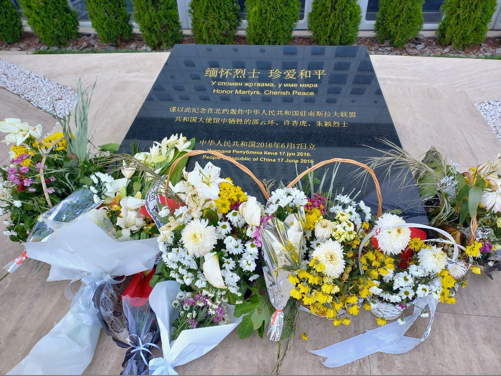 Memorial plaque in front of the Chinese Cultural Centre in Novi Beograd
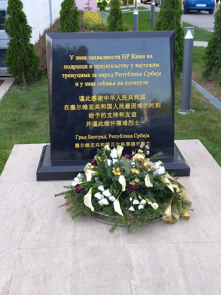 Memorial plaque in front of the Chinese Cultural Centre in Novi Beograd (it reads: “As a token of gratitude to the PR of China for support and friendship in the most difficult moments for the people of the Republic of Serbia and as a memory of those that perished,” City of Belgrade, Republic of Serbia)
Within the park, there is another monument that commemorates the events of 1999. It is the “Eternal Flame” monument, erected in 2000 in the memory of the victims of the NATO bombing of the Federal Republic of Yugoslavia (FRY). Over 78 days, 19 NATO member countries bombed the country that consisted of present-day Serbia and Montenegro. Setting aside the absence of a UN resolution approving NATO’s attack on the FRY, considering that the FRY did not attack any NATO member state, the “defensive” nature of this military alliance was permanently and clearly brought into question by the aggressive actions of the alliance itself.
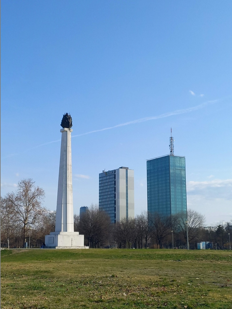 “Eternal Flame” monument and the Ušće Business Centre
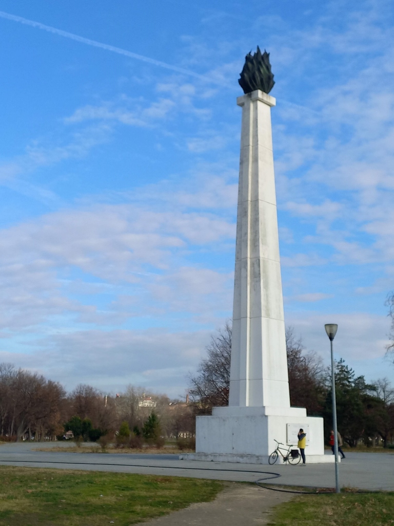 “Eternal Flame” monument
From the plaza in front of the monument begins a very interesting part of the park called the Friendship Park, which as a landmark represents an immovable cultural property.
 Friendship Park in Novi Beograd
Namely, in 1961, when the Palace of Serbia was completed and Belgrade hosted the First Summit of the Non-Aligned Movement, the idea emerged to create a memorial space in the form of a memorial park where foreign officials would plant a tree each as a “symbol of the struggle for peace and equality of all peoples in the world.”
 Friendship Park
The first trees were planted here by Tito on 7 September, 1961 and over time, various statesmen from around the world came here. Besides the planted trees, stone plaques with the names and countries of these statesmen, along with the year of their visit, have remained from that period. Of course, a large number of statesmen came from non-aligned countries.
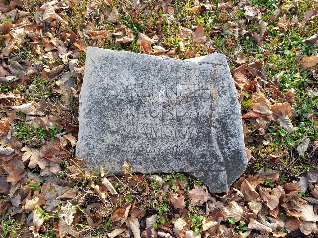 Friendship Park: Kenneth Kaunda (1924-2021), first President of Zambia
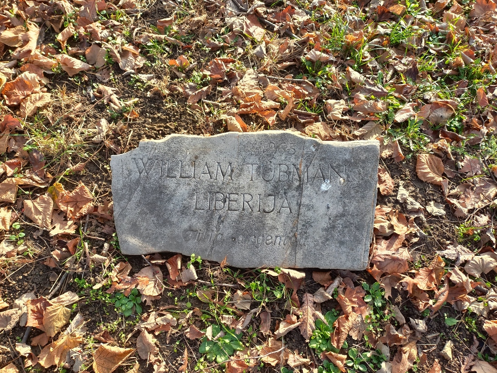 Friendship Park: William Tubman (1895-1971), President of Liberia
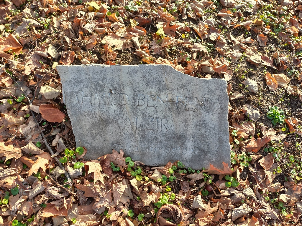 Friendship Park: Ahmed Ben Bella (1916-2012), first President of Algeria
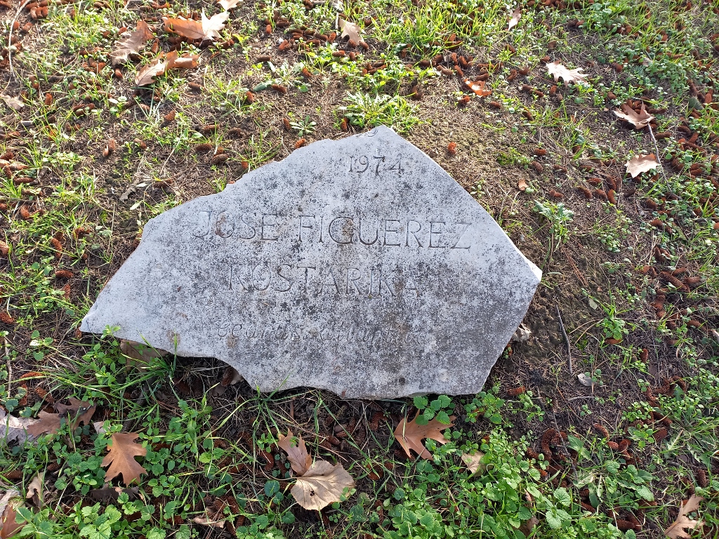 Friendship Park: José Figueres (1906-1990), President of Costa Rica
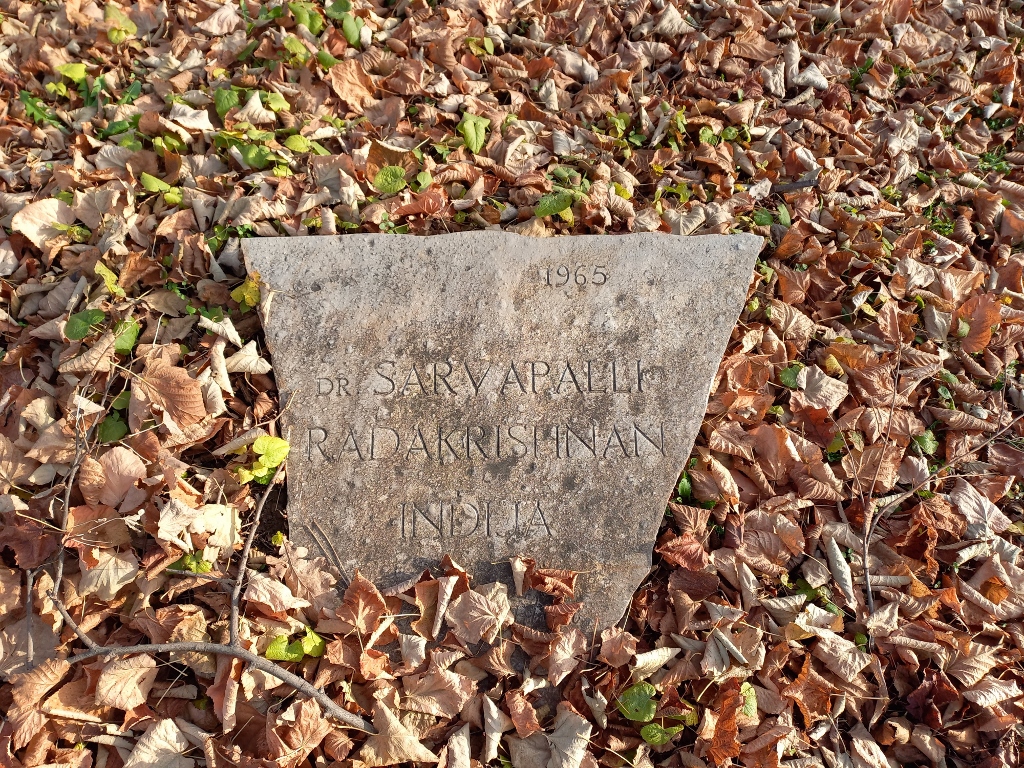 Friendship Park: Sarvepalli Radhakrishnan (1888-1975), President of India
Some of these plaques represent an extraordinary reminder of the 20th century history.
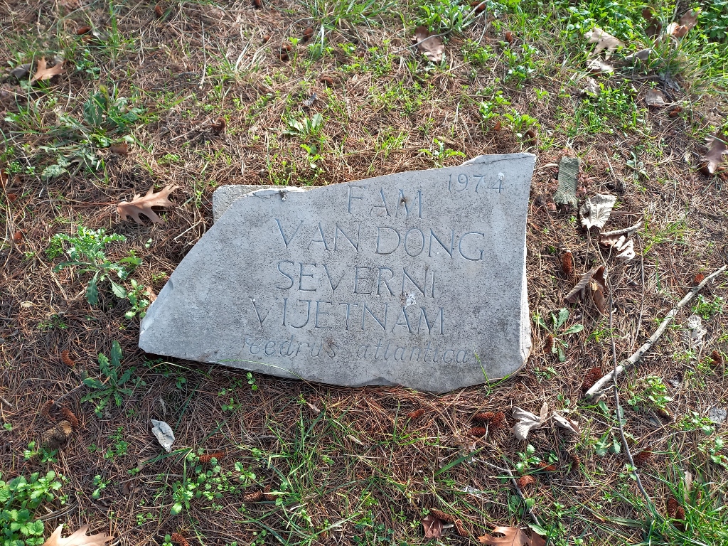 Friendship Park: Pham Van Dong (1906-2000), Prime Minister of North Vietnam
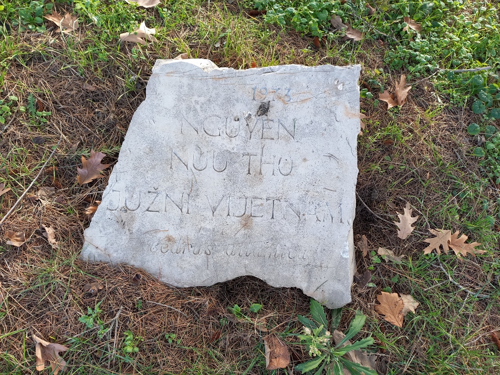 Friendship Park: Nguyen Huu Tho (1910-1996), Chairman of Consultative Council of the National Liberation Front of South Vietnam
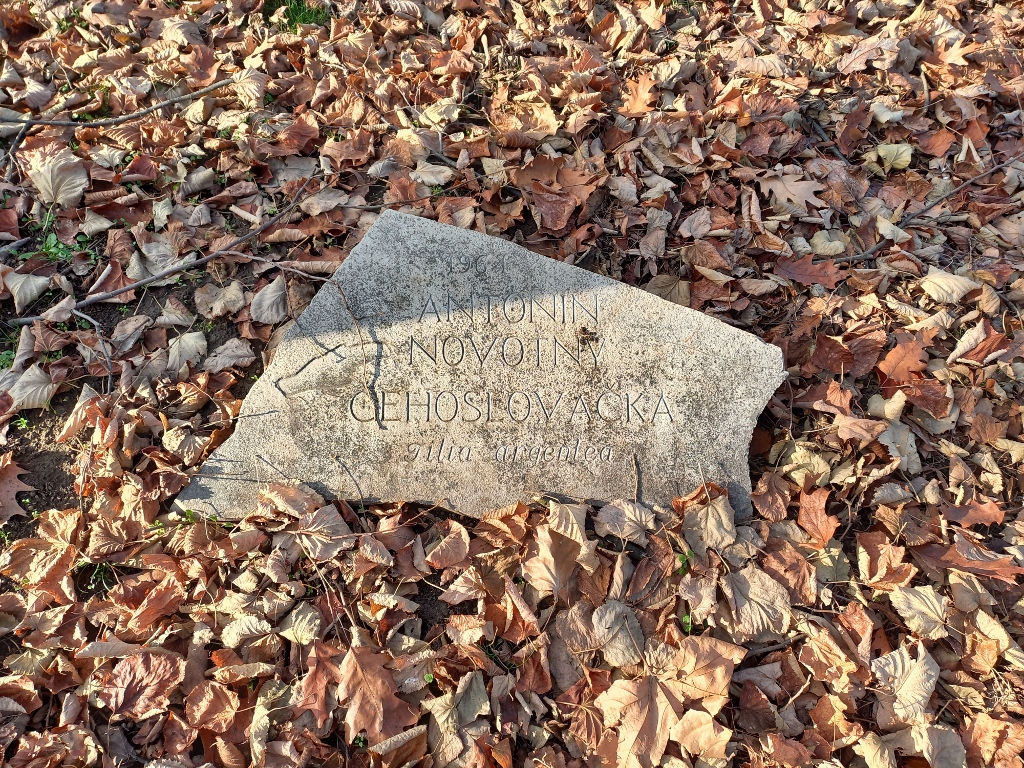 Friendship Park: Antonín Novotný (1904-1975), President of Czechoslovakia
There are also plaques that serve as a memory of some statesmen from Eastern Europe, as well as cosmonauts.
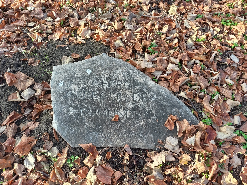 Friendship Park: Gheorghe Gheorghiu-Dej (1901-1965), President of Romania
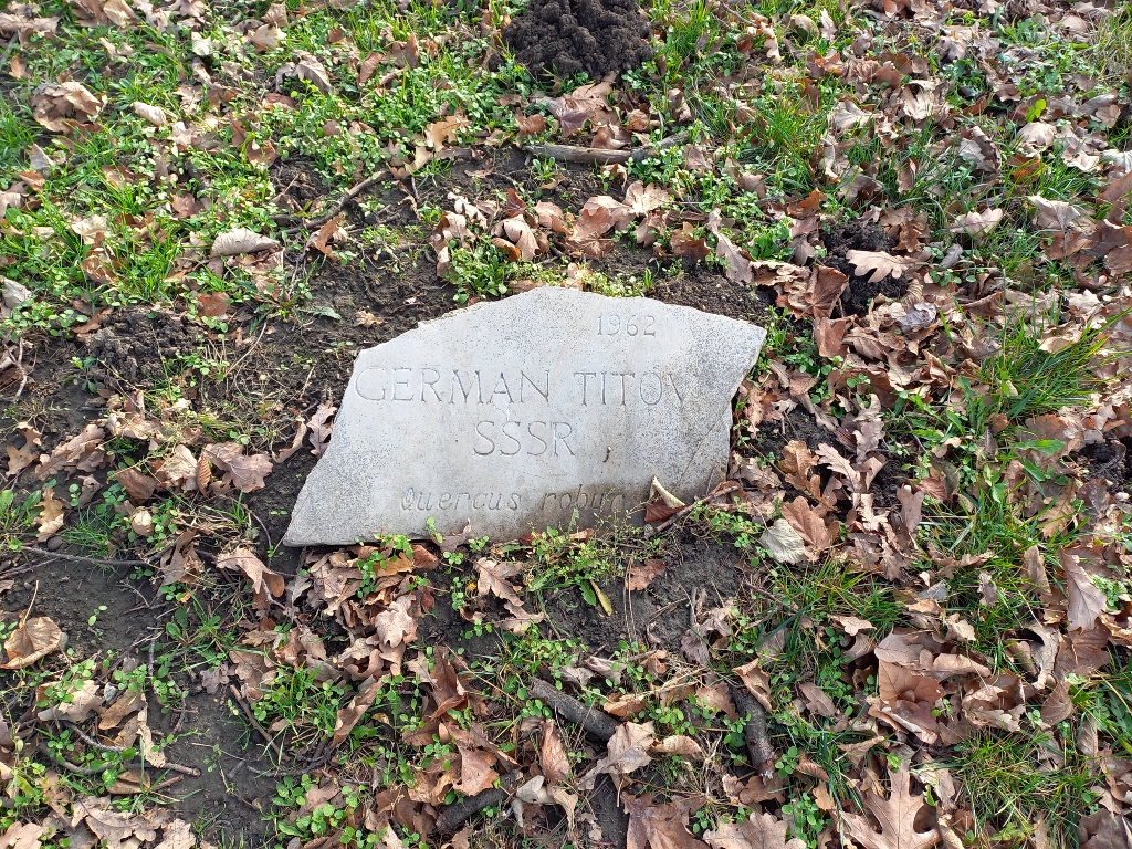 Friendship Park: Gherman Titov (1935-2000), Soviet cosmonaut
The park was also visited by representatives of international organisations, as well as statesmen from Western Europe.
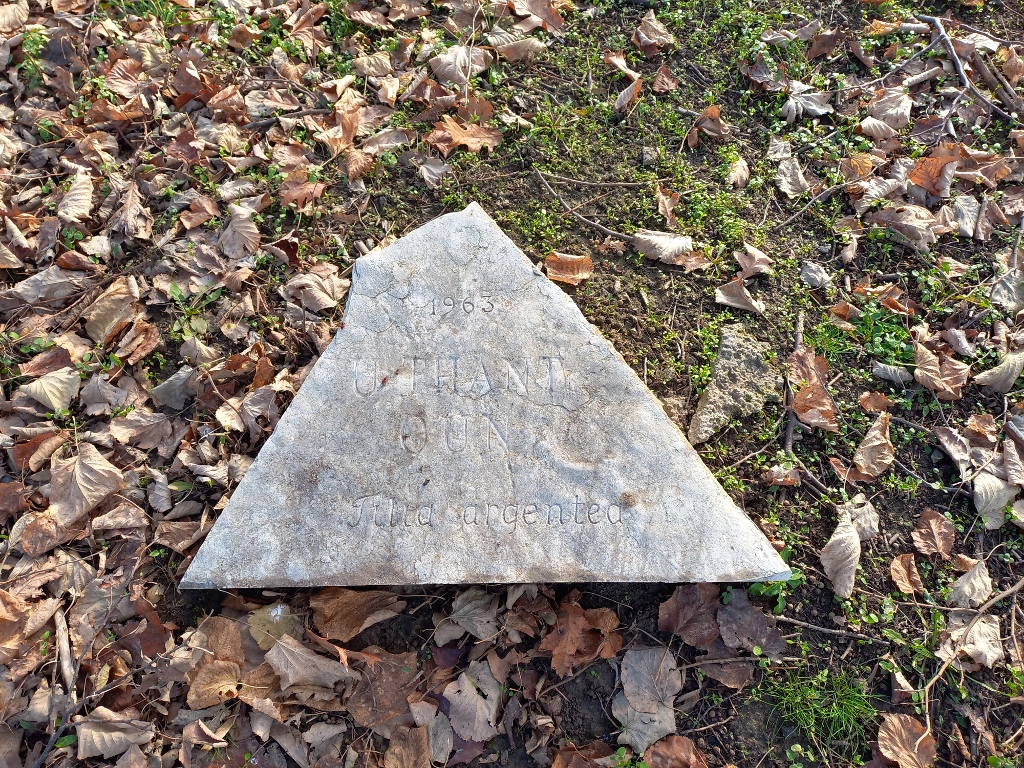 Friendship Park: U Thant (1909-1974), Secretary General of the UN
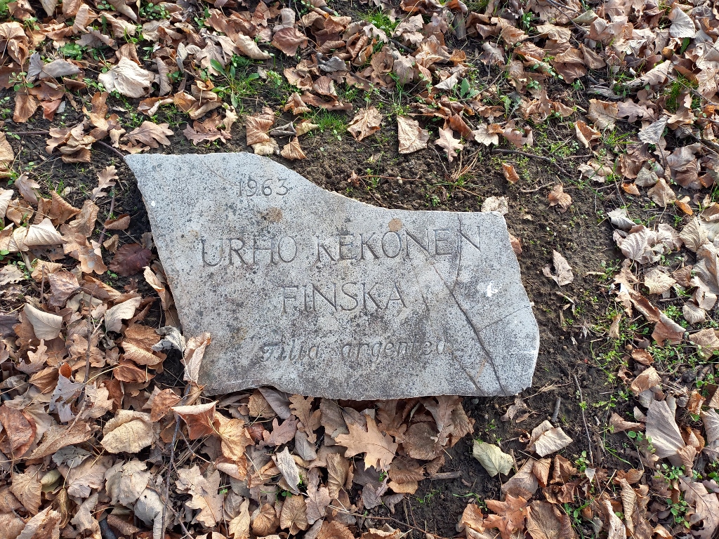 Friendship Park: Urho Kekkonen (1900-1986), President of Finland
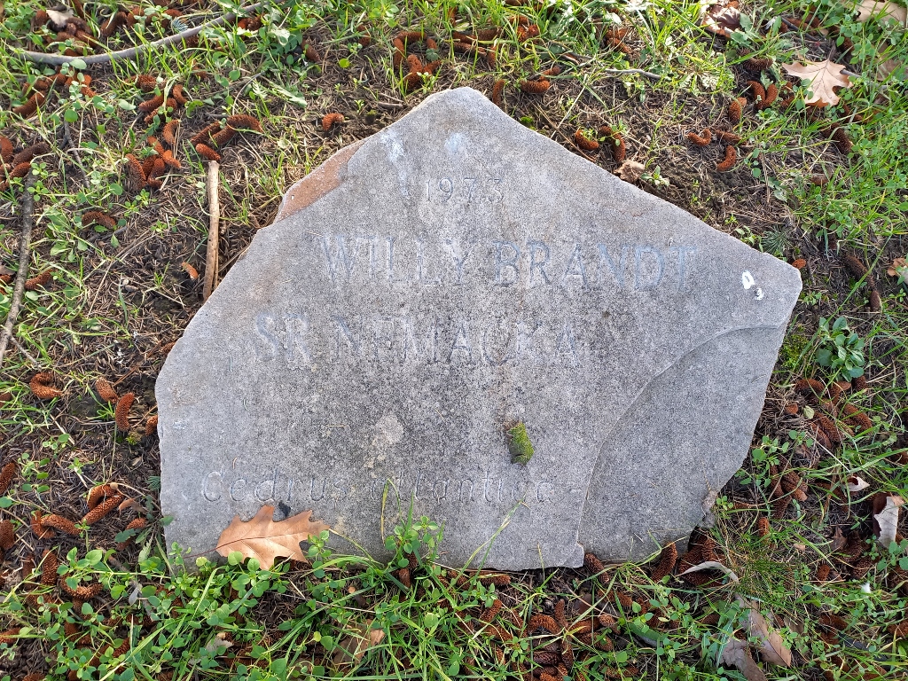 Friendship Park: Willy Brandt (1913-1992), Chancellor of FR Germany
Besides politicians and political leaders, monarchs have also visited and left their mark.
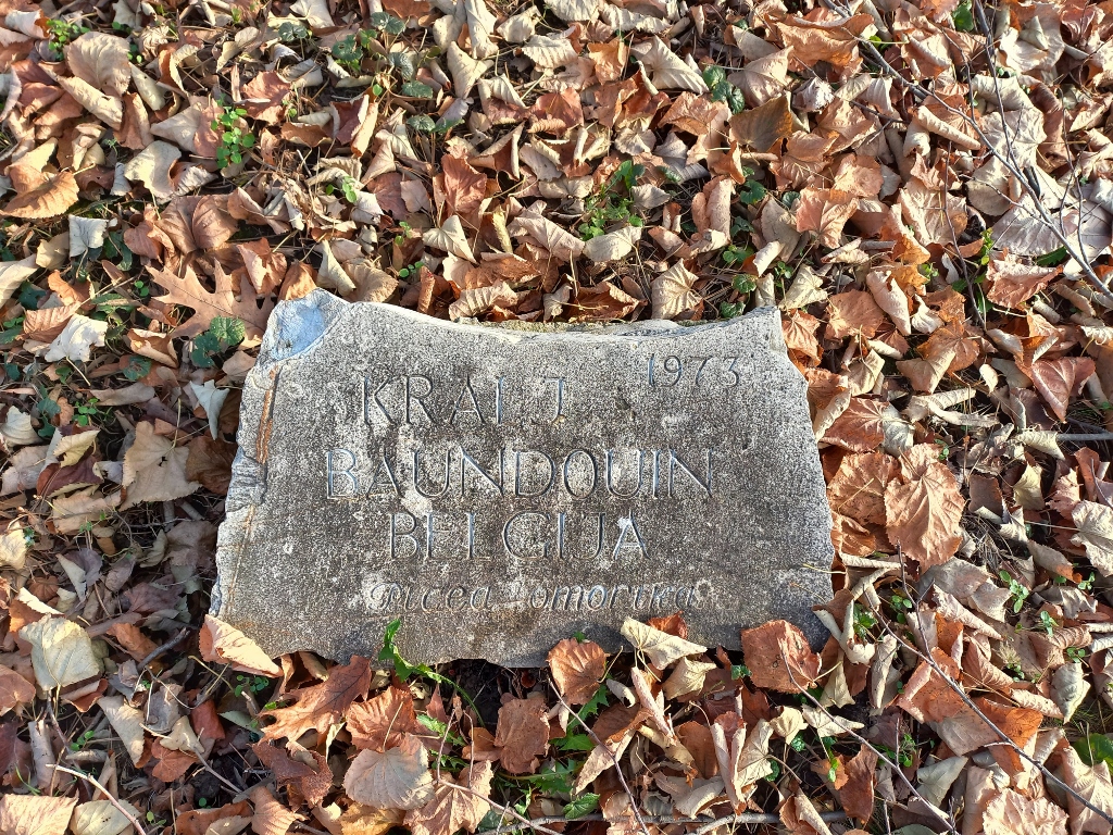 Friendship Park: Baudouin (1930-1993), King of Belgium
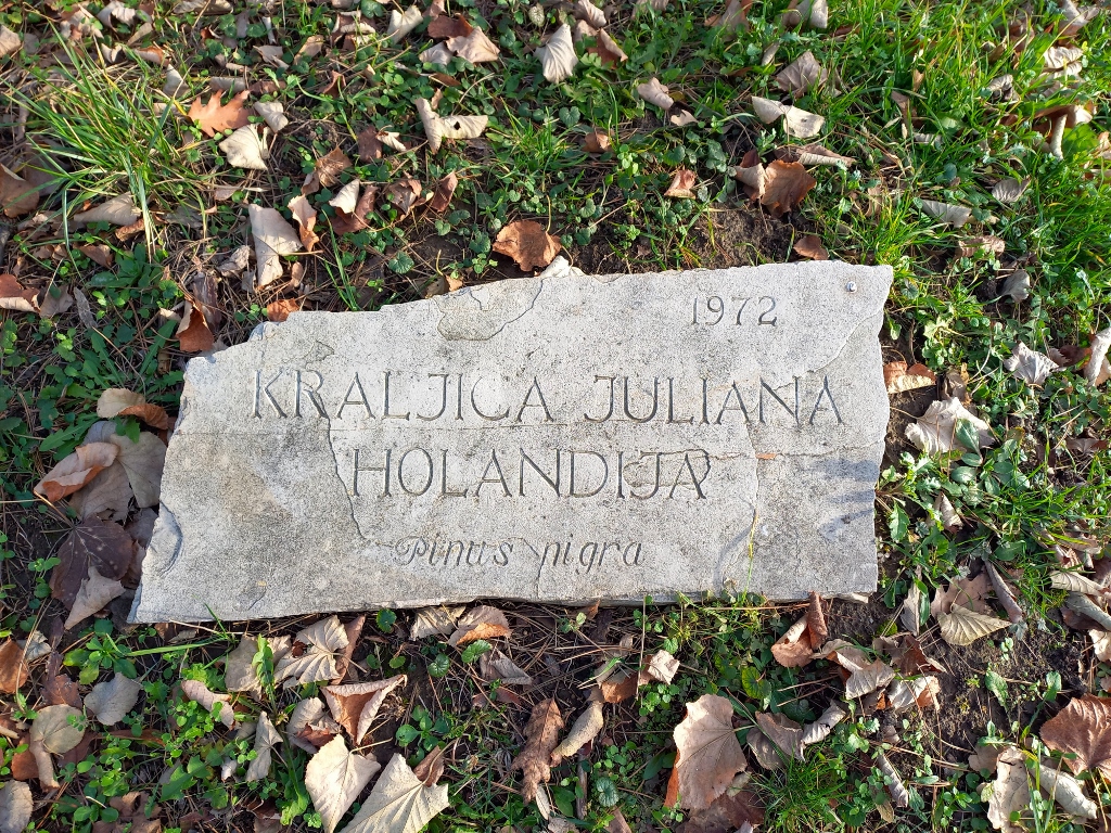 Friendship Park: Juliana (1909-2004), Queen of the Netherlands
Yugoslavia and Tito were also visited by Queen Elizabeth II of the United Kingdom, but in in this context I find this amusing for another reason. Namely, near her stone plaque, there are two more plaques that together make for a very interesting trio. It’s hard to imagine these three individuals being “placed” so close to each other anywhere else.
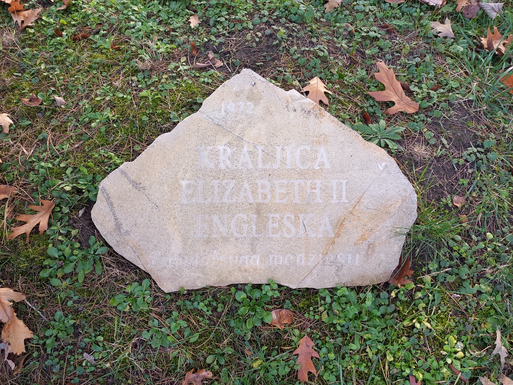 Friendship Park: Elizabeth II (1926-2022), Queen of the United Kingdom
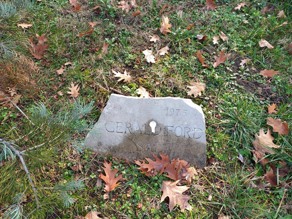 Friendship Park: Gerald Ford (1913-2006), President of the USA
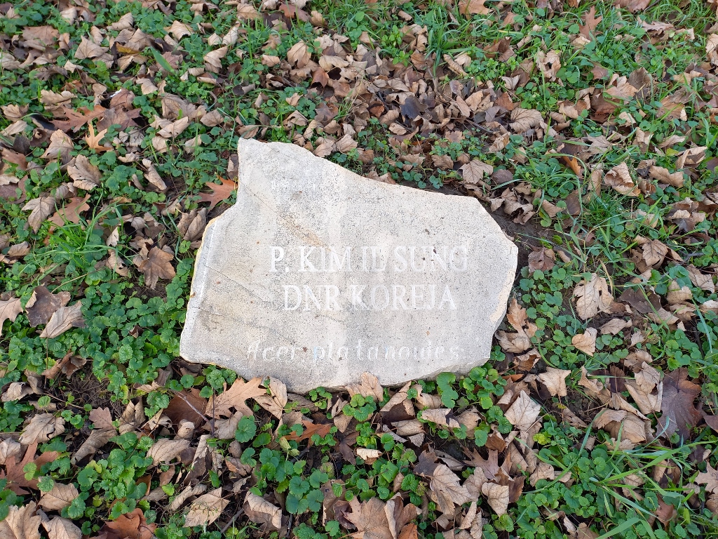 Friendship Park: Kim Il Sung (1912-1984), President of the DPR of Korea
The last major planting in the Friendship Park was carried out in 1989, but trees are also planted in other parts of the park along the Danube. For example, directly across from the Palace of Serbia, nearly 100 plane trees were recently planted in order to symbolise the 100th anniversary of the birth of Heydar Aliyev (1923-2003) and the Azerbaijani-Serbian friendship.
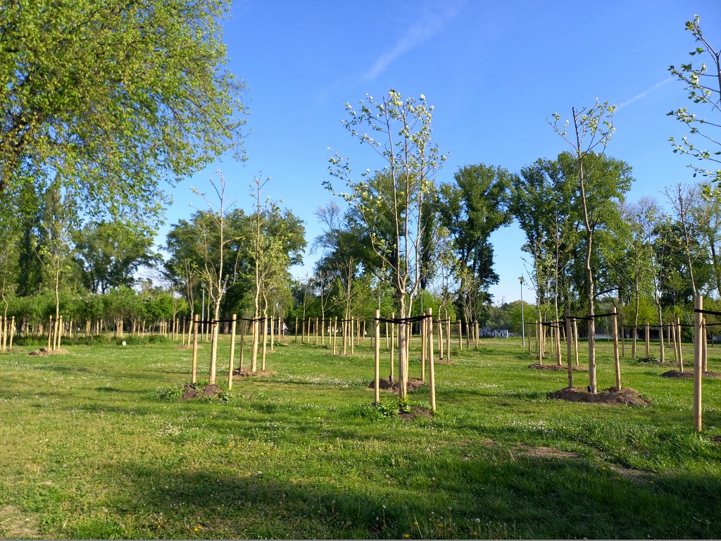 New trees in the park along the Danube
Not far from the Friendship Park, there is another cultural monument, the Museum of Contemporary Art.
 Friendship Park
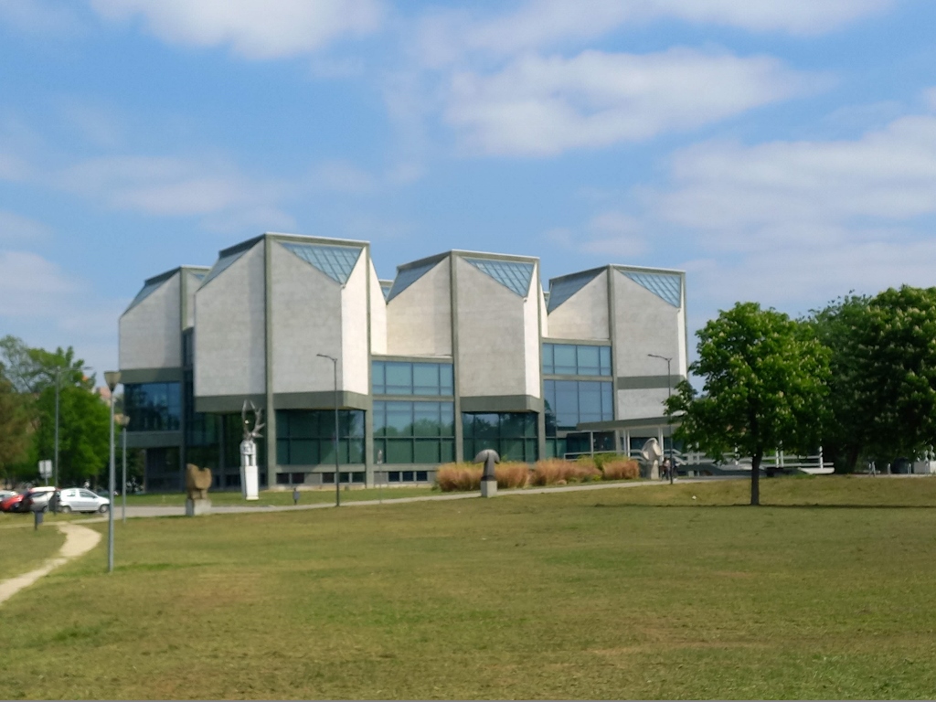 Museum of Contemporary Art
The museum was built between 1962 and 1965. Its permanent exhibition displays works of Yugoslav and foreign artists from the 20th century, while occasional temporary exhibitions and other events are also organised. Some works can be seen exhibited around the building itself that not only thematically, but also visually, reflects the contemporary trends of the second half of the 20th century, both externally and internally.
The museum is located in the part of a large green area called the Ušće Park that stretches along the Sava River to its confluence. In the recent years, this area has developed quite nicely, featuring a promenade along the river, various paths and facilities for leisure and recreation.
 Ušće Park and the Museum of Contemporary Art
 Ušće Park, a detail
 Ušće Park, a detail
 Ušće Park, a detail
 Ušće Park, a detail
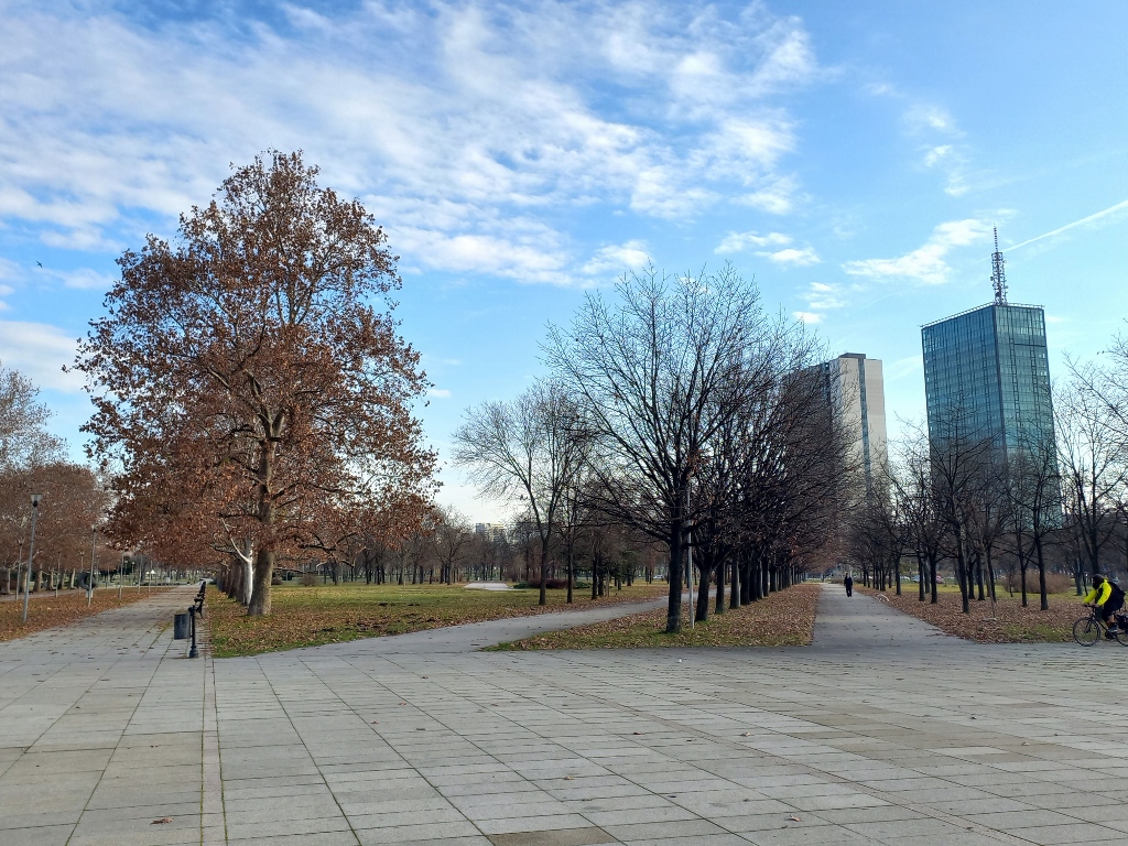
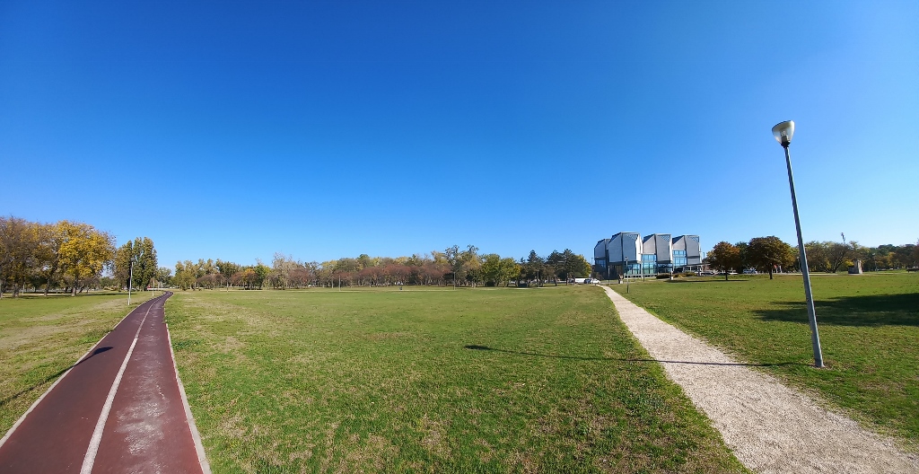
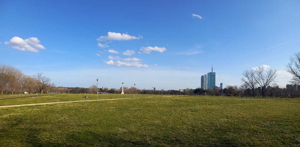
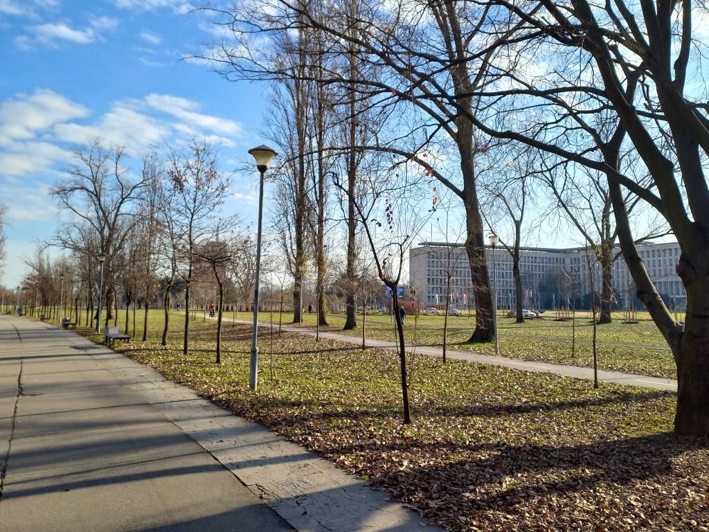
When you start from the Ušće Park and head along the Danube towards Zemun, that promenade is officially called Zemunski kej (Zemun Quay), although a large part of it is in the territory of Novi Beograd. It is often referred to as Dunavski kej (The Danube Quay), but only in the context of Novi Beograd (since the official Dunavski kej exists in the old part of Belgrade), to distinguish it from Savski kej (The Sava Quay), which is the name for the promenade along the Sava River near blocks 45, 44, 70, and 70a. Whatever it’s called, this is one of my favourite places in Belgrade and living nearby makes it even better, especially with the flat terrain that makes cycling easier.
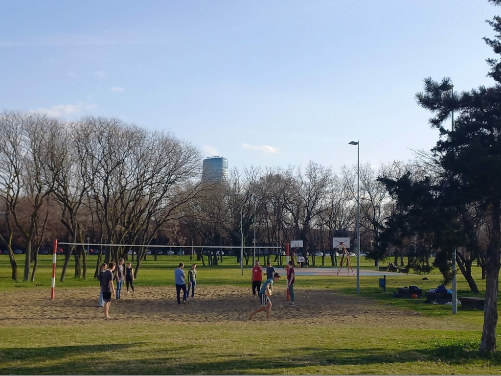
Within the park that stretches along Zemunski kej, there is a wide area where concerts and festivals are held in the summer. I enjoy going out, but this often gets too noisy and lasts too late into the night. Foreign musicians (like the Rolling Stones, Madonna, Billy Idol, Metallica, ...), like well-behaved children, typically finish their concerts before midnight. On the other hand, local musicians, during solo concerts or festivals, like a rowdy and wild horde, are allowed to howl until 4 in the morning!
 Park beside Zemunski kej and the area for concerts
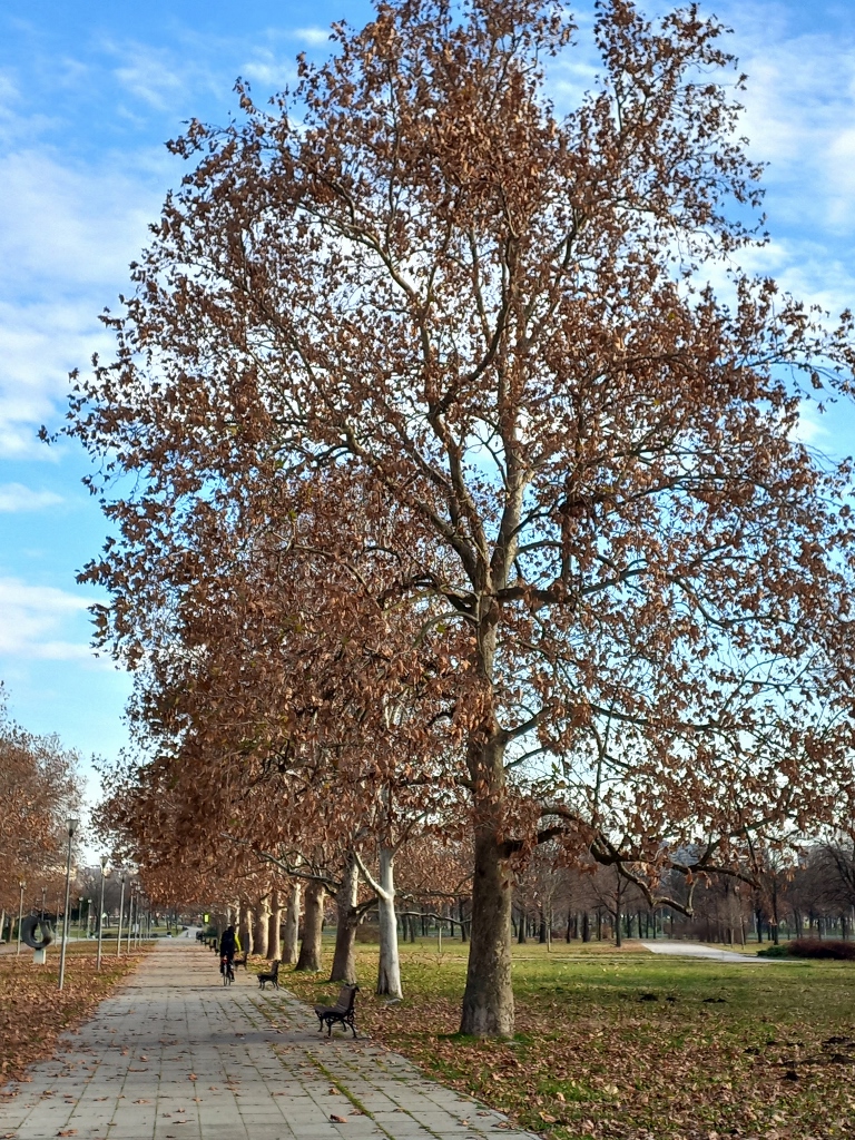
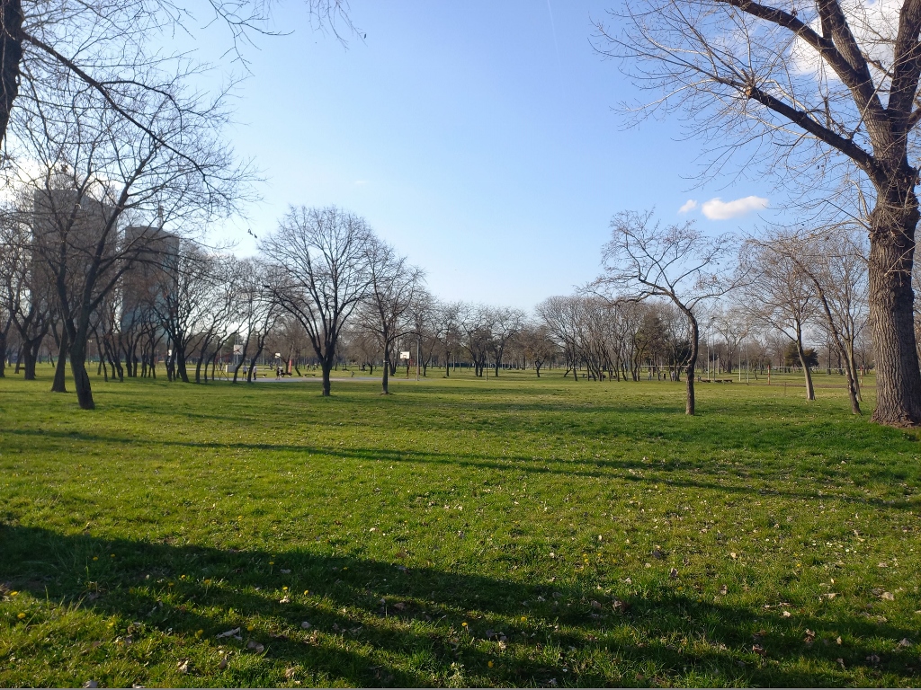
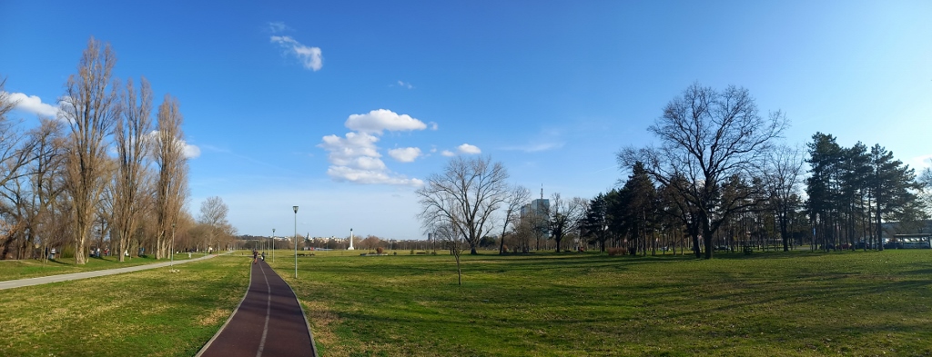
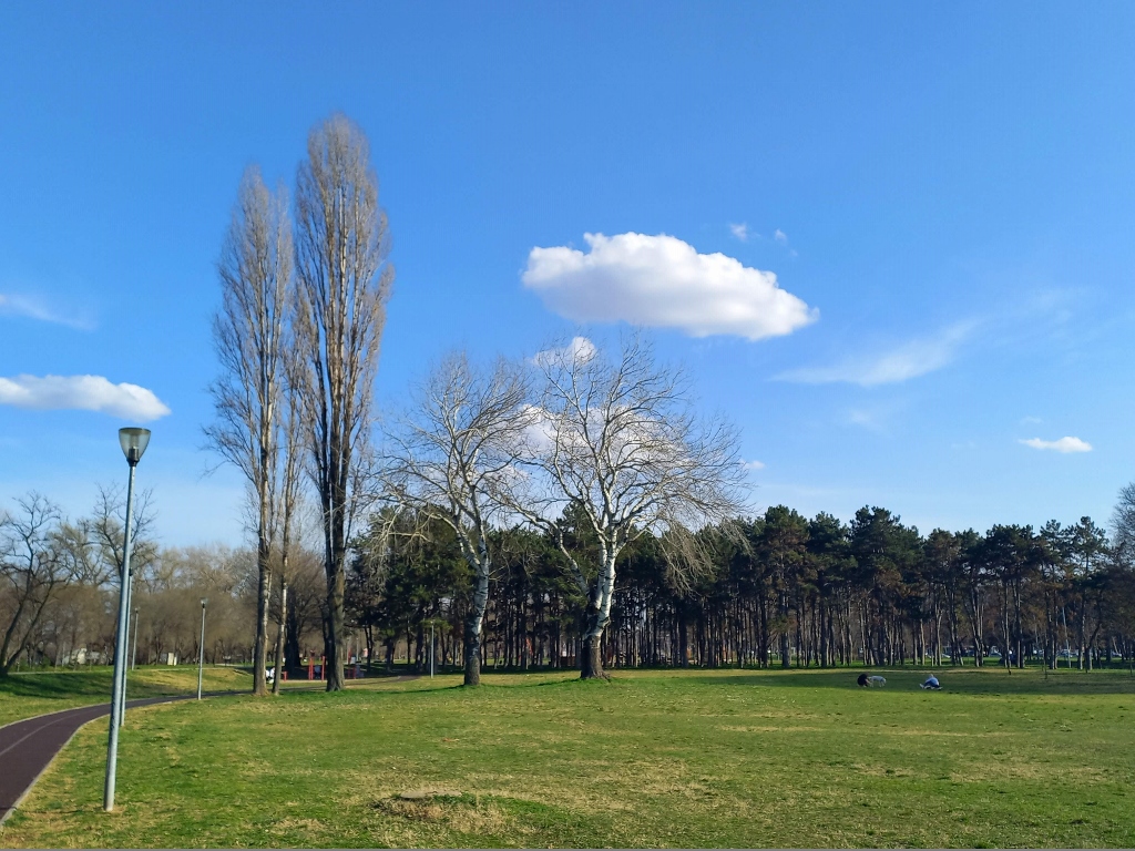
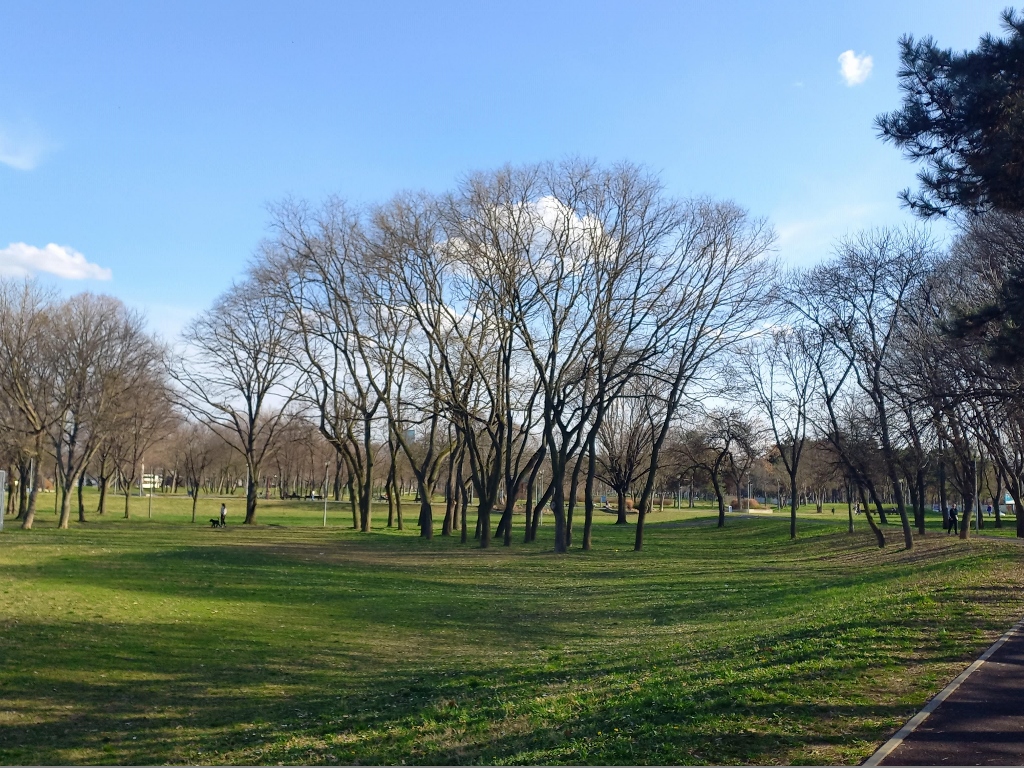
When there are no concerts, this is a very nice place to spend time in urban nature. Besides the lawns, there’s a running track, a bike path, and a promenade.
 Park beside Zemunski kej
 Park beside Zemunski kej
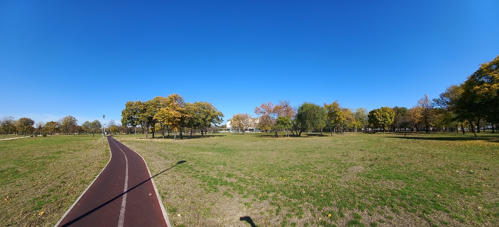
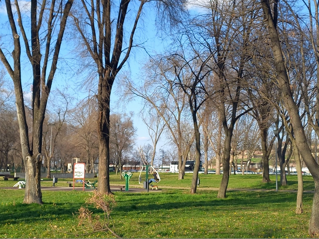
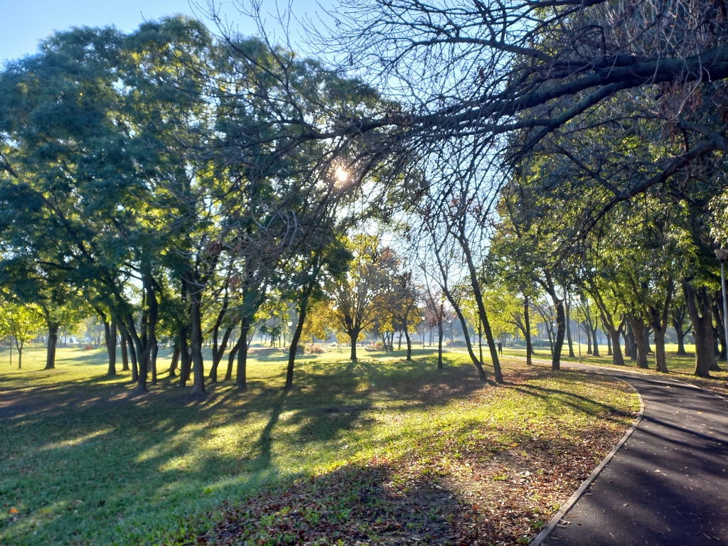
Depending on the season and the time of the day, the park can be more or less crowded and it is not always as empty as it may seem from my photos. Sometimes people just stroll or relax on the lawn, dogs are regularly walked, bicycles and joggers pass by, and there are areas designated for sports activities and children’s play.
 Park beside Zemunski kej
 Park beside Zemunski kej
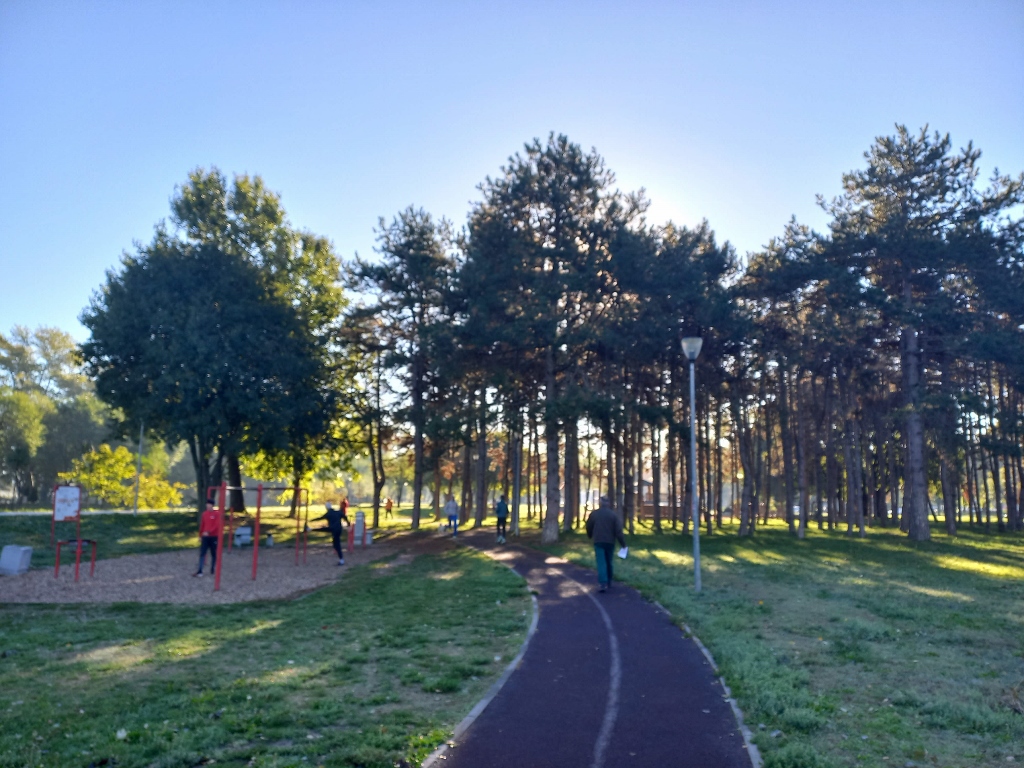 Park beside Zemunski kej
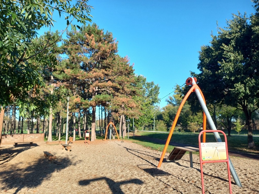 Park beside Zemunski kej
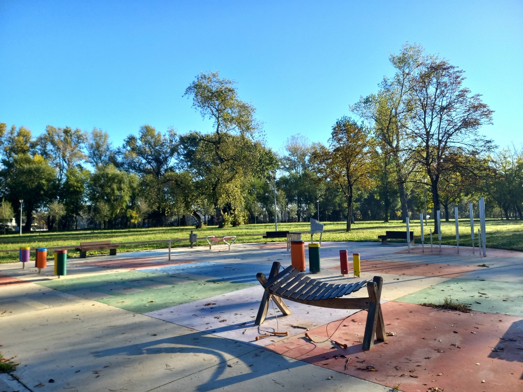 Park beside Zemunski kej
And if one continues walking further from the direction of the confluence, one certainly transitions into the territory of Zemun, but that calls for new visits and new stories.
 Park beside Zemunski kej
For now, here is a map with the sites that are mentioned in my story about Novi Beograd: