At the beginning of the year I read an article about a little visited forest on the outskirts of the urban part of the city, so it occurred to me I could go there for a walk. When I started to look at the map and how to get there, I noticed an interesting site nearby, then another... And there I had a whole day’s trip. The only problem was that it took me 2-3 months to organise myself finally, but when I did so, I used the following map primarily for the car routes. The walking was more improvised.
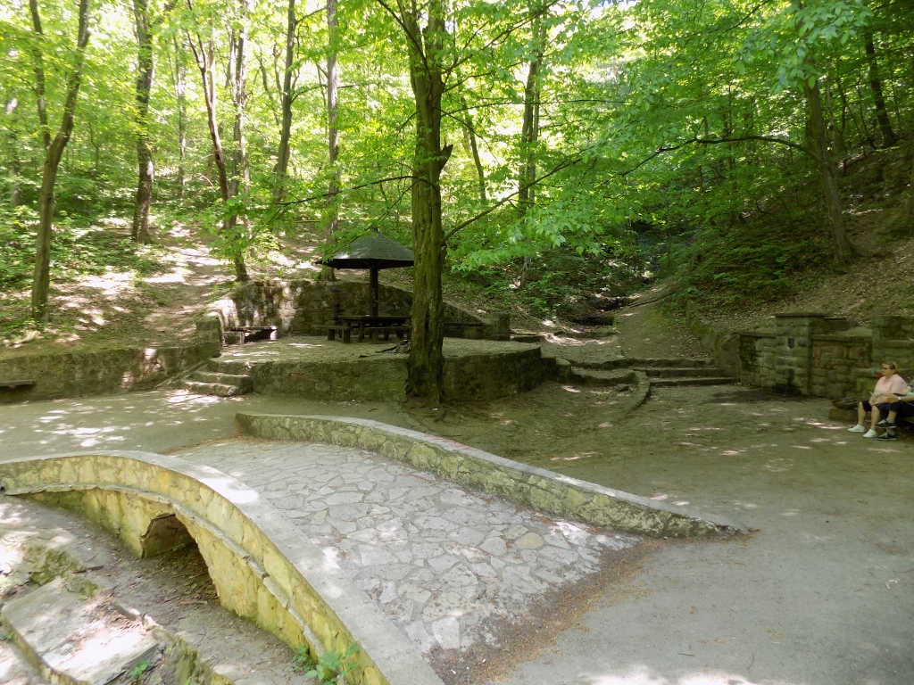
So, 25 minutes after leaving my flat I was already at the beginning of the forest. This is Stepin Lug (Stepa’s grove) that used to be called Titov Gaj (Tito’s grove, after the president of the SFR Yugoslavia). The forest covers the area of 8.5 km2 and there are no houses there. A narrow road leads from a larger street that runs alongside the settlement to a clearing where I left my car and there was also a ramp that marked the place where one enters a car-free zone.
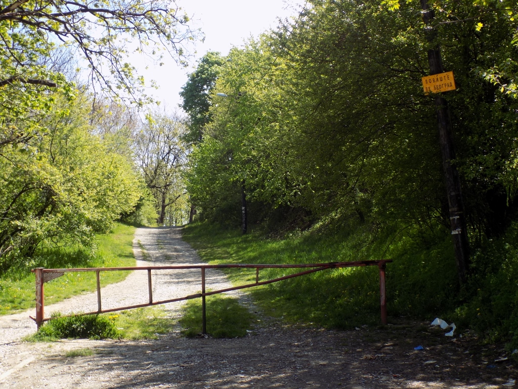 Beginning of the forest
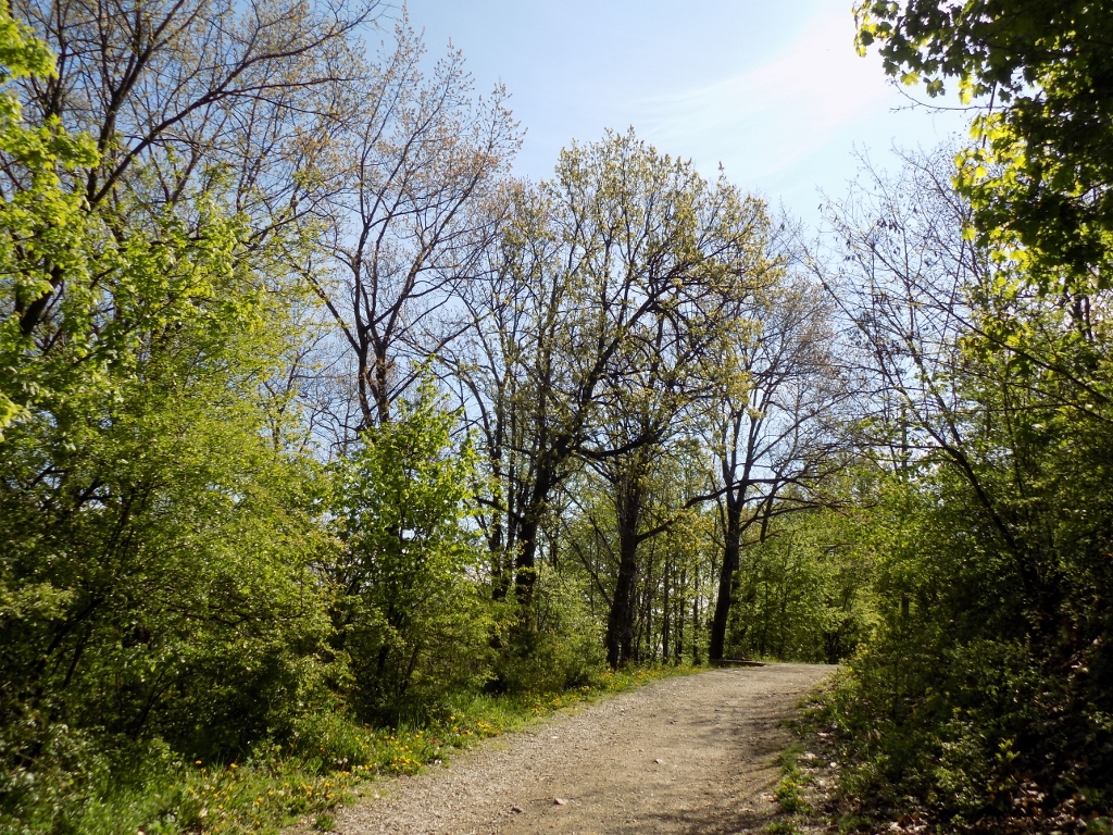
Without any clear concept about what I wanted to do here, except that I wanted to go for a walk, I headed along the wide path.
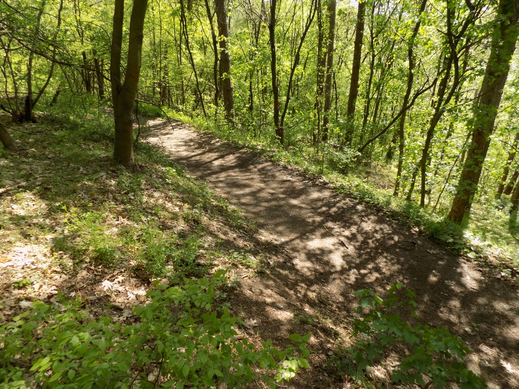
 Stepin Lug
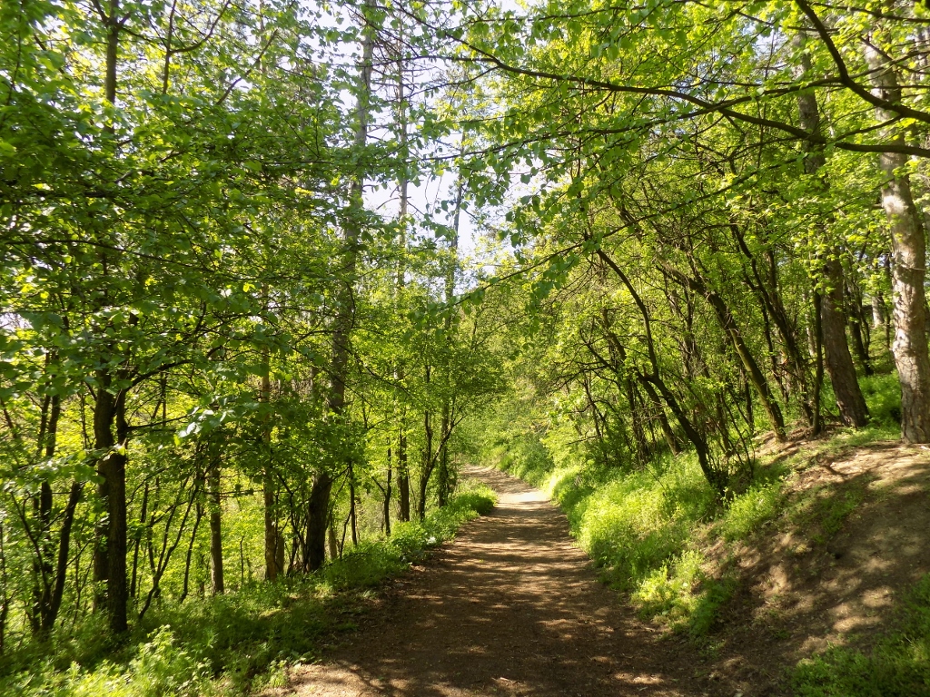
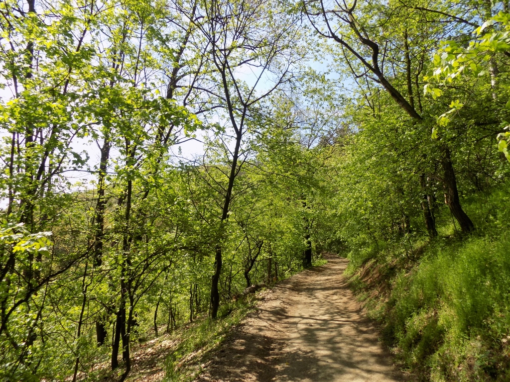
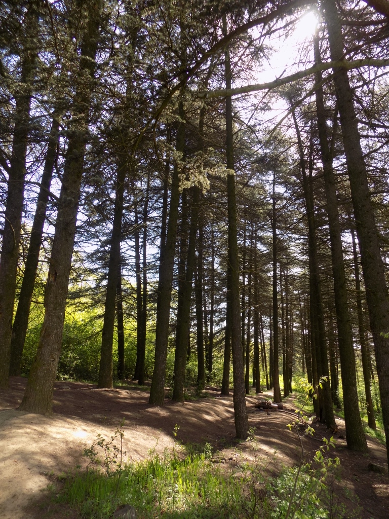
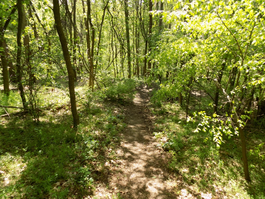
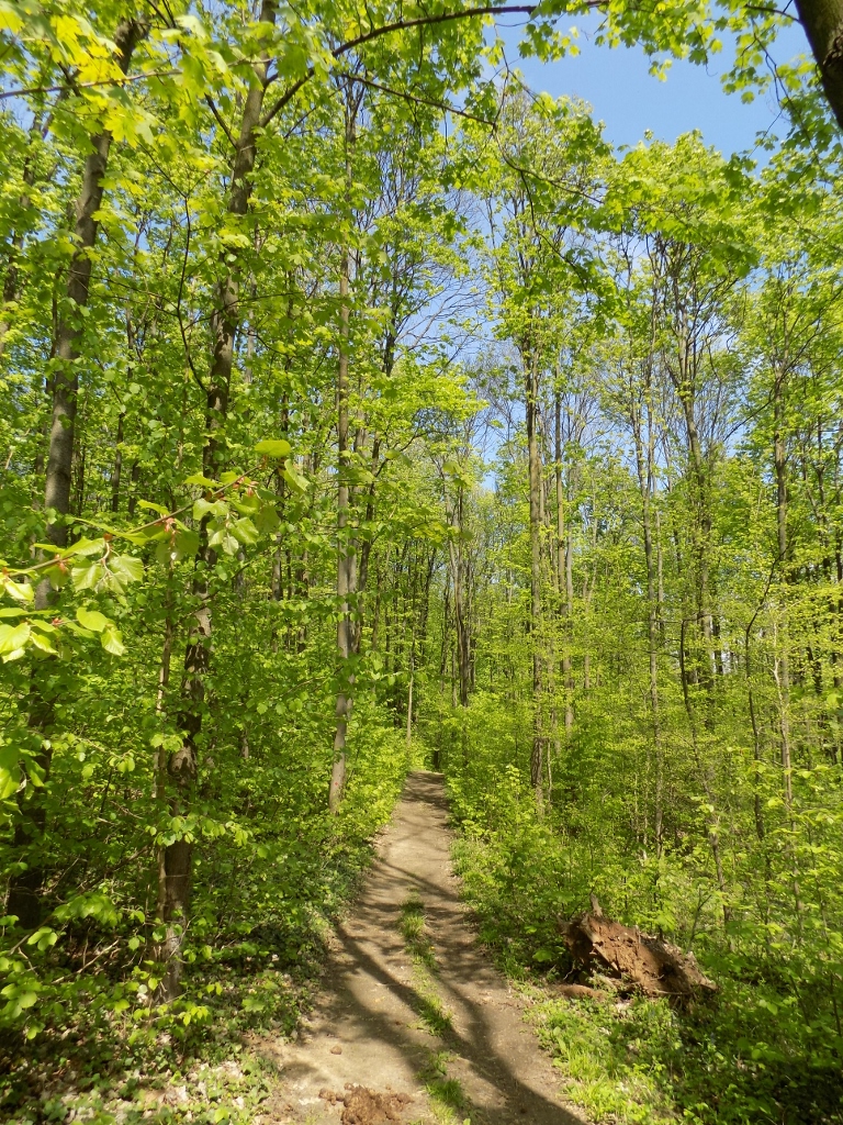
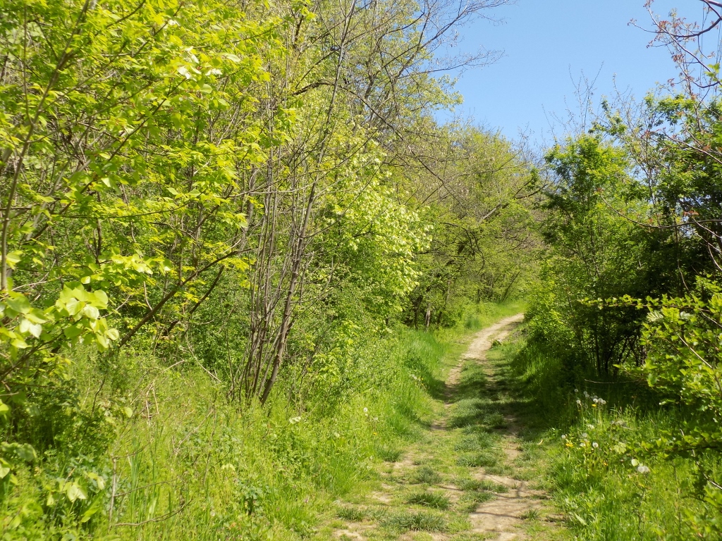
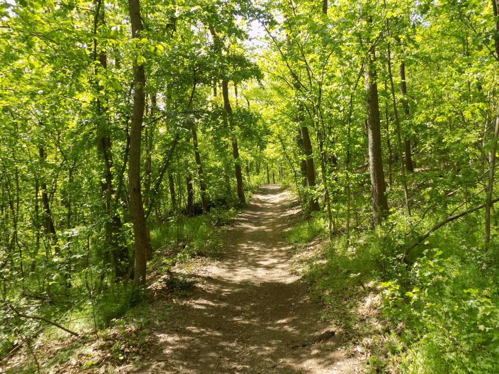
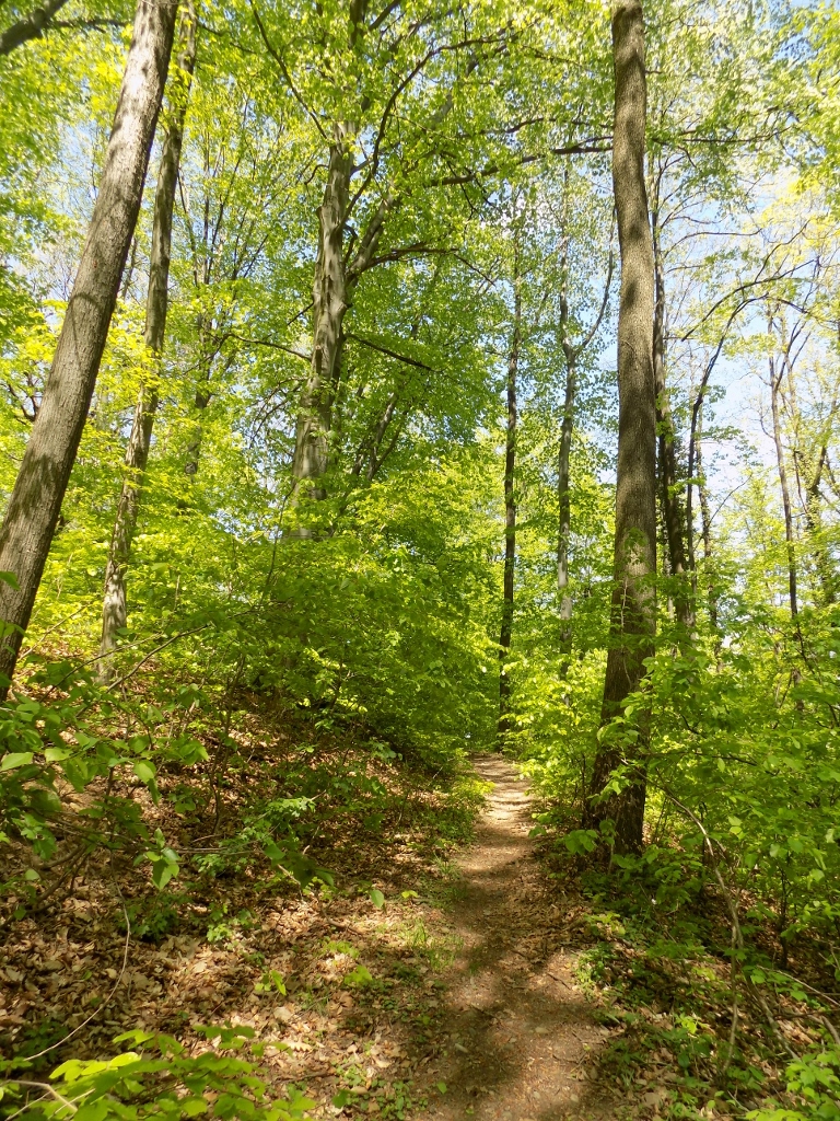
In the beginning the path was wider and thus more exposed to the sunlight, but then I got to a section where the treetops were closer one to the other, so there was a lot of shade.
 Stepin Lug
 Stepin Lug
Just as I got to a fork, a man was coming my way, so I took the opportunity and asked him if I could make a circle around the forest. He told me I could and explained which way to go. By the way, I decided on purpose to do this excursion on a working day, so until the end of the walk, an hour later, in addition to this man I met only a couple of other people, which I guess is good during a pandemic. Be as it may, I went to the right from that fork.
A little later, on my right-hand side, I saw a part where some evergreens had clearly been planted, which I concluded by them being arranged in a straight line, plus the ground seemed to have been cultivated by the human hand. Generally speaking, a lot of trees had been actually planted here originally, not necessarily the autochthon species, but in other places I did not notice such a regular arrangement of individual trees.
 Stepin Lug
Right next to these evergreens, on a meadow in continuation, I could see young saplings of new trees that had also been planted there, but certainly much more recently.
 Stepin Lug
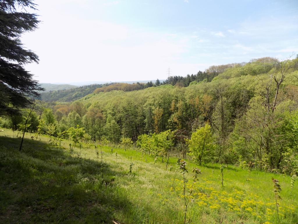
There was also a wide path leading to the side from here and down a slope, towards another part of the forest. Still, I did not want to head that way, since I thought that would be turning away from my imagined circular route. Such kind of adventurism had to be left for some other time.
 Stepin Lug
So, I continued straight and soon I came across two people who brought their herd of goats and a few sheep to graze here.
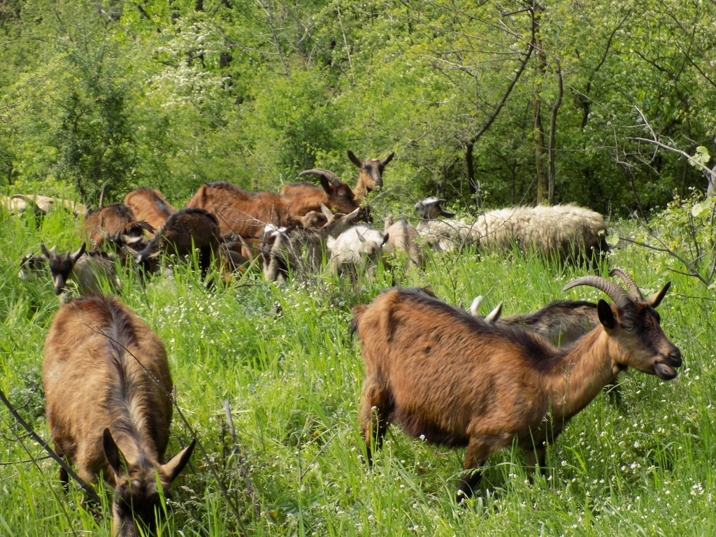 Domestic animals in Stepin Lug
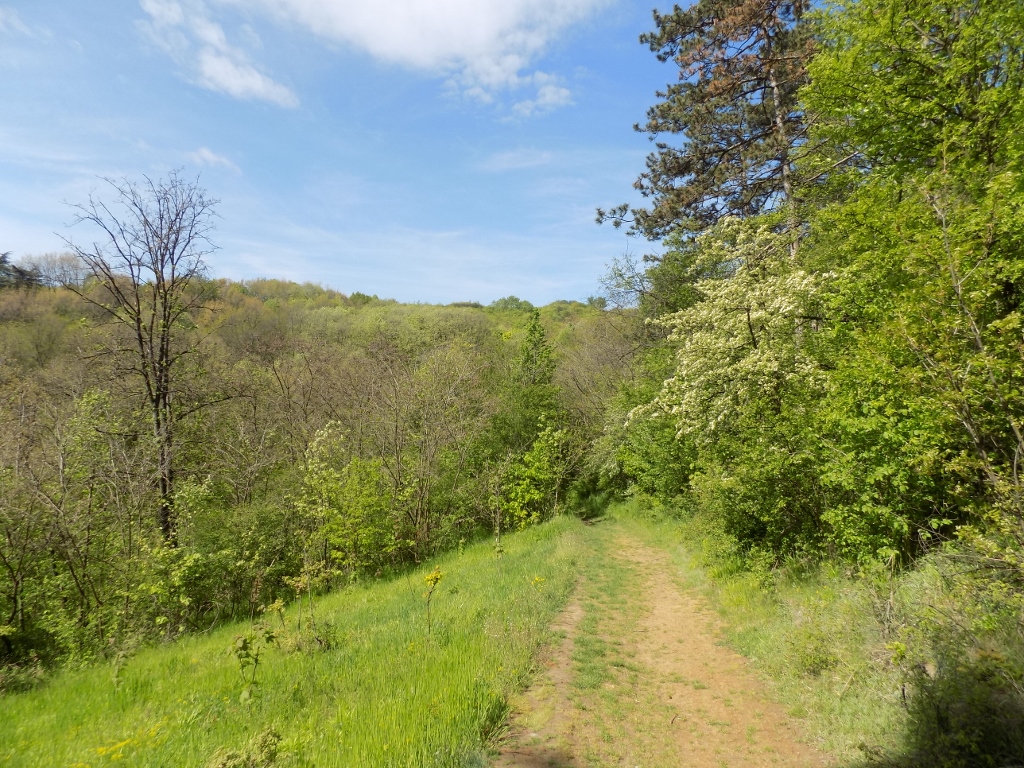
The wide path I followed turned into a narrow path at some point, but as it led straight I simply continued to follow it. It was clear to me that the path was going along a ridge and although I was completely surrounded by woods, I could hear to my left-hand side the sounds of the traffic along the motorway. I was not worried by that, but rather by the occasional rustle I could hear on the right-hand side and the first thing that came to my mind was the memory of the notice board at the entrance into the forest mentioning the “hunting ground.” I wondered what lived here – wide boars, bears, wolves or, perhaps, yetis? Joking aside, as far as wild animals are concerned, there are only rabbits and pheasants here, but I did not see any of them.
On the other hand, carried away by the rustle coming from the woods and my pondering on the subject, I did not deal too much with the narrow path that I followed and that started to descend at some point, seemingly rather steeply, while I had no idea where I was or where exactly this path was leading to. I wondered what I would do if there was a dead end to it, while it was completely clear that I would have to turn back which in itself was not problematic at all, but I was not particularly fit, so any such climbing would seem quite challenging and demanding.
Still, at some point the path came directly across some wide path and so I began to feel quite comfortable again.
 Leaving the narrow walking path behind
 Descending to the wide path
The continuation of the walk was very pleasant and judging by the sound of traffic which I could hear now coming from my right-hand side, it was clear to me that I was going back in the desired direction.
 Stepin Lug
The day was perfect for walking and I was very satisfied that I was surrounded by nature. So much so that I felt like making a selfie.
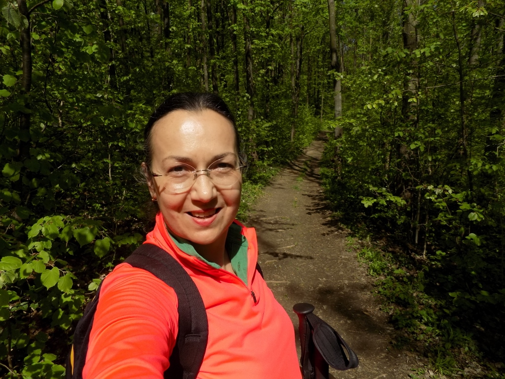 U Stepinom gaju
I came here at the end of April and not everything was fully leafed, but the sights around me were certainly not any less beautiful on account of this. Keep in mind that this grove is only about 12 km away from the very centre of Belgrade!
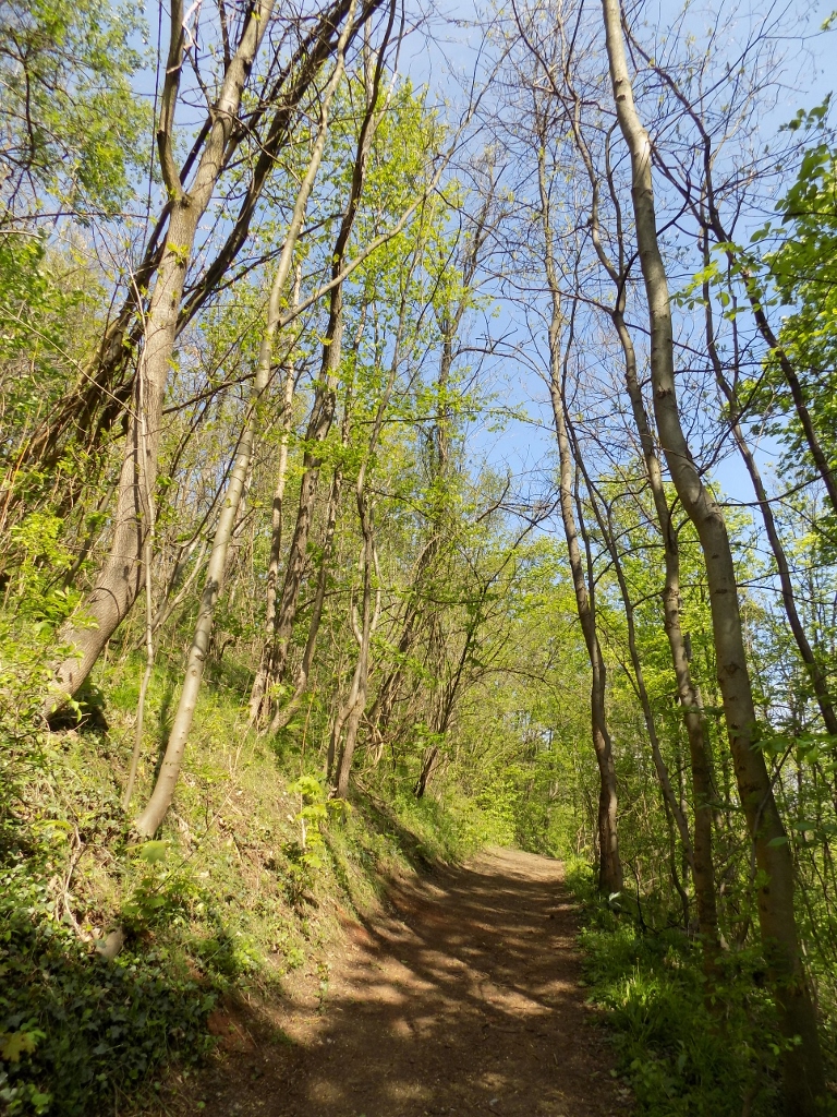 Stepin Lug
 Stepin Lug
Still, the fact that there were no people around me did not mean I was alone. I could hear different birds in the area, but I did not see any. There were, however, some other, less speedy residents of the woods.
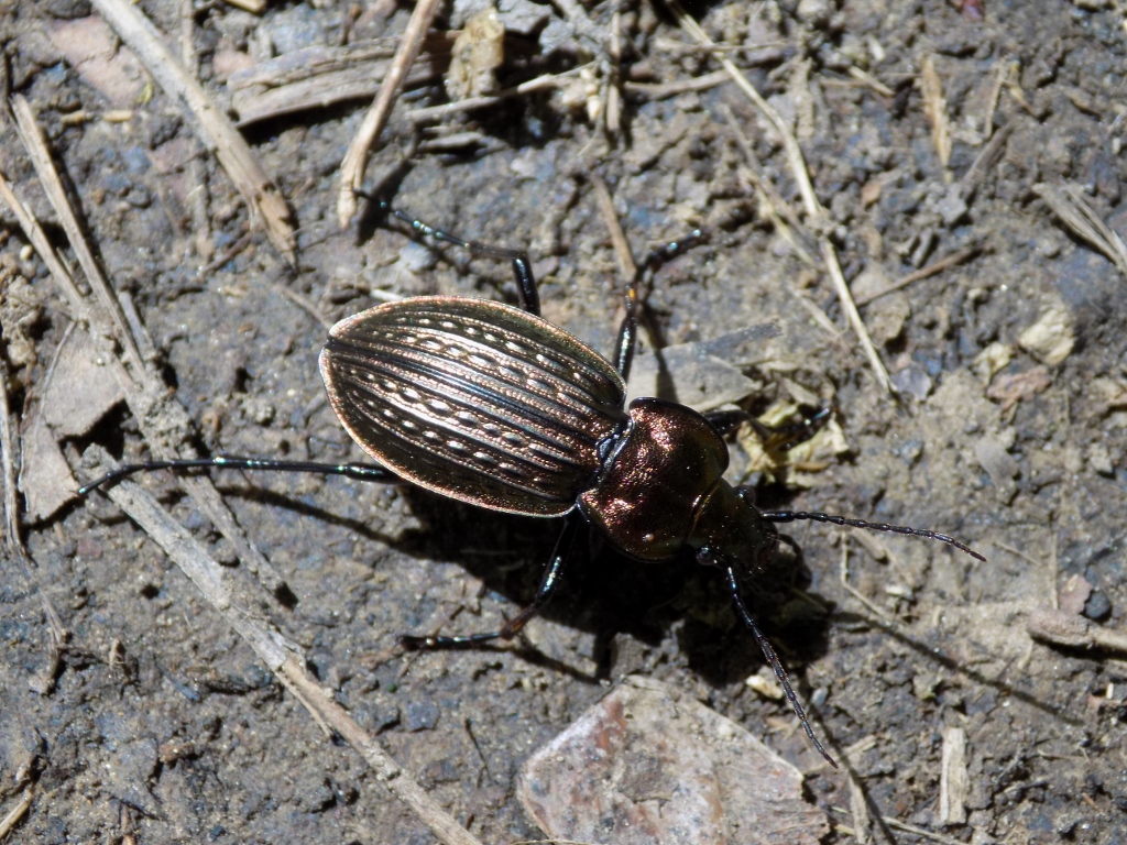 A ground beetle (Carabus ullrichi)
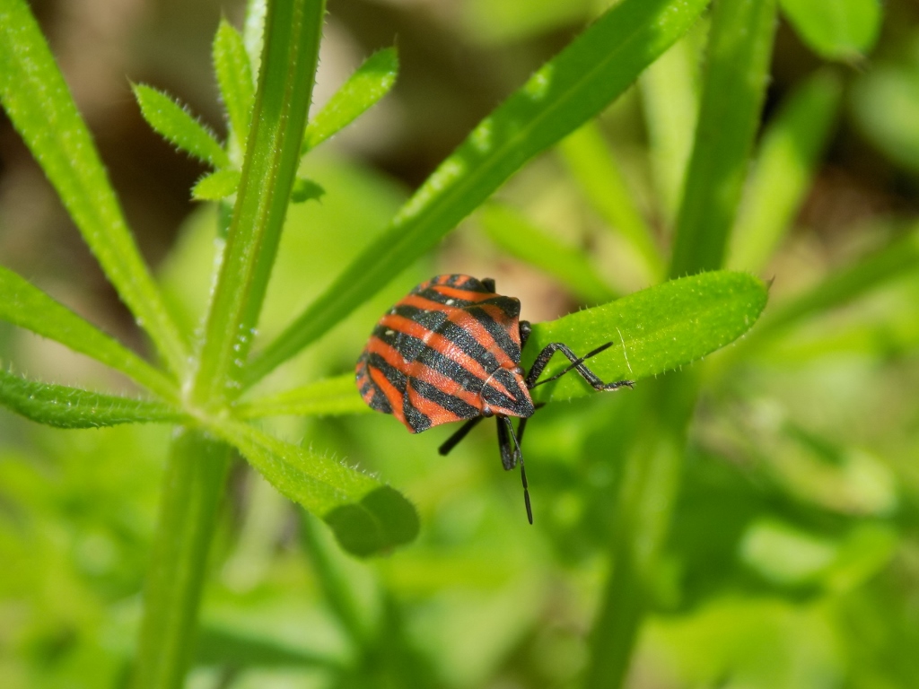 A species of shield bug (Graphosoma italicum)
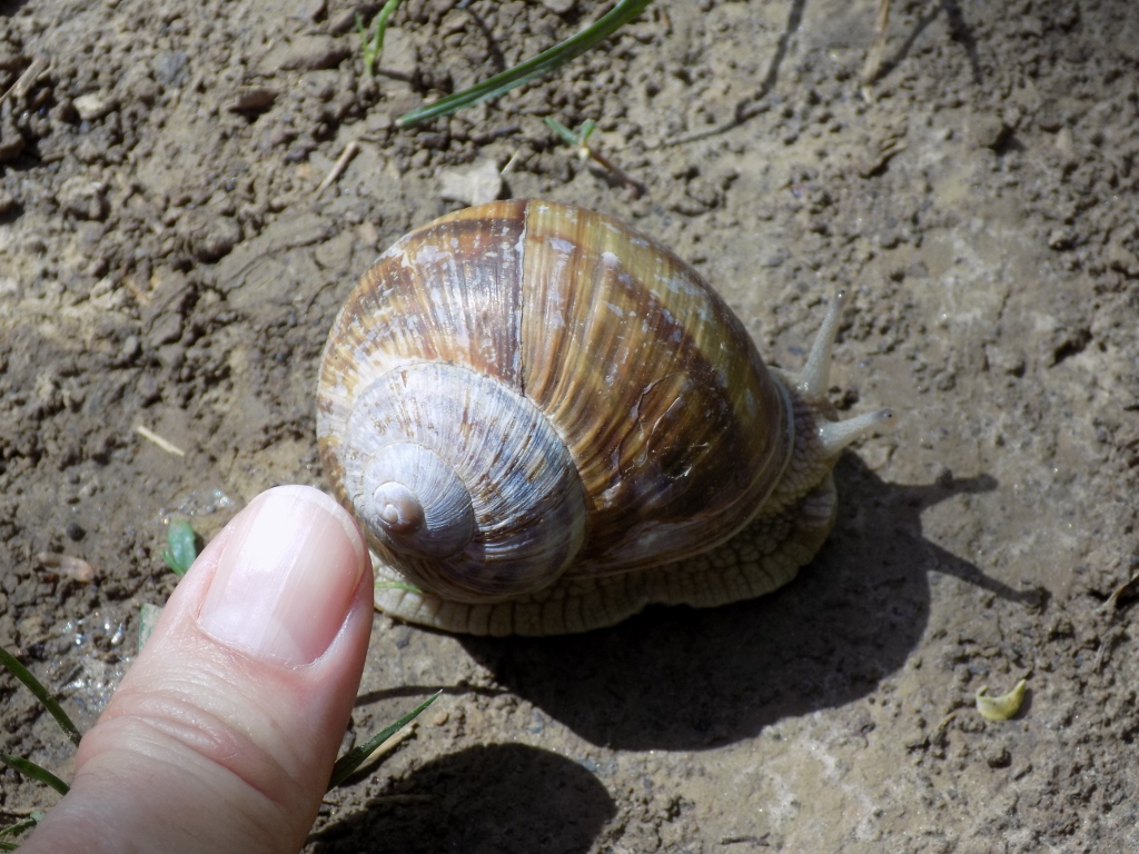
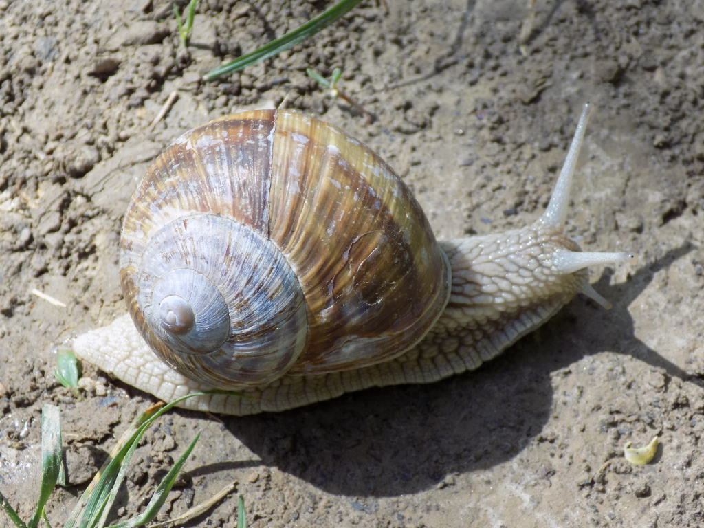 Burgundy snail (Helix pomatia)
Although I did not even touch it, when I placed my thumb close to its shell, this burgundy snail sensed my presence and thus it shrank a little.
 Burgundy snail
The path lead through a woody area for a while yet and then I reached a wide meadow.
 Stepin Lug
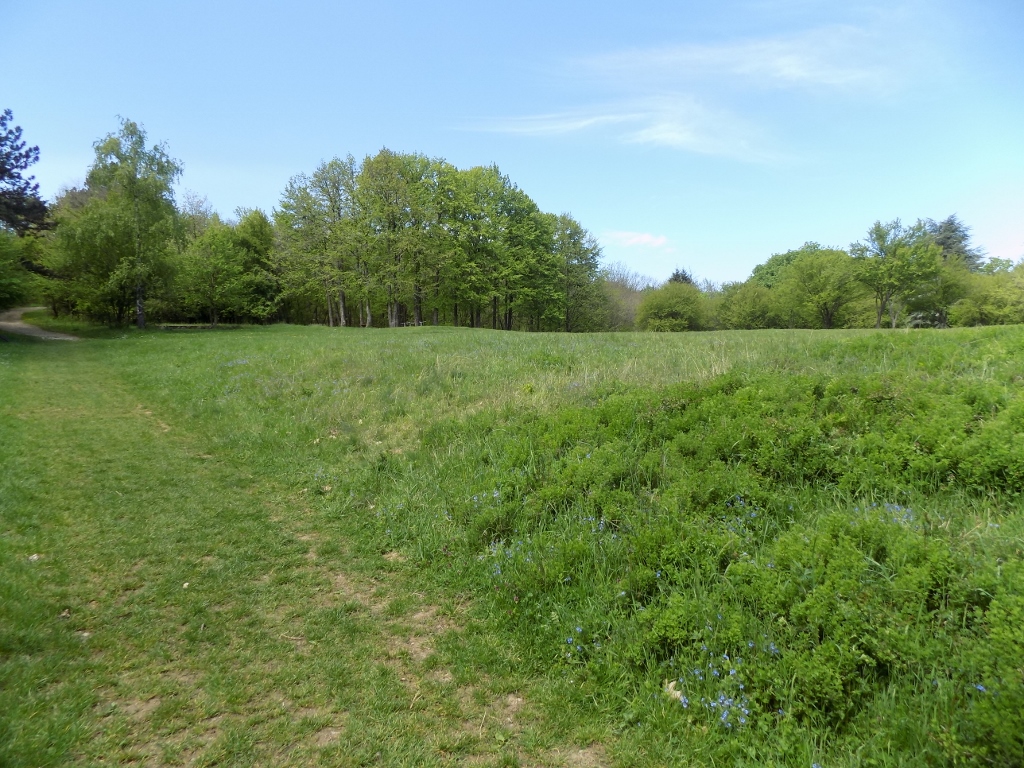 Stepin Lug
In this wide meadow, I noticed a wooden table with benches under a tree, so it is obvious that a picnic could be organised here, but more than by this I was impressed by the myriad of lovely flowers of the bird's-eye speedwell (Veronica chamaedrys). Young bees were already here enjoying their fresh food.
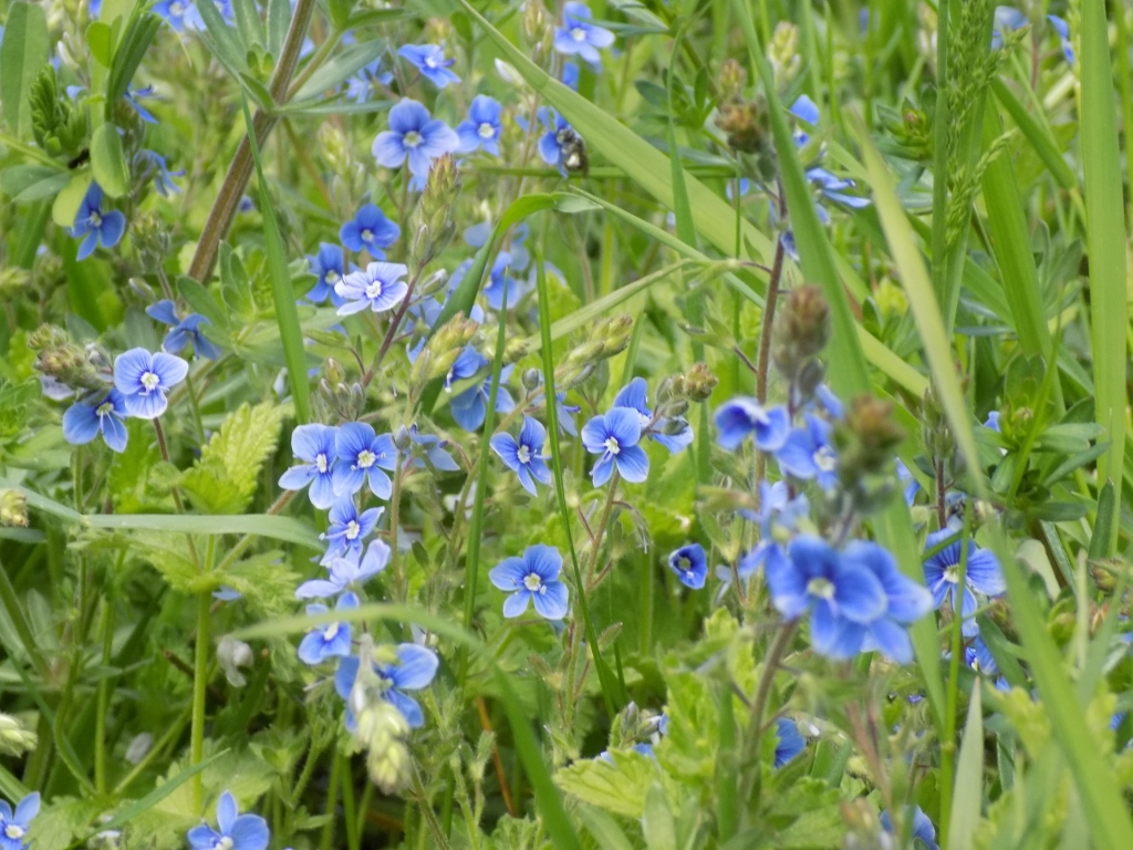 The bird’s-eye speedwell; if you look carefully, you will see a time bee that is not entirely in the focus
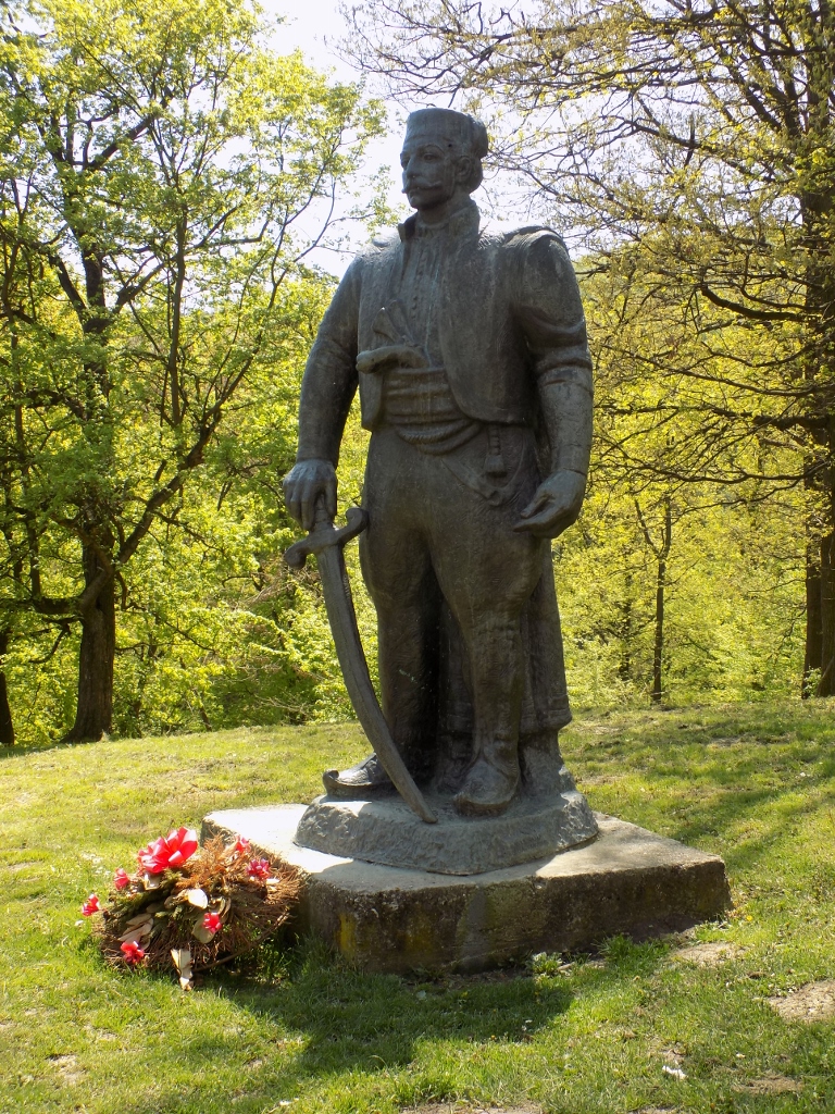
Here I also finished with my tour around Stepin Lug, so I just returned to my car and then transferred a couple of kilometres farther to the birth house of Field Marshal Stepa Stepanović that the grove has been named after.
Field Marshal Stepa Stepanović (1856-1929) was one of the famous military commanders of the Kingdom of Serbia who particularly earned their fame during WWI. Among other positions he held, he was the commander of the 2nd Serbian Army that took part and won the Battle of Cer (1914), which was in fact the first Allied victory over the Central Powers in World War I. He also played a decisive role in the breaking of the Macedonian Front and the liberation of Serbia in 1918.
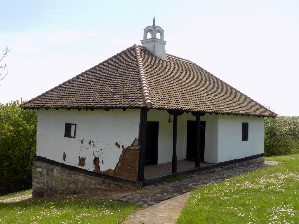
This impressive military career started in a house at the end of the village of Kumodraž in Belgrade.
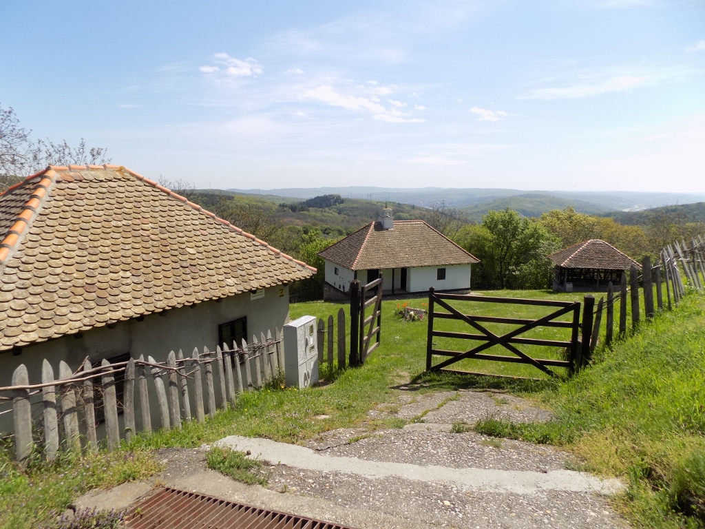 Birth house of Field marshal Stepa Stepanović
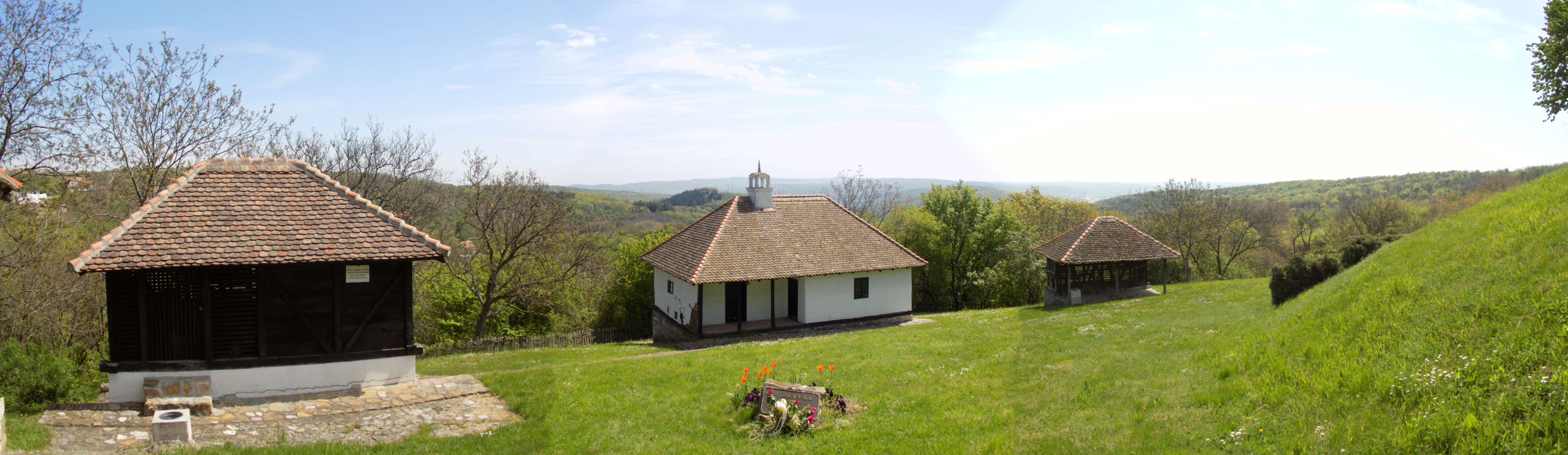 Birth house of Field marshal Stepa Stepanović (the white one, in the middle)
The house was built around the middle of the 19th century and the wall to the left from the porch is damaged a little, so one can see that it was made of cob.
 Birth house of Field marshal Stepa Stepanović
There are three rooms inside, two of which are organised like an exhibition area dedicated to Stepa Stepanović.
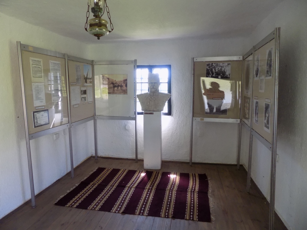 Birth house of Field marshal Stepa Stepanović
As opposed to these two rooms, the floor of which is made of wooden boards now, in the third room there is still the original, dirt floor, plus there is a hearth, and this third room is organised more ethnographically.
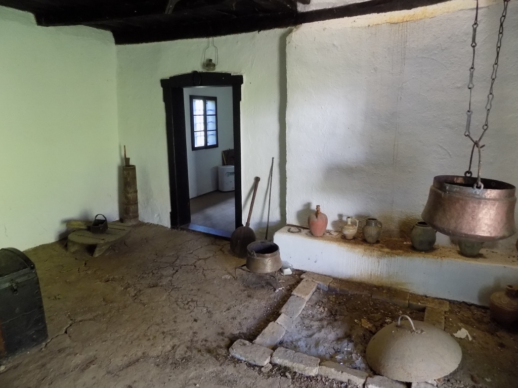 Birth house of Field marshal Stepa Stepanović
Above the hearth, there is a chimney that has the shape of an upside-down square funnel.
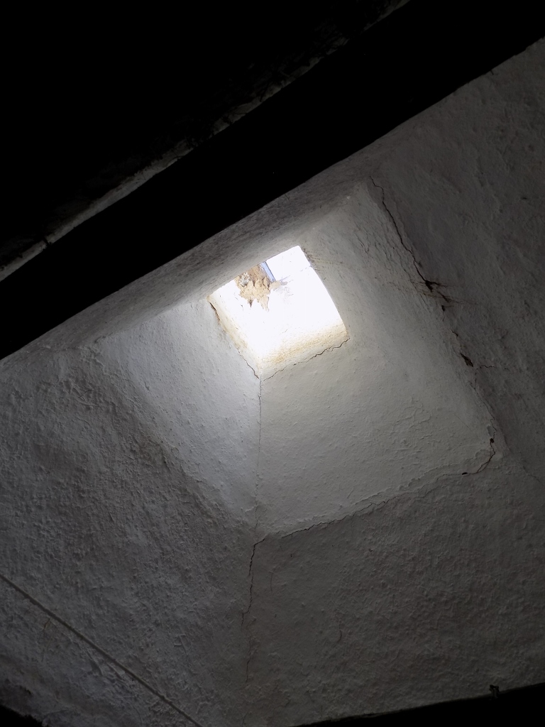 Birth house of Field marshal Stepa Stepanović
On the lower side, this plot of land is fenced off by traditional wooden fence which I love to see so much.
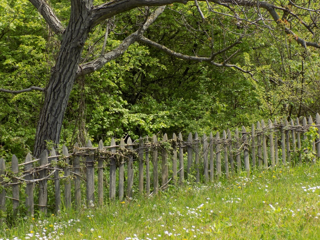 Lower part of the fence surrounding the plot of land with the birth house of Field marshal Stepa Stepanović
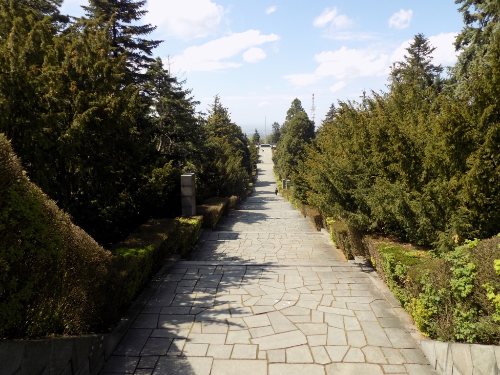
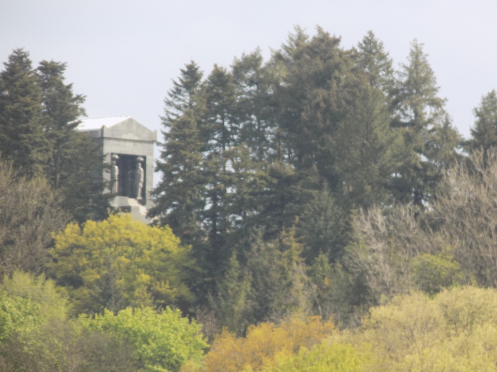
When I finished with the short visit to the birth house of Field marshal Stepa Stepanović, I got into my car again and moved from Kumodraž to the village of Jajinci. Before the next stop, the road took me through a forest and then I reached a clearing from where I could see the monument in Jajinci Memorial Park.
 The road I came by to Jajinci Memorial Park
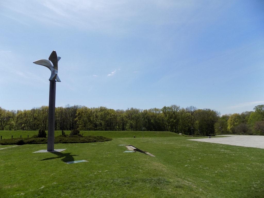
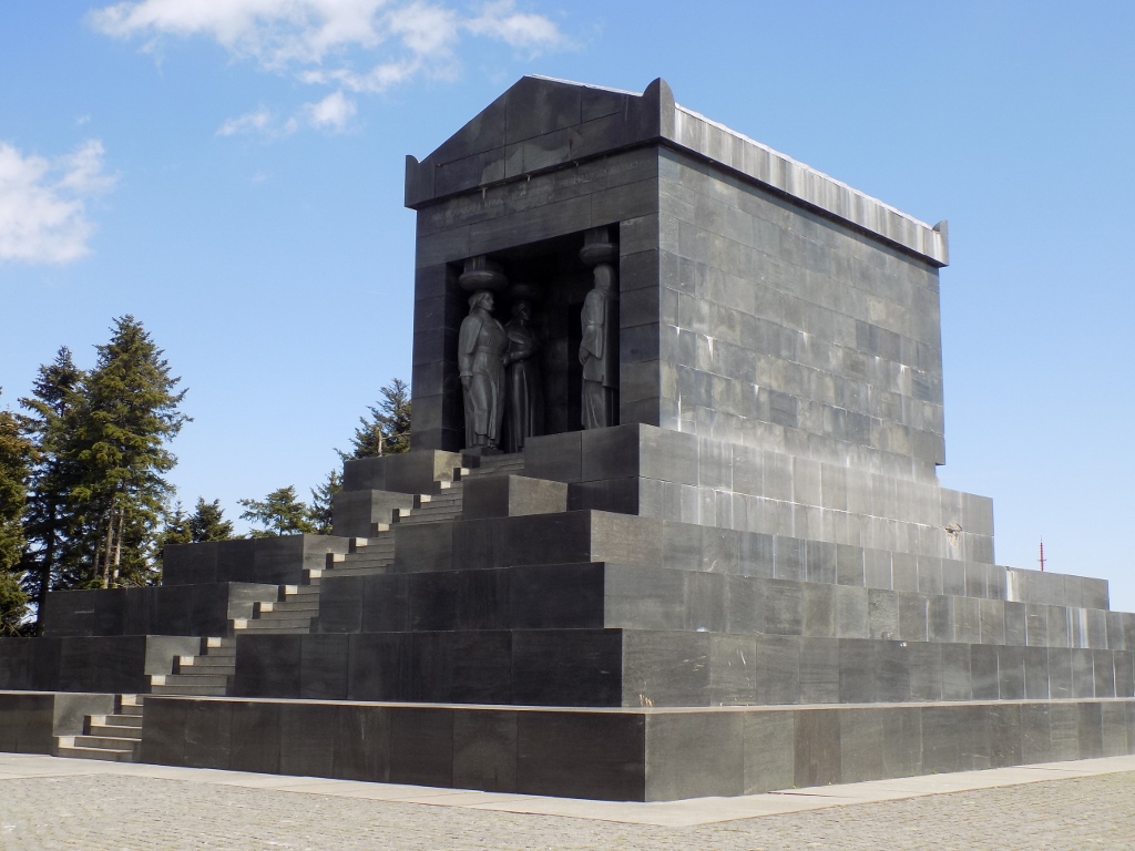
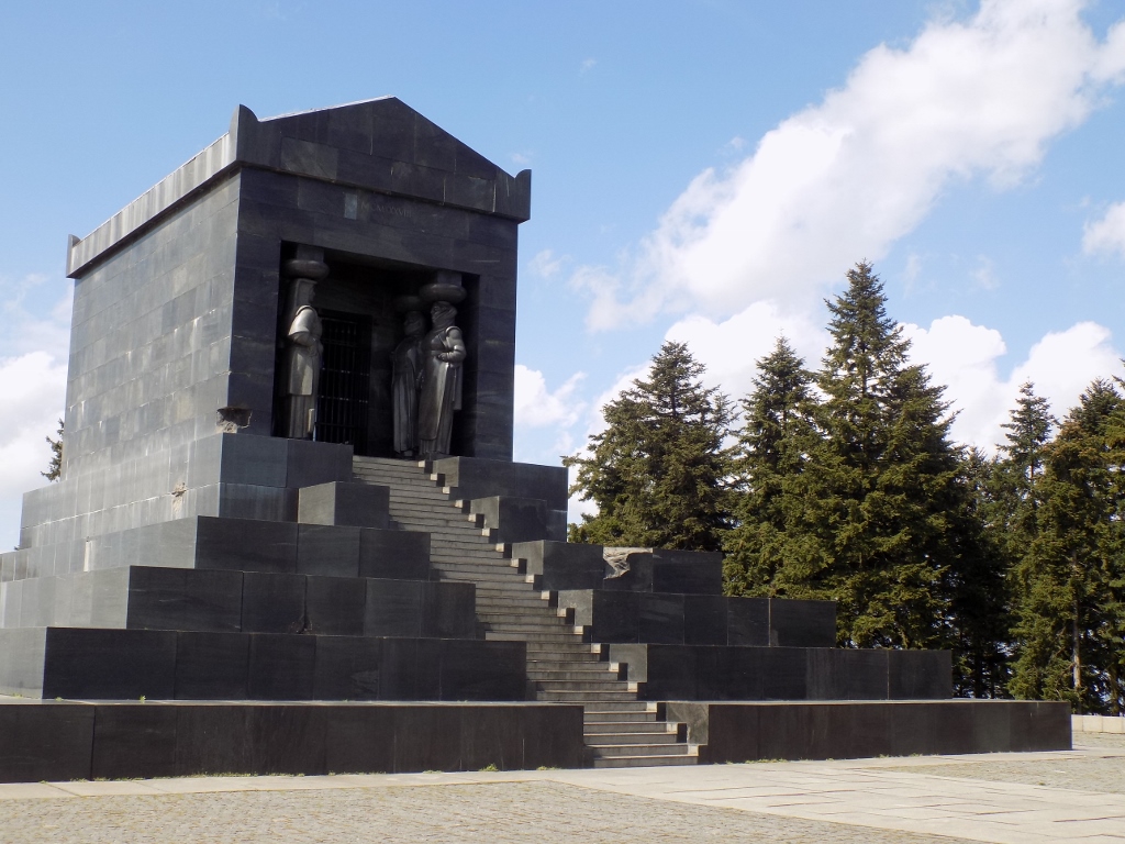
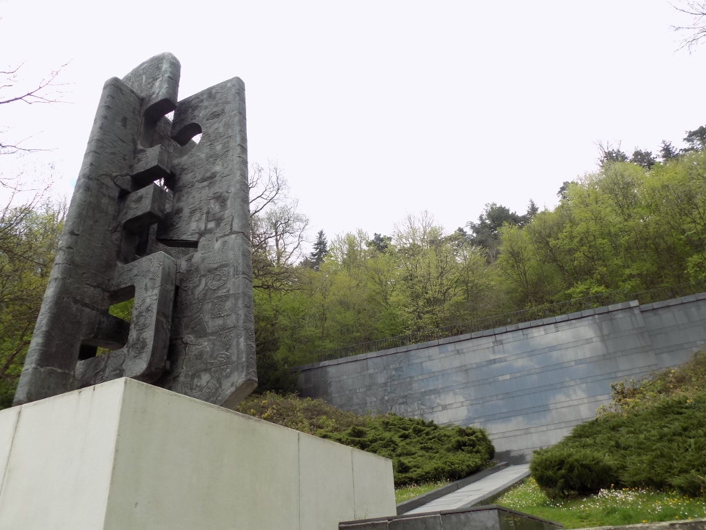
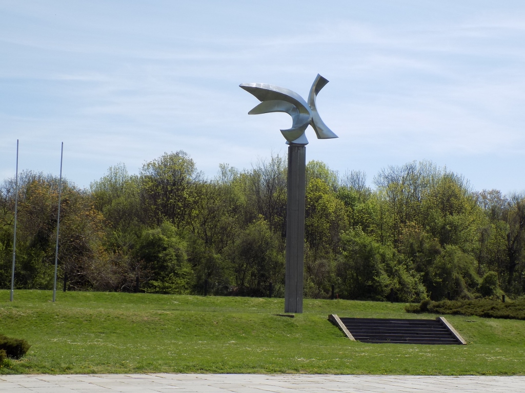 Monument in Jajinci Memorial Park
Before WWII, there used to be a military shooting range of the Kingdom of Yugoslavia here, but during the German occupation the venue was used for massive killing and burial of people, the biggest such place on the territory of occupied Serbia. This was the place where the Serbs perished, as well as the Jews, Roma and others. During the winter of 1943/44, the Germans or Gestapo, to be more precise, organised exhumation and burning of the remains, but the research conducted after the liberation has shown that around 65,000 people were killed here. Today, in the central section there is a large clearing with a monument that symbolises a bird, while around there are woods where it is possible to go for a walk.
 Jajinci Memorial Park
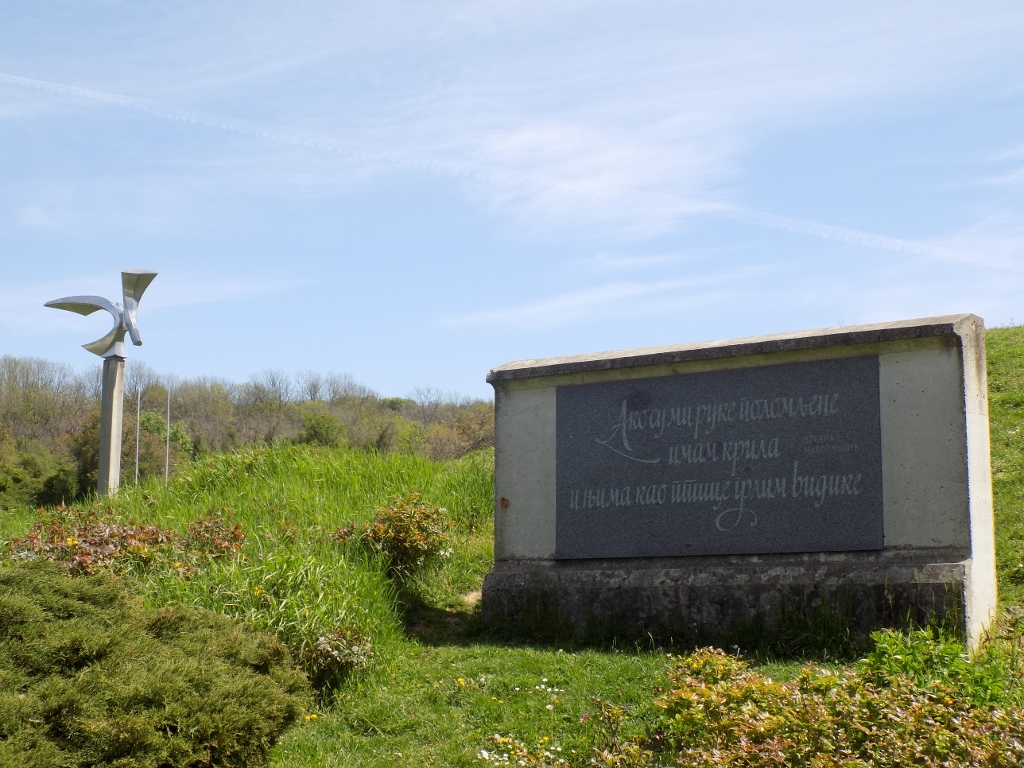
The symbolism of the bird is reflected in the words of a famous Serbian poet, Desanka Maksimović: “If my arms are broken, I have the wings and with them, like birds, I embrace the horizons” written on a stone slab placed very near the monument.
 Jajinci Memorial Park
On this occasion I did not walk around the memorial park, but rather I transferred by car to the village of Beli Potok at the foot of Avala or more concretely to the mountain lodge “Čarapića brest” where I first sat down and had a coffee.
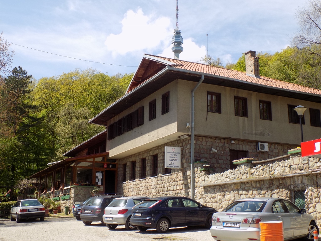 Mountain lodge “Čarapića brest,” with Avala Tower in the background
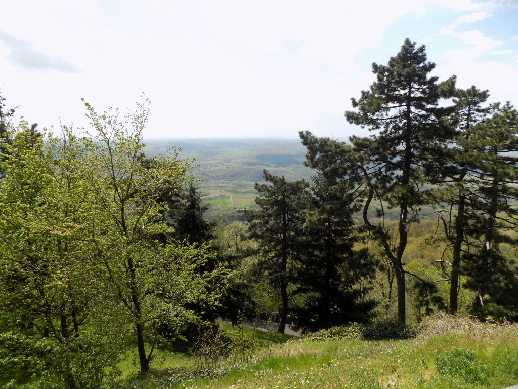
Let me first say something about Avala. When you look at the physical map of Serbia, the hilly and mountainous areas that dominate the south and central parts of the country drop slowly towards the north and the rivers Sava and Danube, north of which there is the Pannonian Plain (with the exception of mountain Fruška Gora, at least on the territory of Serbia). The last elevation towards the right banks of the Sava and the Danube (in the case of the Danube, this applies from the confluence of the Sava and the Danube in Belgrade downstream) is precisely Avala. When I went to school, we learned that hills were elevations of up to 500 m a.s.l., while mountains are from 500 m upwards. So, strictly speaking, with its altitude of 511 m above sea level, Avala is a mountain. Its name comes from Arab or Turkish (different sources say different things). On its top, the ancient Romans had a fortification built since, although it is not particularly high, the top of Avala is the highest point in the area and from there it is possible to control this entire region very well. At the time of the ancient Romans this was important because of their settlement Singidunum (present-day Belgrade) and because they used to have mines on the slopes of the mountain. Later, the Serbs built their fortification on the top and it was called Žrnov. In the 15th century, the fortification was taken by the Ottomans who abandoned it most probably in the 18th century.
During the liberation of Belgrade from the Ottomans, as a part of the First Serbian Uprising, in 1806, one of the most prominent military commanders of Karađorđe (the leader of the uprising), Vasa Čarapić (1768-1806), got killed. By birth, he was precisely from here, Beli Potok village, at the foot of Avala. By the way, he also took part in the Austro-Turkish War (1788-1791) so he has been remembered in the history as one of the greatest Serbian fighters and heroes from that period. In addition to one of the central downtown streets in Belgrade being named after him, Vasina street, his name has also been given to the mountain lodge “Čarapića brest” (The Elm of Čarapić), while very close by there is his monument positioned in such a way that Vasa Čarapić looks in the direction of his birthplace.
 Monument to Vasa Čarapić on Avala
My plan was to go from here to a mine shaft from the Roman times, but I did not know the way, i.e., the path. So, I asked a woman and she sent me to one side. I started to go along that path and it was very steep, while I was not fit at all. I had to make a couple of stops at the very beginning in order to catch my breath. However, very soon I got to a part where the path ascended very mildly, so I even remembered to take a photo.
 Walking path on Avala
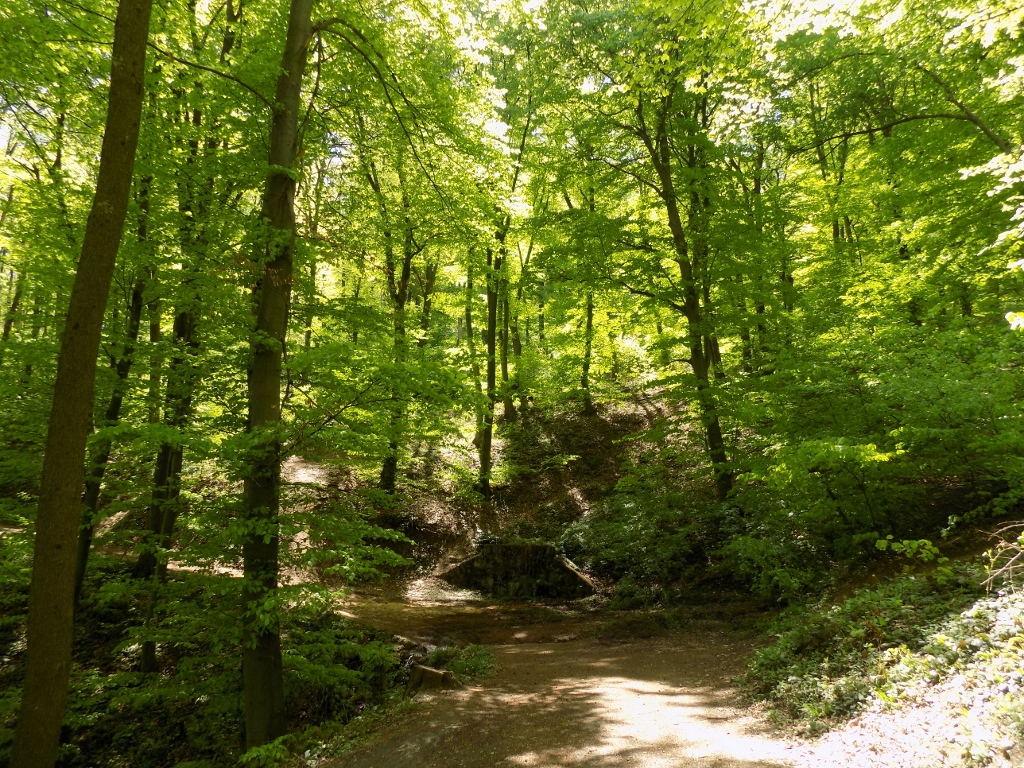
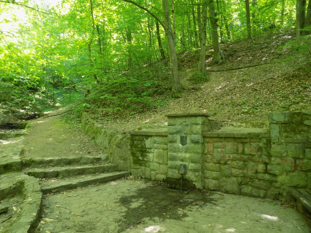
And then I got to an asphalt road. I still did not have any idea where I was, but through the treetops I could see the top of Avala Tower and so I realised I was in a completely wrong place. Although I believe she did not have any bad intention, that woman sent me to the asphalt road probably thinking I would get more easily to wherever I was going from there. But, I wanted to walk along the paths through the woods and in this I was helped out by the fact that the treetops were still not dense and so I could see in which direction there was the top covered in evergreens, for I knew that they surrounded the top of Avala. Although my original plan was not to go there first, I decided to adjust to the situation and so I headed along a wider walking path relying on my sense of orientation. Soon I got to a place where apparently there was a water spring (the built section on the slope), but it was dry at this time. On the other hand, right nearby there was a small stream down which flows the water that obviously springs somewhere higher up.
 The built, currently dried out water spring on Avala (the path leads directly towards it)
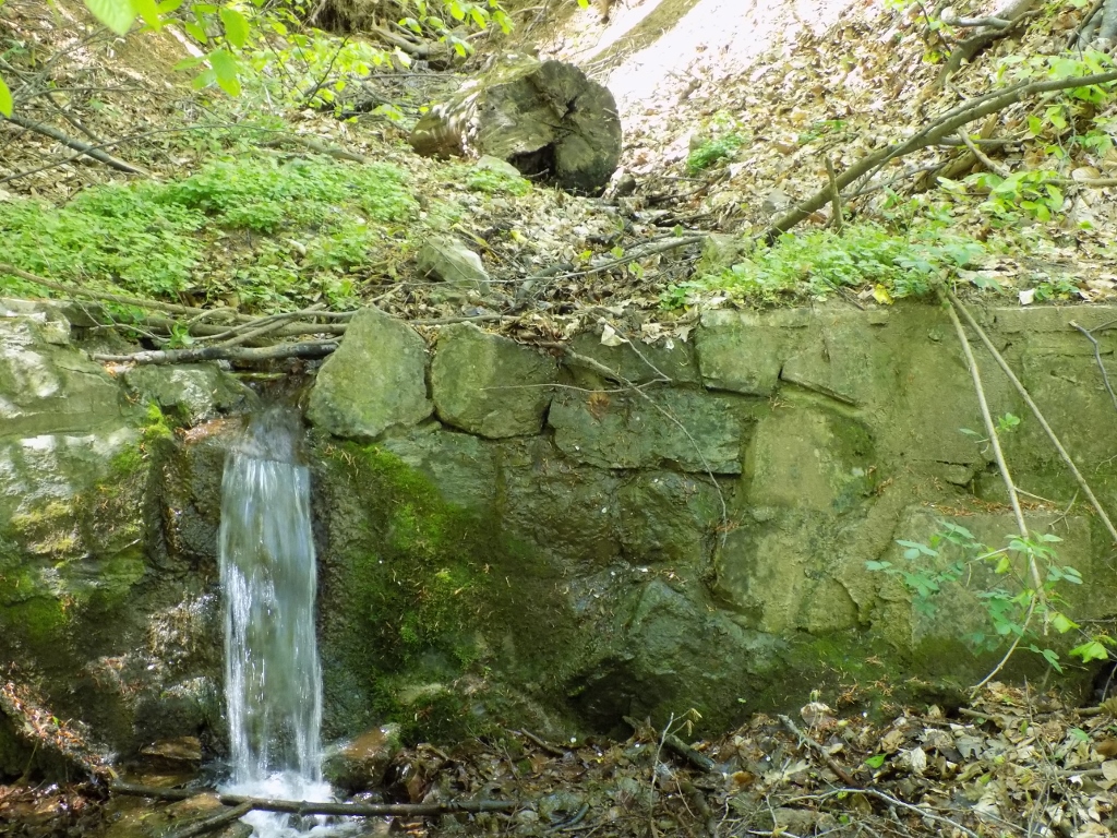 Waterfall of a half a metre
At some point I realised it was no use following the wide path since it was not leading to the top, but around, so I turned onto a narrower and steeper one. Although I did worry a little where exactly I was going, I must admit I was very happy and felt fulfilled. Being in nature usually creates such feelings in me.
 Narrower path leading to the top of Avala
After some walking I reached a picnic area closer to the “Avala” hotel where I first headed for the Monument to the Unknown Hero.
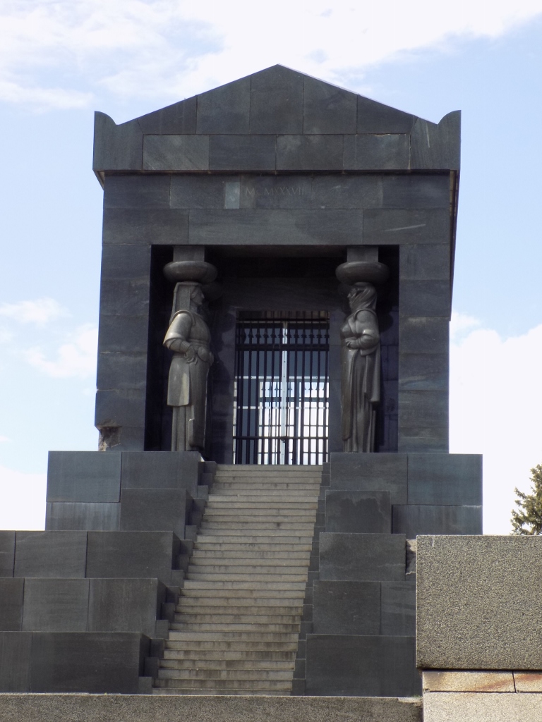
At the proposal of sculptor Ivan Meštrović, a decision was taken in 1932 to build a monument to the unknown hero on the highest point on Avala, at the level of 511 m, that would symbolise the gratitude to all those heroes who gave their life for the homeland and whose names are unknown. This is practically the Serbian counterpart of the French Tomb of the Unknown Soldier beneath the Arc de Triomphe in Paris. The French version is dedicated to the soldiers from WWI, while the Serbian version is dedicated to the soldiers from two Balkan Wars and from WWI.
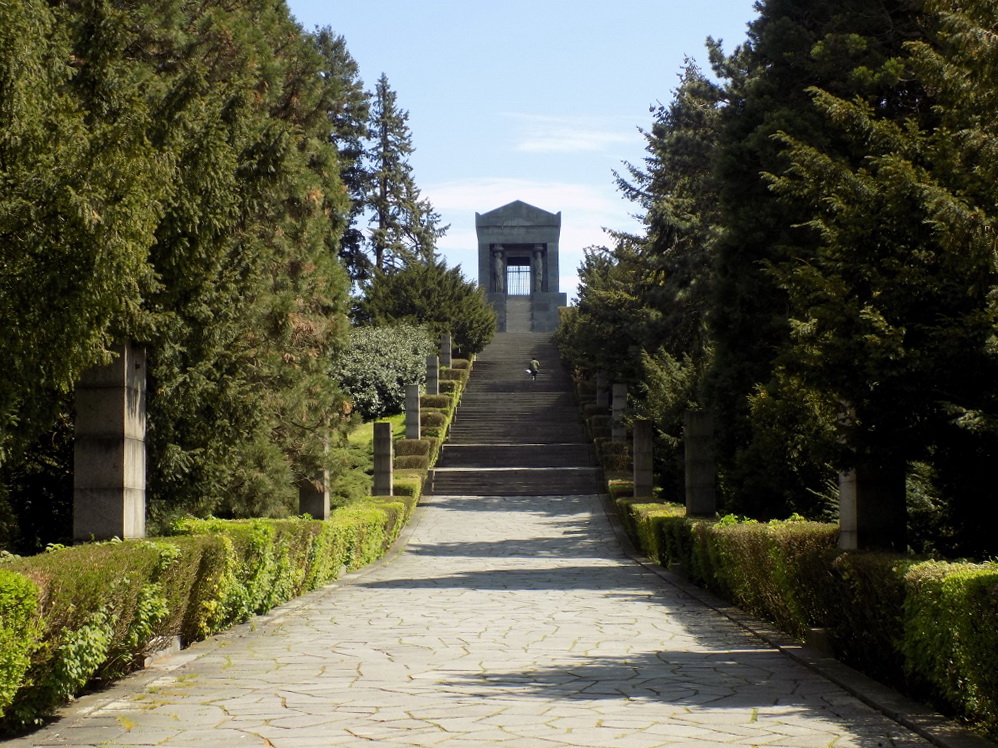 Access to the Monument to the Unknown Hero on Avala
 Access to the Monument to the Unknown Hero on Avala
The works on its construction began in 1934, but to start with the rather well preserved ruins of fortification Žrnov had to be blown up. The monument was completed in 1938.
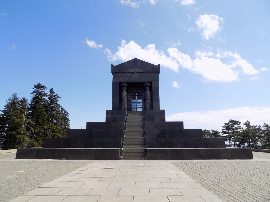 Monument to the Unknown Hero on Avala
The monument was made of the Jablanica gabbro, rock from Jablanica, a small place in Bosnia and Herzegovina. This place is particularly interesting for the readers of this story who come from the former Yugoslavia because it is precisely there that the bridge blown up during the Forth Enemy Offensive (Battle of the Neretva) is located.
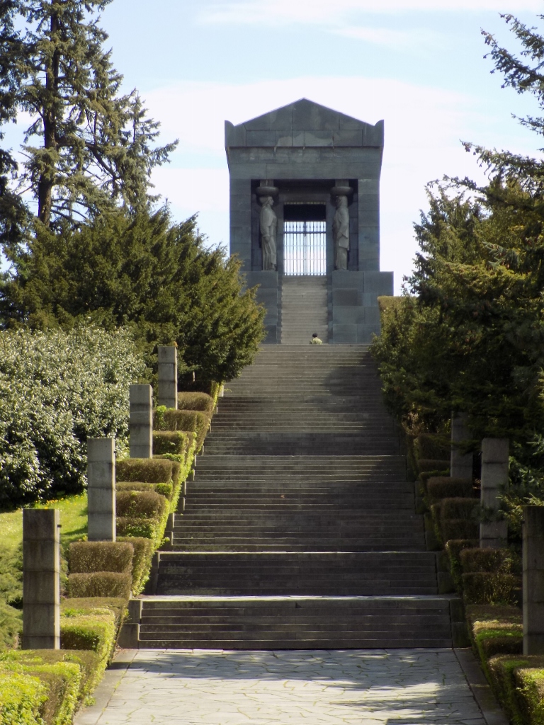
When I reached the plateau on which the monument is located, I first looked at my surroundings a little.
 Access to the Monument to the Unknown Hero
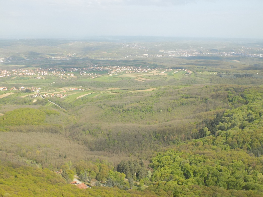
 West view from the top of Avala
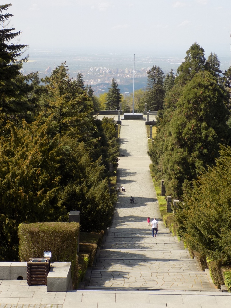
Then I made a circle around the monument before climbing up the stairs to the very top. The entrance side of the monument is positioned in such a way that it faces Belgrade, while the back side faces the central region of Šumadija.
 Monument to the Unknown Hero – entrance side
 Monument to the Unknown Hero – back side
The monument was partially damaged during WWII and this has mostly been rehabilitated, but a couple of damaged places have been left in order to show where the grenades hit the monument, without demolishing it.
 Monument to the Unknown Hero – back side
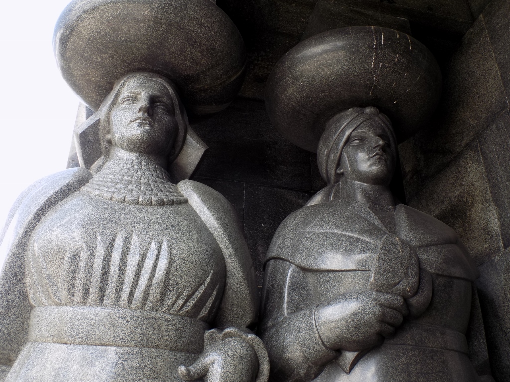
A part of the monument are eight caryatids, female figures made out of a single piece of rock each, shown as dressed in the national costumes from eight regions of the then Yugoslavia. Each caryatid weighs 15 tons.
 Monument to the Unknown Hero, a detail
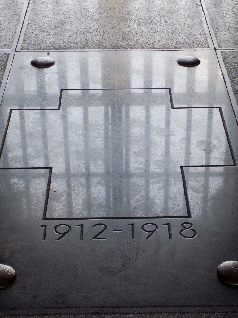
Within the mausoleum it can be seen that it is indeed dedicated to the unknown heroes from the two Balkan wars (in 1912 and in 1913), as well as from WWI (1914-1918).
 Monument to the Unknown Hero, a detail
From the top of the stairs that lead to the mausoleum there is a stunning view at the surroundings.
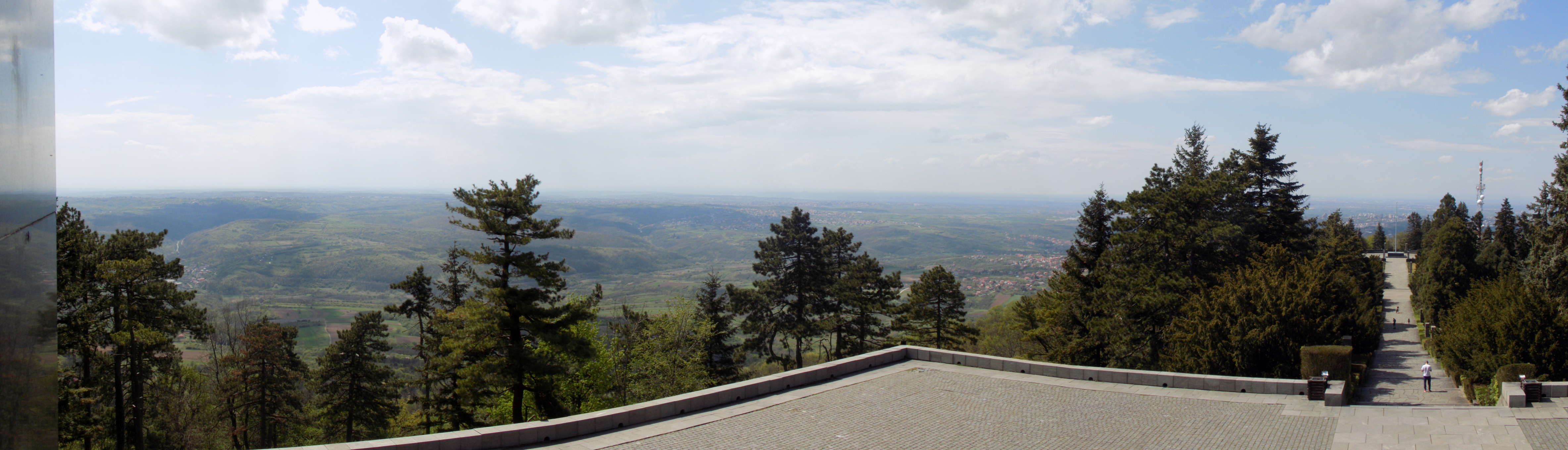 View from the top of the stairs at the monument
 Access to the monument as seen from the top of the stairs
I have already mentioned that this entire area around the top of Avala on which the Monument to the Unknown Hero is located is covered in evergreen trees and precisely this helped me out when finding my bearings during the climbing. What is interesting is that the evergreens planted here during the construction of the complex were a gift from Adolf Hitler (symbolic rapprochement after WWI) and the saplings came from the Botanical Garden in Munich.
From here there was also a splendid view at Avala Tower, but my plan was to get there later.
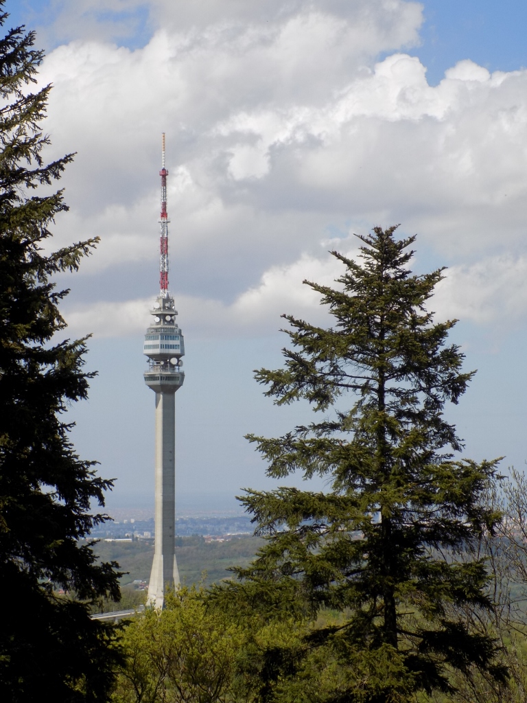 Avala Tower as seen from the top of the Monument to the Unknown Hero
For the time being I went down to hotel “Avala.” This is a hotel built in 1928 at the order of King Aleksandar Karađorđević.
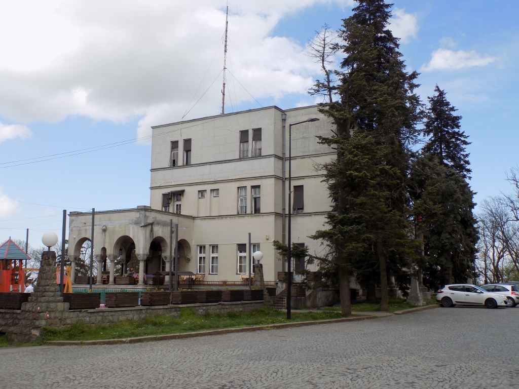 The “Avala” hotel
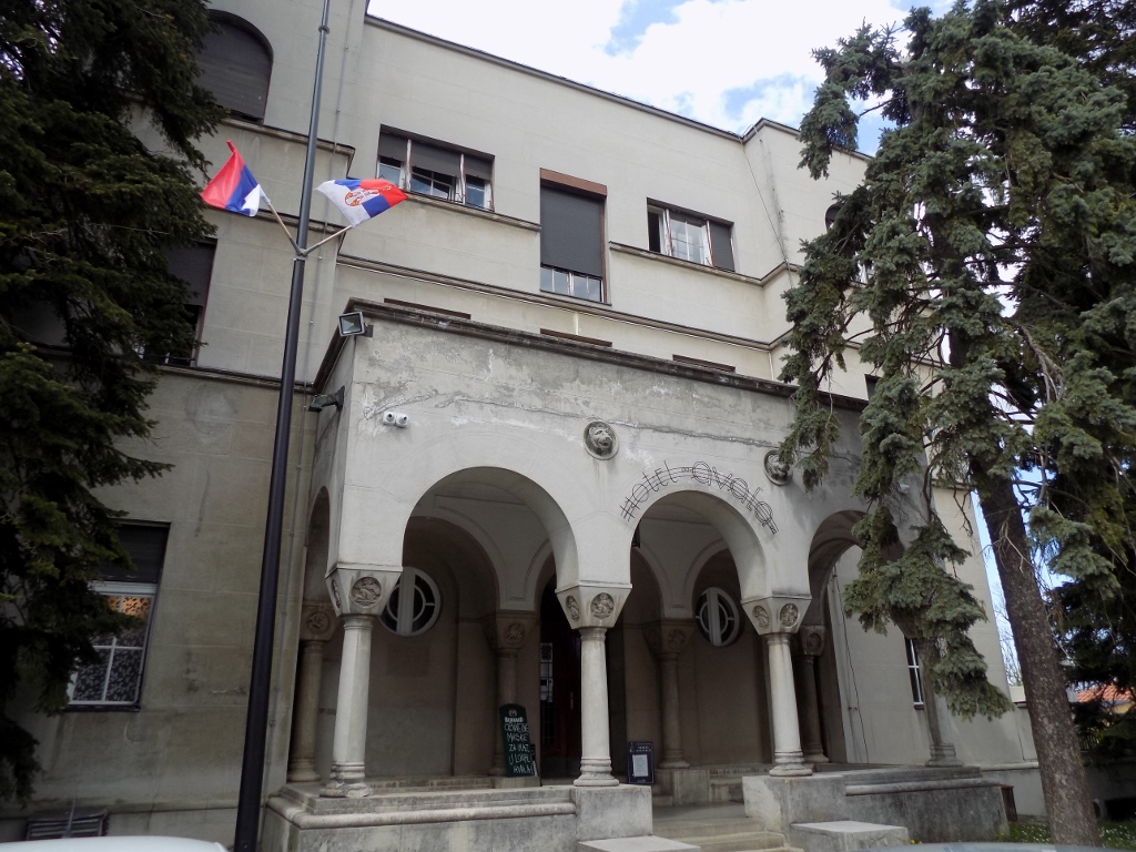 The “Avala” hotel, main entrance
Although it may be concluded by many details that the hotel has seen better days, it belongs to the structures of cultural and historic importance for Belgrade. Both at the main entrance and on the flanking sides, the “Avala” hotel has porches carried by pillars the capitals of which have decorations in the shape of mythical beings.
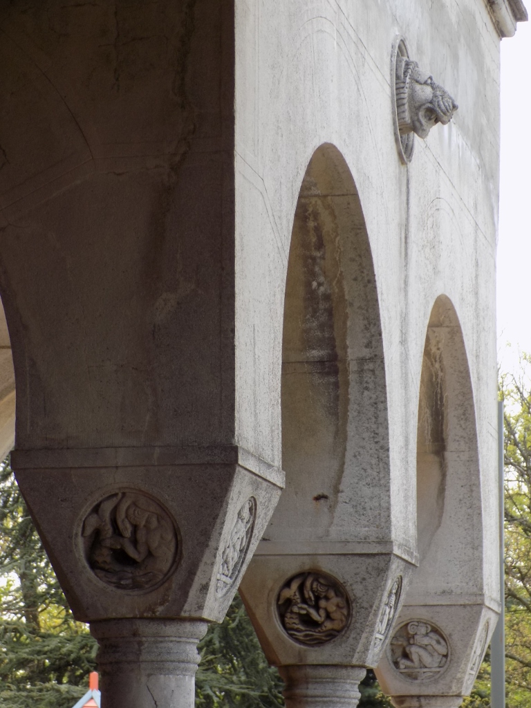 The “Avala” hotel, decoration details
To start with, I took a seat on the terrace in order to rest a little and drink something refreshing and there I was met by starogradska muzika (traditional music) which I quite enjoyed. After this fine break I went down to a spacious paved area from where there is an access staircase leading to the hotel. (By the way, the hotel and its terrace cannot be reached from this side and the visitor needs to use either the main entrance or the side entrances.)
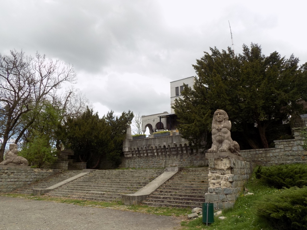 Access staircase of the “Avala” hotel
This staircase is decorated by two sphinxes, which is a part of the thematic decoration of the building.
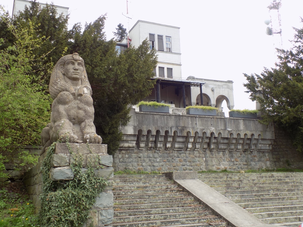 Sphinx at the access staircase of the “Avala” hotel
By the way, the spacious plateau in front of the access staircase includes a parking lot as well as a road that passes by. If one comes to Avala by car, there is a one-way road leading from the foot to the top, i.e., precisely to here in front of the “Avala” hotel from where the road continues, still as a one-way, down to the foot of the mountain following a different route.
From this point I started to walk down that asphalt road in the direction contrary to the one in which the rare vehicles I encountered moved. The reason was that I wanted to go down a little to the Monument to Soviet War Veterans.
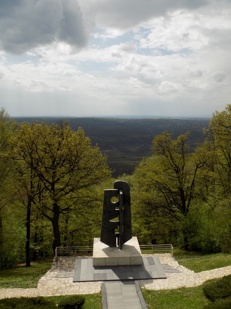 Monument to Soviet War Veterans, seen from the road
Namely, in WWII, on 20 October 1944, Belgrade was liberated by the Yugoslav partisans together with Red Army units. On 19 October 1964, a delegation of Soviet war veterans was coming to Belgrade to mark the 20th anniversary of the liberation, but unfortunately the plane crashed into Avala and all the passengers were killed, including the Marshal of the Soviet Union Biryuzov. I think it is particularly tragic that all the members of the military delegation took part in the liberation of Belgrade, surviving then, and yet they still got killed in Belgrade, 20 years later.
 Monument to Soviet War Veterans, view in the direction of the road
After I went down to the monument and took a couple of photos, I got back to the road and continued to walk down in the same direction as before. I descended to a very sharp curve and even a little farther.
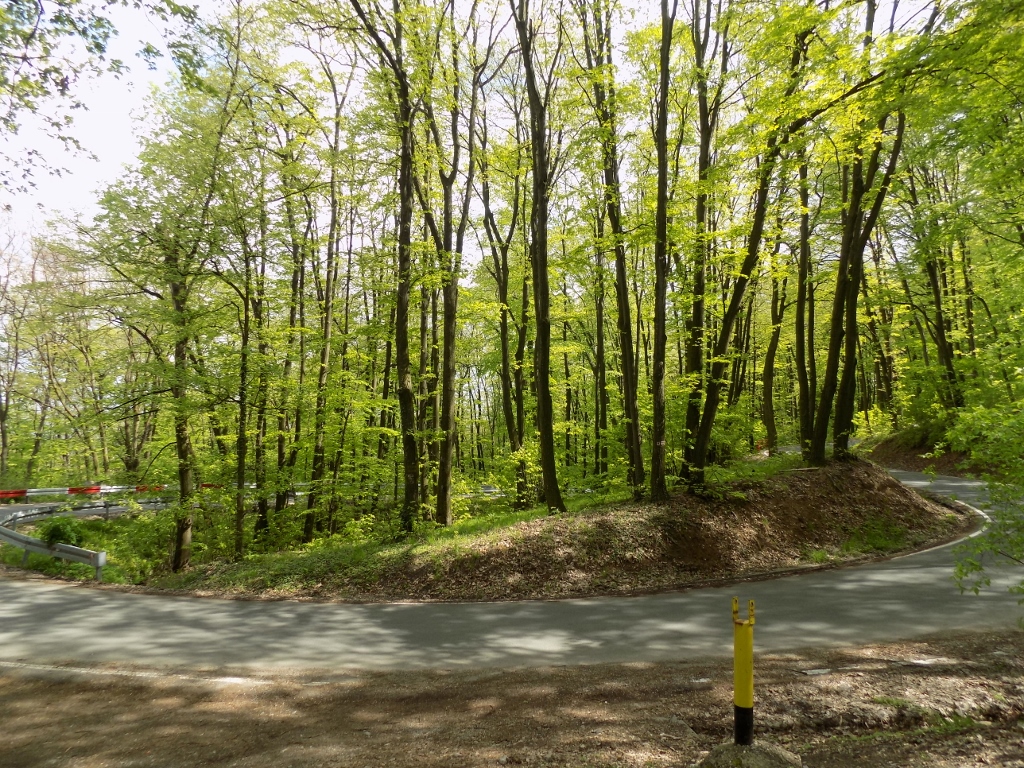 Very sharp curve on the road leading uphill
The reason for this descent was to get to the Roman mine shaft. This mine shaft is in fact from the 6th century CE and its existence reflects the very rich mining history of Avala and its surroundings. Different ores were mined here from around 2000 BCE to the 1970’s. I find it particularly interesting that until 1953 there was a lead and silver mine at the foot of Avala, while in the second half of the 20th century mercury was mined at a site some 3 km away from the top of Avala. There is even a mineral called avalite which is a type of illite.
Earlier there used to be a sign by the road showing the direction in which the Roman mine shaft was, but no such sign was there this time. Still, I managed to find a reasonably deep hole in the ground that was certainly not natural, but it was not fenced either. Very carefully I got as close as I deemed safe, taking a couple of photos and even waving my left hand in order to show the shadow. Well, the photo is nothing special, but the same could be said for the shaft as well. Still, I’m glad I got there.
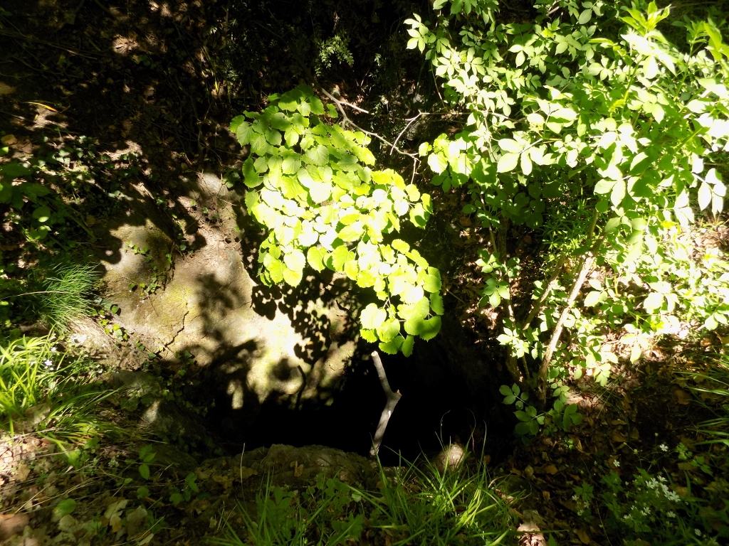 Roman mine shaft
After this, I could finally head for Avala Tower, but I did it by following a dirt path through the woods after the sharp curve in order not to walk along the asphalt road again, because it would basically be boring. Walking through the woods is certainly much more interesting.
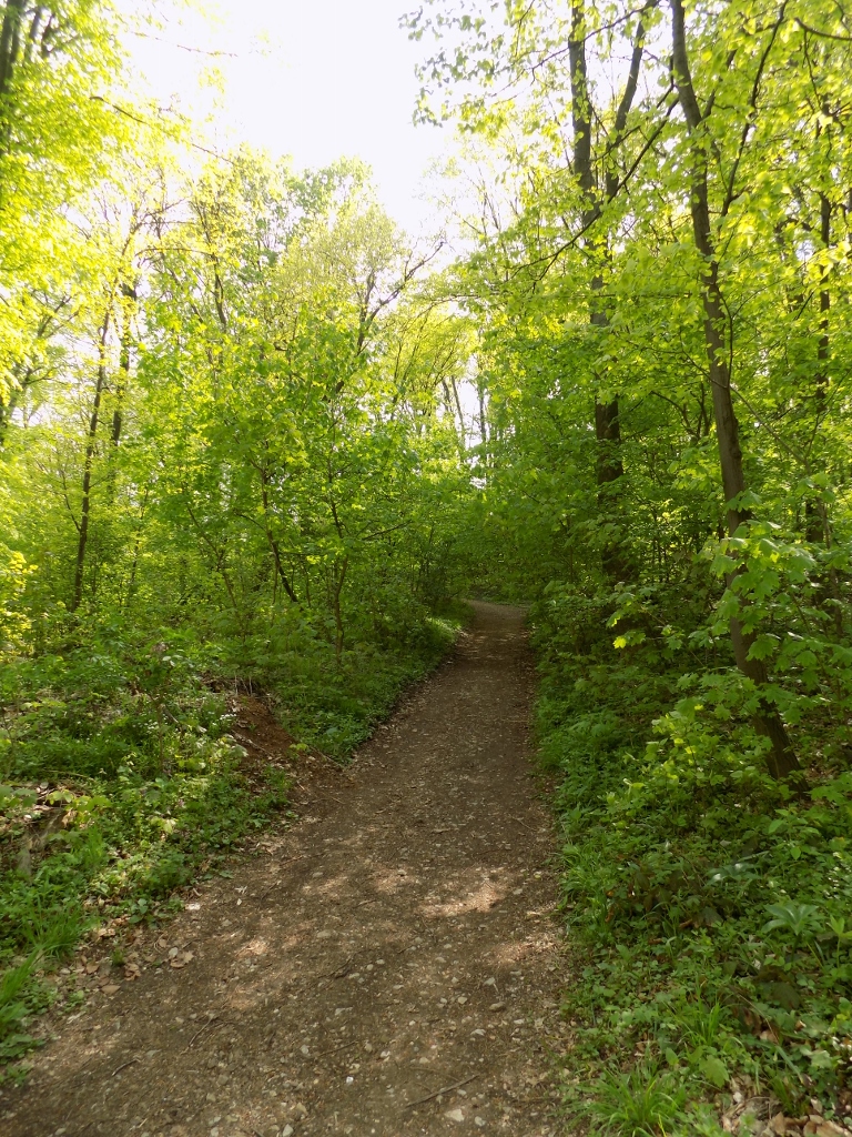 Following a path to the top again
And I was right. Very soon I came across several violas that usually blossom at the end of winter and the beginning of spring, while this was all happening at the end of April.
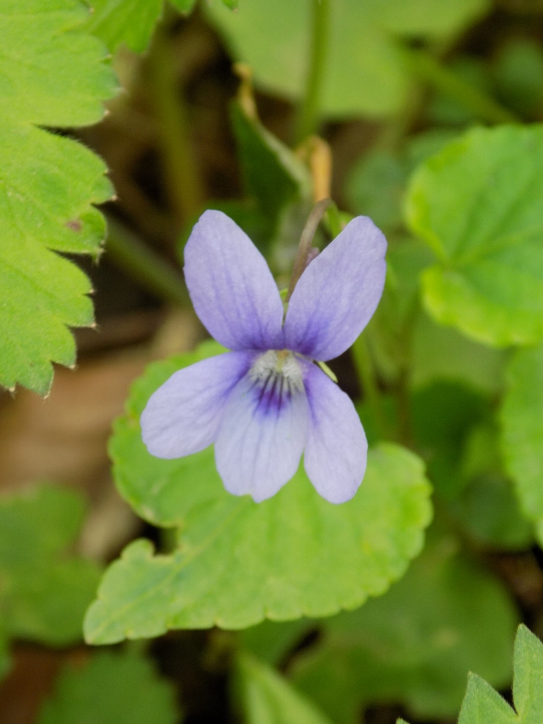 Viola
Viola
I also saw a very greedy bumblebee that just kept flying from one flower to the next and it was heavier than the plants it landed on, so they bent and I could not get a better photo.
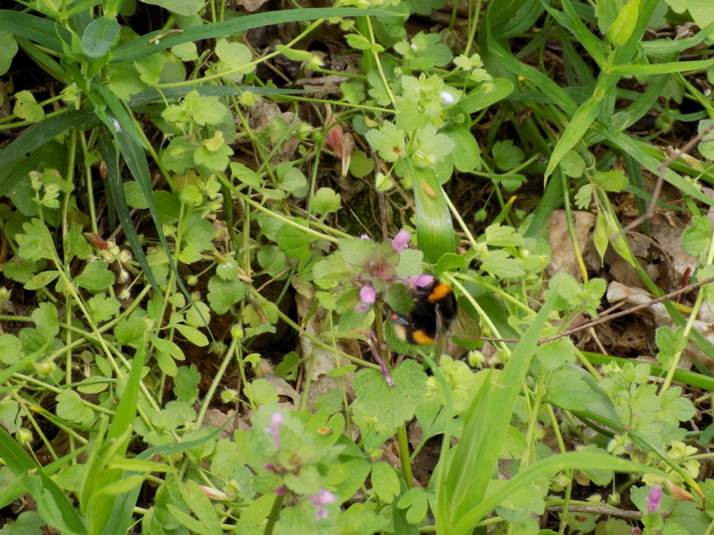 Bumblebee
When I reached the asphalt path leading around the top with the Monument to the Unknown Hero I finally succeeded in noticing a bird in a treetop. It was a common blackbird (Turdus merula). I even managed to take a photo of it from two angles.
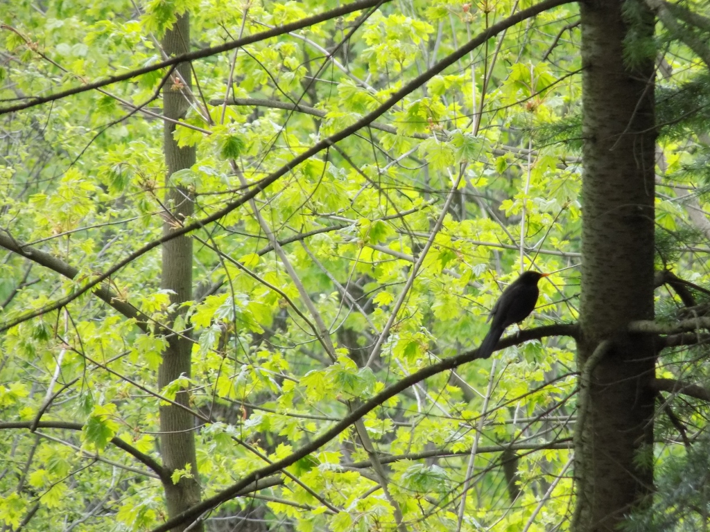 Common blackbird in a treetop
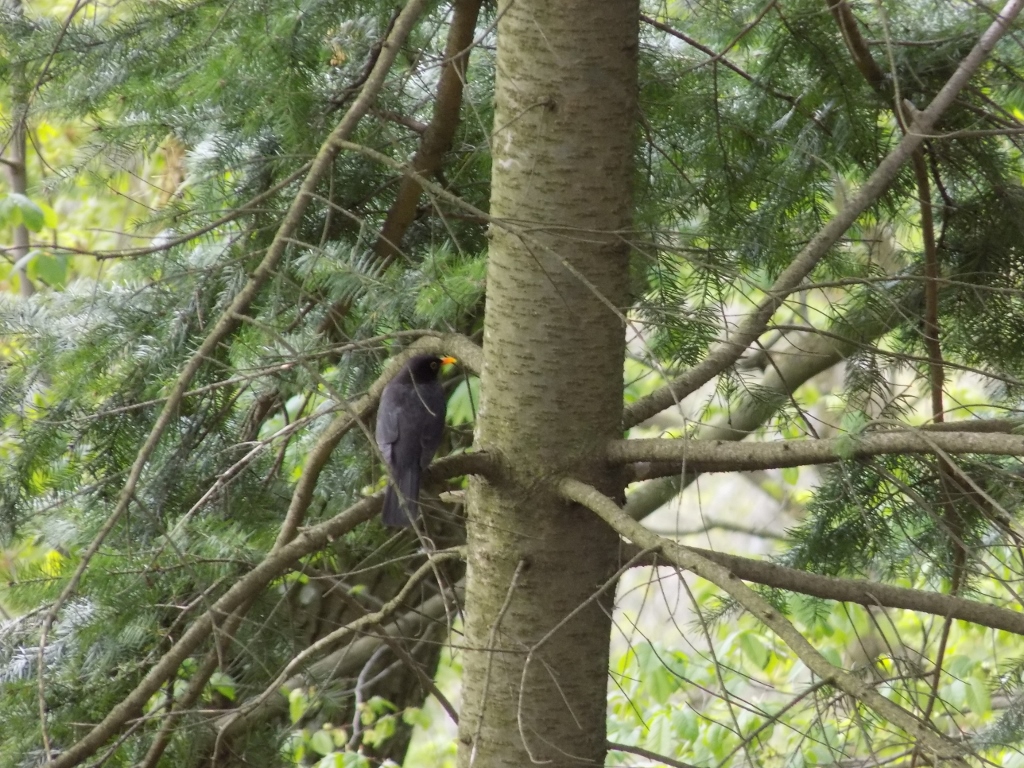 Common blackbird in a treetop
When I started to go down from the top of Avala towards the Tower, I decided to make a break at one of the numerous wooden tables with benches in order to have lunch. Like I used to do when I was a proper hiker way back when, I brought some food from home and I was particularly content with my home-made apricot juice I made last summer.
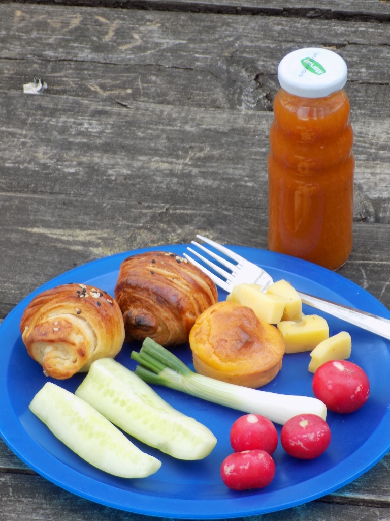 Hiker’s lunch
While I was eating there some ants appeared, so I threw them some crumbs. One ant was particularly ambitious.
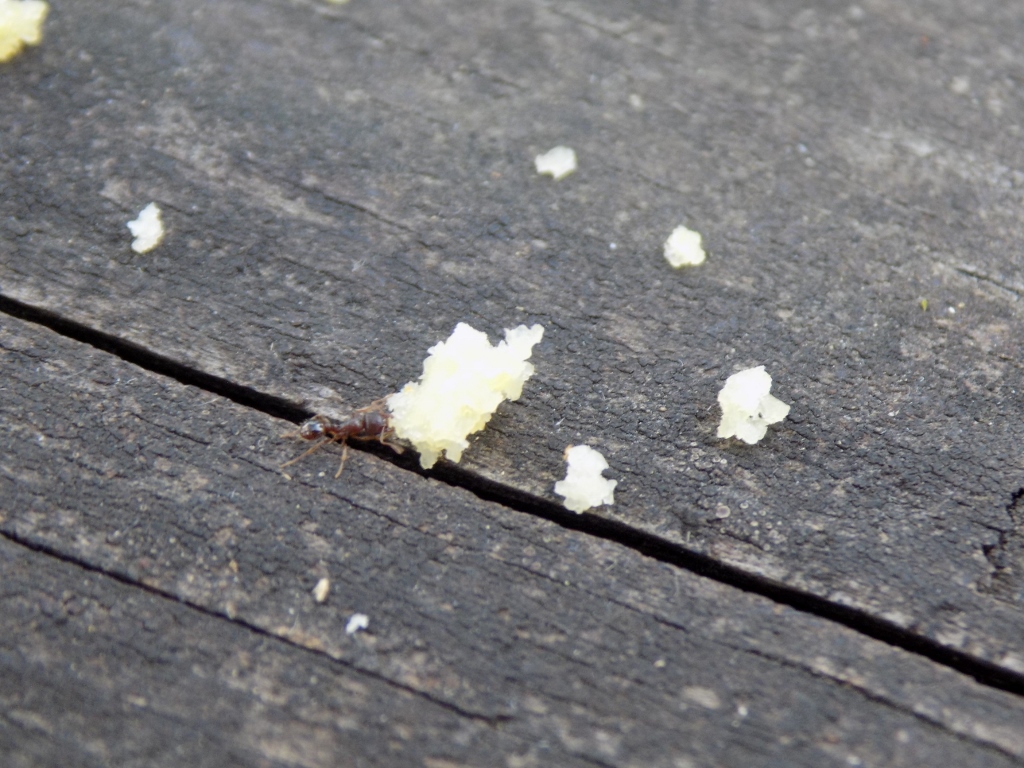 Ambitious ant
After my lovely lunch, I walked to the nearby wooden church that has been built very recently – it was founded in 2017.
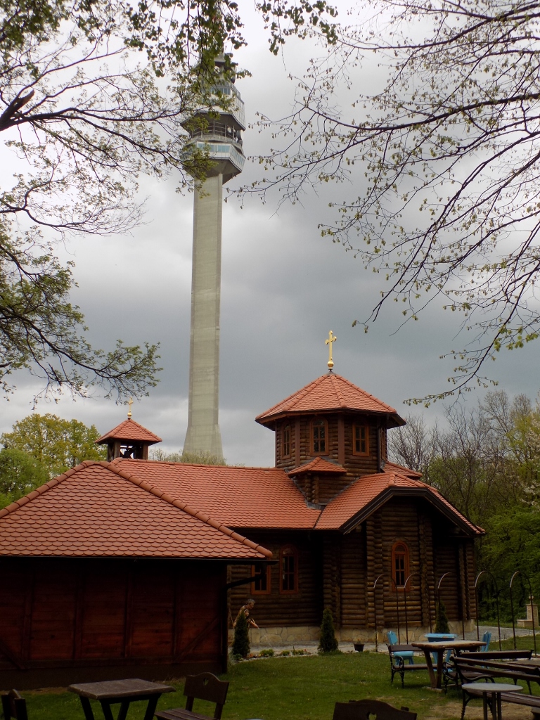 Wooden church and Avala Tower
The church is dedicated to Saint Stephen the Serbian Despot (Despot Stefan Lazarević) who made Belgrade the capital of Serbia in 1405.
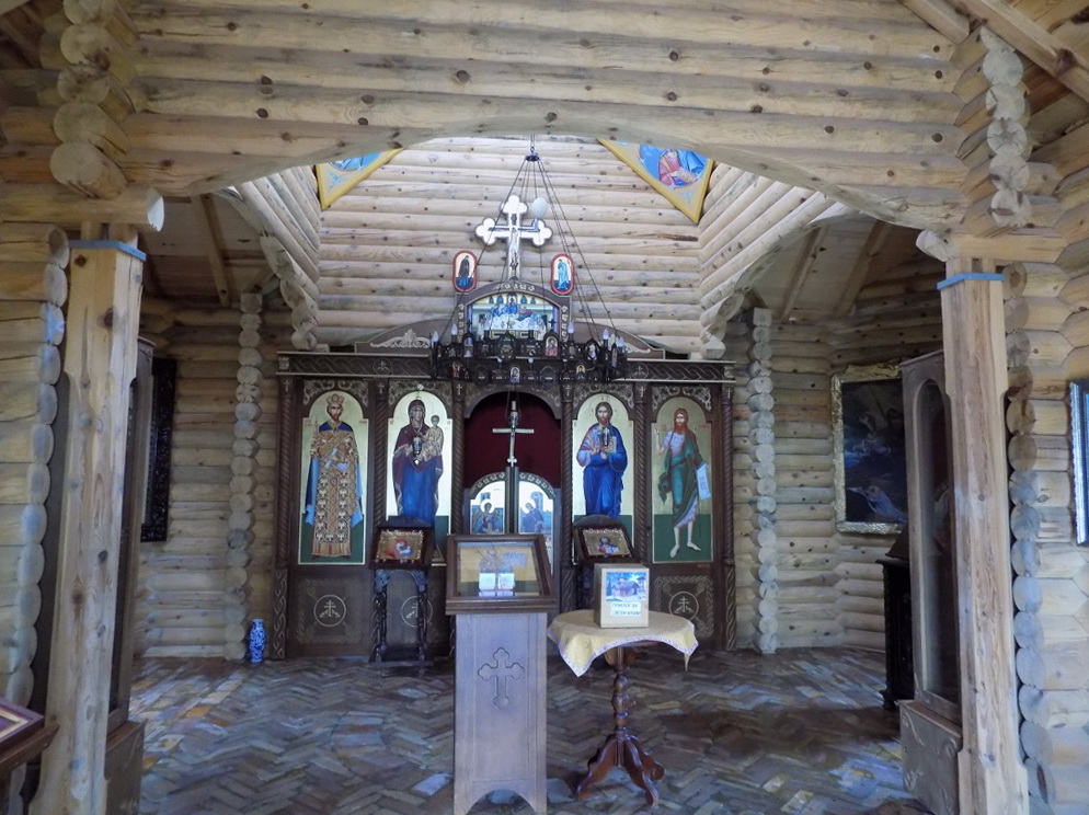 Church of Saint Stephen the Serbian Despot
From here I wanted to go to a spring and I did go eventually, but first I have to say that when I planned my visits here, the map showed two places marked by the same name. One was very close to the road, but this one is not the right one. In reality the spring is significantly lower on the western slope of Avala. On the other hand, there is a paved path from the picnic area near the church that connects the foot of Avala and the top, so I started to walk down that path. After some 20 minutes I reached the place I wanted and that was Sakinac spring.
 Sakinac spring
 Sakinac spring
The spring is often called Vajfertov izvor (Weifert’s spring) after Đorđe Vajfert (Georg Weifert) (1850-1937), Serbian industrialist of German origin. He was also the Governor of the National Bank (his image may be seen nowadays on the 1000 dinar bill) and the founder of modern mining sector in Serbia, while he and his father also founded the first brewery in the Kingdom of Serbia. What links Đorđe Vajfert and this spring is that it was precisely the water from this spring that was used at his beer factory.
Although people drink water from this spring today as well, according to what I have read, the water is no longer good for daily intake on account of an increased content of chromium of natural origin. Nothing will happen if one drinks water from here, but this should certainly not be done over a longer period of time.
Since I got to the spring and took photos here, I started to climb up again following the paved path, for I was already quite tired and did not want to lose my way. The next destination was Avala Tower.
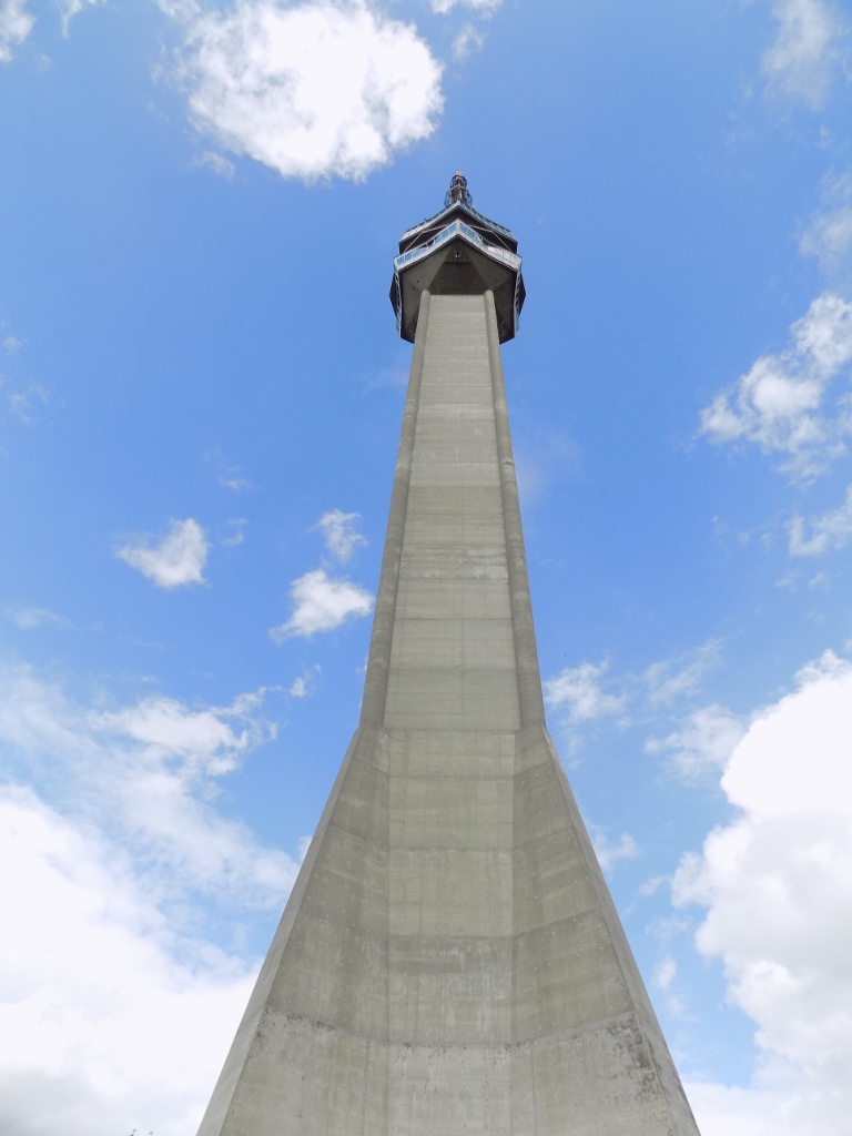
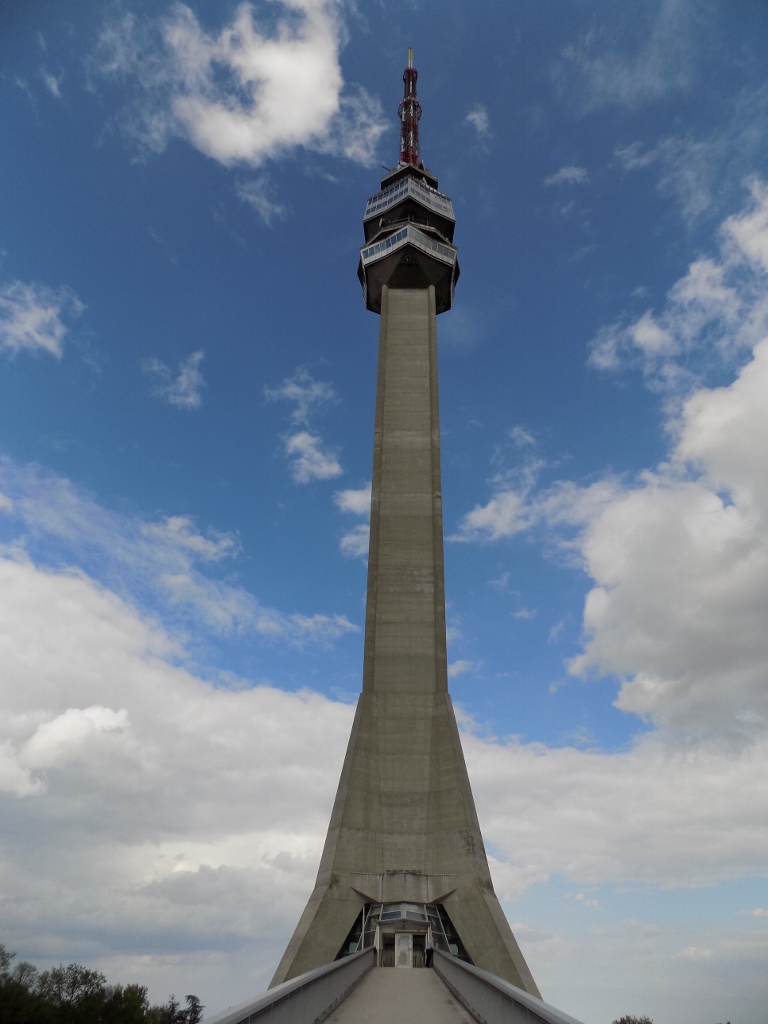 Avala Tower
The construction of the tower started in 1961 and its use began in 1965. In terms of civil engineering, Avala Tower was very interesting and according to some criteria unique in the world at the time. It was originally planned for the needs of PTT (Postal, Telephone & Telegraph), but soon its primary function was linked to television. It used to be 207 m high and there was a restaurant with a viewpoint high up and the first time I came here was with my parents and my brother a very long time ago.
In April 1999, during the NATO bombing of Serbia, among other things the NATO destroyed this tower as well, allegedly because it served for the “regime’s propaganda.” I can only say that the TV broadcasting in Serbia continued regardless of the non-existence of the tower, but an almost unexpectedly large number of people were particularly disturbed by the demolishing of this structure. It used to be a part of our life for decades and whoever travelled by motorway from the direction of Niš to Belgrade knew they had reached their destination once the tower was in sight. Afterwards there was one more uphill section and then a broad view at all of Belgrade.
Because of this, intensive national joy accompanied the reconstruction of the tower which is slightly lower (2.5 m) than the original and which was formally opened on 23 October 2009. The new tower also has a viewpoint and a restaurant.
In order to get to the top of the tower, one should go along some access ramps (after one had bought the ticket). From there, I had a lovely view at the top of Avala with the Monument to the Unknown Hero.
 View at the top of Avala
 View at the top of Avala
I have already mentioned that the Monument to the Unknown Hero is situated at the top of Avala, 511 m a.s.l., while Avala Tower was built somewhat lower, at the altitude of 439 m a.s.l.
I took a lift up to the viewpoint and made a circle there.
 East view
 Dense forest at the foot of the tower
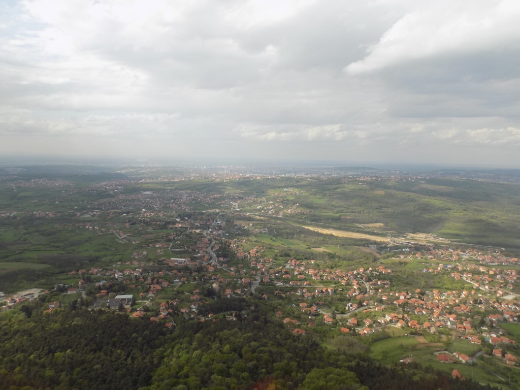 North view, i.e., view towards Belgrade
Then I went down by the same lift, looking back at the tower once again.
 Avala Tower
And here I completed my daily excursion. The only thing left for me to do was to walk down to the mountain lodge “Čarapića brest” for that was where my car was parked, but by this time I felt quite confident about my sense of orientation in space. Still, I did not want to experiment too much, so I walked a little down the asphalt road and a little down a path through the forest. While I was still on the asphalt road I encountered yet another interesting local resident. It was a species of beetle (Morimus funereus).
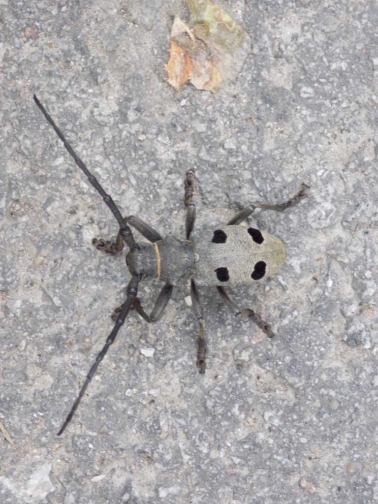 Morimus funereus
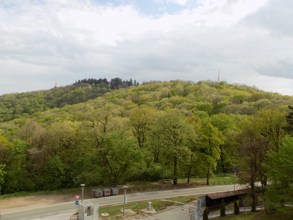
Soon I reached my car and it was only when I got in that I realised how exhausted I was. Still, it was an easy thing to drive and when I got home I looked from my balcony once again at Avala where I had walked so nicely on this day.
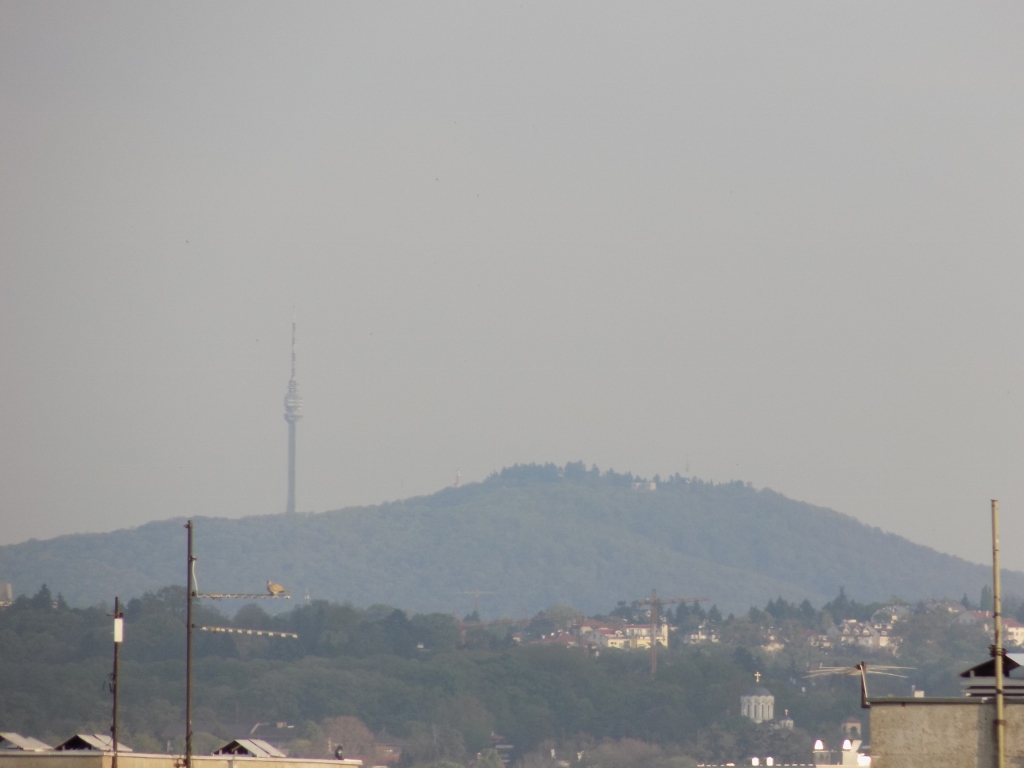 View at Avala from my balcony