After we drove northwards from Zaječar to Kladovo, my parents and I turned left when we reached this little town on the banks of the Danube and continued with our trip following the valley of the second-longest European river upstream.
In this section of the Danube’s course, the other bank belongs to Romania and not far from the town of Kladovo there is a large hydroelectric power station shared by these two neighbouring countries.
Some 30 km farther, near Tekija village, right on the right-hand side of the road leading to Golubac, there is a monument to Koča Anđelković designed by a well-known and prolific Serbian architect Momir Korunović. On the monument there is an inscription which says: “In this place, in 1788, fighting for the freedom of the Serbian nation, the first herald of the freedom after centuries-long subjugation Captain Koča Anđelković and his comrades were impaled by stake.”
Namely, during the Austro-Turkish War (1788-1791), Serbian volunteers who fought on the side of the Austrians were led by Koča Anđelković. Because of his success and bravery, the Austrian Emperor Joseph II gave him the rank of a captain and for this reason this historic character is also known as Koča the Captain or Captain Koča. It was after him that the Serbian territory liberated during this war was called “Kočina krajina” (Koča’s krajina, krajina meaning the frontier territory), taking into account that he actually founded this territory and managed it until his death.
However, in autumn of 1788 the Turks caught him and took him to Tekija where they first tortured him and then in November they also impaled him by a stake, along with some thirty of his comrades-in-arms. Impalement was a particularly torturous version of killing prisoners and on the Serbian territories this was used by the Ottomans primarily as a form of intimidation and for discouraging any relapsing by others.
In any case, it is believed that the venue where the impalement took place was precisely here where this monument is. On the other hand, regardless of the gruesome death, the legacy of Koča Anđelković and Kočina krajina is huge in the Serbian history, for this led the way for Karađorđe, the leader of the First Serbian Uprising (1804-1813), which initiated the process of the final liberation of Serbia from the Ottomans.
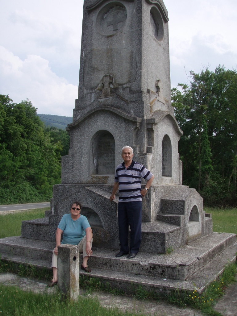 My parents by the monument to Koča Anđelković
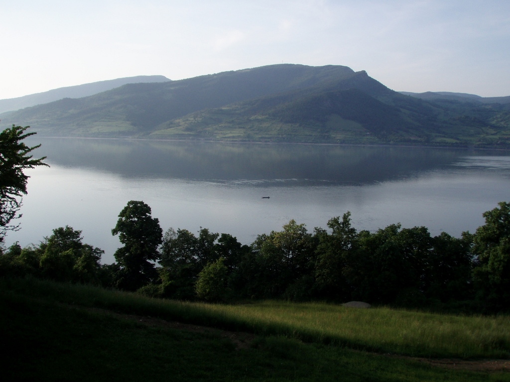
A few kilometres farther, there is again a nice place by the road where one needs to make a stop, but for a completely different reason. Namely, this is a very good viewpoint from which one can see a part of the Iron Gates gorge called Kazan.
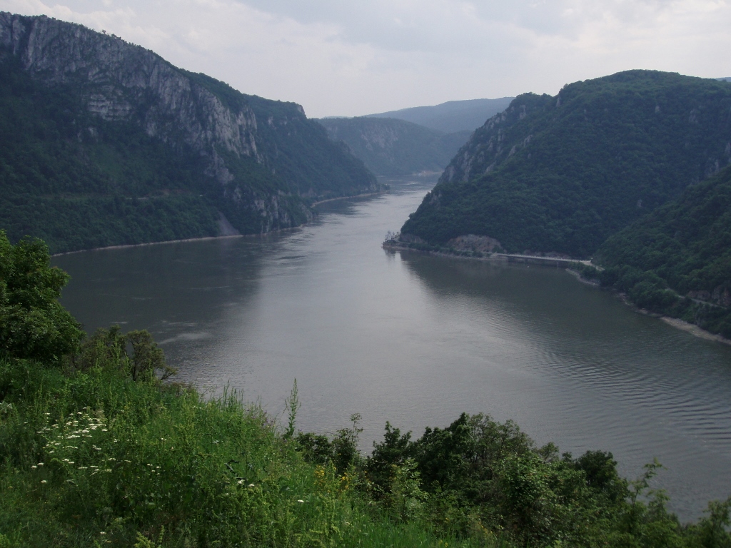 Iron Gates gorge
The Danube has been flowing along this way for thousands of years, but until the construction of the Iron Gate I Hydroelectric Power Station (begun in 1964 and finished in 1972), it was significantly shallower here and what can be seen now in this gorge is one big reservoir.
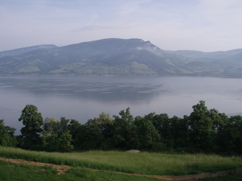
If you look at the details more closely, on the very bank on the Romanian side, you can see Mraconia Monastery.
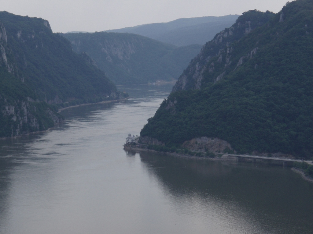 Mraconia Monastery on the Romanian side
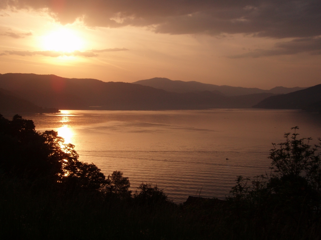
After this stop at the viewpoint, we continued to Donji Milanovac, more accurately to a local hotel beside the Danube. We took the rooms there and after an early dinner my parents were already set to go to bed since they were rather tired bearing in mind that they were in their seventies at the time. Still, we agreed to be all together in one room while it was still the daytime so that they would not fall asleep too early (especially my dad), so we first chatted a little and then they watched TV, while I was taking photos of the Danube and the sights I could see from the balcony.
 The Danube in Donji Milanovac
The following morning I took a photo of the same sight, right across the room, which I had taken a photo of the evening before and that was a picture of the Danube and hills on the Romanian side. Looking at my photos I found it interesting to see this with two different lights.
 The Danube near Donji Milanovac at dusk
 The Danube near Donji Milanovac in the morning
After an early breakfast, we got into the car and some 15 km later we got off the main road in order to visit a very important archaeological site – Lepenski vir. We were a bit early, so we had to wait a little for the place to open, but the advantage was that it was May, early in the morning and thus we were the only ones coming for the visit at the time. Again, apart from our voices there were only the sounds of birds.
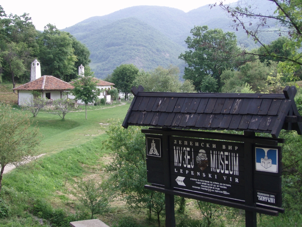 Access to the Lepenski vir site
At the very entrance there is a small ethno-park in the shape of a few houses that represent an example of the traditional architecture, which can be seen in the photo above. In this section of the site it can also be seen that it is located right next to the Danube, while on the other side, quite close, there is Romania.
In order to get to the archaeological site itself from this ethno-park, one needs to follow a nice, wide path that leads in-between dense greenery.
Lepenski vir is one of the biggest and most important prehistoric sites from the Mesolithic and Neolithic periods, that is, it covers the period from around 9500 BCE to around 5500 BCE. This is also the oldest, i.e., the first planned settlement in Europe.
The site was discovered in 1960 and to date seven successive settlements and over one hundred structures, both residential and sacral, have been found. In addition, stone sculptures with human and animal images, tombs and different small objects made of stone and deer antlers have also been found.
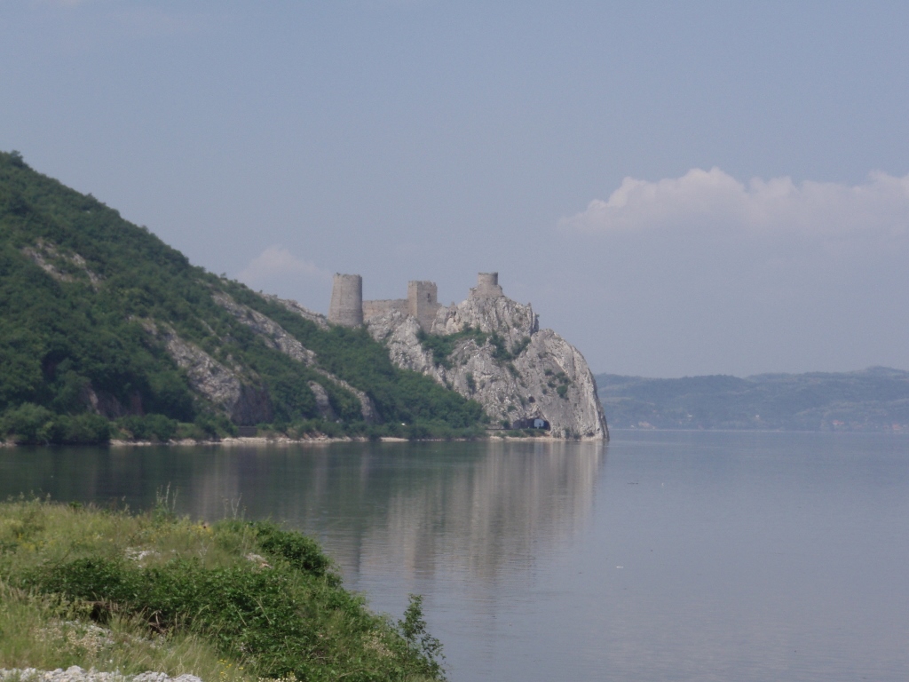
Also, this culture did not exist only in one place, but rather it covered a wider area, both on the present-day Serbian and Romanian sides. Moreover, on the Romanian side there is cliff Treskavac which was a holy mountain and the guardian of this particular settlement. It has been established that over a short period of time during spring the Sun rises exactly behind this cliff in relation to the original place where the settlement was first discovered (it was moved during the 1970’s owing to the forming of the reservoir), which facilitated the establishing of the beginning of the period of warm weather.
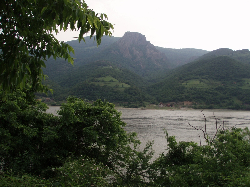 The Danube which in this section makes the border between Serbia and Romania, and cliff Treskavac on the Romanian side
When my parents and I came here in 2006, the site was well protected from atmospheric influence by a special structure and visitors could walk along wooden platforms over some parts of the site in order to see them better. However, in the meantime (in 2010), a new glass roof was installed and Lepenski vir now has a more upscale appearance.
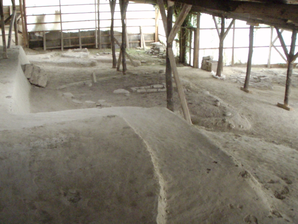 Lepenski vir in 2006
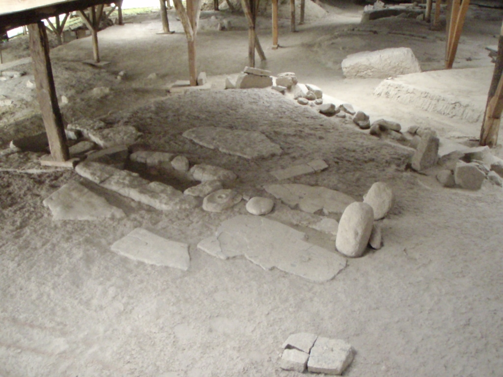 Lepenski vir in 2006
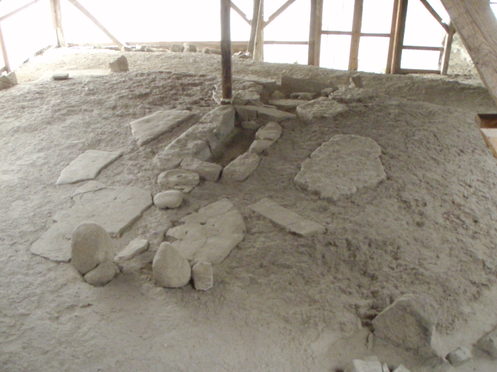 Lepenski vir in 2006
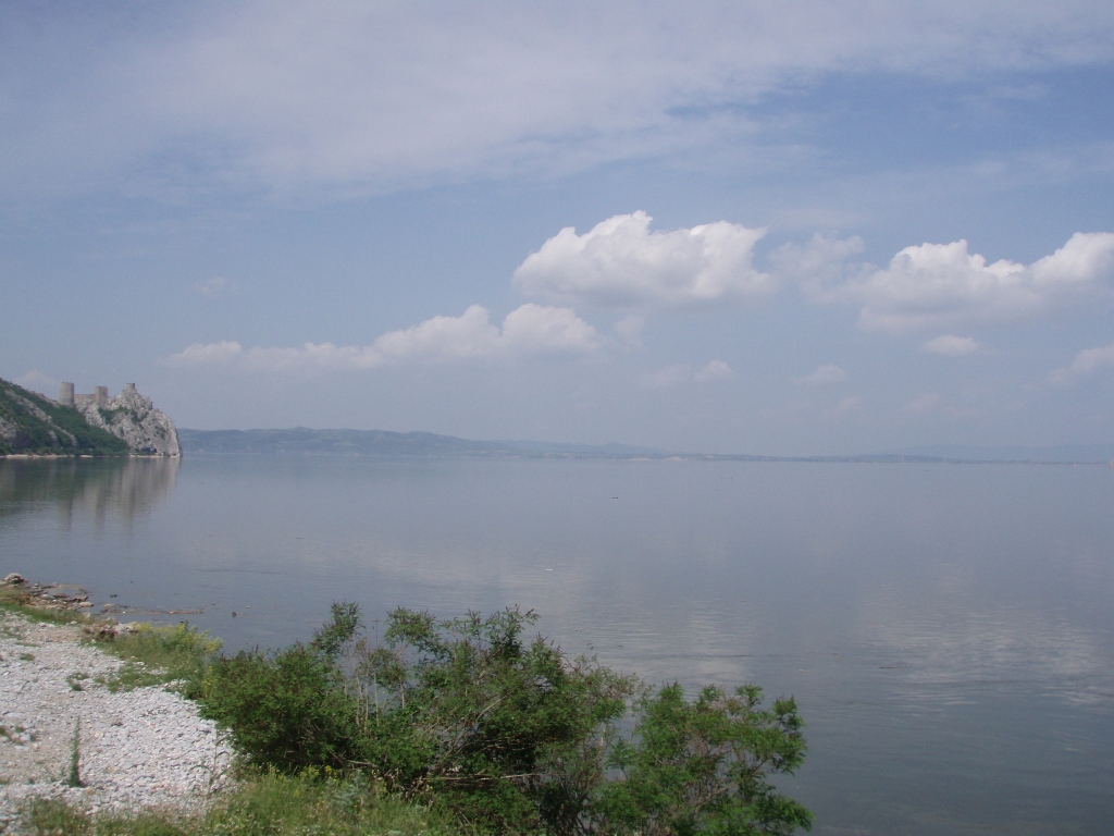
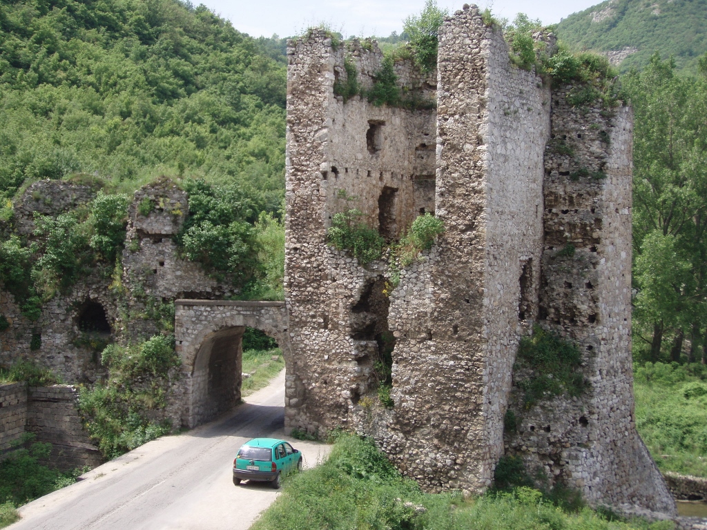
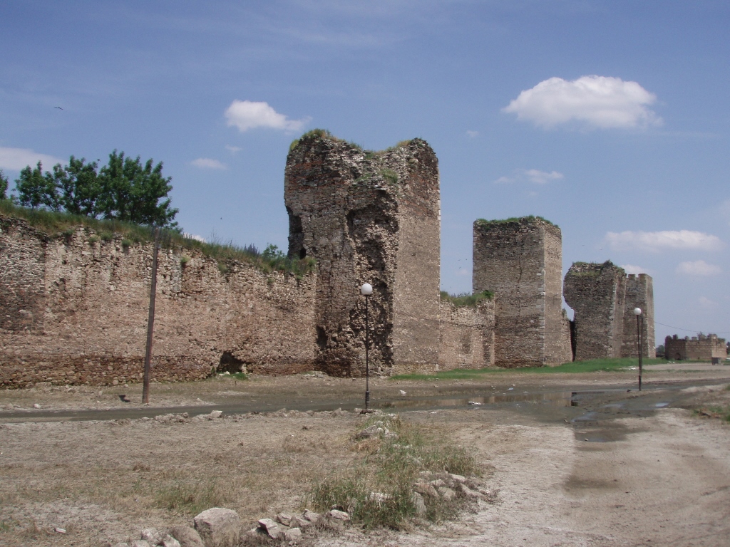
Some 40 km farther up the Danube, one gets to the fortress of Golubac which rises above the Danube.
 Golubac fortress
To start with, the Danube is incredibly wide here (I guess it is getting ready here before entering the narrow Iron Gates gorge) and the distance between its two banks in this location is around 5 km!
 Golubac fortress (left) and just one part of the Danube
While we were standing here at the riverbank admiring the width of the Danube, my dad drew my attention to a large white rock that rises from the river and is located a little farther on the Romanian side. The rock is called “Baba-kaj” and it is, like the name of the fortress, linked to a legend. To start with, Golubac fortress has different names in several languages, but in each version the base of the name consists of a word that means – a pigeon (golub in Serbian). As for the legend (which certainly dates back from the period after the construction of the fortress), it says that a very beautiful girl used to live here and her name was Golubana. The rumours about her beauty spread and a Turkish pasha wanted to have her in his harem. She refused and as a punishment he chained her to the rock that protrudes from the Danube in order for her to repent, but then she died there. Apparently (according to the legend), “Baba-kaj” means “repent” in Turkish and thus the rock was named after this, while the fortress got its name after the girl.
If you look more closely at the first photo showing Golubac, you will see that the road leads through a tunnel made through the cliff on top of which there are walls and towers of this fortress. That tunnel can also be partially seen in the photo below.
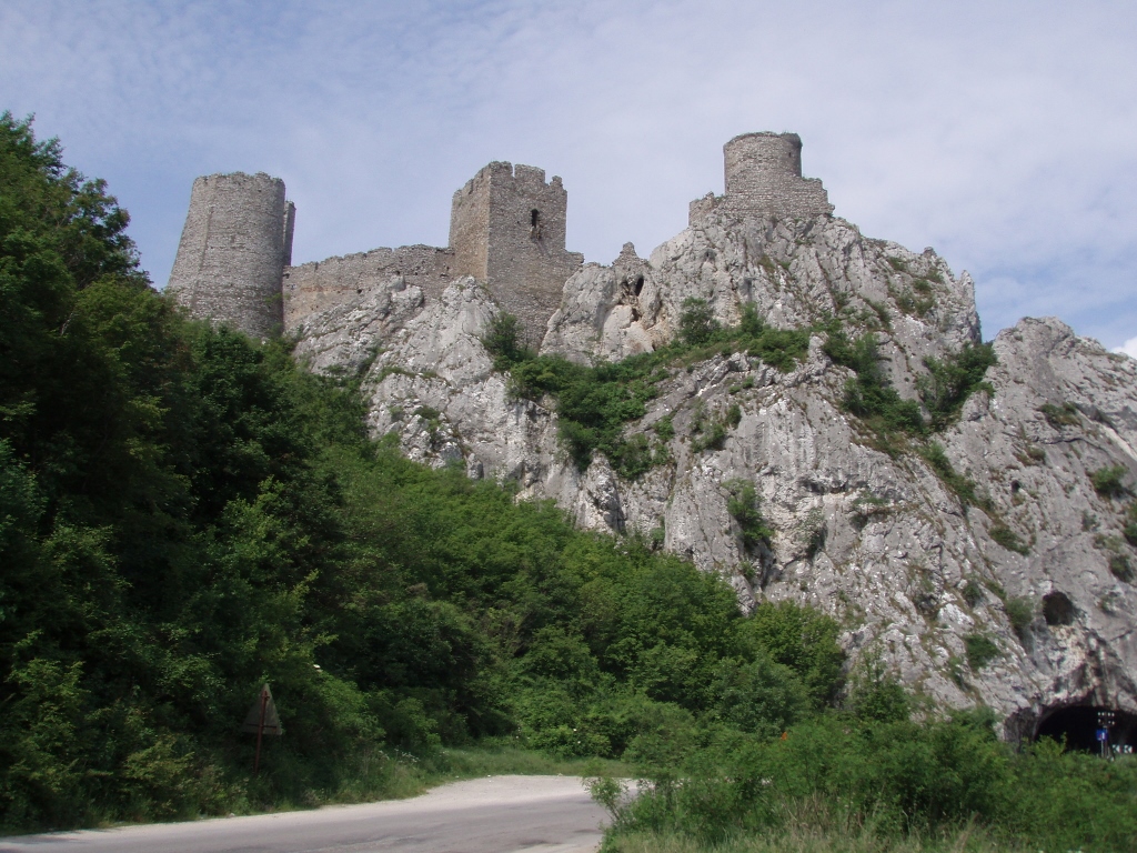 Golubac fortress, in 2006
Although there was a settlement in this place already at the time of the ancient Romans, the medieval fortress was built here in the 14th century. It was used by different conquerors and it was finally liberated in 1867 during the reign of Prince Mihailo Obrenović.
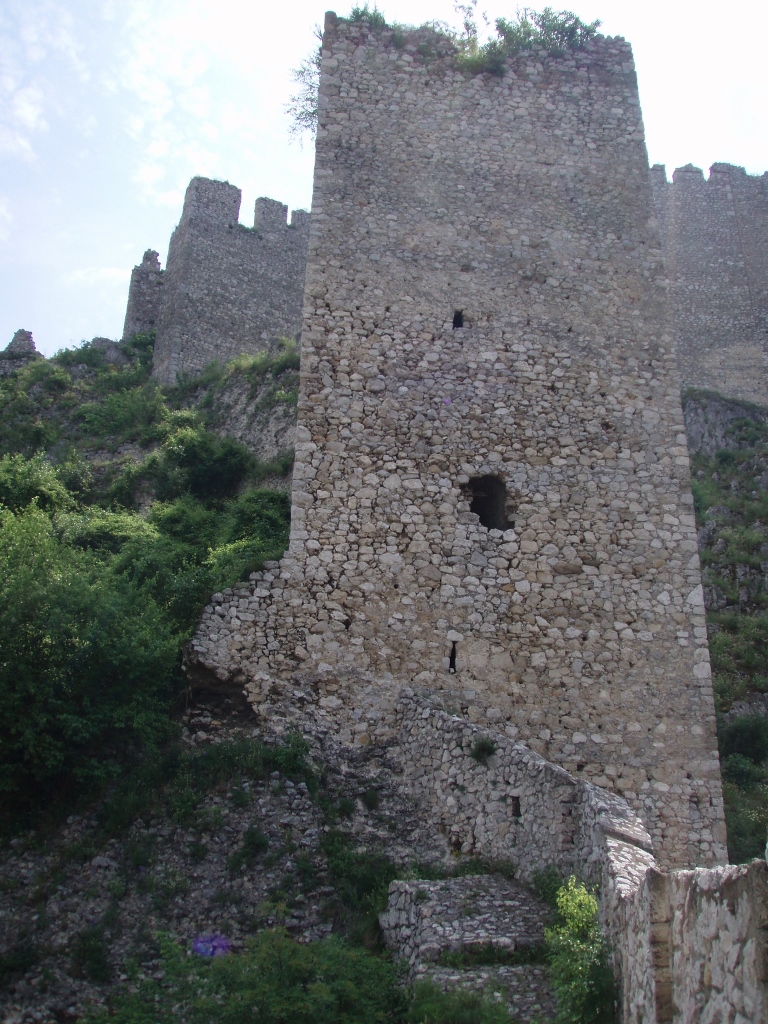
The fortress includes 10 towers and has two cart gates that were also used for the passage of the asphalt road.
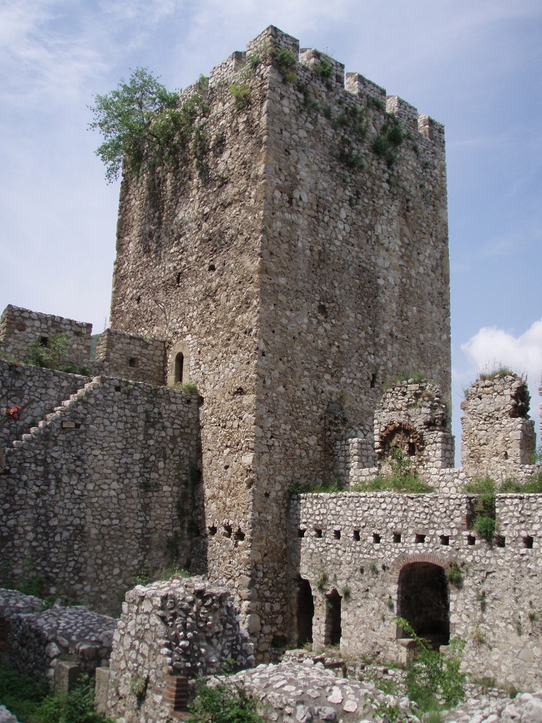 Golubac fortress, in 2006, a detail
 Golubac fortress, in 2006, a detail
 Golubac fortress, in 2006, a detail with one of the gates
 Golubac fortress, in 2006, a detail
In the caption of the photographs, I emphasised that they were taken in 2006, since in the meantime the fortress has been renovated and it is now in a much better shape, while that project was completed in 2019. According to what I have read, the asphalt road now no longer runs under the fortress, but rather a new tunnel has been made for the passage of vehicles. In other words, I’d better go to Golubac again.
After our stop at Golubac, we continued to Požarevac. Namely, my dad wanted to visit the grave of Slobodan Milošević, the former President of Serbia and the FR Yugoslavia, since he had been buried here at the property which the family Milošević has in Požarevac. Personally, I could not be less interested in politics and more neutral, but the wish of my father was enough for me. However, when we got to Požarevac we encountered certain problems. Needless to say, there are no info-boards around the town pointing to the house of the family of Slobodan Milošević, so we had to make stops and ask passers-by. As it would turn out, at first we mostly came across those who apparently were not keen on the former president and who thought it would be good fun to give us wrong instructions and send us on a wild goose chase. Still, with patience and perseverance, in the end we managed to find what we wanted and my dad was content.
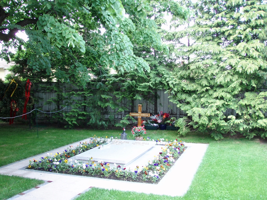 Grave of Slobodan Milošević
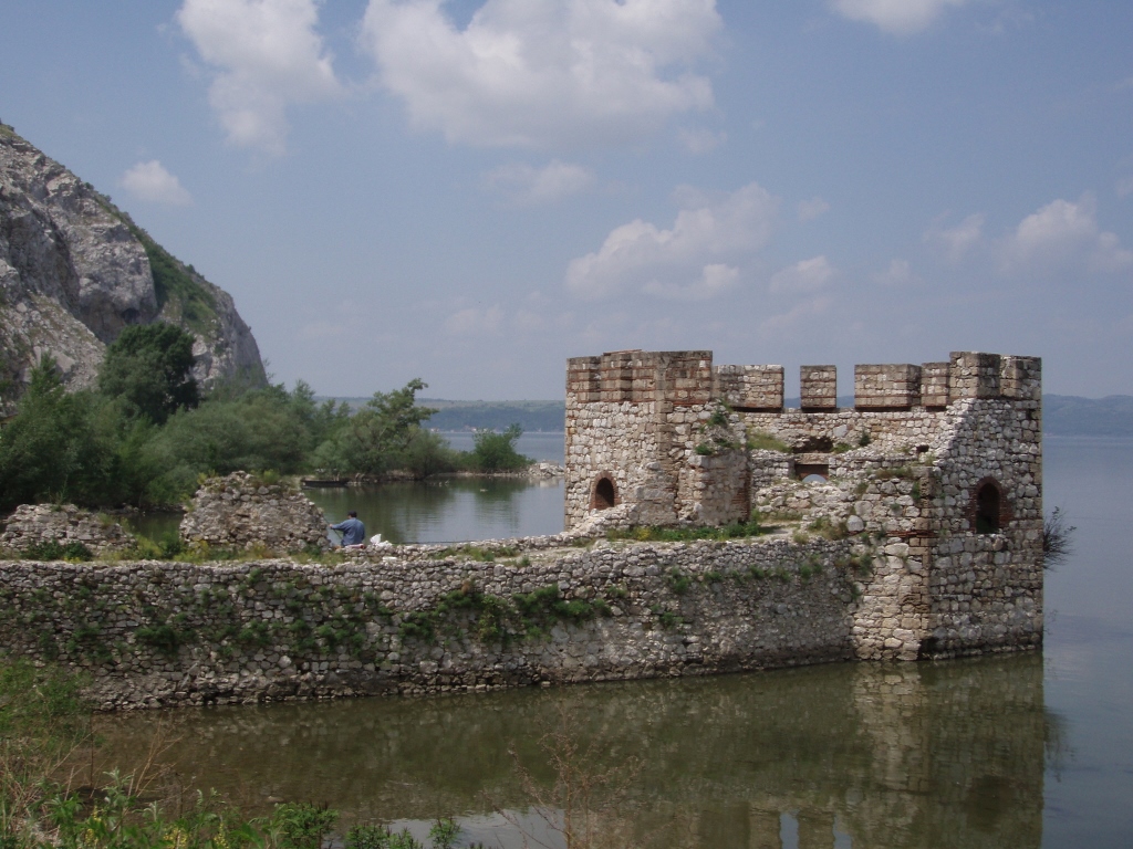
And then, for the end of our trip we headed for Smederevo with its famous Smederevo Fortress.
Smederevo Fortress is a medieval fortification built in the second quarter of the 15th century at the confluence of the Jezava river into the Danube by Despot Đurađ Branković, the then ruler of Serbia. The fortress has a very simple triangular ground plan – on its one side there is the Danube, on the other the Jezava river, while the third side of the walls is accompanied by an artificial trench.
By being a lowland type of fortress, Smederevo Fortress is unique within the scope of the Serbian medieval architecture, while its size makes it one of the biggest fortresses in Europe.
However, there were major floods in Serbia in April 2006 and thus, among other problems, the Danube overflowed its bed beside Smederevo and the fortress was flooded. When we came here in May 2006 the water has already receded, but it had left large deposits of mud which stank quite a lot at the time of our visit and since it had not been cleared out, it was not possible for us to enter the fortress. In other words, we only looked at the fortification from the outside a little and the impression was far from striking.
Within the fortress, on its north point, there is the so-called Small Town that has been conserved and restored, and it is used for different cultural and sporting events, while the rest of the fortress is called the Big Town and for the time being it is left to the mercy of the time. Taking into consideration that the fortress was originally built very solidly and then used, maintained and added to over time, historically speaking the fortress did quite well up until the 20th century when it was heavily damaged during WWI and WWII.
In any case, when we came here in 2006 we could only see the exterior walls and towers in a rather crumbly state.
 Smederevo Fortress, the exterior
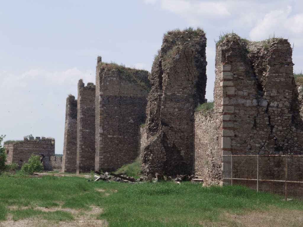 Smederevo Fortress, the exterior
 Smederevo Fortress, a detail
Although it was only early afternoon and the day was pleasantly warm, we did decide to wrap up our sightseeing visits. In the parts and towns of Serbia that we went through there are many other interesting places, but on this occasion I made a selection of those which I had wanted to visit for years. In the end, all three of us were very content both with the trip and the visits (with the exception of Smederevo Fortress), as well as with the time we had spent together. My parents certainly enjoyed this segment of togetherness in particular since they were always happiest in the presence of their children. And I was happy, too, for giving them such pleasure. Anyway, very content and happy, we drove back to the motorway to Belgrade and around an hour later we were home.