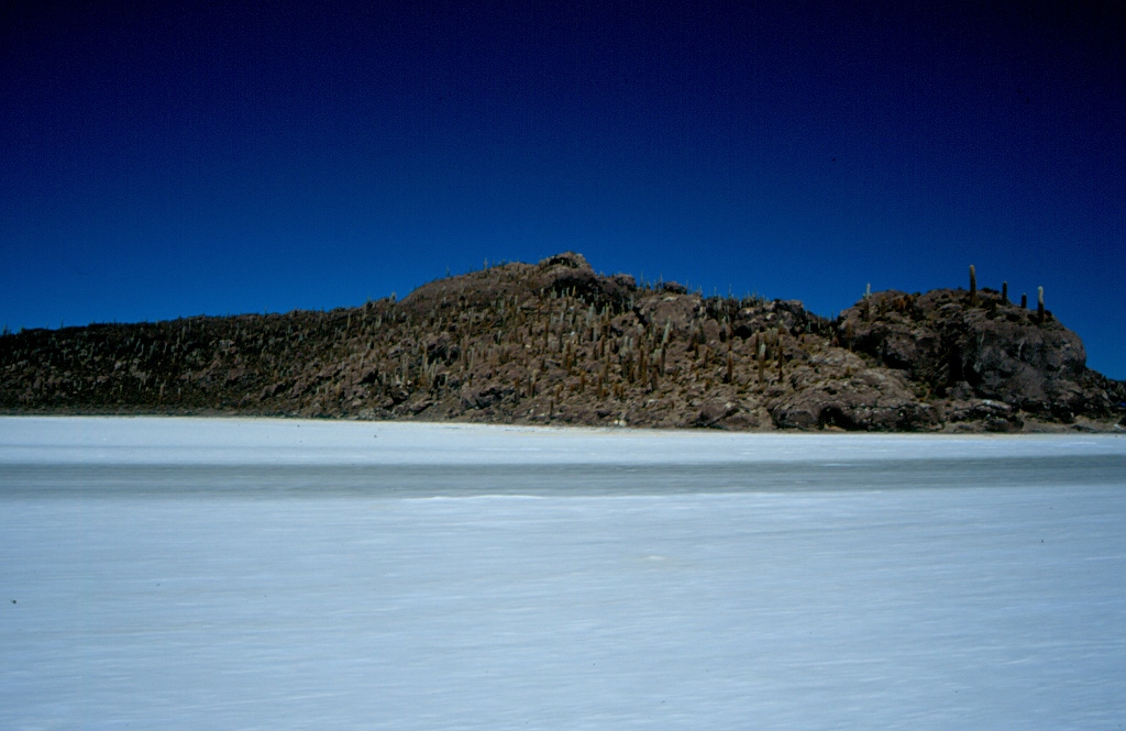
Within the salt lake there are several rock islands covered with some minimal vegetation and standing out in the general whiteness. We stopped to visit Inca Wasi or Isla de Pescado (Fish Island). It was planned to have a lunch there. While we walked around the island, which was practically a hillock, our guide prepared the food that awaited us later served from the SUV’s cargo compartment, but regardless of this informality, the lunch was quite good and tasty.
 Isla de Pescado, Salar de Uyuni
There are many cacti growing on the island and this is a kind that is typical of this area. The cacti are resistant to fierce night colds and they also have a very firm trunk which, when it dries out, may be used as building material. For instance, they used them for door posts at the salt hotel, but also several huts located on this island were made entirely out of these cacti. It is also possible to see a lot of fossils of sea creatures, which suggests that this used to be a sea bed, but now it is at around 3600 m a.s.l. Soon after I had climbed to the top of the hillock, a large group of Bolivians also came and they sang the national anthem (I presume) since it was the day of the national holiday. We were also told that several days earlier some Aymara also had their ritual on the island expressing gratitude to Mother Earth, Pachamama, to whom they left numerous gifts laid down on a small altar. Standing on the top of Isla de Pescado, I had a great view of the salt flat, seeing trails of coaches and trucks that seemed to follow some well laid route across the overall whiteness. Also visible in the distance was an extinct volcano Thunupa with its 5435 m a.s.l.
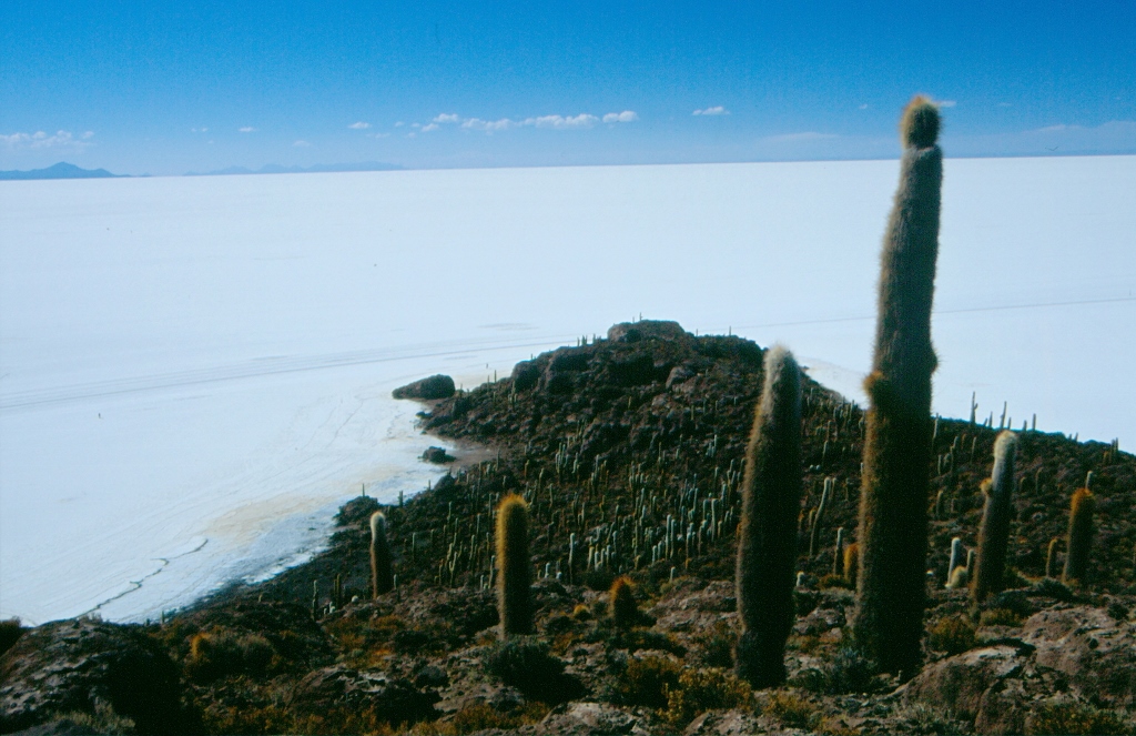 Cacti on Isla de Pescado, Salar de Uyuni
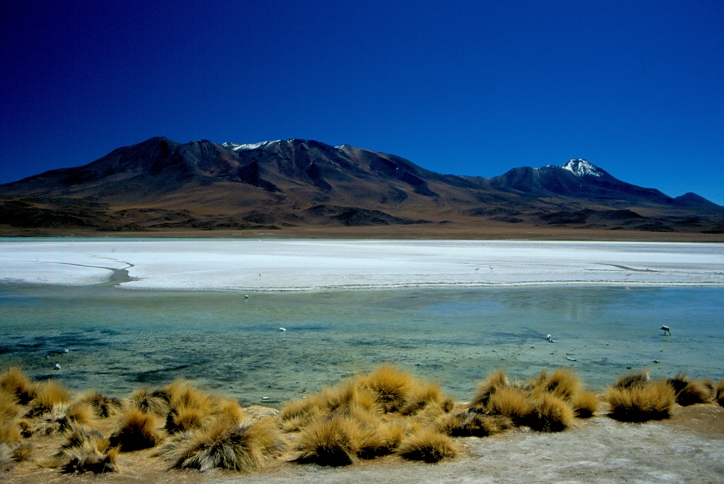
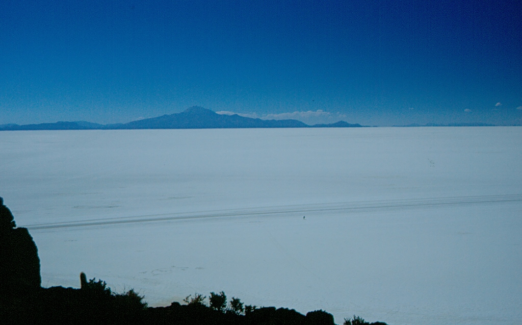 Salar de Uyuni: volcano Thunupa can be seen in the distance, across the middle there are vehicle trails and the tiny dot next to the trails is a man. This provides a good idea about the scale of the place.
Later than afternoon, we left the salt flat and moved on to a ground surface. We spent the night in the village San Juan. The entire group was placed in a large room containing beds, while the toilet and shower, as well as the dining room, were shared by two to three groups. Before the dinner, Angel, Cedric, Nancy and I went for a walk to a nearby necropolis originating from the pre-Columbian times. Its name is Kausay Huasi (or Wasi) and it was really worth the visit. On a mild slope there are mounds that appear as if shaped by erosion, but in fact it was all manually created and in each one of them (or in almost all of them) there was a hollow containing human remains, mummies, of different sizes and age, with accompanying pots and vessels. It was truly very interesting.
This sightseeing was partially spoiled by a new onset of altitude sickness caused by little rum with cola that I tried before starting the walking expedition. The problem was not big, but the headache did bother me. The only good thing was a lesson learned – no alcohol at all at high altitudes. Alcohol has this property that it dilates your peripheral blood vessels, leaving less blood for muscles and internal organs, which is not something one would want here. By the way, during the day I tried again to chew on coca leaves and the impression was the same as the first time – yuck!
The next morning we got up around 7 and after breakfast continued with our trip. As we were no longer on the salt flat, the landscapes around us were quite different. We drove through a plane, the high plateau, with volcanoes on the horizon. Then at some point the dirt road took us among the volcanoes and elevations and we stayed in such surroundings almost until the end of the tour.
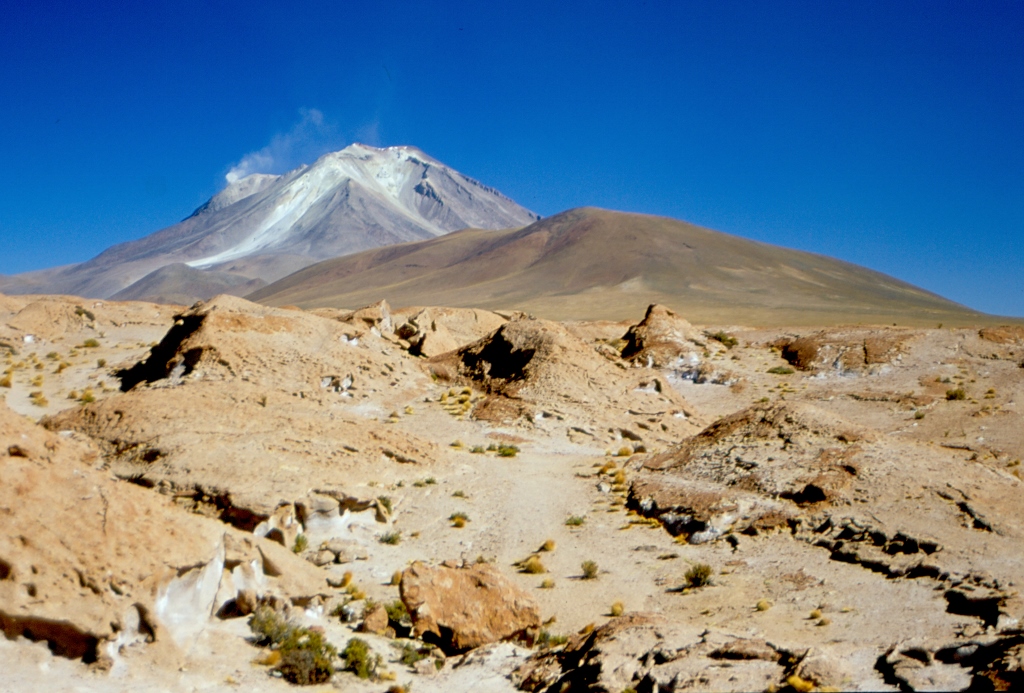
We made several breaks in order to take photos. One of the first ones was in the vicinity of the still active volcano Ollagüe that lies on the border with Chile. It is 5865 m high and we actually made several stops around it in order to look at it from different sides. But no matter where you observed it from, it was still breathtakingly beautiful.
 Volcano Ollagüe – close to its top, to the left, it is possible to see some smoke
 Volcano Ollagüe – the smoke that can be seen confirms that this is an active volcano
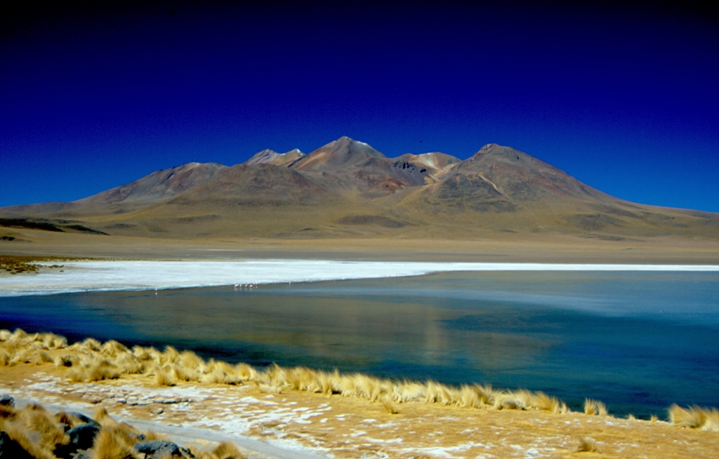
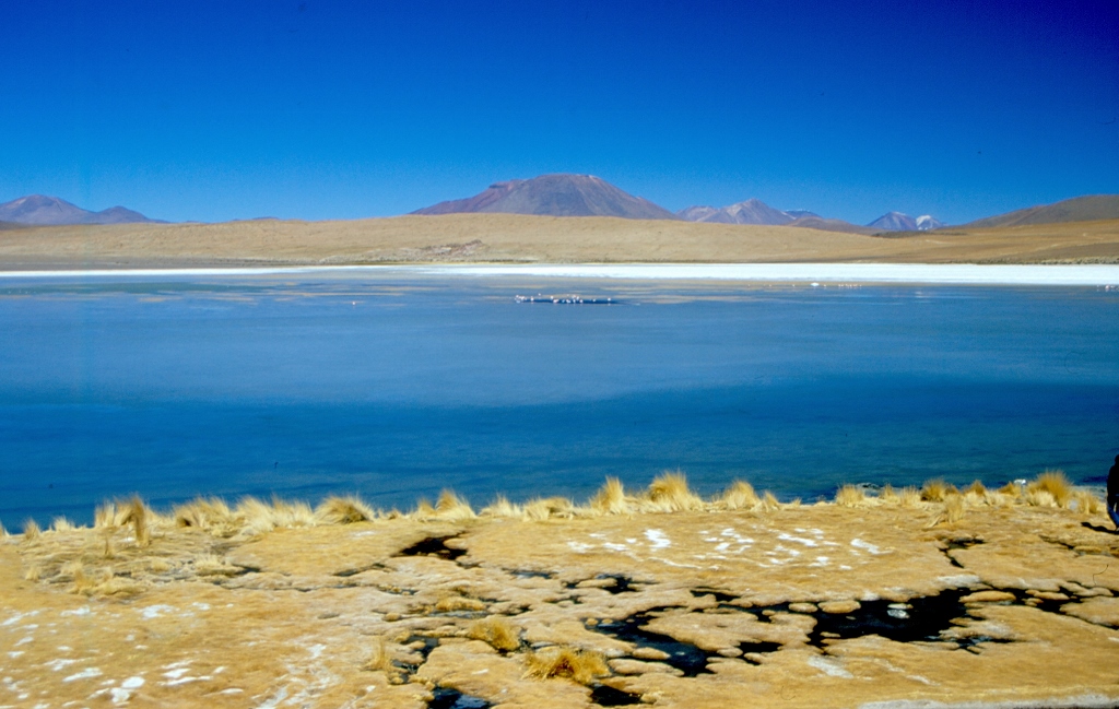
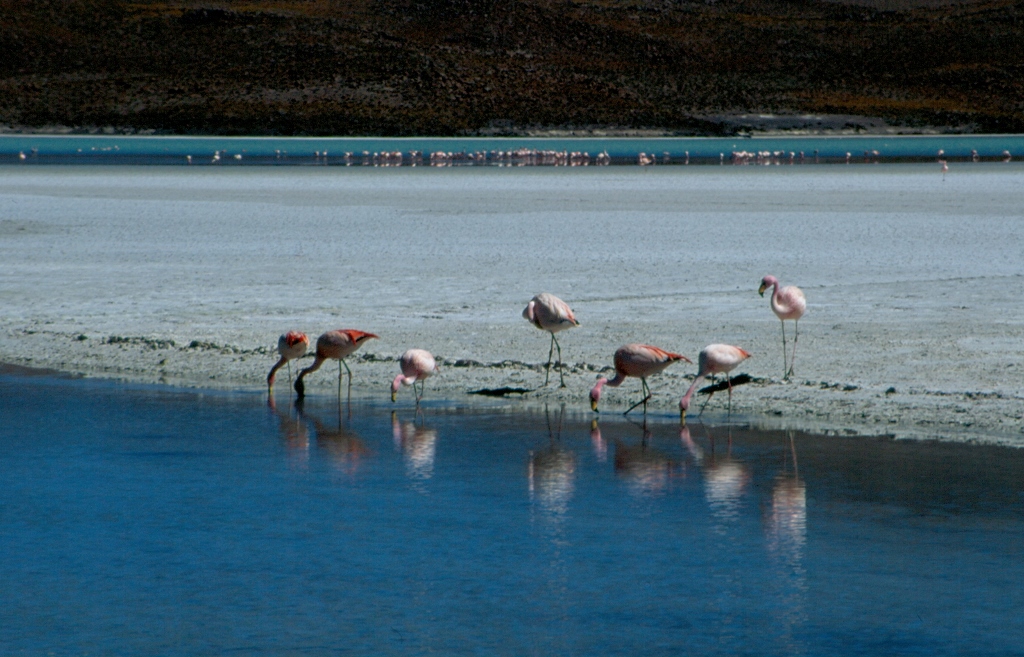
Then we started coming across lakes. The first one on our way was the gorgeous lake Cañapa. This was also the first time we had an opportunity to see flamingos. Namely, these were all salty lakes, with different algae that flamingos feed on. The shores of the lake were bordered by white colour, but this was only partially frozen water and the colour was mostly due to different salts. Regardless of the shining sun and the perfect blue sky, it was quite cold. Even the surface of the lake was covered in some spots by thin ice, while flamingos gathered in the parts where water was accessible.
 Lake Cañapa
 Lake Cañapa
All of these places we came across or we passed by, the lakes and the volcanoes, were truly incredibly beautiful. The sky was of magnificent blue colour, without a single cloud, the air was perfectly clean, the colours of the surrounding landscapes were also unbelievable and I stared at all of that with my eyes wide open hoping that this beauty will engrave itself in its entirety into my soul and memories.
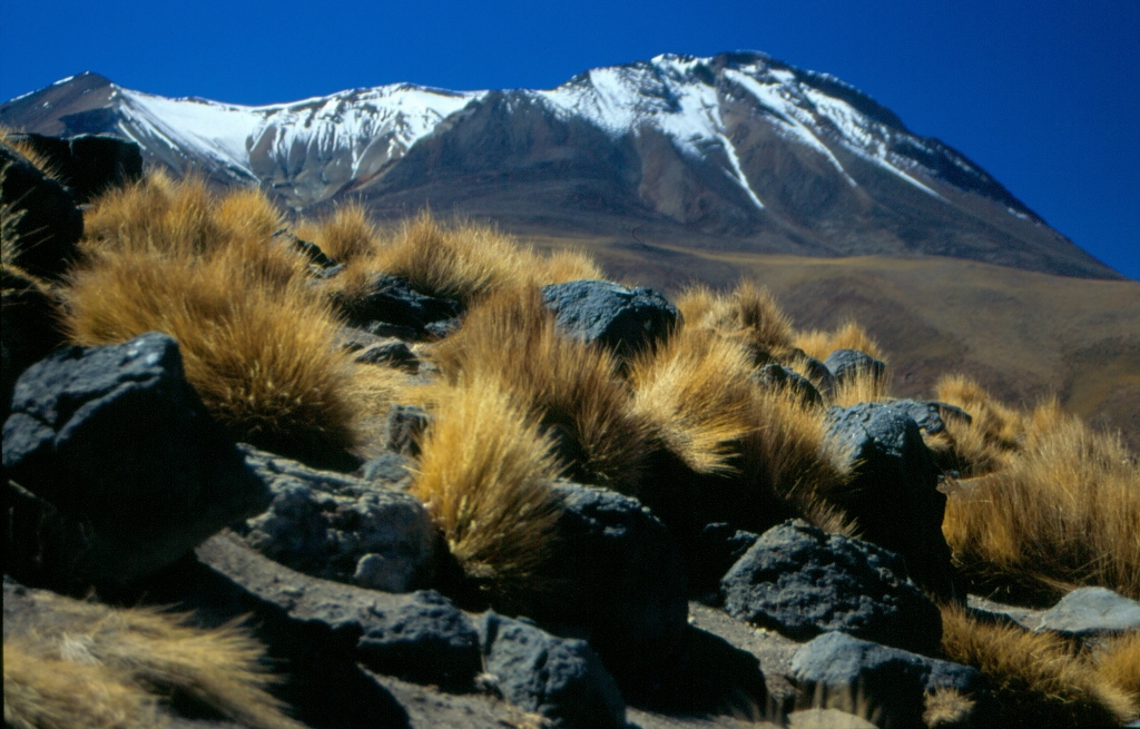 Rough grass which is the only vegetation at this altitude, vicinity of lake Cañapa
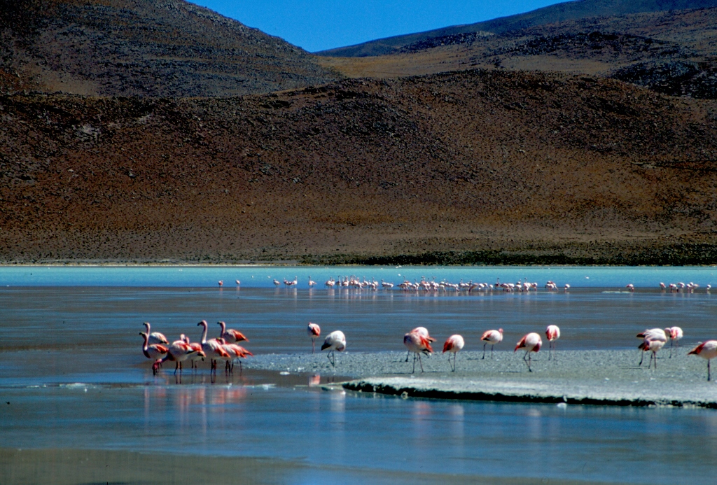
The next on our way was Laguna Hedionda, i.e., lake Hedionda. There, at 4105 m above sea level we had a lunch break, again served from the cargo compartment and again consisting of tasty food. When we approached the lake later on, it turned out that it had a very bad smell. This was again a salty lake, but this lake, like the others, is not salty because of ordinary kitchen salt, but rather there is borax or boric acid salt in the water which creates a white crust on the shallowest parts of the lake. However, that didn’t stop flamingos from gathering in large numbers here as well.
 Lake Hedionda
 Flamingos on lake Hedionda
 Flamingos on lake Hedionda
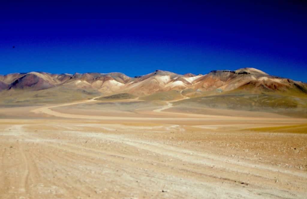
As we drove on, we entered a large protected area called Eduardo Avaroa Andean Fauna National Reserve. First we passed through a relatively monotonous area, but there was nothing monotonous about it for me. Quite the contrary. There were plenty of different colour tones. Everything was somehow subdued and yet, everything was stunning and breathtaking. The area is called Pampa Siloli. It is a desert at very high altitude consisting of volcano ash and gravel.
 Pampa Siloli
At one point we came to some rocks. This is where the guides cheat a little bit for the benefit of their tourists and they leave a couple of pieces of bread in order to attract local residents. Since the latter are used to these treats, they very gladly respond to the invitation and then they briefly pose for the visitors. The residents are the viscachas. Cute rodents of very unusual appearance: half rabbit, half squirrel, the size of an average bunny.
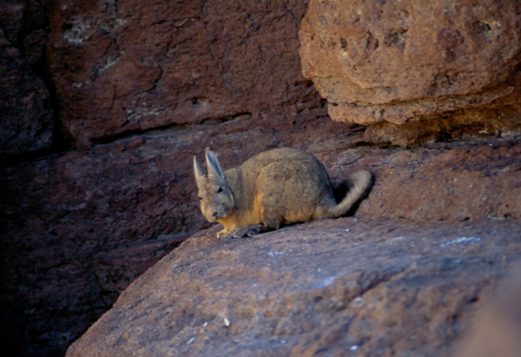 Viscacha
The next stop was at the Stone Tree (Arbol de Piedra). This is in fact a natural stone sculpture. Namely, in this area there are big chunks of rock that protrude from the volcanic soil and gravel, and then the rains, winds and pebbles carried by the winds erode these rocks into very strange shapes, the strangest of which is precisely Arbol de Piedra. It truly appears amazing: a much bigger segment of the same rock stands on the narrower part which resembles a tree trunk.
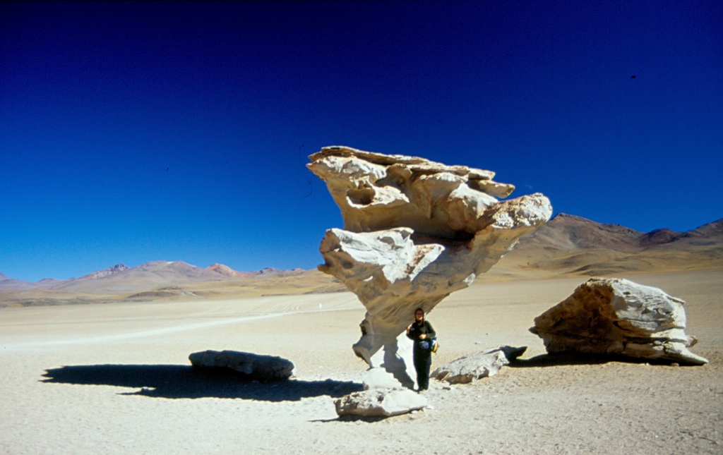 Arbol de Piedra, with a 181 cm reference object