After our short stay in the town of Saint-Pierre where we mostly walked on the beach and beside it, during which time the clouds dispersed, the four of us (three French women and myself) continued to drive further up north in the fine sunny weather.
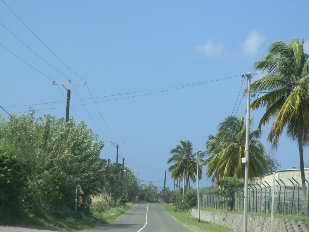 Road to the north of Martinique leading along the west coast of the island
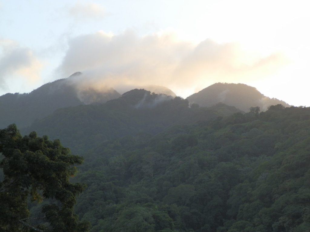
We drove towards town Le Precheur. I was trying to take a photo of Mount Pelée from the moving car, but this was mostly impossible on account of the vegetation. It was only at one brief moment that I caught the sight of the slopes of this active volcano with my video camera and later I made a photo out of this. Digital technology and computers rule!
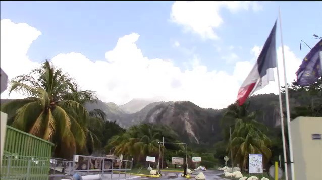 Mount Pelée
During the drive I joined the conversation of the three French women very little. On the one hand, the communication with them was very limited on account of my French which I hadn’t used in years, but we still somehow functioned as far as the general things were concerned. On the other hand, I simply laid back and let them organise everything, while I only followed them. And that was not too bad for a change.
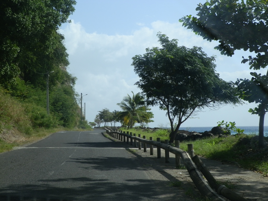
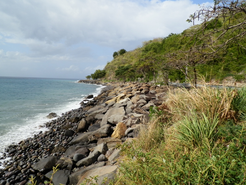
We went through town Le Precheur and continued further along the road that passed by Anse Ceron.
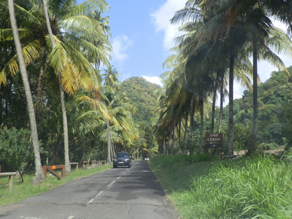 Road close to Anse Ceron
In the northwest of Martinique there are several coves with beaches which are quite close to the road, but we did not stop there. After all, swimming was obviously not in our plans for the day. Cendrine just continued to drive along the asphalt road and then the normal road with two lanes turned into a very narrow road which in the shape of numerous curves led through a dense forest. It was occasionally also very steep and there Cendrine’s driving skill was pronounced again, while the small and certainly quite old car struggled to pull us uphill.
I say “was pronounced again” since already from the very start of her drive it was quite clear to me that Cendrine was a FANTASTIC driver! She is by far the best driver I have ever been in a car with. She was absolutely impressive – she drove decidedly and fast, but within the bounds of the permitted limits, and yet quite safely and I could see that she was fully concentrated and that she followed the events on the road and anticipated them. Fabulous driving intelligence!
In any case, we got to the end of that road and from there, there was a walking path, but as it turned out none of us was equipped for hiking. Namely, all four of us had beach footwear and not the one for walking in a forest and possibly over rocks, so we simply turned back in our car and returned to the parking lot near Anse Ceron. There we left the car and walked a little through the forest till we got to the beach, while also taking some photos.
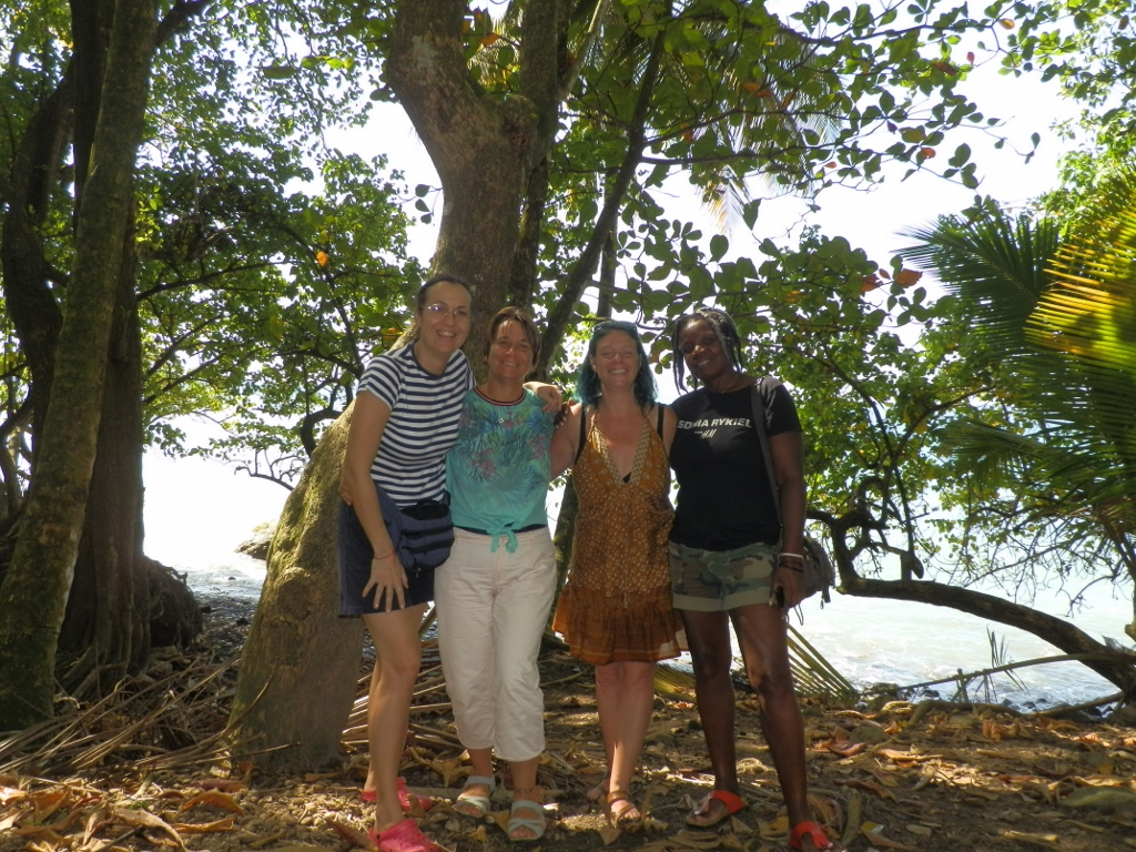 Me, Christelle, Cendrine and Silvane
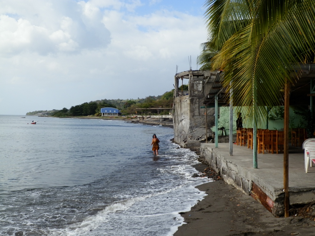
In this part between the parking lot and the beach, there is a pick-nick area (meaning there are wooden tables and benches in the shade), while there were only a few swimmers in the water and almost nobody on the shore. This beach is rather far away from the main sections of Martinique and probably because of the sand colour it does not seem too attractive.
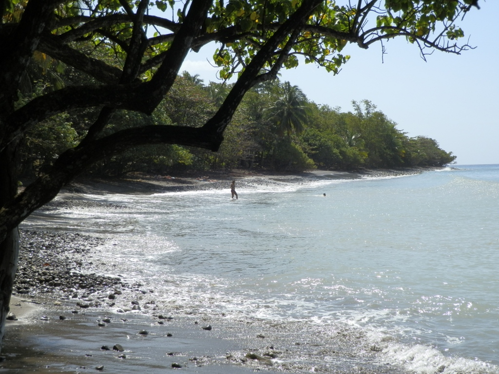 Anse Ceron beach
Also, from the shore it was possible to see a large rock protruding from the sea called La Perle.
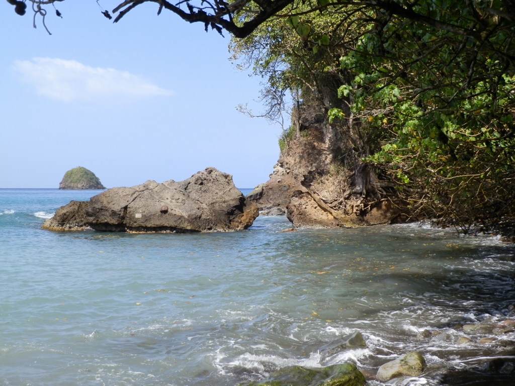 La Perle rock in the distance to the left
There were a lot of trees on the shore, including quite a few palm trees. With one guy who was there Christelle worked on the opening of some coconuts, but this proved to be very challenging since neither was quite expert for the task. Still, in the end one coconut yielded.
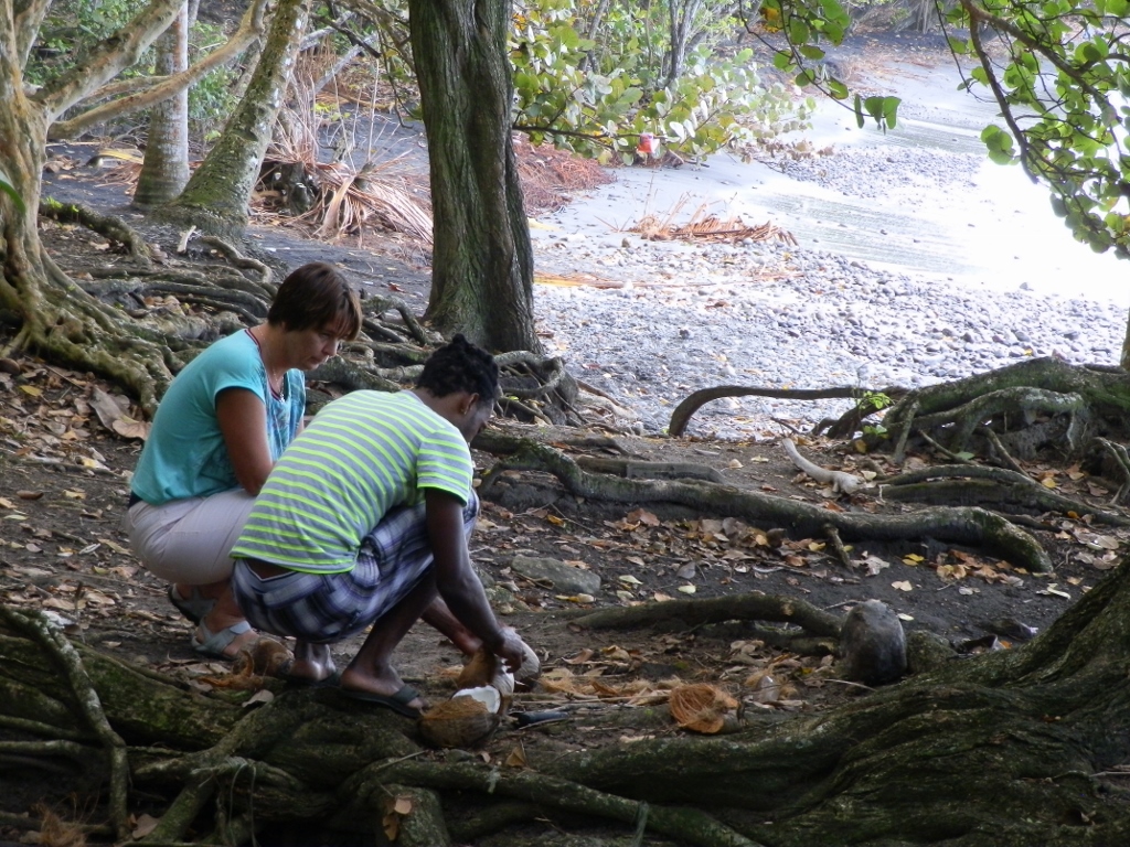 Opening of a coconut by the beach
At some point two younger French women came here in their car and it turned out that they knew those I was with by actually renting rooms in the same house. So, we hanged there together for a short while and at the same time these two girls gave us a recommendation for a restaurant in order to go for lunch there. After this break by Anse Ceron we headed back towards Saint-Pierrre and there at the very entrance into the town was this restaurant that was recommended to us.
 Road beside the sea leading to Saint-Pierre
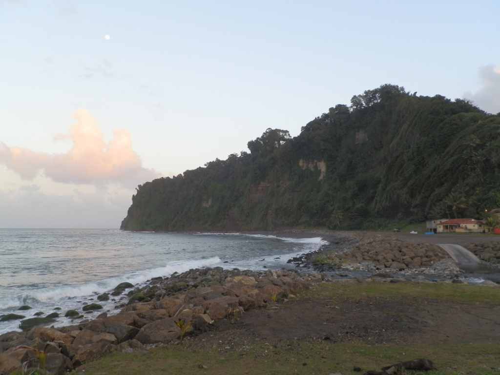
Still, before getting to the restaurant, Cendrine stopped at a parking lot beside the shore in order for us to watch the sea a little.
 Shore of the Caribbean Sea in the northwest of Martinique
So, at the entrance into town Saint-Pierre we made a break in order to go for lunch at the restaurant recommended by Laurie and Eva.
If we hadn’t received the recommendation, we would have certainly not come here, since it was necessary to get off the road in order to get to a parking lot and then this restaurant, obviously intended only for the locals or those in the know, was a little tucked away. Still, no matter how modest it seemed, it was on the beach itself and the terrace was covered, so it was a pleasant place to sit and relax.
To start with, Cendrine went down to the beach in order to look for broken blue glass. I just could not fathom why she needed it, but I did understand that she told me people keep breaking glass bottles and vessels and all this glass eventually ends up in the sea. With time, the waves and hitting against the sand bottom soften the sharp edges of the broken pieces and such pieces may be seen thrown out on the shore by waves. Well, these were the type of pieces sought after by Cendrine, but it was important that they should be blue for apparently the blue glass was the rarest. What she did with it later has remained a mystery to me. If anybody has a clue, please let me know.
 Cendrine on the beach by the restaurant looking for blue glass
Looking not only for blue glass, but also at other things she was taking photos of, Cendrine went to the other part of the beach and there were some locals pulling out a boat onto the dry land. And I was watching all of that from the terrace of the restaurant.
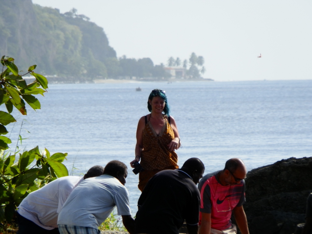 Cendrine giving moral support for the pulling out of the boat to the dry land
Then we all gathered at a table and ordered food. I had the impression that the chef also worked as a waitress.
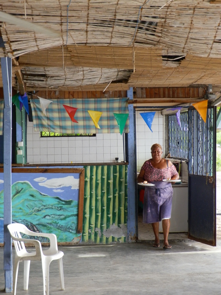 Chef/waitress at a local restaurant
The modesty of the place where we ate should in no way create any doubt about the quality and the great taste of the food we had ordered. Plus, the lunch had all of its important parts, just as it should.
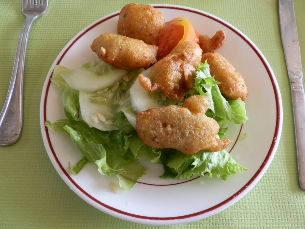 Accras du morue as a starter
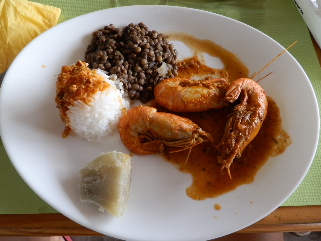 Crayfish as the main course
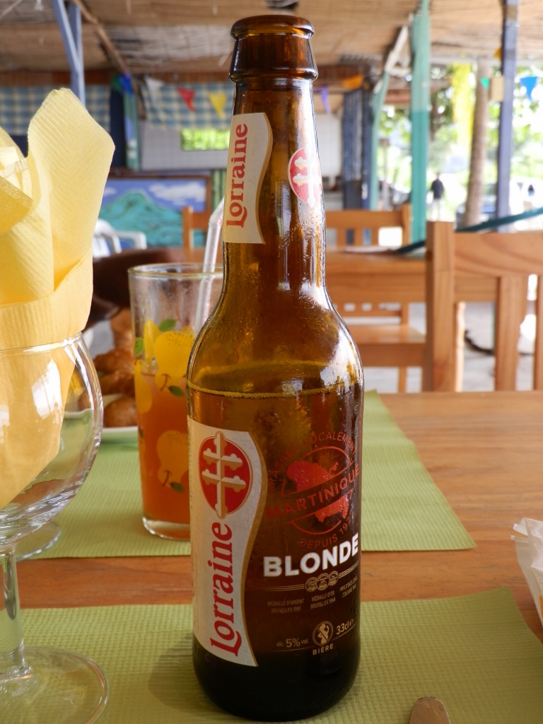 Local beer with the main course
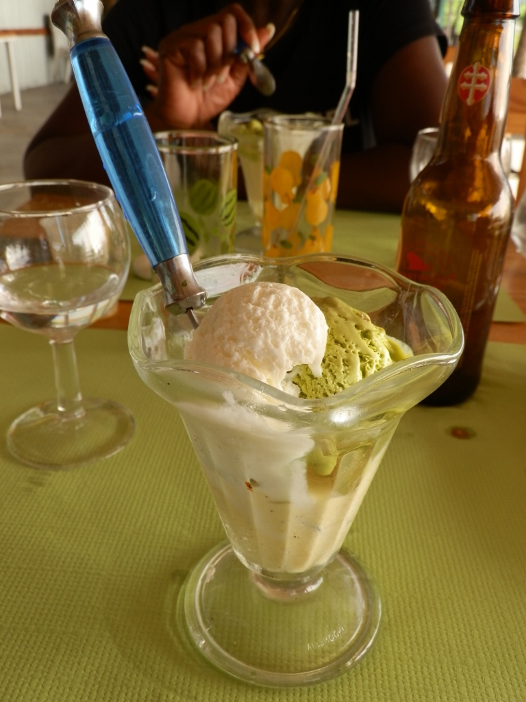 Ice-cream as the dessert
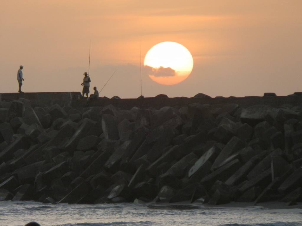
Not moving from the table where one delicious food came after the other, I enjoyed not only the food, but also the view at the sea where a man was patiently fishing from his boat.
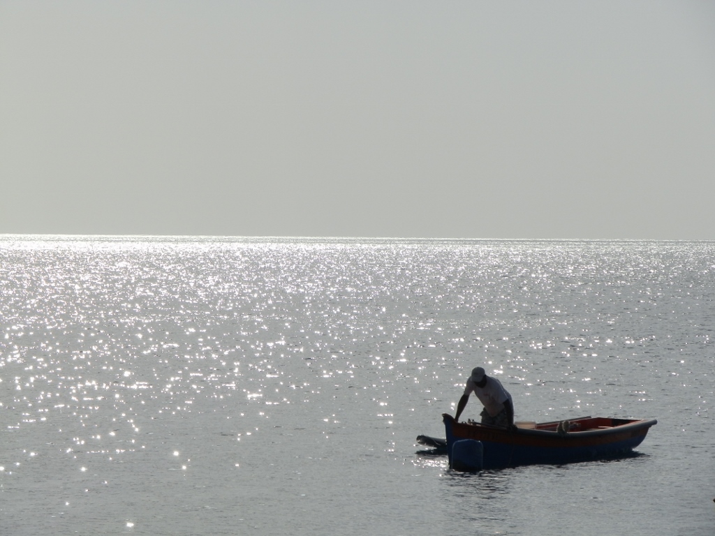 Fishing at the Caribbean Sea
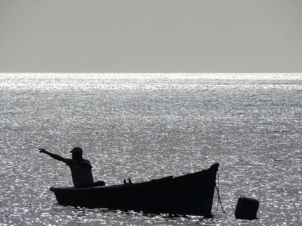 Fishing at the Caribbean Sea
When we finished with our lunch, we went to the parking lot to get the car and I looked once again in the direction of the summit of volcano Mount Pelée which could still not be seen in its entirety – that day the clouds kept hiding it.
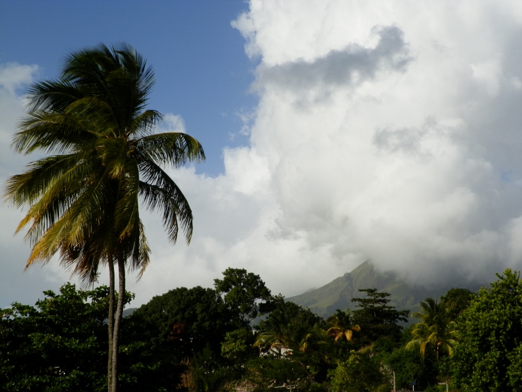 View at volcano Mount Pelée
From the restaurant we first went towards the centre of Saint-Pierre and from there we started to go up towards small town Le Morne-Rouge practically driving over the volcano’s slopes in order to transfer to the north coast of Martinique.
It was all covered in dense vegetation – partly forest, partly sugarcane plantations. In the forest sections I kept seeing some enormous bamboos, but as there were a lot of curves and it was all more or less uniformly green, I could not make a good photo since there were no reference points that would accentuate the true size of those plants.
In addition, although large patches of the sky were blue and in some others there was a cloud or two, yet some other parts were covered in heavy and dark clouds and thus occasionally we drove through rain only to get out into the dry area once again very quickly.
So, we eventually got to town Le Morne-Rouge, but we did not stay there, opting rather to turn towards the north of the island at the main crossroad. Along the way, we also drove past the Church of Our Lady of Deliverance. The first church built in this place in 1844 was made of wood, but it was later replaced by a structure made of stone that was completed in 1868. As this part of the world is often visited by hurricanes, plus in 1902 there was this huge volcanic eruption just a couple of kilometres away from this place, there was a constant need to keep repairing the church and making additions to it.
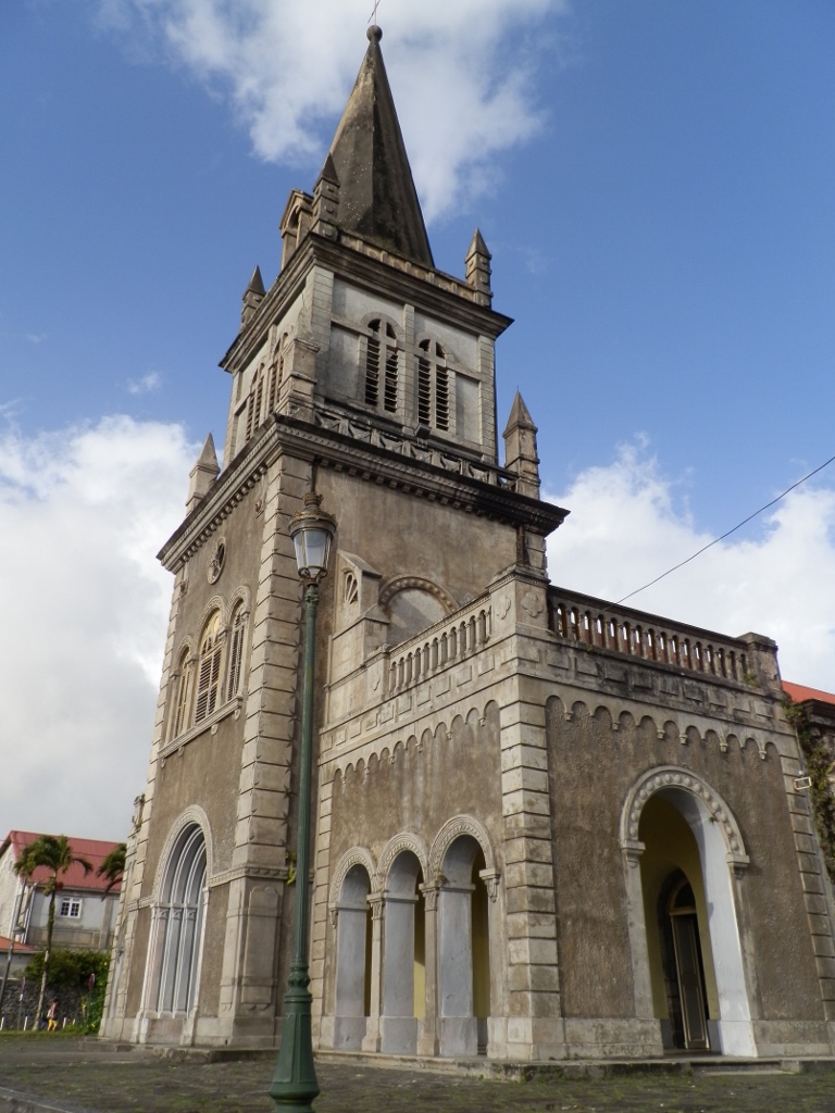 Our Lady of Deliverance Church
After a while we also went through town L’Ajoupa-Bouillon and there we also encountered rain-drenched streets, but for us it was more important that we started to descend towards the northeast coast of Martinique.
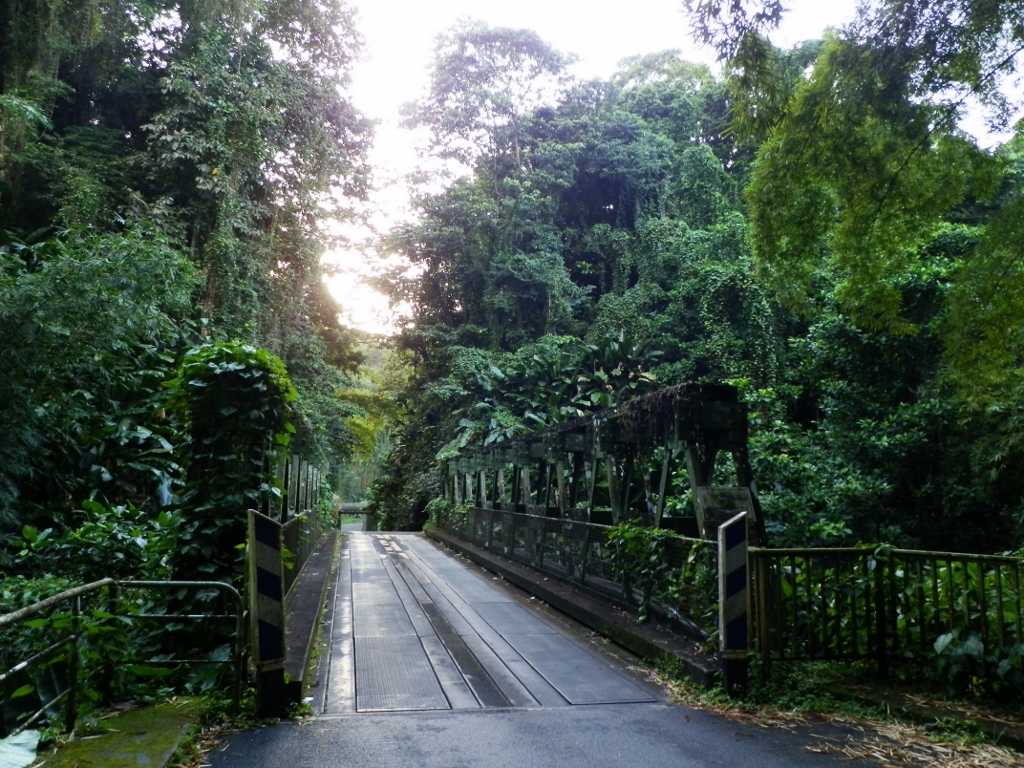
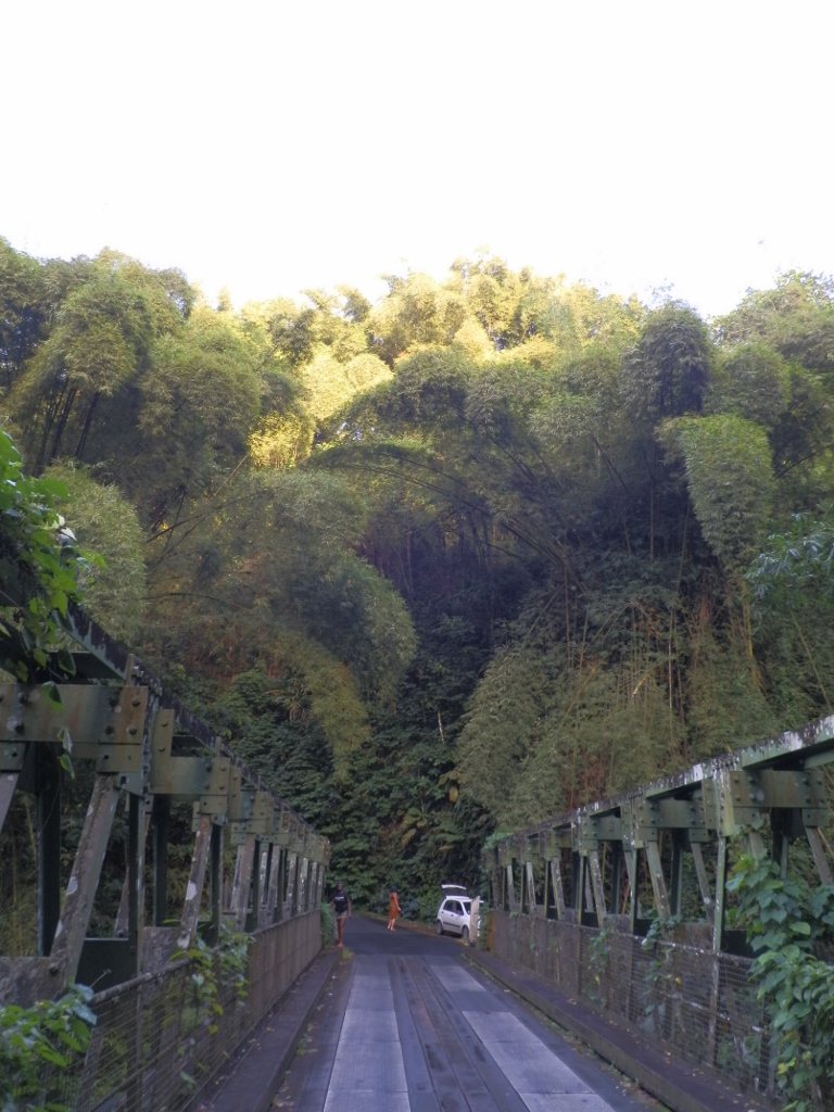
When we practically got to the littoral area, we headed for the very north of the island and thus we came to village Macouba from where we continued towards the final destination for the day which was village Grand Riviere. Still, before that we had to cross a bridge called Pont de Grand Riviere which is located in the middle of dense and lush vegetation. The bridge is very interesting because it is made on two levels, i.e., this is a bridge consisting of two sections linked by a road that runs downhill over the length of a few dozen metres. It could be said that these are in fact two separate bridges with a small piece of land in between, but the singular name for the bridge suggests that the structure is deemed to be just one single bridge.
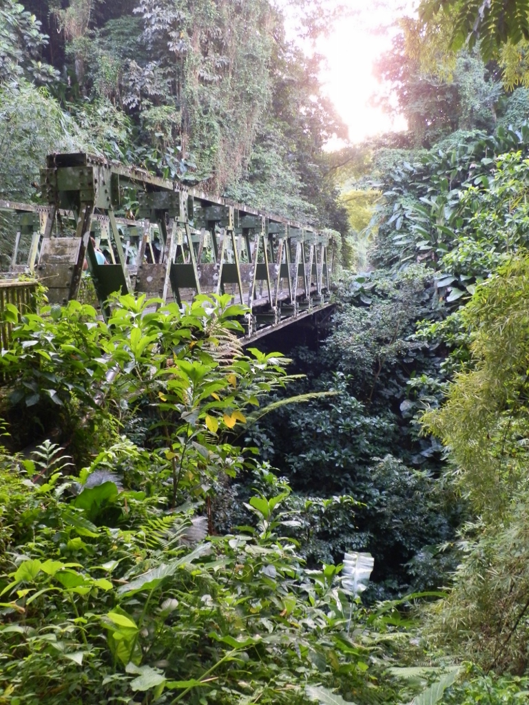 Pont de Grand Riviere – first part of the bridge
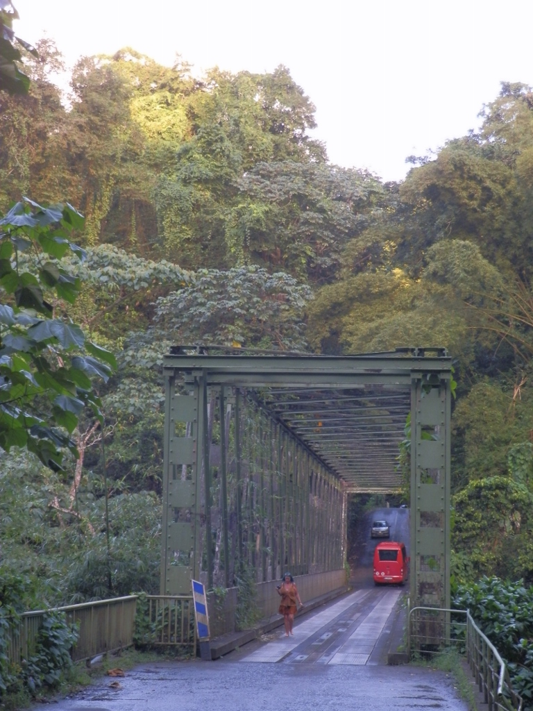
It is additionally interesting that the bridge is very narrow and only a single vehicle can drive over it (no vehicles in parallel). That also inspired us to leave the car at the very beginning and then to go on foot over both sections of the bridge, taking some photos along the way before going back to the car.
 Pont de Grand Riviere – first part of the bridge; further down there is the “roof” of the second part of the bridge that comes after the downhill land section
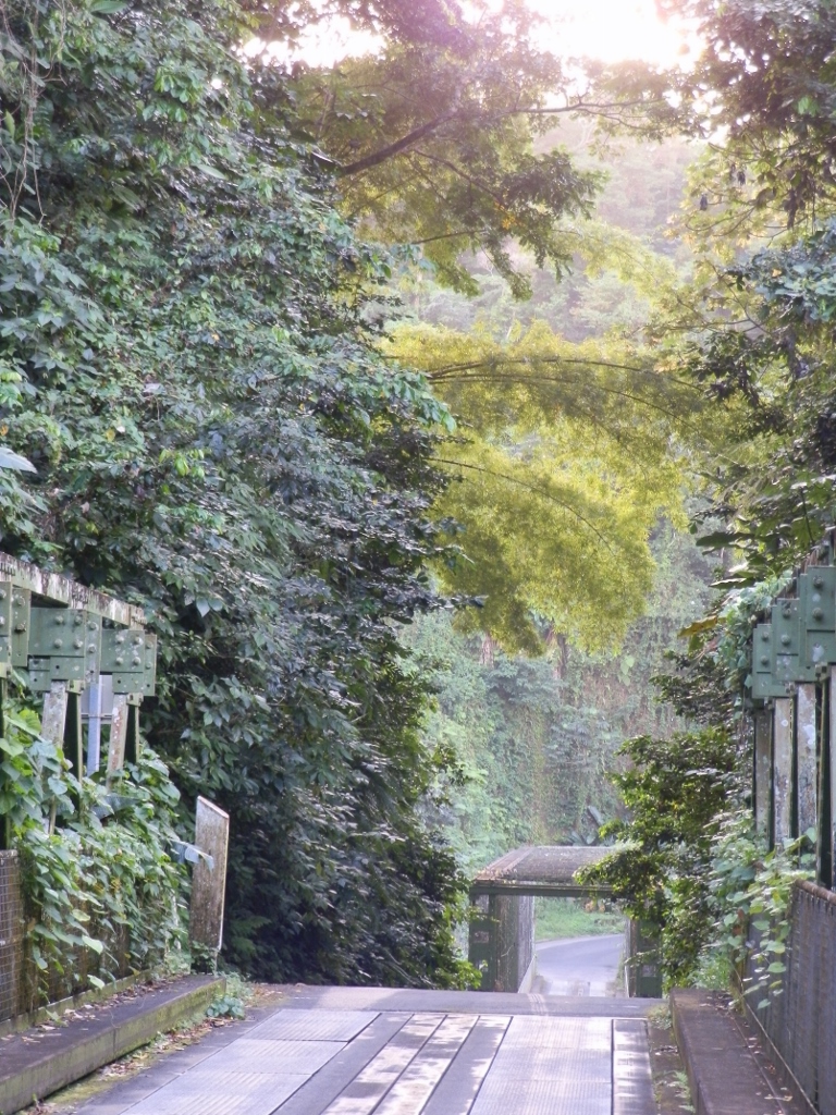 Pont de Grand Riviere – end of the first part of the bridge and the second part after the downhill land section
When I got to the end of the second part of the bridge, I looked back and then I could see well the downhill land section and the entire second part of the bridge, as well as how both parts of the bridge function only as one way roads (although two vehicles can drive in parallel on the downhill land section).
 Pont de Grand Riviere – second part of the bridge and the downhill land section
After this brief walk, I went back to the beginning of the first part of the bridge where the car was parked. As it may be seen from the photographs, the surrounding vegetation was truly impressive, primarily because of its lushness, but in the photo below it is also possible to see the imposing size of some of the surrounding plants.
 Enormous bamboos close to Pont de Grand Riviere
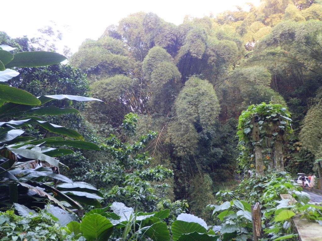 Enormous bamboos and other vegetation close to Pont de Grand Riviere
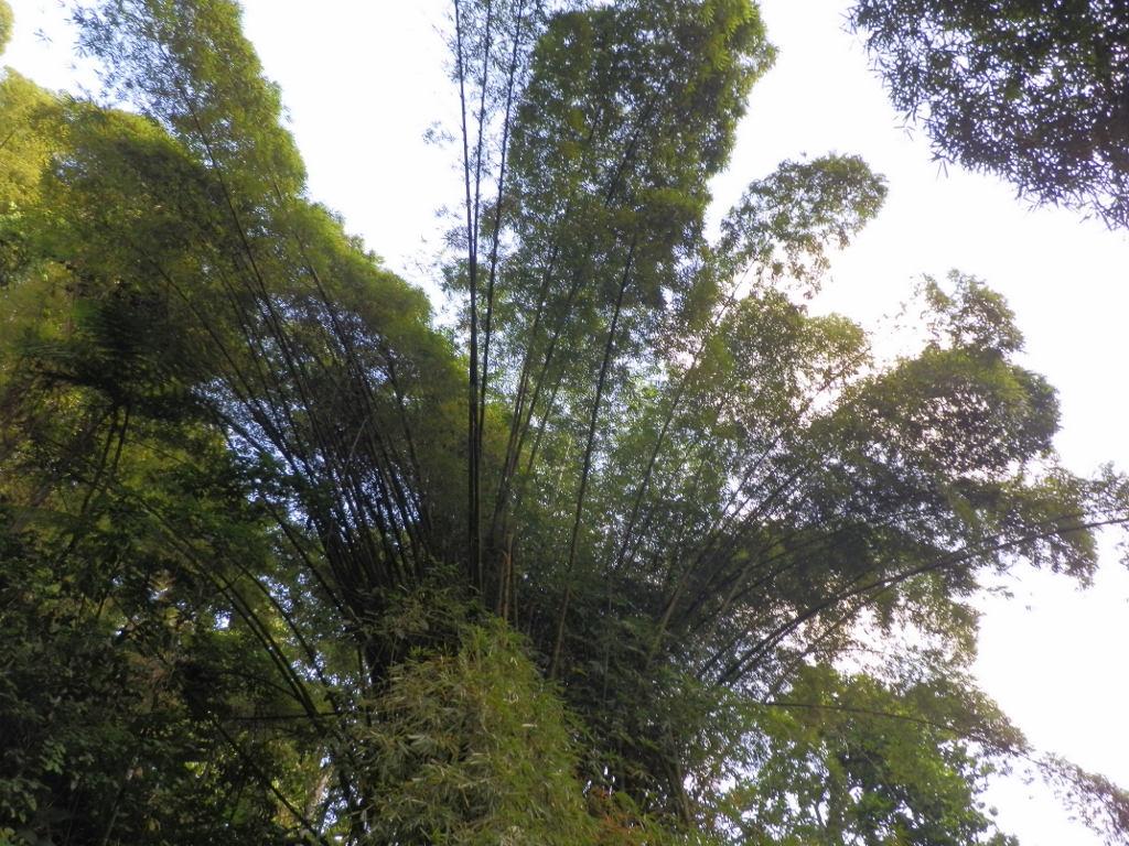 Enormous bamboos close to Pont de Grand Riviere
As we were gathering around the car, getting ready to continue with our trip, Laurie and Eva came in their car. It was again a joyful reunion and then I took the advantage of the bridge’s fence to make an “old-fashioned” selfie.
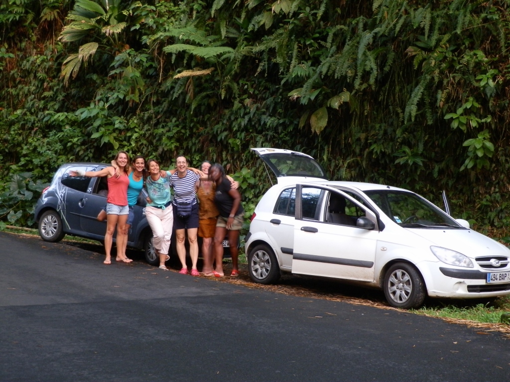 Two cars and six merry women
When we continued after the photo-session, it turned out that the two-section bridge was not the only point of interest on our way to Grand Riviere. It was also the road itself since it was very narrow during its final descent to the village and made for only one vehicle to pass, i.e., it functions in one way only and it also has a lot of curves. This issue is resolved by traffic lights and then the traffic goes alternately, first in one way and later in the other. So, first we waited on the hill with a couple of other vehicles for the green light to come on and only then could we move down towards the coast, which obviously applied in the same manner but in the opposite direction a little later.
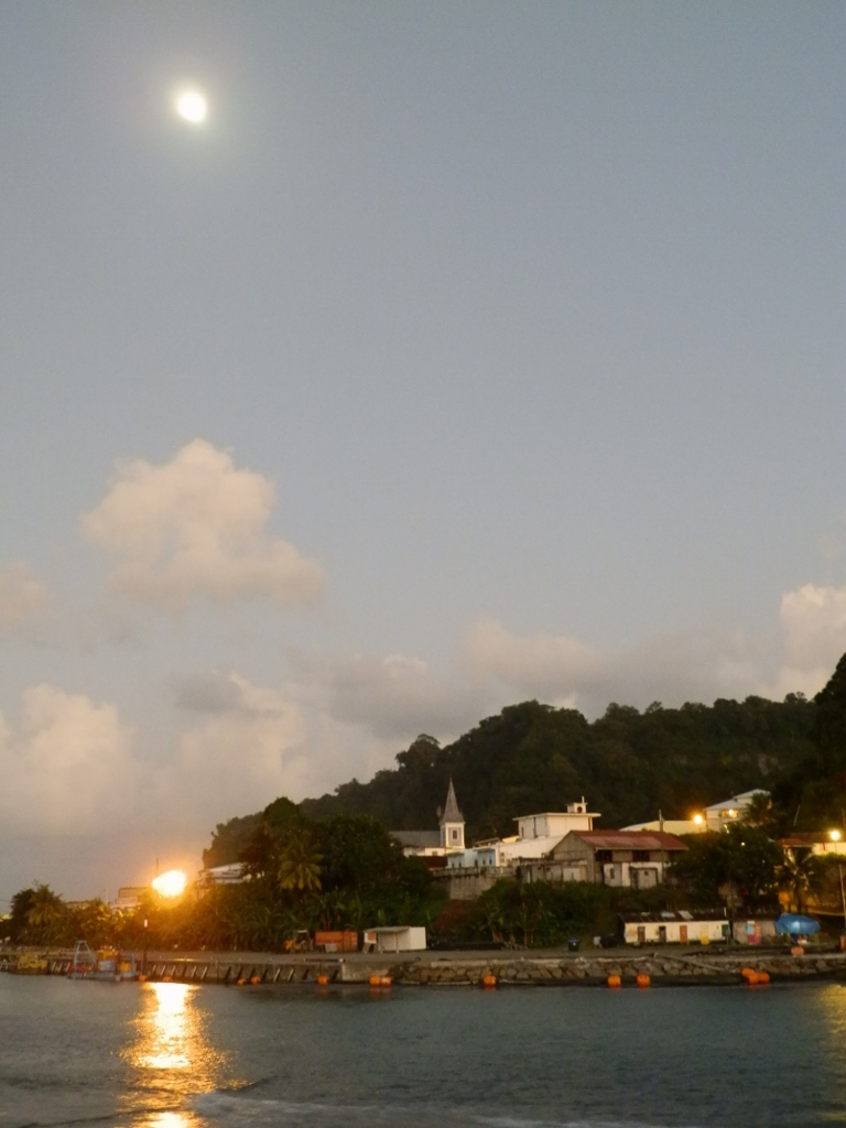
Small town Grand Riviere is located on the north coast of Martinique and it formally faces the Caribbean Sea (as it is slightly more to the west along the north shore). Although the sea actually does not know its name, the east parts of the island are in fact the shores of the Atlantic Ocean, while the west coast is a part of the Caribbean Sea. In addition, Grand Riviere is situated on a narrow stretch of shore with the slopes of volcano Mount Pelée on one side and the sea on the other.
 Slopes of volcano Mount Pelée in the background of Grand Riviere
 Part of the narrow coastal area near Grand Riviere
When we finally reached this village, the day was already at its end. In the photo above there is the Moon that was not quite full yet, while the photo below shows the Sun slowly getting ready to set.
 Local fishers on the breakwater structure in Grand Riviere
As an addition to the topic of seas and oceans, I think it is interesting that when standing on the shore in village Grand Riviere which is almost at the very “top” of the island when looking at it on a map, when I faced the east and the Moon which was rising on that side, I was actually looking at the waters of the Atlantic Ocean. And, of course, in contrast the Sun was setting behind the waters of the Caribbean Sea.
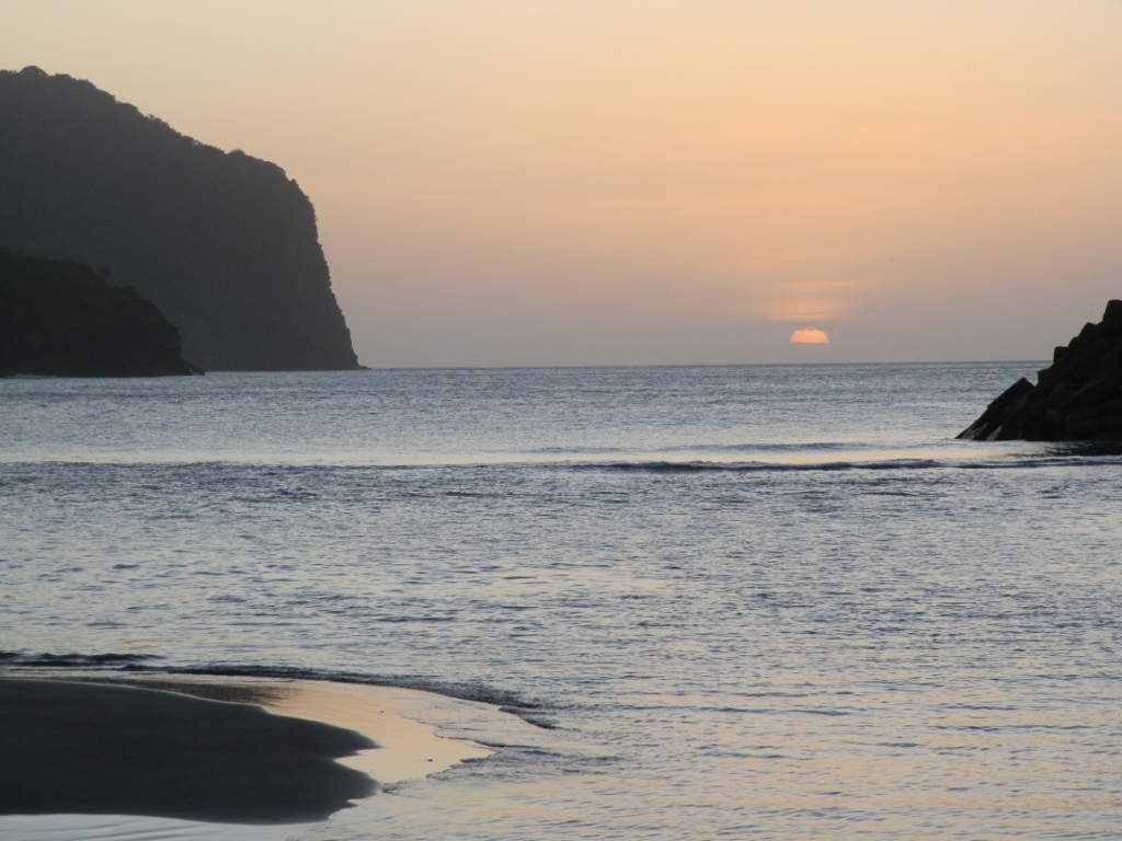 Sun setting behind the waters of the Caribbean Sea
While I was standing in one part of a lawn taking photos of the ocean, the sea and the Sun, all of a sudden my right foot started to burn very strongly. I looked down to see what was happening and realised I had stepped onto something like an ant nest which was obviously the home of fire ants. This was certainly not a very big ant nest, for I think I would be much worse off. This way, I had a very strong burning sensation in my foot, but after half an hour it started slowly to calm down. As far as I’ve read, the consequences of fire ants’ bites may be quite serious and may even require medical intervention. In other words, I was very lucky!
We all walked a little over the breakwater structure and from there it was possible to see the centre of the village. One of the more important buildings in the place is the Church of Saint Catherine of Grand Rivière.
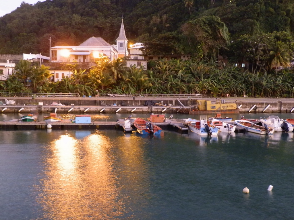 View at Grand Riviere from the breakwater structure
The first church was founded here by the Jesuits back in 1660. Like with all old buildings on the island, the original chapel that grew into the church went through different phases of additions, damages and renovations, while as a historic monument the last time the church was thoroughly restored was in 2007/2008.
 View at Grand Riviere from the breakwater structure
It was here that we finished with our sightseeing for the day and it was a truly fantastic day indeed! Since our hanging together went well, we agreed that they should pick me up again in a couple of days and then we would do some other tour.
I was very happy that Annie had organised this for me. In addition to the visits (which was not a bad thing at all), I spent the entire day surrounded by the French language and had to make do, but I also had an impression that I had made a quantum leap (in my opinion). Luckily, after almost 20 years, I had started to renew my French a little the previous summer and although this was quite minimal, I don’t know how I would manage without it.