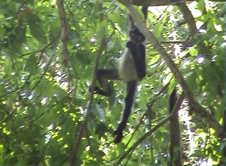
When I descended from the top of Temple V within the archaeological site Tikal in Guatemala, I continued the sightseeing with the group that was set up on the spot earlier that morning. Now we all went to a part of the forest where there was a group of the Geoffroy’s spider monkeys (Ateles geoffroyi).
Although the photos are not great, it can still be seen clearly why these monkeys got their name, at least a part of it.
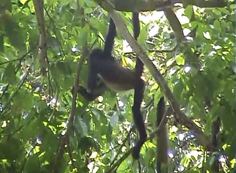 Geoffroy’s spider monkey
 Geoffroy’s spider monkey
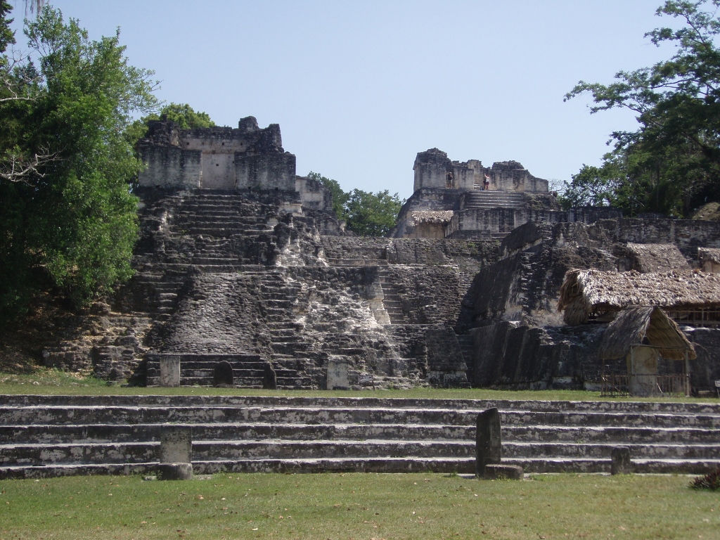
Some 300-400 metres farther away we reached the final destination within this sightseeing tour and that was the Great Plaza (Plaza Mayor).
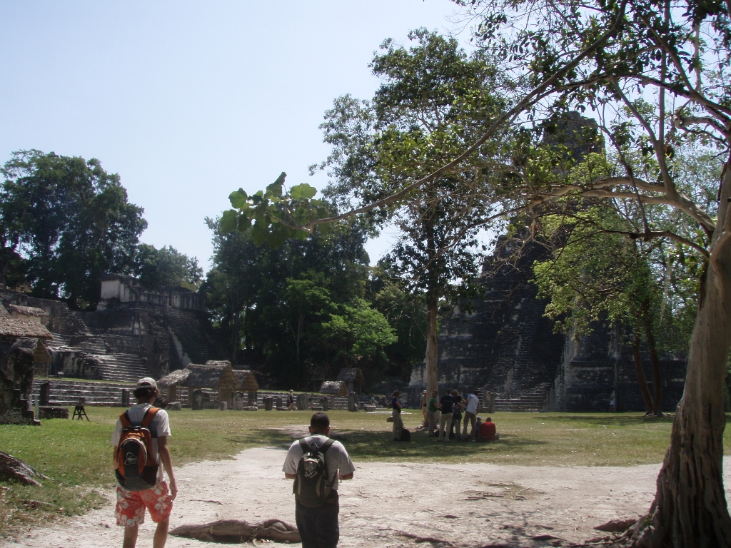 Great Plaza in Tikal
The Great Plaza constitutes the very heart of Tikal and its ceremonial centre which is adored from the east and the west sides by the most famous temples-pyramids in Tikal. We got to the square by passing beside Temple II, so I immediately turned back in order to have a better view.
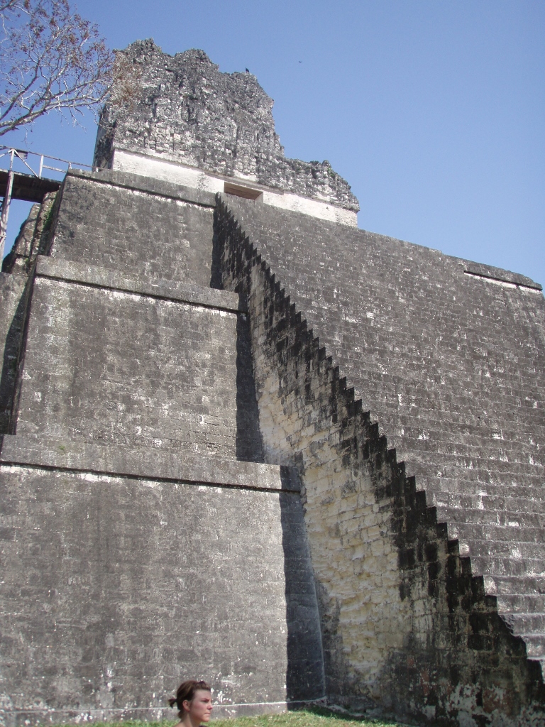 Temple II
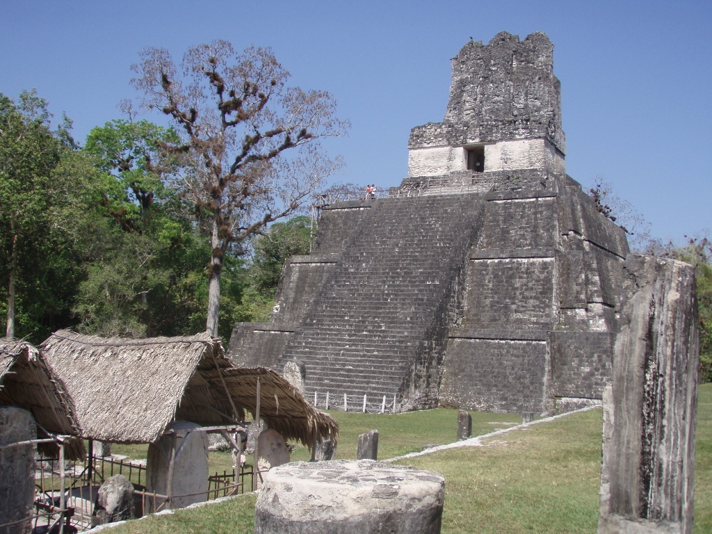
Temple II, also known as the Temple of the Mask, was built around 700 CE and it is 38 metres high. On the platform on the top of the pyramid that has three tiers there is a shrine consisting of the usual three rooms, while laterally from the smaller stairway that leads from the platform to the shrine there are two eroded masks and this is the reason why the temple got its other name. The pyramid was built by ruler Jasaw Chan K'awiil I (ruled from 682-734) in the honour of his wife, Lady Kalajuun Une’ Mo’, also known as Lady 12 Macaw Tails or Lady Lahan Unen Moʼ. Her image is carved in a wooden beam that exists in the middle room and it is believed that she was buried here after her death in 704 although her actual tomb has never been found. This queen was also the mother of the future ruler, Yik’in Chan Kawil (ruled from 734 to around 766), also known as Sun Sky Rain, who also completed Temple II.
While I was standing in front of Temple II taking photos of it, I noticed a local vulture on the top of the temple’s roof comb that can also be discerned in the previous photo, but here it is a little zoomed up.
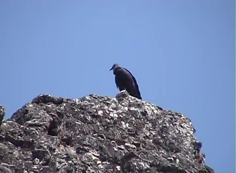 Local vulture on the very top of Temple II
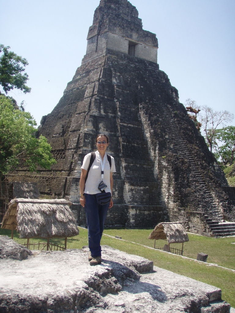
Although it is possible to climb to Temple II, for there is a metal and wooden structure with stairs on the side, I decided not to go up, for I wanted to walk around a little, since the time was limited and the end of the tour was getting close. There at the foot of Temple II I asked Ana to take a photo of me with Temple I in the background.
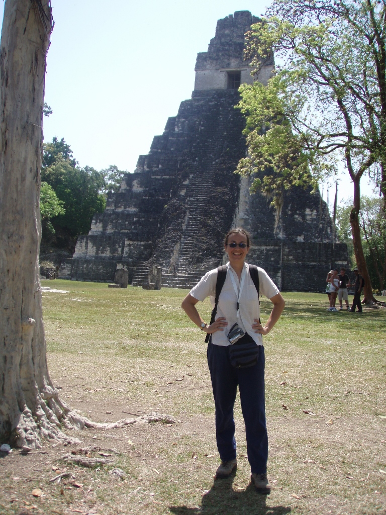 At the Great Plaza in Tikal
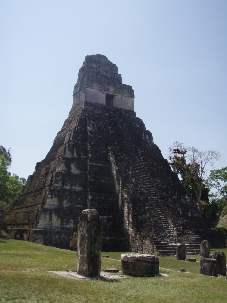
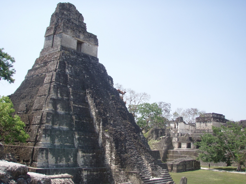
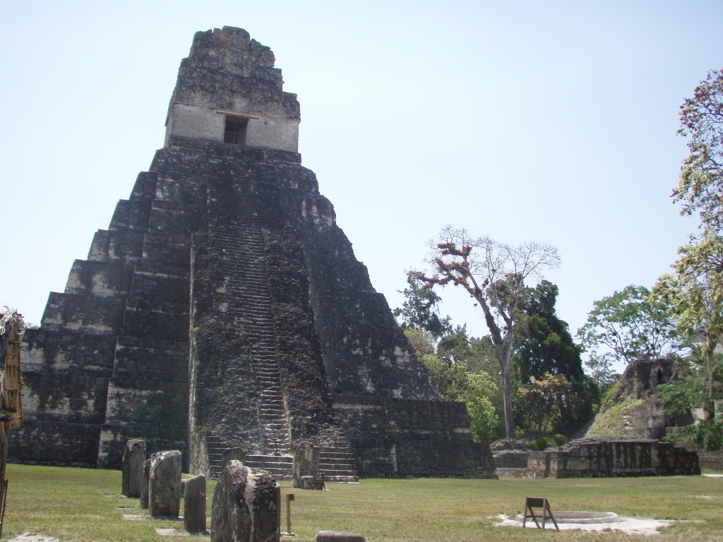
Temple I, which is also called the Temple of the Great Jaguar, is situated on the east side of the Great Plaza and it is 47 metres high. This other name was given to the temple because of a lintel that represents a king sitting upon a jaguar throne. The temple was built around 732 during the reign of one of the greatest kings of Tikal, Jasaw Chan K'awiil I (682-734), who is often also referred to as Ah Cacao and thus the temple itself is often called as the Temple of Ah Cacao, since this ruler was also buried here. The tomb was discovered in 1962 deep within the pyramid and below the level of the Great Plaza. Inside the researchers found the mortal remains of the ruler, as well as the rich offerings in the form of objects made of jade, pottery, shells, as well as 37 finely carved human bones.
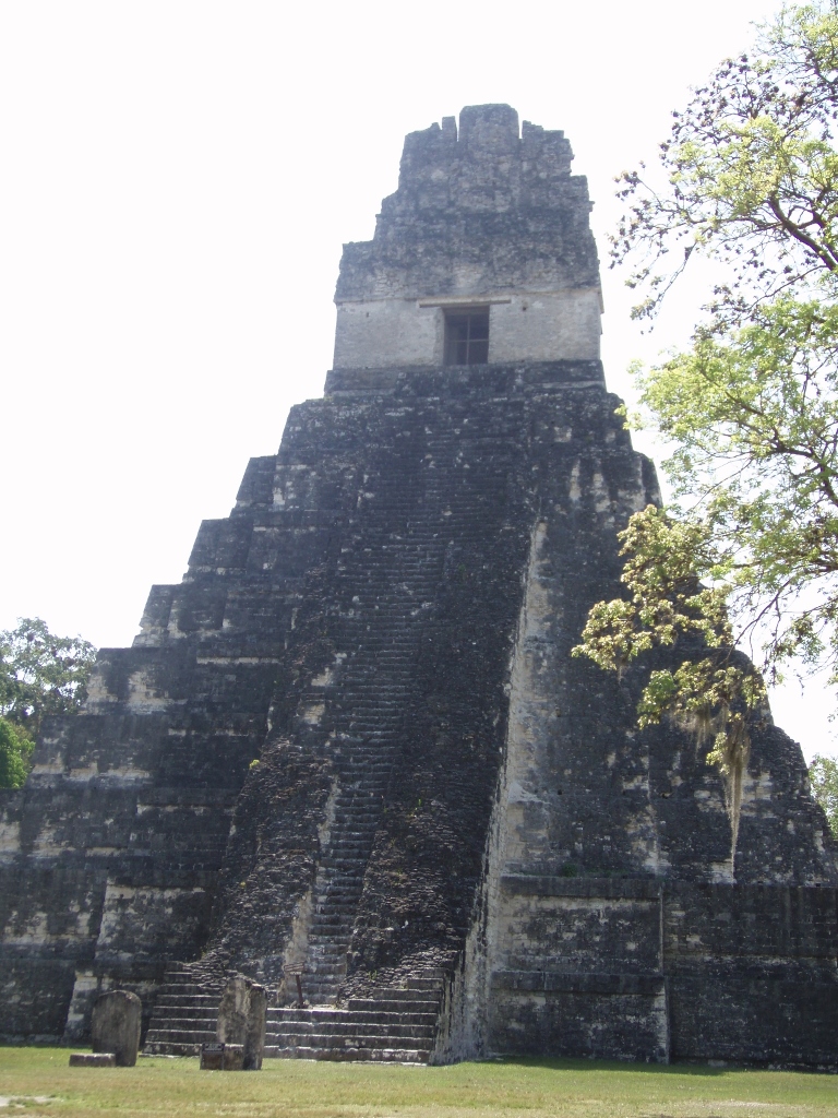 Temple I
The pyramid of Temple I on top of which there is the shrine has 9 tiers, i.e., terraces, since 9 is one of the holy numbers of the Maya, being the number of birth and life, and it was symbolically used for rituals, important meetings, as well as for the coronation or very important ceremonies. In the past it was possible to climb to the top of Temple I (the partially restored stairway may be seen in the photo above), but after a couple of falls with lethal outcome this was prohibited.
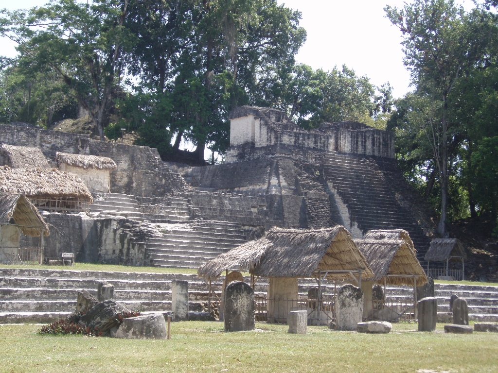
At this point I started to look around at the surrounding parts of the former urban settlement. On the south side of the Great Plaza there is the Central Acropolis.
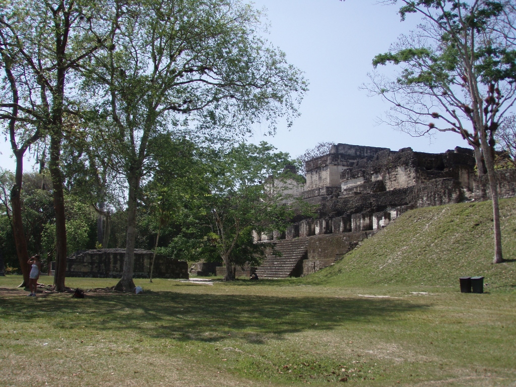 Great Plaza and the Central Acropolis
This is an ensemble that contains numerous structures and rooms connected by stairways and corridors, which all surround six courtyards. The ensemble actually constitutes a complex of royal palaces, although the research suggests that it was used both for residential and for administrative purposes.
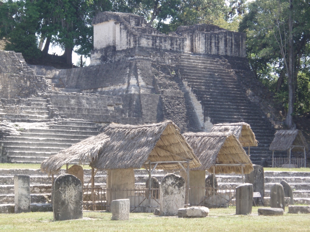
On the opposite, north side of the Great Plaza, there is the North Acropolis built on the terrain that is several steps above the level of the Great Plaza.
 North Acropolis, west part
 North Acropolis, east part
Still, let me also mention that in the area of the Great Plaza, right in front of the steps leading to the North Acropolis there are numerous steles arranged in two rows. They are not even nearly as impressive as those in Copán or Quiriguá, but they keep the memory of the great kings of Tikal. Although these steles can be seen in the previous photo as well, here is another one that shows them more closely.
 Group of steles in the Great Plaza and Temple 29 as a part of the North Acropolis
As for the North Acropolis, it is one of the most studied parts of Tikal and it is a complex group of structures the first of which were built around 350 BCE. In the 1st century CE, this ensemble started to be used more as a ceremonial part of the city and then the Mayas began to bury the members of their royal families here. Over time, the complex became a royal necropolis and therefore in addition to the numerous graves with human remains, there are also numerous temples bearing in mind that each new ruler built new temples over the structure of the older ones. Around the year 250 CE, the structures existing in this place were demolished in order to make a platform and so that the construction of new temples could continue, and therefore in the North Acropolis of Tikal there are around hundred structures. In addition to the numerous temples, the archaeologists have discovered 43 steles and 30 altars here. As far as the royal tombs are concerned, it was precisely ruler Jasaw Chan K'awiil I (682-734) or Ah Cacao that broke with the tradition of burying rulers in the area of the North Acropolis by providing for his own burial in Temple I. Still, it is interesting that the burials in the North Acropolis continued even during the Postclassic Period (from c. 950 to 1525), although it is usually stated that the city was abandoned at the beginning of the 10th century, in other words, even before the very beginning of the Postclassic Period.
The time foreseen for our excursion and visit to Tikal was coming to its end and so the little time that remained I used in order to get onto the platform on which the North Acropolis is situated. To start with, there was a very nice view from there at the temples in the Great Plaza.
 Temple I
 Temple I and the Central Acropolis a little farther away
I thought it would be a pity not to have a photo of mine from here, plus in these photos of Temple I it is possible to see a couple of other interesting details. The first one is that the stairs were built at the angle of 70 degrees, while the other is also linked to the stairway. Regardless of the central segment that leads to the top of the pyramid and that was restored over time in order for it to be used when permitted, at the bottom it is possible to see well the reconstructed section with several steps. This is what the original stairway used to look like.
 In Tikal with Temple I in the background
There was an even better view at Temple II, as well as at the canopied stele in the Great Plaza.
 Temple II
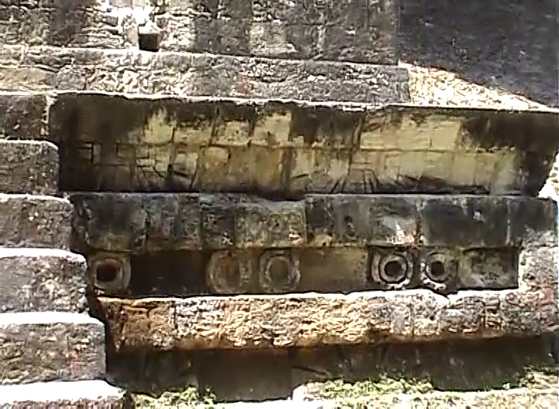
As for the North Acropolis, I got there only as far as Temple 33 that constituted the sepulchral pyramid built over the tomb of ruler Siyaj Chan Kʼawiil II (411-456), who is also referred to as Stormy Sky. Like in the case of the other buildings in the North Acropolis, here, too, there were several structures built one over the other. However, nowadays it is not possible to see the final version of Temple 33 since a permit was issued in 1965 for its complete dismantling. Apparently it was in too bad a state and there were not sufficient resources for its restoration. Still, this turned out to be well, since several smaller structures were discovered that existed under that pyramid which was interestingly enough 33 metres high. What can be seen here are two big masks that originate from the second phase of the construction of this temple and I took a photo of one of them.
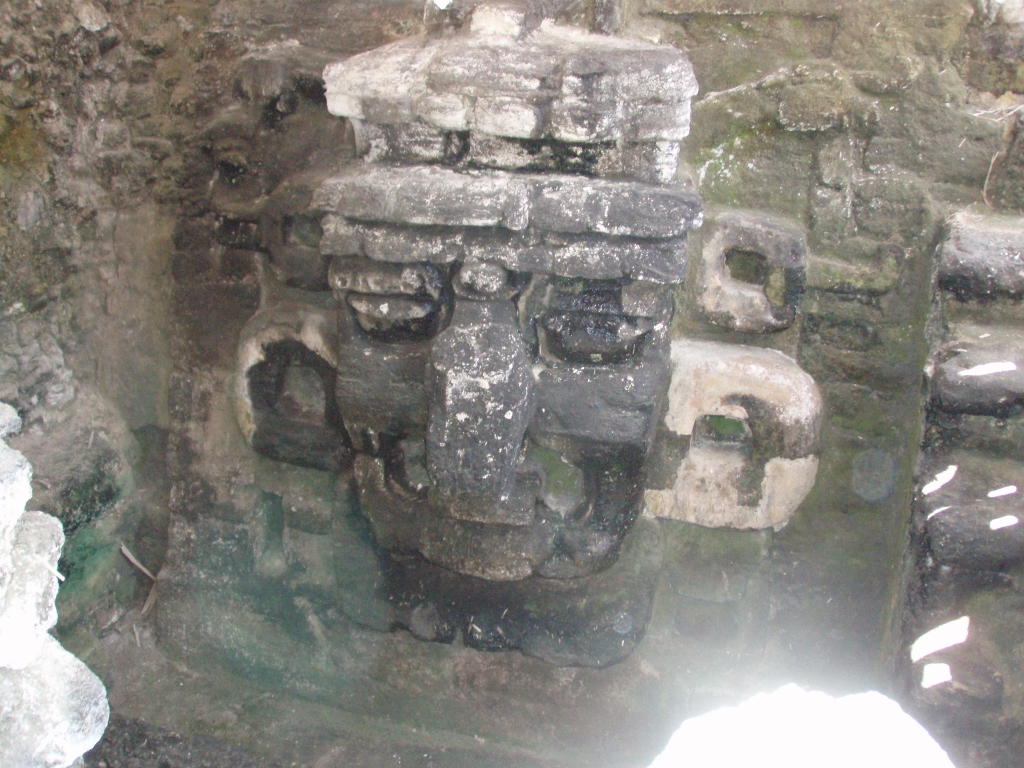 Masks from the second phase in the construction of Temple 33
My visit to Tikal practically ended here. While standing at the very beginning of North Acropolis, I just turned around and over several steps descended to the Great Plaza.
 Again at the Great Plaza and again Temple I
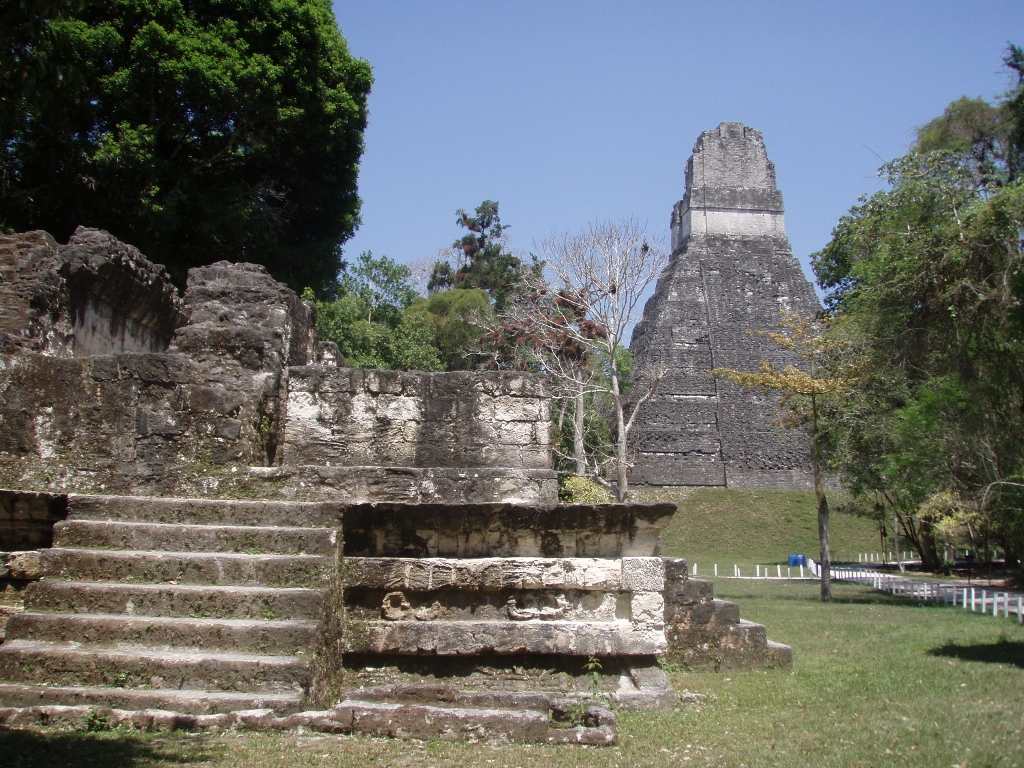
On our way towards the exit from the site, we passed between Temple I and the Central Acropolis where there is a small Ballcourt. A part of it can be seen nicely in the photo above, in the bottom to the right, directly next to the temple.
While going towards the exit from the archaeological site Tikal, we passed beside a lonely, not too big a structure built a little farther from the Central Acropolis. It is actually very interesting. Namely, the guide drew our attention to the stone decoration that can be seen on a part of its facade. These are the eye-like forms that have absolute similarity with the depictions of eyes in Teotihuacan near Mexico City. It is precisely this that is taken as the evidence that, regardless of the existence of different nations and irrespective of the different time periods and specificities that they brought along, the region of Mesoamerica (from the present-day central Mexico to northeast Costa Rica) constitutes in fact a single uniform cultural whole and civilisation.
 Part of the facade of a structure with eyes in Tikal
What I found particularly interesting in connection with this story was that I knew exactly what the guide was talking about. Namely, thanks to the incredibly fortunate circumstances I was in Mexico in 1995 and on that occasion I also visited Teotihuacan. At the time I used slides and thus I have SIGNIFICATLY fewer photos, but upon my return home from Central America I found among my slides exactly what I was looking for.
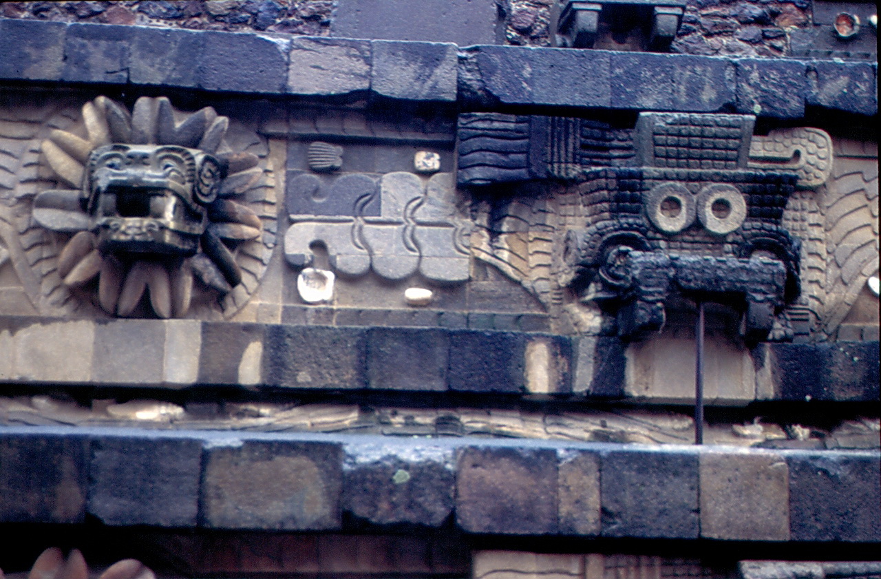 Eyes from Teotihuacan (obviously on the right-hand side of the photograph)
The end of my visit to Tikal was practically right here by this structure.
 Parting with Tikal – Temple I is on the right-hand side, as seen from the back side
Although exceptionally content with my sightseeing of Tikal, primarily because of the fantastic opportunity to see the sunrise from the top of a temple-pyramid and also because I saw the most important structures at the site, it is completely clear that I saw a mere fraction of what exists here. I have already said that Tikal could be visited for a few days. On the other hand, it does stand that such detailed visit requires excellent knowledge of all things ancient Maya. Although I did learn a lot during the actual visit, as well as during the writing of these stories almost 13 years after the journey, I am certainly not an expert for the ancient Maya. In other words, it is quite unlikely that I would ever go back to Tikal again.
What was different here in Tikal in comparison to the other sites from the period of the ancient Maya people that I visited during this trip is that here I did the sightseeing as a part of a group. I think that Tikal is the right place for such a thing. Not only is this site big, but also it is situated in a more or less dense forest and although there are signs, I think that had I been here on my own, I would have wasted a lot of time trying to get my bearings.
I would also say that apart from the extremely early trip to Tikal that was perfect because of the sunrise, although I was often drenched in sweat because of the rush, climbing or simply because of the very high air humidity, that early start also allowed me to visit the site before the hottest part of the day. And finally, by heading back to Flores already at 11 am, I knew that I would be able to continue with my travelling already on this day. The plan was to transfer to Belize and not to spend another night in Flores. Even though Flores is an interesting place with specific history that I have already mentioned, by this time I was ready for something completely different.
Still, I first had to go back to Flores and my hotel. I have already said that Flores consists of the city of Santa Elena on the shore of Lake Petén Itzá and the old town that is actually called Flores, that gave the name to the entire capital of the Guatemala’s Petén Department and that is located on a small island close to the shore. Santa Elena and the old part of Flores are connected by a causeway over which there is a road. This is precisely how we were taken back to Flores and each one of the passengers in the mini-bus to their hotel. This is also where Ana and I parted our ways.
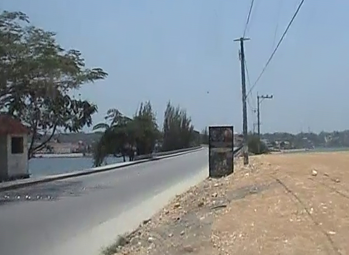 Beginning of the causeway that leads from the mainland to the old part of the city of Flores
Once back in the hotel, I took a shower, changed my clothes, packed up and moved on. Already at 1 pm I was in a passenger van and on my way to the border with Belize. There is direct transportation, but only once a day. Still, I reached the border already around 2.30 pm and there I had to get off the van and cross the border on foot. Not only me, but all the passengers.
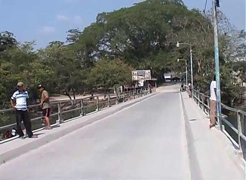
Having put the big backpack on, placing the small one in front of me, I headed for the border crossing and along the way I had to walk across a bridge that goes over the Mopan river. The Mopan starts in Belize, then enters Guatemala where it flows for several dozen kilometres, then it returns to Belize (for around 4 km), then back to Guatemala again for less than one kilometre, only to return to Belize once more where later on it joins the Macal river, thus forming the Belize river. The reason for all of this is that in this section the border between Guatemala and Belize does not follow any topographic features, but was drawn in the shape of a completely straight line while the river obviously meanders.
Be as it may, the main road connection between Guatemala and Belize uses specifically this bridge that I crossed on foot and the bridge is named after the river. In other words, this is the Mopan Bridge (Puente Mopan). It is located on the Guatemalan side and spans the river right in its section that is less than a kilometre long.
While I was walking there, I could see many people from the bridge that were cooling down in the river, some of them fully clothed. In any case, when it is very hot here, and it was on this day, everybody needs to cool down.
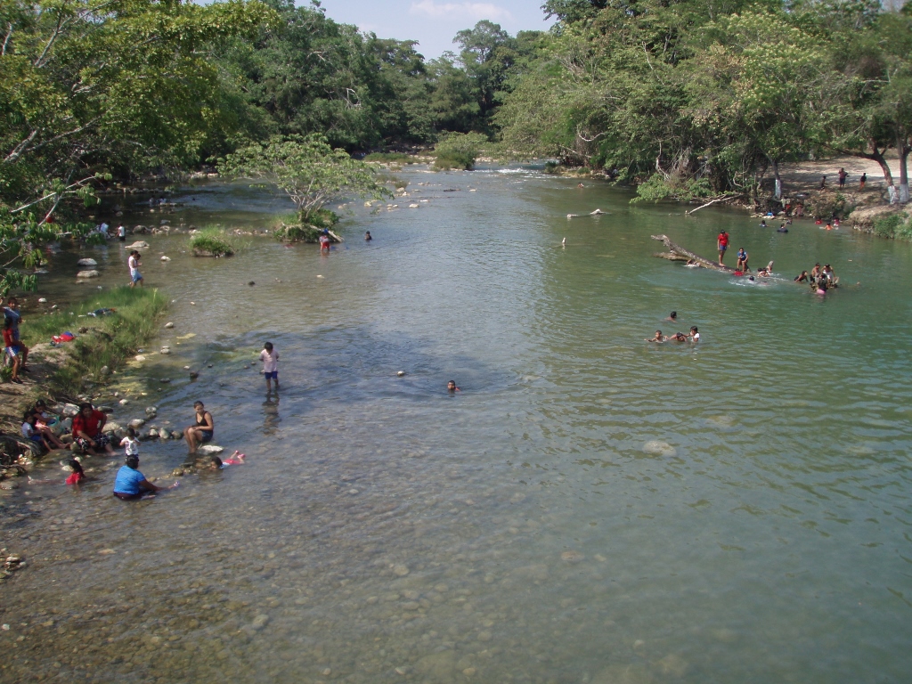 The Mopan
Although I could not see any foam, I presumed that some vehicles were washed in the Mopan river, for I don’t know what else they were doing there.
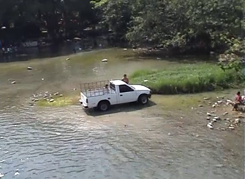 The Mopan
At these moments I felt incredible joy, perhaps inspired by the cheerful cries of the children swimming in the river and probably also because I was so efficient this day and everything was going smoothly. This second stay in Guatemala was exceptionally good and successful, and although one can spend several weeks in Guatemala alone intensively visiting numerous places of interest that this country has to offer, I was very content with what I’ve done. Here is the map showing the second leg of my travel through Guatemala.
Still, I was now literally leaving Guatemala behind me and a couple of hundred metres in front of me there was Belize that promised something completely different and new, and this was where I was heading now.
 Still in Guatemala, while the road in front of me leads to Belize