Following the sunrise at the site of Tikal and after several smaller groups were formed from the visitors who obviously came here very early and each one of these groups had its guide, we all started with the sightseeing tour.
Tikal is an archaeological site in the north of Guatemala and it is situated in a dense rainforest. Admittedly, some parts of the lower vegetation have been uprooted in order to form paths and clearings to ensure access not only of researchers, but also of numerous visitors, for the site of Tikal is one of the most popular tourist destinations in Guatemala and also a part of Tikal National Park. Namely, the whole of north Guatemala that is of the plane type is mostly covered in rainforest and it is full of different national parks and biosphere reserves, but there are also archaeological sites in several places that belong to the ancient Maya civilisation. Still, Tikal is the biggest and the most famous of them all and its scientific research started around the middle of the 19th century.
Tikal National Park is inscribed on the UNESCO’s World Heritage List within the group of properties that belong to Guatemala and it is there on account of its natural and cultural values reflected in the extraordinary biodiversity and the historic and archaeological importance. The park covers almost 60,000 hectares of wetlands, savannah and tropical forests, and it is home to jaguars and pumas, several species of monkeys and anteaters, as well as over 300 bird species, while everything is located in the forests with over 200 species of trees and over 2000 vascular plants. In addition, the forests also contain thousands of architectural and artistic remains of the Maya civilisation from the Preclassic Period (600 BCE) to the demise and final end of the urban centre around 900 CE.
Although during my visit to Tikal I did see some birds and monkeys (not jaguars and pumas though), and there were certainly lots of trees and plants, the primary reason for my visit was to see the remains of the ancient Mayan city.
Tikal was the capital of one of the most powerful states of the ancient Maya people. The power of Tikal has already been mentioned in my stories, since it was precisely the rulers from here that instated the founder of the dynasty which ruled the also powerful Copán (present-day Honduras) for four centuries. Although there are remains of some structures built in Tikal back in the 4th century BCE, Tikal reached its overall apogee during the Classic Period, i.e., from around 200 CE to around 900 CE. The last of the big pyramids that Tikal is famous for was built around 810 CE. After that, the data about Tikal did appear from time to time until the second half of the 10th century, after which the abandoned city was taken over by the jungle. Up until the 19th century when the explorations slowly started to take place here.
Like in the case of the other ancient Maya cities, the theories linked to the disappearance of this civilisation from the scene of the world’s history revolve primarily around the too large a number of inhabitants in the urban centres and the inability to feed such a large number of people, especially bearing in mind the increasingly poorer yields of agricultural crops on account of the loss of nutrients in the soil. Also, the increased deforestation led to soil erosion. In other words, the agricultural activities could not provide sufficient quantity of food for all. Apart from that, the research also shows that the drinking water was polluted by mercury, phosphates and some bacteria.
Nowadays, within the inner urban zone of this archaeological site that has around 400 hectares it is possible to see important architectural structures that include temples, palaces, residential structures of different size, ballcourts, squares, roads, etc. The site is very big especially taking into account the wider zone that is also considered archaeologically valuable and an eager visitor can easily spend several days here. My visit, however, within a smaller group led by a guide, did not go to that level of detail, but it was certainly extremely interesting.
And yet, the visit to the archaeological site started precisely from one tree. This was sapodilla or sapota (Manilkara zapota) also called chicle in Spanish, which is also the Spanish word for “chewing gum.” Namely, in addition to bearing edible fruits and bearing them in a large quantity (twice a year), the bark of this tree produces whitish, rubbery latex that is called chicle and that is collected by cutting the bark at an angle by a machete. It was already the Aztecs and the Mayas who used to chew the chicle in order to reduce hunger, refresh their breath, clean their teeth or for joining objects for everyday use by using this as a glue. In addition, the Mayas also used this rubbery material as tooth fillings. As for the modern use of the chicle, the chewing gum was patented in the USA in the second half of the 19th century (during the 1860) and at that time it contained the chicle as the natural rubbery ingredient. With time, it turned out that the artificial materials were cheaper than the natural ones and so today very few producers make chewing gums using the natural chicle. The following photo is not spectacular by any stretch of imagination, but it serves as a reminder of the story about chewing gums.
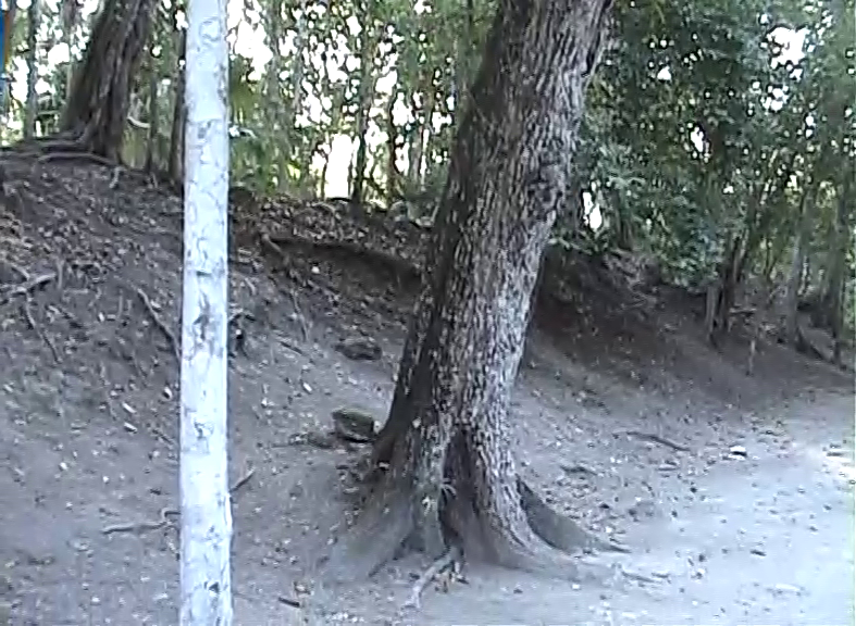 Sapodilla tree (the large one in the middle of the photo)
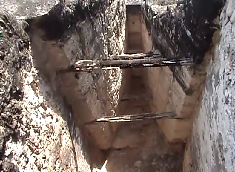
Close to this tree we also passed by an archaeological probe where the researchers had dug a little beside some foundations. Taking into account how big Tikal is and how much archaeological material can be found here, no wonder that there are probably some works all the time. In May 2008, next to this probe it was possible to see how experts worked on the restoration of the stairway that is located on the east side of Temple IV. Judging by some photos I saw on the internet, this stairway has been reconstructed in the meantime. By the way, the big temples-pyramids from Tikal have only one stairway each that is used to ascend to the top of the pyramid where the temples actually are. Here in Tikal the temples often have very well preserved ornamental roof combs.
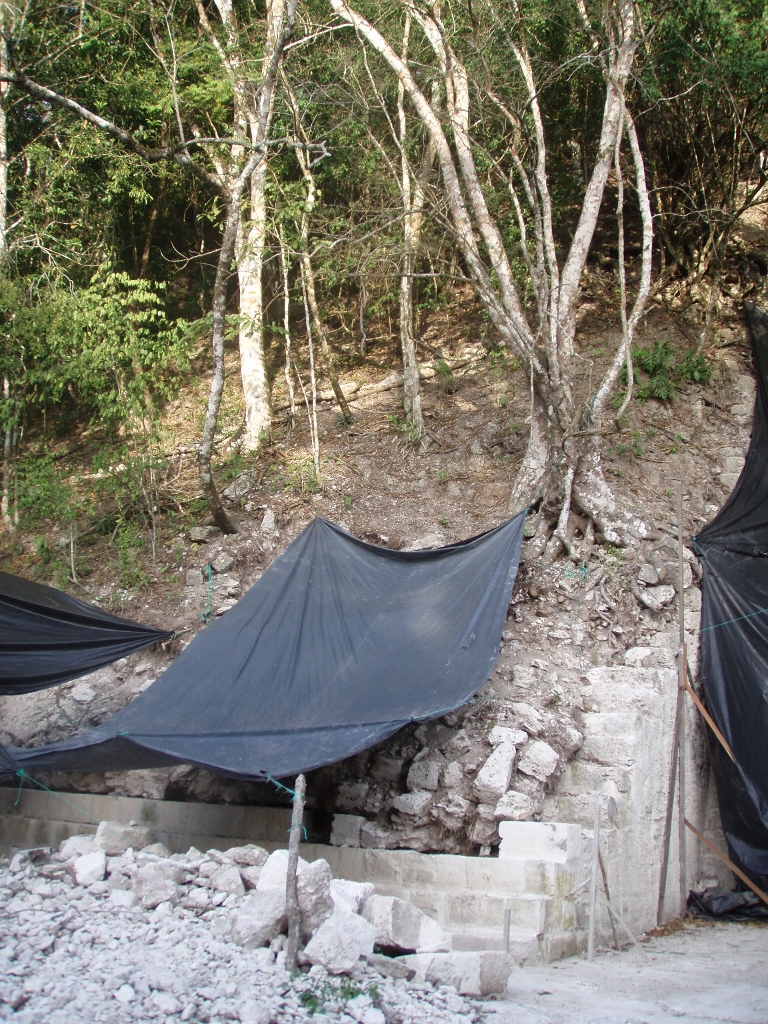 Work on the access stairway on the east side of Temple IV in 2008
The photo above shows the place where the restoration works are ongoing, while the next one, in addition to showing a partially restored wall base, also shows what the site used to look like before the contemporary interventions. Although there are some parts of the temple-pyramid that still stand stable, a good share is ruined either because of the centuries of abundant seasonal rains or because of the roots of the trees that grow profusely on these structures.
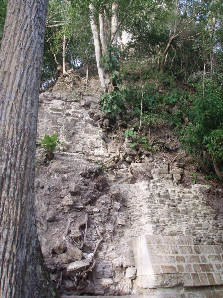 Sections on the east side of Temple IV in 2008
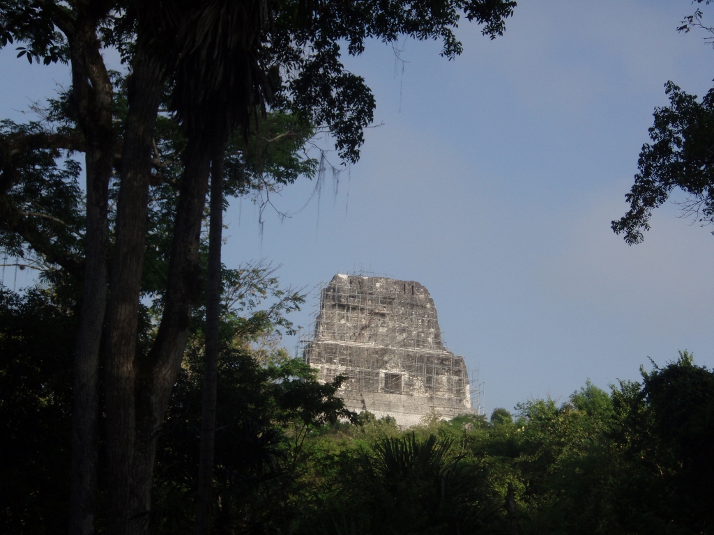
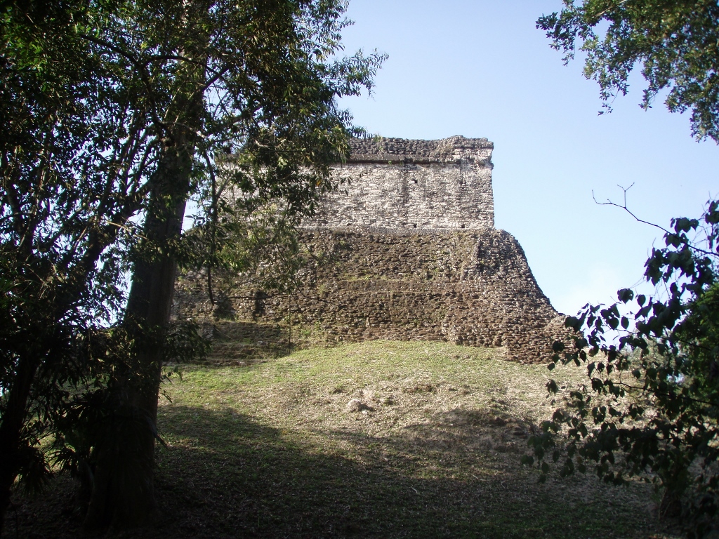
Above the tops of the surrounding trees I could also see the top of Temple IV that was all covered in scaffolding since the works on its maintenance were obviously in full swing.
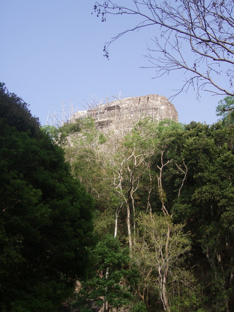 Top of Temple IV in 2008
As we were looking up, the guide drew our attention to a bird that was standing quite far away on the very top of a very tall tree, but its shape could still be discerned. This was the keel-billed toucan (Ramphastos sulfuratus), which is one of the three species of toucan living in Guatemala. The photo is far from ideal, but it’s yet another nice reminder.
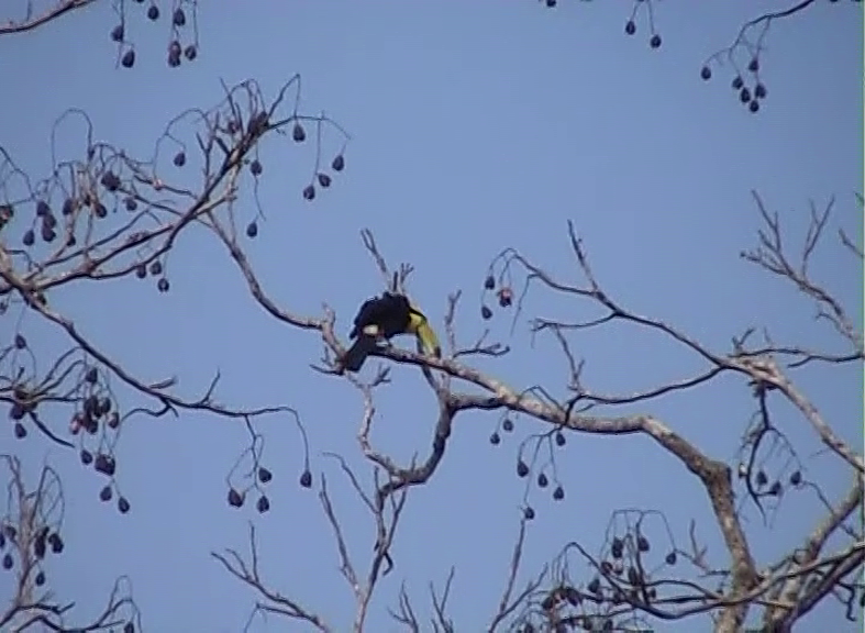 Keel-billed toucan, filmed from the back, while its head and bill can be seen on the right-hand side
Walking further around Tikal together with the smaller group that had the Spanish-speaking guide we got to Altar 5 and Stele 16. It should be said that the originals have been placed in a museum, while the replicas have been displayed near the place where they were found and that is marked as Complex N.
Altar 5 is positioned upright and there it is possible to see two carved figures that perform a ritual by using the bones of an important woman. It is presumed that one of them is ruler Jasaw Chan K'awiil I (ruled from 682-734).
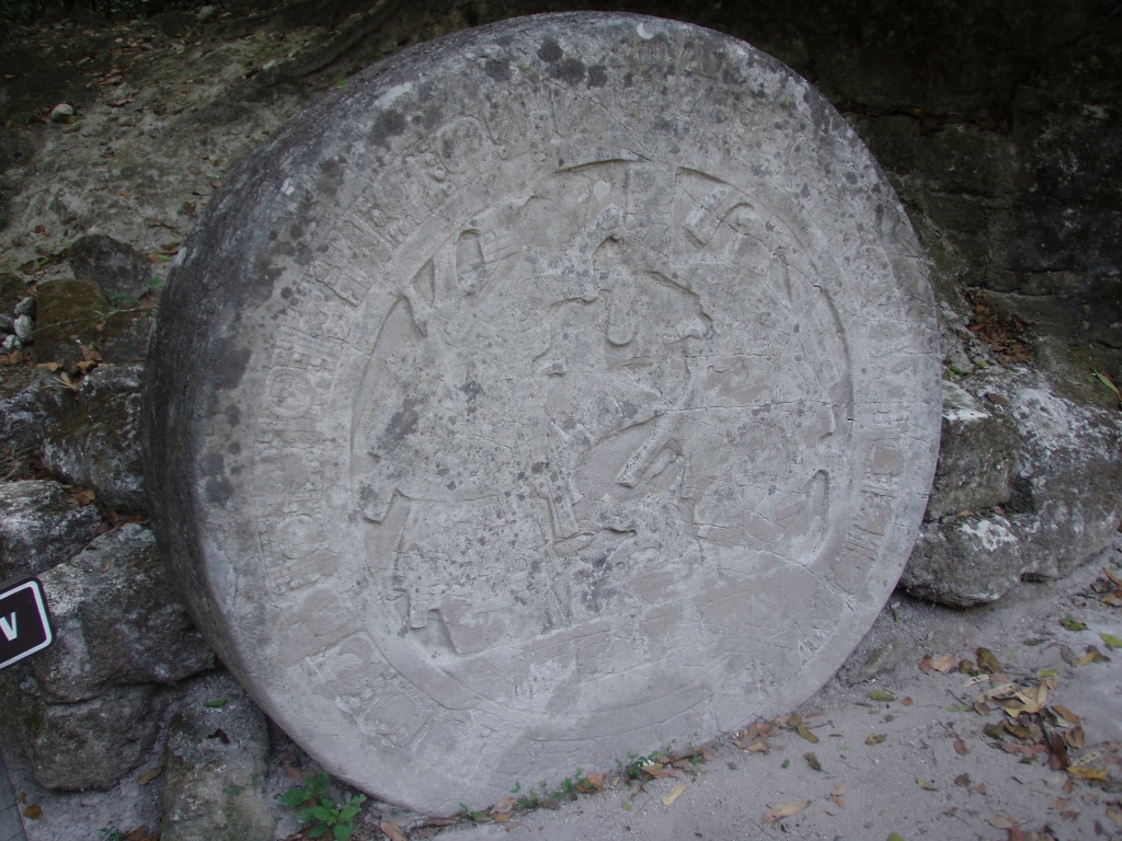 Altar 5
The ruler of Tikal named Jasaw Chan K'awiil I is also designated as Ruler A, Ah Cacao or Sky Rain, while his real title was lord, i.e., ajaw. He was also the father of ruler Sun Sky Rain who had Temple IV built. This ruler, Sky Rain, had the most important temples-pyramids in Tikal built, but more about this later on.
Here I can also add that on top of the supposition that this ruler is seen in the carved depiction on Altar 5, there is Stele 16 beside it that was dedicated in 711 CE and it shows the portrait of the ruler, as well as an ideogrammic text. It is believed to be one of the most beautiful in Tikal.
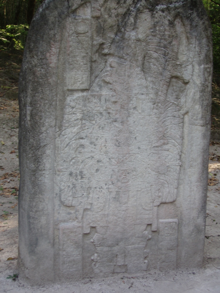 Stele 16
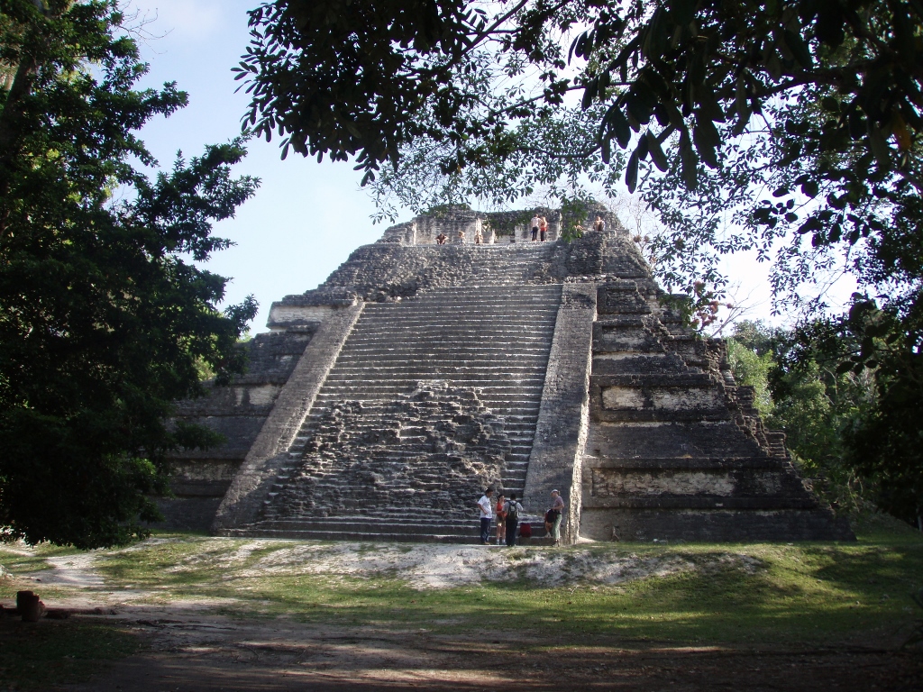
After the short stay by the altar and the stele, we continued with our walk following a winding path through the forest and so we reached yet another place from which it was possible to see the top of Temple IV once again.
 Temple IV – the photo also shows the stairway on which we were sitting when looking at the sunrise
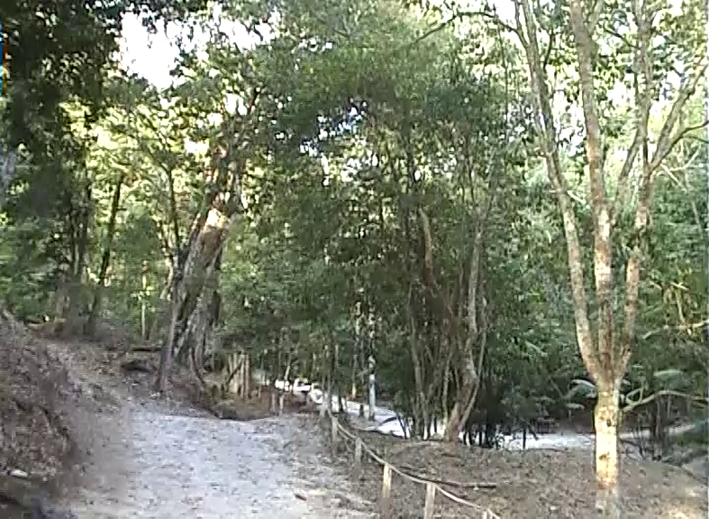 Path through the forest in Tikal
Then we passed beside the back side of the Palace of Windows or Bat Palace. It has two storeys and numerous rooms on both of them. The reason why it has received its name is that it has numerous windows on the upper floor and this is quite handy for the bats that fly through them when retiring for sleep. In contrast, when they go on the foraging for food, it is possible to see them in a large number flying out from the rooms of the palace.
 Bat Palace
I’ve already said that Tikal is a rather large archaeological site and it could be visited for days if one wants to look at everything in more detail.
 Lateral view at one of the “nameless” structures we merely passed by
Because of that large number of interesting structures, there are many paths leading through the forest and it seems to me that an individual visitor could waste a lot of time trying to find the right way to whatever they want to see. The guides, on the other hand, obviously know these paths very well and they also have the experience, so until the very end we almost did not cross paths with any other group and there were several of them. What I want to say is that there is certain beauty in being able to look at a structure without dozens or scores of other visitors around you.
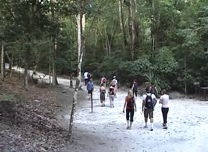 My group during the sightseeing tour
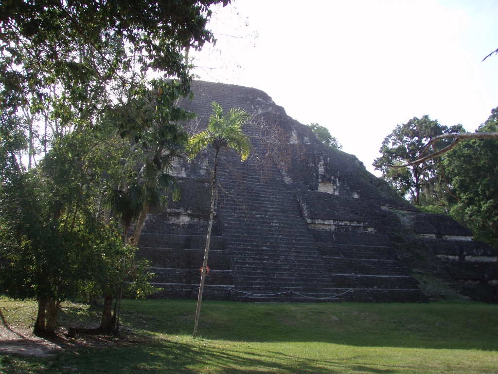
Within our tour we headed for a group of monuments called the Lost World (Mundo Perdido). This is the biggest ceremonial complex that consists of 38 structures that surround a large pyramid. The Mayas often built new structures over the old ones, which can be seen for instance in the case of the rest of the large buildings in Tikal, but in the case of this complex, the structures that belong to it come from different periods – some are from the Late Preclassic Period (350 BCE – 250 CE), some are from the Early Classic Period (250-550 CE), while some are from the Late Classic Period (550-830 CE). This was the first architectural complex built in Tikal and also the last part of the city that was abandoned during the Terminal Classic Period. In any case, it is precisely because of these older structures that the complex got its name.
There are a couple of pyramids within this complex and one of them was named after the talud-tablero, an architectural style that was very popular at some point and was used in the construction of platforms, temples and pyramids in the Pre-Columbian Mesoamerica. Admittedly, more in the parts that were under the direct influence of Teotihuacan (close to the present-day Mexico City) and much more rarely among the Mayas. In order to get the slope that leads to the top there is regular alternation between the sloping levels called the talud and the vertical levels called the tablero. This may be partially seen in the photo below and also in some of the following photos that show the pyramids.
 Example of the talud-tablero architectural style
So, first we got to the Talud-Tablero Temple, also called the Temple of the Three Rooms. In addition to the facade that reflects the talud-tablero style, there are also balustrades on both sides of the stairway which was a rather rare element in the Mayan architecture.
 Talud-Tablero Temple
In the case of this pyramid, the archaeologists have established a few construction phases. The first structure in this place was built in the second half of the 3rd century CE, while the pyramid got its final shape in the period from 550 to 700 CE. The pyramid is 22 metres tall now. I’m saying “now” since in the past there used to be a decorative roof comb, but it collapsed over time.
Here we all had an opportunity to climb to the top of the pyramid and that was also a good chance to have our photos taken while on the stairway.
 On the stairway of the Talud-Tablero Temple
When one gets to the top, it is possible to see three rooms, with the two side rooms being damaged by the collapsed roof comb, while only the middle one has survived in its entirety.
 Talud-Tablero Temple – the surviving room is straight ahead, in front of it, to the left and right, are the other two rooms
 Talud-Tablero Temple – needless to say, the Mayas used the typical corbel vault here as well
It is interesting that before the archaeological survey of the temple, there used to be a lair of a jaguar in the shrine on the top, along with the remains of its prey.
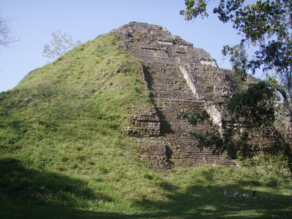
The Talud-Tablero Temple is situated in the north section of the West Plaza, while on the east side there is the Great Pyramid or the Lost World Pyramid.
 Great Pyramid
This is the biggest structure within the Lost World complex in Tikal. This pyramid, too, dates back to the Preclassic Period and was built and reconstructed in several phases. The first structure was built around 700 BCE, making it the oldest structure in Tikal. The pyramid got its fifth and final shape in the 3rd century CE. It is around 31 metres high, while the length along its base is 80 metres. In May 2008 it was not possible to climb this pyramid, but as far as I could see on the internet, a platform has been built on its top and it can be reached via a metal-wooden construction and not using the original stairway.
The Great Pyramid in the Lost World used to be an astrological observatory and to the east from it there are some structures built in the direction of the points along the horizon line above which the Sun rises during the Equinoxes and Solstices. In addition, in the photo above it is possible to see some white fields on the facade of the pyramid. As the guide told us, in the past there used to be masks of god Chaac there, but I actually don’t know what has happened to them.
Also, within the Lost World complex there is a large number of smaller temples, a palace, structures that served an unknown purpose, and there are also numerous graves that have been found here, unquestionably of the members of the elite within the social structure in Tikal.
 Cleared up rainforest and parts of the palace within the Lost World
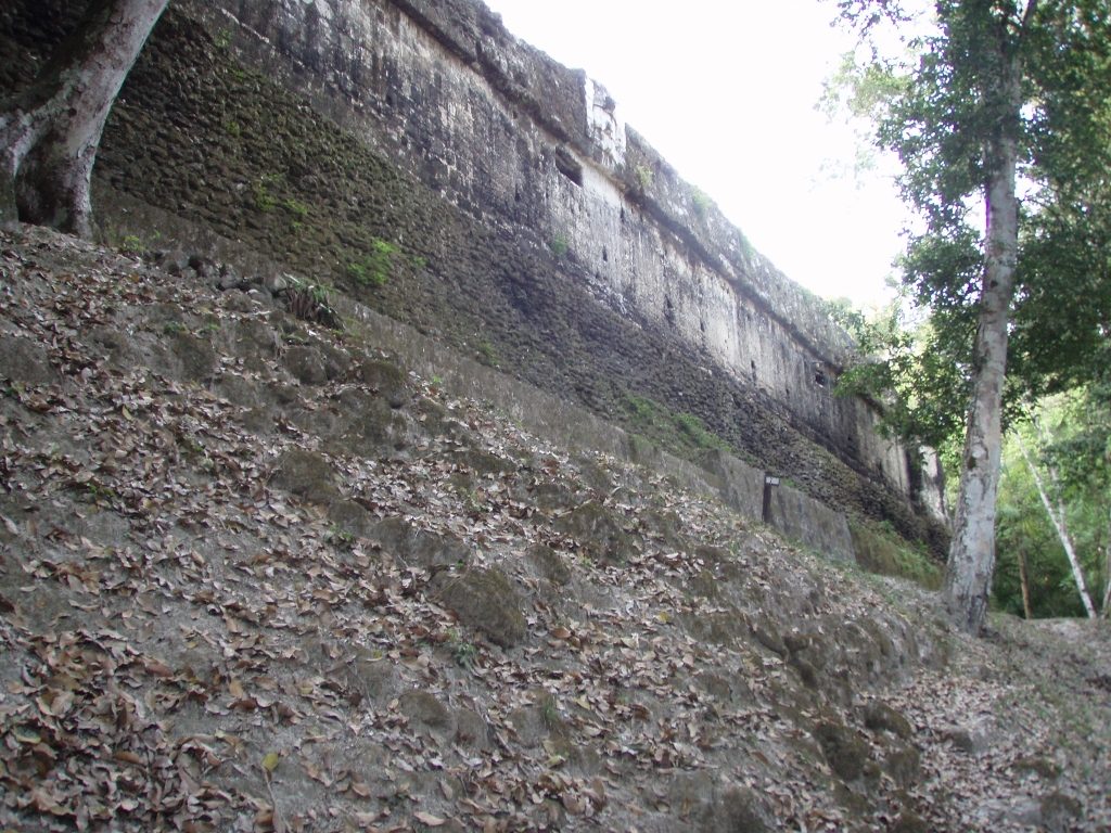
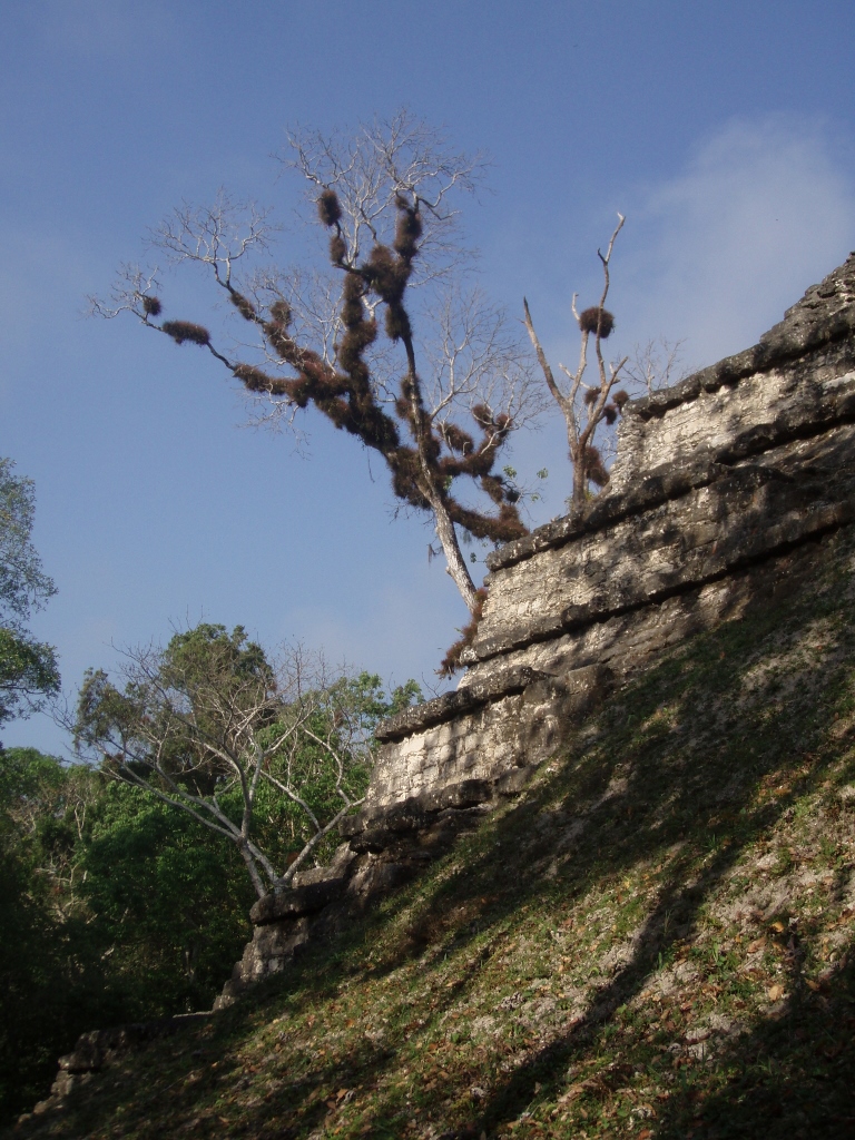
We also walked past the north side of the Great Pyramid and there it was possible to see nicely the difference between the section cleared up by archaeologists and what it used to look like before the contemporary human intervention.
 Great Pyramid – view from the north in 2008
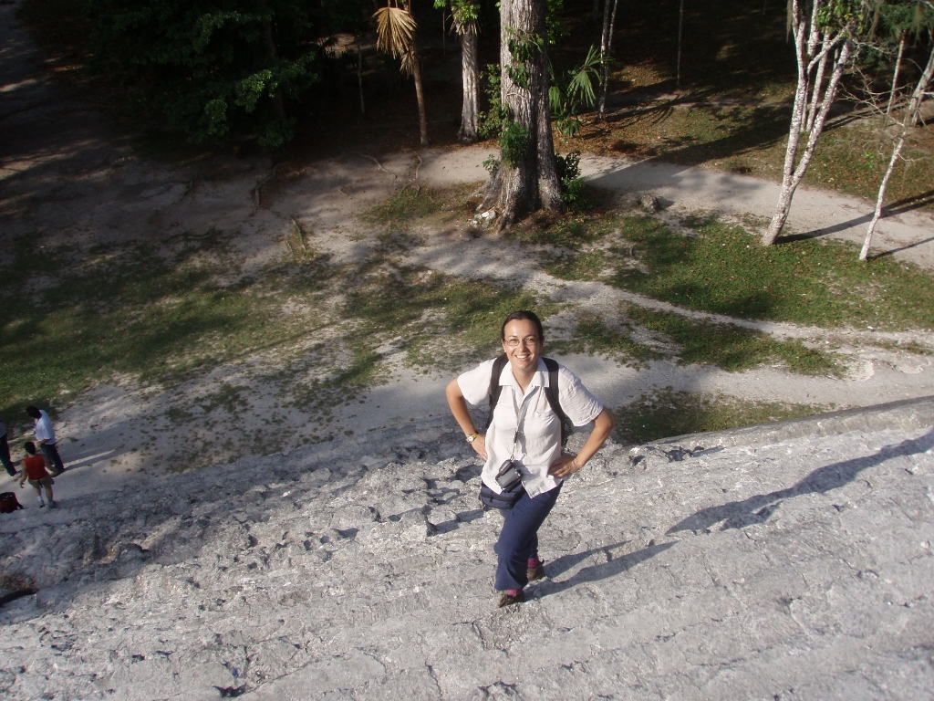
Here I also took advantage of the presence of Ana to have a photo of me taken. Let me clarify the woollen socks and hiking boots. I knew it would be hot, but I did not know if we would walk through (tall) grass and if there would be bugs. In order not to worry about this, I was fully prepared and did not mind it in the least.
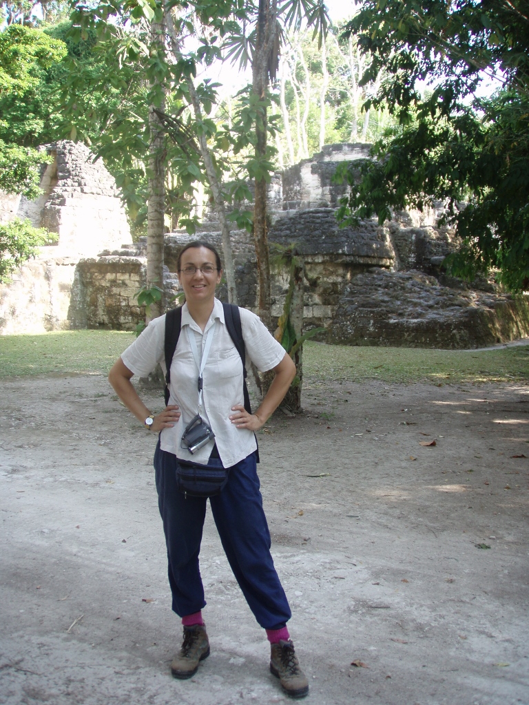 In Tikal