The archaeological site Quiriguá in Guatemala that is inscribed on the UNESCO’s World Heritage List is not as big as the nearby Tikal or Copán in Honduras, but it contains numerous impressive steles and zoomorphs. When I visited it in May 2008, I also reached Stele H.
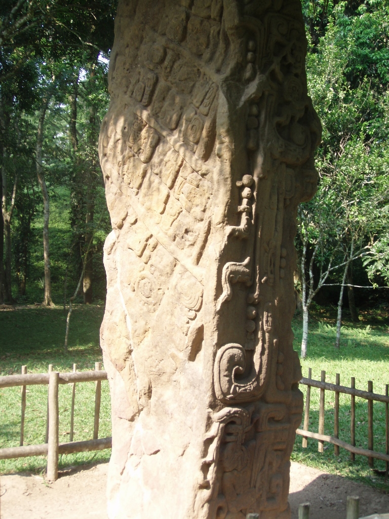 Stele H
Stele H was dedicated in 751 and it stands out among the rest of them because of the askew position of the ideograms on it, which is a relatively rare phenomenon in the world of the ancient Mayas.
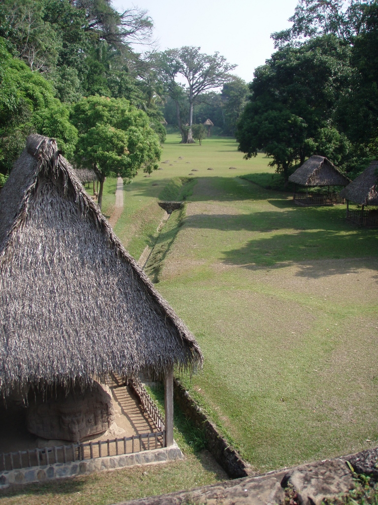
Not far from Stele H there are three more steles (I, J and K), but at this point I was more interested in a group of altars and zoomorphs, so I headed there.
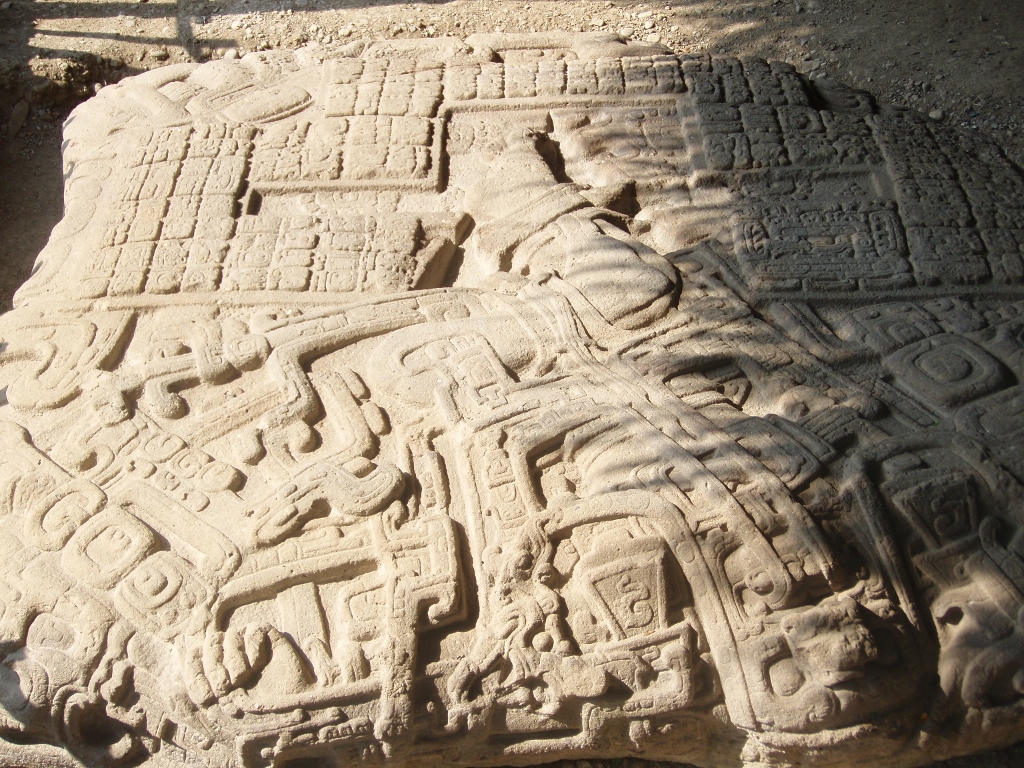
First I walked past Altars M and N. Altar M is often designated as Zoomorph M and it was made in the shape of a compositely carved head that brings together elements of jaguar and crocodile. This altar from 731 is specifically important for the history of Quiriguá for on the one hand this was the first monument dedicated by the greatest king of this Mayan city-state, Cauac Sky (723-785), and on the other it contains the text in which the ruler was called the “holy lord” (k’ul ajaw) instead of merely the “lord” (ajaw), which caused the conflict between Quiriguá and Copán whose vassal Quiriguá was before.
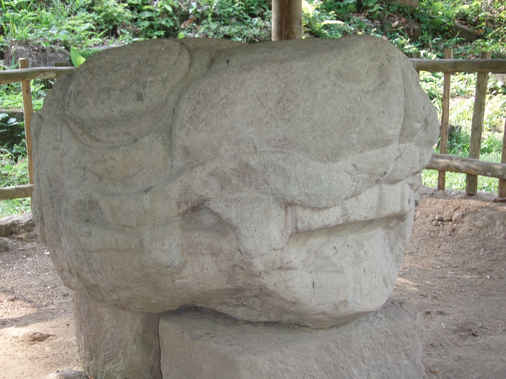 Altar M
Then I went to Zoomorph and Altar O. They were dedicated in 790 by ruler Sky Xul, the successor of ruler Cauac Sky, who ascended to the throne in 785 and ruled Quiriguá over the next 10 to 15 years. The zoomorph shows again a composite being, while on the altar it is possible to see a lighting god.
 Zoomorph and Altar O
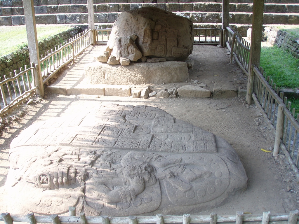
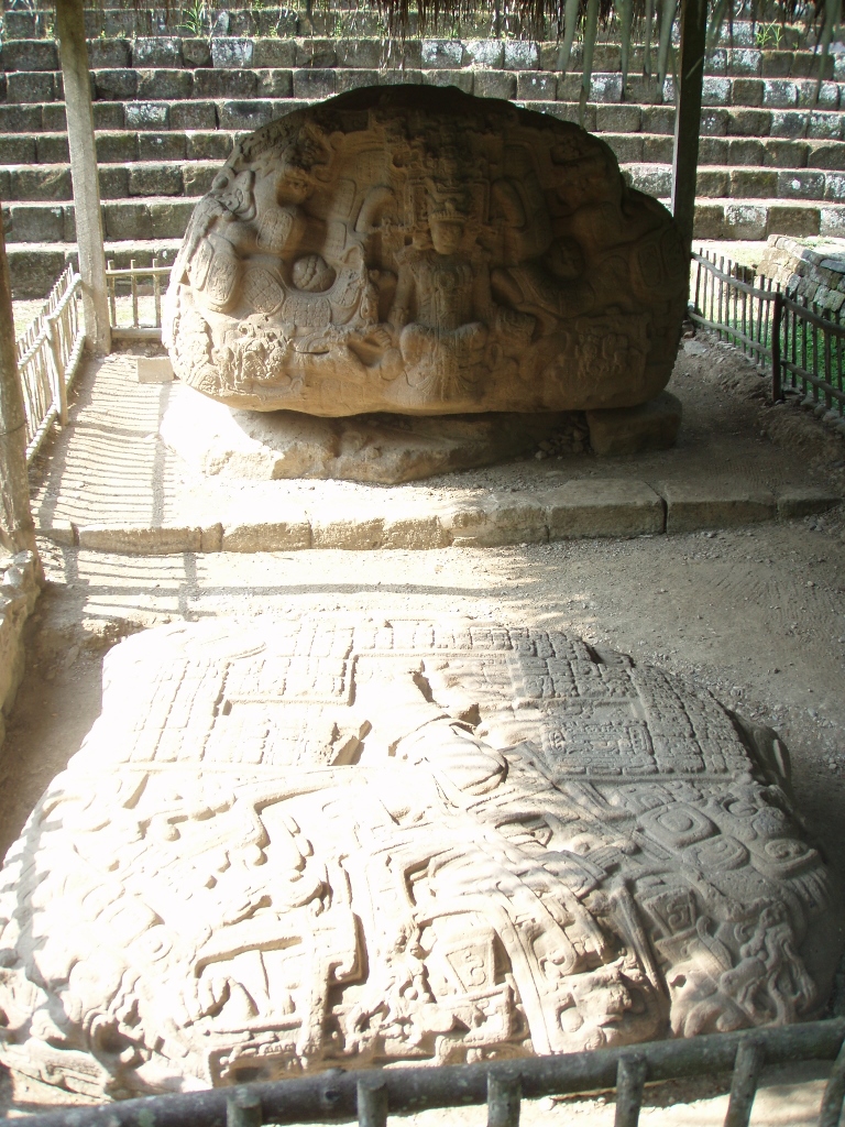
Right next to them there are also Zoomorph P and Altar P from 795.
 Zoomorph and Altar P
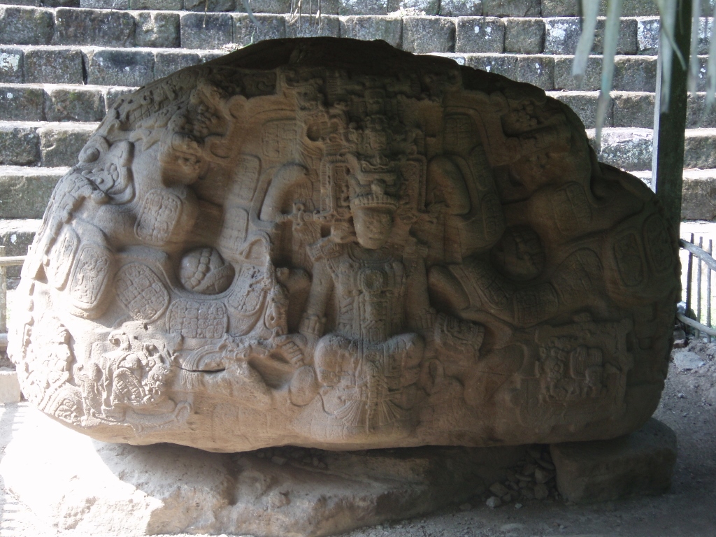
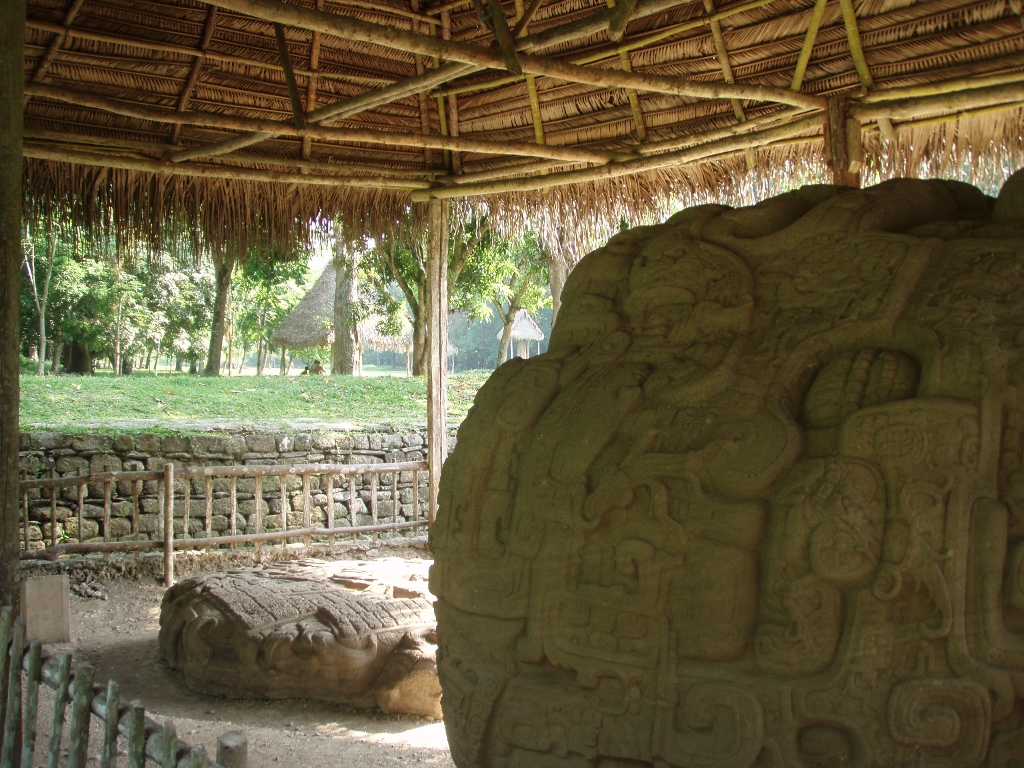
These two monuments are the masterpieces of the Mesoamerican art, while on account of the shape of the zoomorph, the researchers often call it the Great Turtle. To start with, on the altar there is a depiction of an unidentified deity coming out from a split in the earth and there are also numerous ideograms there. From the side from which the altar is commonly looked at, and the photo below shows it like that, it is possible to discern the being that appears as if placed “up-side-down” – its head is below right, his left arm is below left, while his leg (the only one that can be seen) is in the middle (above) in a cleft shaped like an inverted letter V around which there are ideograms.
 Altar P
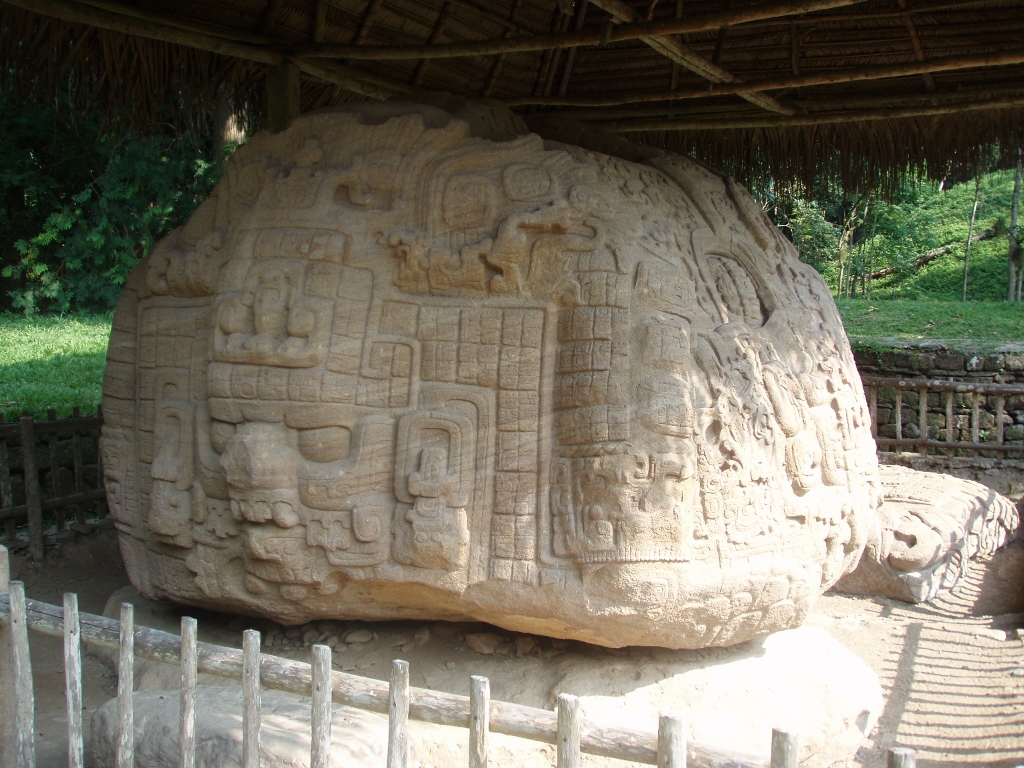
As for Zoomorph P, its weight is around 20 tons. Its whole surface is incredibly skilfully decorated and at a stunning level of detail. On the front side it shows ruler Sky Xul sitting with his legs crossed in the wide-open jaws of a composite mythical monster.
 Zoomorph P
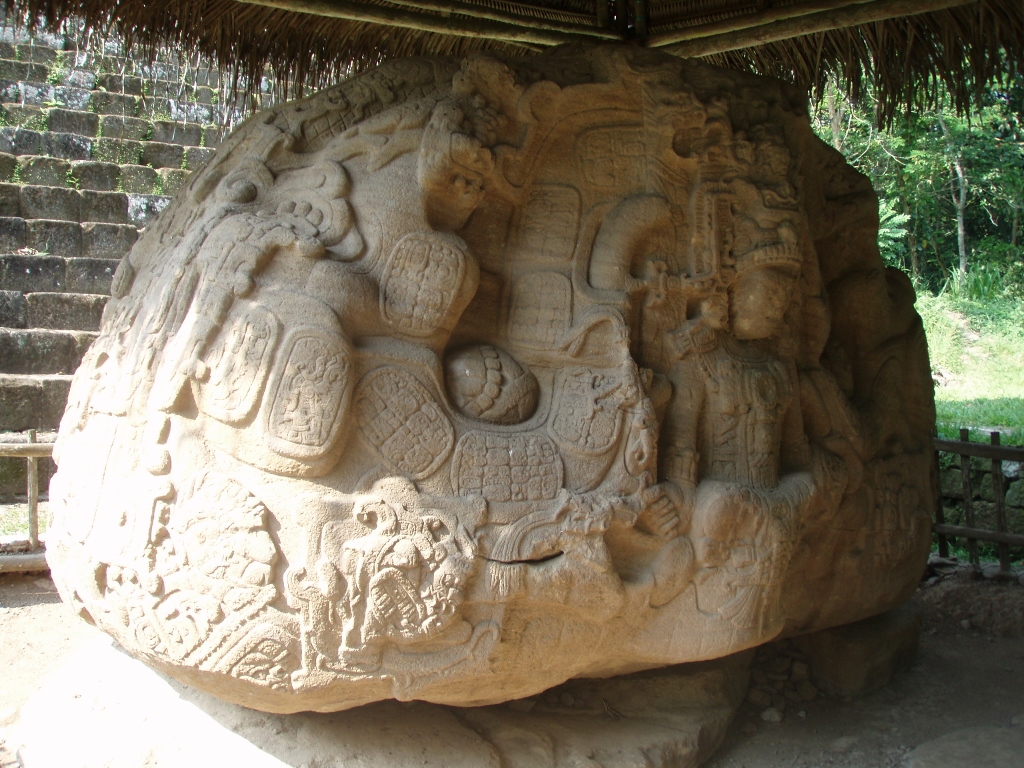
I started to circle around Zoomorph P and it was indeed very interesting to see the wealth of carved decorations on all sides. When one looks from the northwest corner it is possible to see that the zoomorph is wider than it is long.
 Zoomorph P, on the left-hand side it is possible to discern the ruler witting with his legs crossed
On the back side there is a depiction of the Cosmic Monster or Itzamna, the Mayan god of fire who has created the Earth.
 Zoomorph P, god Itzamna is on the left-hand side of the photo
 Zoomorph P, view from the northeast angle
Then I made yet another circle around Zoomorph and Altar P, and so I also looked back towards the Great Plaza.
 Zoomorph and Altar P, with the Great Plaza of Quiriguá a little farther away
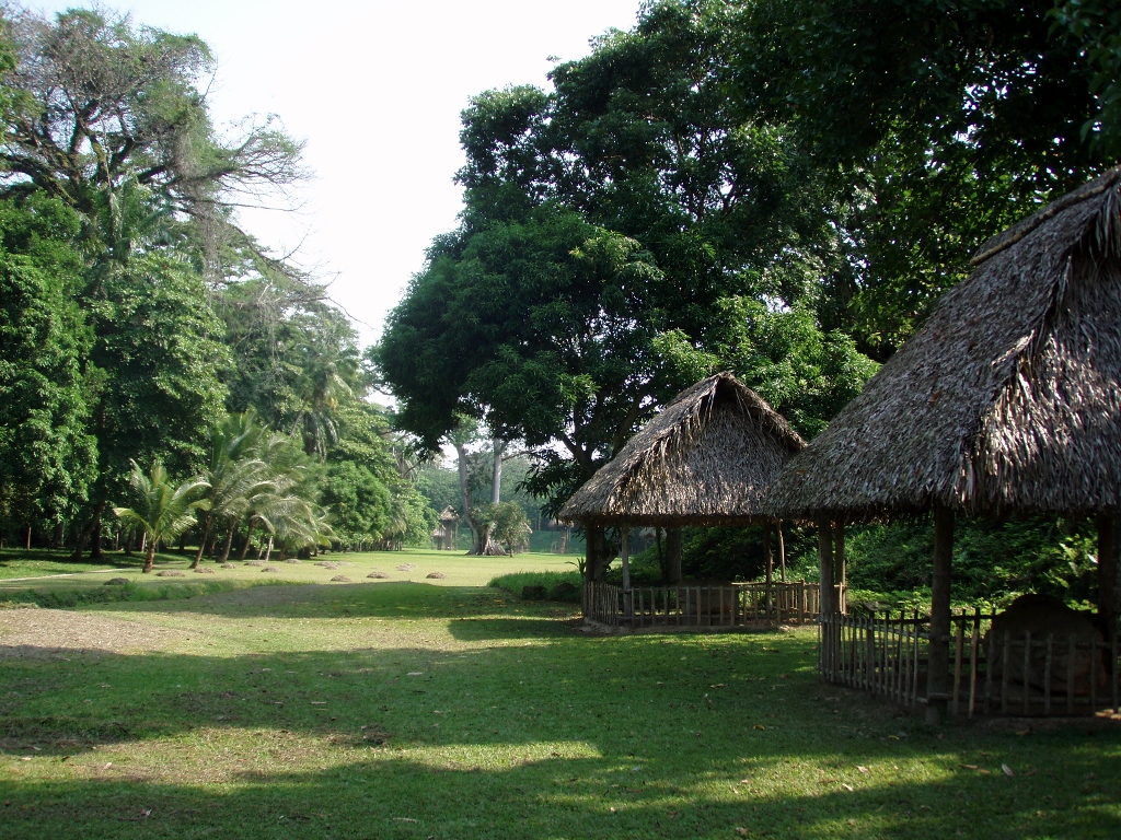
The next item in my plan was to visit the Acropolis in Quiriguá a little. This is the biggest architectural complex at the site which extends from the ceremonial part of this city-state in the southern direction. As I climbed the large staircase that exists right behind Zoomorphs O and P, I looked once again back in the direction of the Great Plaza.
 View at Zoomorph O (left), Altars M and N (right) and farther towards the Great Plaza
In comparison to some other archaeological sites from the times of the ancient Mayas, the Acropolis in Quiriguá, which consists of a complex of palaces primarily used for the housing of the elite and for administrative purposes, does not look particularly striking and it certainly is not very big. However, one should bear in mind that, irrespective of its independence and even the good financial standing of Quiriguá, it is estimated that at its peak it had only some 2000 inhabitants.
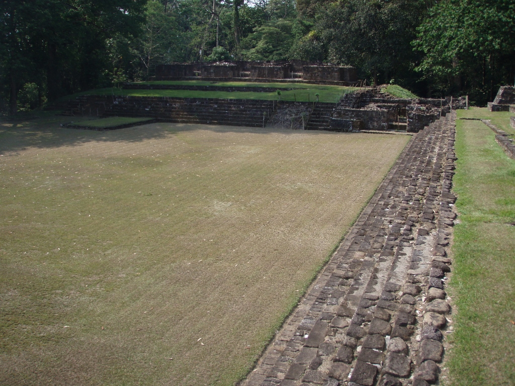 Acropolis
I could also add that although his predecessors gave their contribution to the construction of the Acropolis built in four successive phases during the period from 550 until 810 CE, the most active in this part was the last recorded ruler of Quiriguá – Jade Sky (ruled from c. 800 to c. 810).
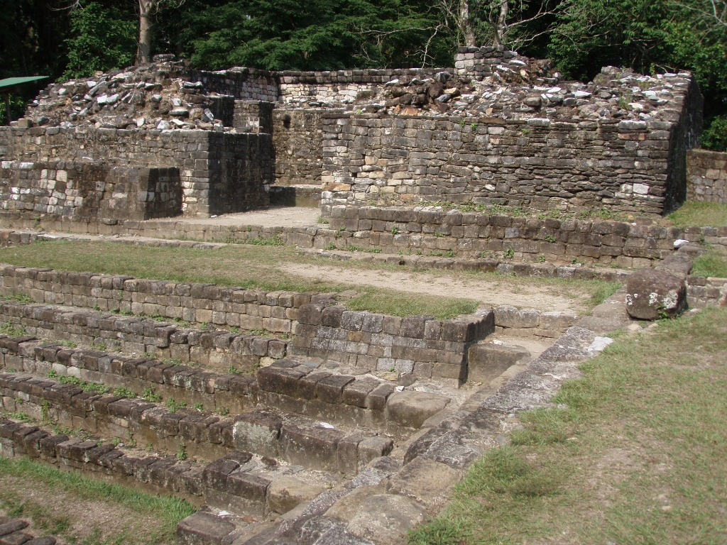 Acropolis, a detail
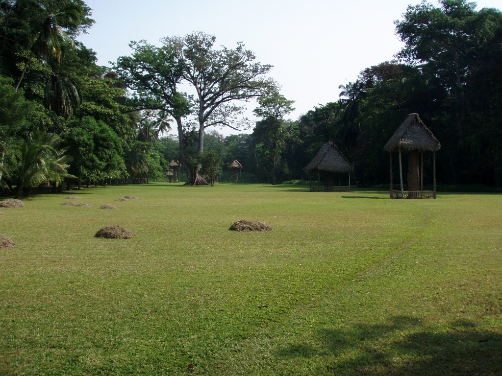
So, without staying at the Acropolis for long, I headed back towards the entrance/exit in Quiriguá. I continued taking photos along the way and so it can be seen that apart from me there were no other visitors at the site.
 Quiriguá: Altars M and N, with the Great Plaza in the distance
 Quiriguá: Great Plaza with Stele J from 756 and Stele I from 800 to the right
Of course, I went past the imposing Stele E again which with its 10.5 metres is the tallest in the world of the Mayas. Let there be no confusion, 3 metres are buried in the ground, while the remaining 7 m plus are what can be seen.
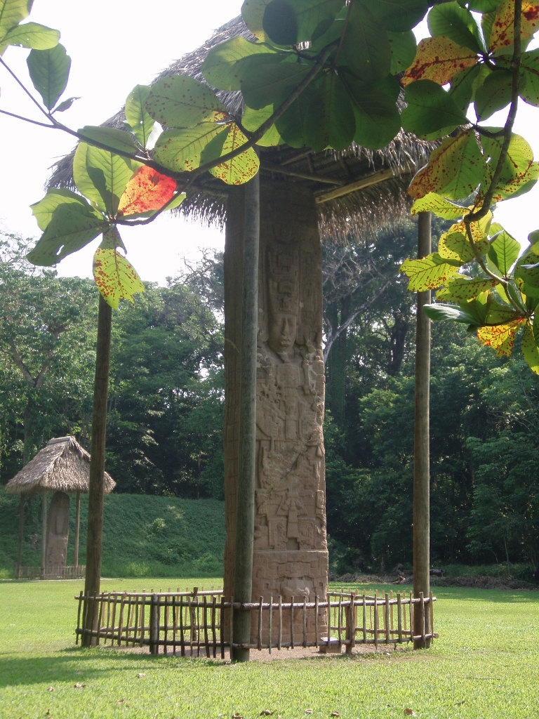 Quiriguá: Stele E, with Stele D a little farther
Talking about tall “objects,” here is one gorgeous ceiba which is the holy tree of the ancient Mayas. No wonder, for one can hardly help worshipping and not staying breathless in front of such imposing presence that is being created in front of your eyes for years, growing up towards the sky.
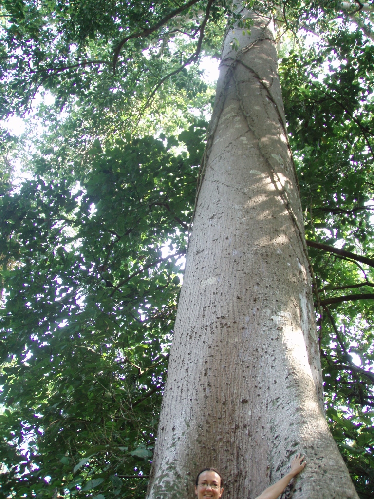 Ceiba and my head in Quiriguá
Then I left the archaeological site and stood by the road where I was waiting for the transportation to come by, for I was to return to village Quiriguá where my things were waiting for me in the hotel room. Around the site there are large banana plantations, but after I had taken a photo of them, I took up a position in the deep shade created by a nearby tree and started to wait for a passenger van or a bus, whatever came first while serving as public transportation.
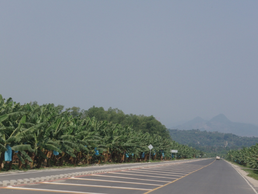 Huge banana plantations that surround the archaeological site Quiriguá
Upon my return to the hotel, I had a light breakfast, packed up my things, had a little rest and then moved on. I wanted to go to the main road that links the capital, Guatemala City, and the city of Puerto Barrios, the main port in the country on the coast of the Caribbean Sea, and catch a proper coach running directly to the Rio Dulce, but there wasn’t any. After initial declining, I finally decided to move in the desired direction, but by taking a seat in the first passenger van that came by. It was clear I would have to change vans, so I first went to town Morales, or more accurately to an intersection from which a road led into the town, and there I waited for another van going to the Rio Dulce. In addition to being hot, it was also quite tight in those vans, but the dense packing of passengers was obviously a part of the local customs and so it was fine with me.
After Quiriguá I was practically moving to the north of the country and originally I planned to go directly to the city of Flores, but since I realised in the meantime that I had a sufficient number of days before the return flight to Europe, I decided to go to the Caribbean coast of Guatemala. On the basis of the data I had, the most interesting place from which to do this was exactly my next destination that is only some 70 km away from village Quiriguá. When in the previous paragraphs I mention the Rio Dulce, I actually do not think of any village or city as such, but of a river, suggested by the name itself, for the Rio Dulce means “Sweet River.”
Here is the map as a reminder of my second leg in Guatemala in May 2008.
I got off the van right after it had crossed the Rio Dulce Bridge (Puente de Rio Dulce), the biggest bridge in Guatemala and the second biggest in Central America, and that was already around noon. Practically speaking, there is a place here called Fronteras, which is often called Rio Dulce Town. Still, I was not interested in this place at all, but only in this part of the river under the bridge where I was to catch a motorboat that went to Livingston town on the coast of the Caribbean Sea.
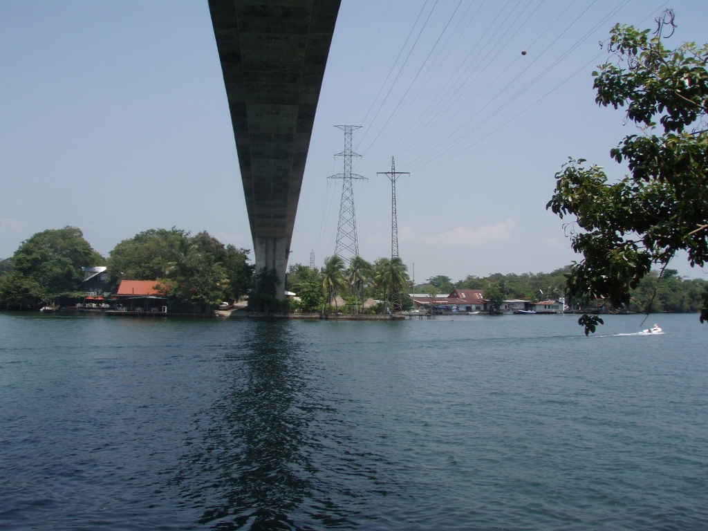 Puente de Rio Dulce as seen from the north bank of the river
However, it turned out that the motorboat receiving around a dozen people was to leave only at 1.30 pm and so I had plenty of time to go and replenish my stocks of local currency, as well as to buy some fruits and soft drinks with the hope I would cool myself down a little. It was incredibly hot or perhaps it just felt like that on account of the exceptionally high air humidity, so after I had finished with what I had, I took a seat in the deep shade. There I was waiting for occasional breeze that brought short-lasting refreshment, for I was trying not to fan myself too often with some napkin, since any movement, even the waving of a napkin, raised the temperature of my body.
As it had been announced, the motorboat left at 1.30, but at first it seemed to me we were going in the wrong direction. However, soon enough I realised what this was about. Namely, the Rio Dulce is a river that connects Lake Izabal, the biggest lake in Guatemala with the surface area of 590 square kilometres, and the Gulf of Honduras which is a part of the Caribbean Sea. Since the Rio Dulce is a navigable river over its entire length of 47 km, then the Lake Izabal itself, which is around 70 km long and has the biggest depth of around 18 m, is linked to the Caribbean Sea and for this reason it is ideal as the parking lot for yachts that can spend their time when they are not sailing the exotic Caribbean tucked away well here. On the other hand, regardless of the size of the lake, I’m sure that these vessels are safer here than what they would be on the coast of the sea where hurricanes create problems every season.
 Yacht parking at Lake Izabal
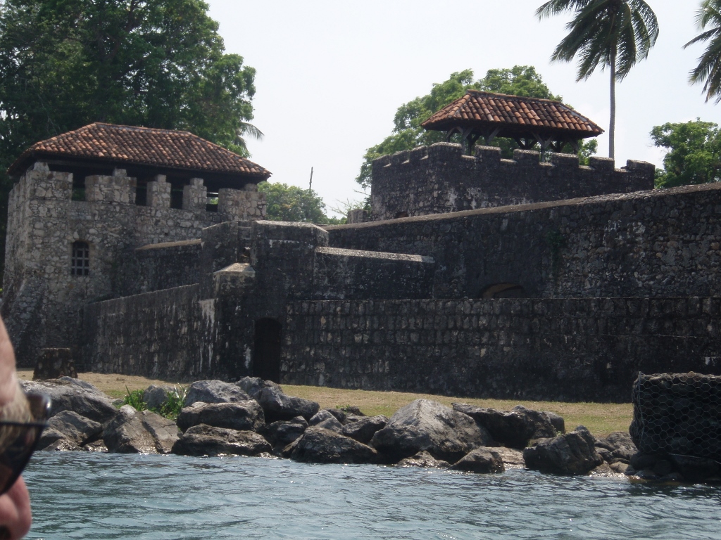
When I had the impression we were sailing in the wrong direction, I was not off beam, for we went from the Rio Dulce Bridge to the lake first in order to pick up a few other passengers after which we turned around and headed in the right direction. Still, apart from having an opportunity to sail a little on Lake Izabal, I also found it interesting that we passed by the Castle of San Felipe de Lara (Castillo de San Felipe de Lara).
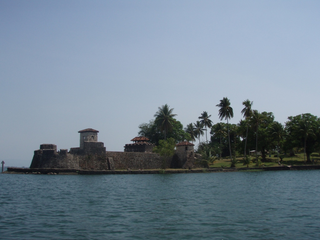 Castle of San Felipe de Lara
This is in fact a fortress that was built by the Spaniards in 1644 at the entrance into Lake Izabal in order to provide protection against pirate attacks. They did not quite succeed in this, since the fortress was destroyed and plundered by pirates several times, but it was also reconstructed several times. Nowadays it is inscribed in the UNESCO’s Tentative List.
 Castle of San Felipe de Lara
It was only after we had picked up a couple of new passengers that the motorboat turned and headed in the “right direction,” i.e., it continued towards the northeast following the course of the Rio Dulce river that actually flows out of Lake Izabal.
As usual, I thoroughly enjoyed the motorboat ride in itself, but it was additionally great when the motorboat accelerated, since this made temperature feel ideal while the water sprayed a little giving its specific contribution to the cooling down.
The motorboat slowed down again soon enough, but this time in order to enter a river branch and pick up a couple of more passengers.
 Branch of the Rio Dulce river
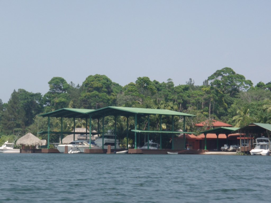
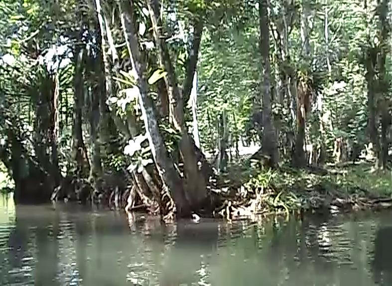
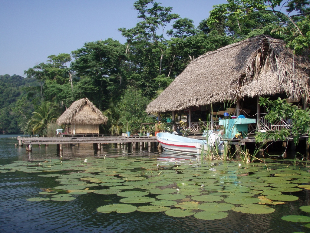
Namely, along the river there are numerous smaller hotels and guest-houses. None of them is too big and they certainly do not spoil the appearance of the banks covered in dense vegetation.
 The Rio Dulce river bank
When we returned to the main course of the river again, the motorboat accelerated and it felt good once more to feel the freshness created by the air through which we sailed. Thus we reached a new lake that we entered without cutting down on the speed.
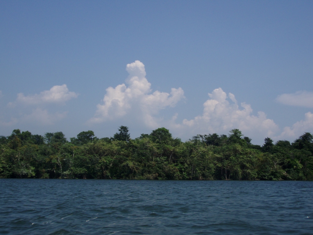
As I’ve said, the Rio Dulce river takes the water from Lake Izabal that is at only 1 m of altitude and it flows into the Caribbean Sea near the town of Livingston. During its course, approximately at the second and third quarters of its length, the riverbed widens significantly and thus a new lake called El Golfete is created there. It is significantly smaller than Lake Izabal, with the length of around 16 km, and it is practically at the same altitude as the sea.
Then the motorboat slowed down again, this time staying on the main course. The reason for this was that we were passing by the Island of the Birds (Isla de los Pájaros) and so the boat moved very slowly in order for us to watch the birds standing in or rather on the treetops, as the case may be.
 Island of the Birds
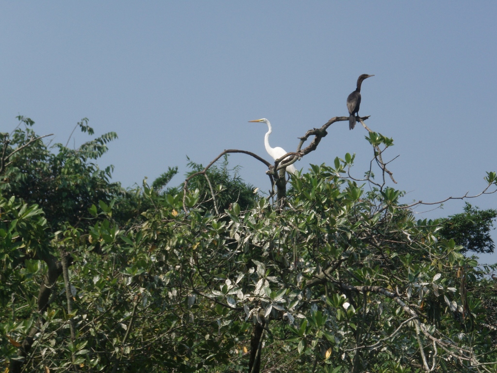
In this part we even moved so slowly that I managed to take a photo of the same pair of birds seen in the photo above again, but a little bit closer up.
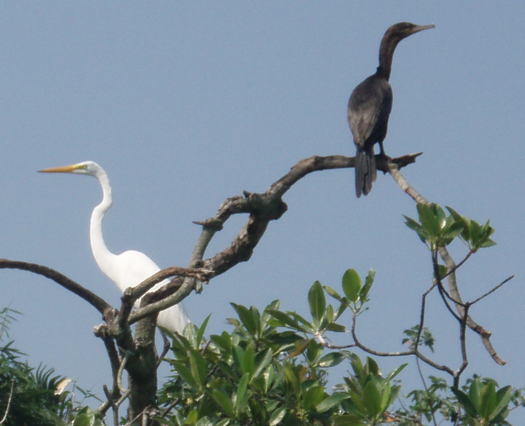 Island of the Birds – great egret and great cormorant
There are numerous birds living here although my photos show only two species, but lake El Golfete is also interesting because this is the place where West Indian manatees (Trichechus manatus) live which I, of course, could not see from the motorboat. But, there were birds instead...
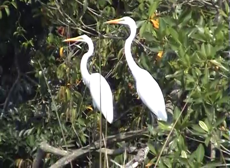 Island of the Birds – a couple of great egrets
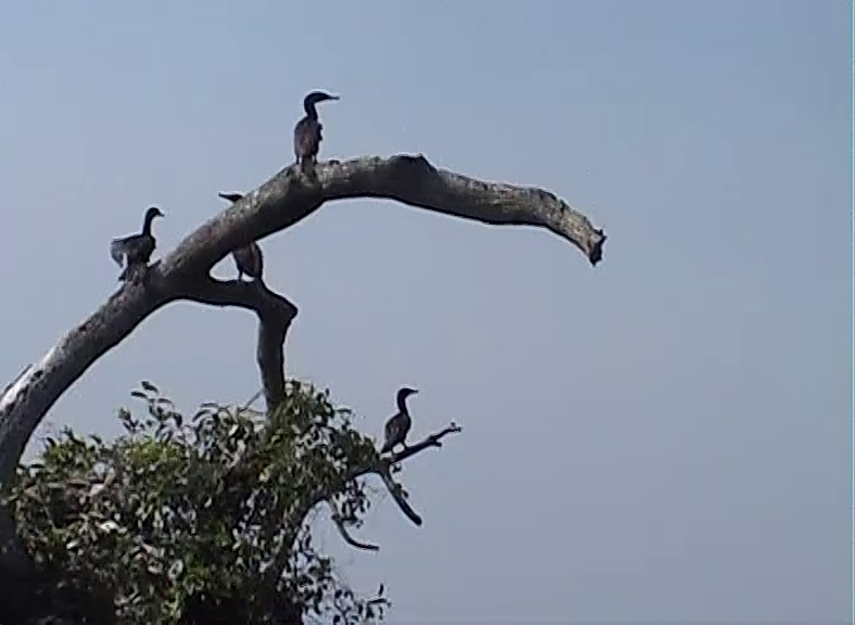 Island of the Birds – great cormorants
Soon, our motorboat which obviously did not serve only as public transportation, but also as a tourist sightseeing boat entered yet another wide branch (if El Golfete is seen as a wider river), that is, a very long and narrow bay (if El Golfete is seen as a lake) known as the Flower Garden. Since the water was calmer here, almost the entire surface was covered in water lilies.
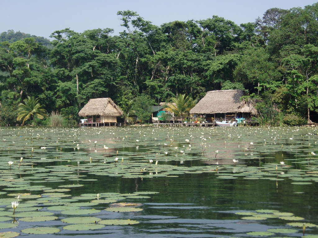 Flower Garden at lake El Golfete
 Flower Garden at lake El Golfete
Although the Rio Dulce and lake El Golfete are surrounded by the Rio Dulce National Park, along the banks of the river and lake, in addition to the afore-mentioned small hotels and guest-houses, there are also numerous private houses, either of the local residents or people for whom these were weekend/vacation houses or houses for rental.
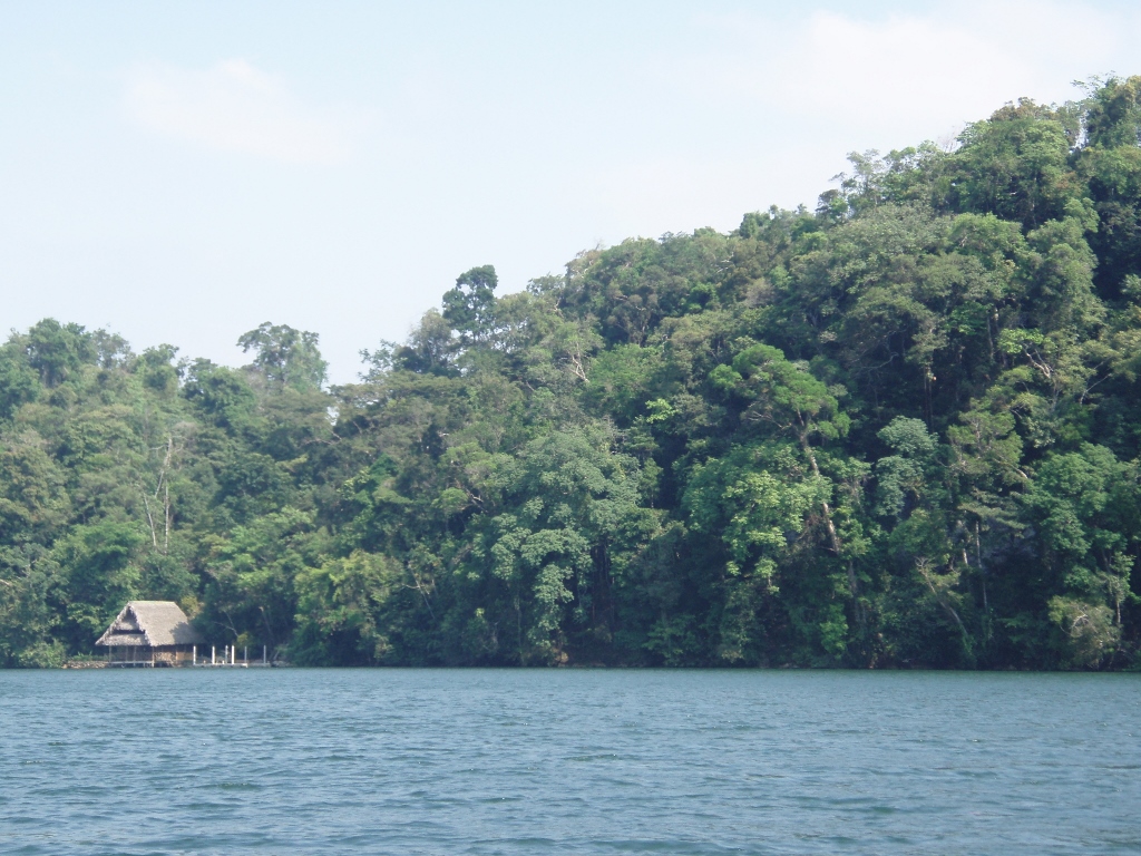 The Rio Dulce river bank
In its last section, before getting to its wide estuary, the Rio Dulce runs through a gorge that is formed by the surrounding hills the highest ones of which are around 200 m a.s.l. But, at the very entrance into the narrow riverbed after lake El Golfete, our motorboat parked by a wooden pier and we had a short break there. The reason – there are hot springs here.
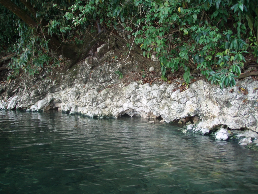 Hot springs by the Rio Dulce
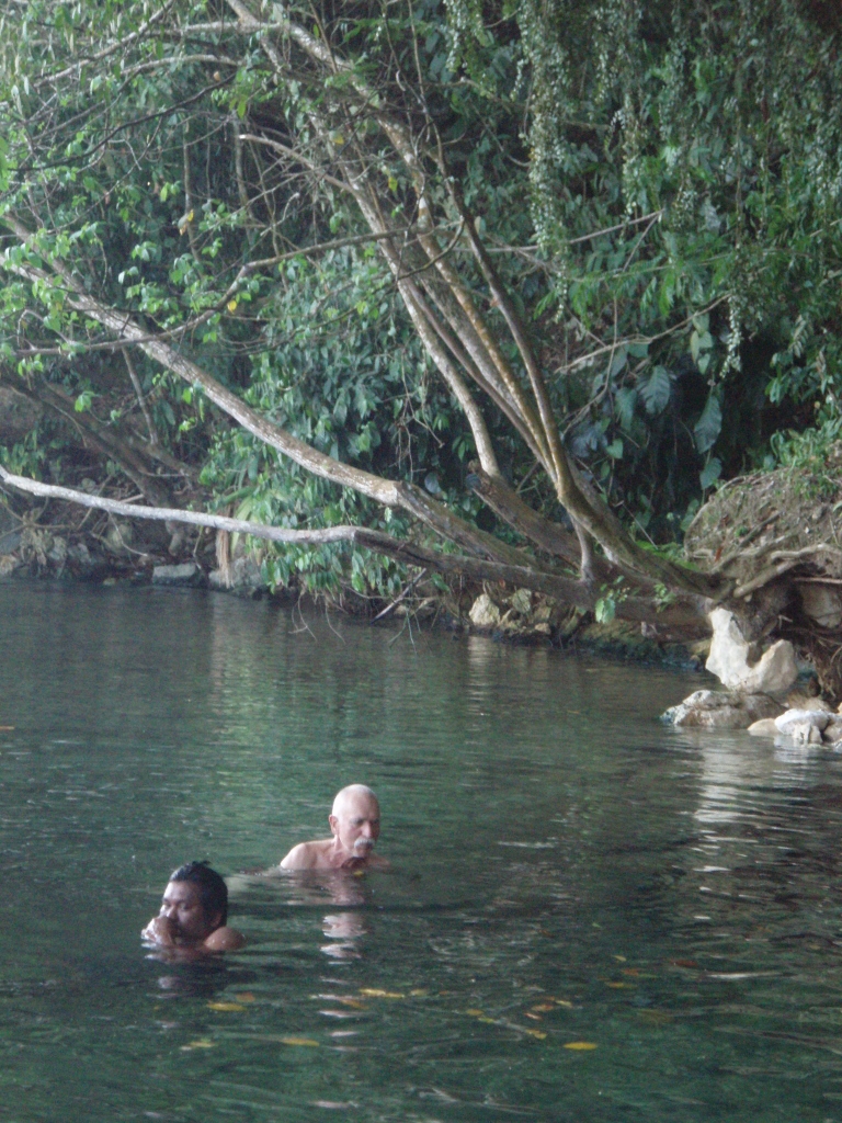
This place is simply called Rio Dulce Hot Springs (Agua Caliente Río Dulce) and the thermal waters that come up here create a small, shallow pool where people regularly come for “bathing,” this including also passengers from the motorboat.
 Thermal water pool
This passenger writing these lines, however, did not bathe, but had to dip in her feet while sitting on the wooden pier.
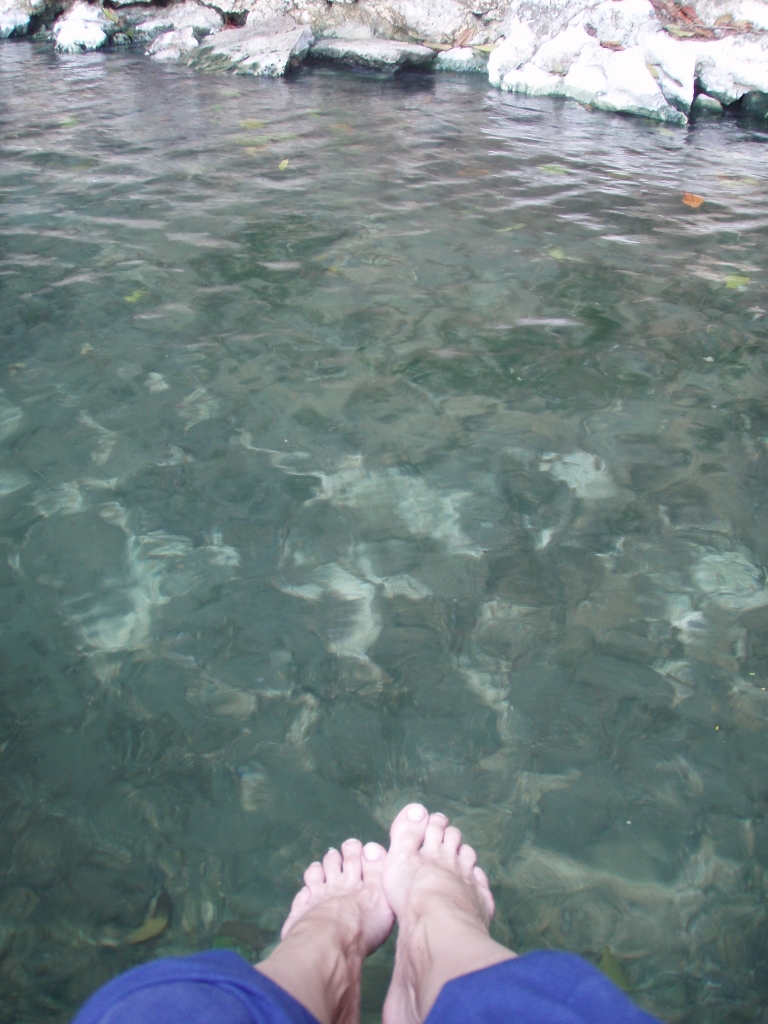 Dipping of feet into the pool with thermal water
I can report that the water was seriously hot and regardless of the high air temperature one could see the steam coming up from the pool, while the water smelled slightly of sulphur.
Then I also made a self-portrait on the wooden pier, just before we all packed up into the motorboat and continued with our journey to Livingston.
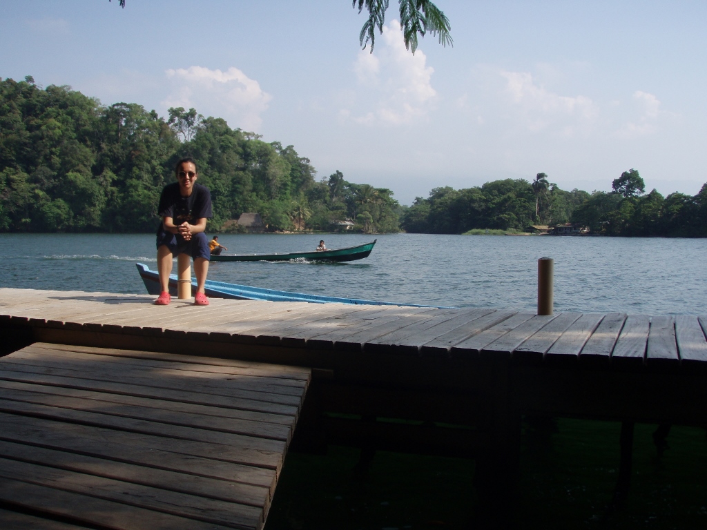 Self-portrait at the Rio Dulce Hot Springs