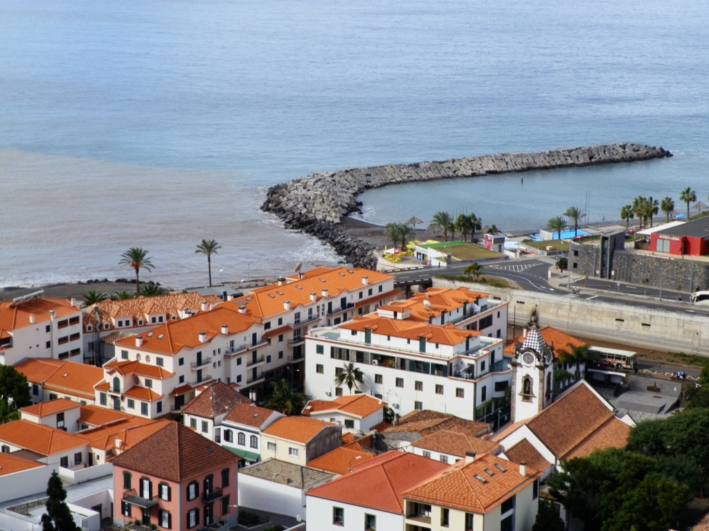
Driving around Madeira with Joao, my new friend, we came to the town of Ribeira Brava, on the south coast of the island. The road brought us to this place from up above and the view was very pretty, but we actually did not stop there. Still, the photo below shows the local Church of Saint Benedict (Igreja de São Bento) with the roof of the bell tower, that also serves as a clock-tower, that is very nicely decorated with bluish tiles.
 Ribeira Brava
During the excursion of this day, before getting here, we essentially mostly drove parallel to the coast, but from here we started to traverse the island in the direction of its north shore.
Still, let me first clarify the name of this place because it is quite illustrative. Namely, Ribeira Brava means angry river because during the rainy season the river that runs in this area can be exceptionally powerful and often tends to create havoc along all of its eight kilometres of length.
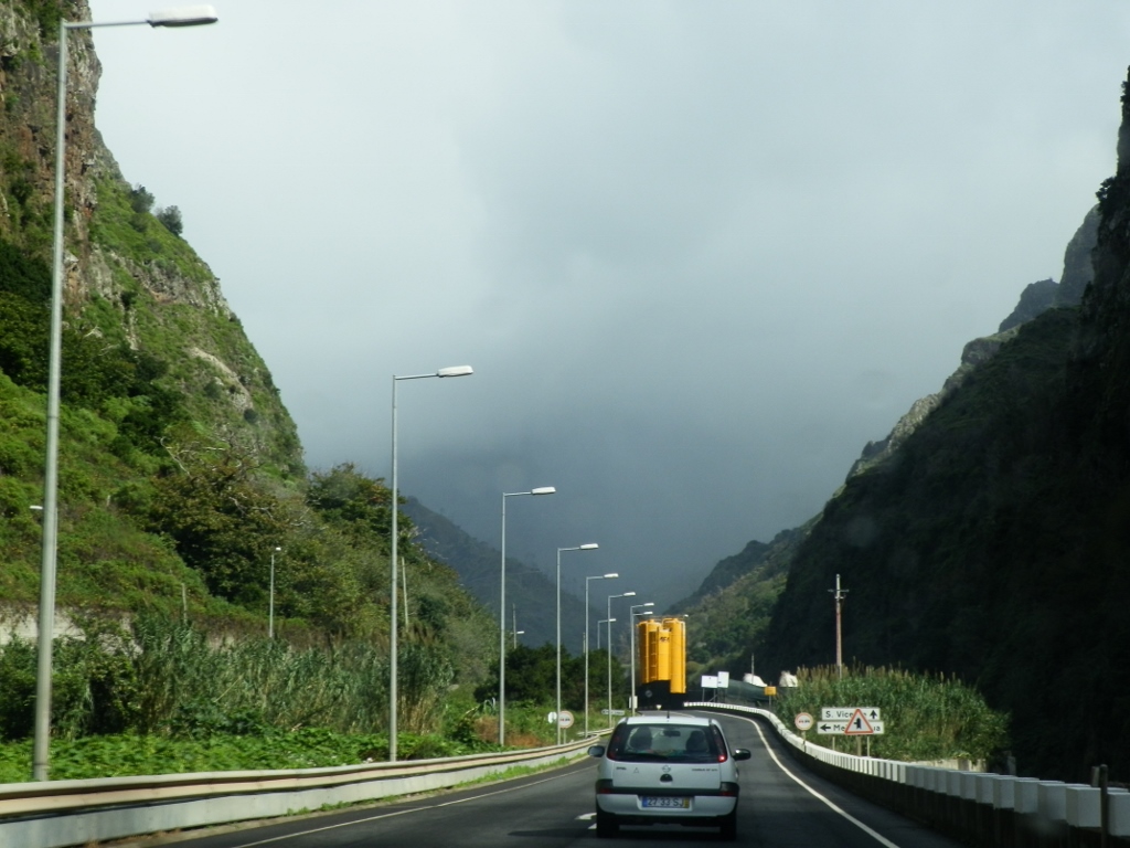
I was not on Madeira during the season of rains, but venturing into the interior of the island along the road that follows the narrow valley of the river in the shape of a gorge, in front of me I could see dense fog and/or low clouds that seemed to fully fill this valley out.
 Going to the interior of the island
Occasionally we drove indeed through sporadic rain and along the road I also saw heavy-duty machinery which the Portuguese used in order to regulate the riverbed. Namely, when heavy rains start to fall and the runoff water starts coming the steep slopes of the surrounding hills and mountains into the narrow valley and an even narrower riverbed, the Ribeira Brava builds up its power and then it can destroy everything in its path. In February 2010, there were major flash floods and landslides on Madeira – a lot of them in Funchal, but the majority took place here in this valley and even some houses were wiped out. The result of this was that over 40 people were killed and over 100 of them were injured and so the Portuguese approach this issue very seriously. At the time of my visit they were fencing off the river with tall concrete walls, also making the riverbed wide enough to be able to prevent any similar occurrence as the one in 2010.
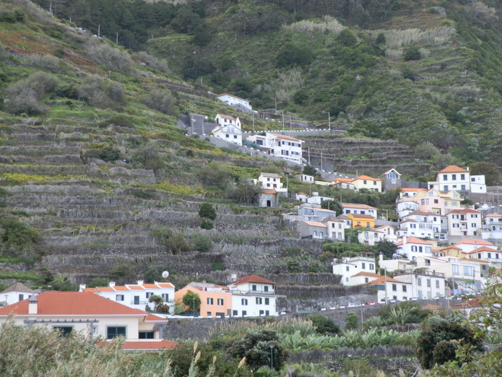
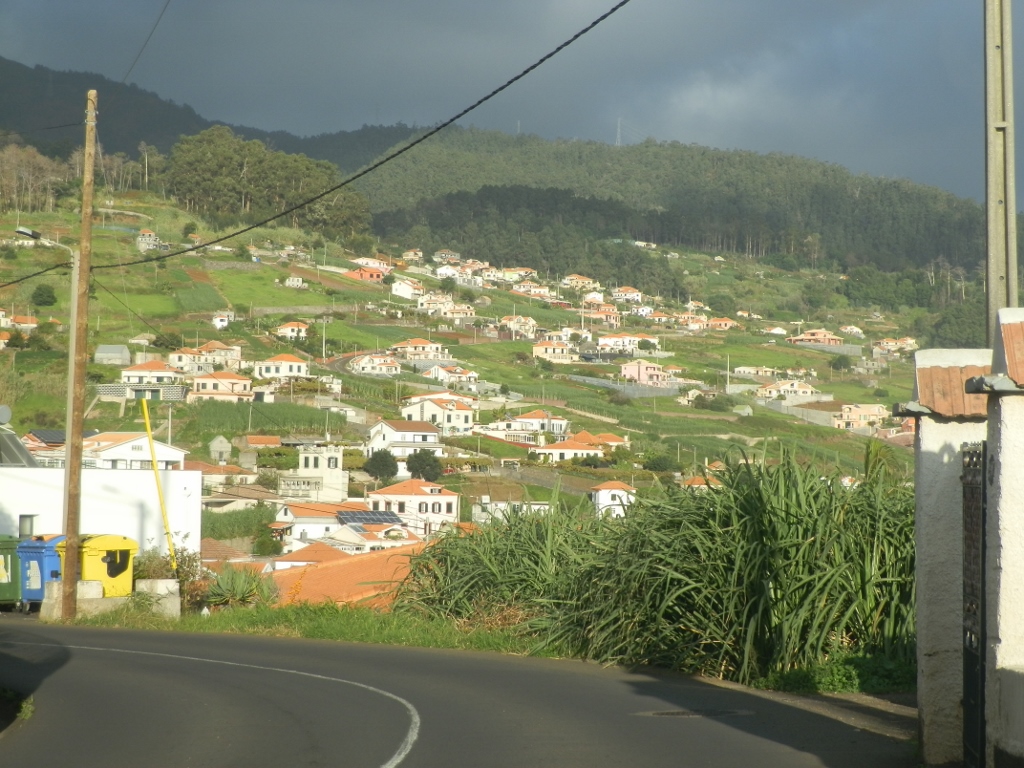
On the other hand, on this island which in a way is the epitome of nice and moderate weather of the “eternal spring” type, in addition to heavy rains, there can also be large fires. I think that it was something like this that had caused the demise of the trees seen in the photo below which I made while we were driving uphill leaving behind us a village called Serra de Água.
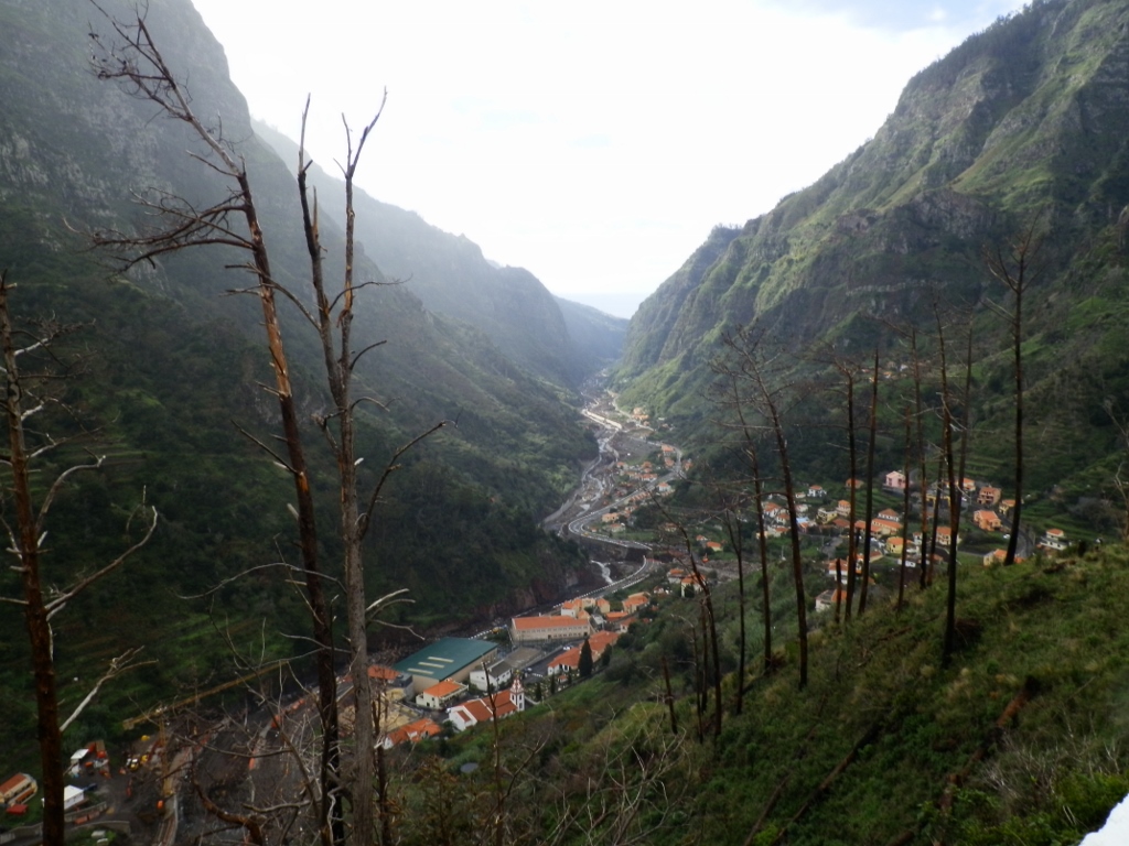 View at Serra de Água from Miradouro Terra Grande
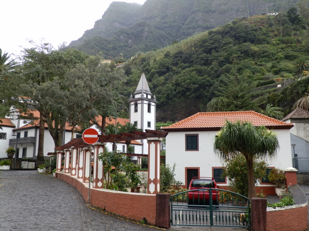
After a while we started to descend towards the north shore of Madeira, but before reaching the coast itself, we first passed through São Vicente where we made a short break.
 São Vicente
Now when we were on the north side of Madeira, there were a lot of clouds in the sky, but they were high up and it had already rained, so we could walk around the centre of this small town without any hindrance of this kind. This was important, since cars were not permitted in the centre of the small town.
Thus we walked to the parish church of Saint Vincent Church (Igreja Matriz de São Vicente). Like in some other churches, here I also noticed a framed board (displayed on the bell tower) which pointed out that the year of 2014 marked the quincentenary of the founding of the Diocese of Funchal.
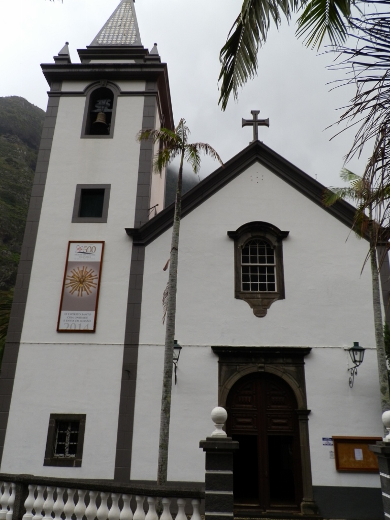 São Vicente Church
It is interesting that when the Diocese of Funchal was founded back in 1514 the world was not as known as today and thus this diocese was given the jurisdiction over the entire territory which Portugal occupied in the Atlantic and the Indian Oceans in the meantime. Since the events linked to the colonial conquests worked to the advantage of the Portuguese, in 1533 the diocese was elevated to the level of archbishopric (abolished a little later and taken back to the level of diocese) and during a period of around two decades this was geographically the biggest metropolitan ecclesiastical province in the world. In addition to Madeira, it also included the Azores, Brazil, Africa and Goa (India).
By the way, São Vicente Church dates back to the 17th century.
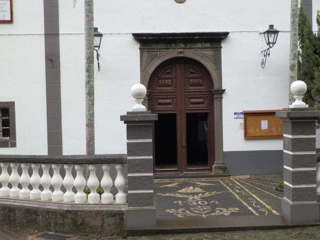 Entrance into São Vicente Church
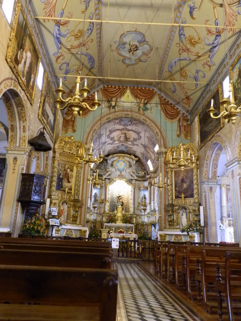 Interior of São Vicente Church
After this short walk, Joao and I went back to the car, continued with the drive and then we got to the north coast heading for the very northwest of Madeira. The mountains descend to the ocean almost vertically here and when the road was first made, cut into those steep slopes, it took around 16 years to construct barely 20 km of the road. Nowadays, the old road has been widened and made more contemporary with different tunnels. The new road mostly uses the route of the old one, although there are some sections of the old road that have not been used and today they are not intended for any vehicles, but visitors can walk along them a little. We did not do it, but rather just continued driving on.
In this part of Madeira there are also numerous waterfalls. Thus, from the road itself we could see Sao Vicente Waterfall (Cachoeira São Vicente). If you pay attention, to the right from the tunnel you can see a part of the old road that cuts the steep slope. I think it is quite clear why the construction of the road took so long.
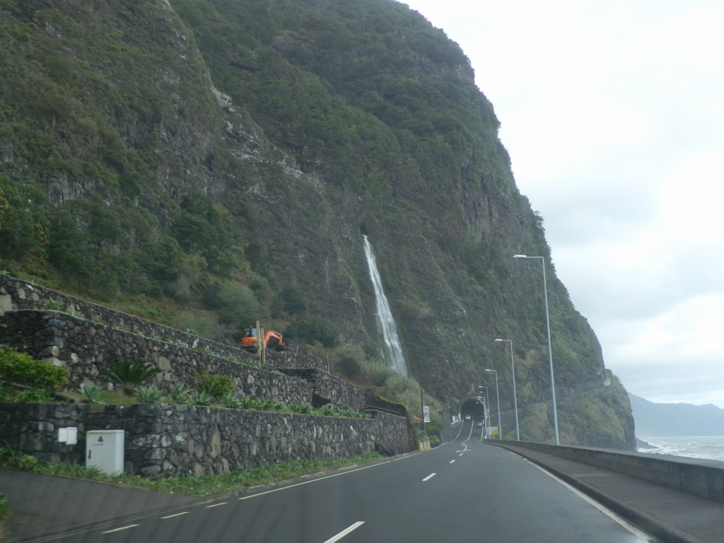 Sao Vicente Waterfall
Still, the waterfall seen in the photo above is not the most famous one in this part of Madeira. The honour belongs to the Bride’s Veil Cascade (Cascata do Véu da Noiva). There is a popular viewpoint from which this waterfall may be seen, but Joao and I drove to a small place called Seixal from where this waterfall can also be seen well.
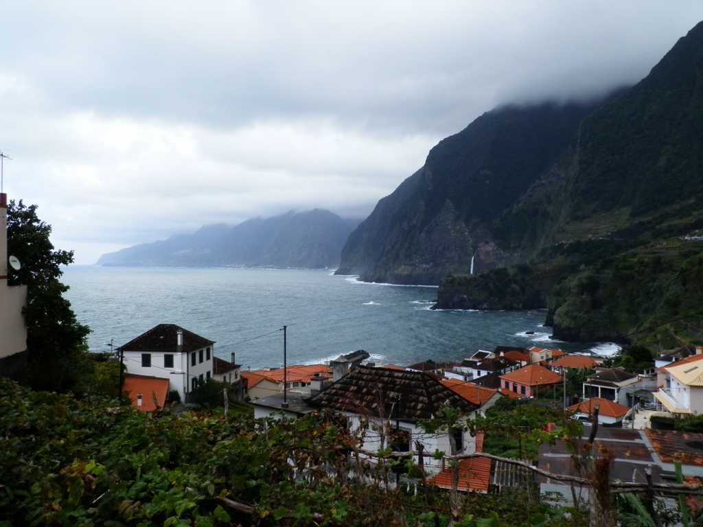 Seixal and the Bride’s Veil Cascade
On the other hand, the advantage of the spot where we stopped was that from there I could also see well some other parts of northwest coast of Madeira. Although the coast here perhaps does not seem welcoming (as may be seen in the photo above), Seixal is quite nicely tucked away and there are numerous agricultural terraces used for growing grapevine. As I’ve read – the result is some excellent wine. It is also interesting that from there, one can see different waterfalls as well. In the photo below, the Bride’s Veil Cascade may be seen on the left, the one falling directly into the Atlantic Ocean, but there is also another waterfall higher up on the right-hand side.
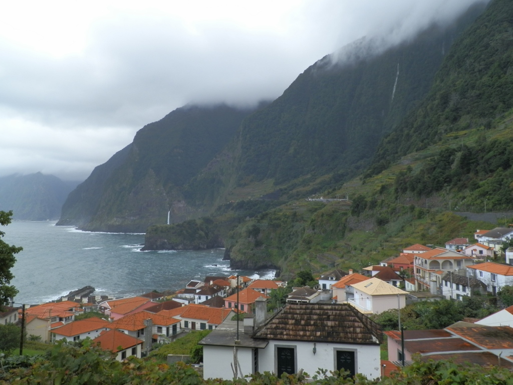 Seixal and the waterfalls
The following photo shows even better the Bride’s Veil Cascade (Cascata do Véu da Noiva) and the agricultural terraces.
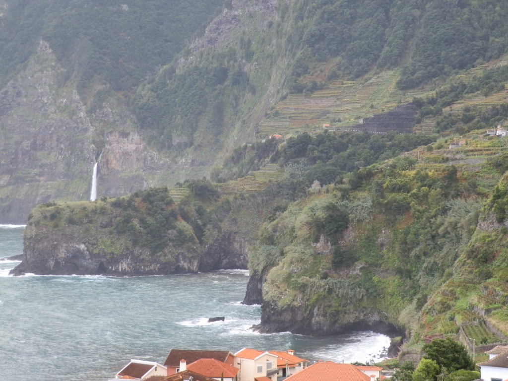 Bride’s Veil Cascade and surroundings of Seixal
In addition to these natural beauties that I had the chance to see, perhaps even more I was impressed by my host and practically my new friend, since Joao and I functioned as if we had known each other for years, although we only met for the first time that very morning. He is absolutely incredibly kind and dear, while also being a perfect host and seeing that I liked photography, without taking off his smile and with a lot of patience he stopped with his car wherever there was some nice place to see something.
With this great companionship of ours and with very interesting stories, we drove also to a village called Porto Moniz at the very northwest tip of Madeira. This tiny place is where the Portuguese settled for the first time in the second half of the 15th century. Still, although this spot may seem a little off the beaten track, it is absolutely worth the visit for there are natural rock pools here which are nowadays linked by concrete paths, while some of them also have bigger or smaller concrete fences and steps that essentially do not take anything away from the venue.
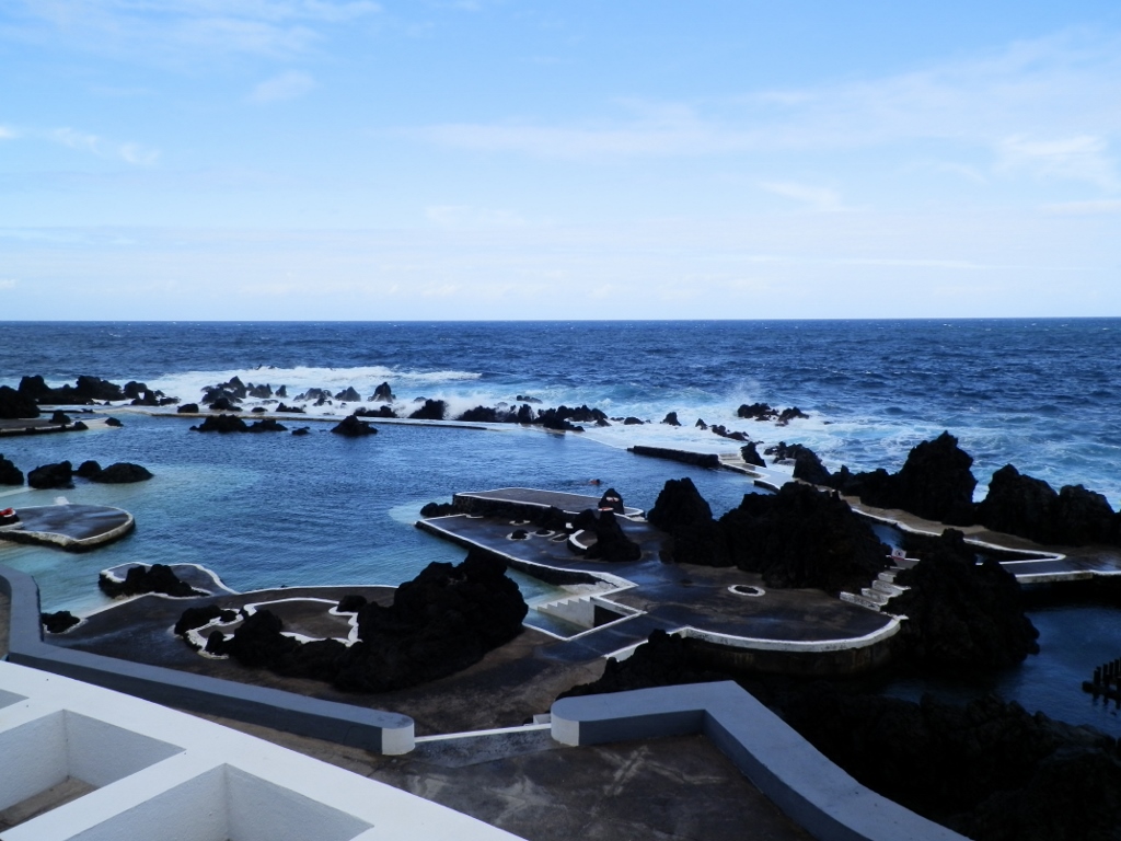 Pools in Porto Moniz
Here Joao arranged with a guard to let me get closer to the pools in order to be able to take better photos, especially of the calm water in the pools against the backdrop of the almost raging waters of the Atlantic hitting against the rocks. The whole idea is for one to swim in the shallow waters of the pools that certainly warm up in the sun, while at the same time being splashed by the cold droplets of the broken waves.
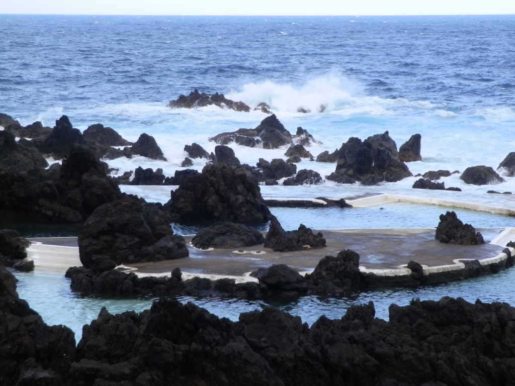 Pools in Porto Moniz
Of course, the pools were originally quite natural, but they have been somewhat revamped over time. There were a couple of people swimming there, but regardless of the decently warm weather I thought that with the strong wind that kept blowing there was no chance I would get into the water. The problem was not the water in the pool, but the idea of getting out when the instantaneous cooling caused by the strong wind would start. But, there are brave people in the world or at least those cold-resistant.
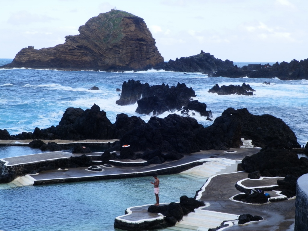 Pools in Porto Moniz
Still, apart from the pools seen in the photos above, in the same place there is another group of pools that are a little “more natural” and they are called the Old Natural Pools (Piscinas Naturais Velhas).
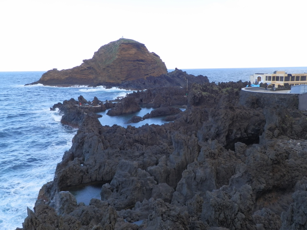 View towards the Old Natural Pools
People have intervened there, too, but significantly less than in the case of the first group of pools.
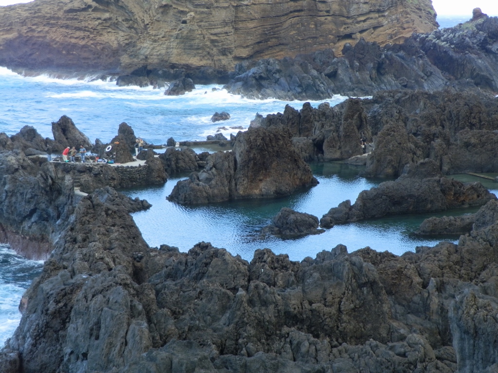 Old Natural Pools
Then we got to these other pools. They were much calmer and they certainly appeared more natural.
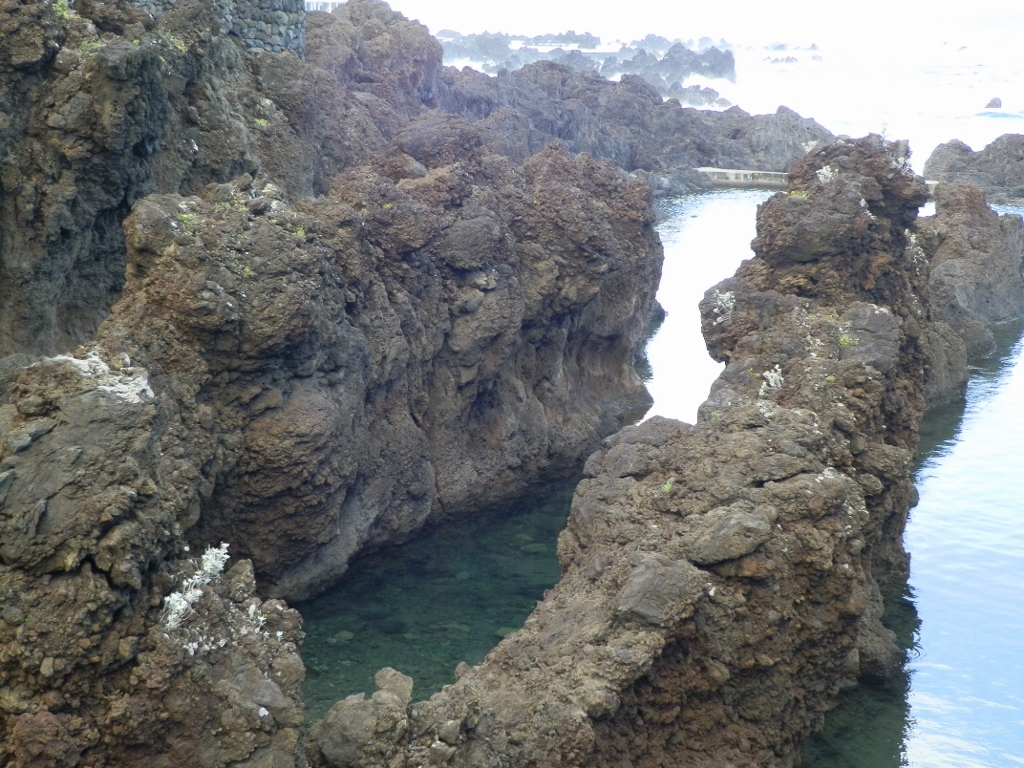 Old Natural Pools
Regardless of the image of getting cooled after leaving the pools, I thought that it must be a wonderful sensation when one swims while watching the waves and the rocks one is surrounded with.
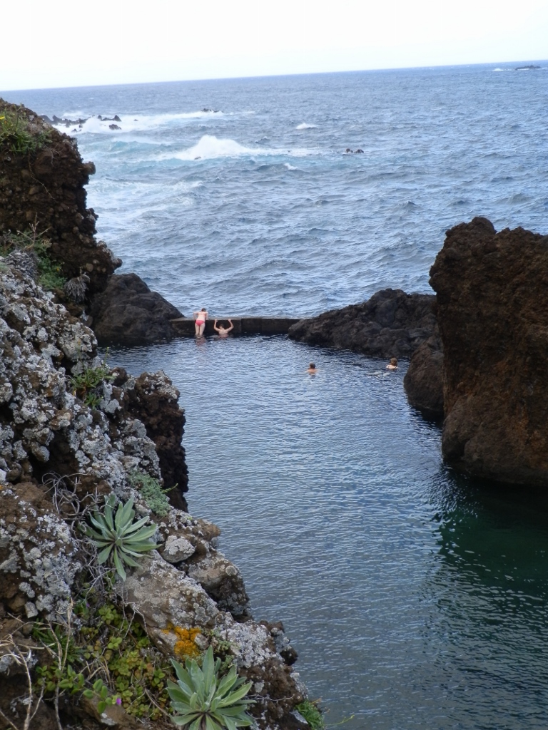 Old Natural Pools
If somebody wants to swim here – the high season is in July and August and during the holiday season.
In addition to these natural pools, Porto Moniz also has numerous agricultural terraces that are here fenced off using some wooden materials in order to protect the plants from the strong winds blowing from the Atlantic and bringing salty moisture.
 Agricultural terraces and a part of Porto Moniz
When we finished with our nice walk, Joao and I packed up in the car once again and then he continued driving but following another road and not the one we came here by. First we climbed a serpentine road after which we got to less winding sections, but we certainly kept going uphill. Then at some point we turned and continued along a road that runs across the middle of the island practically going over some kind of a watershed or at least a plateau.
We were greeted by rain here and it was cloudy or foggy, depending on how one observes the situation. We often drove through fog, but since we were sporadically exposed to dense rain drops, I guess these were (rain) clouds after all, right?
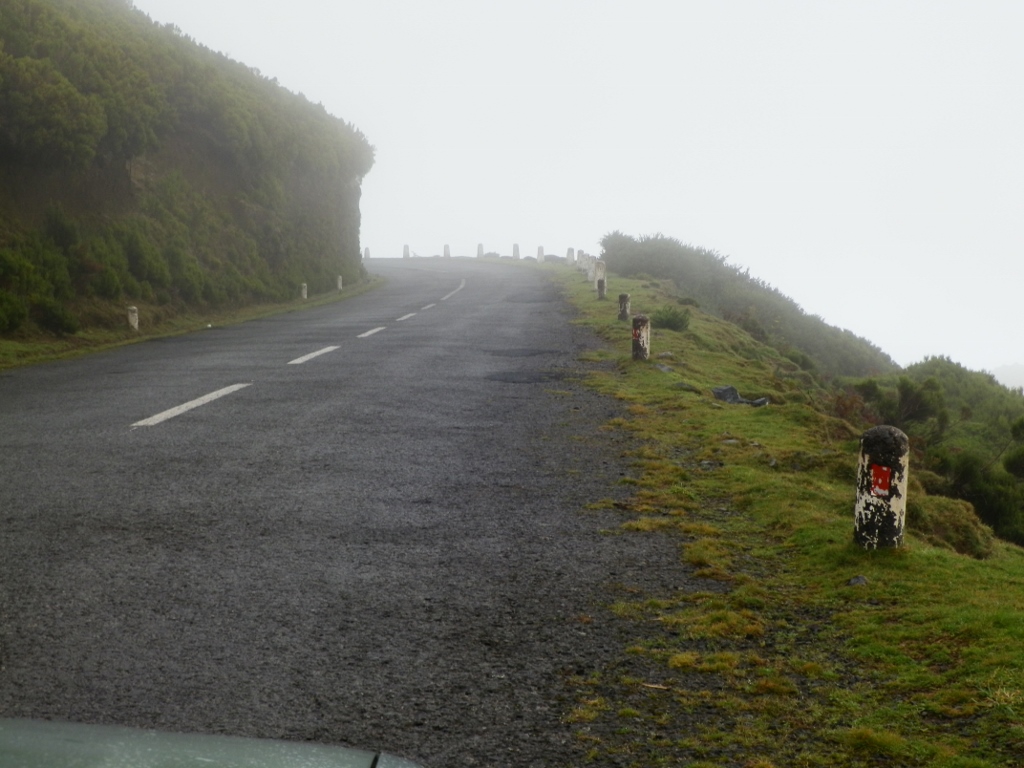 What is it? Fog or clouds?
On the other hand, as we were occasionally higher than some of those clouds and at the moments when they would separate for a short while, it was interesting that from that elevation I could see the ocean in the distance and clouds above it.
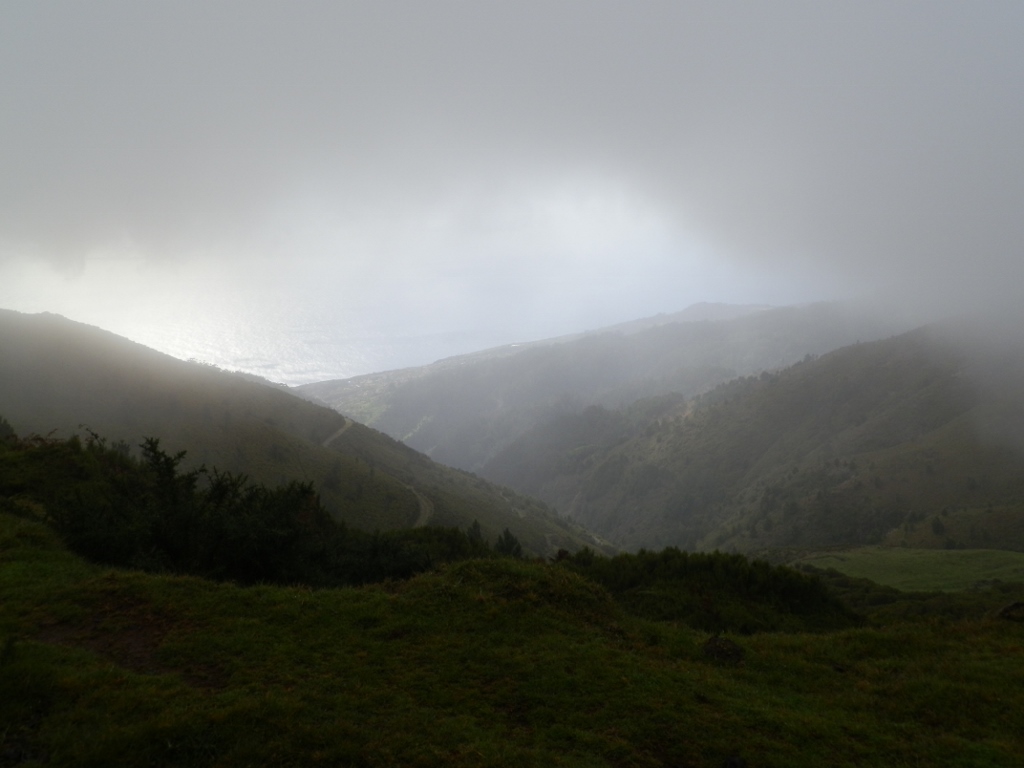 Waters of the Atlantic in the distance
And so we came to a hotel and there was also a restaurant-café. This place is situated at the altitude of 1418 m, on the highest plateau on Madeira and it constitutes the central point for many hiking excursions around the area. It is interesting that apart from that hotel, it is prohibited to build anything else there. Perhaps this makes the hotel capacities limited, but on the other hand the nature is unspoiled and this is certainly a great place for all those who like to walk in the nature. However, Joao and I did not have any walk in mind here taking into account the weather that was cloudy, slightly rainy and fresh, while inside it was wonderfully warm and cosy.
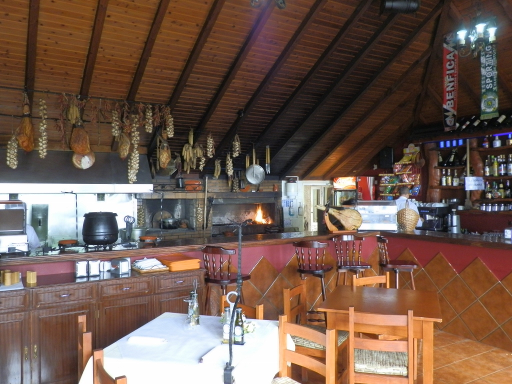 Interior of the restaurant-café
Without any need to advertise them, I will just mention the names of the hotel and the restaurant in order for somebody who may get inspired by this story and goes to Madeira to know where to go to. The hotel is Pico da Urze and the restaurant-café is Jungle Rain.
The warmth we encountered when we entered the place and that felt so good, inspired Joao and I to realise how hungry we were. That’s why we sat down there and had a great soup with barley. That was the right thing for one to warm up the body and the soul.
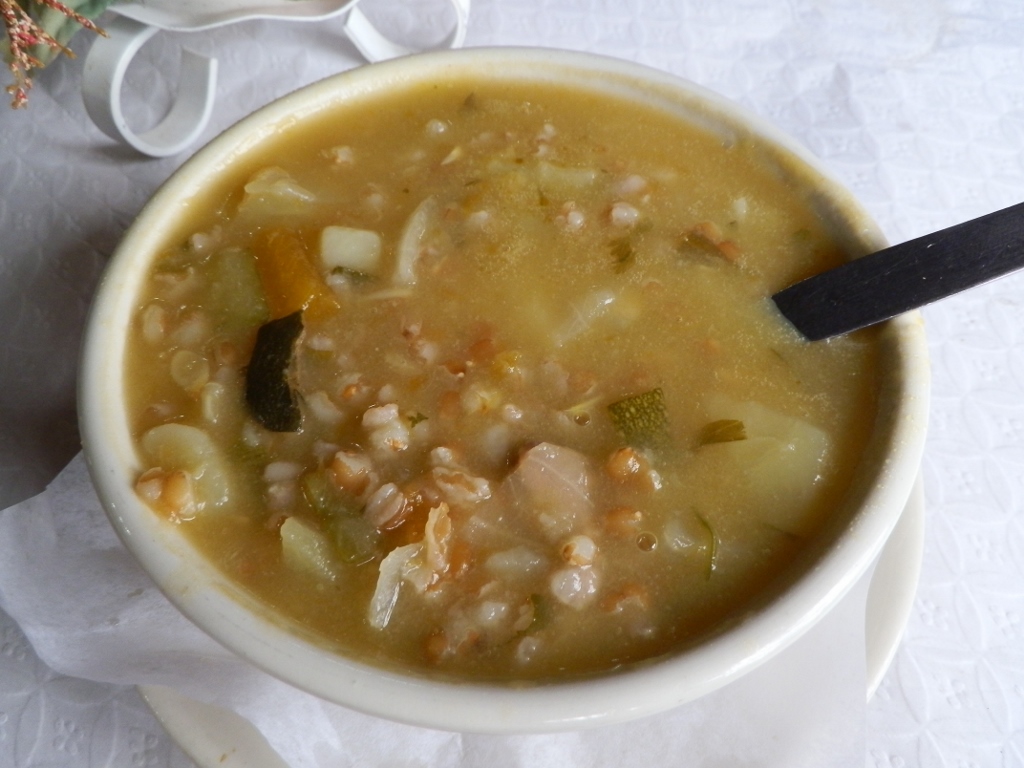 Wonderful thick soup
After the late lunch break, we continued driving over a completely flat area, the plateau of Paúl da Serra and then we started going down an old and shabby road leading through forest. At some point we got again to the part of the island lit by the Sun.
 At altitude and behind the heights there are dark rainy clouds, but here there is the sunshine
We got back again to the south side of the island where by the rule there is more sunshine. Now we drove to the coastal town of Ponta do Sol and there we parked the car at a very interesting public parking lot – in a tunnel. I guess they must have started building a tunnel and then something went wrong, so they closed it off and made a public parking lot from the rest of the construction.
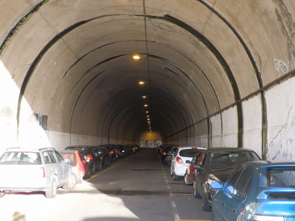 Public parking lot in Ponta do Sol
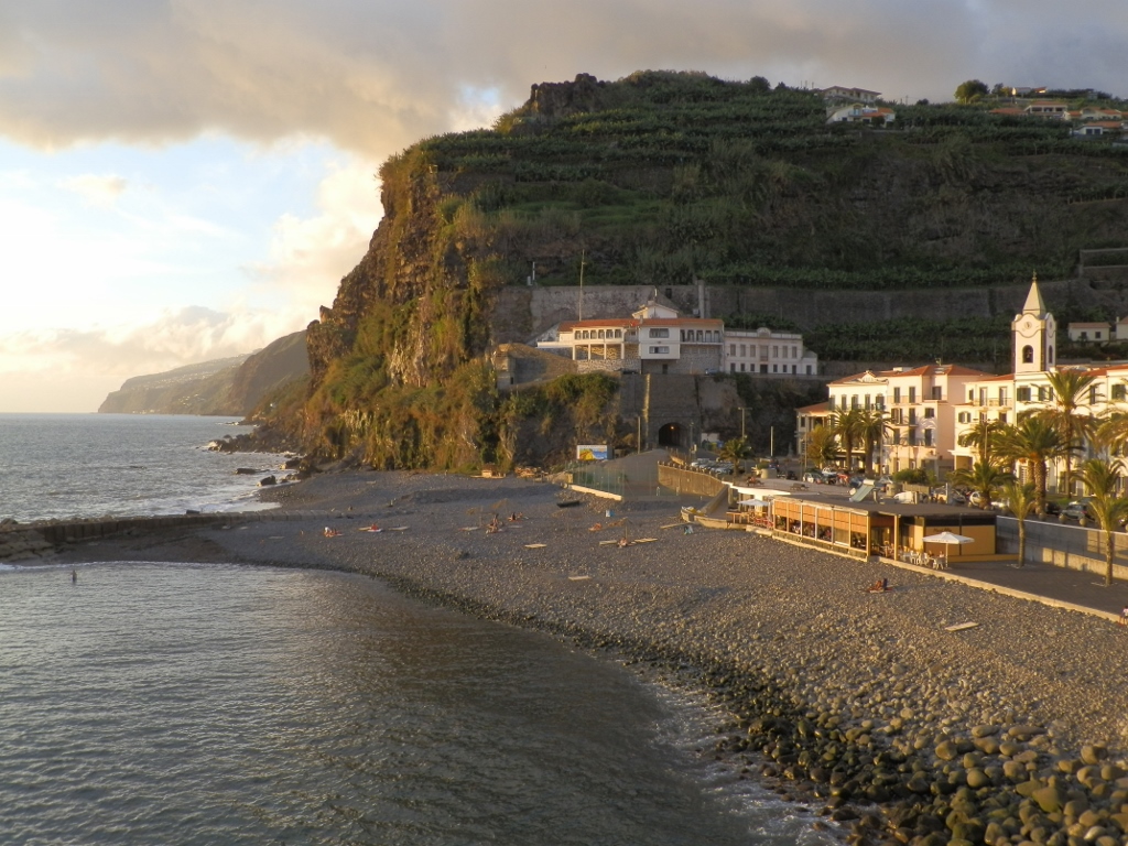
The view at the place from an elevation that led from the parking lot was very pretty. Among other things I could see there the bell tower of the parish Church of Our Lady of the Light (Igreja de Nossa Senhora da Luz). The simple single-nave church was first built here in the 15th century and in 1708 its facade was further extended.
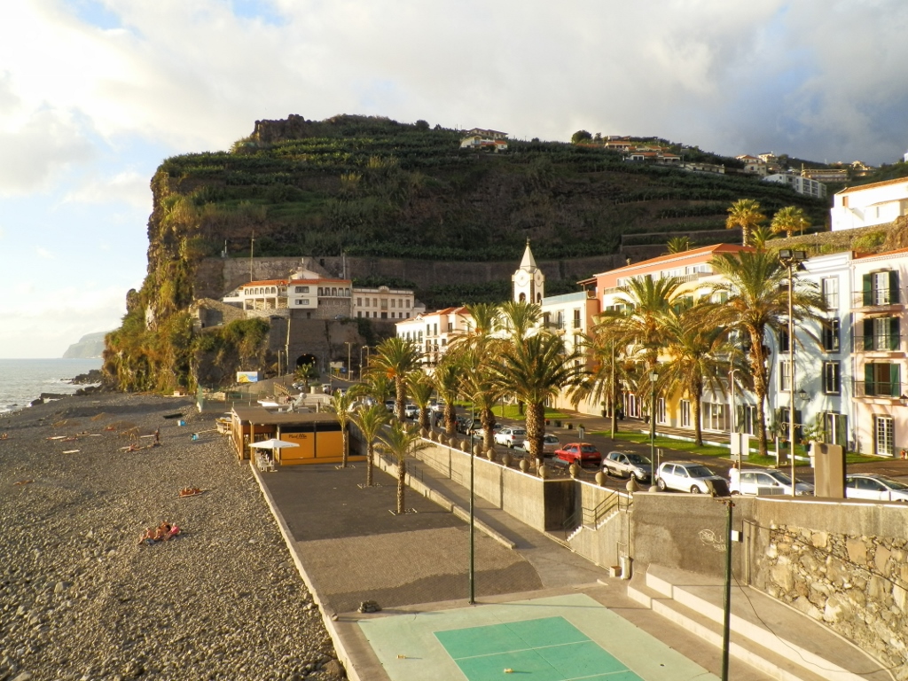 Coastal part of Ponta do Sol
From the same spot from which I took the photo above I could also see nicely the terraces with banana trees made on the steep slopes that surround the town.
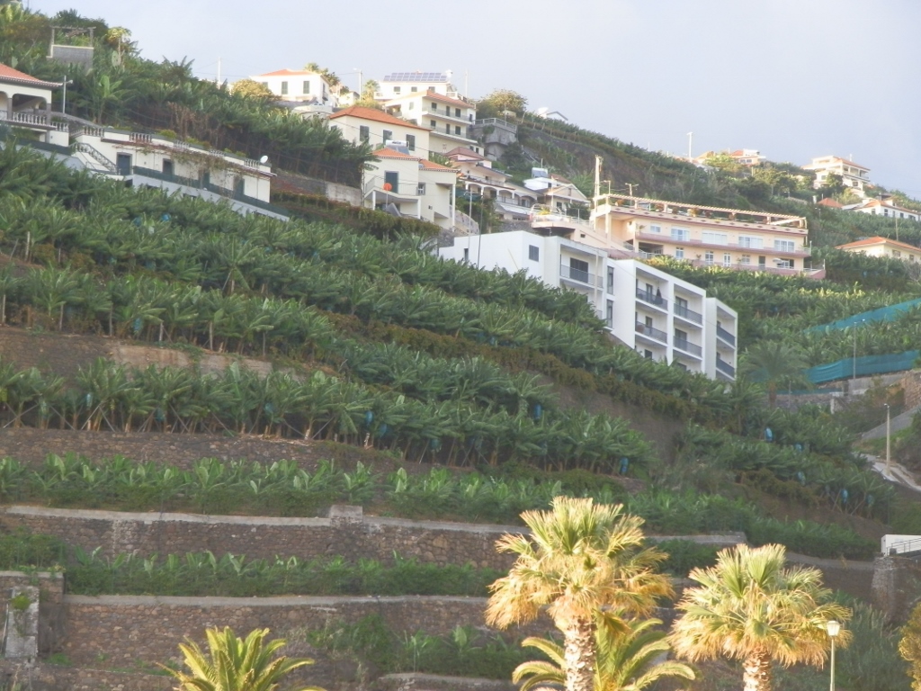 Banana plantations in Ponta do Sol
Still, we did not walk to the town here, but rather to a very interesting viewpoint and a bridge. Namely, there is a large rock here that protrudes from the water and the Portuguese built a base made of stones there and a platform on top of it in order for people to be able to enjoy in the fine views from that platform.
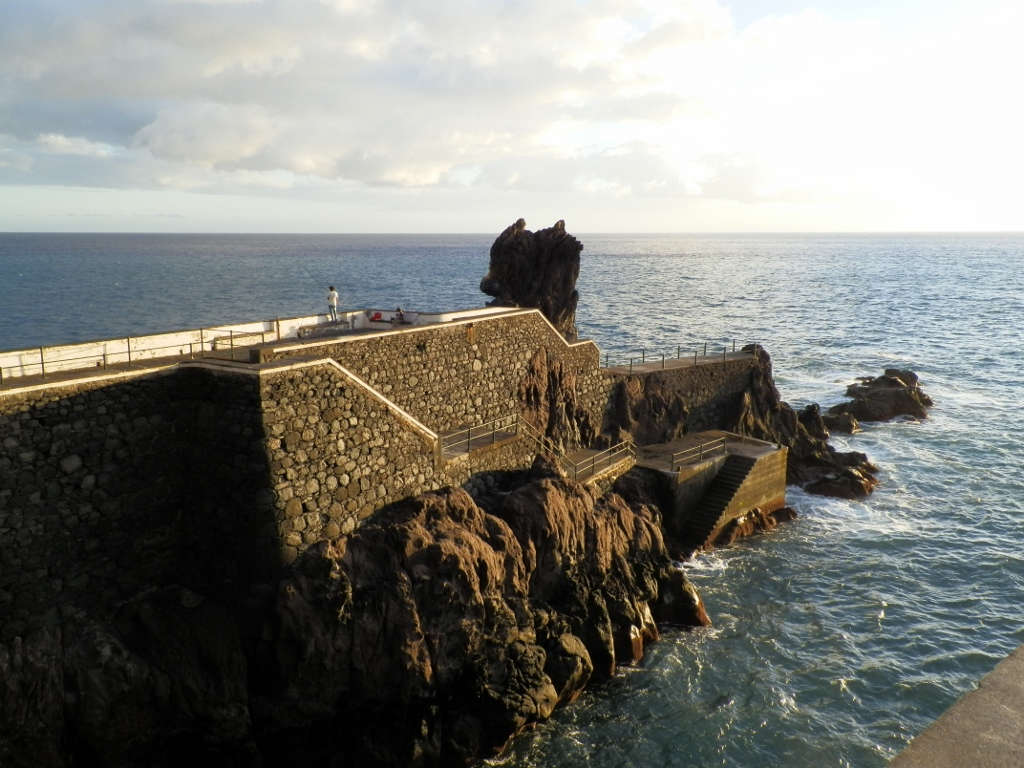 Viewpoint built on a rock beside the shore in Ponta do Sol
But, in order to get to the viewpoint on the rock, there had to be a bridge built there, which was accomplished. Here it is...
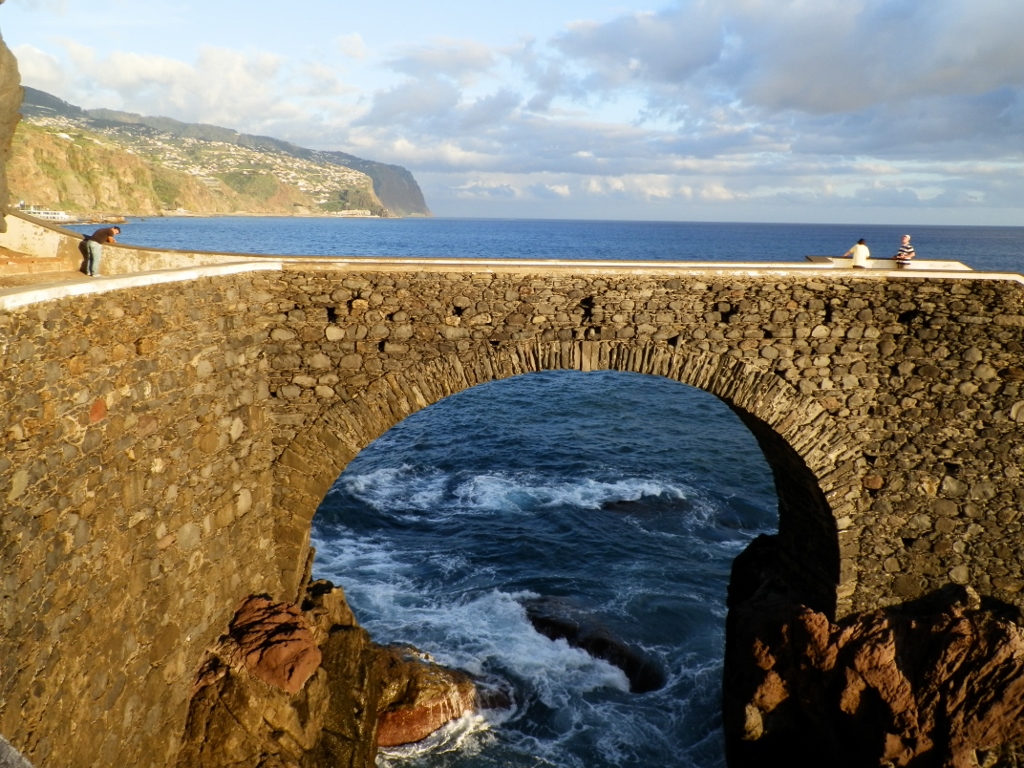 Bridge leading to the viewpoint
I could not resist and asked Joao to take a photo of me on the bridge. I’m the one in the red shirt.
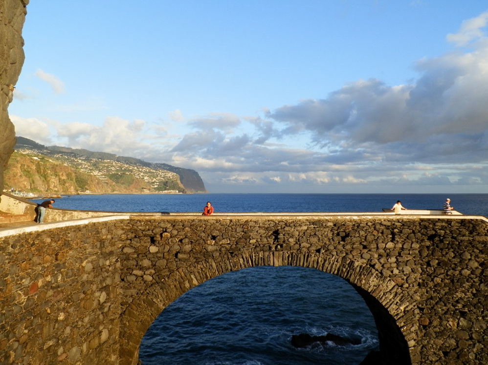 On the bridge in Ponta do Sol
The bridge is also the place from which it is possible to see a part of the south coast of Madeira nicely.
 South coast of Madeira lit by the setting Sun
While we were hanging around there, we saw a woman who was fishing with pure content. As a matter of fact, she had just taken a fish off the hook and it was with great pride and with a smile on her face that she posed for us. It was clear right away that this was a woman – she did not actually care about the size.
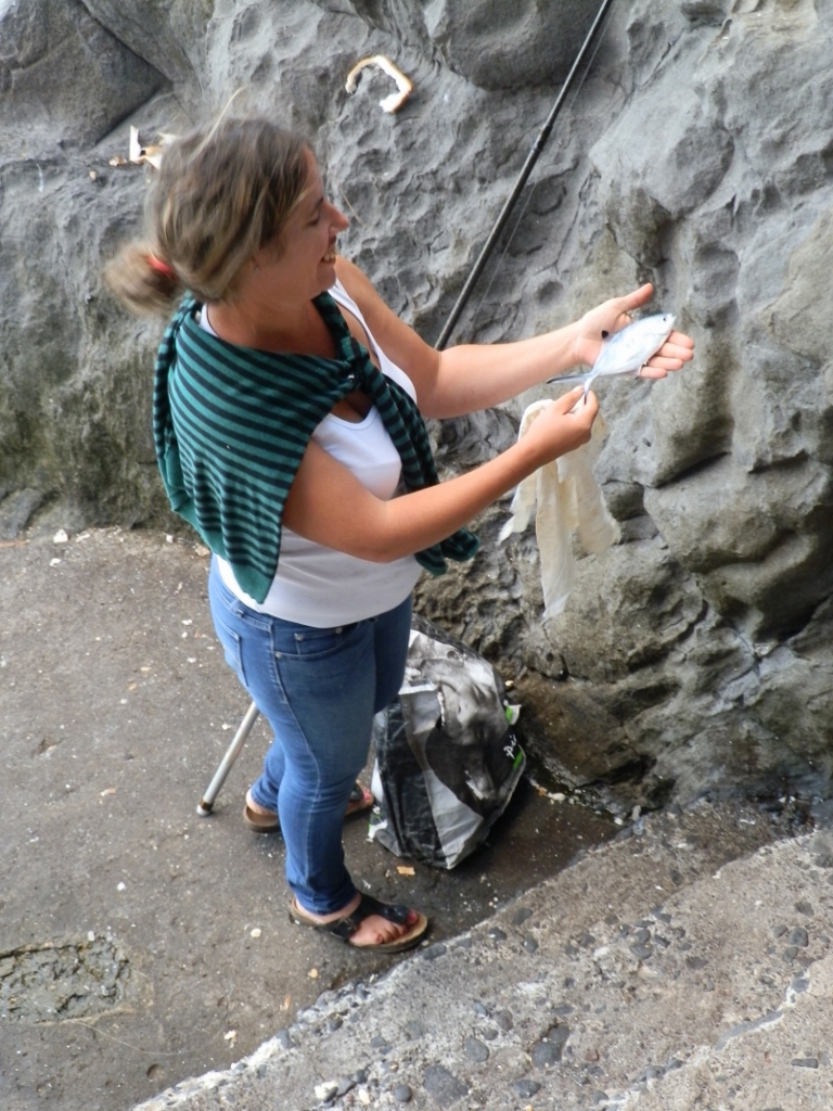 Proud fisher
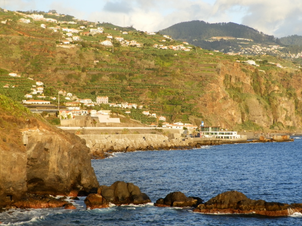
While we were walking across the bridge and the viewpoint’s platform, the Sun was well on its way to the horizon and the colours were fabulous.
 Coastal part of Ponta do Sol
Here in Ponta do Sol there is a smaller breakwater which nicely calms the water beside the beach, so that even at this time of the day, relatively late, there were still visitors on the beach.
As the day was getting over and the sights of the setting Sun were stunning, Joao and I stayed here to watch the spectacle.
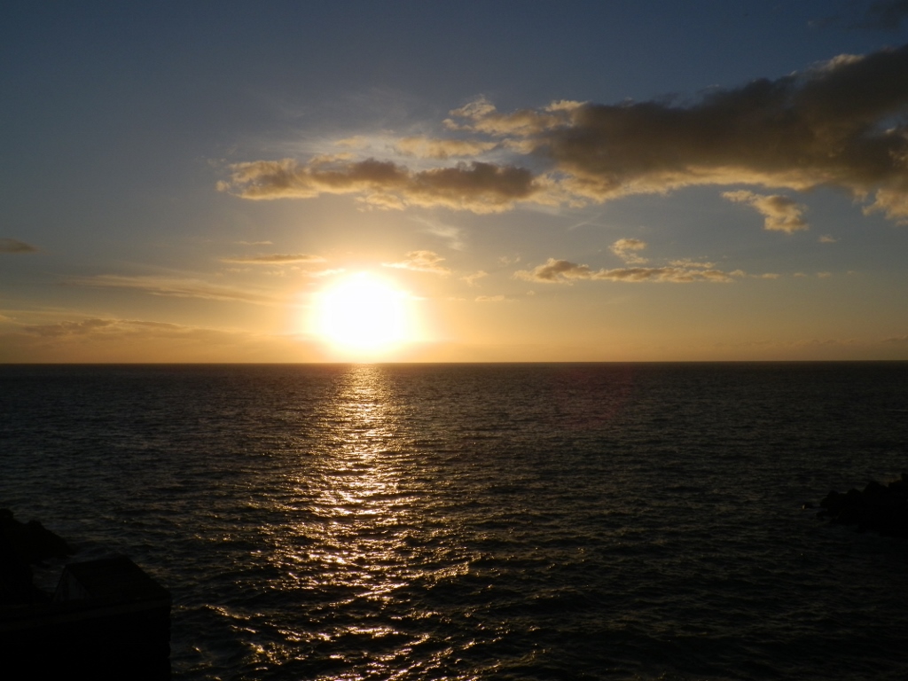 Sunset seen from Ponta do Sol
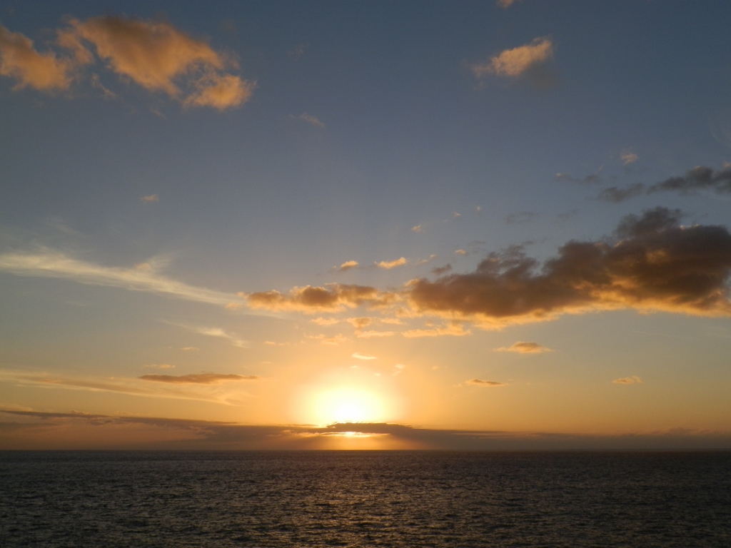 Sunset seen from Ponta do Sol
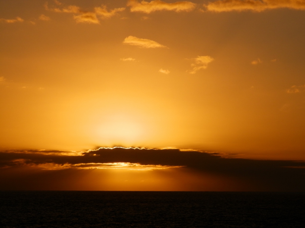 Sunset seen from Ponta do Sol
After this, Joao and I got into the car again and then he brought me to the hotel. Since we had already agreed that we would hang together during the following days, the plan was for him to pick me up again the next day at 8.30 in the morning.