After Rija, our driver in Madagascar, picked us up at the airport in Antananarivo, we first stopped at a largish supermarket to buy water and something to eat along the way and then in the dark we headed towards Antsirabe, a town that is located almost in the very centre of this country and from which roads fork towards west and southwest. The distance between Antananarivo and Antsirabe is around 170 km and it was precisely because of this distance and the time it took the car to cover it (almost four hours) that it was ideal to arrive in Antsirabe that same evening in order not to disturb the remainder of our travel around Madagascar.
I presume that after the very odd night, to say the least, and a stressful day filled with worry about whether and when we would arrive by the flight that was moved by around 10 hours at some point I felt very exhausted and then, apologising to Rija, I lowered my passenger seat and even managed a couple of times to doze off briefly which is extremely rare in my case at least when it comes to napping in cars.
We arrived at the bed and breakfast in Antsirabe almost at midnight and we had to get up early in order to continue in line with the itinerary. We almost felt very sorry about this, since we had an extremely cute room and although we certainly would not spend our free time inside, it really felt good to be surrounded by beauty and harmonious interior decoration. The surroundings of the B&B, itself located in a very nice house, constituted a direct opposite – there was a torn up, muddy street with improvised stalls, a large number of people going up and down on their business, but I did not mind this in the least. It was just completely different from the nicely decorated and perfectly clean bed & breakfast.
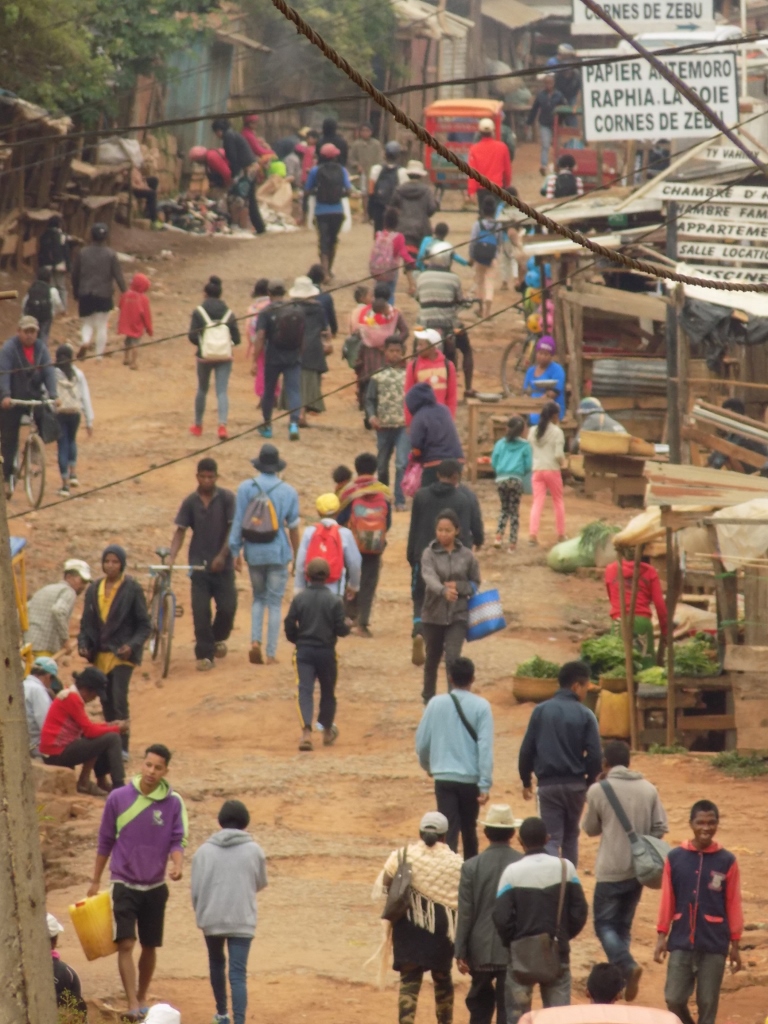 Street in front of our B&B in Antsirabe
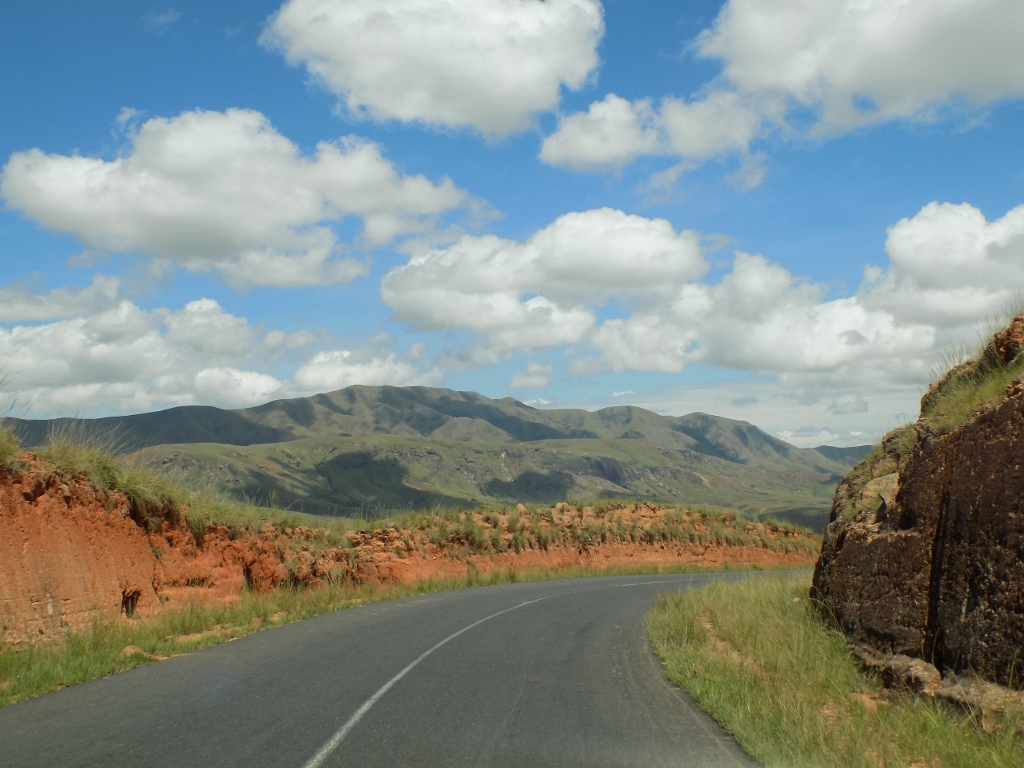
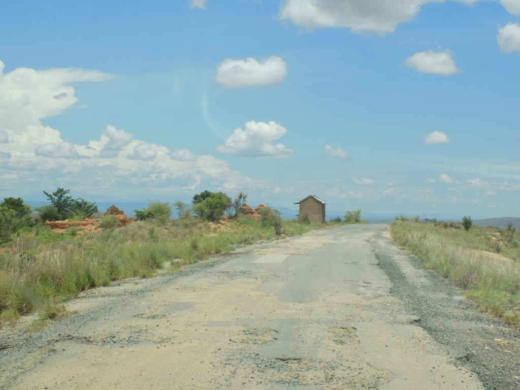
So, after that early breakfast we were ready to start with the “real” journey around Madagascar by car. In front of us, there was a westbound road leading to Morondava while the distance was around 500 km. The expected duration of the travel was between 8 and 10 hours, but to start with we drove up the steep street with a market that extended in front of the B&B where we had spent our night. By the way, town Antsirabe is famous for its rickshaws, but I must say that we kept seeing them in other places as well. The only thing that made them a little more specific in Antsirabe was the fact that here there were more rickshaws which were pulled by their “driver” while moving on foot.
Now would be a good time to say something about the geography of Madagascar. Madagascar is the fourth largest island in the world (after Greenland, New Guinea and Borneo). It surface area covers around 590,000 square kilometres, it is around 1600 km long and 570 km wide. As far as its population is concerned, in 2018 Madagascar had around 26.3 million inhabitants and as I’ve already mentioned, they are mostly young – the medial age is around 20 years.
On this day we started with the touring of the country by car and as a reminder here is again the map of our stay in Madagascar. The straight lines mark flights, while the blue lines of an irregular shape show where we were driving.
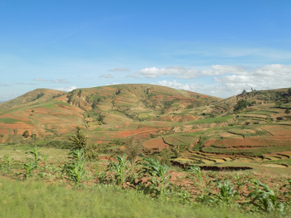
Although the morning in Antsirabe was cloudy, soon the Sun appeared and with time the blue sky became predominant. We had a long day’s drive ahead of us and Rija did not hesitate at all, but rather pressed on the gas. It was actually very good that he was driving and not me, because my drive would take at least 10 days since I would stop every couple of hundred of metres. Namely, behind every curve there was a new sight which to me all seemed stunning and unrepeatable. Was this about the houses made of fired or unfired bricks, possibly covered with some mud, or children who hastily filled up potholes in the road expecting to be given some money for that, or numerous rice paddies that were sporadically arranged on the terraces made along the slopes, or people working these fields, the ploughs and harrows pulled along the road by zebus after they had finished with their work in the fields, or rice that was scattered here and there in a thin layer by the road in order to dry...?
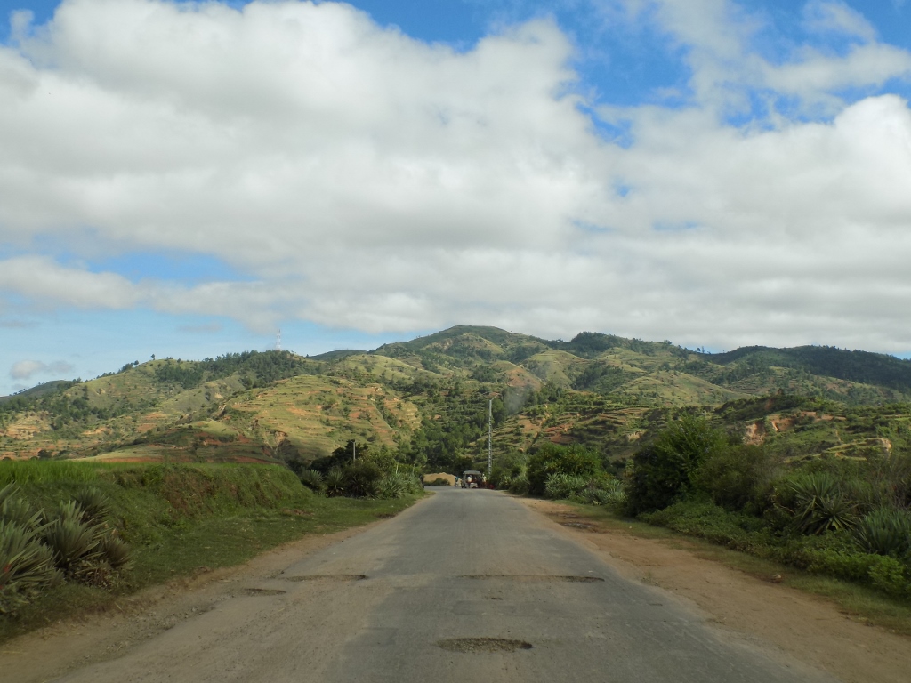 On the road to Morondava
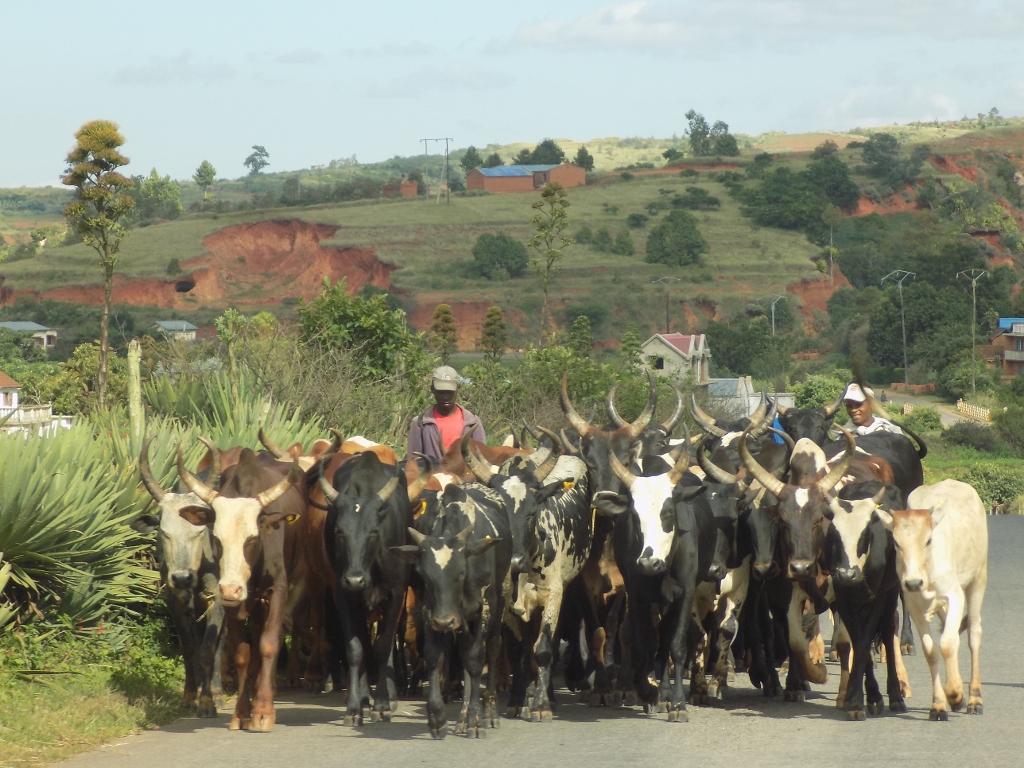 Zebus on the road
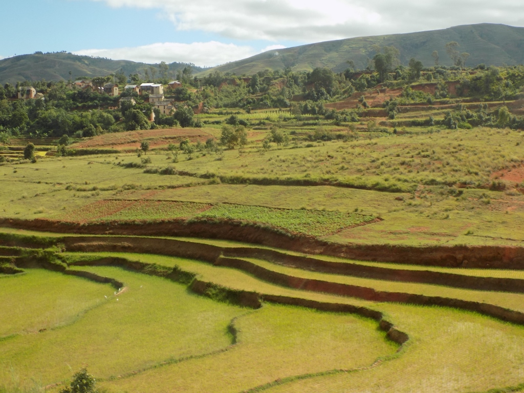 Rice fields surrounded by hills
 Some maize and much more rice paddies
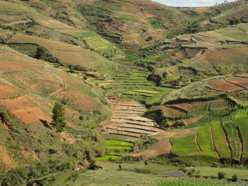 Rice paddies tucked in-between hills
 Incredibly bright green colour of young rice in the field and the harvested rice arranged on the road in order to dry
 Incredibly bright green colour of young rice
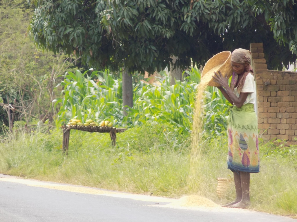 Pouring rice on the road where it will dry
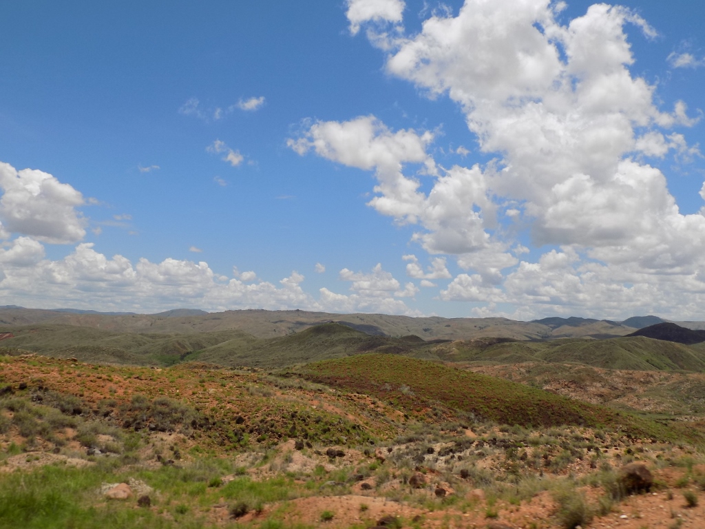
Perhaps what delighted me most were the landscapes that were dominated by the amazing red colour of soil which renders the other name for Madagascar – the Red Island – particularly in the combination with green vegetation, whether these were grasses, rice, agaves or trees. On top of this, the addition of the blue sky with a cloud here and there, all lit by the Sun, made these sights magnificent and even the greyness of the road covered in red dust coming from the surrounding earth could not spoil the beauty. I felt indescribable exaltation inspired by that splendour and my heart was filled with happiness, joy, enjoyment and gratitude to my destiny, the Universe, my Holy Guardian Angel or whichever force had brought me here and allowed me to feel my soul by looking at this spectacular beauty.
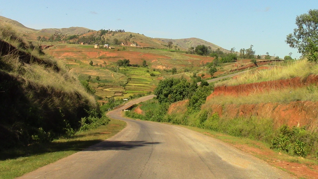 Impressive sights of the Red Island
 Impressive sights of the Red Island
 Impressive sights of the Red Island
 Impressive sights of the Red Island
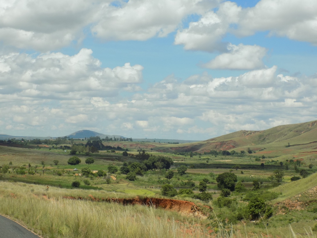
Parallel to the east coast of Madagascar there are hills and mountains and thus in the middle part of this large islands there are the central highlands that have the average height between 750 m and 1500 m, while the highest mountain peak which is situated in the north of the country is 2876 m high. In that elevated central section, almost in the very centre of the island, there is the capital, Antananarivo, as well as Antsirabe, the town we left from that morning. East of the central mountains and hills, along the entire island, there is a narrow lowland area, while west of the highlands the lowland area is significantly wider.
Also, with majority of its surface area Madagascar is located in the torrid zone, but its south sections lie along the Tropic of Capricorn, which typically means that the climate in these regions is dryer and thus the deserts are usually located precisely in the zones of the tropics. In addition, east of the island there is the vast Indian Ocean, while in the west there is its integral part which is specifically called the Mozambique Channel. The climate is divided into the rainy and the dry seasons, but because of the size of the territory, the direction in which the island extends and different altitudes, you get a very interesting combination of, I would call them, climate micro-zones and this certainly influences the landscapes, the vegetation, as well as human activities.
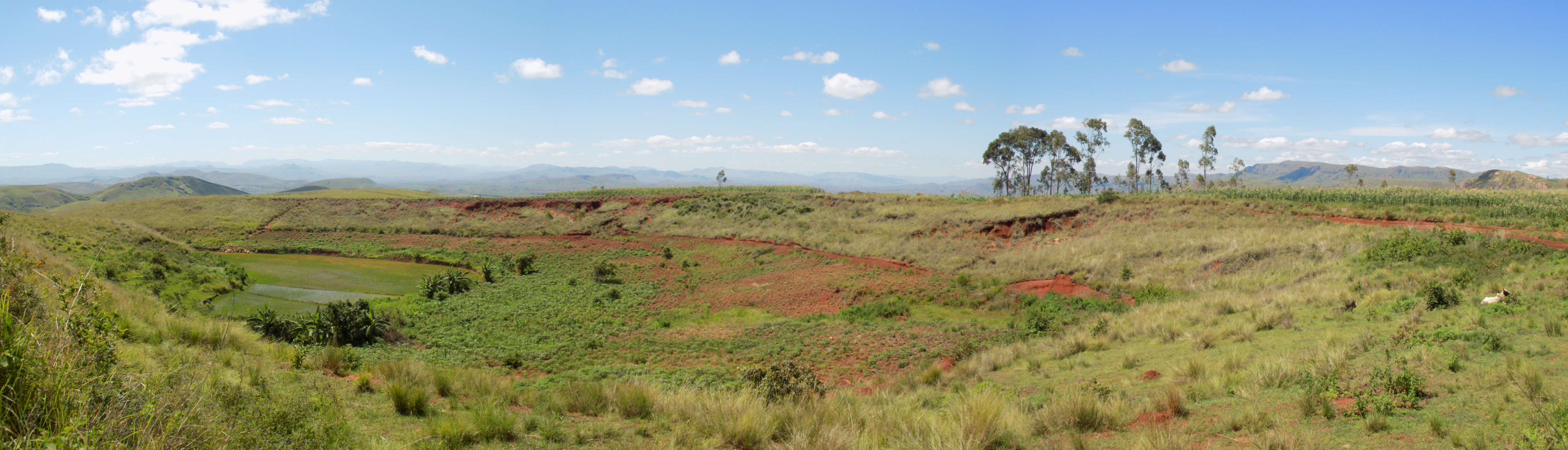
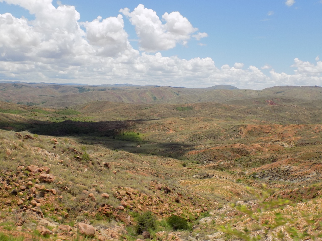
Since I’m mentioning humans, let me say something about the destruction of forests on Madagascar. A good share of the vegetation changes that can be noticed even during a simple car drive are a result of massive deforestation in order to use this timber for industrial purposes on the one hand and on the other in order to increase the surface areas for the growing of agricultural crops. Unfortunately, the humans are not known for their long-term planning, but are more focused on short-term gains. What happens, however, in the long run is that the soil gets degraded very quickly since the Malagasy like to cultivate their crops in the traditional manner, which certainly makes the products healthy and unpolluted, but already after a couple of seasons the soil is basically destroyed and is no longer good for use (since they don’t have sufficient quantities of natural fertilisers, while the artificial ones are expensive and do not fit into the traditional manner of cultivation). At the same time, the lack of the living roots of those logged down trees also leads to erosion and the examples of such “caving in” of the land can be seen along the road we were driving on this day.
 As Rija told us, once upon a time, all these areas were covered in rainforests
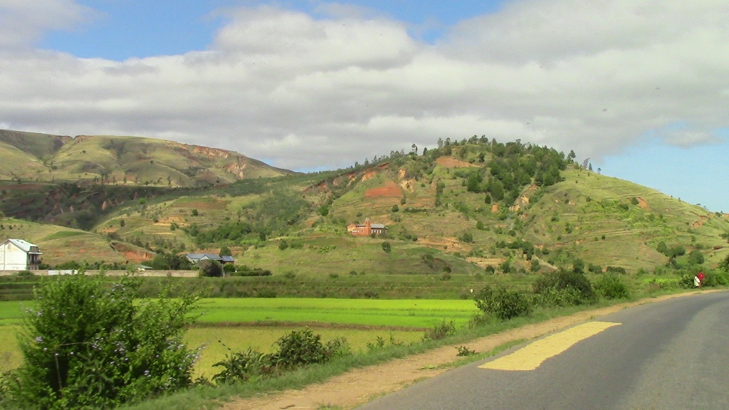
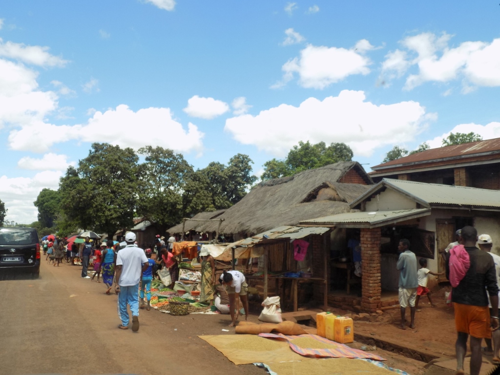
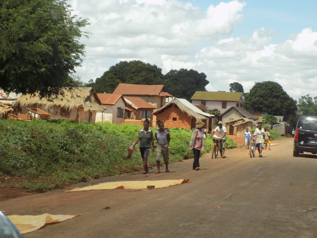
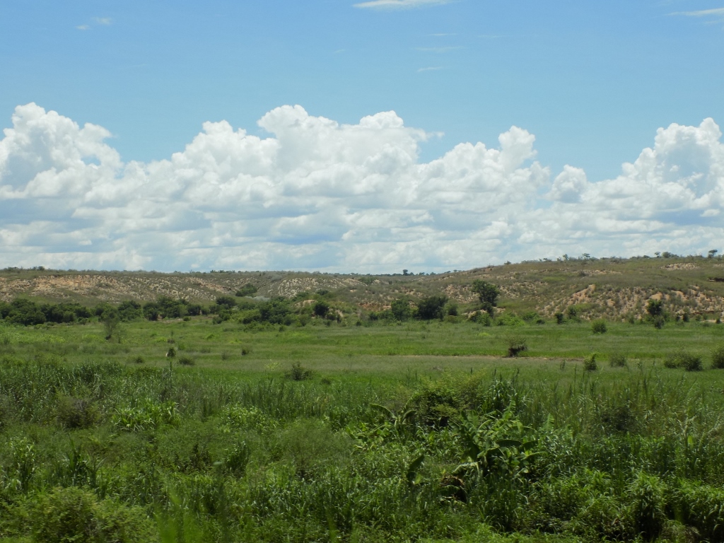
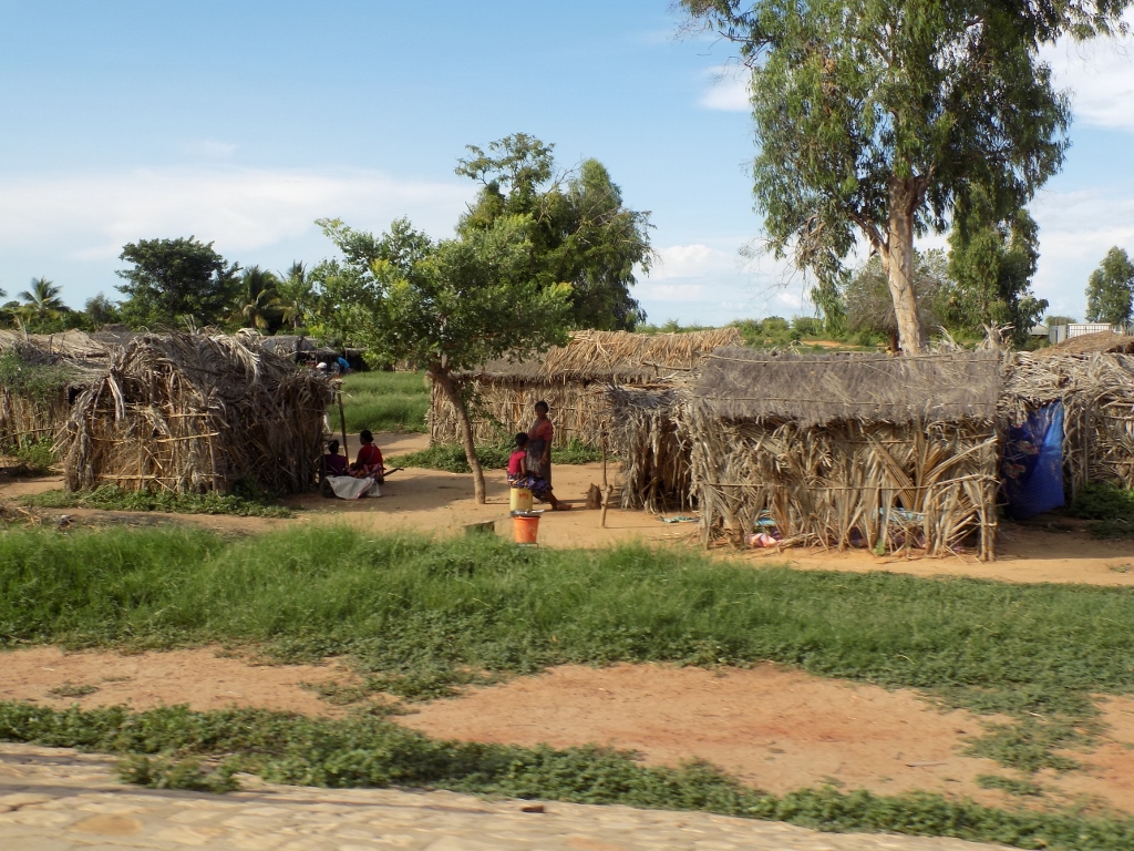
Before reaching the town of Miandrivazo and particularly in the first part of that section we also passed through bigger or smaller villages where people went on about their daily life and they certainly dried their rice there, often not directly on the pavement, but arranged over some pieces of canvass placed on the hot road.
 Settlement on the road to Miandrivazo
 Settlement on the road to Miandrivazo
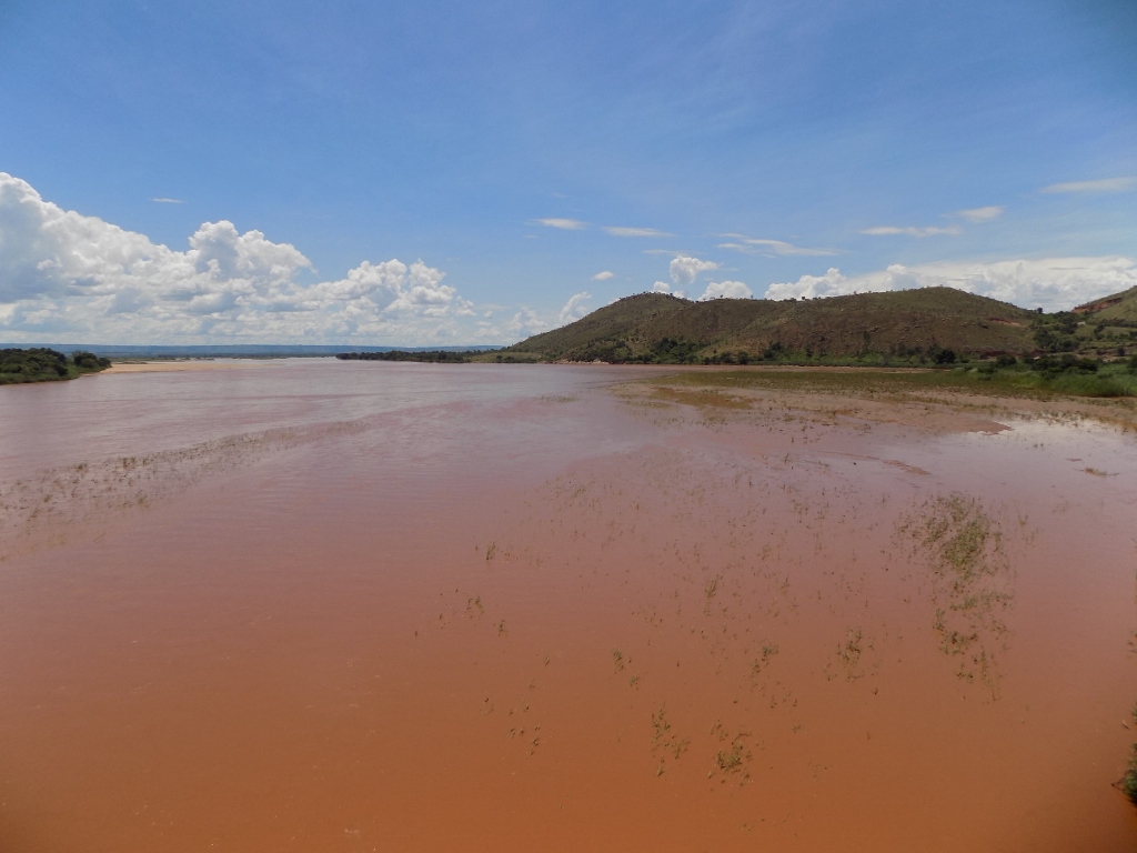
From time to time, we also crossed bridges that had been constructed over smaller or bigger watercourses which were at this time of the year, during the rainy season, filled with muddy water which on Madagascar, the Red Island, was regularly bright red.
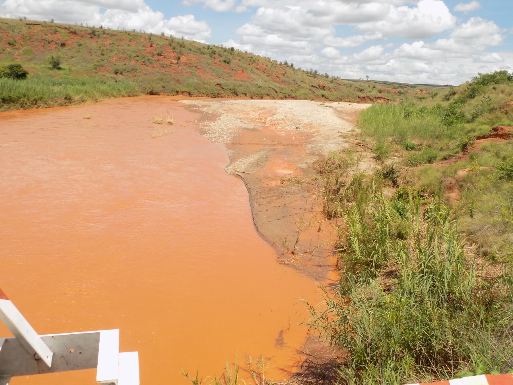 One of the rivers on the road to Miandrivazo
Along the way we also came to one particular small river which was interesting for carrying rocks that contain gold. For this reason, it was possible to see on its rocky banks local residents who were getting bigger pieces of rocks from the river, crushing them then in order to pan the obtained powder looking for possible bigger pieces of gold residue.
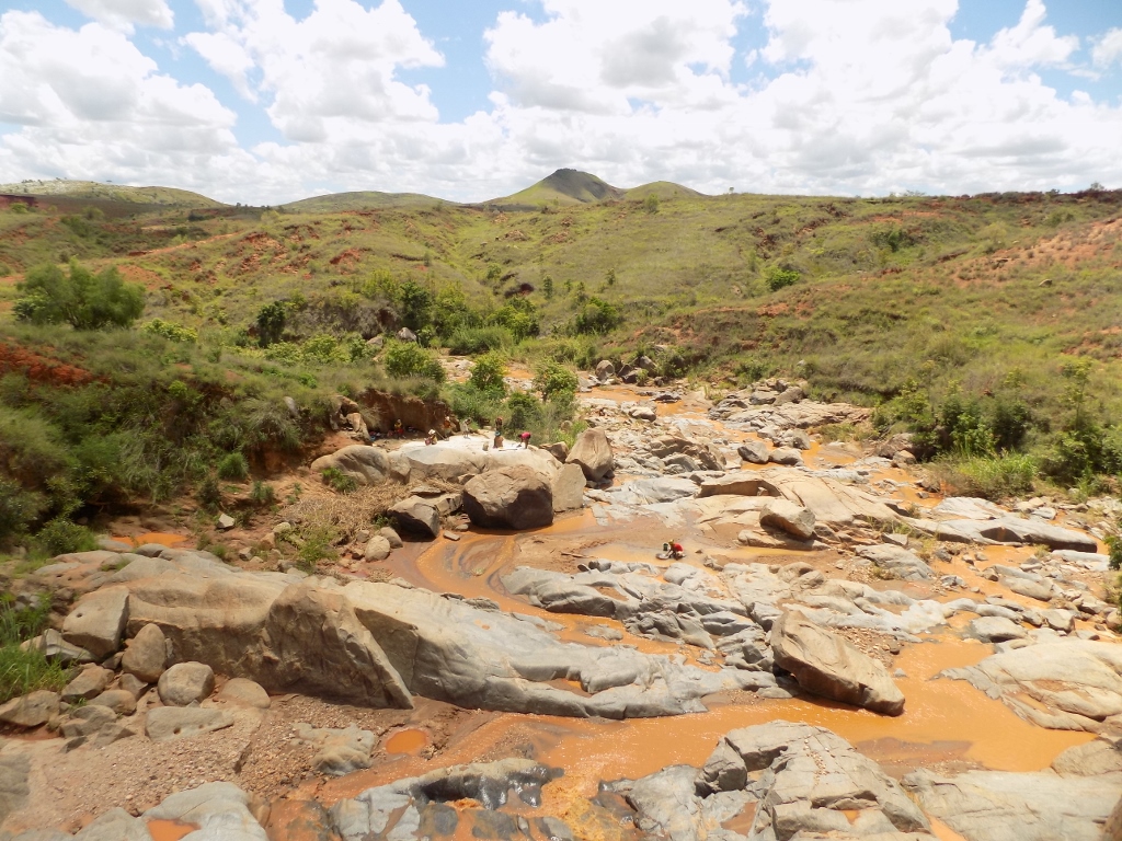 Gold-bearing river on the road to Miandrivazo
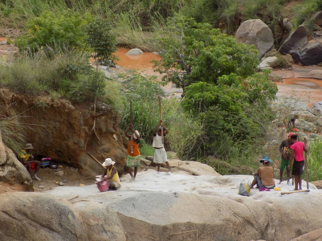 Crushing of the rocks taken from the river
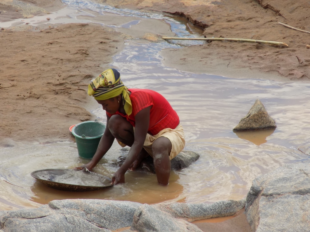 Panning of the obtained rocky powder
Some 30 km before town Miandrivazo, where our plan was to have a lunch break, the road became rather bad, but Rija navigated it all very successfully.
 Road before Miandrivazo
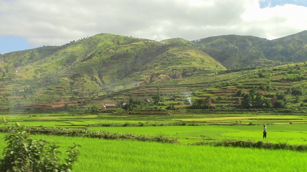
However, the surrounding landscapes continued to be spectacular, although I could clearly see the change in the local climate and the soil, thus consequently in the vegetation as well.
 On the road to Miandrivazo
 On the road to Miandrivazo
Right before Miandrivazo, the road starts to descend towards the lowland areas and there from the height it was possible to see one of a couple of big rivers that flow in this region. This was the Mahajilo which a little farther on joins the Mania thus creating a third river – the Tsiribihina. This third river, together with the river Manambolo that is located more to the north, is known for the cruises that are organised for visitors. Originally, I planned that the two of us should spend some 3 to 4 days sailing slowly down one of the two rivers, but I was told that January was not a good month for something like this since the rivers tend to flood (depending on the quantity of rain) and then the cruise did not make much sense.
Town Miandrivazo is the most frequent starting point for these cruises, but it is also an unavoidable place where the travellers going in both directions between the central parts of the country and the town of Morondava on the shores of the Mozambique Channel make a break for lunch. Rija has told us that during the high season it is necessary to book table in the restaurants in advance and that it is impossible to find a free table unless previously arranged. There was no such danger in January, though, so we had a nice meal there and could even choose a table we wanted. The only thing that mattered was that the table had to be in the shade. In January, around noon, the Sun is almost directly above one’s head and then it is really seriously hot unless you are in the shade.
After the lunch we continued with our drive. The road which until Miandrivazo leads in the east-west direction turns significantly and continues in the direction of the south. A little later, in the place called Malaimbandy, the road also visibly turns almost at a right angle and continues westwards and towards the ocean. All of this takes place in lowland parts of the country.
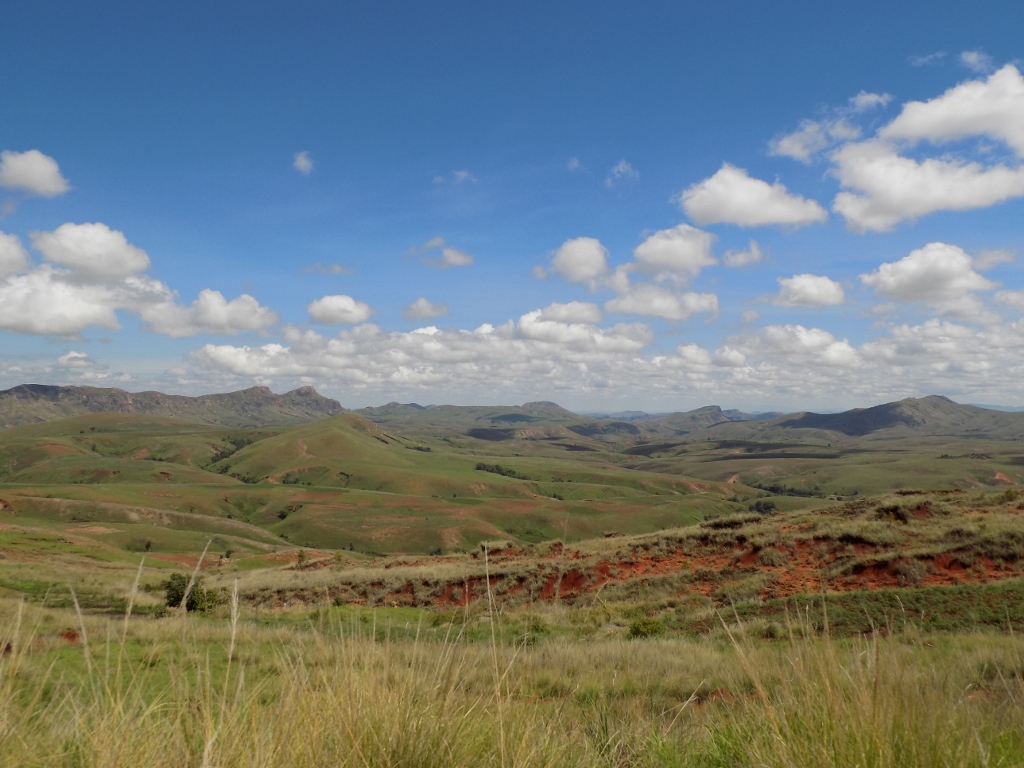
In the meantime, I watched the clouds piling up in the west where we were heading and I wondered if we would be caught in the rain that had been forecasted so often. We also came across a large bridge over the river Mania.
 Clouds in the west of Madagascar
 Mania river
In addition to the river Mania, we saw along the way other, bigger or smaller watercourses and their levels depend on the quantity of the rainfall. What I found more exciting during this afternoon, in addition to the again different landscapes was the dramatic sky covered with clouds.
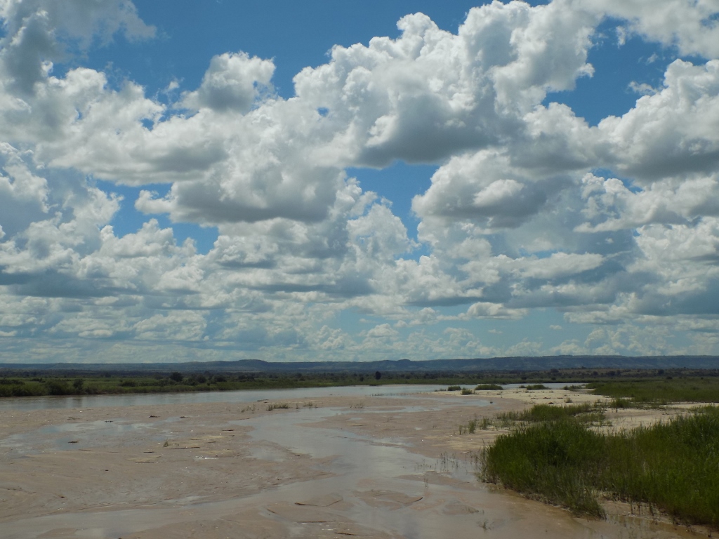 Clouds above a shallow river on the road to Morondava
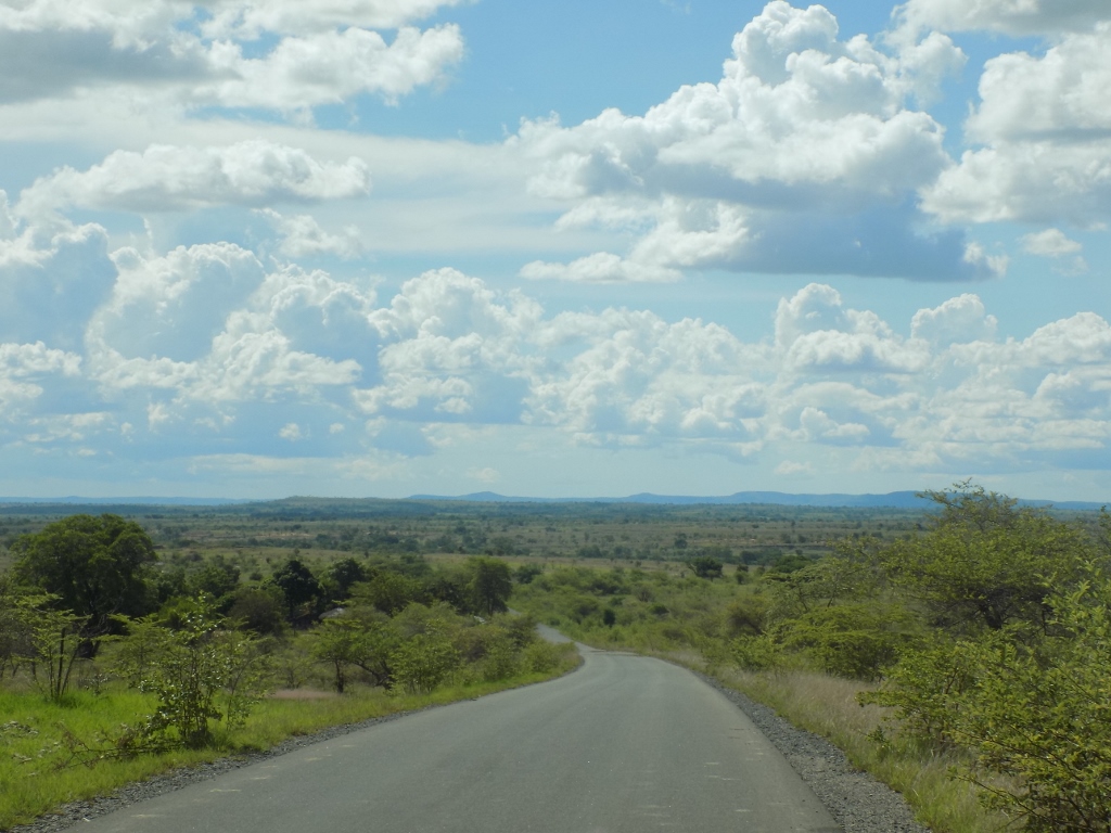 Road to Morondava
It was interesting that Rija told us that between Miandrivazo and Morondava we should not make any stops for any reason whatsoever, which confused me since if people talk about road safety it is usually emphasised that it was not safe to travel during the night, but our journey was taking place during the day. However, on the one hand, there are very few settlements in this particular part of the country and on the other, as far as I understood it, these areas are known for their zebu thieves who are ready, if they have nothing else, to take advantage when tourists make stops. I think that Rija was probably too strict and too careful, and that the situation was not that bad, but I also thought that there was no reason not to trust him and his good intentions, and there was certainly no need for us to stop.
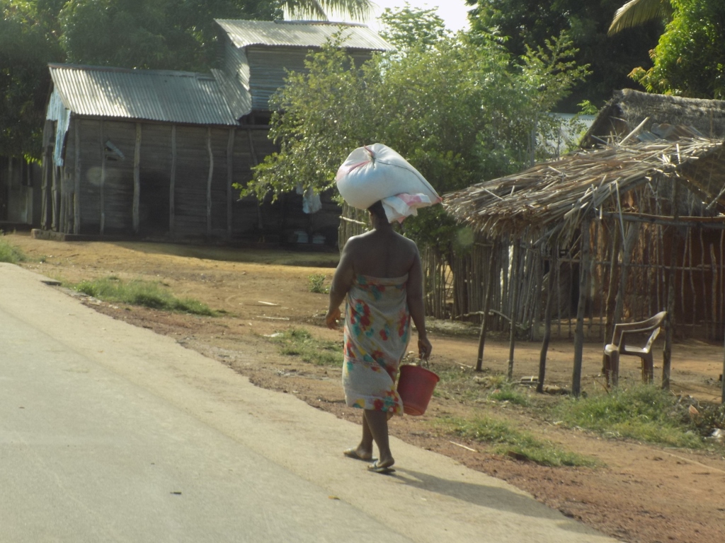
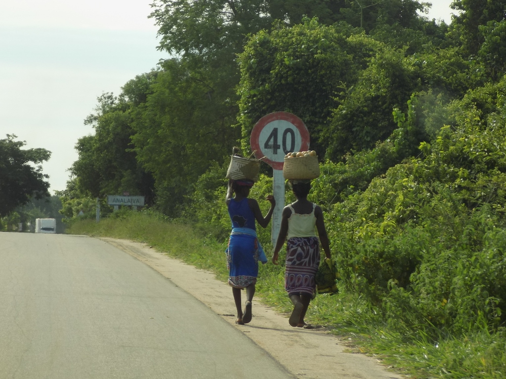
Along those almost 300 km, which is the distance between these two towns, there were very few villages. What happened more often was that we passed by a few huts made of mud, straw or wooden boards. From time to time I saw people lying down on the ground by the road in the shade made by some canopy, but there were also those who were working on something, such as, for instance, women who almost regularly carried different loads on their heads. Generally speaking, it was completely clear that the Malagasy start carrying things on their heads already as children. One gets an impression that this is done only by women, since they are seen like this more often, but I also noticed some men from time to time and this carrying of larger loads on one’s head seems like a skill that could not be learned at an advanced age, although it certainly ensures a very good posture.
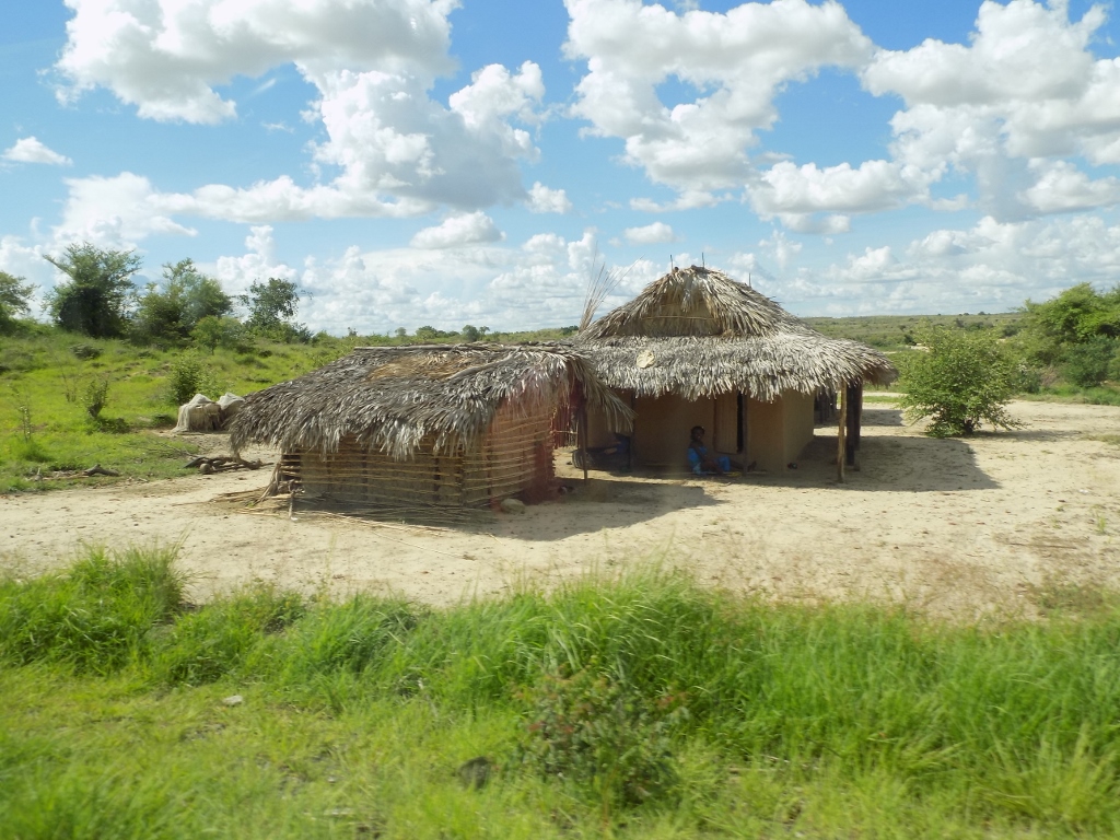 Houses beside the road to Morondava
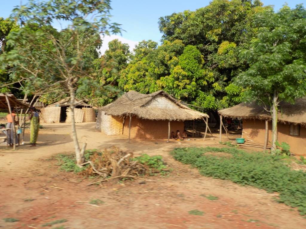 Houses beside the road to Morondava
 Houses beside the road to Morondava
 The load is not carried only one one’s head
 It is certainly more interesting in a company
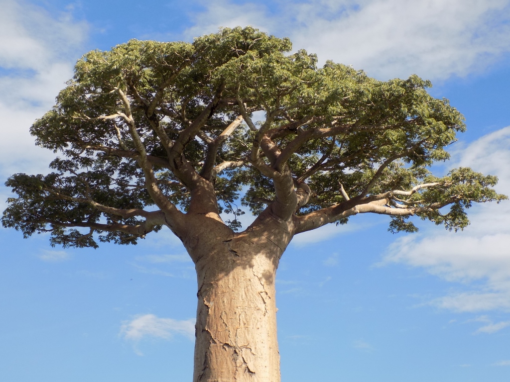
And just as we were approaching Morondava we started to see them – the baobabs! The main reason for this long drive which we planned to repeat in the opposite direction in two days in order to continue visiting the rest of the country was precisely to come here and see baobabs from up close.
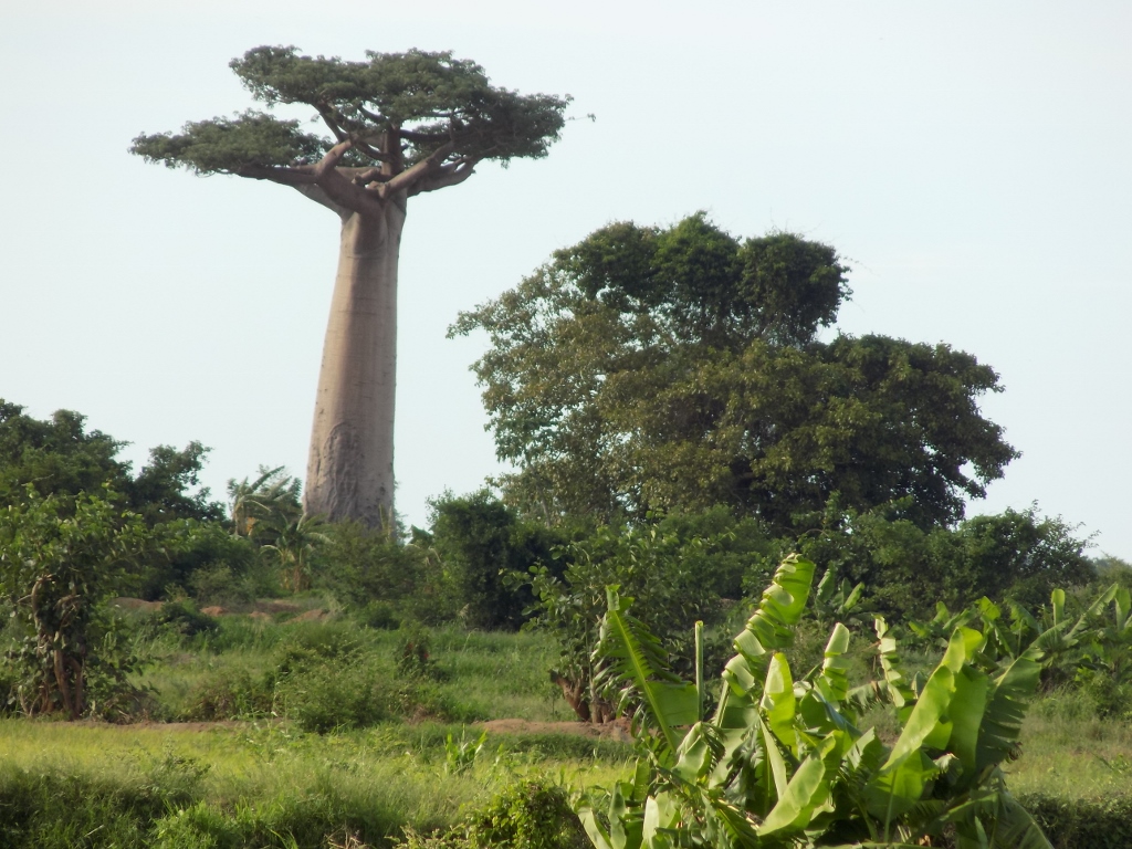 Baobab
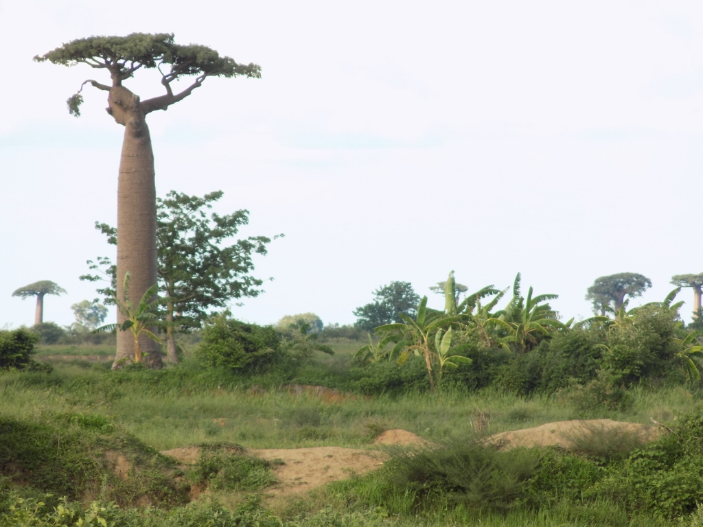 Baobabs
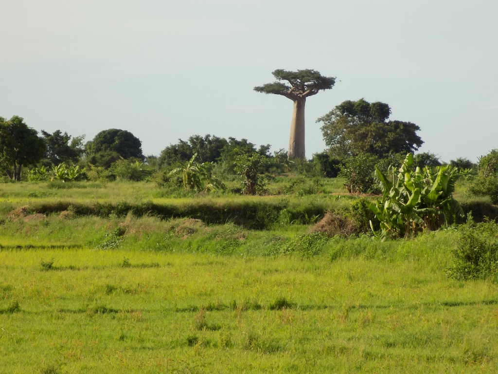 Baobab
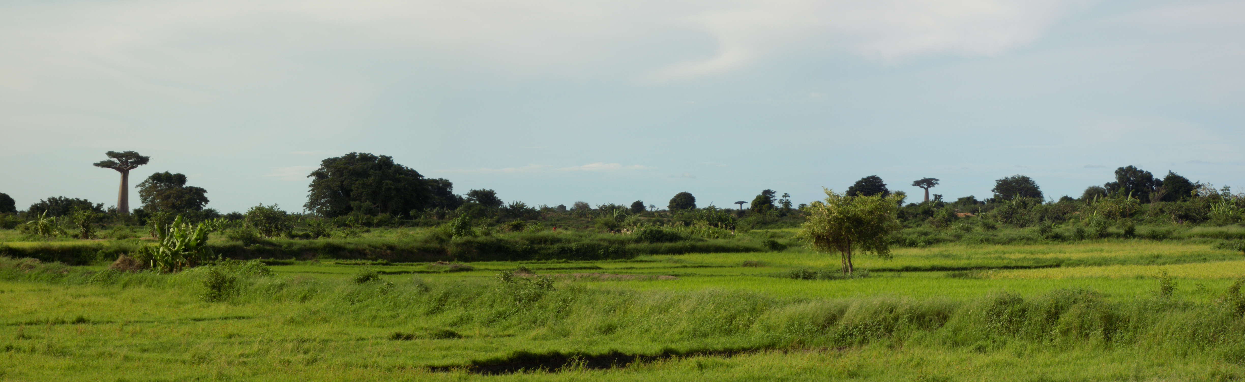 Baobabs
Already back at home, I got this desire to approach a baobab and, if possible, hug it, but I was not sure it this was feasible. Let me say immediately – it is! Moreover, there is one that grows right beside the road to Morondava and Rija stopped there in order for us to take photos and in order for me to hug this fantastic and impressive tree.
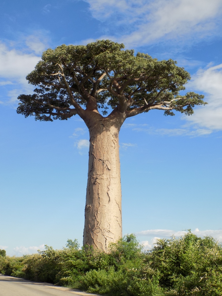 Baobab by the road
Baobabs are deciduous trees, so that at this time of the year, during the rainy season, their tops were filled with green leaves.
 Green top of a baobab
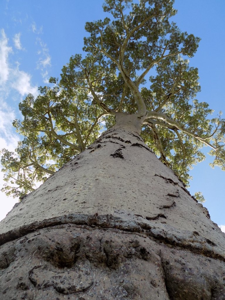 View upwards when one hugs a baobab
After this close encounter, we continued by car and soon we arrived in Morondava on the shore of the Mozambique Channel.