When on this day we left from the surroundings of town Ranohira further towards the southwest of Madagascar the sky was completely covered in clouds. Sneža and I commented how lucky we had been the day before when we went to visit a part of Isalo National Park and when the sky was perfectly blue, without a single cloud.
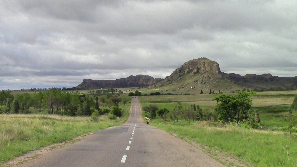 Clouds above Isalo National Park
The travel and sightseeing plan for the day included a visit to the “Isalo Window” rock formation that exists within the park. As I’ve already written, our wish was to go there at the time of the sunset, since the visual effects can be particularly good at that time of the day, but the clouds regularly kept piling up late in the afternoon, so the Sun simply could not be seen at the time. Therefore, in agreement with Rija, our driver, we kept deciding not even to try to go there. But, this place is less than 20 kilometres from town Ranohira and on this day it was on our way, so with or without the Sun, even in the morning, there was no way we wanted to miss out on it.
Still, to start with, the road first took us beside another rock formation called “Queen of Isalo” which is situated literally beside the road and it is impossible to miss it. This is a natural sculpture which members of the Bara people named like that long ago, since it looks like a woman with a crown on her head. I think it will be completely clear from the photo below why this rock has earned this picturesque name.
 “Queen of Isalo”
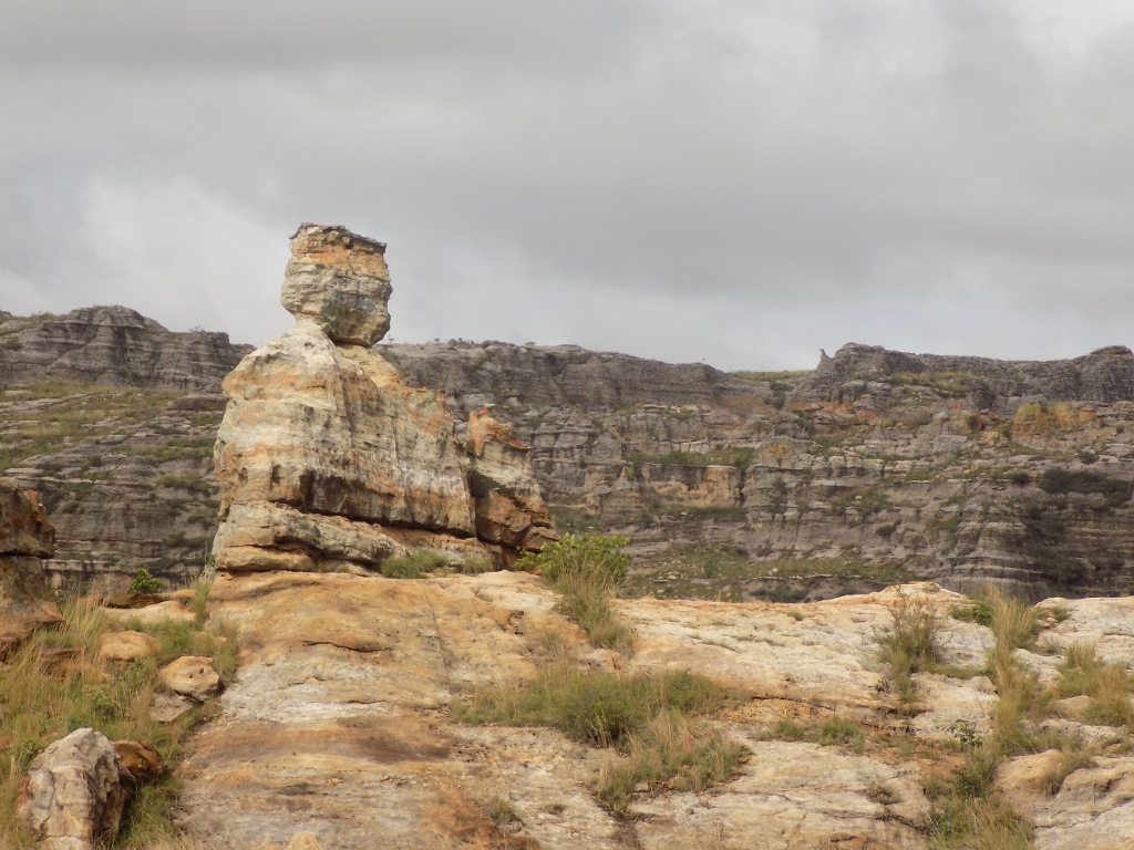
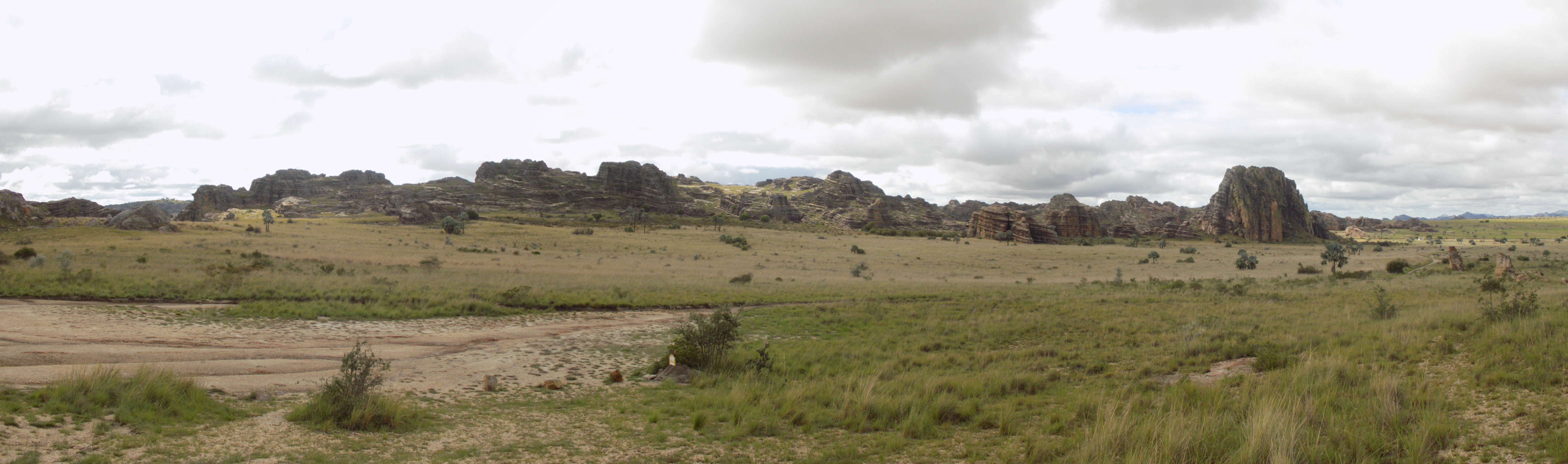
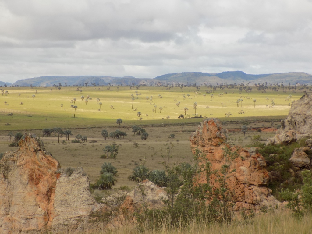
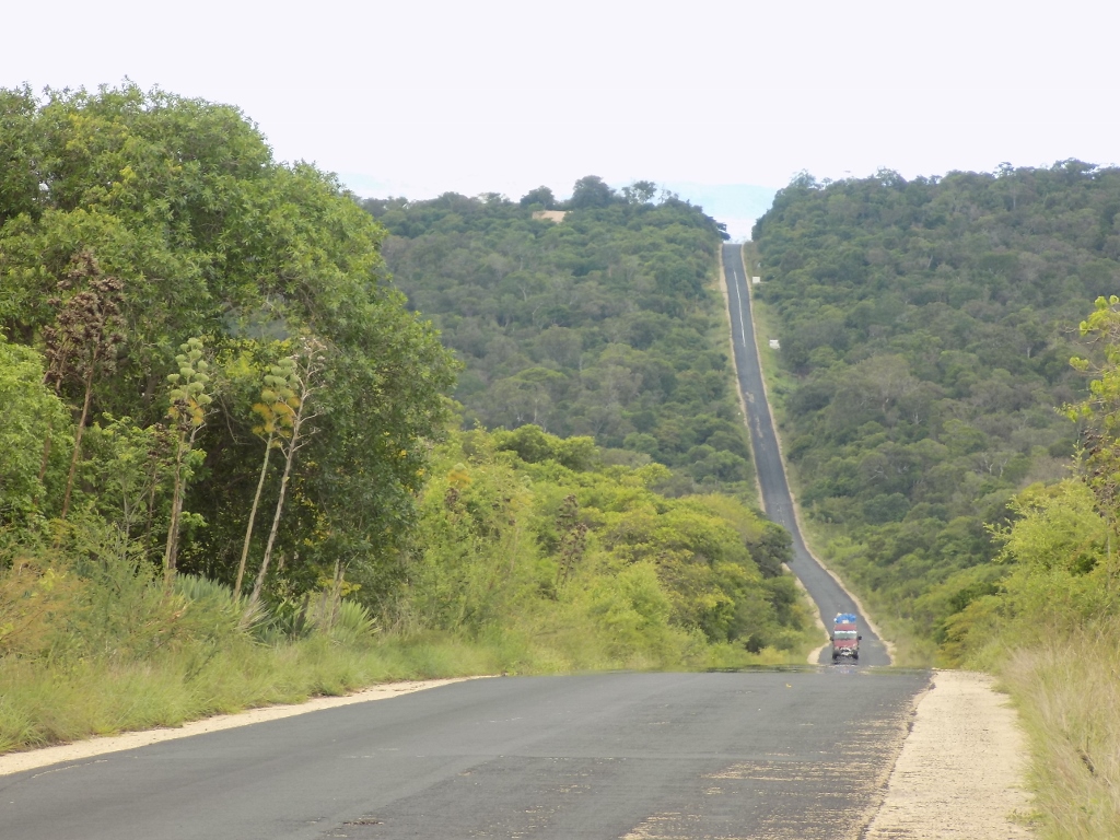
This whole area that belongs to Isalo National Park includes a large sandstone mountain massif which the wind and water erosions have made exceptionally interesting and I was again delighted by the specific beauty of the landscapes we were going through. The height of these mountain peaks goes from 820 m to 1304 m above sea level, but one needs to bear in mind that the road goes across a plateau, so the relative heights of these mountains are not too big.
 Edge sections of Isalo National Park through which RN7 road passes
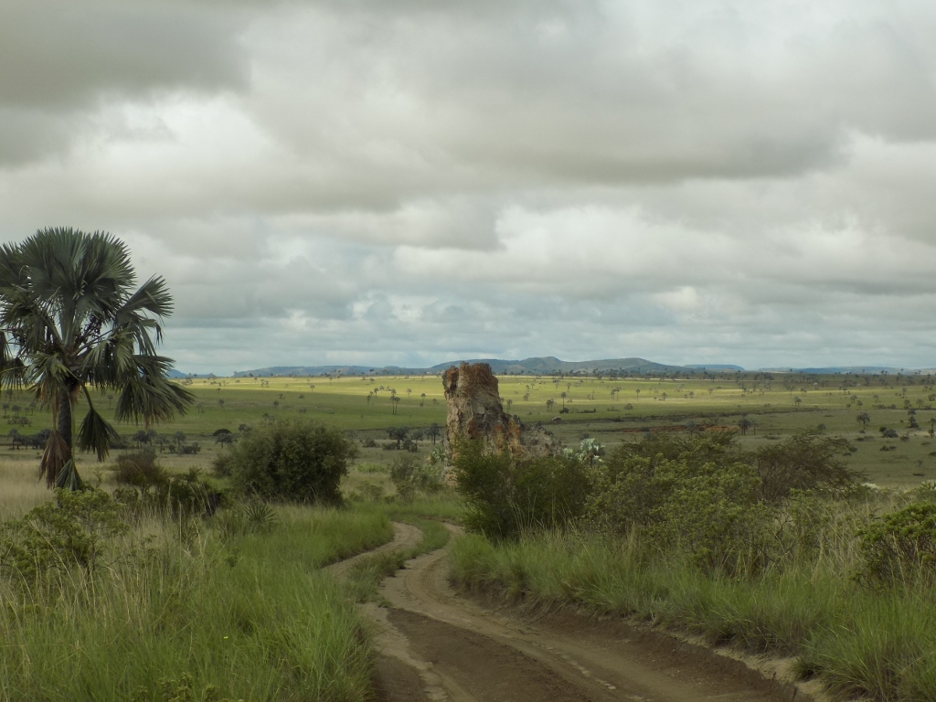
Soon we got off the paved road following a dirt road consisting mostly of compacted sand which practically goes around the rock formations that extend along the asphalt road and which leads towards the grassy plain. After about 1.5 km, the dirt road ends in an expanded lot used for the parking of vehicles and there, a couple of dozen metres away, is “Isalo Window.” It was again fascinating that the three of us were the only humans in sight.
 End of the dirt road (the parking lot is visible to the left); behind the rocks in the distance passes the asphalt road
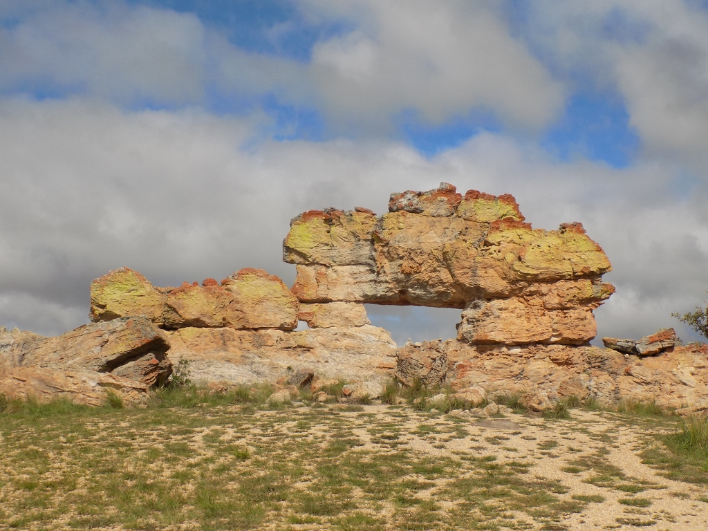
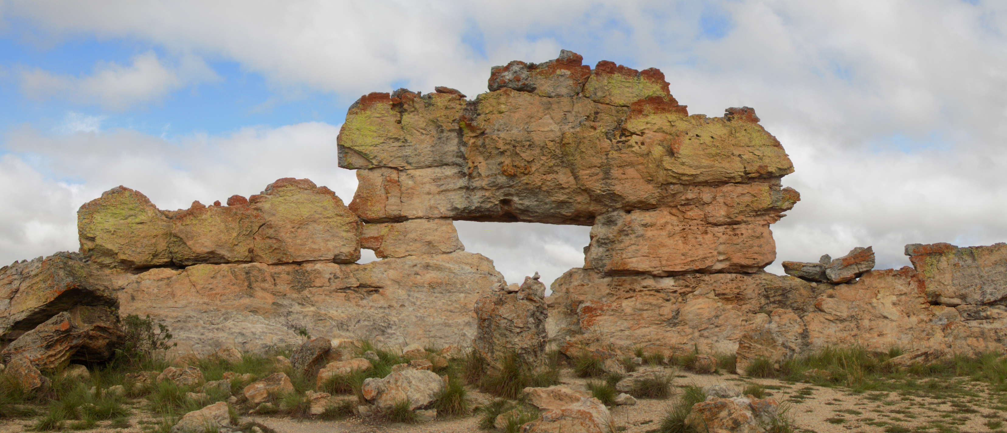 “Isalo Window”
So, this is a completely naturally shaped sculpture made of rocks which has an opening and this creates the window association. It is particularly interesting that the window faces west and that is why it can be particularly nice to come here at the time when the Sun is setting. Then the photos can often be truly impressive. Still, we found it interesting to see this place even like this, on a mostly cloudy day and during the morning.
Here is also a panoramic photo which shows how in the space extends that sequence of rocks in which the erosion has created the opening.
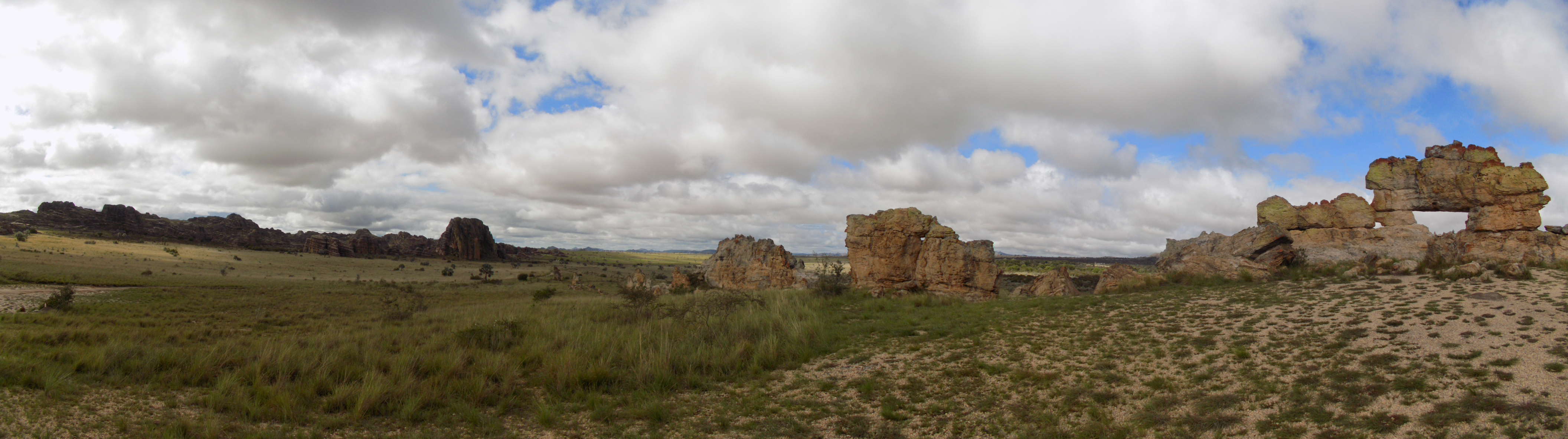 “Isalo Window” and the surroundings
Still, without a reference, it is very difficult to get an idea about the size and the scale of this group of rocks. By coincidence I posed in two places, close and right beside the “Window,” and since I’m 1.80 m tall, then it is possible to get a better idea about the size of this formation.
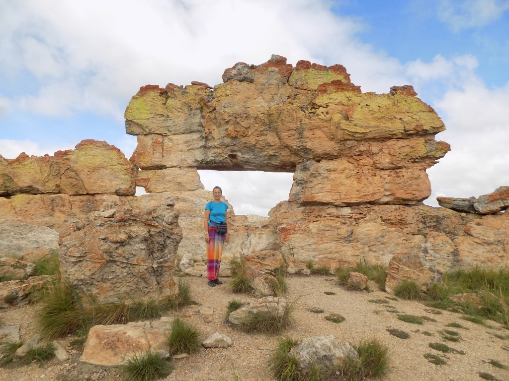 Me as a reference close to “Isalo Window”
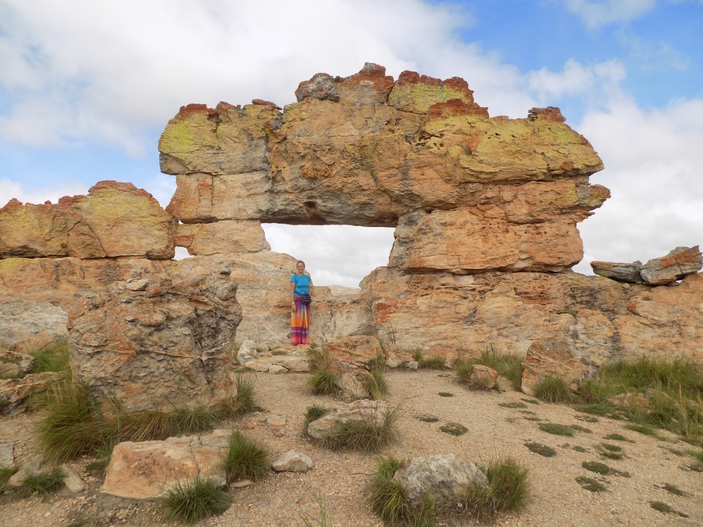 Me as a reference right next to “Isalo Window”
While we were taking photos, I noticed that the clouds were moving very fast – it was clear that there were very strong winds higher up, but on the ground it was not too windy. Be as it may, looking towards the clouds I realised that the Sun would soon light the “Window,” so I decided to wait a little bit, which meant that in turn Sneža and Rija had to wait for me. Taking photos sometimes requires sacrifice.
I took the opportunity to take photos of the grassy landscapes in the distance that were lit by the Sun at the time and that were particularly interesting because of the palm trees scattered across that area.
 Palm trees in the distance
Although my travel companions were getting restless, I still succeeded in waiting for the Sun to pierce through the clouds and light the “Isalo Window.” The sight was not spectacular, but I was content nonetheless. We could move on now.
 “Isalo Window” lit by the Sun
We returned to the asphalt road driving, of course, along the same dirt road and after a short appearance on the stage while we were still by the “Window,” the Sun now hid again behind the clouds.
 We are in the shade again
Soon we got back to the asphalt road and continued with our drive towards the southwest. Thus we also reached town Ilakaka. At the beginning of the 1990’s, there used to be a village here with fewer than 100 inhabitants. And then one of the biggest sapphire deposits in the world were discovered here leading to a “sapphire rush,” while Ilakaka turned into a town with over 50,000 residents. 70% of the sapphires in the world market come right from the surroundings of this town, as well as of another town called Sakaraha.
 Ilakaka
Needless to say, such a turn of events led to a situation in which Ilakaka, as the capital of sapphires, the centre of the mining of this gemstone, has become the point of congregation of a large number of very shady characters and the town is often called the Wild West. It is completely unsafe at night, even for the local population, because it is not good if you do not find sapphires since you have nothing to live on nor is it good if you do find them, because the news spreads around and you become the person of interest for criminals who do not shy away from anything.
Be as it may, visitors here may go on organised tours that include a visit to a sapphire mine. These are short tours, but that time is used to explain the whole process. The guidebook we used during the journey says that staying here during the day, including these tours, is quite safe, but Rija was not keen at all on stopping and hanging around here. Therefore, we stopped only on one bridge from which we could see a large local comprehensive washing venue – it was used to wash laundry and cars, and the river was also used as a bathtub.
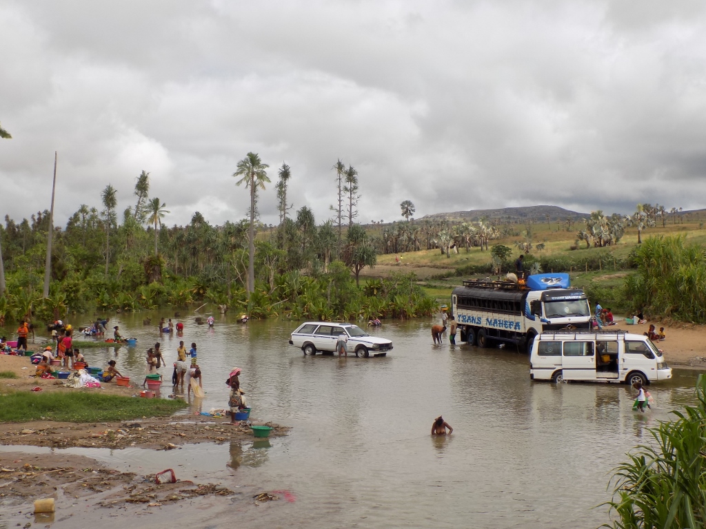 Ilakaka – place for washing and bathing
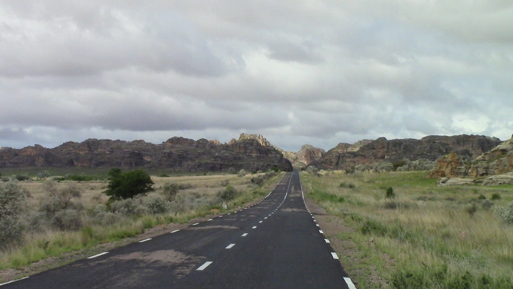
We continued with our drive, following the RN7 road which took us through fantastic landscapes of southwest Madagascar that kept taking my breath away.
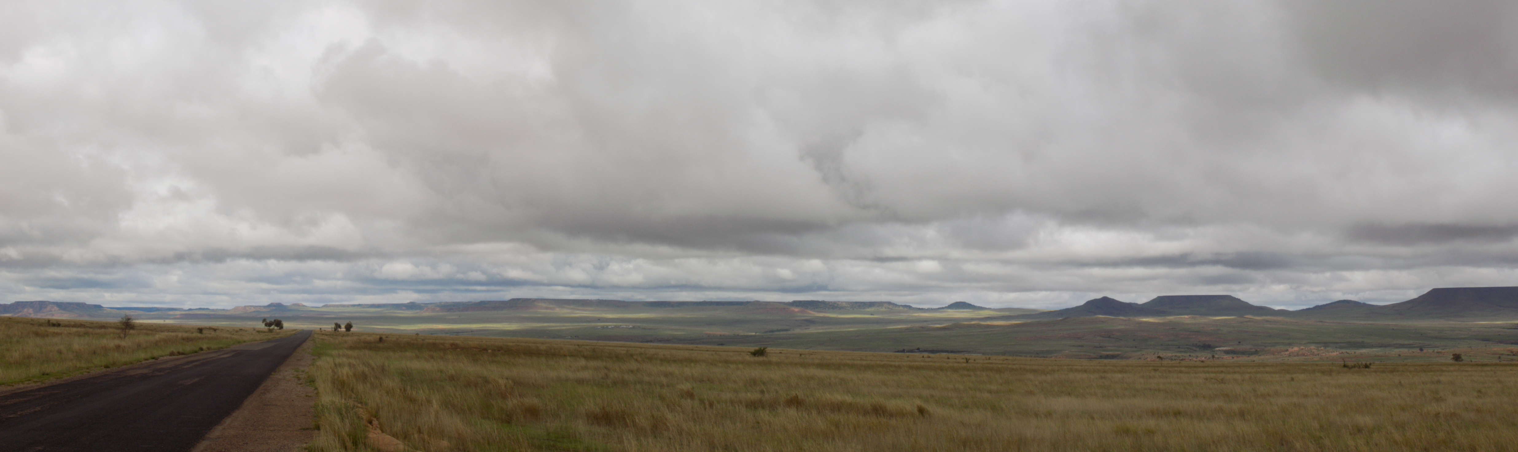 Grassy plateau in the southwest of Madagascar
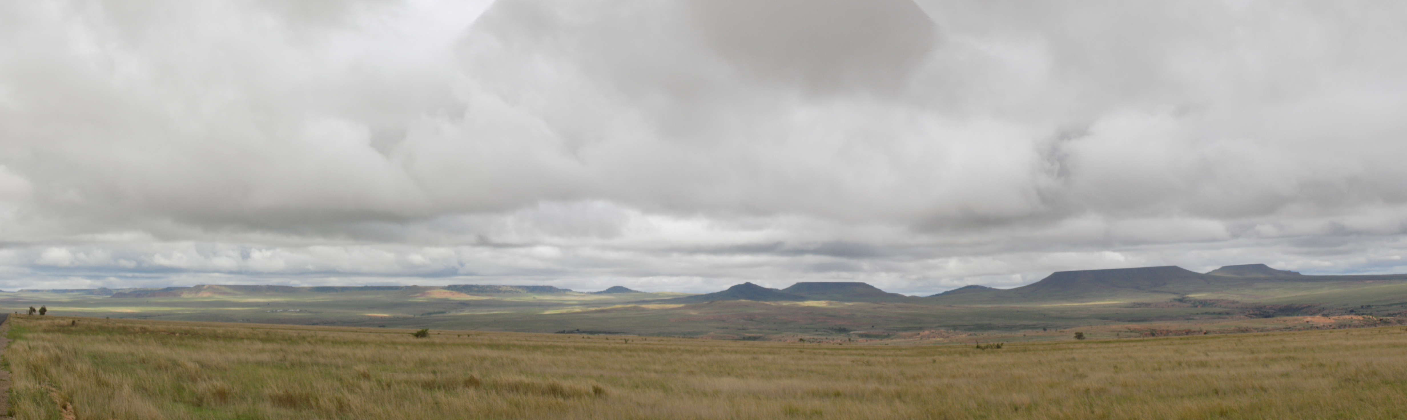 Grassy plateau in the southwest of Madagascar
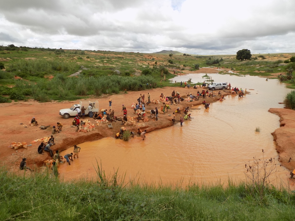
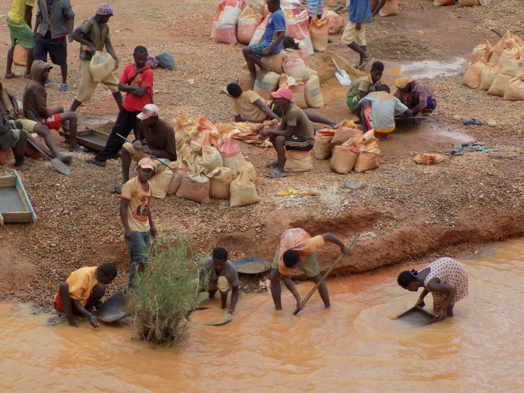
And then we came once more beside a body of water where there was some washing again, but this time this was about the panning of the excavated earth which potentially contained sapphires.
 Place where they are panning the earth which potentially contains sapphires
The excavated earth is brought here in large bags and then it is panned in order to see whether there are pieces of sapphire hidden in it. Everybody works.
 Different stages in the panning of earth while looking for sapphires
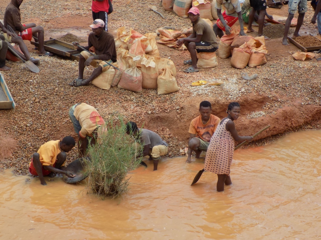 Different stages in the panning of earth while looking for sapphires
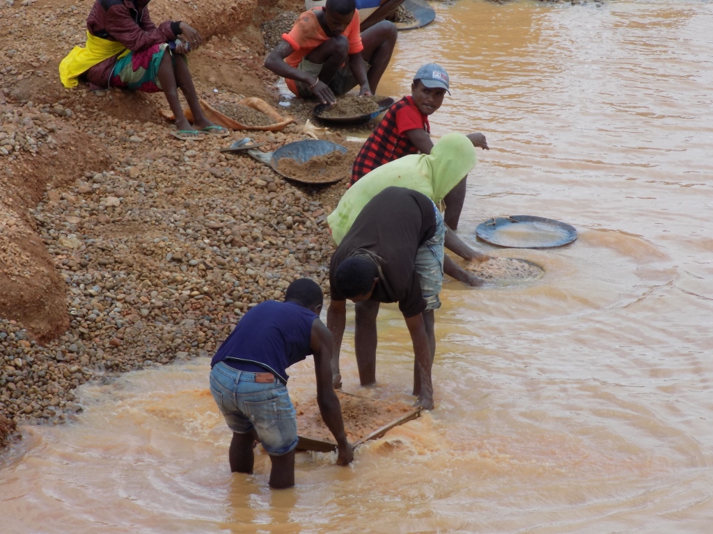 Different stages in the panning of earth while looking for sapphires
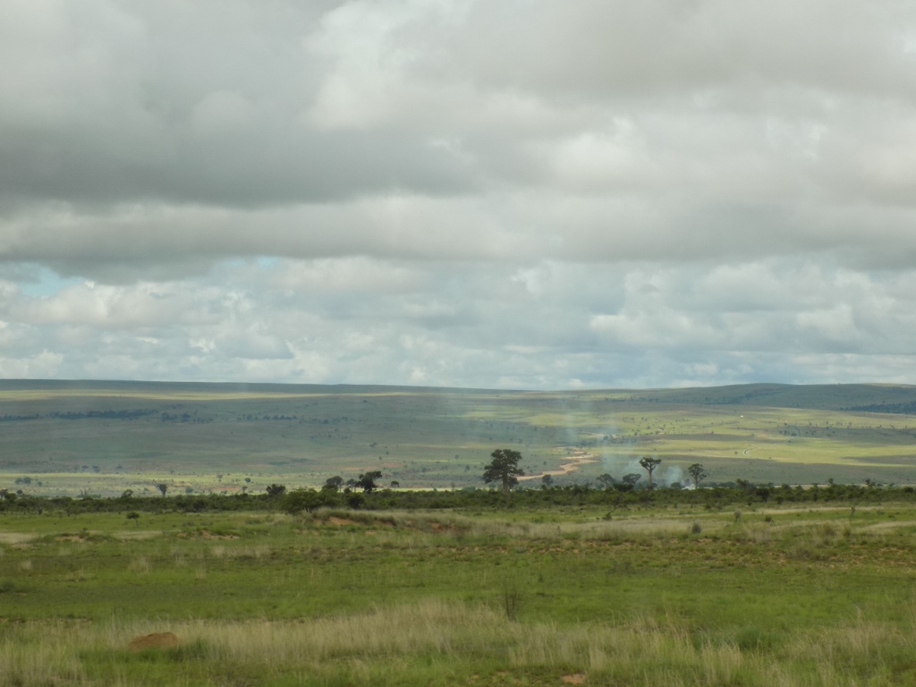
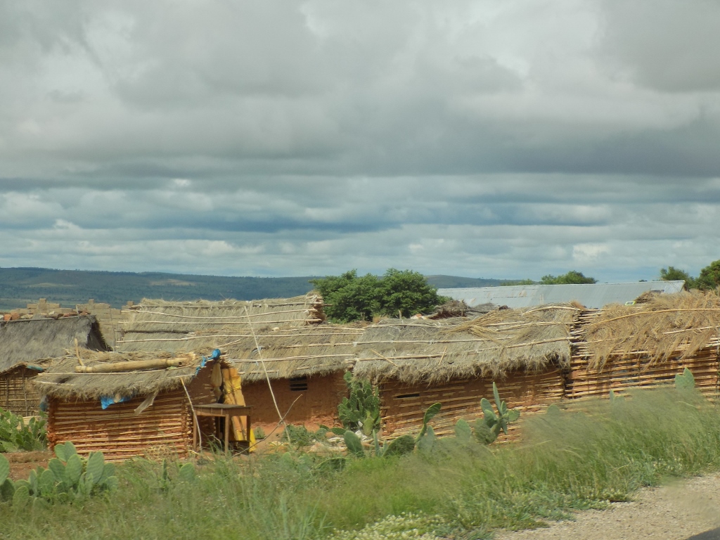
After this short break, we continued with our journey heading for town Tulear that is situated on the coast of the Mozambique Channel. The landscapes were mostly flat and with sparse trees, and then we came across slightly wavy land and a rather dense forest.
 Lowland areas in the southwest of Madagascar
 Wavy landscapes with a dense forest in the southwest of Madagascar
The forest seen in the photo above is a part of Zombitse-Vohibasia National Park which covers the area of 363 square kilometres. The park consists of three sections that are precisely in the form of forest. The forests contain a significant wealth of flora and fauna, and the park is specifically known by a large number of birds, including also a small species called Appert’s tetraka (Xanthomixis apperti) which is so endemic that it can be seen only in this forest and one other place on Madagascar!
The park is also interesting because of a large number of different species of nocturnal lemurs (here it is possible to see five nocturnal species in comparison to three diurnal species), so whoever is interested in this may easily get to this National Park as it is less than 150 km away from town Tulear in which there is also an international airport.
Sneža and I did not make a stop here. First, we realised late that the road would take us right beside the entrance into the National Park, so we did not organise our time well, and second – the middle of the day is not a truly ideal time to visit the forest and look for the animals. One can see much more earlier in the morning or later in the afternoon, and there are also night visits during which nocturnal lemurs may be seen. Thus, we just drove by the forest in our car hoping that perhaps we would return here one day and then be able to look for that little bird and the nocturnal lemurs.
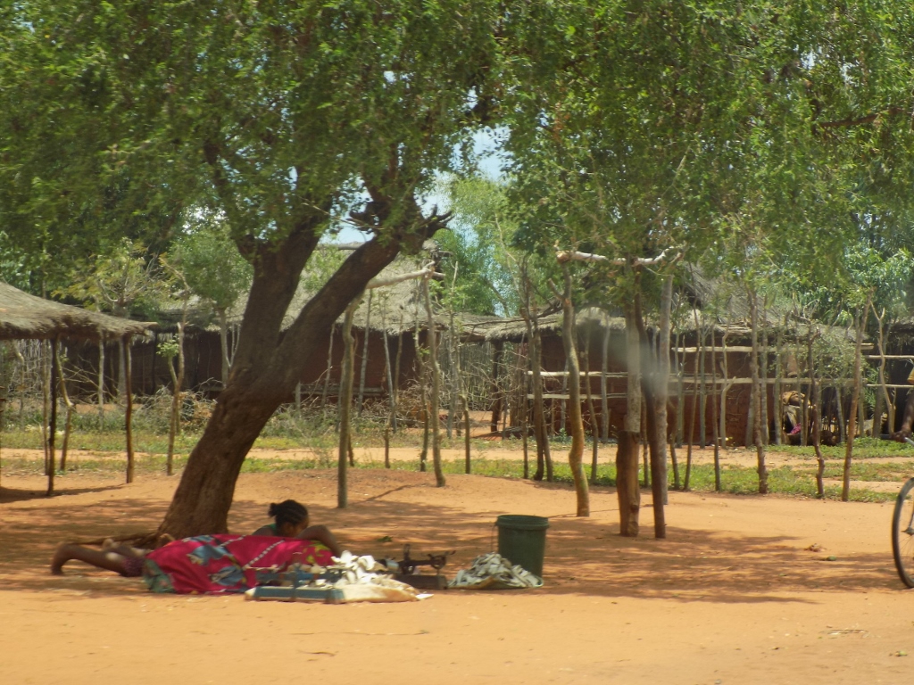
I spent the rest of the journey that day, which entailed driving through inhabited places, watching intensively the world go by and also taking photos of the daily life of the residents of southwest Madagascar. For instance, women who carry different types of load on their heads.
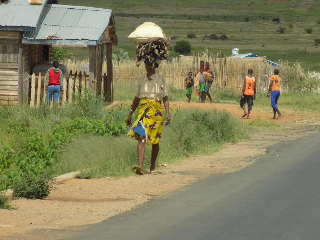 Carrying load on the top of the head is certainly not an easy task, but it does require perfect body posture
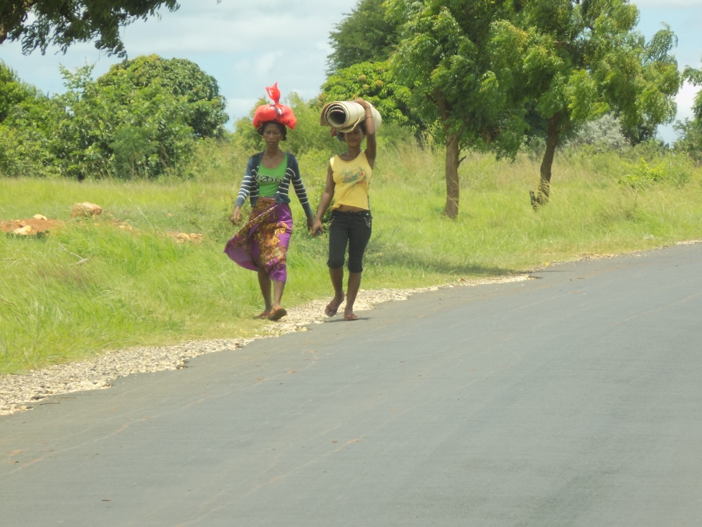 Carrying load on the top of the head is certainly not an easy task, but it does require perfect body posture
Or men operating different types of vehicles.
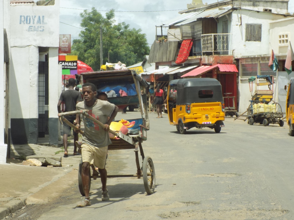 Pulled rickshaw and an auto rickshaw
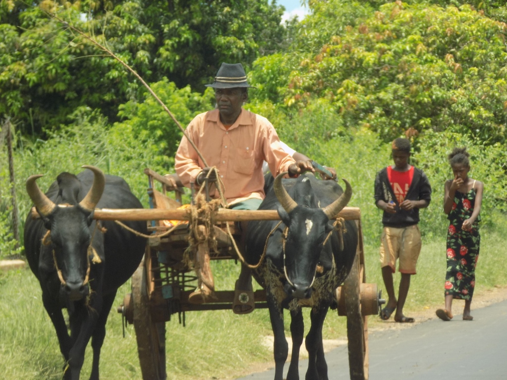 Traditional cart pulled by zebus
Still, perhaps the most picturesque is the following photo in which you can see the quantity of load that is transported on the roof of this van. Whatever is put into these large bags arranged on the roof of the van it still seems like too much load, doesn’t it?
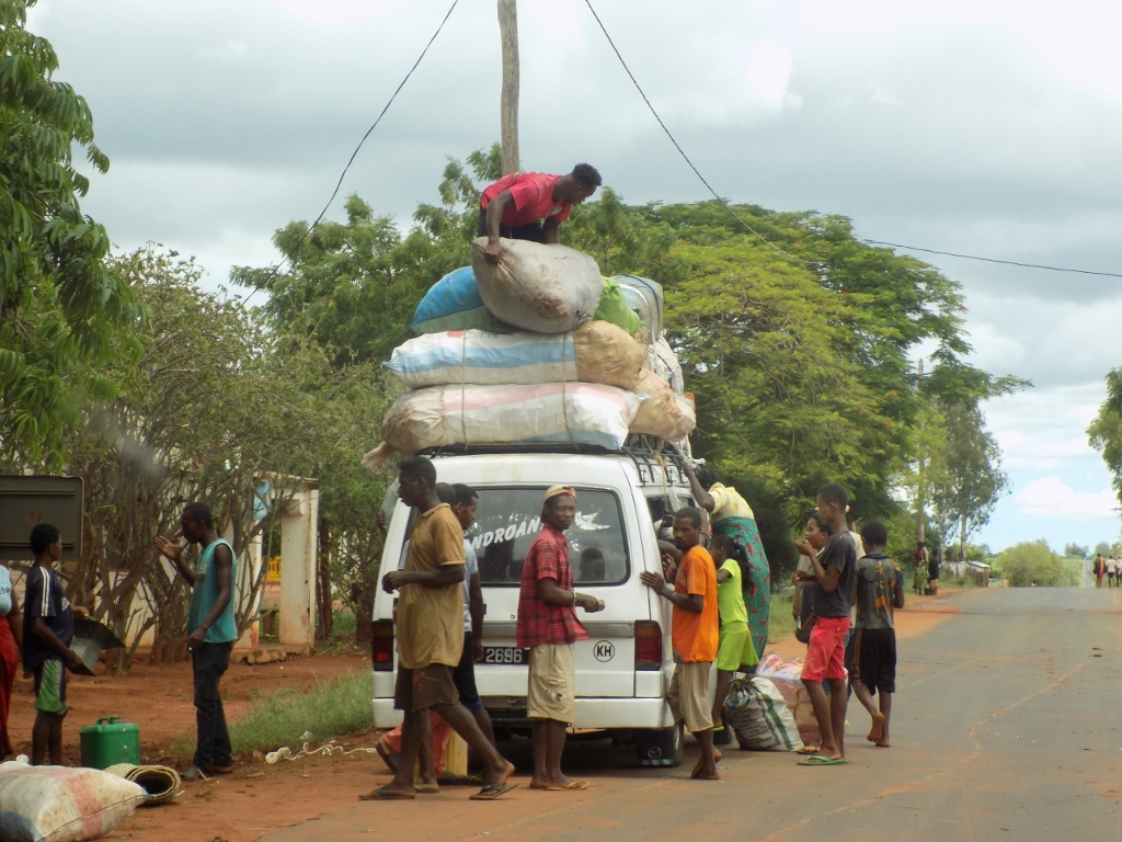 Van and its load
Also, at some point we drove through a village that is known for its production of an alcoholic drink. Our driver Rija told us that during our journey he had been collecting the 1.5 l water bottles which we had emptied and wanted to throw away. The reason for this was that he intended to give these empty plastic bottles to these people since they used them for packing and selling of the local “home-made” drink produced here. What I want to say is that this was not a question of some real factory that had its proper packaging, but rather people here try to be resourceful. On the other hand, I was also very glad that our “discarded” bottles could be used for anything again. Rija also told us that his plan was to buy a couple of bottles of this drink on his way back, but neither Sneža nor I were inspired even to try the drink, whatever it may have been.
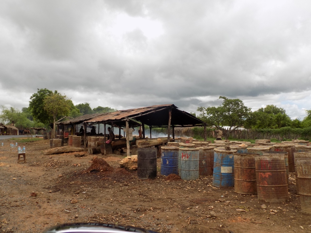 The exhibit “hall” and the liquor shop
As it can be seen in the previous photos, the sky was rather cloudy this day and occasionally I could see in the distance rain that was falling sporadically from individual clouds. Still, the Sun managed to prevail here and there and the moment when it would shine on the Earth in would be particularly hot in this part of Madagascar, so the people who waited by the road either for something or for someone tried to do that waiting in the shade.
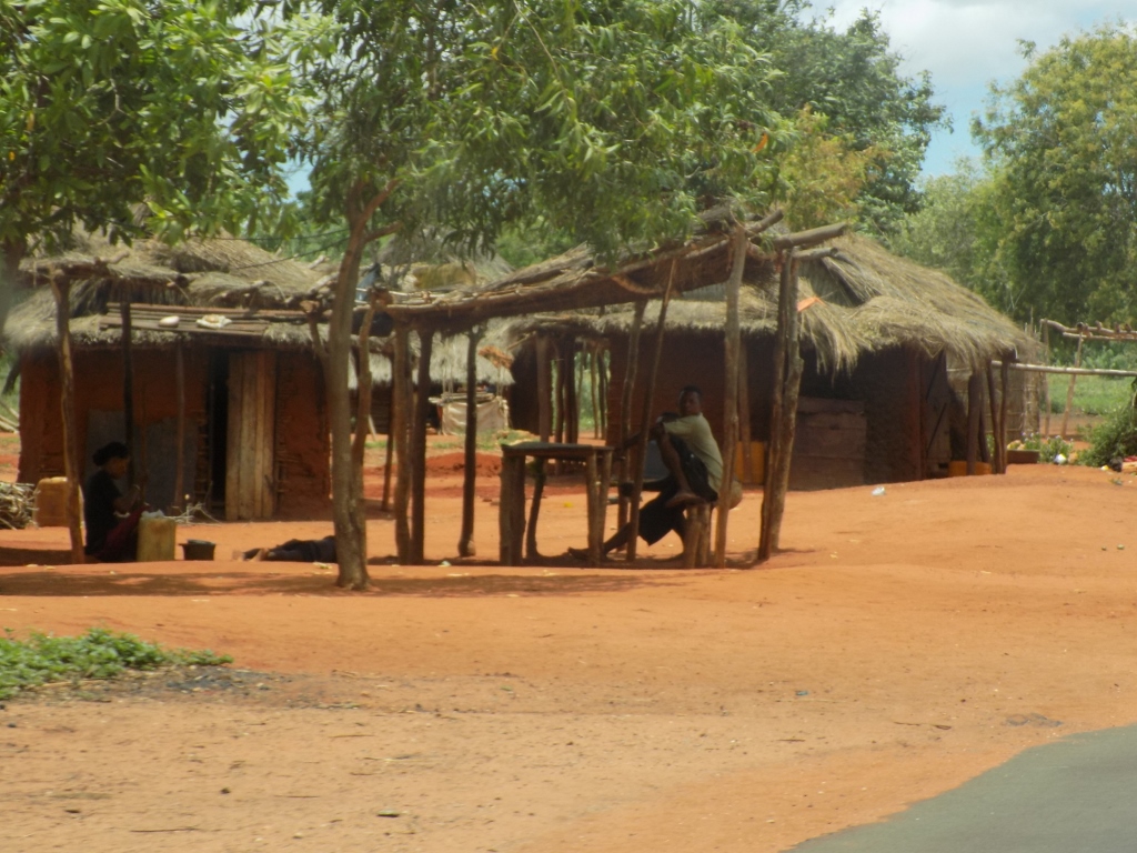 Waiting in the shade
 Waiting in the shade
This particular heat I’m talking about comes from the fact that almost exactly over this part of Madagascar crosses the Tropic of Capricorn, which means that in January, when we were there, at noon the Sun is almost exactly above the head of the person standing out in the open. In that position, the sunrays are particularly hot and this is not necessarily linked to the air temperature, but rather to an impression that your brain is going to boil any minute if you continue standing in the sun.
By the way, this part of Madagascar has dry climate and Rija told us already back in Antananarivo that it never rained in the southwest of the country and that at least we would not need to worry that we came to Madagascar in the middle of the rainy season once we reached the southwest. Admittedly, by the time we got to town Tulear he slightly modified his story into: “It rains in Tulear only three times a year,” which he was supposed to know quite well, since this was exactly where he grew up. Be as it may, the vegetation that was a little lusher in some places and a little sparser in some others was accustomed precisely to the dry climate. Thus we often saw cacti with broad leaves that grew beside human settlements and when they grew up considerably they served as a protective fence.
 Cacti starting to grow beside houses in a village by the road
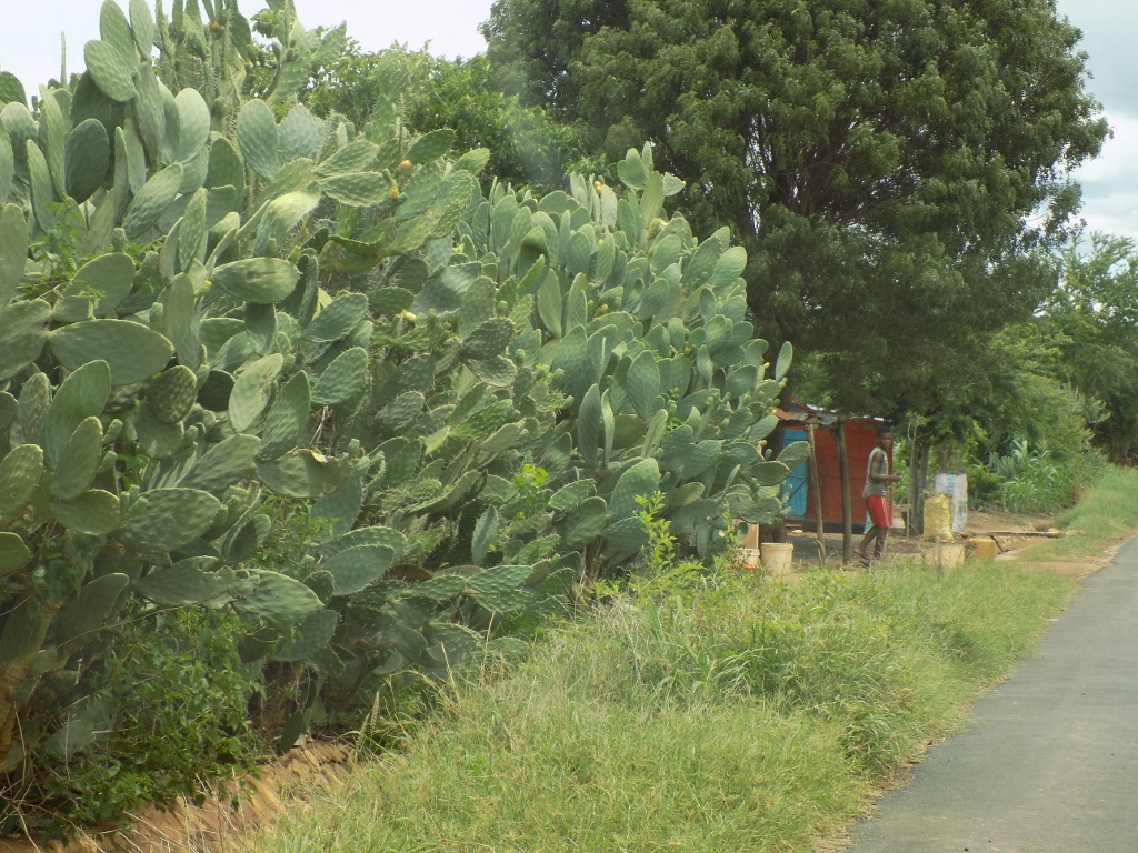 Cacti that have already grown considerably and now protect houses on the other side of the fence
But, as far as vegetation is concerned, here we started to see baobabs again.
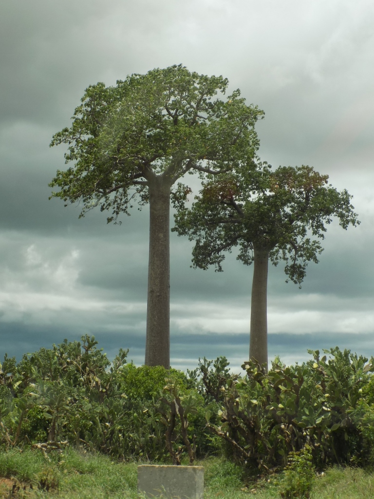 Baobabs in the southwest of Madagascar
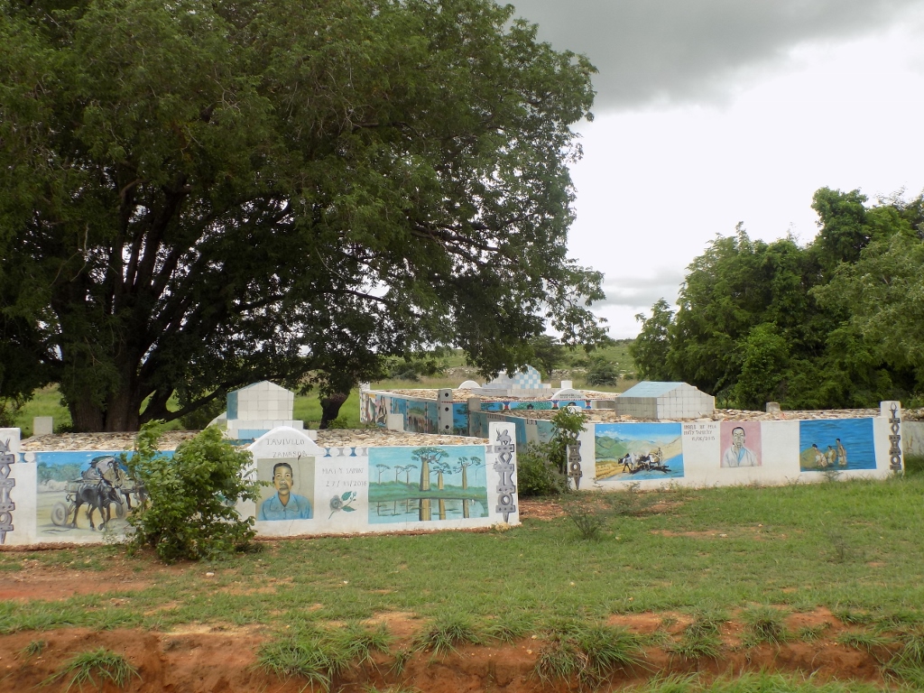
Still, perhaps the most interesting places we drove by on this day were tombs that belong to members of the ethnic group Mahafaly that lives in the southwest of the country. Like all the ethnic groups on Madagascar, the Mahafalies, too, have a whole bunch of taboos which they respect very much and which are called “fady” here. One of them is that the tomb sites can be visited only when there are funerals or if one needs to retrieve a lost zebu. Also, in the past, it was prohibited for the white people to enter their territory. In our case, this concretely meant that Sneža and I were not allowed to get out of the car. Although there was nobody else in sight, Rija was very clear about this saying that we may take photos only from our vehicle. The two of us were absolutely fine with that and we behaved appropriately, while he moved car little by little so that we could get a good view at what we wanted.
 Some of the tombs are very complex and imaginative structures
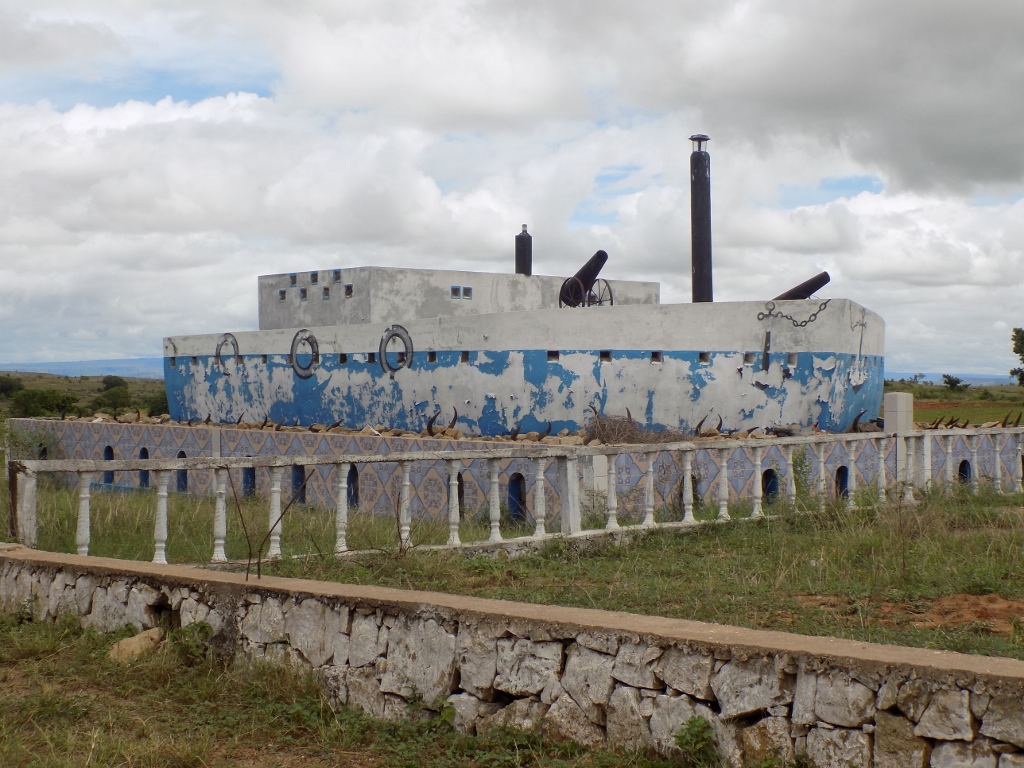
It was clear on the basis of the size of the tomb seen in the photo above that this was the place of burial of members of a rather wealthy family. One of the typical rituals conducted during a funeral is sacrificing a zebu whose horns are later left at the tomb. This was seen here quite well.
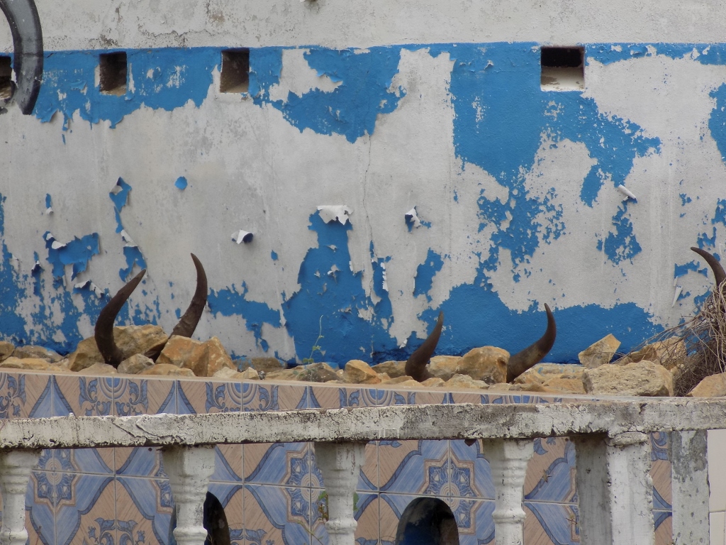 Zebu’s horns arranged along the perimeter of the tomb
This tomb or the plot of land on which it is located to be more precise was fenced off and on the basis of the broken glass bottles arranged along the top of the fence it was clear that the visitors were not welcome here.
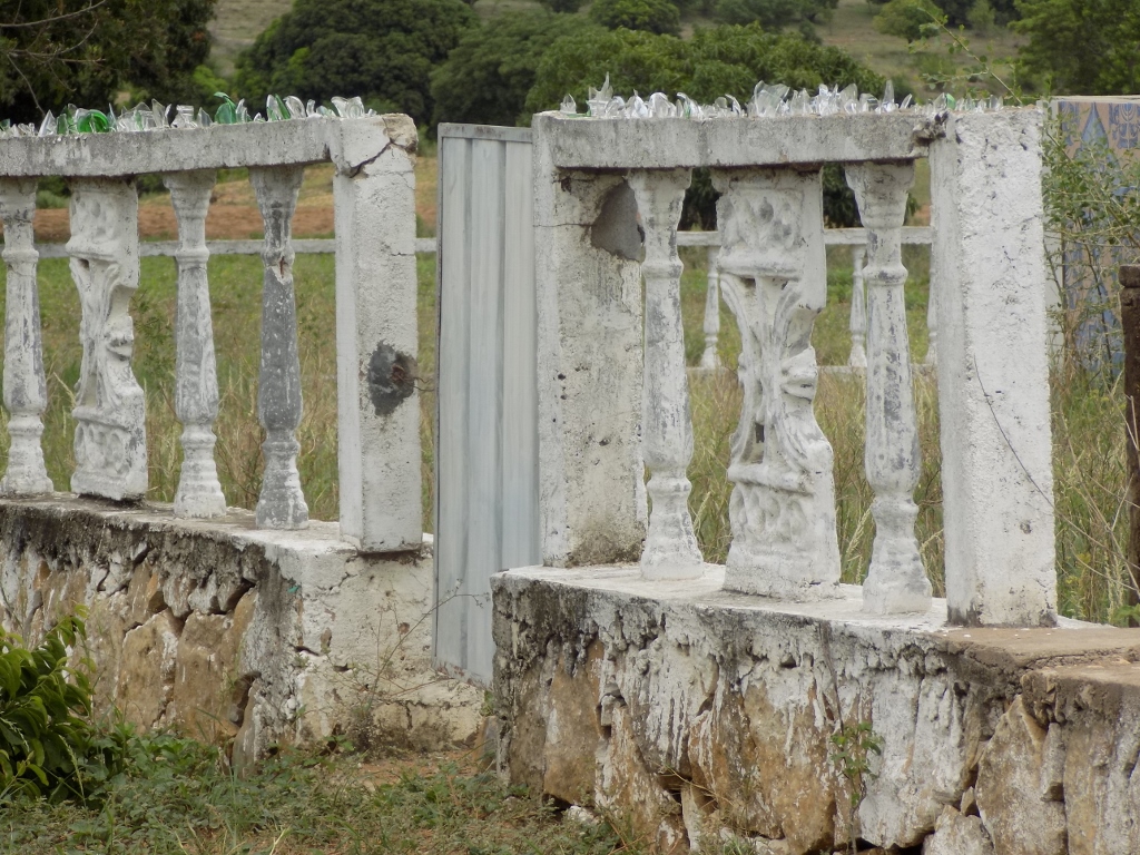 Gate for entering the tomb’s parcel and the fence with the broken glass on top
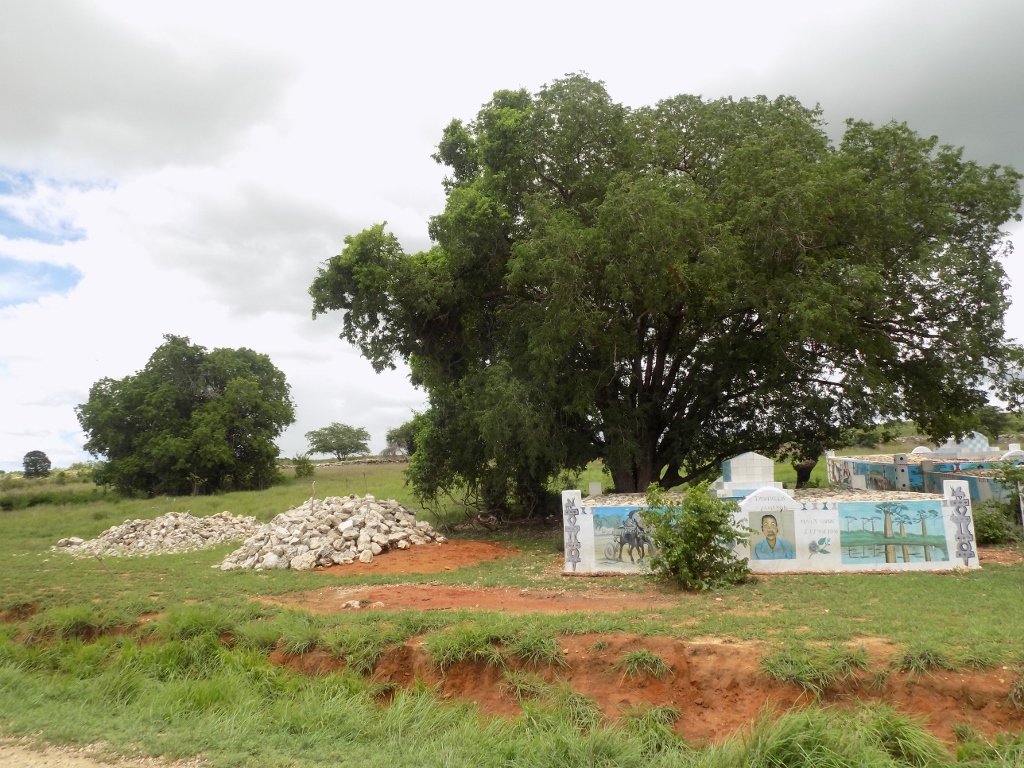
In addition to the tombs constructed in such a complex manner, the road also passes by significantly more modest places where poorer Mahafalies bury their dead.
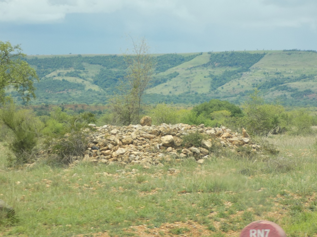 A modest tomb by the RN7
In the past, the Mahafalies used to bury their dead in forests, but since there has been major deforestation here, this is no longer the case. Still, from time to time I could see trees around the tombs.
 Several tombs by the road
In the place seen above we saw different tombs again not leaving the car.
 The tombs of those without money and those with money