I was again greeted by a cloudy and cold morning in Amman with occasional rain, but I was told at the hotel that I should not worry since I was going to the eastern parts of the country and the sky would be clear there since it was the dessert.
To start with, here is again the map of Jordan with marked places that I visited during my stay here in January 2022.
After the breakfast I went down to the reception and there was already a driver waiting for me there. It was not the same one as two days before and with time I realised that the first driver was not actually particularly considerate or helpful. Unlike him, this one proposed that before leaving Amman we bought coffee to go. I agreed immediately and wanted to pay for it, but he would not hear of it. Generally speaking, everybody says that Jordanians are an exceptionally hospitable and kind nation. Although I basically had very good experience with all of them, my impressions about Jordanians are certainly limited, since it all mostly came down to the people working in tourism. And there, contacts with foreigners, money and all the rest can sometimes even spoil people, as well as the impressions about them. Without any wish to hurt anybody, but based on my very limited experience, it seemed to me that people in the north parts of Jordan were pronouncedly kinder and more pleasant. They also do their job for money, but this is less striking and more likable than what my experience reflected as I later moved southwards. I may be wrong about all of this, but this is how I saw it on the basis of my random sample.
Be as it may, we stopped along the way by a shop selling coffee and the driver bought two Turkish coffees for us (the Jordanian version, i.e., with cardamom) served in cardboard cups. The coffee was piping hot, the cups were full almost to the top, but we moved on. Although the road was very good, I still had to be very careful lest I poured the hot liquid all over myself. I looked at the driver skilfully balancing his whole arm and the coffee cup he was holding, so I tried to imitate him. Not too successfully, but I did not spill it, although I did burn my tongue a little trying to reduce the quantity of the coffee in the cup.
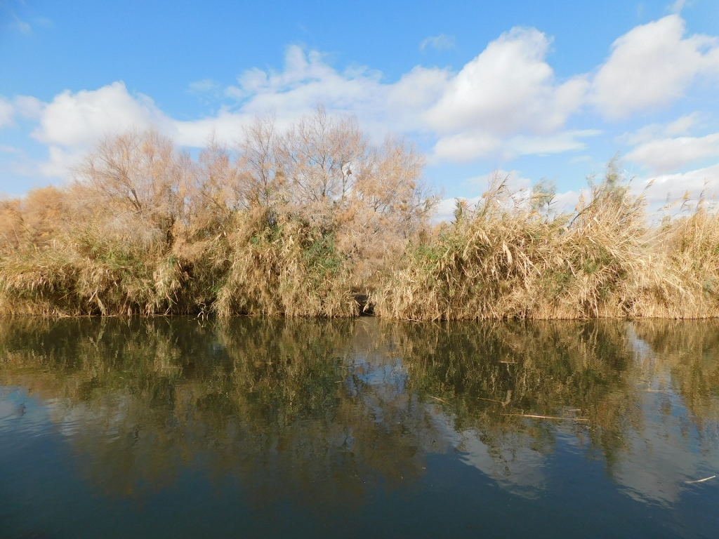
Soon the clouds were gone and I enjoyed the beautiful morning in the east of Jordan.
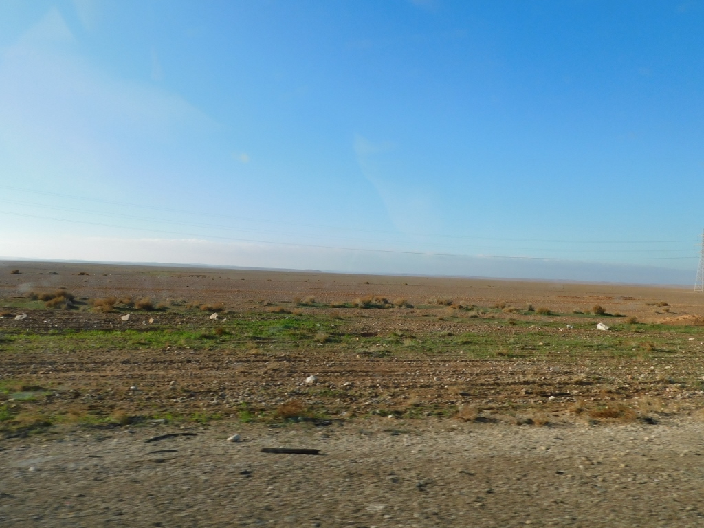 Landscapes by the road east of Amman
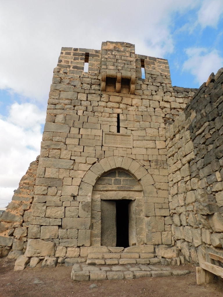
The plan was to go to oasis Azraq first, but the road passed right beside another interesting site and although it was not even 9 o’clock in the morning, the driver and I easily and quickly agreed to make a stop here. This was a castle/fortress Qasr Kharana, although other names may also be found when transcribed in English, e.g., Qasr Al-Kharranah. Generally speaking, the internet and guidebooks offer different transcriptions of the original names in Arabic, but I presume that this is caused by the nature of the Arabic language and different nuances in the pronunciations.
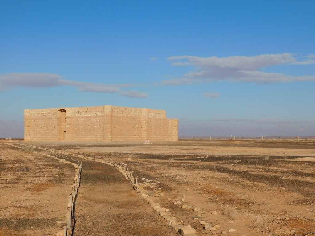 Qasr Kharana
Qasr Kharana belongs to the group of the so-called “Desert Castles.” This is a group of structures built during the early Islamic period or rather during the rule of the Umayyad dynasty, mostly in the 7th century. In fact, these structures seem like fortresses, while being neither fortresses and even less castles. The name “castles” was given by the 19th-century explorers. They were practically built by the Umayyad rulers who managed their country from Damascus, but who had these structures built in several places throughout the desert in order to be used as places for rest, caravanserais, hunting lodges, places for gathering and holding meetings and negotiations, etc. But, let us not kid ourselves, there were the perfect hiding places to escape to from the quarrels between their wives, the screaming of the children and other domestic problems.
When I got here, the ticket office was still not open (it was not 9 am yet) and there was absolutely nobody around, but I could enter the area around the castle, so I headed that way. Still, I quickly had to return to the car because of the extremely strong and cold wind, so I had to get my other jacket with a hood, since the simple, winter one and my woollen cap were not enough. Now I was equipped to go to the castle that was still locked, but that did not take anything away from my intensive enjoying in the place.
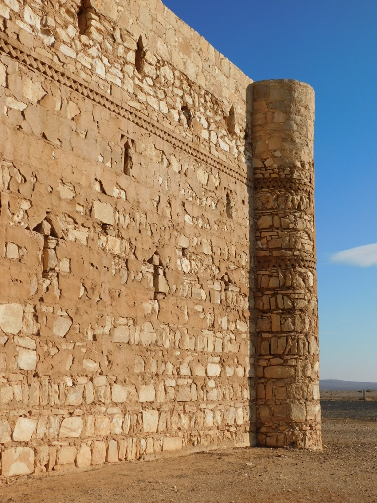 Qasr Kharana, view at the wall and a corner of the structure
Although at first sight Qasr Kharana looks more like a defensive fort, bearing in mind the corner towers and the narrow slits in the walls, the towers were actually built in such a way that they could not be climbed, so it is clear that these are just visual embellishments and not elements with defensive function.
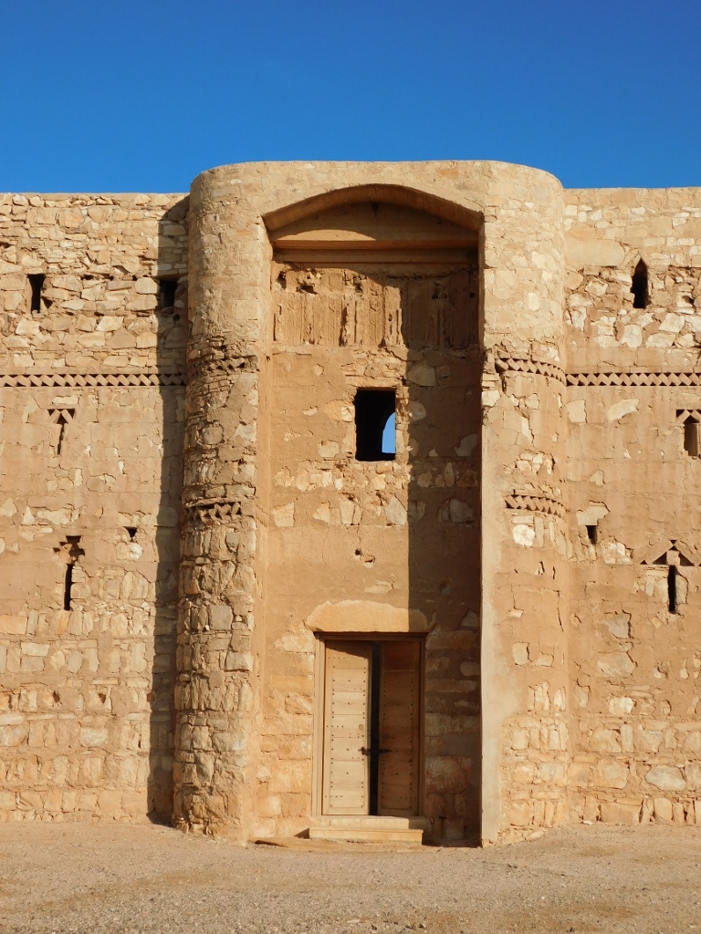 Qasr Kharana, the entrance
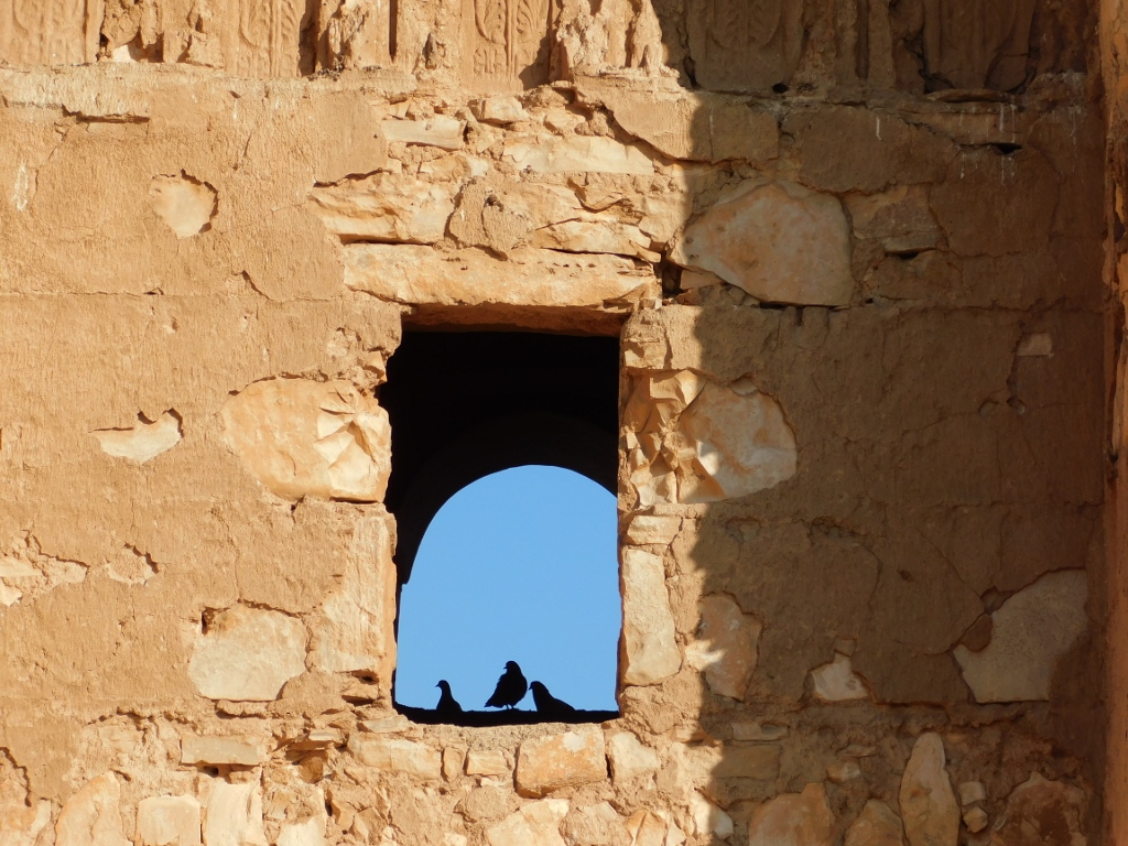 Qasr Kharana, view through the window above the entrance
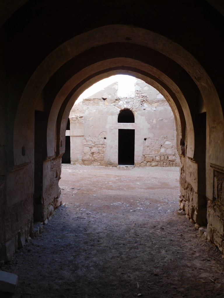 Qasr Kharana, view when peering through the parted entrance doors
As there was nothing else for me to see here, I just continued walking along the marked path that goes in a circle around the area in front of the castle, which is actually quite nice, since that allows the castle, notwithstanding its simplified shape, to be seen from different angles.
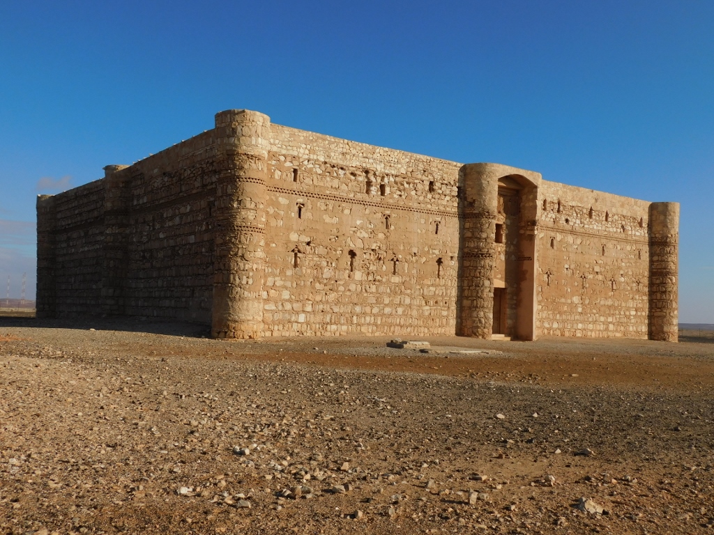 Qasr Kharana
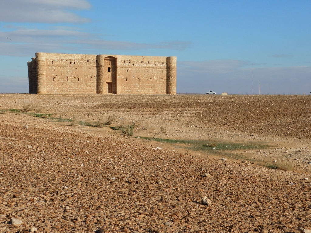 Qasr Kharana
Laterally from the area that belongs to this monument of culture, on the other side of the fence, I could see a Bedouin household. The Bedouin is the name for nomadic Arab tribes that populate the areas from North Africa to the Middle East, including also the Arabian Peninsula. Generally speaking, throughout Jordan and especially in the south of the country, one can often see Bedouin tents in which these people live. This apparent modesty of accommodation should not fool anybody, for frequently beside the tents that are a part of the traditional way of life there are large 4x4 vehicles and these vehicles are not cheap.
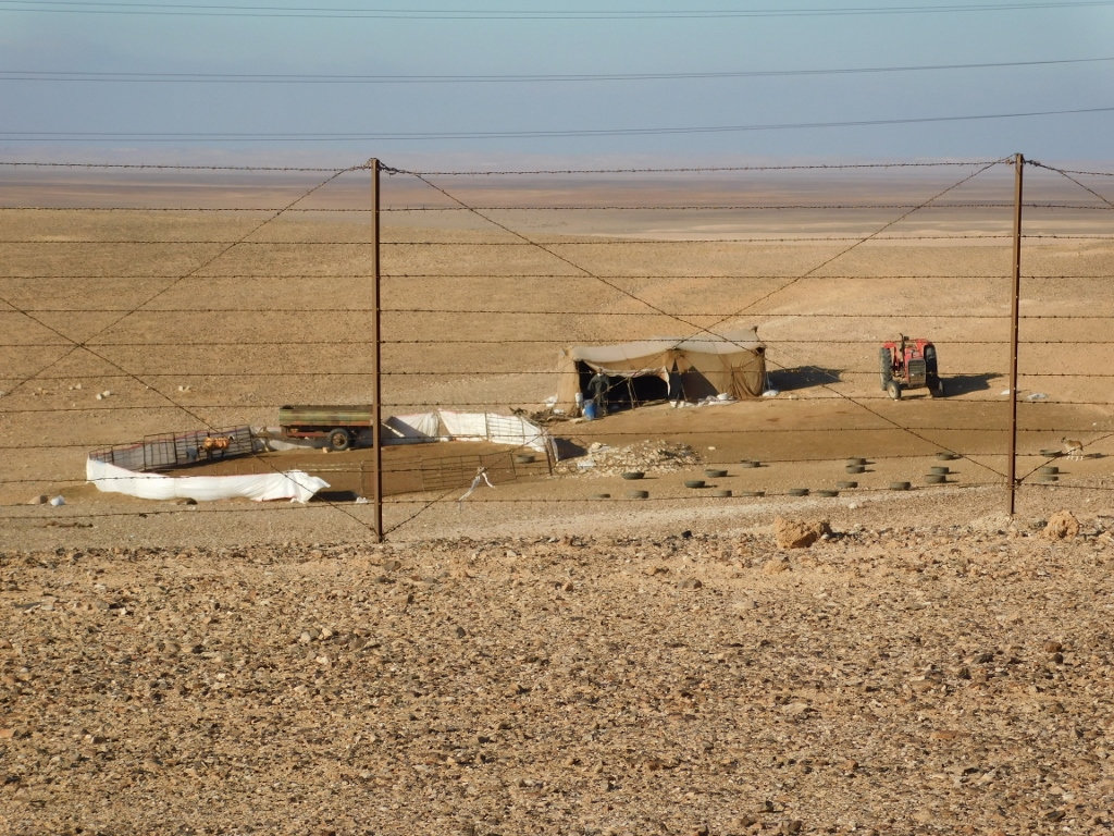 Bedouin household
After this I went back to the car and then we continued along the road eastwards towards the Azraq oasis. Still, we first made a stop at yet another place. This was Quseir Amra (or Qusayr Amra). This monument of culture, too, is right next to the main road, so we parked there, but not only the ticket office was not open yet, the building itself was still closed. I could see that from a visitor path that led me to an elevation from where one can see that building well. This place is a must, so I simply postponed my proper visit for later.
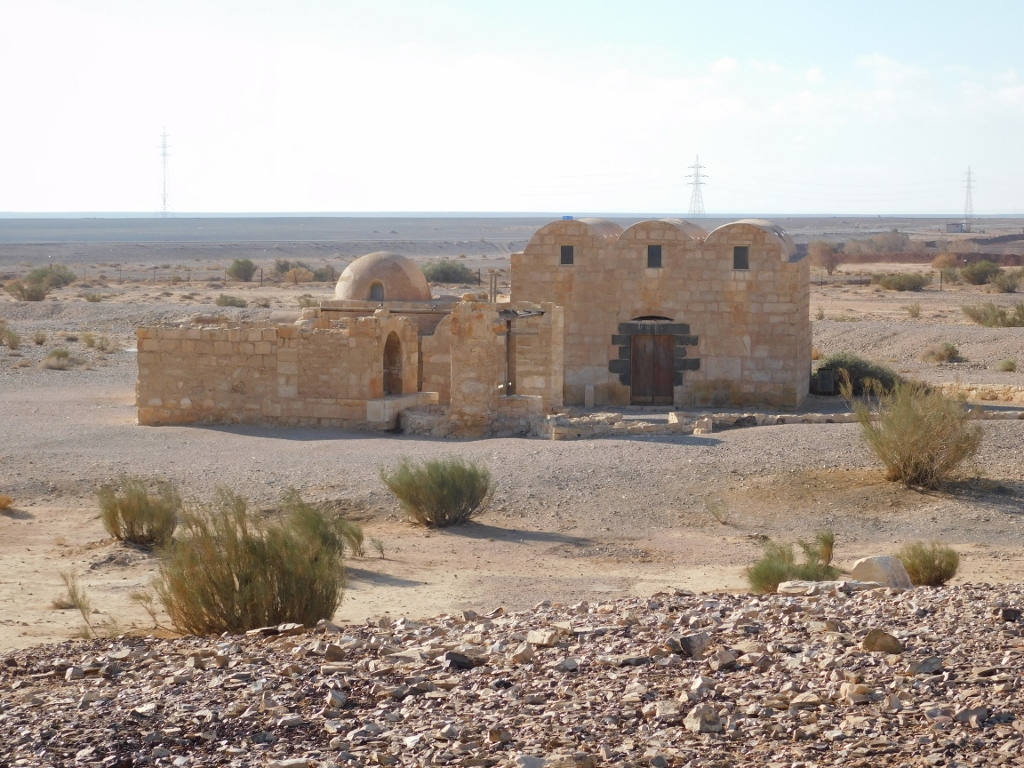 Quseir Amra
We continued further along the eastbound road and the Azraq oasis.
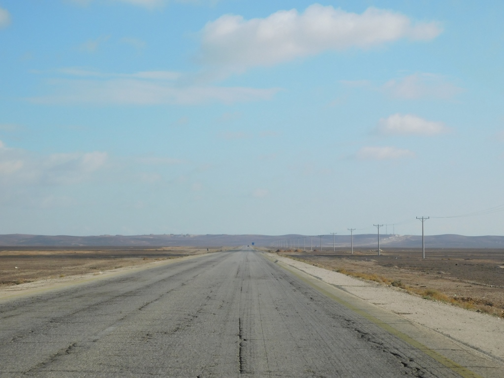 Going east
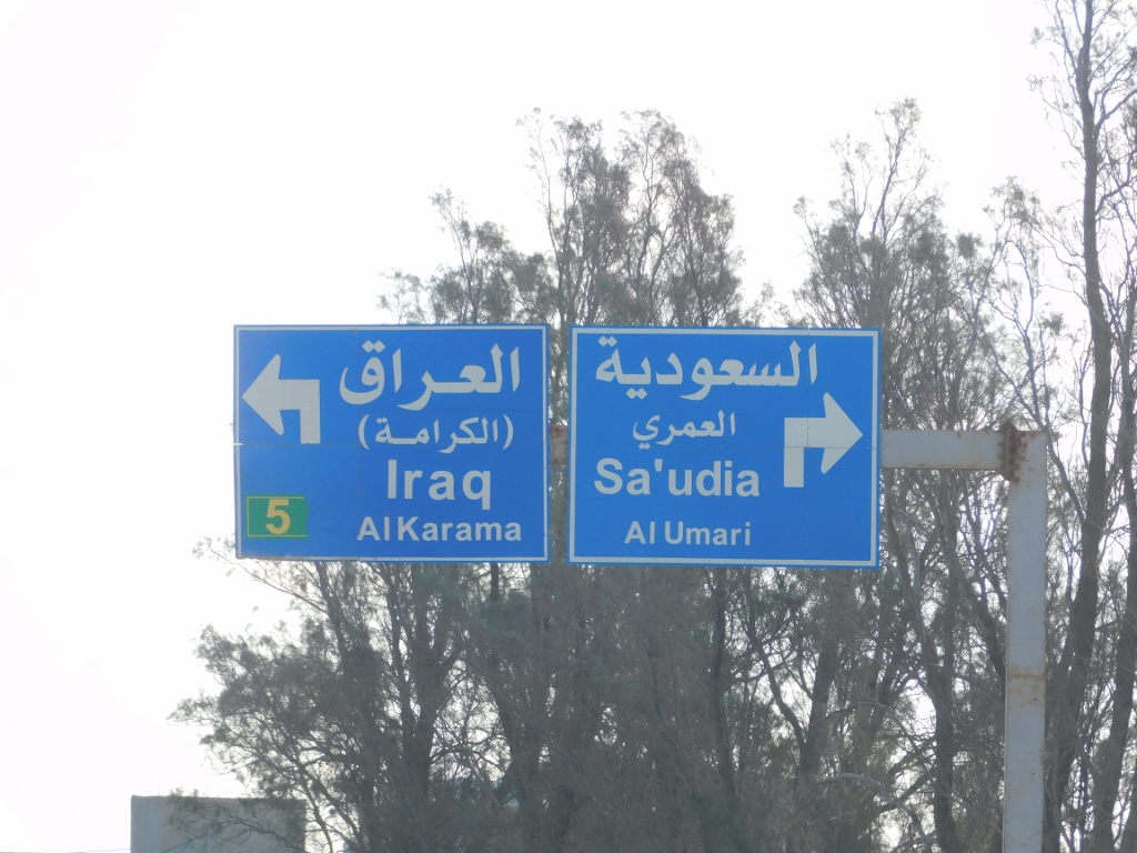
At one point, the road turns into a proper, modern motorway and right in this section there is an interchange with another modern motorway, but we continued straight, just as the sign, which I found to be particularly interesting, showed.
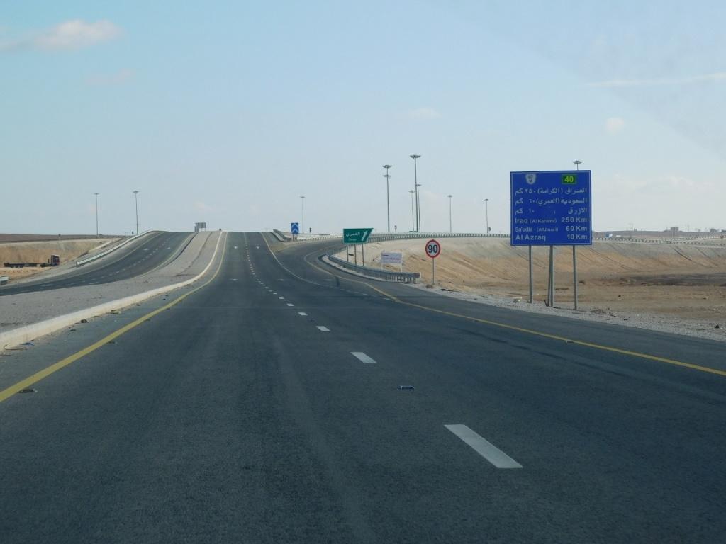 Signs beside the road
A little later we reached the main crossroad in Azraq itself, where the roads parted, but we did not go any farther, staying rather in the oasis.
 Signs that refer to the old road
As for Azraq, this is the only permanent oasis in Jordan and also a town that is some 100 km east of Amman. Still, it does not have any romantic flair, primarily because of the traffic jams and large trucks that constantly pass through the town.
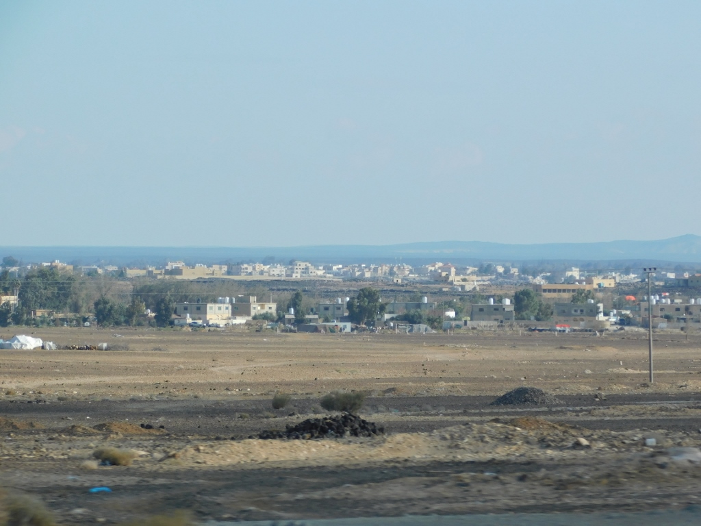 Azraq oasis seen from the main road coming from Amman
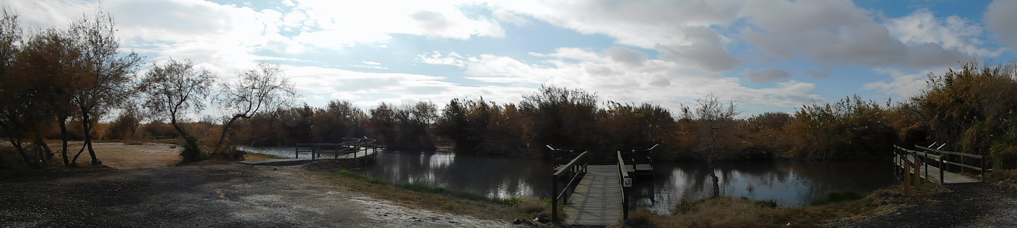
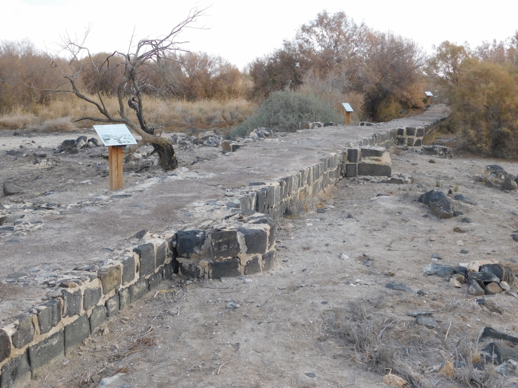
Not only today, which can be seen from the photos above with the traffic signs, but throughout the history, this area here was an important crossroad of trading routes. And so, even the ancient Romans built a fortress here that was continuously maintained although the conquerors of this place kept changing. I visited that fortress a little later, but the main reason why I came here in the first places was the Azraq Wetland Reserve.
The reserve was founded in 1978 and it covers a surface of around 12 km2. This marshy area is unique for it is situated in the middle of the arid Jordanian desert and since it contains several bodies of water, a large number of birds stop here every year during their migration between Europe and Africa, or they just spend the winter here. A total of 290 bird species have been recorded in the reserve.
 Azraq Wetland Reserve
However, by 1993, the pumping out of water reached such a degree that the surface water practically disappeared and the ecological value of this area was literally destroyed. But, with international assistance, numerous projects have been initiated and now every year around 2 million cubic metres of water are pumped in and yet, bearing in mind the growing number of inhabitants and the needs related to agriculture, this is not enough for a total recovery although a lot has certainly been done.
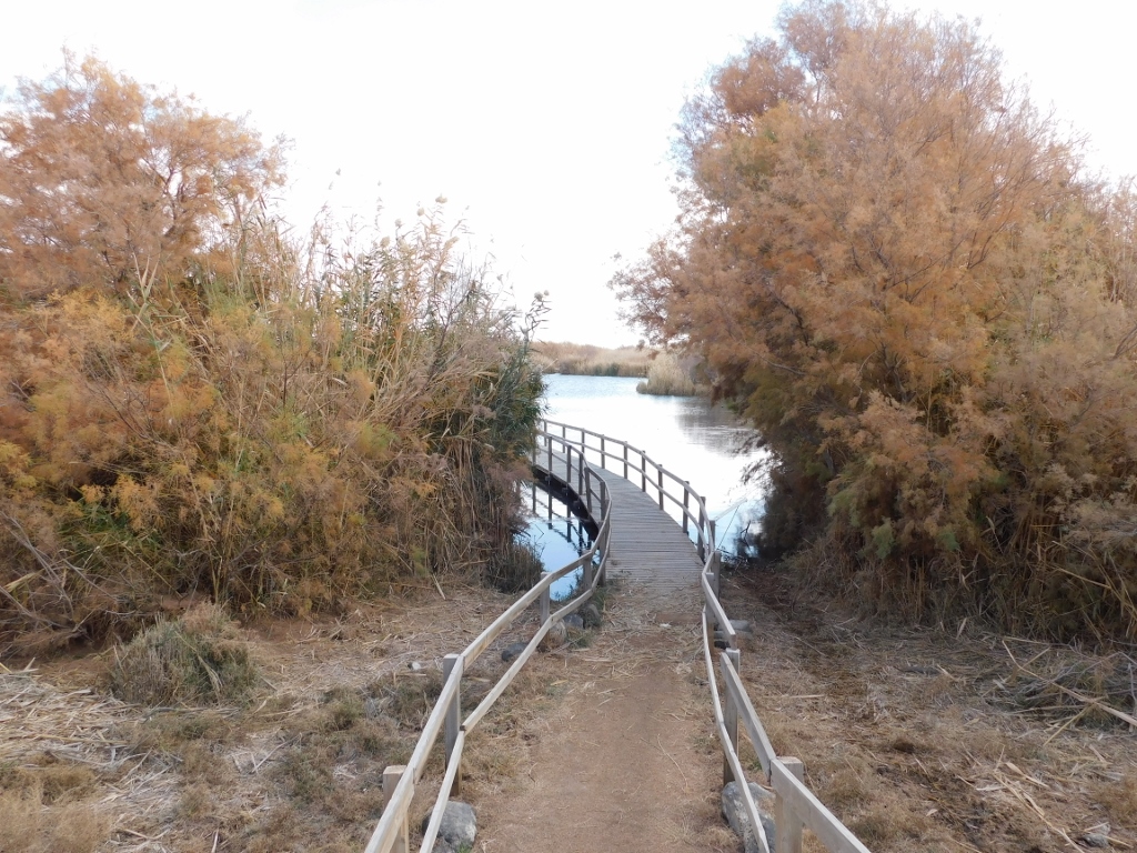
When I got here, I could choose between two types of sightseeing tour: to go on my own for a walk following a marked trail that is around 1.5 km long or to hire a private guide and visit the reserve for some 2-3 hours. For different reasons, I eventually opted for option no. 1.
 Smaller pond near the Visitor Centre
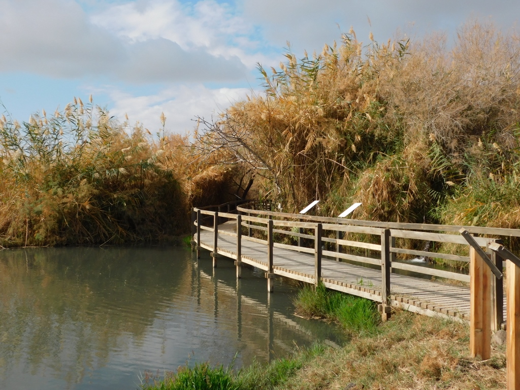 The sightseeing tour starts from here
The weather was very nice and I really enjoyed this walk, although I did not see the birds I came all the way here to see. Still, along the trail there were some information boards that said one should walk slowly and not make any noise. I did as instructed, but there was still nobody in sight – not only were there no birds, but there were neither any other visitors. I guess other people are smart and do not go looking for birds in the middle of winter, even when this concerns the Azraq Wetland Reserve, although the guidebooks I used claimed that January was quite a good month for bird watching here.
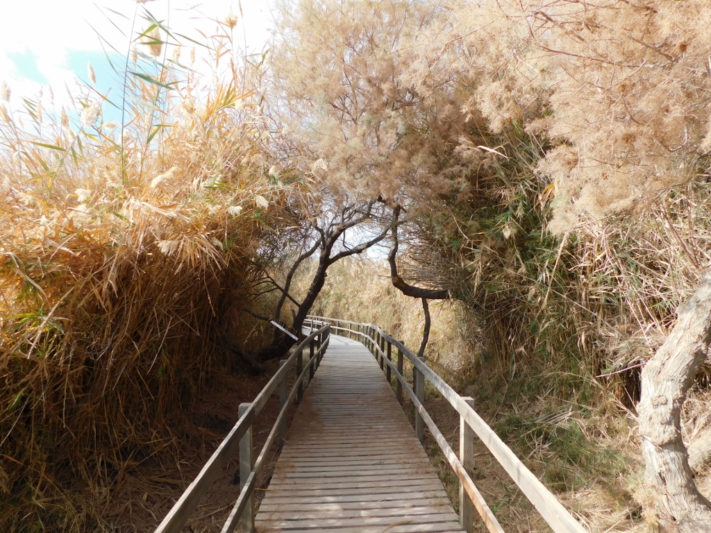 Azraq Wetland Reserve, a detail
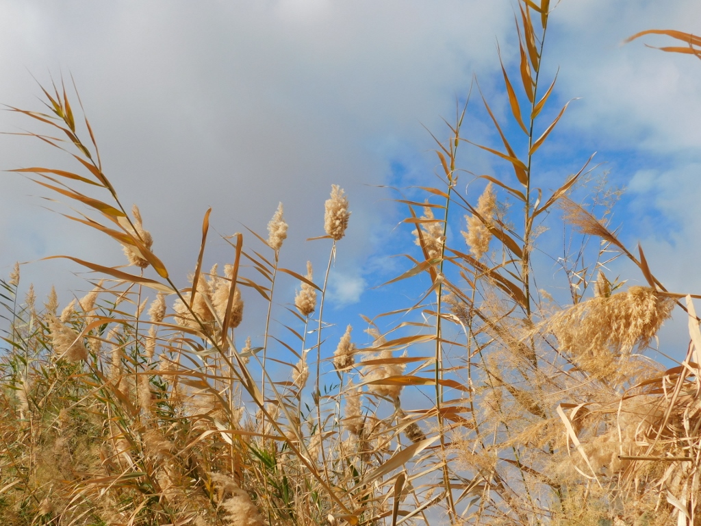 Azraq Wetland Reserve, a detail
And then the trail led to a section where it can be seen quite clearly what human activity has done to the naturally swampy area.
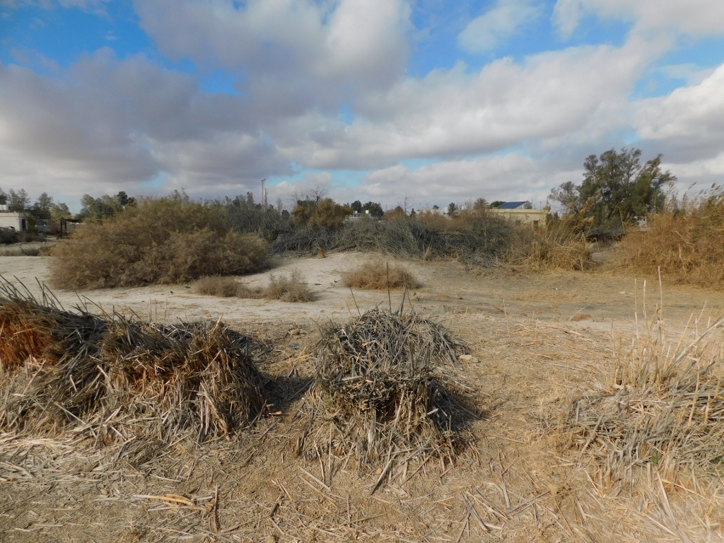 Azraq Wetland Reserve, a detail
An information board here says that during the 1980’s in this spot one would be neck high in water. Nevertheless, not only have the surface water quantities been drastically depleted, but also the levels of the groundwater have gone down. This leads to an increased quantity of dust, as well as easier outbreaks of fire, which additionally destroys the flora and fauna.
And one more very important thing in connection with groundwater. There are pockets of very salty groundwater here and traditionally this water was used to produce table salt that was utilised in Jordan and Iraq. However, today it is more cost-effective to get salt from the area around the Dead Sea, so that these pockets with salty groundwater here are not used and hence this water penetrates into the natural reservoirs with freshwater and destroys it. Because, once you “salt” the water, it cannot go back to being freshwater again. So much about Homo sapiens and its concern about ecology, climate change and the rest of it.
The trail then leads to a wall which some believe dates back to the Roman times, while others claim that it is from the Umayyad period. The wall beams made alongside the wall were there in order to reduce the impact of the water.
 Old wall within the marshy area
The function of the wall is not quite clear, but it is presumed that it was used in order to separate the freshwater and the salty water, and to grow gardens, catch fish and bathe. A part on the right-hand side of the wall, seen in the photo above, was the area that used to include the Ein al Soda pond with a very powerful freshwater spring. In 1993, the water spring dried out and everything continues to be completely dry to the present times.
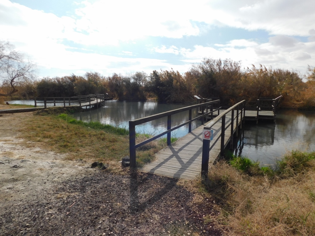
After the dry section, the trail eventually does lead to a pond.
 Azraq Wetland Reserve, a detail
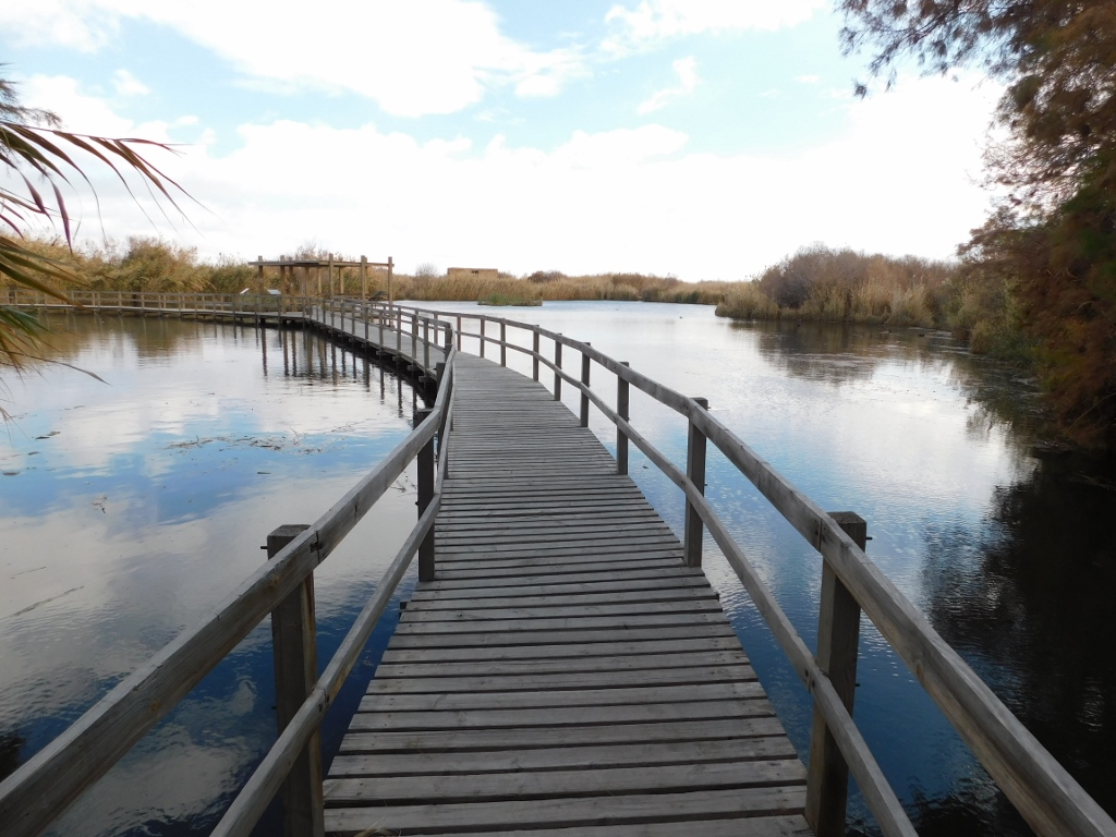 Azraq Wetland Reserve, a detail
Here I finally saw a few birds, but although they were nice birds, these were Eurasian coots (Fulica atra) that I can almost regularly see on the Danube, a couple of hundred metres away from my flat. But, since I did not observe any other species, I had to content myself with the Eurasian coots. Admittedly, a couple of birds flew over the pond at one moment, but this was way to fast for me to be able to make any conclusions as to what species they were, let alone make a photo.
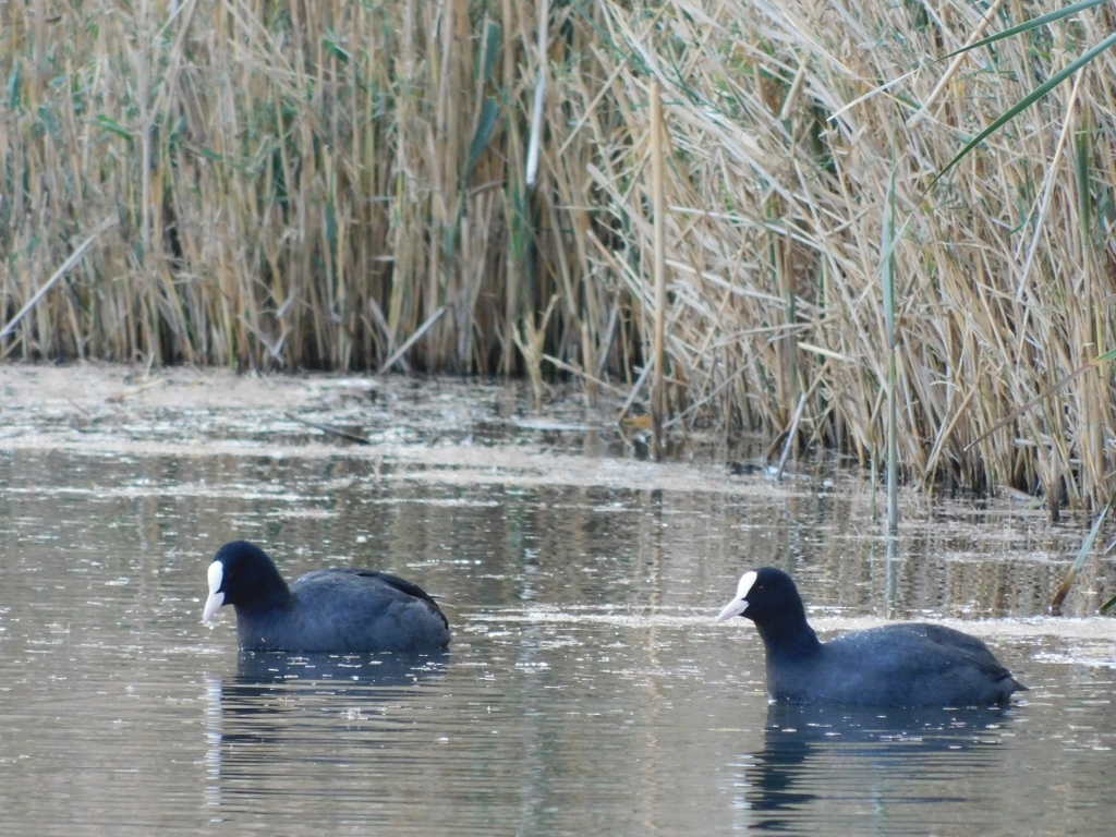 Eurasian coots
However, I must admit that nature was very beautiful.
 Azraq Wetland Reserve, a detail
I also saw a hide made of mud bricks that I found particularly interesting, so I went up its stairs and entered. It looked at another pond and now I realised how photographers can get close to birds – they actually let the birds get close to them.
 Azraq Wetland Reserve, the hide
 Azraq Wetland Reserve, the hide’s interior
I have to say that the visit to the Azraq Wetland Reserve was a rather big disappointment. Perhaps I just expected too much, taking into account that it was January after all, but I heard local roosters from the surrounding farms more than I saw any wild birds. I also wondered if I made a mistake by not opting for the longer tour with a guide, however, although I like birds very much, I actually don’t know a lot about them to justify this more complex tour.
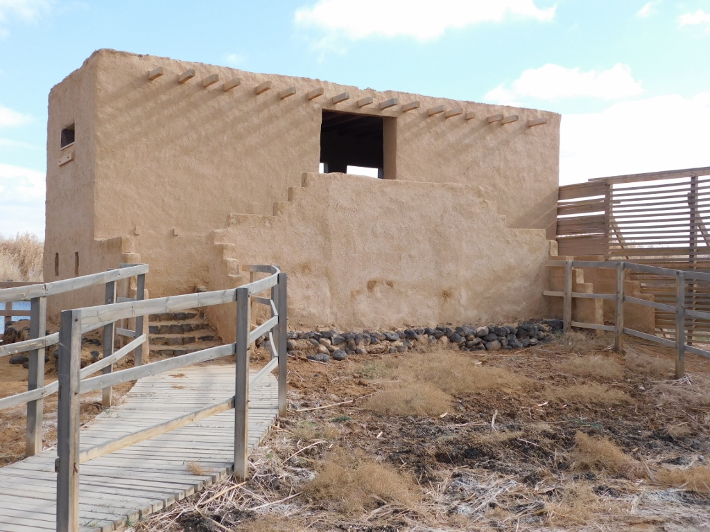
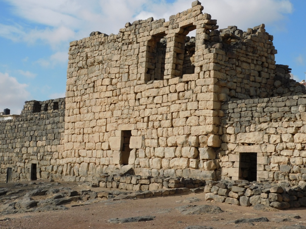
This way, I just got back to the car and was taken to Qasr Azraq, that is, to yet another one of the numerous “desert castles” which is nowadays situated in the town itself, right next to the road to Iraq.
 Entrance to Qasr Azraq
I have already said that the Romans were the first to build their military fort here, but it got its current shape during the renovation and expansion in the 13th century, which is supposed to be what is written on the stone slab placed above the entrance.
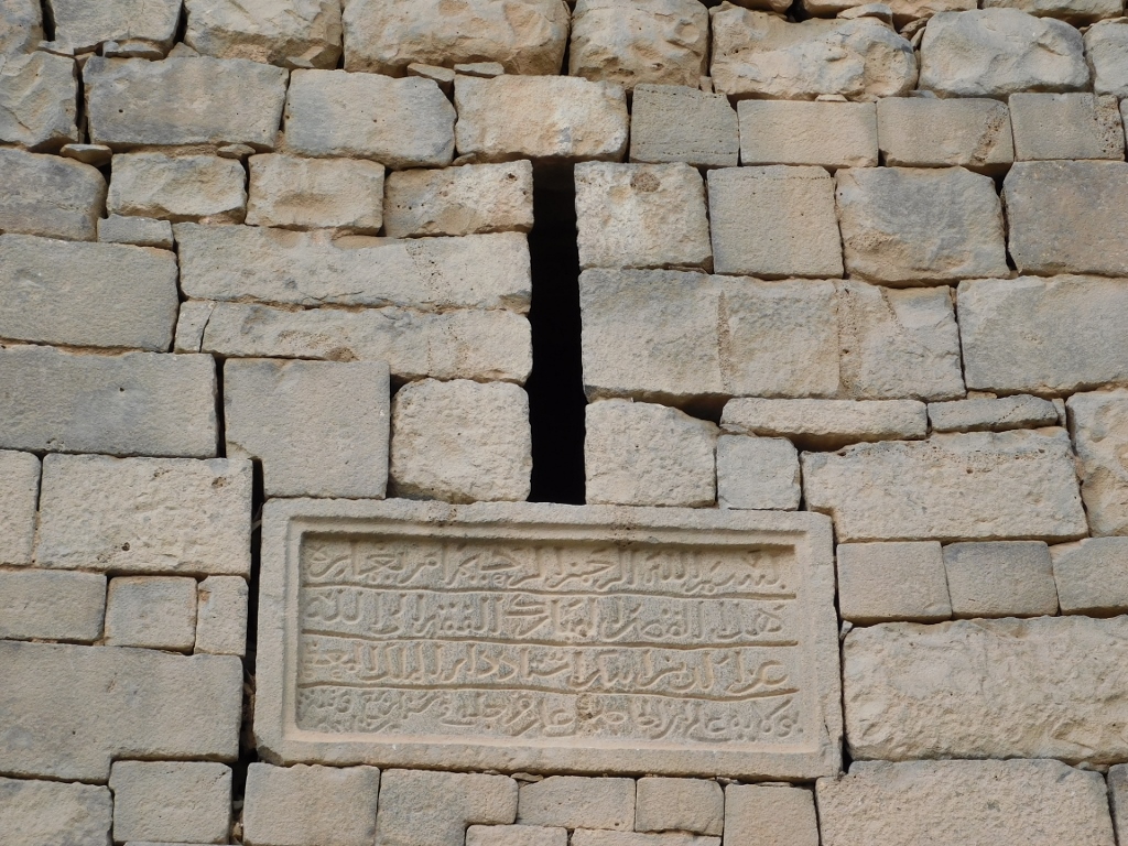 Stone slab above the entrance gate into Qasr Azraq
Above the entrance and the stone slab there is a machicolation. This is no decorative ornament, but rather a frequent element in the construction of military forts. These protrusions were used in order to pour hot oil over those below who uninvited tried to get in.
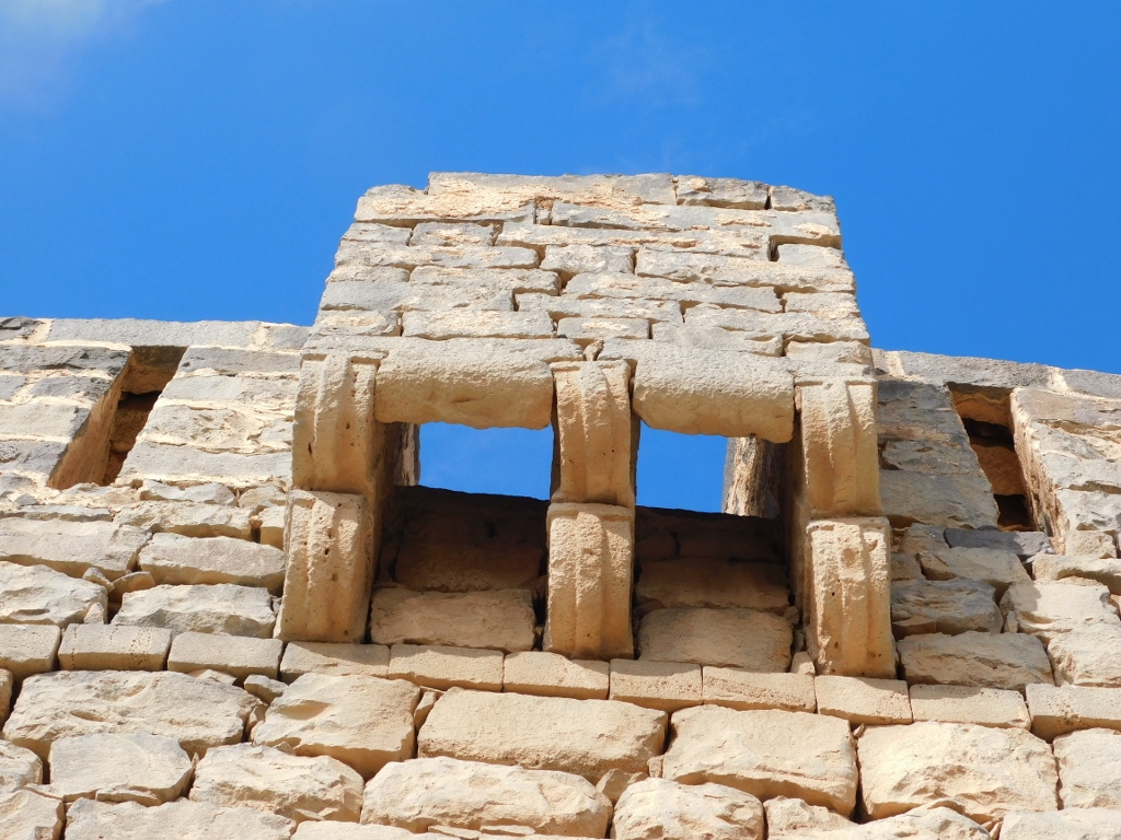 Machicolation above the entrance gate into Qasr Azraq
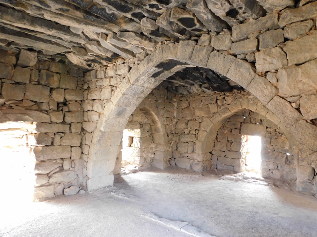
As for the entrance, there is still in place a stone door made of basalt rock. When you go through the doorway and the rooms directly behind, you get to the inner courtyard.
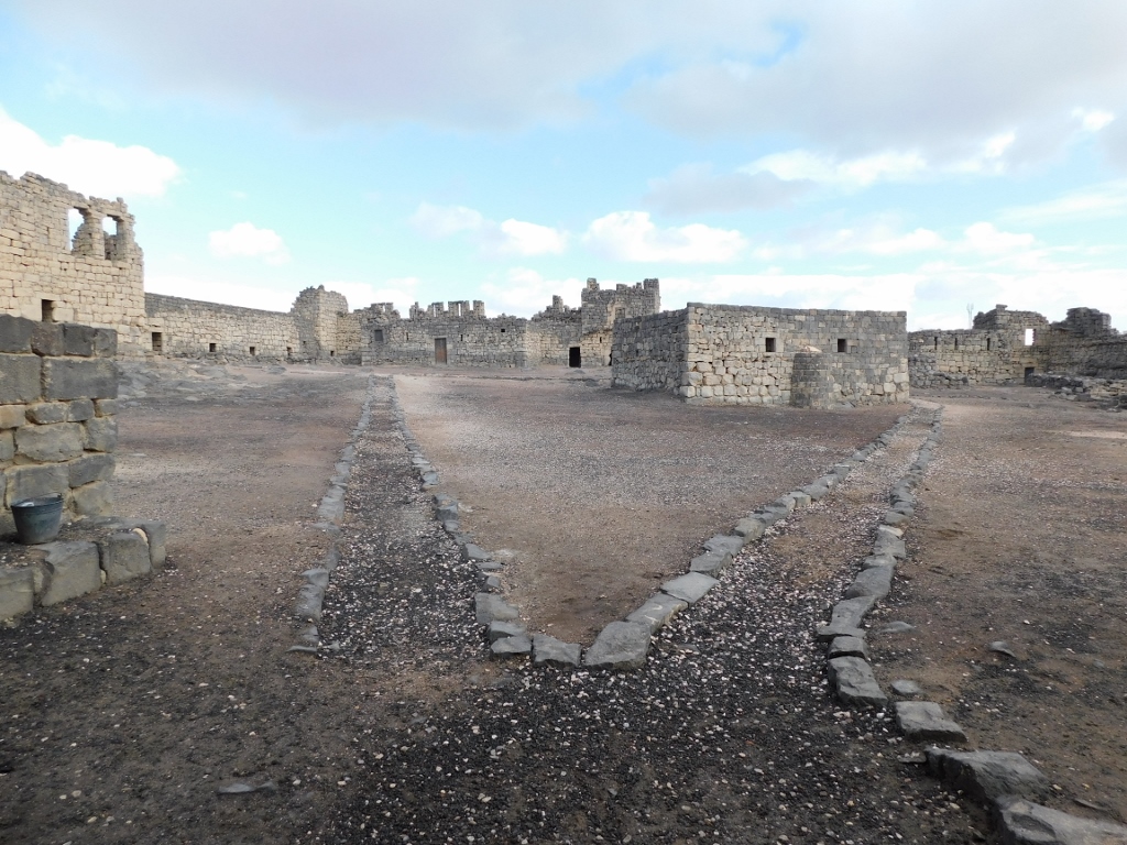 Qasr Azraq, the inner courtyard
There was absolutely nobody inside and I just made a circle, visiting some of the buildings. In the middle of the courtyard, in the photo above, there is a square-plan building. This is a small mosque believed to have been built during the renovation at the time when the rulers came from the Ayyubid dynasty.
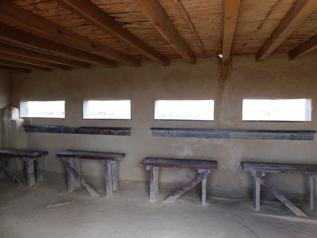
On the north side one can enter several structures. The following photos show former stables with unusual arches, as well as a dining hall.
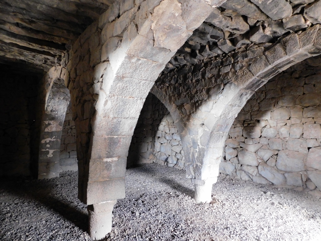 Qasr Azraq, a detail
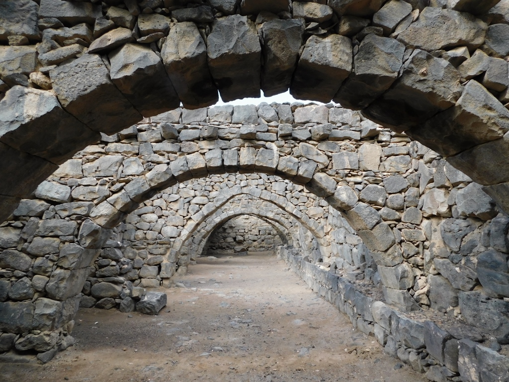 Qasr Azraq, a detail
On the west side there is a tower that can be entered and partially climbed, but it is all quite crumbly. In 1927, there was an earthquake here that rather shook the fort, while all the heavy traffic that regularly passes a couple of dozen metres farther certainly does not help.
 Qasr Azraq, a detail
Still, what makes Qasr Azraq probably best known is that in 1917 T. E. Lawrence, aka Lawrence of Arabia, established his headquarters here. Right in the room that is situated directly above the entrance gate.
 Qasr Azraq, the room that used to be the headquarters of Lawrence of Arabia
I must admit I’m not delighted with the whole story about the so-called Lawrence of Arabia and, according to what I have read, to put aside that he was primarily an active participant in the mutual fight for dominance between the then major powers (Britain and France) without much essential concern about the local population, he was most of all very good in promoting himself. Still, it’s worth going up to these premises, since there is a nice view at the interior of the Qasr Azraq from a section in front of the former headquarters.
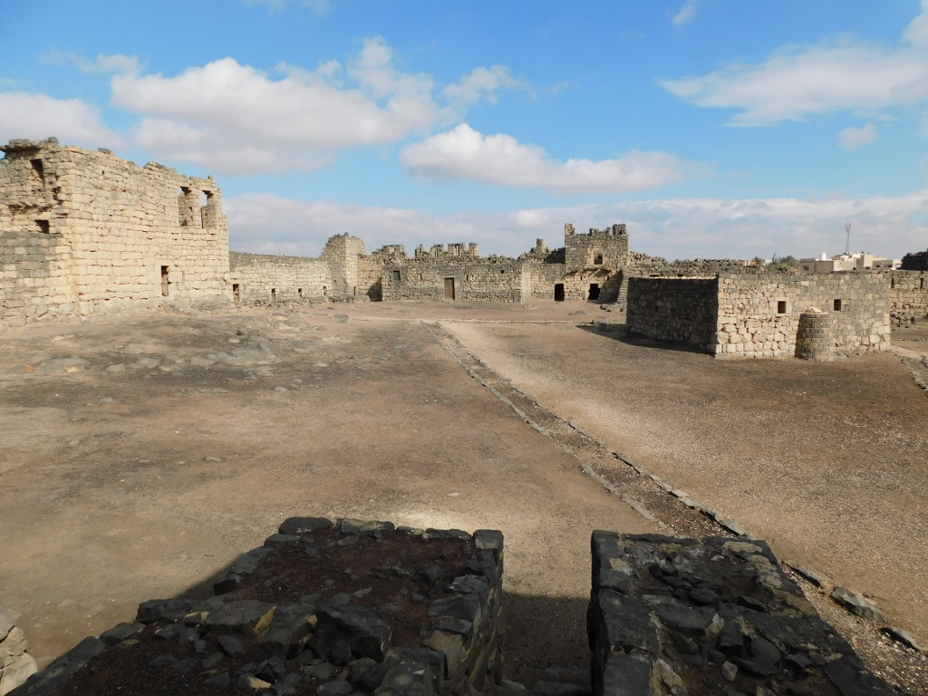 Qasr Azraq, the inner courtyard
Having finished with the visit to Qasr Azraq, I could now head back in the direction of Amman, but with a few more stops.