Once you get to the top of mount Nebo and enter the area of the memorial complex dedicated to Moses, before visiting the church with mosaics and the viewpoint, it is good also to visit a smallish museum.
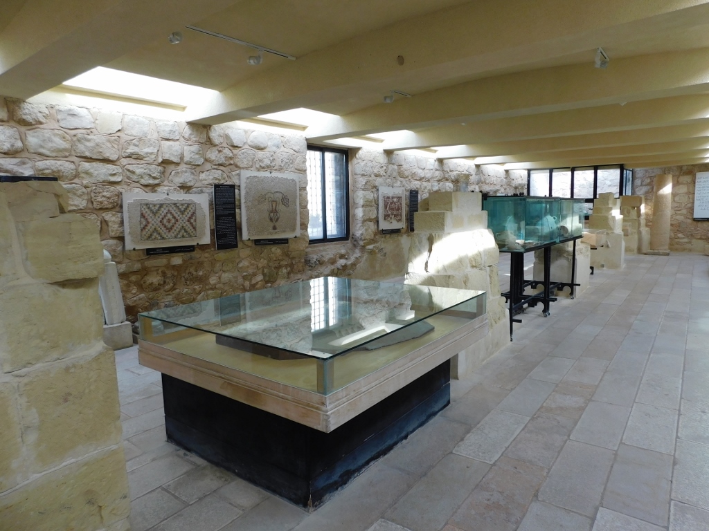 Mount Nebo, the museum
Still, probably the main reason to come here is to evoke that view at the Promised Land which Moses had from the top of Mount Nebo just before he passed away. When approaching the viewpoint, the visitor certainly first has to see a large contemporary sculpture – the Brazen Serpent – which in fact refers to a text from John 3:14: “And as Moses lifted up the serpent in the wilderness, even so must the Son of man be lifted up...”
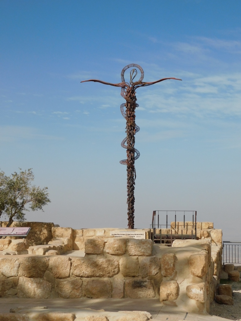 The Brazen Serpent sculpture
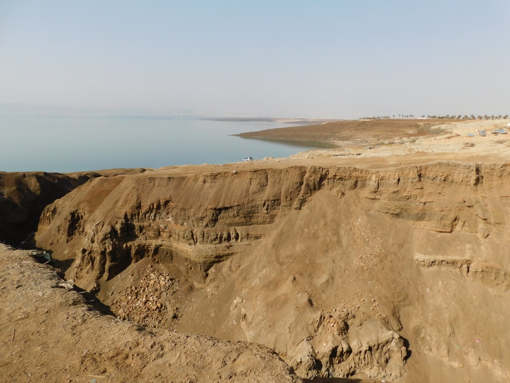
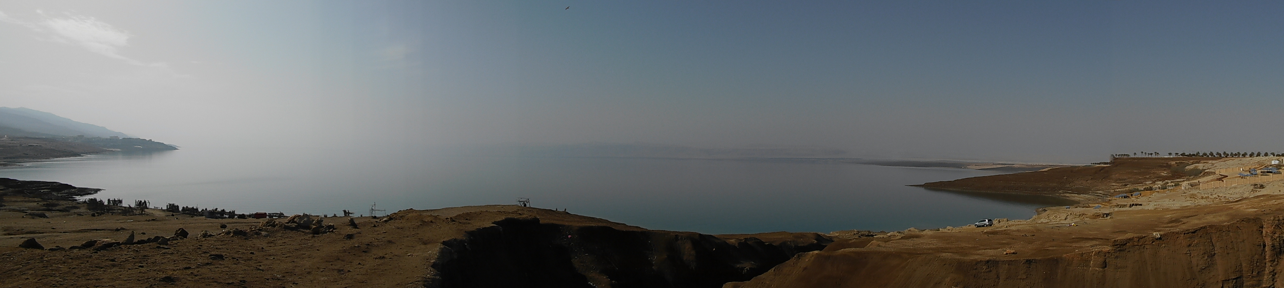
And then you get to a couple of platforms from which there is a truly stunning view.
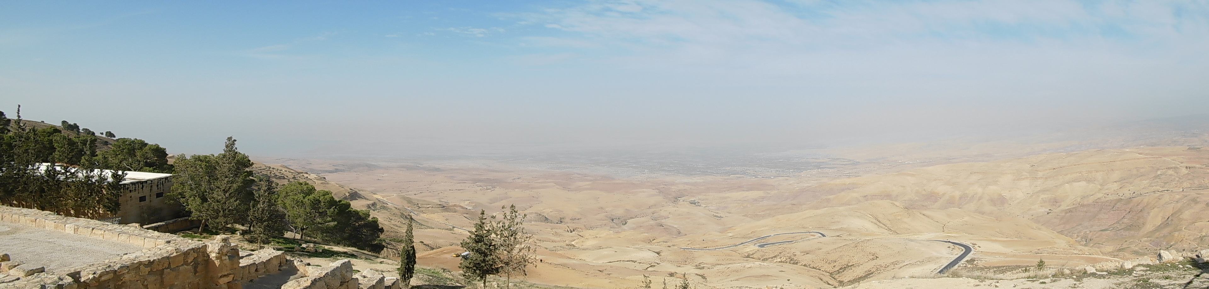 View at the Promised Land
Although the sky was mostly clear, the air was not and not much could be seen. However, there are information boards at the platforms rendering the view at the “Promised Land” that show the direction in which different places are, from the Dead Sea to Jerusalem, Bethlehem, Jericho, etc.
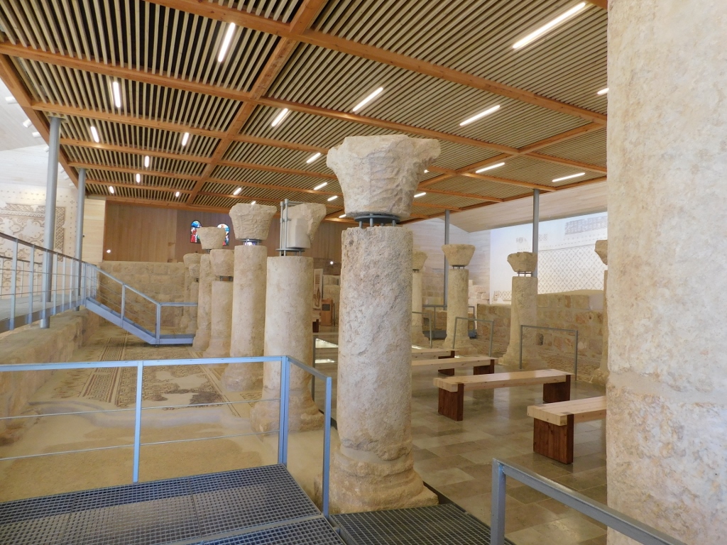
Having enjoyed the fine view, I moved on and went to visit the church. The original church was built here in the 4th century AD, but over time, just like the entire site, it turned into ruins. The excavations started in 1933 and then numerous mosaics were found, with a beautiful mosaic found in the diaconicon in the second half of the 20th century. Although the remains of the church were brought into function by 1984, the construction of a brand new church over the old one started in 2007 and this is what can be seen here today on the top of Mount Nebo.
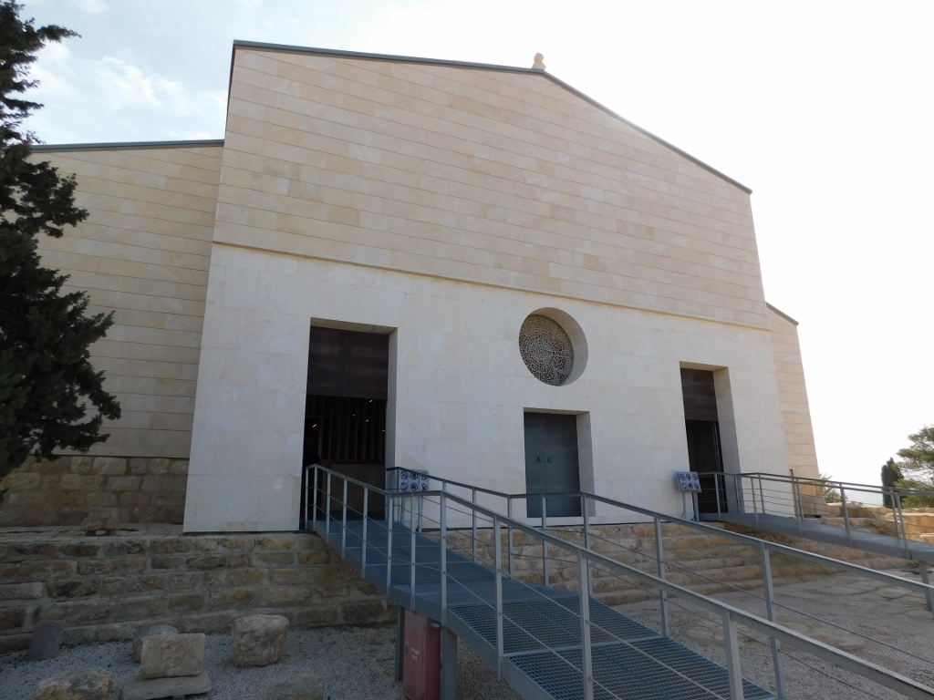 Church on the top of Mount Nebo
 Interior of the church on the top of Mount Nebo
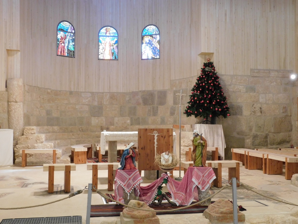 Interior of the church, the decoration left from Christmas
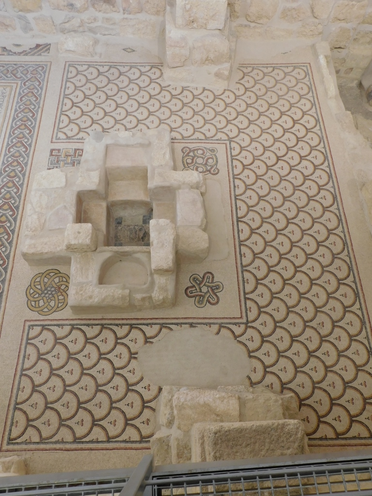
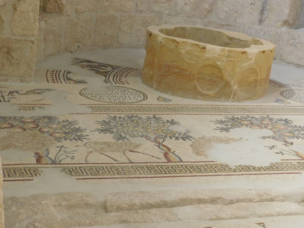
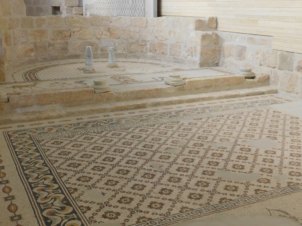
Since several mosaics have been discovered at this site, some of them have been left in situ, while others were mounted onto walls. How could it happen that there were so many mosaics in the same place? Quite simply – they were made one on top of the other. Thus, in 1976, a mosaic from 597 CE was taken off in order to be cleaned properly and then a new one from 530 CE was revealed. This older mosaic is considered one of the most beautiful in Madaba and its surroundings (the top of Mount Nebo is some 10 km away from Madaba).
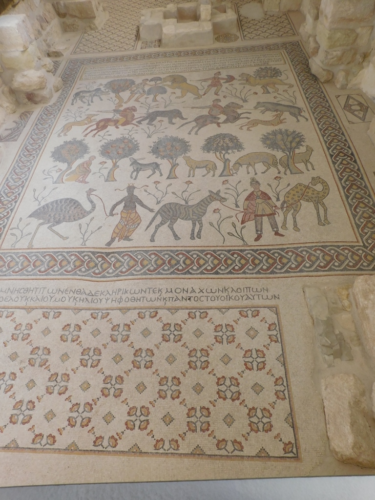 Mosaic of the Diaconicon
 Central panel of the Mosaic of the Diaconicon
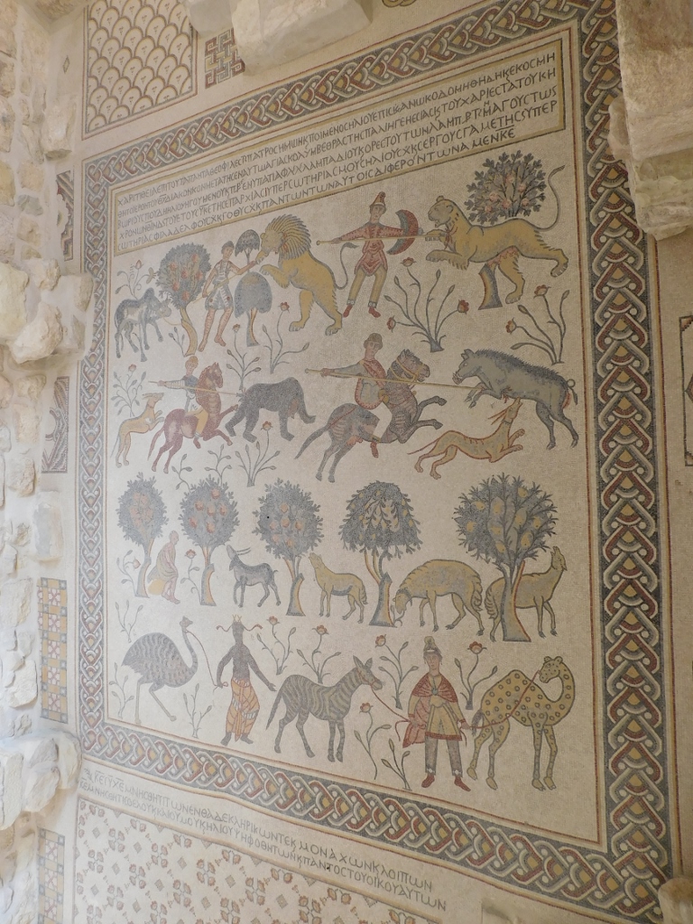
The above two photos display some queer perspective angles, but the following photos that show close-ups of some scenes will illustrate the true beauty of the mosaic.
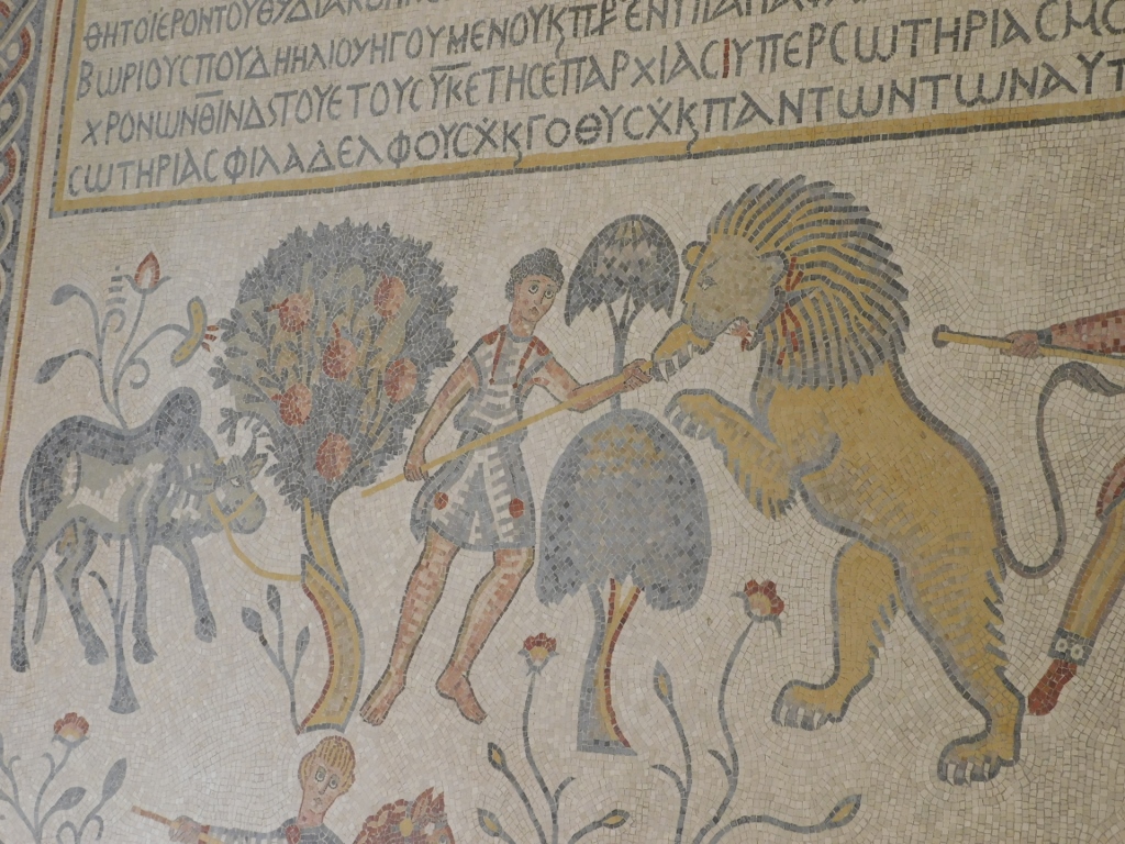 A young shepherd is fighting off a lion, protecting a zebu tied to a tree
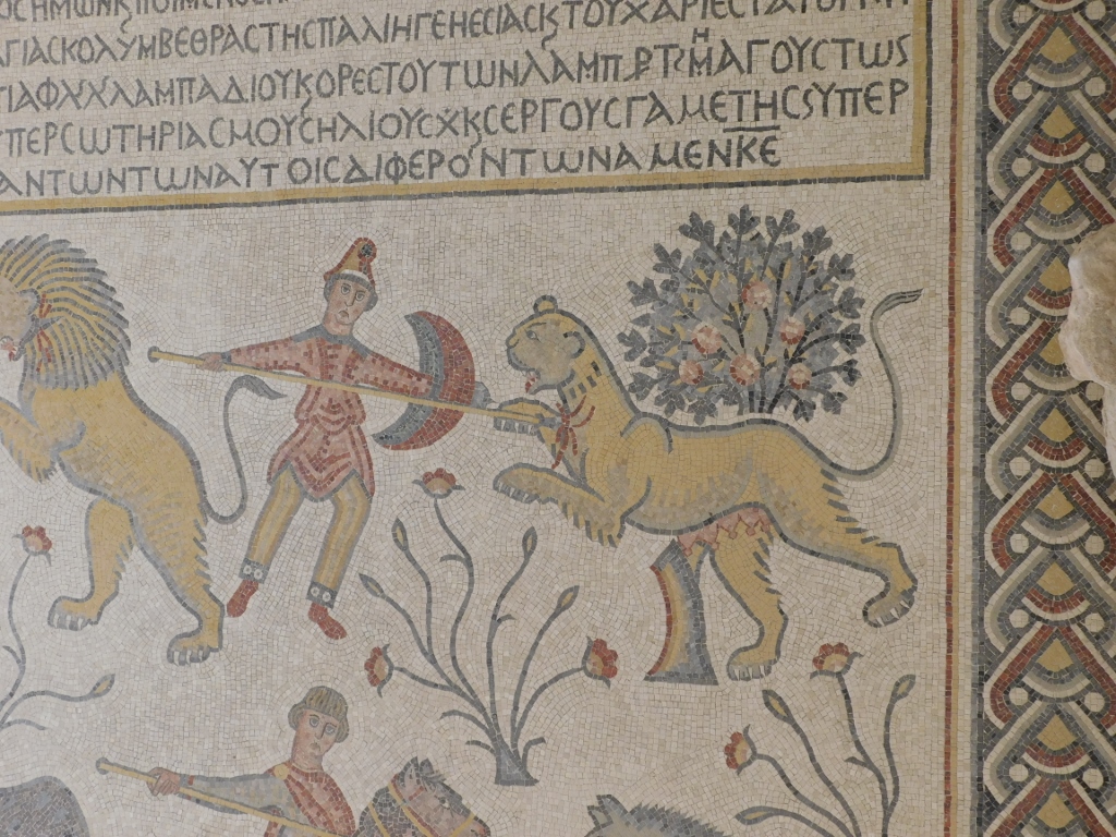 A soldier bearing a shield is using his lance to spear a lioness that attacks him
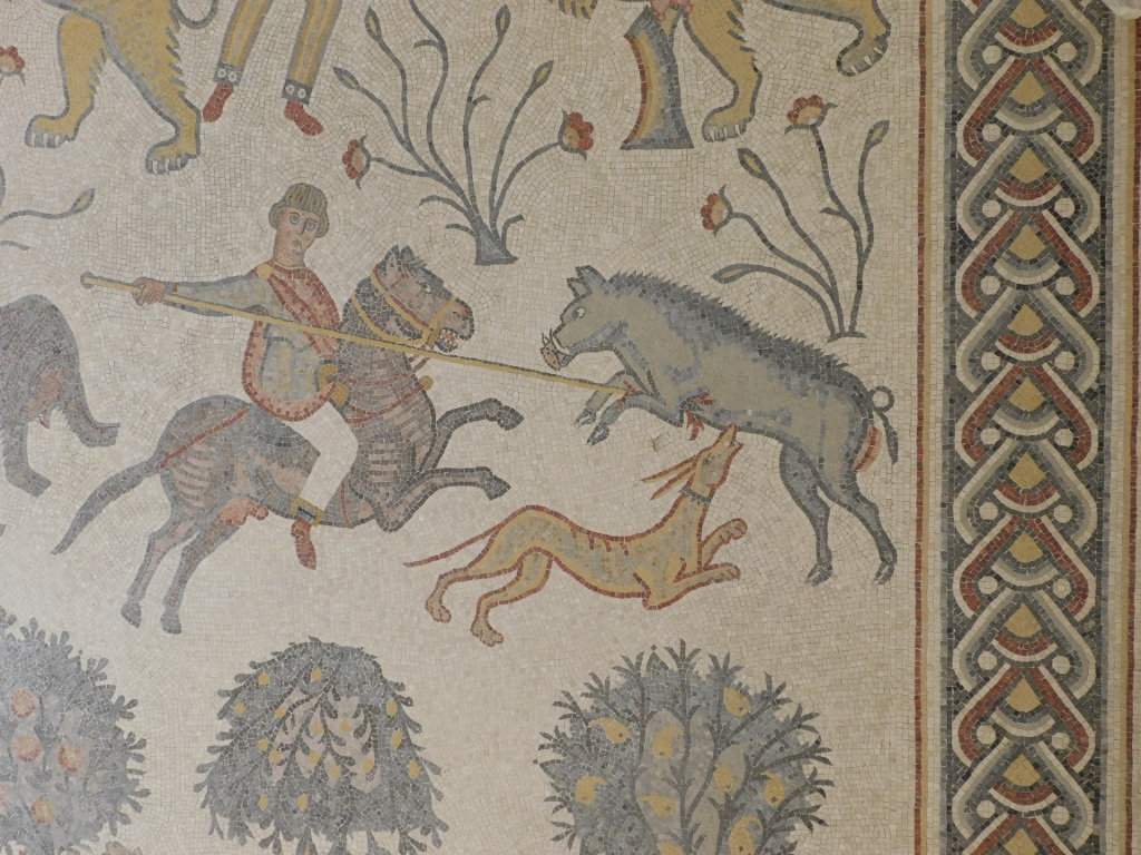 A hunter on horseback with the help of a dog is spearing a boar
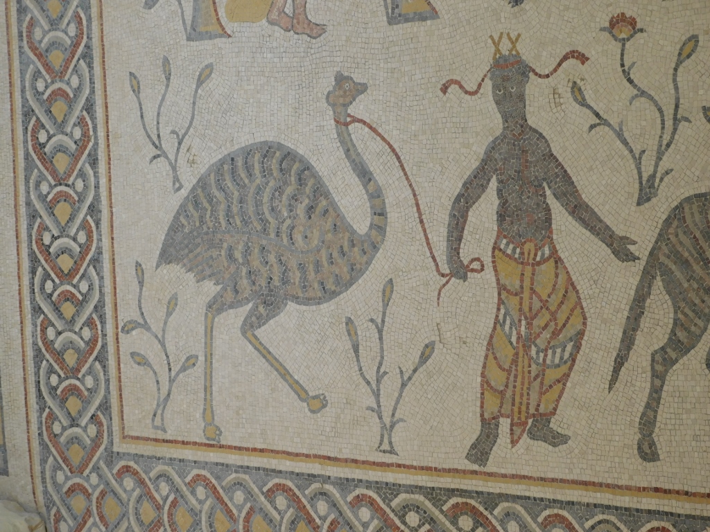 A dark-skinned man leading an ostrich by leash
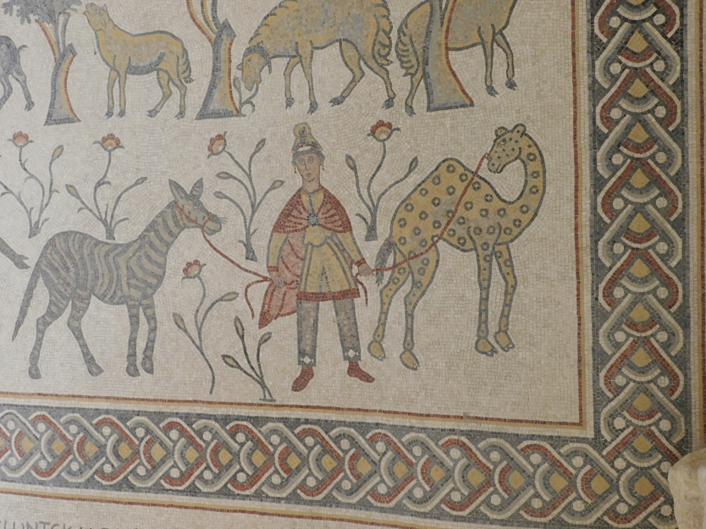 A young man in Persian attire is leading a zebra and a camel or giraffe
One should really come here, not only because of the stunning view, but also because of these mosaics. Because, in addition to the picturesque mosaic from the diaconicon, the others are also exceptionally beautiful and I was very glad it was January during the times of coronavirus and there was nobody else at the church at the time I was inside.
 Church on the top of Mount Nebo, mosaic
 Church on the top of Mount Nebo, mosaic
 Church on the top of Mount Nebo, mosaic
 Church on the top of Mount Nebo, mosaic and the baptistery
 Church on the top of Mount Nebo, Theotokos Chapel, mosaic
I have already mentioned that throughout the history, in addition to the church, there also used to be a monastery her and in fact the local name for the site is Siyagha meaning – monastery. Nowadays, one can see remains of different rooms that were a part of the monastery complex.
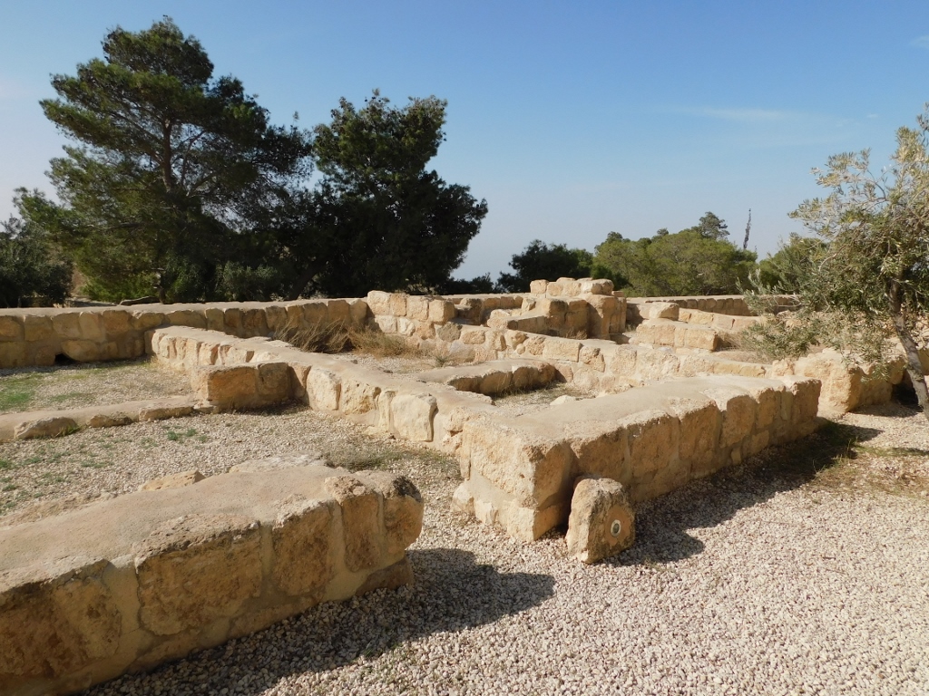 Remains of the monastery on the top of Mount Nebo
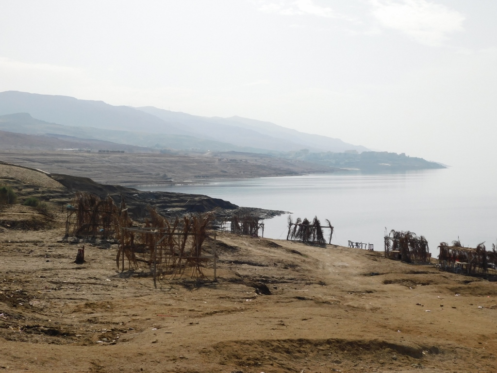
After this I was ready to go to the beach and the sea and they were some 25 km to the west from Mount Nebo. I’m talking about the Dead Sea, of course.
 View at the Dead Sea
This body of water is situated in a depression and the sea coast which is at the altitude of around -400 m, i.e., it is below the standard sea level, constitutes the lowest ground point on Earth. The Dead Sea is famous for having exceptionally large density caused by a high salt content (around 30 per cent), so a human being cannot sink. The water flows into the sea by the Jordan river and seasonally by flash floods, but there is no outflow. Still the sea level does not rise because a large quantity of the water evaporates. The climate is significantly different here and the temperature is always higher than, for instance, in the east parts of Jordan that are located on higher elevations (Madaba is 700 m a.s.l. and Amman is on an average at the altitude of around 900 m a.s.l., which means 1100 m and 1300 m, respectively, above the level of the Dead Sea, while being only around 30 km and 50 km, respectively, farther away). On the other hand, I have heard from a lot of people that they believe the Dead Sea will soon dry out completely on account of the reduced fresh water inflow, since a lot of water is used upstream for irrigation and conversion into potable water. The problem is that these parts of Asia have traditional problems with water shortages, while now they all have larger numbers of inhabitants with increasing needs.
Although the weather was sunny, I certainly did not have even the slightest desire to swim here. First, in January, it was too cold here for my taste even outside, let alone inside the water. Second, I would not have the place where to take a shower afterwards and I guess it was extremely important to rinse off all that excess salt. The Dead Sea will simply have to wait for me for some other time. But, this was not the reason for me not to walk down to the water. The driver brought me to some kind of a parking lot and told me I could go for a walk, while he would wait for me there. As I descended down the slope, I kept taking photos.
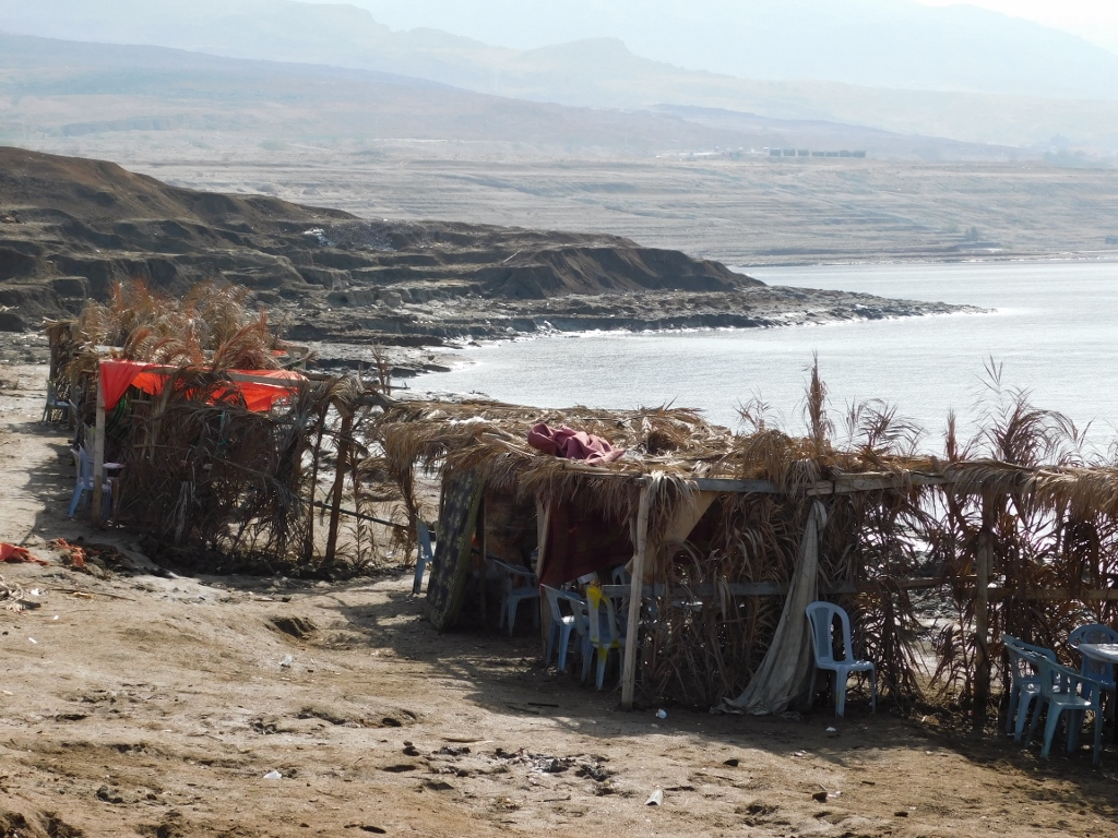
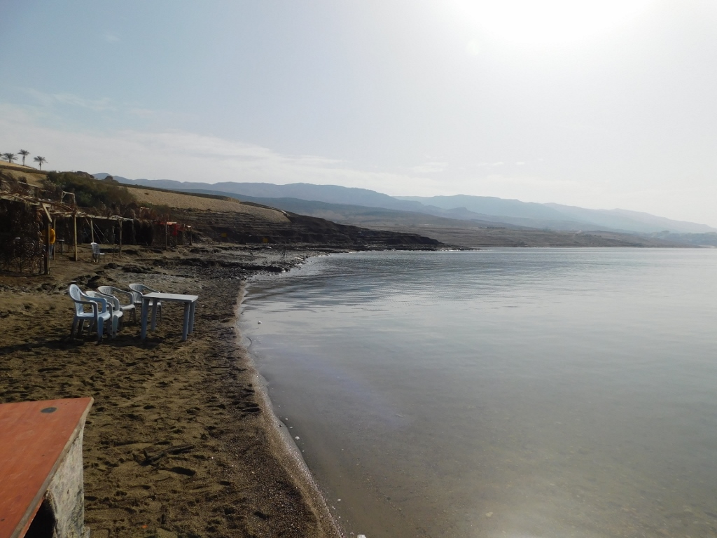
 The Dead Sea shore: it’s probably crowded here during a high season
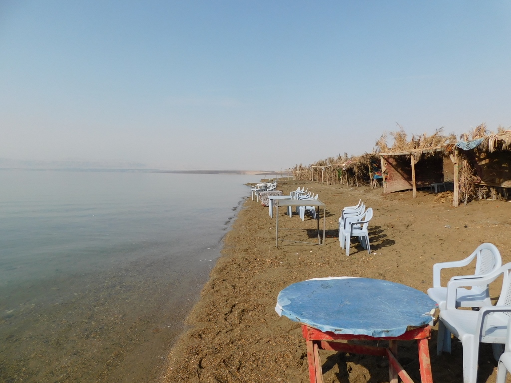
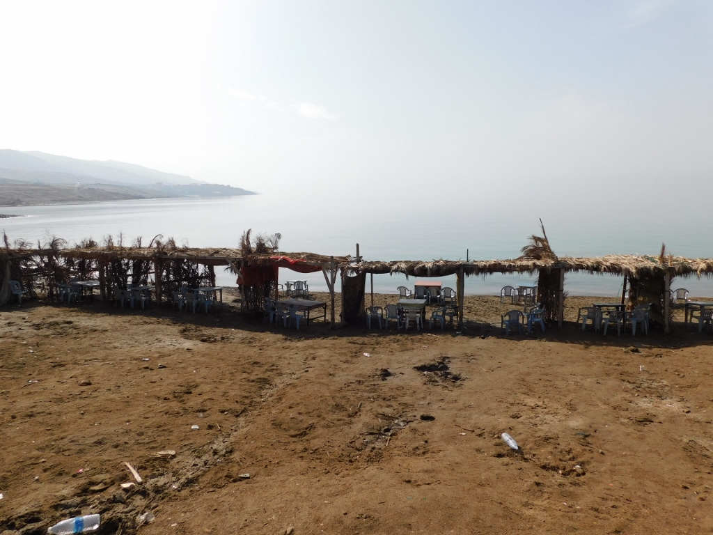 The Dead Sea shore: visitors can probably rent these covered lots with tables and chairs
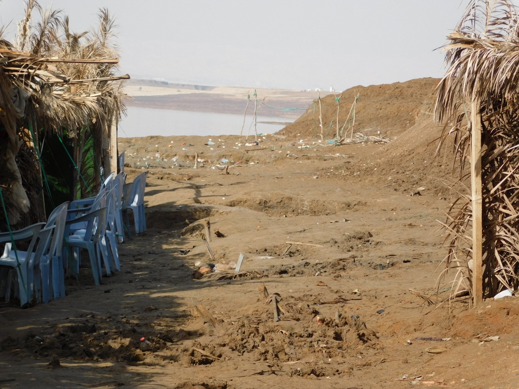 The Dead Sea shore
 The Dead Sea shore – tourist part
 The Dead Sea shore
 The Dead Sea shore
And then I reached the water. I must admit I did not feel in the least like touching the water. I don’t know why. Probably because I did not find any of it particularly attractive.
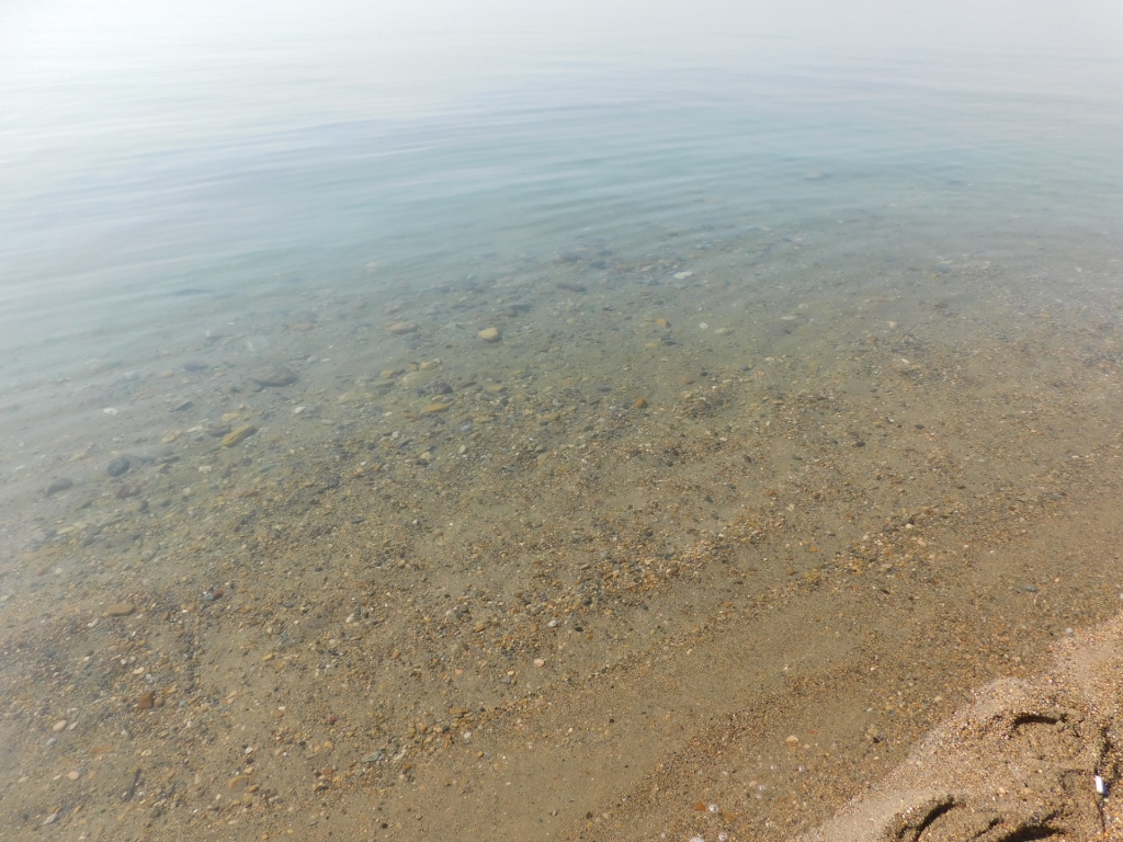 The Dead Sea water
Just as I went down to the water, so I went up. I walked past a couple of men, which was interesting since the beach was mostly deserted. They invited me to sit down together with them, but I had the driver waiting for me, plus, there was still some sightseeing to do, so I asked if I could take a photo of them instead. They said yes.
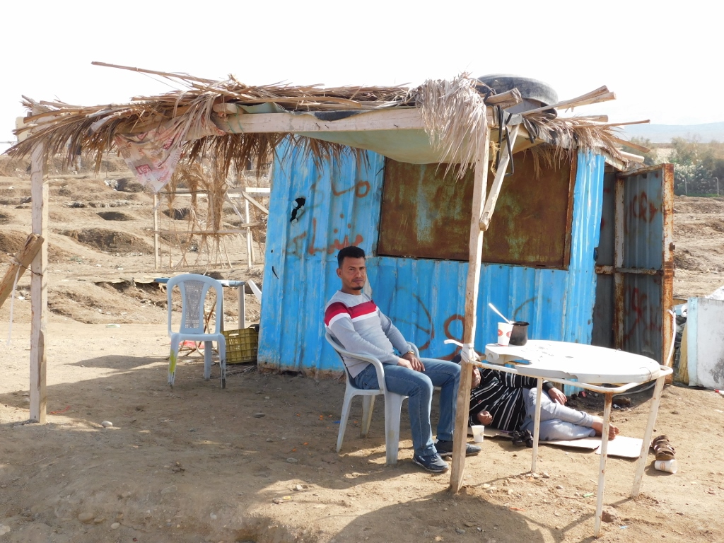 "Beach guard" in winter
I also went a little to the side and there I could see a ravine that is probably where the flash floods run down, but on this particular day everything was dry and calm.
 Deep ravine near the shore of the Dead Sea
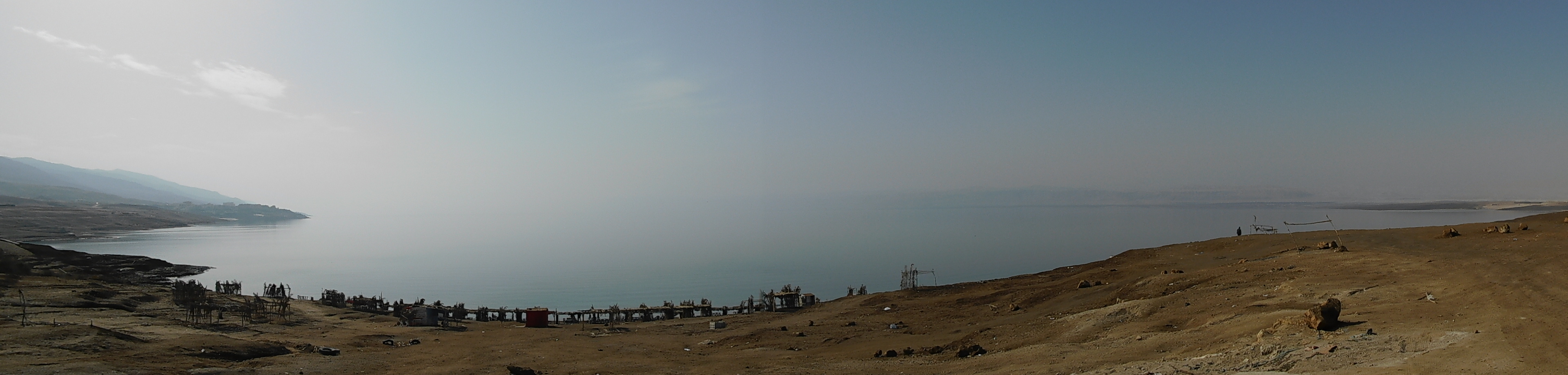
From the edge of the ravine I made yet another panoramic photo of the Dead Sea.
 The Dead Sea
But, before I reached the car, I had to take a photo of yet another visitor that was sitting there peacefully.
 There are all sorts of visitors coming near the Dead Sea
I finished with my brief visit to the Dead Sea here. According to my original plans for this journey around Jordan, I was supposed to spend a couple of days on the coast of this sea later on and perhaps I would have dipped in, but these plans did not materialise. Well, maybe this could be a good “excuse” to come here again. Certainly not to this exact spot, but as I’m getting older there will probably be some rheumatism in my body, while the waters and the mud from the Dead Sea are proven to be good for various skin and rheumatism ailments. This should definitely be checked out.
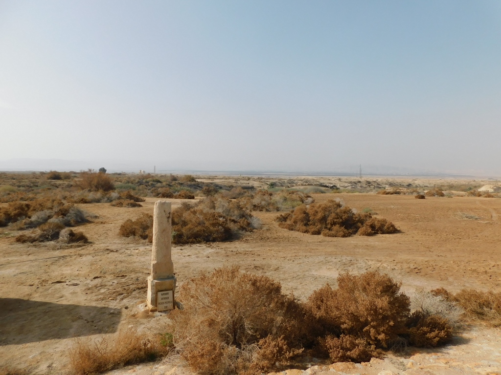
On this occasion, I went back to the car and then I was taken to a very important and special place. Actually, I came by car to a parking lot for visitors and there was also a ticket office where I bought the ticket and had to wait for about half an hour in order for a group to form. Namely, I got to the starting point for the visit to Al-Maghtas officially also called the Baptism Site “Bethany Beyond the Jordan.” In other words, the place where according to the traditional beliefs John the Baptist baptised Jesus Christ.
Although archaeologists have found evidence that this area was inhabited by a smallish group of farmers already in the 4th millennium BCE, the main construction activities linked to religion started probably already in the 2nd-3rd century CE and certainly more intensively from the 5th-6th century CE, which made Al Maghtas turn, especially during the Byzantine times, into one of the most important pilgrimage destinations for Christians. Though the original buildings were constructed on the east bank of the Jordan river, from the beginning of the 6th century, because of the easier access, the pilgrimage site gradually got moved to the west bank. As the conquerors came one after the other, there was less and less new construction, but the old buildings were used for quite a while yet. From the 15th to the 19th century, only very sporadic pilgrims came here, while a small chapel was built in the 19th century. Still, it got destroyed in an earthquake in the first half of the 20th century.
Because of the passage of time, the ruined structures, as well as the war-related activities in the 20th century, the archaeological site was rediscovered relatively recently. Al Maghtas, in other words the site on the east bank of the Jordan river, is certainly a part of the state of Jordan, but the west bank of the Jordan river is in fact THE West Bank – the territory that belonged to Jordan from 1948 until 1967, that was then occupied by Israel in 1967 (Jordan claimed this territory up until 1988 when it officially relinquished it) and that is otherwise a part of Palestine.
The excavations that started in 1996/7 revealed 11 Byzantine churches, five baptisteries from the Roman-Byzantine period, numerous monk and hermit caves, as well as the remains of dormitories for pilgrims.
Guided tours start from the ticket office every half an hour or hour. The visitors enter a mini-bus and then they are taken to the central part of the site with a stop in one place in order for the guide to give them the introduction. This whole area seemed to me rather large and along the way I could see that there were sections with visitor paths, but not all of that was included into my sightseeing tour. That’s why it was important for the guide to say a few things about the part we did not visit. Namely, Al-Maghtas consists of two main archaeological segments. The first one can be seen from the point where we stopped and that is a low elevation called Elijah’s Hill with remains of a monastery. According to the tradition, prophet Elijah who lived in the 9th century BCE came to Jericho and there with his mantle he stroke the Jordan river that divided into two and thus he and his disciple Elisha walked to the other side of the river. As it had been foretold, there, on a nearby hill, prophet Elijah assumed into heaven, which means that he did not die, but rather he was alive when he went to heaven.
 Al-Maghtas site
 Al-Maghtas site: monastery remains are to the left and up
I must admit I did not ask how one can visit this part as well, while my simple tourist visit was probably a result of the fact that it was January, a low season, with fewer visitors, which meant fewer guides and security guards. I’m not sure one can just roam around, since the site is located in a border area. In the end, I must say that I rather enjoyed this time being taken around. The only thing I felt sorry about was that the group was mixed – I was the only English-speaking visitor, while the others spoke Arabic. That meant that the guide spent half of the time (probably even a little more than a half) speaking in Arabic and then, as it seemed to me, less than half the time speaking English. But, let there be no mistake, the guide was brilliant and very kind. All I’m saying is that I would have preferred it if all the time had been used for different stories in English. Still, the visit was a success and I was very content in the end. As it would turn out later, being a part of a mixed group, with visitors from Jordan, also had its significant advantage.
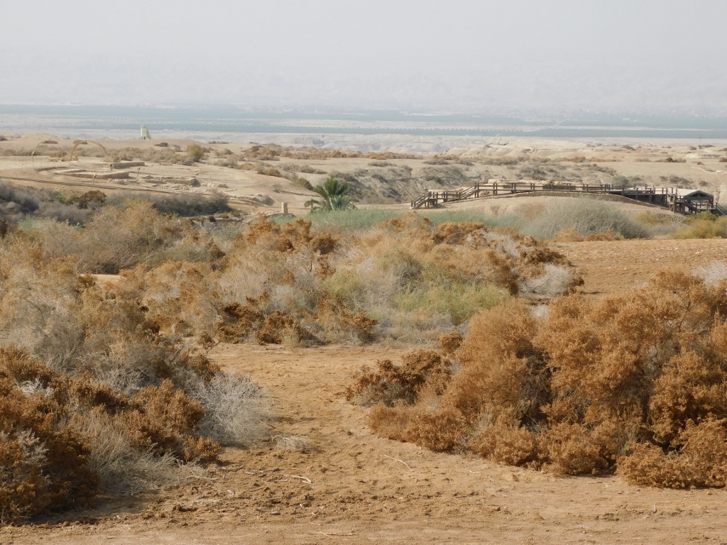
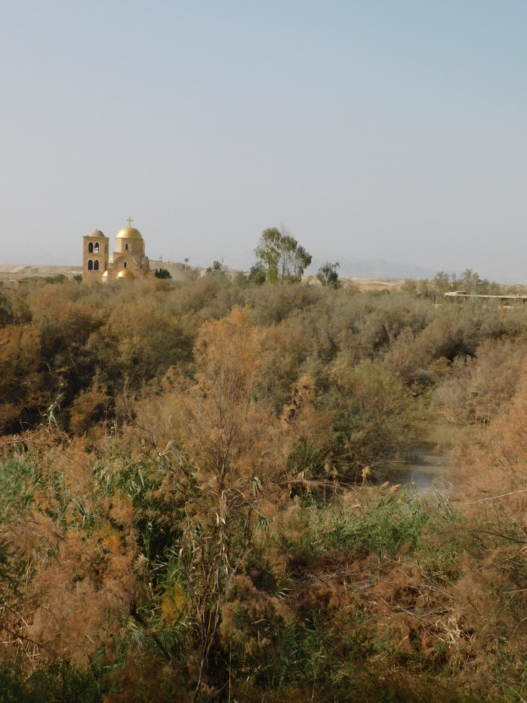
From the vantage point where we stopped, I could see several churches in the distance. These were all new buildings, for several different Christian denominations have built churches here and each one was done in the style typical of the given denomination. The plan is that in the end a total of 12 Churches have their temples built at the site.
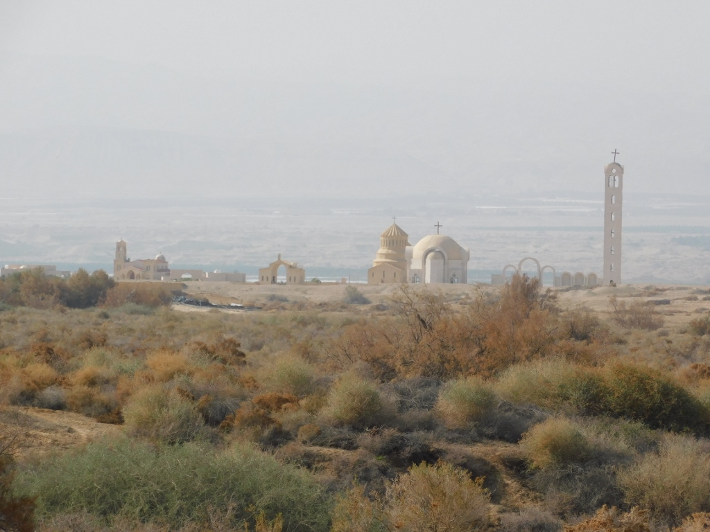 New churches at the Baptism Site “Bethany Beyond the Jordan”
While we continued to drive on, some of these new churches could also be seen.
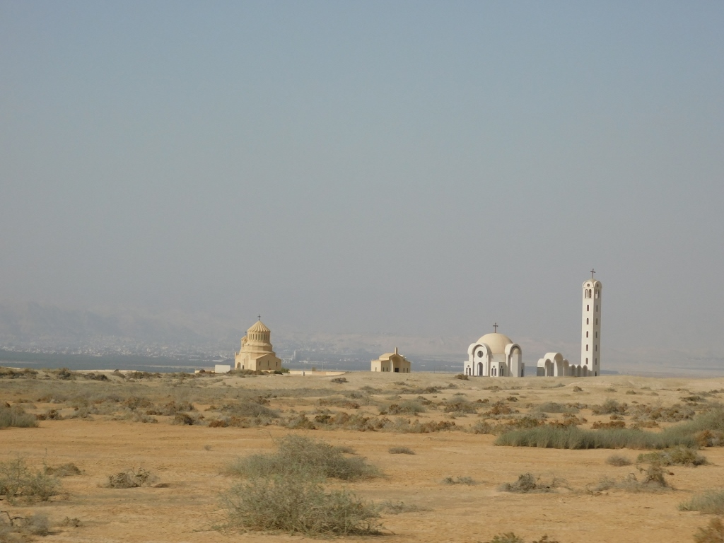 New churches at the Baptism Site “Bethany Beyond the Jordan”
Once we reached the central part of the archaeological site, we got out of the mini-bus and went for a sightseeing walk. First we got to the Jordan river.
 The Jordan river
 The Jordan river
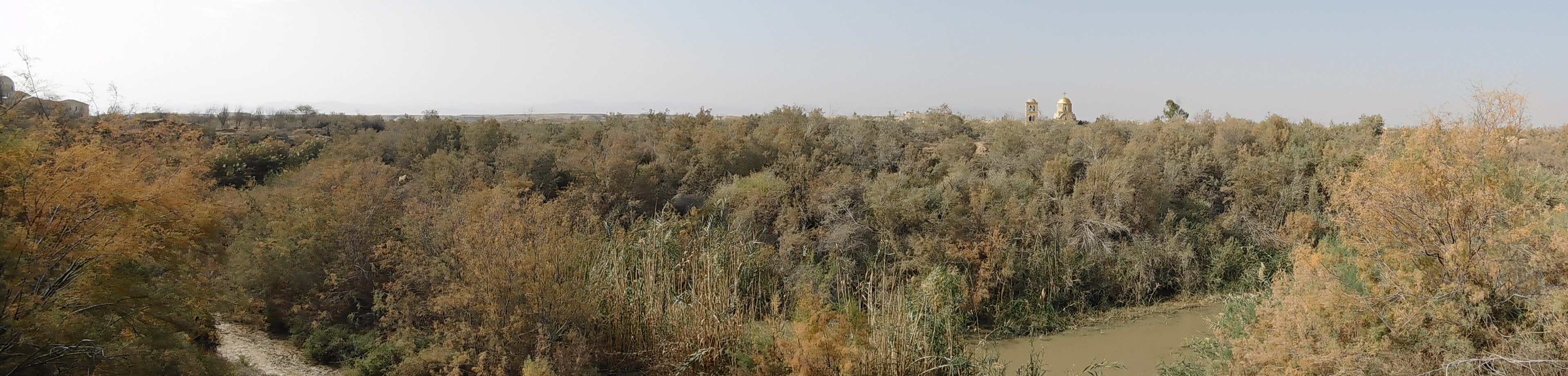
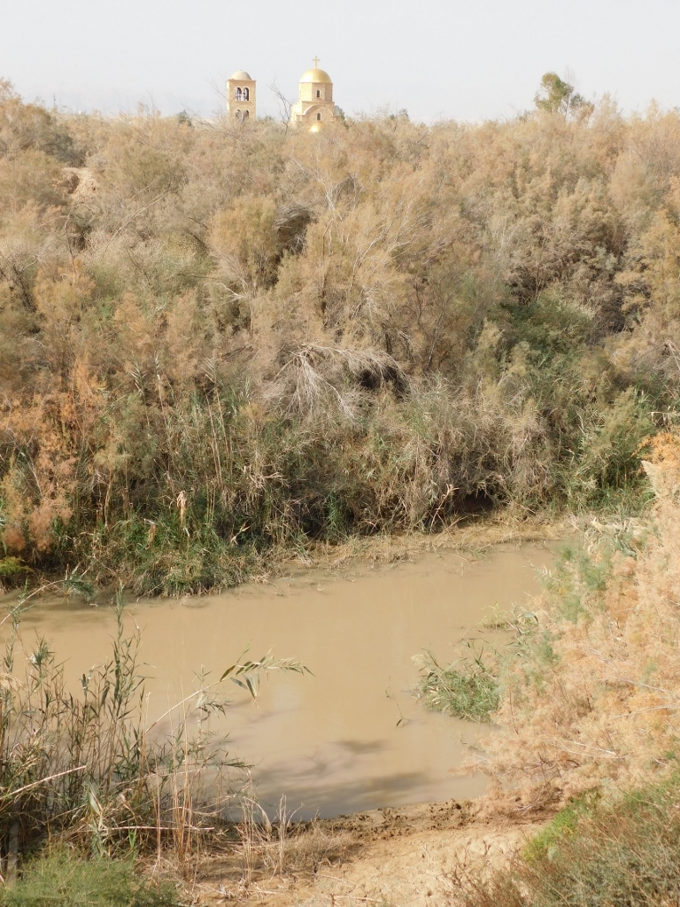
I must admit I was taken aback. I had always imagined the Jordan as a much more impressive river. Admittedly, it is believed that the Jordan was a much bigger river in the past, that it often flooded the surrounding areas and that it could be as much as one kilometre wide. Well, this is not the case anymore.
Another interesting thing for me was that right there, on the other side of the river, was the West Bank, i.e., Palestine, i.e., the area occupied by Israel. The river constitutes the border. In the previous two photos, one can see a church and may easily get an impression that it is located on the West Bank. However, when you continue with the walking tour, you can see that the river meanders here and, as it would turn out later, the church is actually on the territory of Jordan.
The photo below shows a different position of the church in relation to the river and also on the right-hand side of the photo it is possible to discern a canopied part of the walking path.
 The Jordan river meanders and, as the tour continues, one can see a different relation between various elements
This area is also below the level of the sea, as much as 350 m below, and during summer temperatures can be exceptionally high. This is probably the reason why canopies have been installed above the walking paths, so that the visitors would not faint from sunstroke. I’ve also read that in summer there are huge quantities of flies that may disturb visitors. In this regards, January was ideal. It was warm, but pleasantly so and there were practically no flies whatsoever.
But, let me go briefly again back to the Jordan river and its muddy appearance. I guess it may be presumed that the situation was similar some 2000 years ago, especially during the floods, in addition to which in places the Jordan river can be too deep and fast for the needs of baptism. It is also presumed that John (the Baptist) dwelled close to the hillock from which prophet Elijah assumed into heaven, since that site had been known from the past. This elevation is linked with the Jordan river by a ravine, Wadi al-Kharrar, some 2 km long, through which several smaller, perennial brooks flow. They spring up on the elevation and in its surroundings before reaching the Jordan. In other words, it is also presumed that John symbolically cleansed people from their sins using this clean water.
While the guide talked to the visitors in Arabic, I took the opportunity to get photos of the brook in a couple of different locations and by God I even dipped the tip of my forefinger in the water and drew three crosses on my forehead. I guessed this could do me no harm. After all, this is a very holy place.
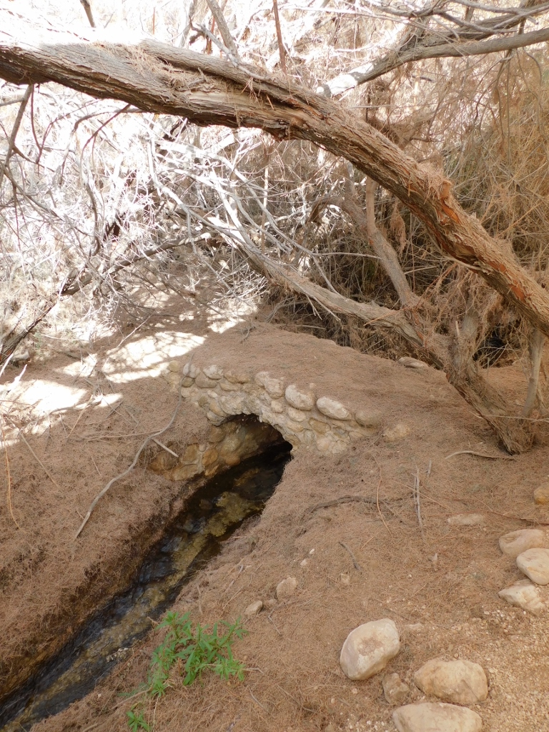 The Wadi al-Kharrar brook
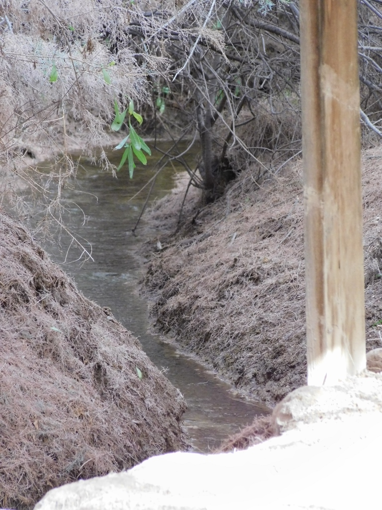 The Wadi al-Kharrar brook
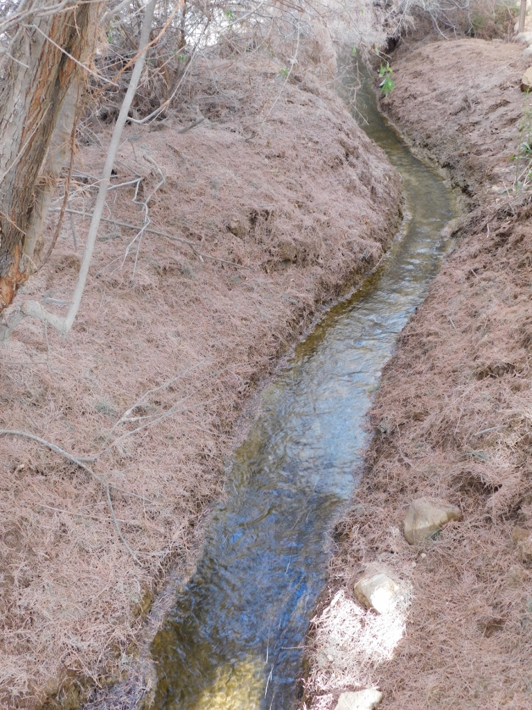 The Wadi al-Kharrar brook