Petra was the capital of the Nabataean Kingdom that existed from around 4th century BCE until 106 CE when it was annexed by the Roman Empire. The Nabataeans, a Bedouin tribe that over time settled here, called their capital Raqmu, but because of the abundance of rocks and cliffs at the site of the capital, the history refers to this city by the name originating from the Greek word for stone – Petra.
This site that is located between the Red and the Dead Seas was, however, inhabited already during the prehistoric period. At first, Petra was seasonally inhabited by nomadic traders and cattle breeders, but from the 3rd century BCE a permanent settlement started to develop here.
Since the city was located at a very important crossroad of the trading routes between Arabia, Egypt and Syria-Phoenicia, as well as some much farther away destinations, the Nabataeans developed it as their political and religious centre that was the hub of the caravans. In time, both the kingdom and the city became very rich. I have already written about some details linked to the kingdom itself, but I would like to focus a little more on the city now.
Petra was partly built and partly carved out of the magical, often rosy cliffs it is surrounded with and thus it is often called the Rose Red City. The mountains and massifs that are located around the central valley are full of narrow gorges and passages, and such type of relief greatly impacted all aspects of the life of its inhabitants, including religion, architecture and culture. But, the life of the inhabitants of Petra was also influenced by all the people who came and passed through here, either for the purpose of trading or warfare.
The centre of the city is situated in a comparatively flat, spacious valley surrounded by rocky heights and in a way this creates a kind of a natural fortress. Because of this, the Nabataeans distributed guard posts across the surrounding summits, but on these rocky heights they also built numerous temples and altars where they carried out their religious ceremonies.
It is estimated that at its peak Petra had between 20,000 and 30,000 residents. And that peak was more or less at the turn of the millennia, during the reign of King Aretas IV (9 BCE – 40 CE) and a couple of his heirs, at the beginning of the new era. In that period, around 600 tombs and their facades were chiselled in the cliffs around Petra and some other structures were built as well.
As I’ve mentioned, the territory of the Nabataean Kingdom lost its independence in 106 CE and then it became Roman Provincia Arabia. Petra continued to develop, but in another direction now. In 363 CE it was hit by a powerful earthquake and although its importance was already declining at the time, it continued to function for a while. In the 5th century, a few churches were built here, but by the 7th century the city practically stopped existing as such and only a few smaller settlements scattered around the valley remained. The last historical data about Petra are linked to the 13th century.
Local Bedouins were, of course, familiar with the remains of the ancient city, but it kept being unknown to the West until 1812. In that year, within a secret mission, a Swiss man came here and this marked the modern “discovery” of Petra.
As a reminder, I was here in January 2022 and spent two days visiting Petra. The first day only in the afternoon, but the second day the whole time – from the opening to the closing. I certainly saw the most important segments, but I think it would take me at least 2-3 more days to see everything I think is interesting and also to look again in more details some of its parts.
In the previous sequel of my travel stories I got to the Street of Facades. This is a wide passage where the visitor path goes, as well as a bed of a seasonal torrential stream Wadi Musa that was luckily quite dry during my visit. This section of the path got its name after the numerous facades carved on the cliffs on both sides of the “street.”
The right-hand side of the Street of Facades, when going to the centre of the city, belongs to the Jabal al-Khubtha massif. This massif is, among other things, interesting because it can be climbed from the plateau in front of al-Khazneh or the Treasury in order to see the Treasury better from up there. But, it is also important because on its west side, facing the centre of Petra, there is a sequence of exceptionally impressive and important rock tombs that are elevated above the level of the visitor path.
The first important tomb that you come across is the Tomb of Uneishu. In the following photo, this is the tomb the facade of which can be seen on the right-hand side. As opposed to most of the tombs that are designated by numbers, this one in addition to a numerical designation (BD 813) also has a concrete name. The reason is that there is an inscription on a grave slab here that says “Uneishu, brother of Shuqailat, son of...”
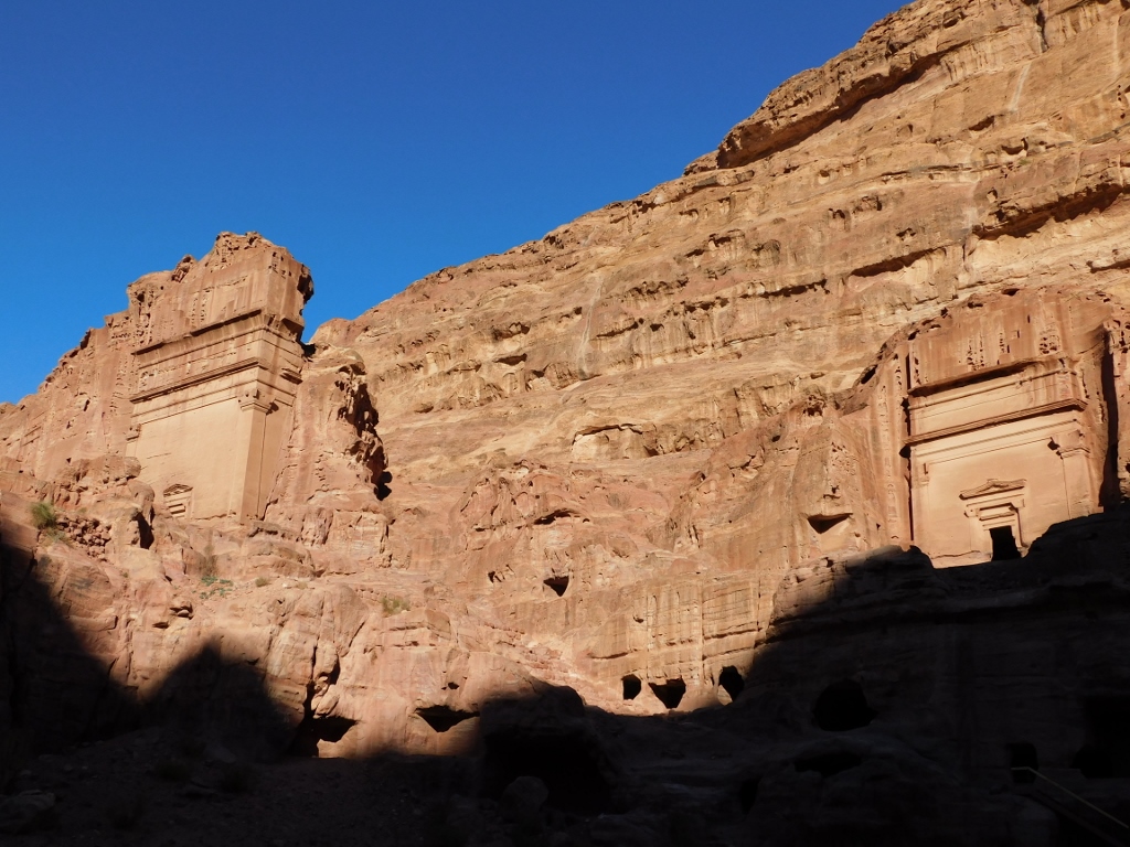 Street of Facades, the Tomb of Uneishu is lit on the right-hand side
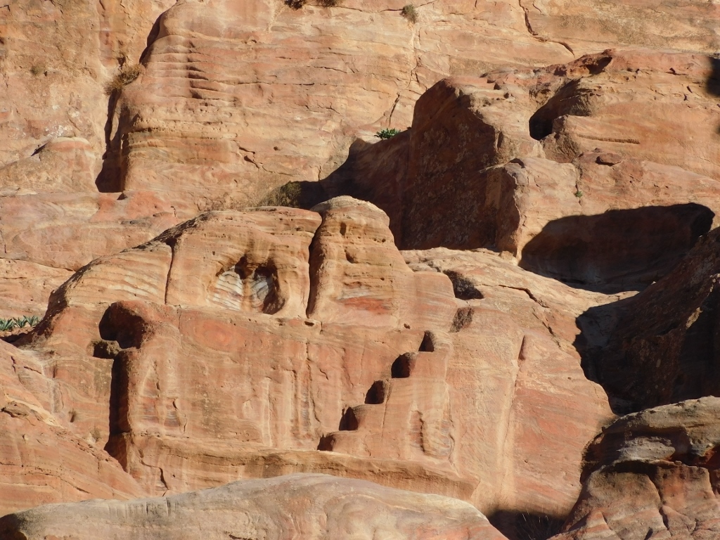
In the photo above, in the lower segment, it is possible to see numerous caves that were carved out there. Although my guidebooks said that it was possible to climb to the upper level by some stairs, all I could see were boulders that a couple of people tried to climb over at the time. I was in mood to attempt any of that. On the other hand, perhaps because of the combination of colours, I personally found the next large tomb much more impressive. And yet, I could not find any information about it. What I presume is that there are so many tombs around here that only fervent archaeologists and historians of art visit them all and deal with them. For us, regular visitors, apart from a few that stand out by some particular feature or characteristic, the rest of them are just a fraction of a large nameless multitude.
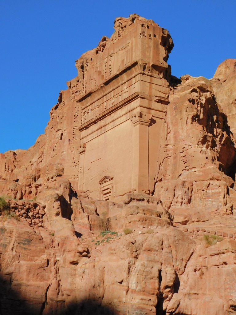 Street of Facades, another tomb with a large facade
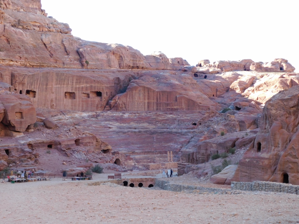
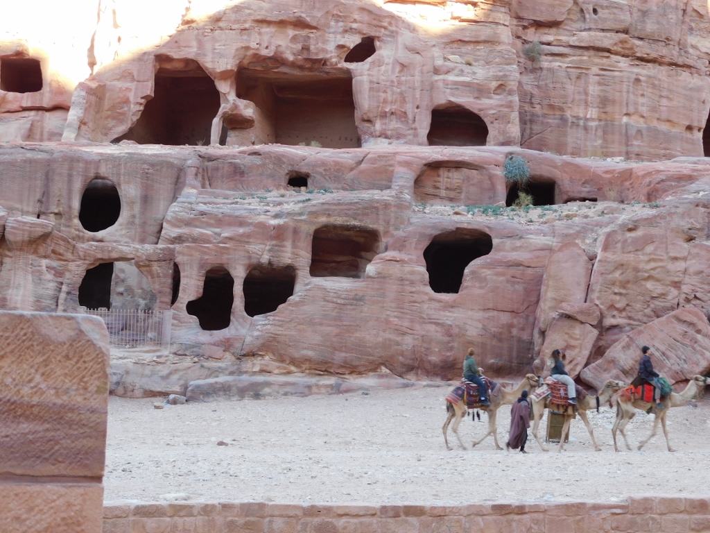
On the other side of the Street of Facades, across the Tomb of Uneishu, there is a large group of smaller tombs called the Theatre Necropolis. The reason for such a name is the theatre that is located on the same side of the visitor path just a little farther away.
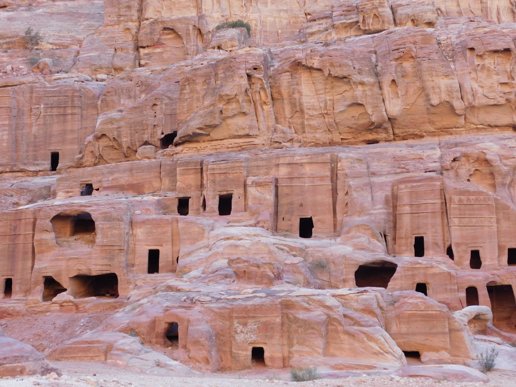 Theatre Necropolis (this is just a part of it)
Although significantly smaller than those previously seen, the number of these tombs is absolutely stunning. The very thought of the quantity of work that must have been put into their construction makes this utterly incredible. On the other hand, it may also be concluded that the Nabataeans were hopelessly bored (this is a moment of my “creative” interpretation of history). They made a lot of money just thanks to the place where they established their kingdom and developed their capital, but without doing anything. This is VERY boring. The fact is that there is a theatre here, but you don’t go to the theatre every day and that too can become boring. So, I presume the logic was: “We have the rock. Now, let’s make something out of it.” That makes the time pass by more interestingly... Especially during the break between two theatre plays, since the next structure after the necropolis is precisely the theatre.
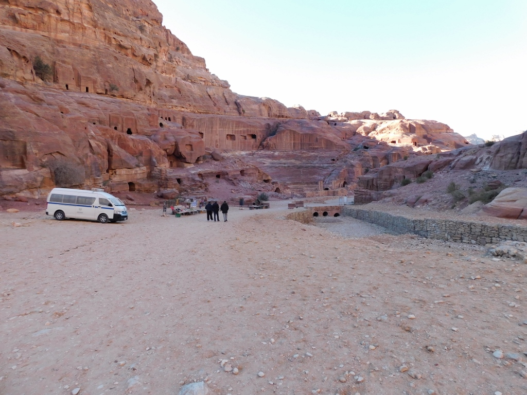 Segment of the Theatre Necropolis, followed by the Theatre
 Theatre
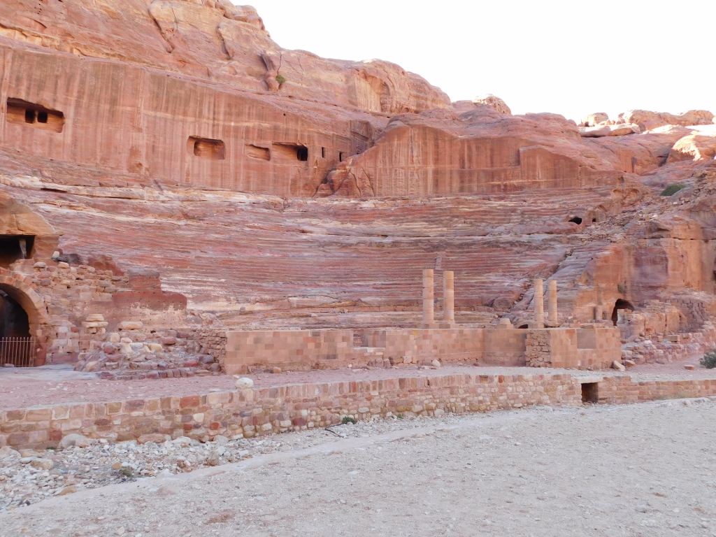
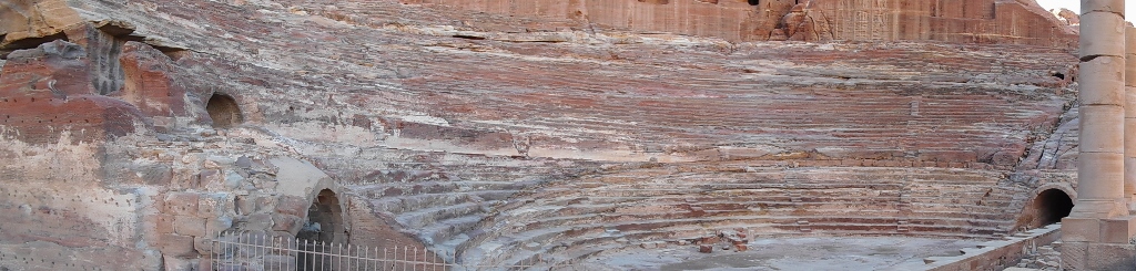
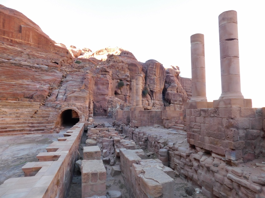
The Theatre in Petra is an impressive structure that was, just like the tombs, simply carved out of the rock. In order to comprehend the scope of the endeavour, it needs to be said that the theatre could seat some 8000 spectators. The theatre was originally made at the beginning of the 1st century CE, but after the annexation by the Roman Empire in 106 CE it was expanded. By the way, that expansion destroyed some of the rock tomb facades that are a part of the necropolis. For instance, above the last row in the theatre you can see the vertical cliffs with rectangular openings that were obviously made by the human hand. These are precisely some of the tombs the facades of which were “taken off.”
 Theatre
The Theatre was made in the shape of a Roman theatre, in other words, as a semi-circle with rows of seats facing the partially elevated stage. Between these two segments there is a flat semi-circle, the orchestra. The auditorium here has around 45 rows of seats divided into 3 galleries.
 Theatre
The stage has been partially reconstructed and the photo below shows the remains of the stage, as well as the main entrance with a barrel vault.
 Theatre, a detail
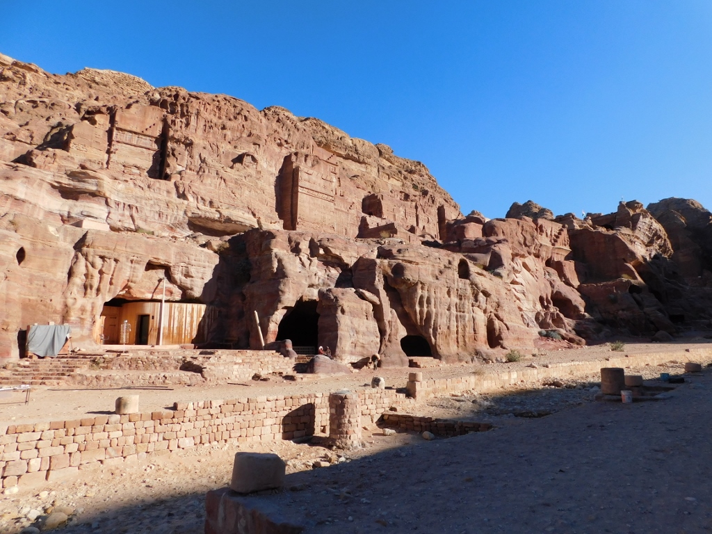
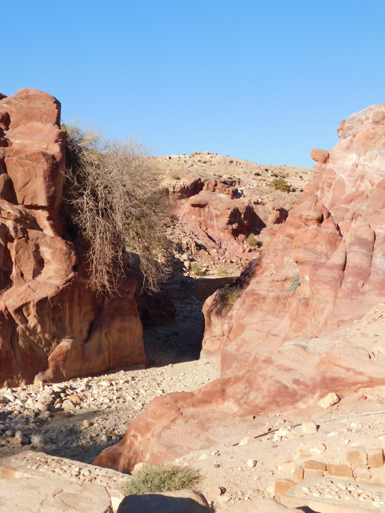
From the direction of the theatre, on the other side of the “street,” it is possible, among other things, to see numerous caves carved their by the entrepreneurial Nabataeans.
 Petra, a detail
After the brief visit to the Theatre in Petra, once again I looked back at the Street of Facades that led me here from the Outer Siq. In the photo below you can see the wide visitor paths, as well as the bed for the passage of the seasonal Wadi Musa stream.
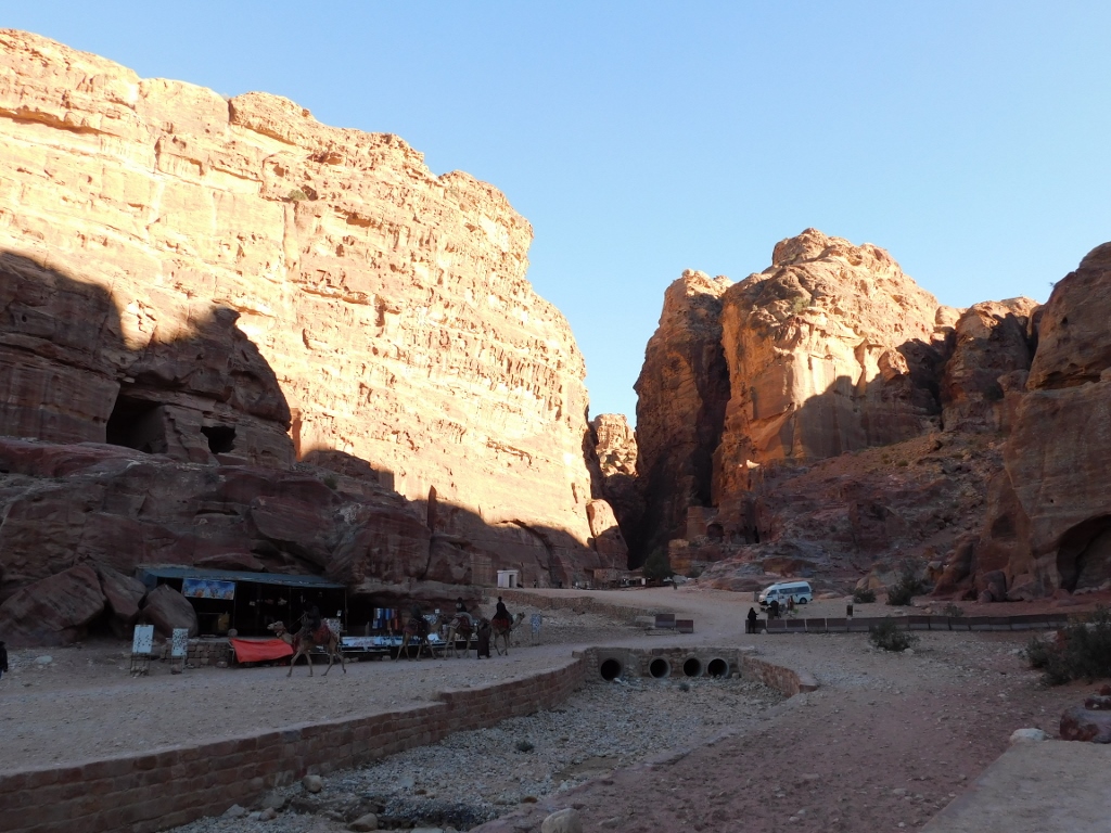 View towards the Outer Siq and the Street of Facades
As I continued to walk along the wide visitor path I was still impressed by the facades that could be seen on a part of the western side of the Jabal al-Khubtha massif that are considered not particularly important!!!
 Part of the western side of the Jabal al-Khubtha massif
I kept enjoying just looking at them and it was especially convenient that they were lit by the slowly setting Sun. On the other hand, I could also notice some other interesting and beautiful details.
 Petra, a detail
 Part of an eroded facade and the fascinating colours of the cliffs in Petra
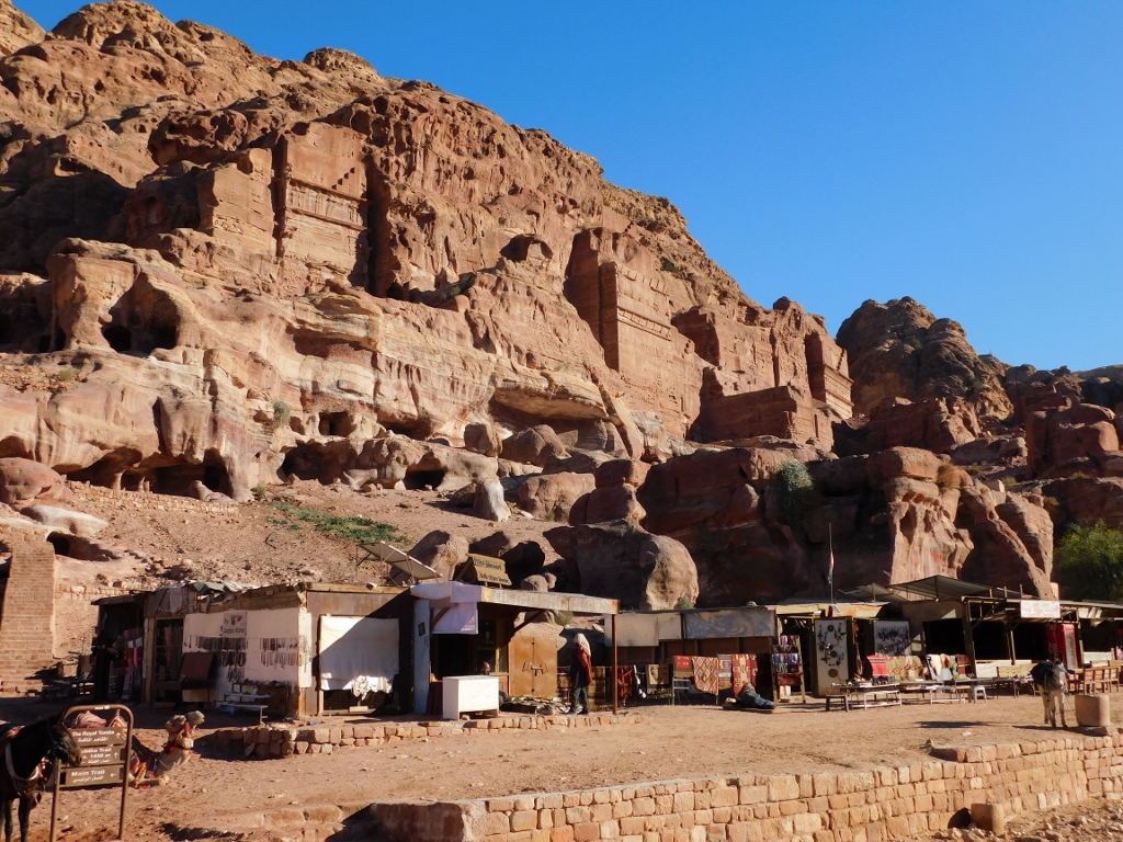 Where there are tourists, there are souvenir shops
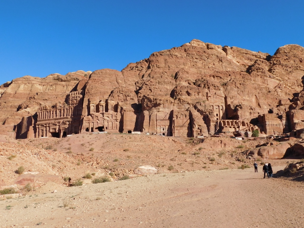
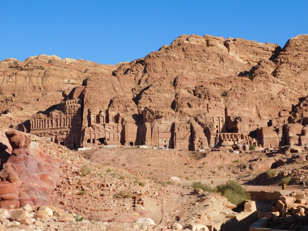
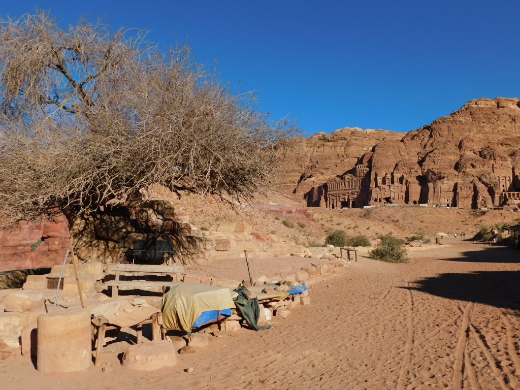
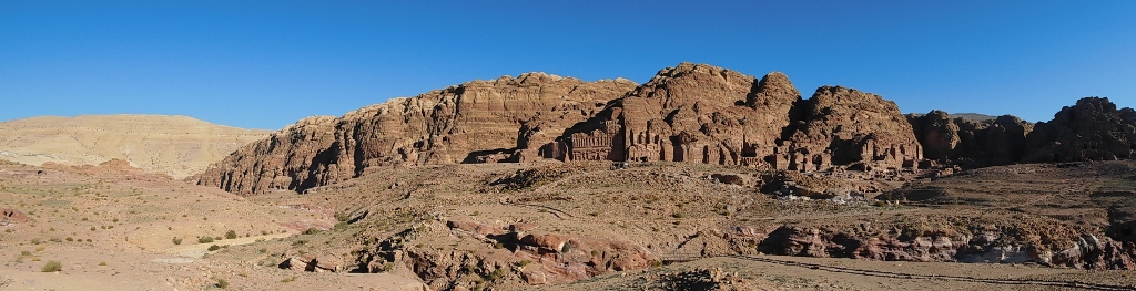
The reason why the tombs seen in the previous photos are not considered important enough to be accentuated in particular is seen very quickly. Namely, the west cliffs of the Jabal al-Khubtha massif are the venue where there are majestic tombs nowadays called by the joint name of the Royal Tombs. This is a sequence of mausoleums with very large and richly decorated facades. All of that was, needless to say, carved out of the cliff.
The first tomb seen from the path is the Urn Tomb.
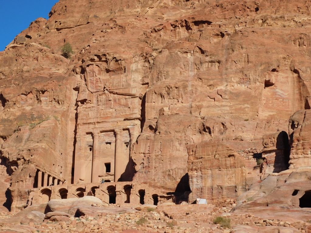 Urn Tomb
Since I certainly did not plan to visit the Royal Tombs this afternoon, leaving that for the following day, I will not write about them individually now. But... This does not mean that they will not feature often in my photos. First, because they are exceptionally beautiful and impressive, and second, lit by the late afternoon sun they just kept inspiring me to take photos of them.
 Royal Tombs
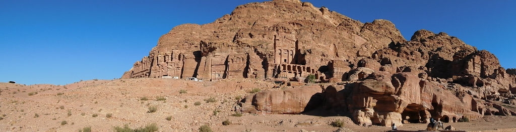 Western side of the Jabal al-Khubtha massif and the Royal Tombs
 Royal Tombs
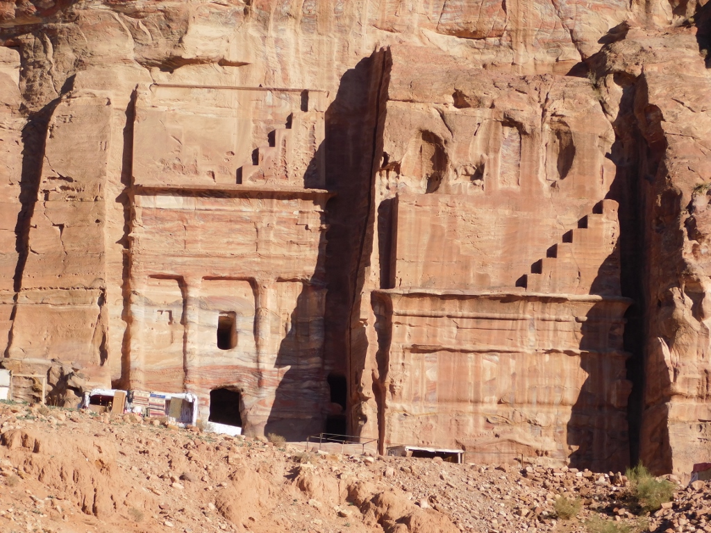 Silk Tomb
 Corinthian Tomb
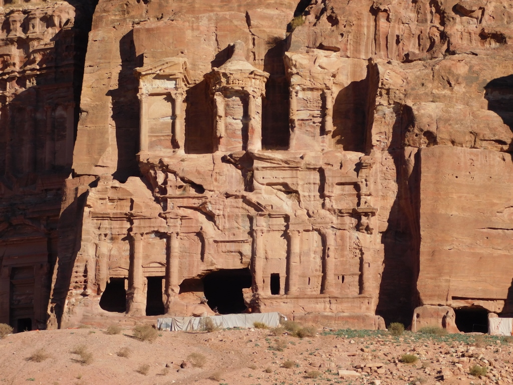
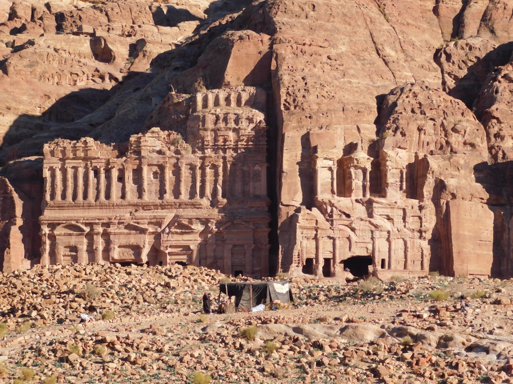
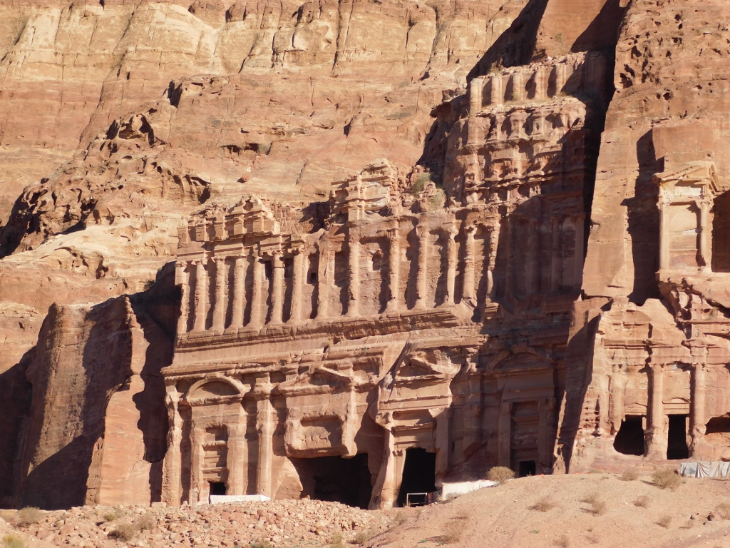 Palace Tomb
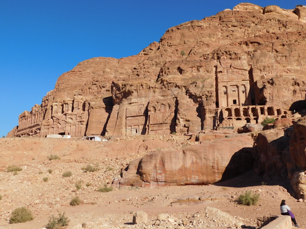
Here they are in a row once again, as seen from a distance. From left to right, they go in the following order: Palace Tomb, Corinthian Tomb, Silk Tomb and Urn Tomb.
 Royal Tombs
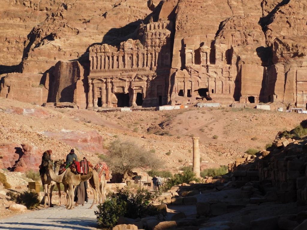
So, I continued down the visitor path and at some point I looked back once again towards the tombs before focusing more on some other structures that I was passing by and that are located in the Colonnaded Street.
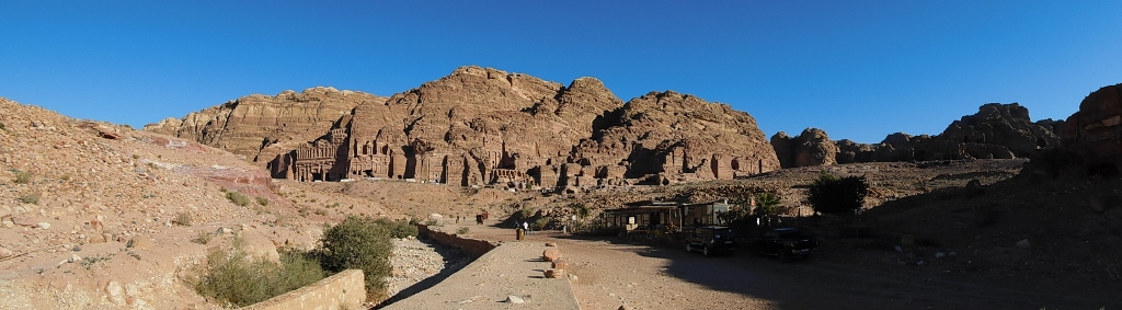 Royal Tombs in the distance and the Colonnaded Street
Right next to the path (on the right-hand side as you approach), there are remains of the Nympheum, i.e., a public fountain. Such public drinking fountains were a frequent occurrence in the Greco-Roman cities and consequently in Petra, too, at some point. These fountains constituted not only the place where people got their water supply, but also a place of gathering. It is presumed that this fountain, built in the 2nd century CE, with all the elements that accompanied such structures, got its water by a type of a water supply system connecting the Siq and the centre of the city. Today, there are only its remains here in the shape of the lower sections of the fountain and there is also an info-board claiming that the pistachio tree growing here is some 450 years old.
 Remains of the Nympheum and the old tree, with the Royal Tombs in the distance
But, the place where the Nympheum was built was not chosen accidentally. Namely, this is where the beds of the seasonal Wadi Musa stream coming from the east and the seasonal Wadi Mataha stream coming from the northeast join together. The Wadi Mataha stream actually carries the water that is redirected by a dam at the entrance into the Siq first towards Wadi Muthlim, which takes it all the way around the rocky Jabal al-Khubtha massif. When I talked about the state of affairs around the entrance into the Siq, I mentioned that there is a ditch and a tunnel which, when it is dry, provide a trail that may take the visitor all the way to the centre of Petra. To put it more accurately, it would lead the visitor right here to the Nympheum.
 Exit from Wadi Mataha by the Nympheum
It is, of course, also possible to go back to the entrance into the Siq following this way, but one should bear in mind that this is almost double the length as the direct way that I was on.
Now, following a side path beside the Nympheum I went up a small elevation to the remains of the Byzantine Petra Church which is believed to have been built in the second half of the 5th century using the material that belonged to Nabataean and Roman buildings. This church is only one of three that constitute the church complex in Petra, but by this time I was very exhausted and so I visited only this one. Namely, all the time I was aware that I would have to go back the same way I came and it already seemed I was at the end of my strength and was just dragging myself.
As for Petra Church, this is a three-nave basilica that is 26 x 15 m. But, in order to enter the church, one first enters an atrium with a water cistern through a side entrance.
 Atrium of Petra Church
The atrium takes up the space between the Baptistery and the west side of the church where there were three doorways leading inside. On the east side of the church there were three apses, practically at the end of each nave.
 Petra Church
The central nave was obviously paved because even today it is possible to see beautiful slabs, but the aisles are particularly interesting. Namely, they contain very well preserved floor mosaics that in each aisle cover the surface of around 70 sq. m.
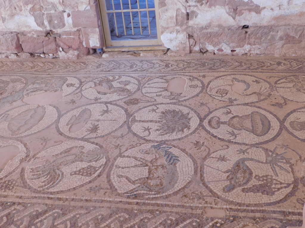 Petra Church, mosaics
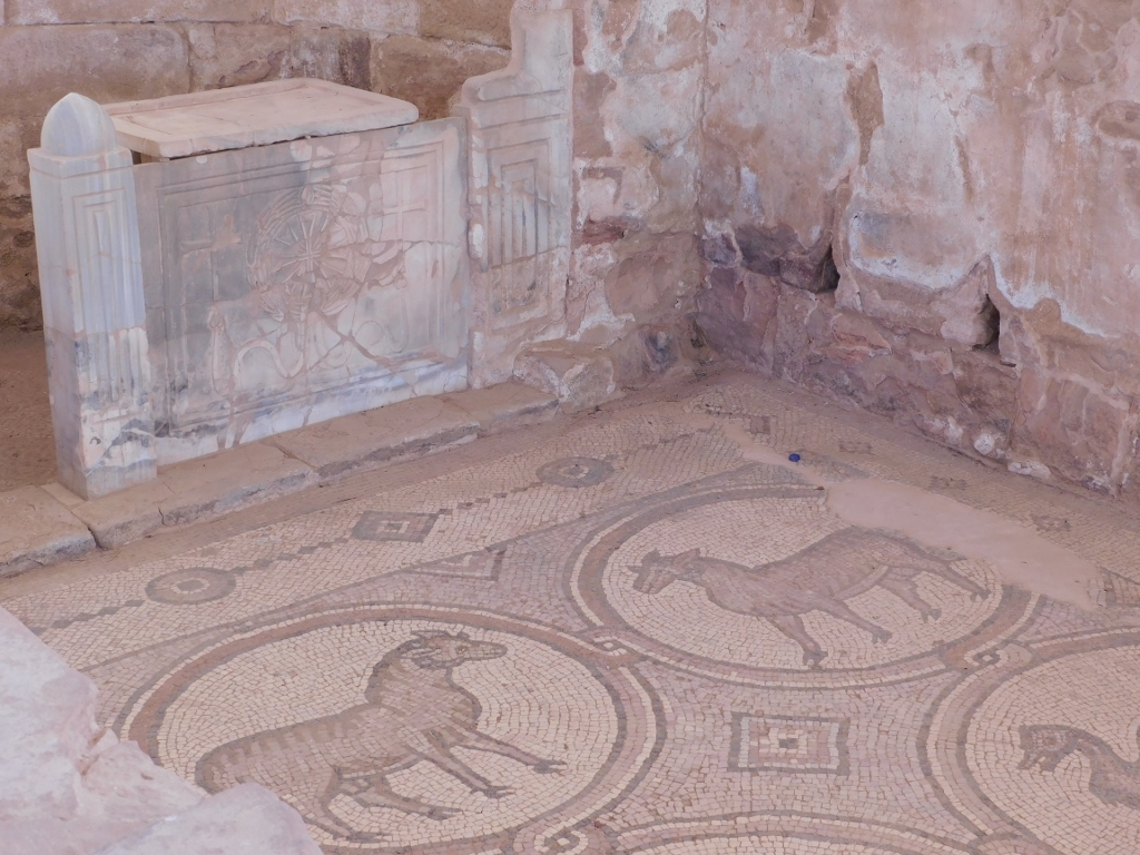 Petra Church, mosaics
In a room at the very northeast corner of the church, some papyrus scrolls were found in 1993. Although they were apparently in a very poor state, the scientists succeeded in deciphering a lot (these included contracts, out of court settlements and tax returns!!!), so they provide a very interesting insight into the daily life of Petra.
Petra Church was destroyed in a fire around 600 CE and was eventually finished off by subsequent earthquakes. Still, it serves as a good reminder that this place was also ruled by the Byzantines and not only by the Nabataeans and the Roman.
When I finished with the visit to the church, from that same elevation I looked again in the direction of the Royal Tombs. They were still magnificent!
 Jabal al-Khubtha massif and the Royal Tombs
 Royal Tombs, a detail with a Bedouin tent
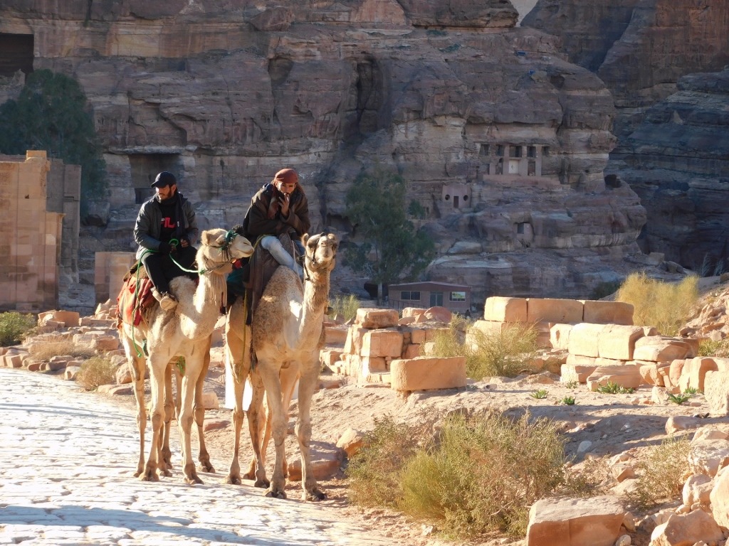
I descended slowly to the main sightseeing path and that is the Colonnaded Street. It is quite clear why it was given this name.
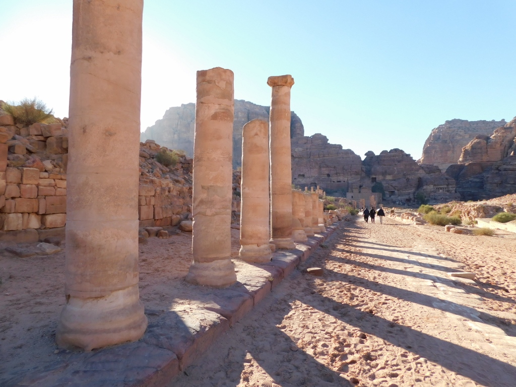 Colonnaded Street
This paved street in the very centre of Petra that follows the bed of the Wadi Musa seasonal stream was made in the 2nd century CE by the Romans who in this way replaced the earlier gravel and earth street used by the Nabataeans. It is presumed that along the street there used to be houses and shops (markets) where, among other things, people traded with incense and myrrh from south Arabia and east Africa, as well as fabrics, semi-precious stones and spices from India.
The earthquake of 363 CE seriously damaged the entire street – both the columns and the shops. Still, using parts of the columns found in situ, archaeologists managed to reconstruct a part of the colonnade that can be seen here today.
Even today, the area alongside the street is used for trading, with souvenirs this time, but it is more important that the photo below shows a part of the paved street, as well as the Royal Tombs in the distance.
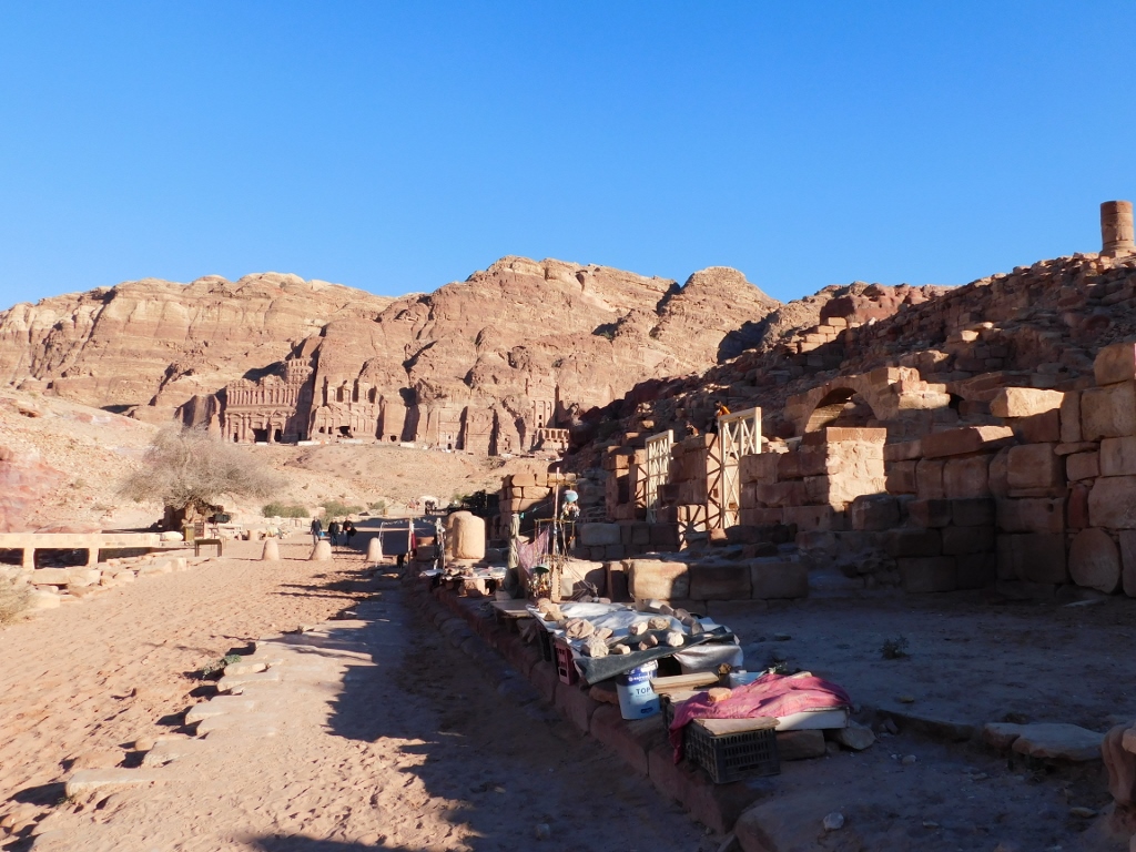 Colonnaded Street, a detail
Moving on along the remains of the Colonnaded Street, I kept taking photos of some details that I found interesting.
 Colonnaded Street, a detail
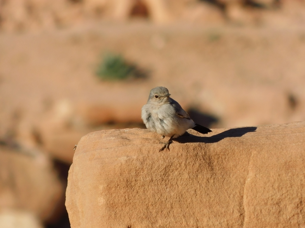 Colonnaded Street, a blackstart (Oenanthe melanura)
Still, I was continuously drawn to taking photos of the Royal Tombs the facades of which are especially striking in the late afternoon, before the sunset.
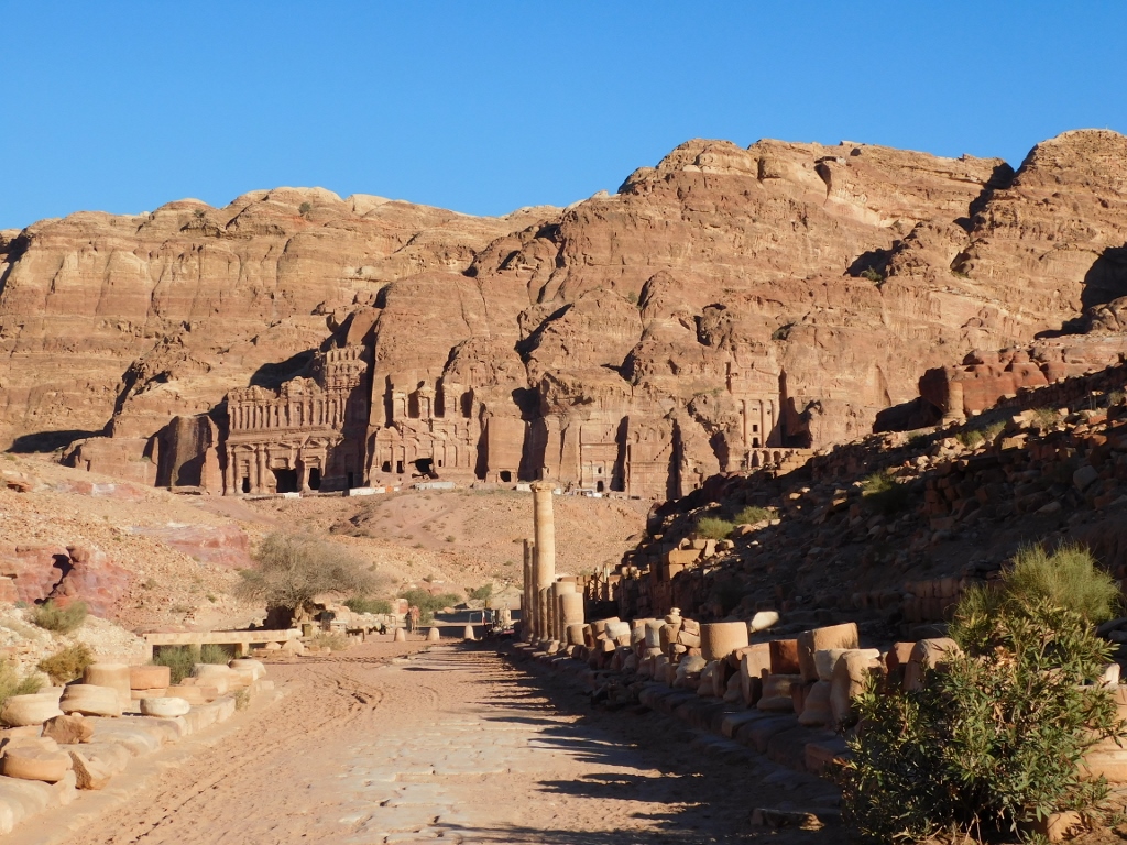 Colonnaded Street and the Royal Tombs
 Colonnaded Street and the Royal Tombs