I had this trip in my mind for several years. This idea was encouraged by the fact that there is a direct flight from Belgrade to an airport that is physically located in France, but is very close to a tri-border area that includes Germany and Switzerland. Moreover, it is only 6 km from Basel. So, it occurred to me that within a week I could visit Mulhouse, Freiburg and Basel. That was the basic plan.
I think it is interesting that I was already in each one of these three places before, but this was all way back when and I remembered little apart from the fact that I had found Freiburg and Mulhouse particularly lovely. As for Basel, it had a pale image in my memory, but I know several people who praise it, so I decided to go again and check it for myself.
Since I had a week at my disposal, it was clear to me that this would be too much time just for these three places. So, I started to think in broader terms and thus I came to a very interesting journey, at least for me. Here is a map that shows the places I actually visited.
To start with I booked rent-a-car at the airport and when I took the vehicle over I drove directly to Germany, i.e., to Freiburg. The first part of the trip took me through France, but at some point the road crossed the Rhine and soon enough I was in Germany. Following the GPS I had in the car, I drove for a while along one of those famous German autobahns without speed limit, but first of all it was relatively crowded on the road and thus nobody drove at some neck-breaking speeds and neither did I. Second, even if I had been alone on the road I would not have driven more than 120 km/h simply because I don’t like it.
I know this for sure, because back in the day I had an opportunity to drive a very good car on a very good motorway with hardly any other cars around. Then I vented my inner Formula 1 driver and got to the speed of 180 km/h. I drove like that for a couple of minutes and then I realised I did not feel well. Not in terms of feeling sick or anything of the kind, but rather I felt quite clearly some trepidation within myself and that felt quite unpleasant. I reduced the speed to 150 km/h and the unlikeable feeling disappeared. I drove at that speed for a short while and then I increased it again to 180 km/h; the unpleasant trepidation, almost like an inner quiver, reappeared. I realised it was adrenalin or cortisol or whichever hormone it is that is secreted when we are exposed to an unpleasant stress. But I also learnt a very good lesson in less than 10 minutes. I don’t like wild driving on a road. Nowadays, I don’t even think of going 150 km/h. I have realised that the speeds up to 120 km/h feel quite well, since I am more relaxed.
But, in some sections of the motorway there was a speed limit and everybody drove more slowly, so at some point I could safely take a photo of a motorway in Germany.
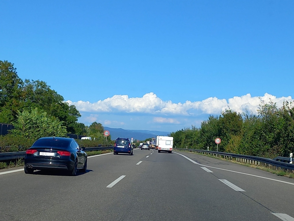 Motorway in Germany with a speed limit
As I had planned, I drove to a hotel in Gundelfingen, a municipality near Freiburg where I had booked a room simply because I did not want to get into the city. One of the main reasons why I don’t rent cars more often during my trips is that I almost pathologically hate looking for a parking space. This hotel had its small parking lot for the guests and it was also situated literally 2-3 minutes from the motorway, while in a very quiet spot. In other words – ideal.
After I had settled, the very kind manager of the hotel recommended a restaurant in the centre of this place and so I walked there. It does not matter what I actually ate there, but to start with I ordered a nice, local draught beer. After all, I was in Germany.
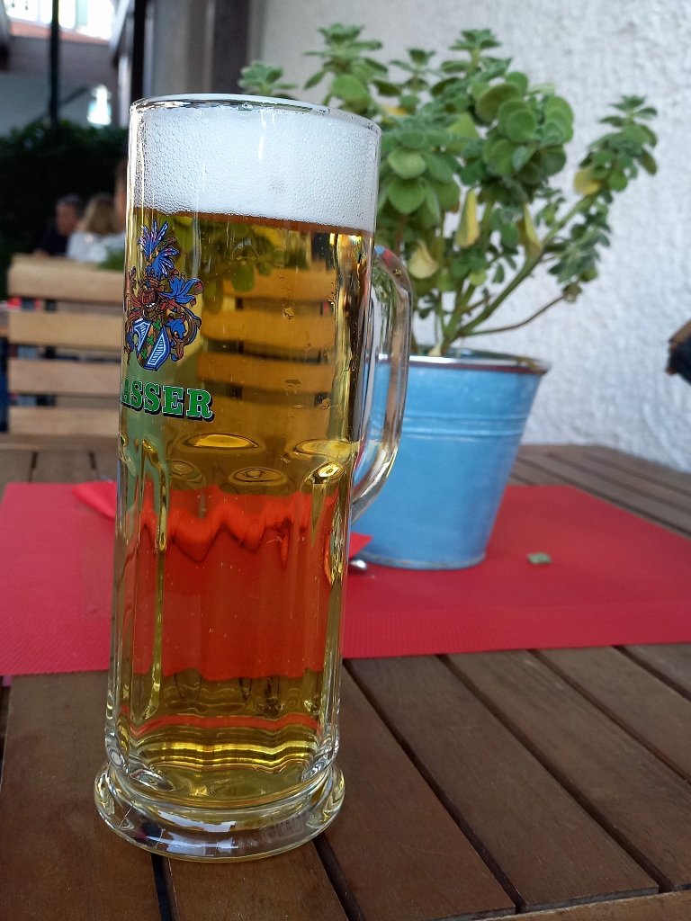 Beer accompanying my dinner
Following the breakfast the next morning, I went on a daily trip by car. This was also one of the main reasons why I rented it. Namely, Freiburg practically “leans against” the mountain region of Black Forest (Schwarzwald) and in one of my guidebooks I had read about a fine daily excursion around the southern third of this area. Thus, I first went to mountain Schauinsland.
In order to do this I had to pass through the city, but as soon as you leave Freiburg from the south side you enter the area of Schwarzwald, which means dense forests since Schwarzwald actually means “Black Forest” and in this case it also entailed a very winding road that led me uphill. I enjoyed the ride immensely, but there was no suitable place to make a short stop and take a photo, so I simply drove up to a pass where there was a parking lot.
Since I knew I would be walking in nature, I had already taken trekking poles from home, so I took them out from the car here, put my small backpack on and started to walk. I wanted to go to the very summit of the mountain that was very close and it was a very short walk indeed – hardly 2 km up to the top and back, but it all started with some steps.
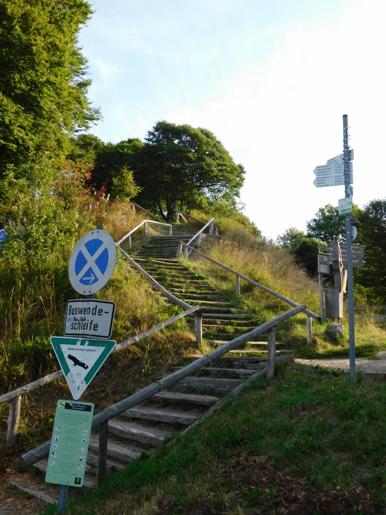 Climbing the top of Schauinsland
I even had information that there were 91 steps in total, but I must admit I did not count. The point is that the parking lot is at 1200 m above sea level, while the summit of Schauinsland mountain is at 1284 m. In other words, it was really not much.
As soon as one climbs these stairs, there is a very fine view at the south part of the Black Forest region.
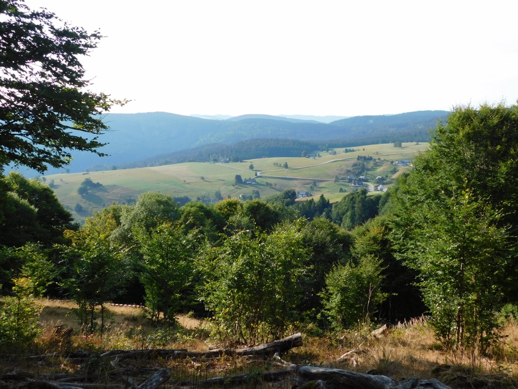 South Schwarzwald
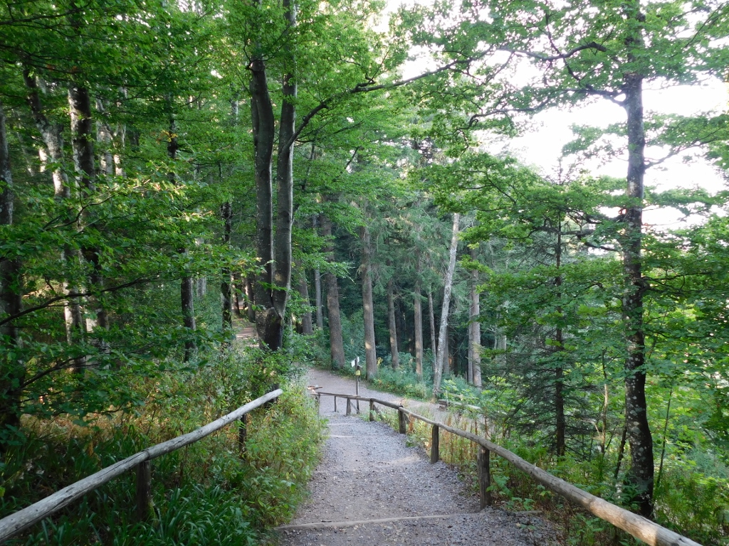
After the stairs, there is a narrow path and only then one gets to a wider trail that leads to the top (where there are a few more steps). All of these trails are well marked, but it was a working day and a morning, so I hardly met anyone. I had an impression that I could hike across the mountain for days and that would certainly be a very fine experience.
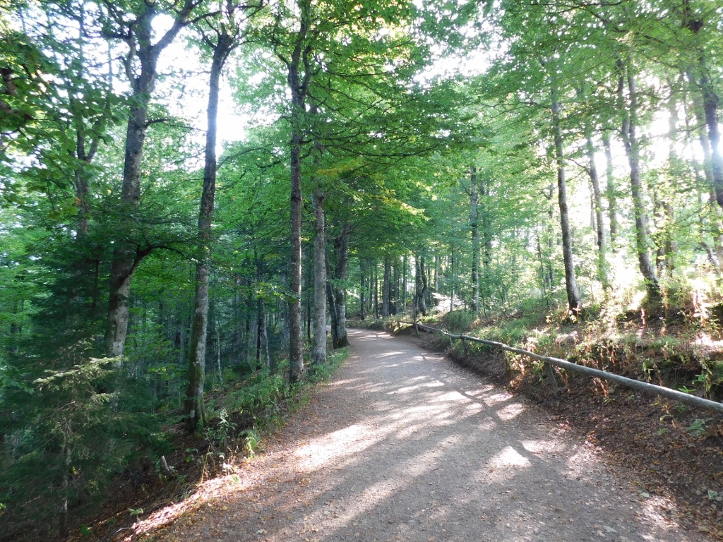 Walking trail in Schwarzwald
By the way, in this area where I walked there were not too many of the tall and densely growing conifers that could be seen alongside the road from Freiburg, but still, here and there, through the slender and tall deciduous trees I could spot some of these conifers.
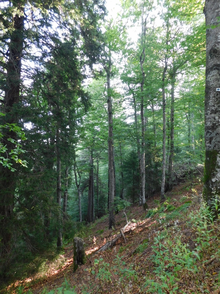 Forest in Schwarzwald region
Soon I reached the summit and there was a tower that serves as a great viewpoint. Of course, when climbing the tower is permitted. This time, there was a fence that prevented the access to the stairs, so I just walked around the tower and occasionally, when the trees were not too much in the way, I enjoyed the splendid view.
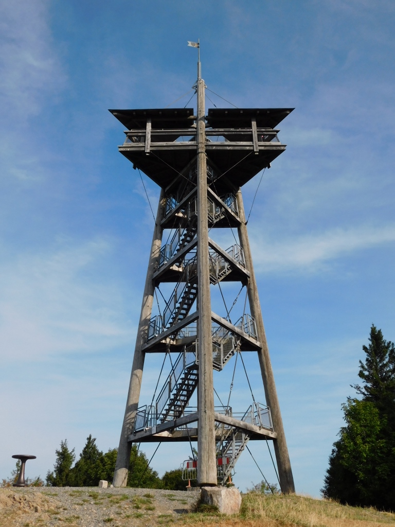 Tower on the top of Schauinsland mountain
 View from the top of Schauinsland mountain
After a brief respite during which I sat on a bench for a short while enjoying the view and the sunny day, I started to head back to the parking lot following the same route.
 Going down from the top of Schauinsland mountain
This place is certainly worth the visit because of this nice walk, but it did not suffice for me. Admittedly, there is a Mining Museum (Museums-Bergwerk Schauinsland) nearby placed in an inactive underground mine, but it is not open on all days, plus, the visiting tours are done mostly in German (unless you announced the visit as a group in advance).
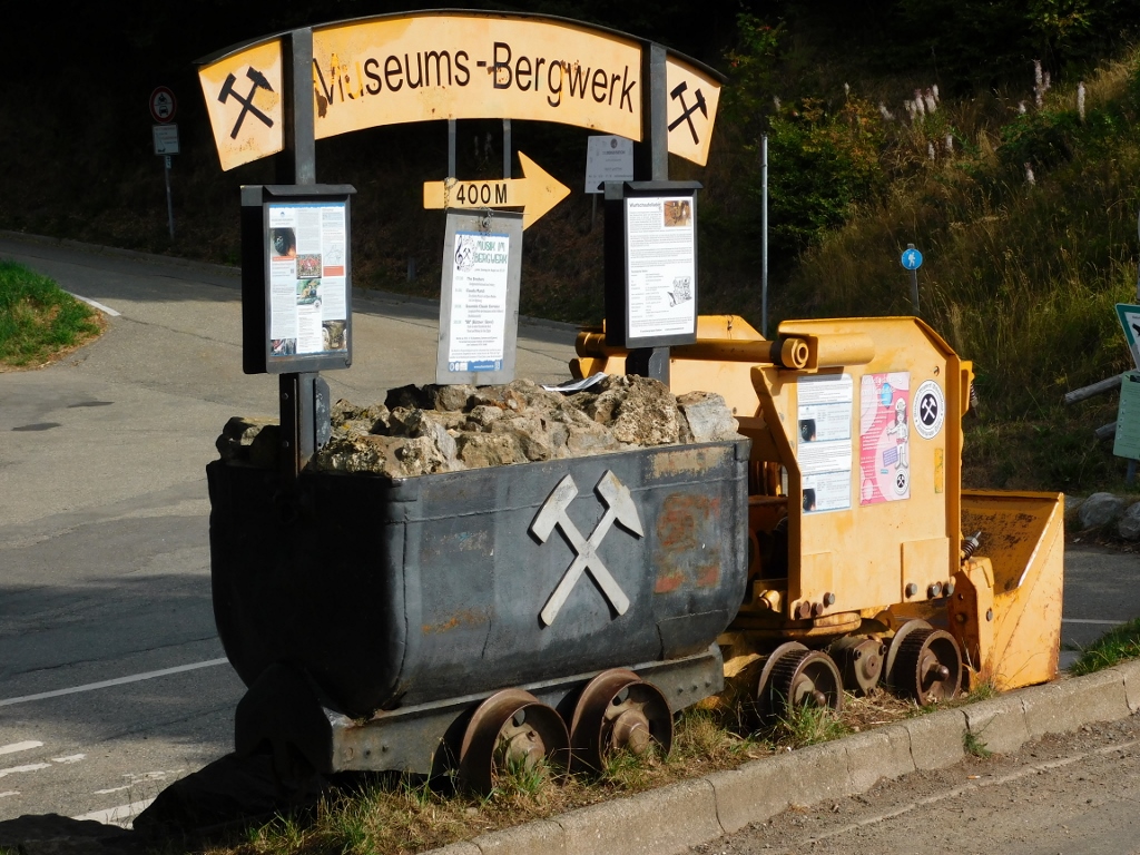 Information about the nearby museum
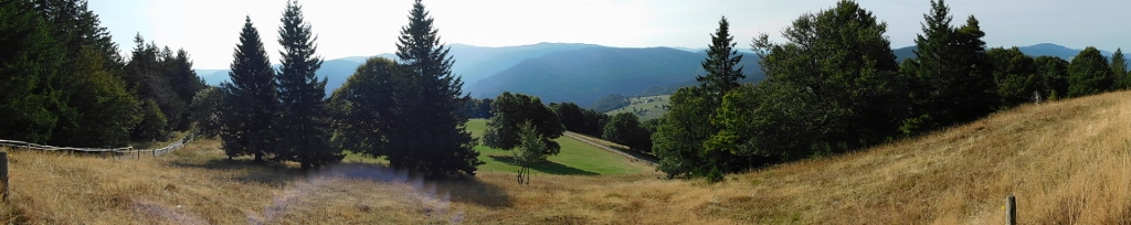
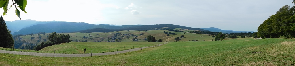
So, I did not even try to go there, but I did go to a different slope of the mountain not far away and the view from there was truly perfect.
 Slope on Schauinsland mountain in Schwarzwald
I could also conclude that there were ski runs here in winter. How? Very simply – I could see the top of a ski lift and a platform that is certainly covered in snow during winter.
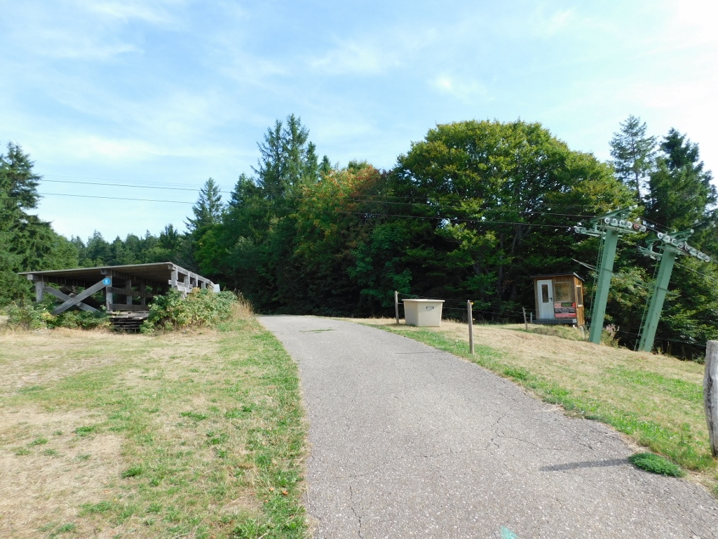 Parts of a ski lift in summer
Now I returned to the car and moved on. I had certain difficulties with the GPS navigation in the car, but after some wandering I did park near my next destination and then following a narrow path through a forest I started to descend. Soon I reached the Falls of Todtnau (Todtnauer Wasserfälle).
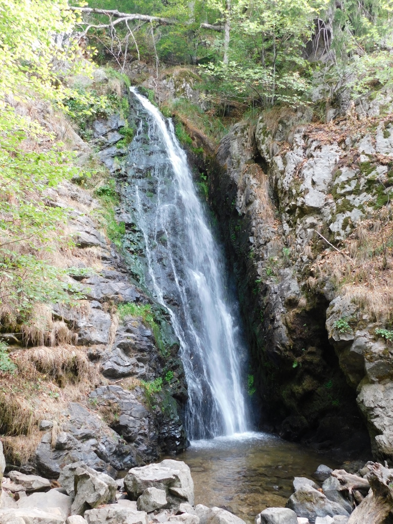 A part of the Falls of Todtnau
Although this waterfall seemed very pretty and even tall, as it would turn out, it was only a part of the whole waterfall, although I was not aware of this at first. There was a small bridge here over the river and so I moved to the other side; just like some other visitors whom I encountered there. A little farther I noticed another wooden bridge over the river and I concluded that there was probably a nice view from there, so I proceeded to that point.
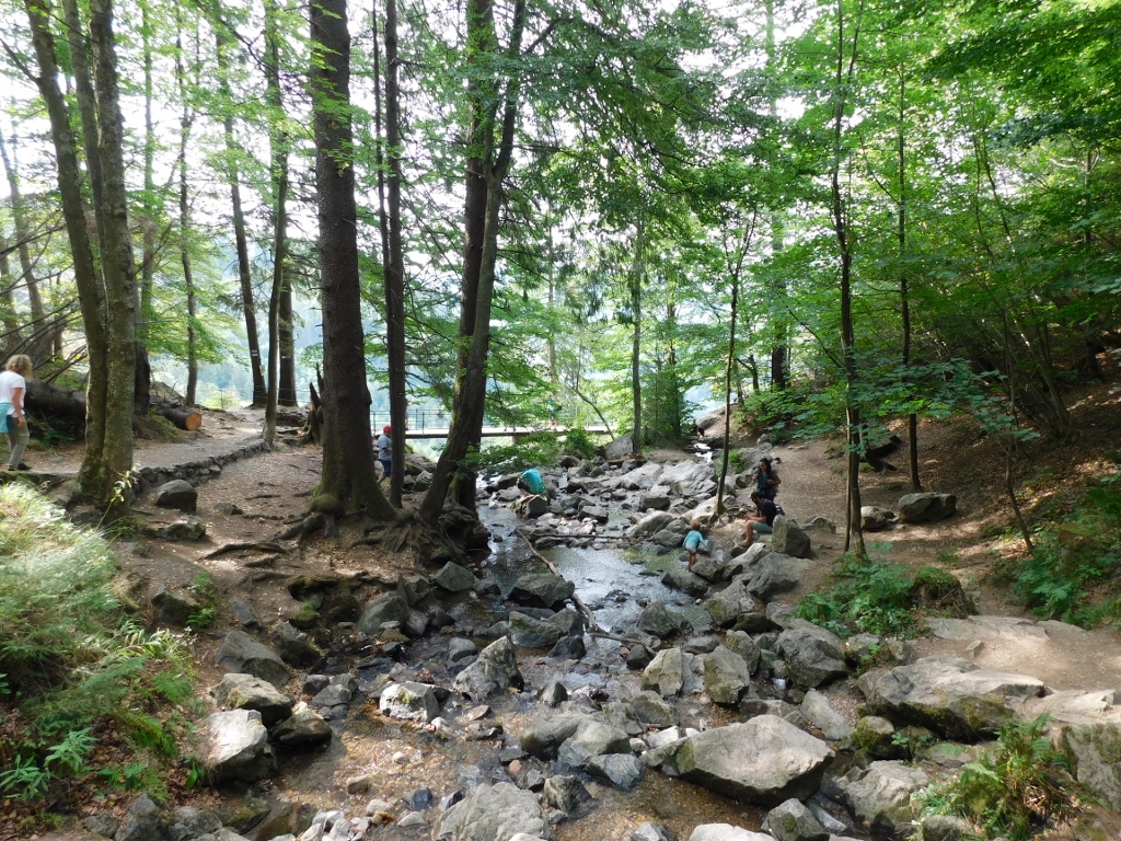 The Falls of Todtnau area
I was right as far as the view was concerned, but only when I got to the bridge did I realise that there was a much bigger waterfall that started from that point and that I could not actually see from this position. But, when I noticed people who were obviously at the bottom of the main waterfall, I simply gave up any idea of walking down there. In the following photo, in the middle of it, it is possible to discern some very tiny human figures – this creates the impression about the altitude difference.
 The Falls of Todtnau area
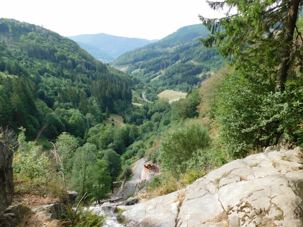
I saw a trail leading there, but I already had to descend down a very steep path when getting to this particular point and was worried about how I would get back to the car. The main reason for my concern was that these months I had certain issues with my right knee and during this entire trip I wore a soft knee brace in order to protect it and support it. I did walk a lot during this trip, but this was mostly walking along a relatively flat terrain.
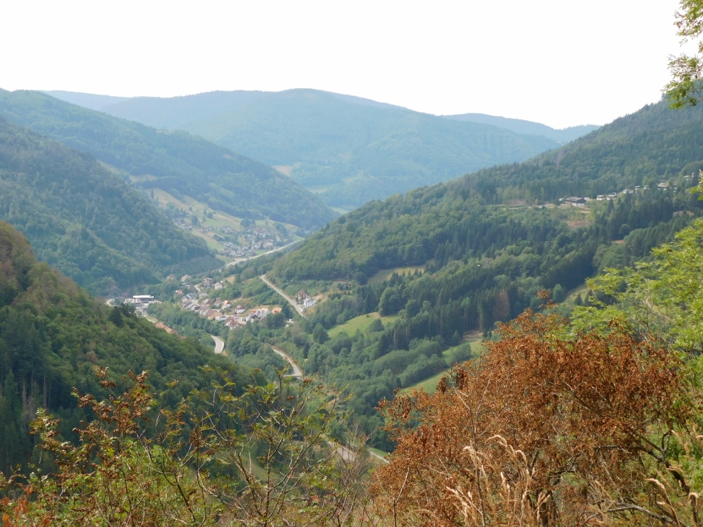
On the other hand, I could see an asphalt road leading to the bottom of the main waterfall and then I remembered that during my wandering with the car I had also noticed a road leading off from the main one, so I thought it would be easier to approach the waterfall from that side. Obviously, not by car. As it would turn out, my idea was quite sound, but as it happened there were some works on that side road at the time of my visit and thus the access to the waterfall, which is considered one of the most beautiful in Schwarzwald, was not permitted from that side. In other words, in the end I did not see the waterfall, that is, its main section, but I guess that was in the stars. As a consolation, while I was climbing back to the car, from one spot, when making a break, I could admire the area from a viewpoint.
 The Falls of Todtnau surroundings
So, I first went down by car to a parking lot from which it would be possible to approach the waterfall (it is only some 10 minutes away without any major ascent), but since that access path was closed, I continued to drive down by car and so I got to a place called Todtnau that gave the name to the waterfall(s).
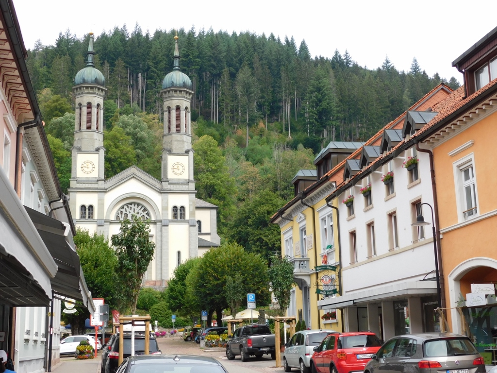 Todtnau: Church of St. John the Baptist (St. Johannes der Täufer)
Although Todtnau is a small town, there is still a nice town hall.
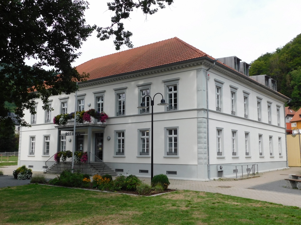 Todtnau: Town Hall (Rathaus)
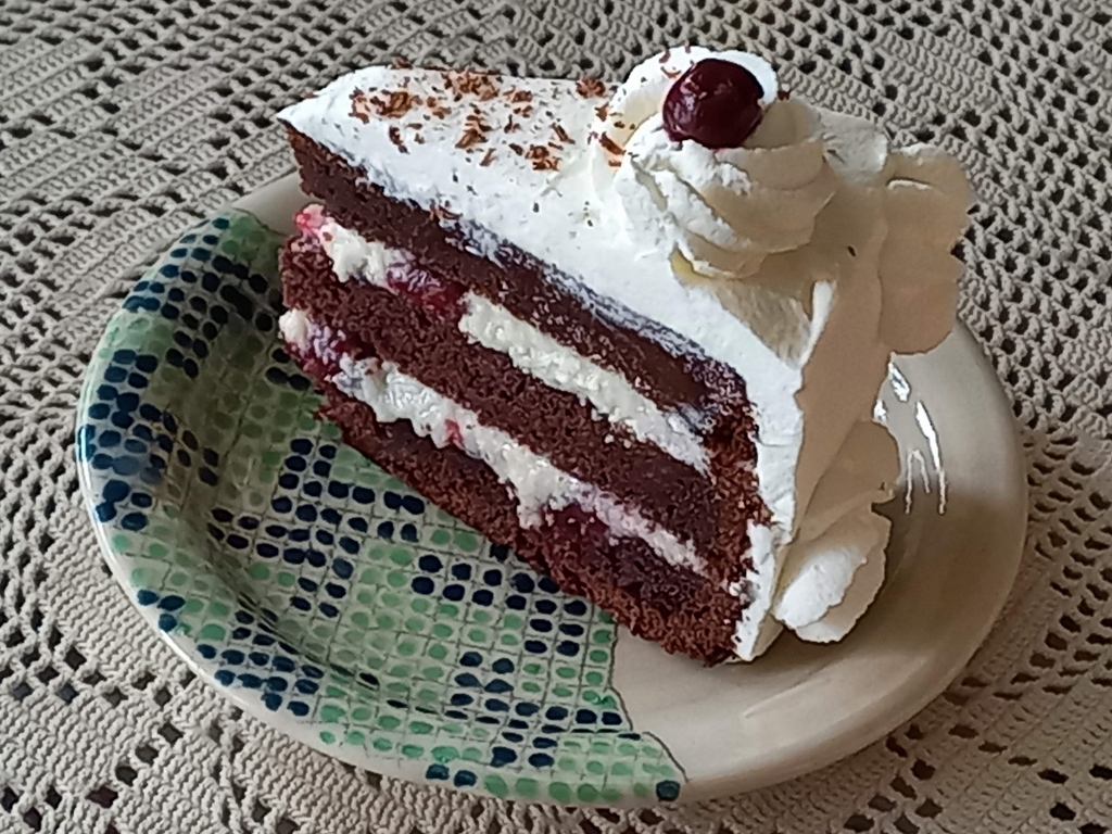
Todtnau is known as a sports centre and the place for hikers and bikers. But, this small town is also known for its annual festival dedicated to the Black Forest Gateau (Schwarzwälder Kirschtorte). Although I was not here during the festival, I thought I had to order a piece of the cake right there and right then when I was visiting Schwarzwald.
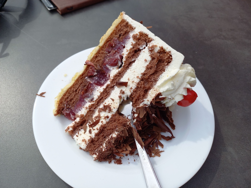 Black Forest Gateau in Todtnau
Still, I must say that I prefer my version of this cake, although the one I ate in Todtnau was not bad at all. I don’t actually make this cake the way the Germans like it, but I make it for myself and my friends who happen not to include any Germans, so the problem is solved and the cake gets eaten.
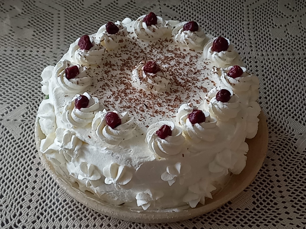 Black Forest Gateau
 Black Forest Gateau in my way and served on a place I personally made
Here is the recipe:
BLACK FOREST GATEAU
- 250 g butter
- 200 g sugar
- 200 g brown sugar
- 320 g all-purpose flour
- 140 g cocoa powder
- 2 tsp bicarbonate of soda
- a pinch of salt
- 3 eggs
- 180 ml sour cream
- 360 ml buttermilk
- 250 ml milk
- 3 tbsp cornstarch
- 125 g sugar
- 125 g butter
- deseeded sour cherries
- 500 ml double cream
- kirsch for the cake
Beat butter and sugar until pale and fluffy. Once you reach this stage, add the brown sugar and then mix some more until the sugar dissolves in the butter.
Sieve together the flour, cocoa and bicarbonate of soda. Leave on the side and then make the buttermilk, if you cannot find it in the shop. This is how to do it: measure 350 ml milk and then add 10 ml of apple vinegar and also leave it on the side.
Add the eggs, one at the time, to the butter and mix well. Then add the sour cream. Then add a half of the flour mixture. Once this is well incorporated, add the buttermilk. When this is well mixed, add the remaining flower and incorporate it well so that there are no lumps.
Bake at 180 degrees C. You can choose the size and the shape. I opted for a round cake and baked the batter all at once, but you can do it layer by layer. The point is that you need to have three tiers.
While the batter is baked and then cooled down, make the cream. Put the milk on the stove to warm up and take a couple of tablespoons of it while it is still cold and mix it well with the cornstarch. Then add the sugar to the milk. When the milk is almost boiling, add the mixture of the cornstarch and the cold milk and mix until it thickens. Let it cool a little and then add the butter and mix until the butter has melted. Let it cool completely.
Place the first layer on a plate used for the cake and brush it with some kirsch. You should not overdo this. Then put a half of the cream and arrange some sour cherries over it. Then put the second layer of the cake that should also be brushed with kirsch, followed by the remainder of the cream and some more cherries. Put the third layer of the cake on the top and brush it also with some kirsch.
Cover the cake with plastic wrap and leave in the fridge overnight. The following day, before serving, beat the double cream with some icing sugar and decorate the cake. The cake is traditionally additionally decorated with chocolate and sour cherries or candied cherries.
While I was enjoying the big piece of cake in Todtnau, I noticed on the slope south of the town a very interesting structure and even more interesting activities. This was a huge summer toboggan run called Hasenhorn Rodelbahn Todtnau.
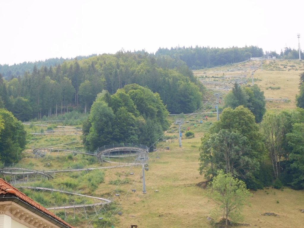 Hasenhorn Rodelbahn Todtnau
Those interested in the run go up to the Hasenhorn station by chairlift and then descend by the toboggan that is 2.9 km long! If you look at the photo below more carefully, you will notice at least two persons coming down the toboggan by carts.
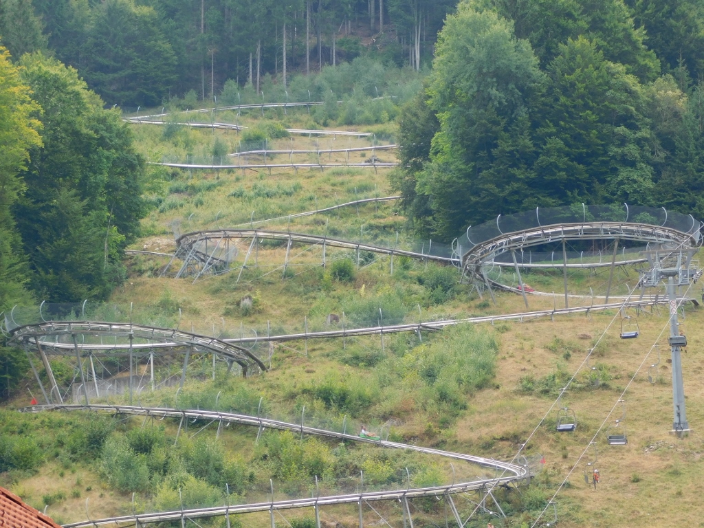 Hasenhorn Rodelbahn Todtnau
I was exceptionally inspired and on the verge of going there myself and coming down by the toboggan. I must admit that I regret not doing this, but there were many other things I wanted to do on this day and so, after the coffee and cake break, I went back to the car and drove to the nearby mountain Feldberg.
I left the car at a garage there and then I walked to the cable car.
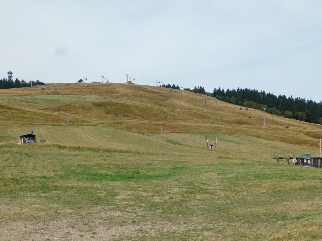 Slopes of Feldberg mountain and the cable car (you can also see the observation tower Feldbergturm up and to the left)
Feldberg is the highest mountain in the German region Baden-Württemberg and it would have been the highest in Germany, had it not been for the Alps. This means that it is a well-known centre both for summer sport activities, such as walking and hiking, as well as for winter sports.
The cable car runs from the tourist area with a hotel, restaurants and shops to the lower summit of the mountain called Seebuch which is 1448 m high (second highest).
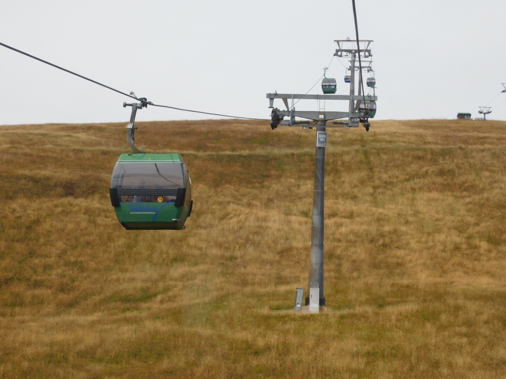 It’s easy to go up in a cable car
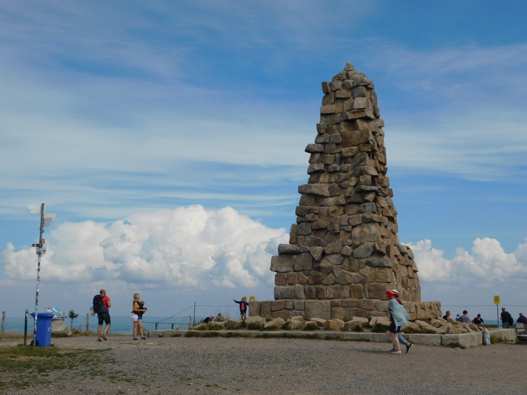
When you exit the cable car, you can see the Bismarck monument nearby.
 Bismarck monument
Namely, already from 1868, monuments to Bismarck (1815-1898) started to be erected throughout the German Empire or the German Reich because of his decisive role in the unification of the German states into the German Empire, which took place in 1871.
The same thing happened here, in 1885-1886, when a monument made of rubble stone with a portrait medallion was made on the summit of Seebuch, obviously while Bismarck was still alive.
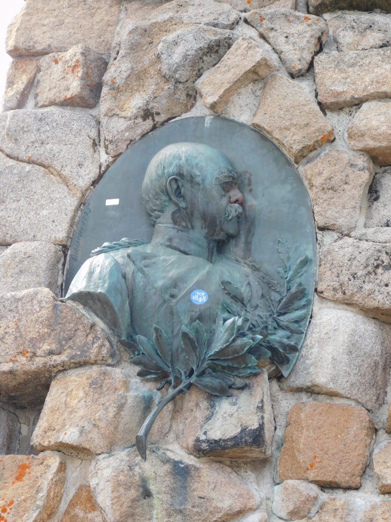 Bismarck monument, the front side
From the plateau in front of the monument, there is a very fine view at the surroundings, especially at lake Feldsee.
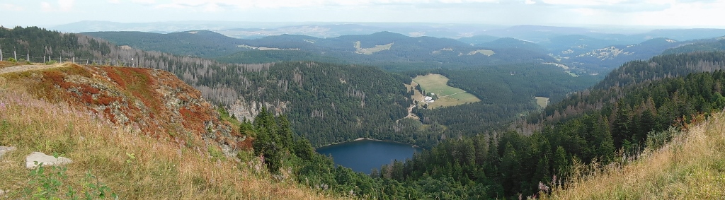 View at lake Feldsee and the surroundings
By the way, the tarn of Feldsee is a part of the Southern Black Forest Nature Park. Needless to say, I did not go down to the lake, but right there on the spot I decided to walk to the highest summit of the mountain, Feldberggipfel, that was some 2 km away.
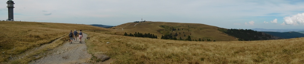 View at the highest point of Feldberg; Feldbergturm, an observation tower, is on the left
Feldberg is also under a certain degree of protection, by having a Nature Reserve here. This is the habitat of numerous vulnerable plants and animals, and thus there are notice boards with suggestions about the desirable behaviour of visitors. I did not need that because I just wanted to walk to the highest summit, 1493 m, and back.
The view at the surrounding landscapes was wonderful and I thoroughly enjoyed the walk.
 Feldberg: sights seen from the top – the northeast view
Near the summit, there is a TV tower, as well as a meteorological station, but there is also a round platform where hikers and bikers can rest.
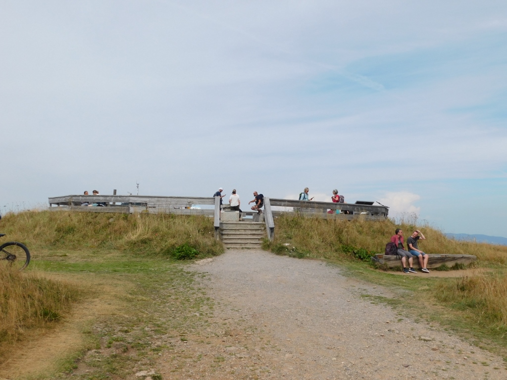 At Feldberggipfel which means Feldberg Summit
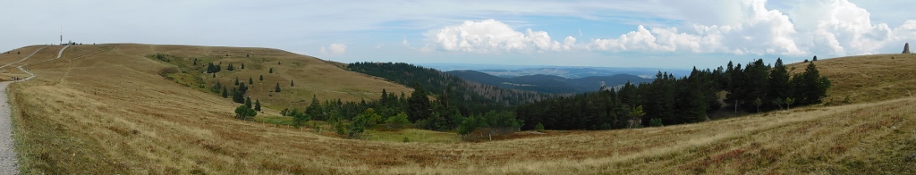
I looked at the surroundings from the platform a little, but nothing seemed more interesting that what I could observe along the way. So I started to go back, this time, following a wider asphalt path that is mostly used by bikers and that is certainly primarily earmarked for vehicles that need to reach the towers and the station.
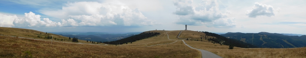
 Feldberg: sights from the top – the Feldbergturm observation tower to the left and in the distance, while the TV tower can be seen to the right and in the distance
 Feldberg: sights from the top – the Feldbergturm observation tower is in front of me
When I reached the cable car station, I simply went down to the ski centre and the garage, where I got the car and continued with my visit of the south Black Forest region.
Here is a short video that illustrates my experience with the cable car: