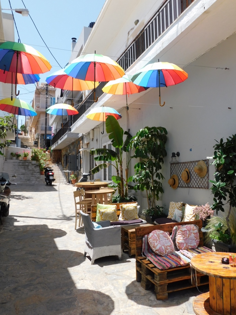
When I returned from Spinalonga islet back to Elounda by boat, I first went for a walk along the shore, but I was actually looking for a café. This was actually not difficult, just as it is not difficult in any other Greek town. On the one hand, there are plenty of restaurants and cafés, but on the other hand this can also be a problem for the person to choose only one. Although you can always move to yet another one.
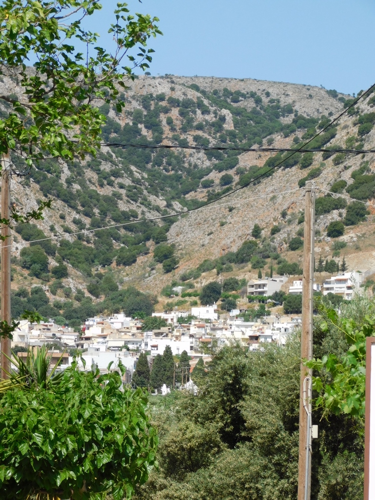
 Elounda
 Elounda
 Elounda
 Elounda
In the end I opted for a place by the sea and I took my seat there making a wonderful break. As opposed the previous days, on this one I had very little moving to do and I was quite lazy. It felt good.
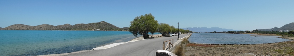
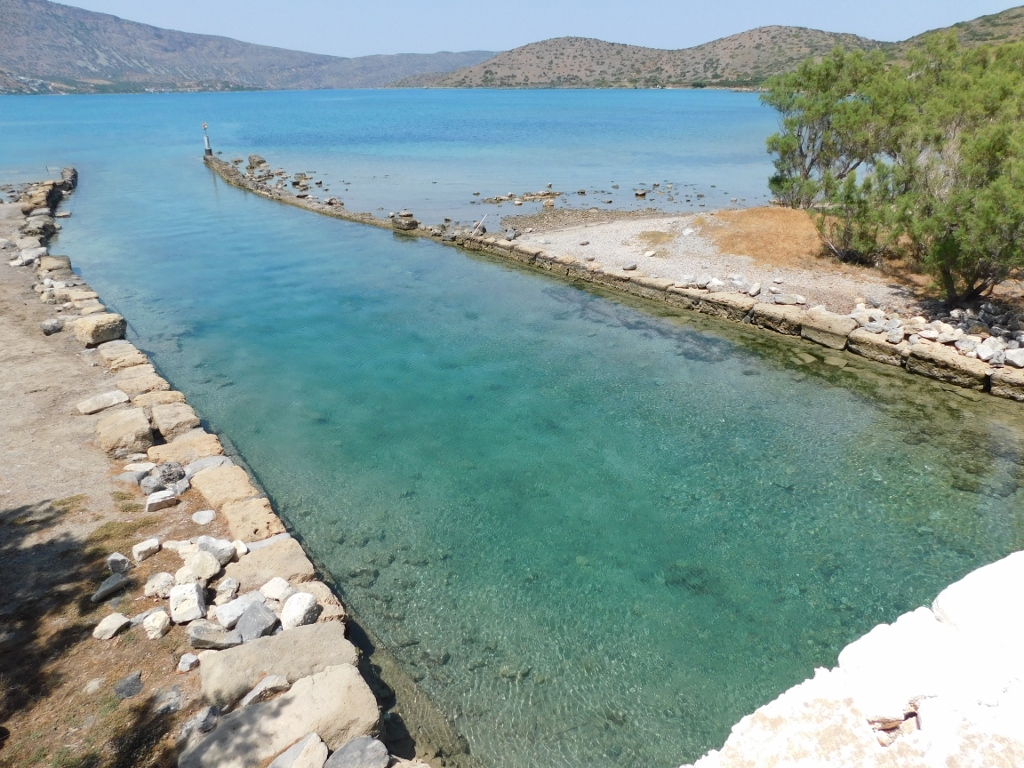
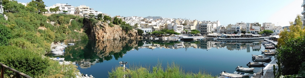
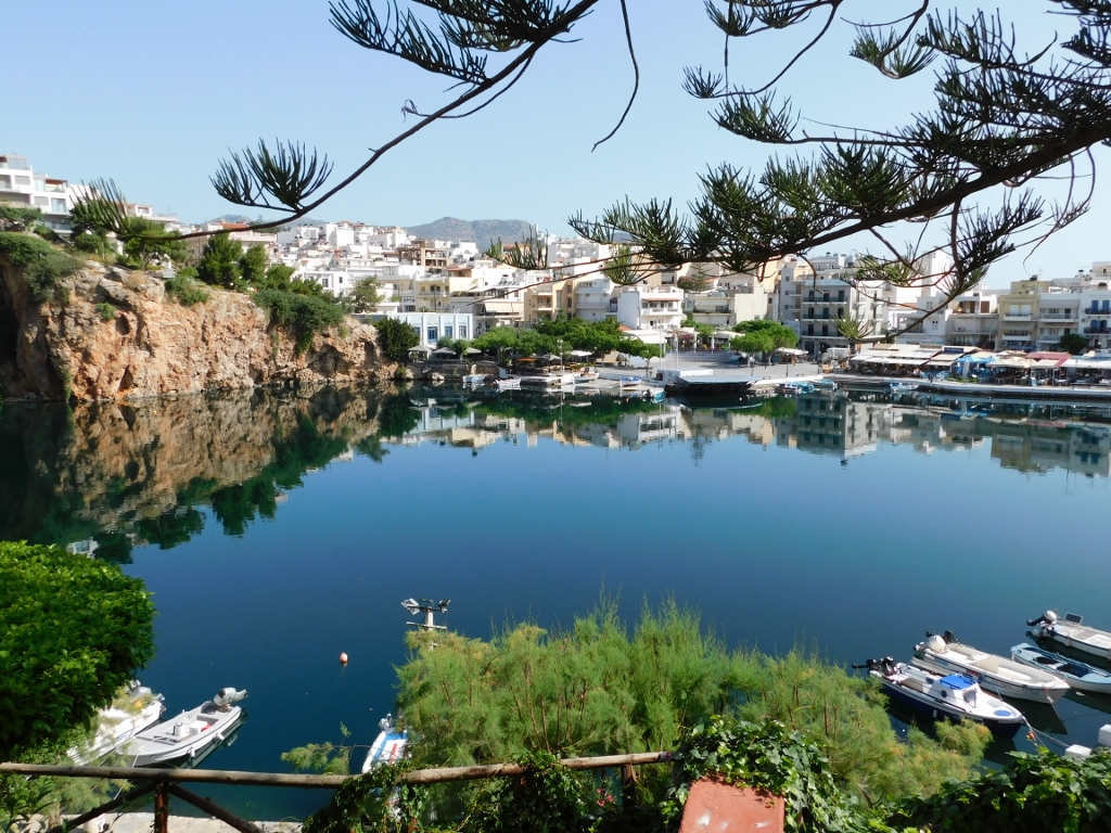
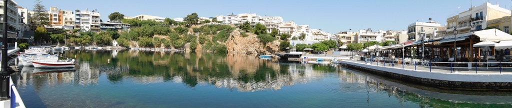
Still, after a while I continued with my leisurely stroll along the shore, since Elounda is in fact a very interesting place. Right next to it there is Spinalonga peninsula with which Elounda is connected by a disproportionately narrow isthmus which makes this Spinalonga a peninsula rather than an island.
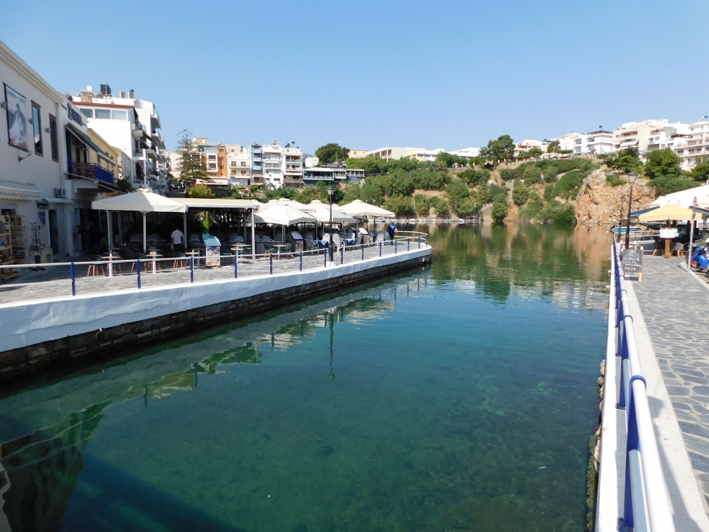
When you walk from Elounda towards the isthmus that starts already from the end of the urban settlement, you can notice a shallow entrapped body of water on the right-hand side.
 Beginning of the isthmus at Elounda
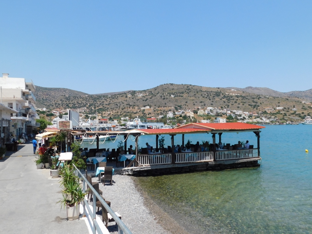
The Venetians developed a major production of salt here in the past, but this declined to a large degree during the Ottoman rule. The local population, however, continued with the reduced production of salt until the second half of the 20th century. Nowadays, Elounda is renowned as a seaside resort with luxury hotels, numerous restaurants and cafés, as well as warm climate and sea because of the shallow bay and the protection from the wind which allows for a long season when it is possible to swim in the bay’s waters.
 The isthmus at Elounda
 View at the shallow waters of the Chiona Beach
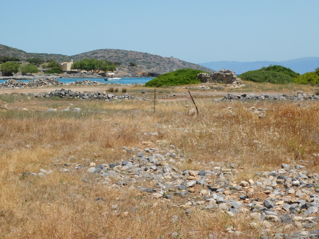
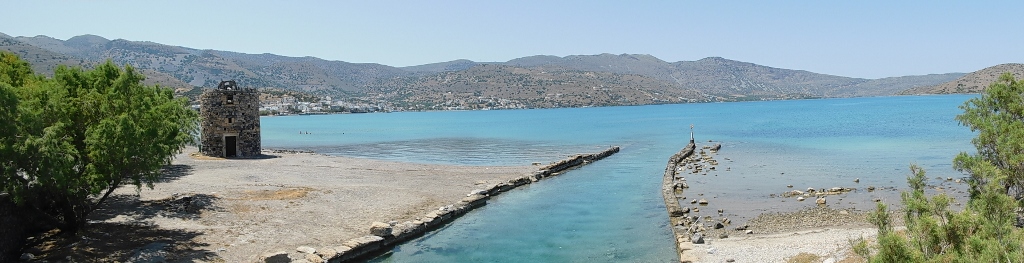
After this “lake” on the right-hand side of the isthmus there is a slightly wider stretch of land where there are remains of the ancient city of Olous. Olous existed already during the Minoan times, but it reached its peak in the period from the 5th to the 2nd century BCE. The settlement continued to function also during the Roman rule and there are mosaics from the 6th and 7th centuries CE found in this area. Still, what makes this site particularly interesting is that the settlement has meanwhile sunken in the sea.
There are different theories as to why this happened, from the volcanic eruption in Santorini, through earthquakes and to the natural tendency for all of Crete to “tilt” – the east parts of the island “decline,” while the west ones “rise”.
Be as it may, most of the remains of the ancient settlement are under water and in this piece of land it is possible to see only very sparse remains of walls. Still, it was interesting to walk there a little.
 Remains of ancient Olous
 Remains of ancient Olous
As I was walking here, I could hear a beautiful song – this was a small crested lark (Galerida cristata) that was in a great mood.
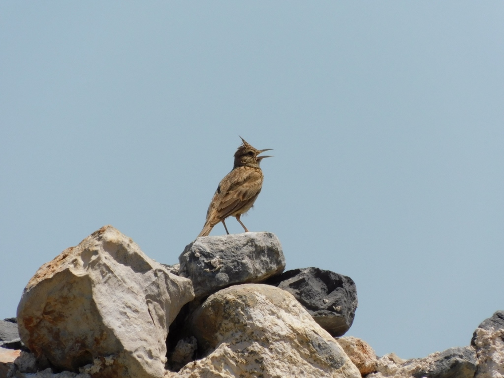 Crested lark lost in its song
When I got to the east part of this smaller piece of land with the archaeological remains, I could see nicely the south side of the isthmus, Spinalonga peninsula and the large Mirambelo Bay.
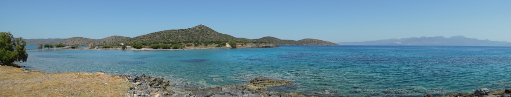 Waters of the Mirambelo Bay
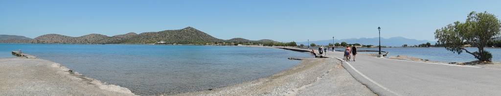
It was specifically important to see the isthmus itself and some of its parts from here. In the following photo, it is possible to discern a particularly interesting small bridge.
 Narrow isthmus leading to Spinalonga peninsula
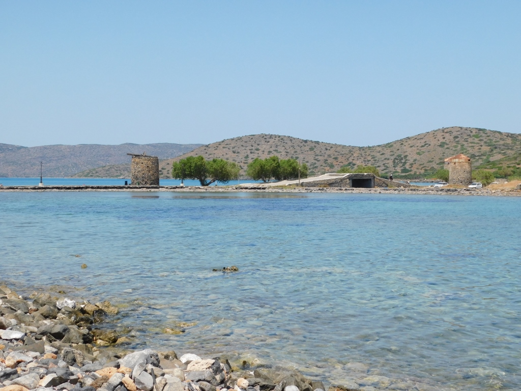
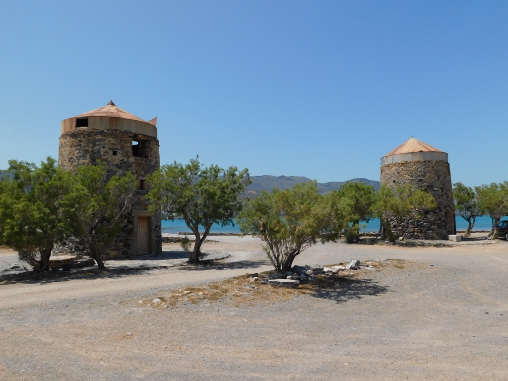
Now I walked over to the isthmus and the road that runs over it. There are three windmills here. They are of a circular shape and made of stone, but no longer in function.
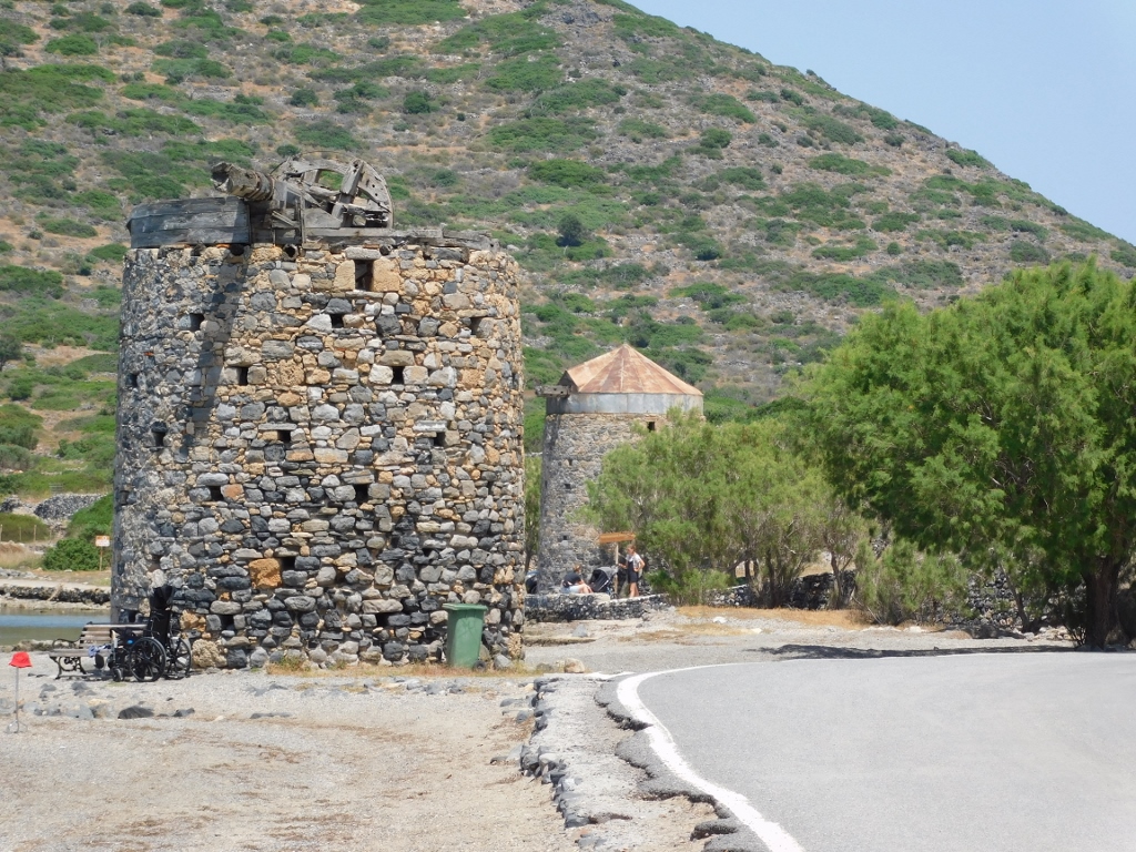 Remains of old windmills in Elounda
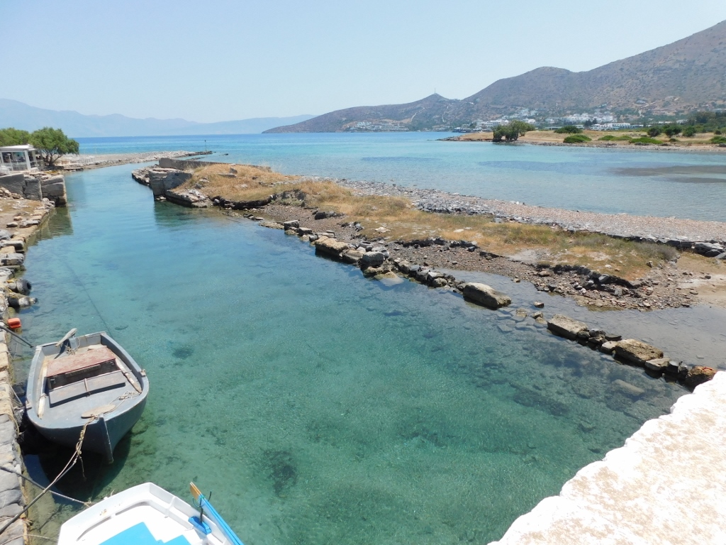
Right after the first windmill, the road ascends a little and passes over the small bridge that I have just mentioned. Formally speaking, Spinalonga peninsula actually became an island in 1898 because the isthmus was cut here when French soldiers dug out a canal.
 Canal through the isthmus dug out n 1898
Namely, in 1897 and 1898, the Ottoman Empire was slowly, but surely losing its grip on Crete and during this period the then Great Powers, Great Britain, France, Russia and Italy, had their troops here.
 Canal at Spinalonga peninsula: north view
 Canal at Spinalonga peninsula: south view
Having moved to Spinalonga, I took another photo of the windmills and then I walked to the nearby remains of an early Christian basilica.
 Remains of old windmills on Spinalonga
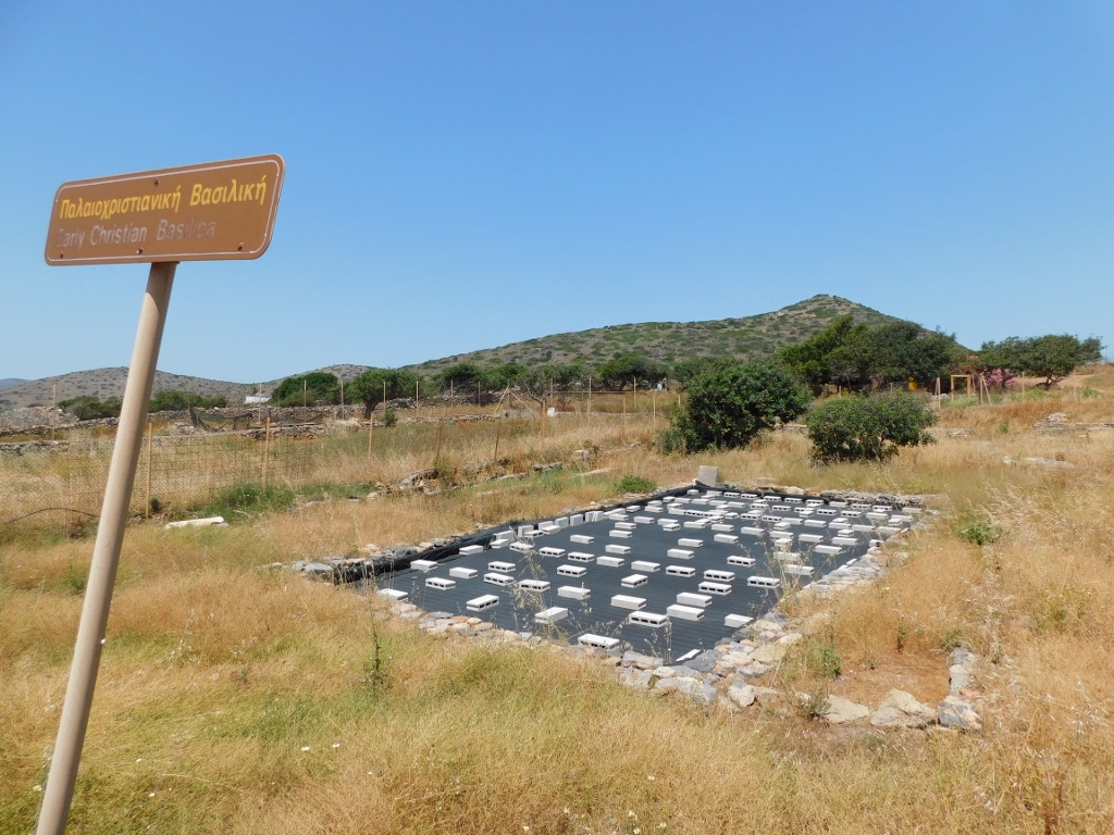 Remains of an early Christian basilica; I presume that a (protected) ancient mosaic is here
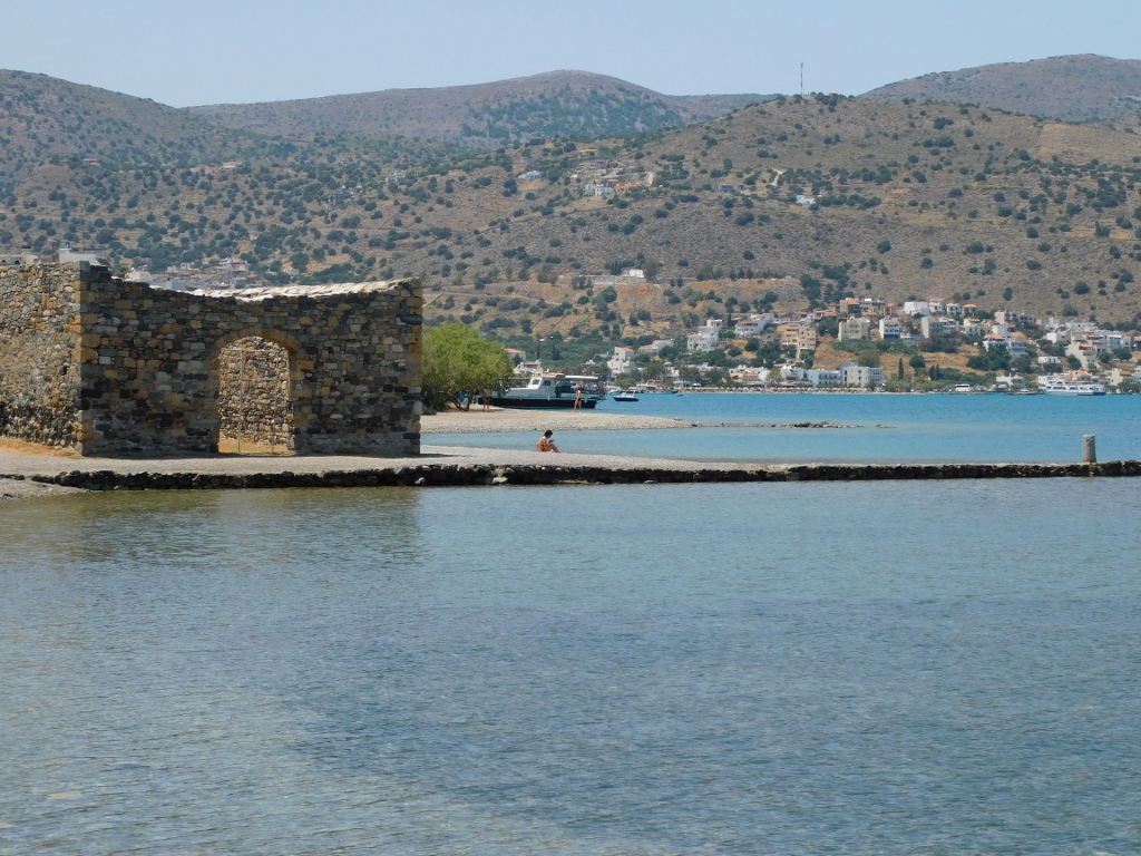
Although it is possible to walk around the peninsula since there are, according to what I’ve read, a well marked trail, as well as several smaller ones, plus picturesque beaches, I did not go that way. What I actually did was to go back to Elounda and the parking lot where the rented car was waiting for me. Once more I had a look at the nearby Shisma Beach and then I returned to the hotel in the suburbs of Agios Nikolaos.
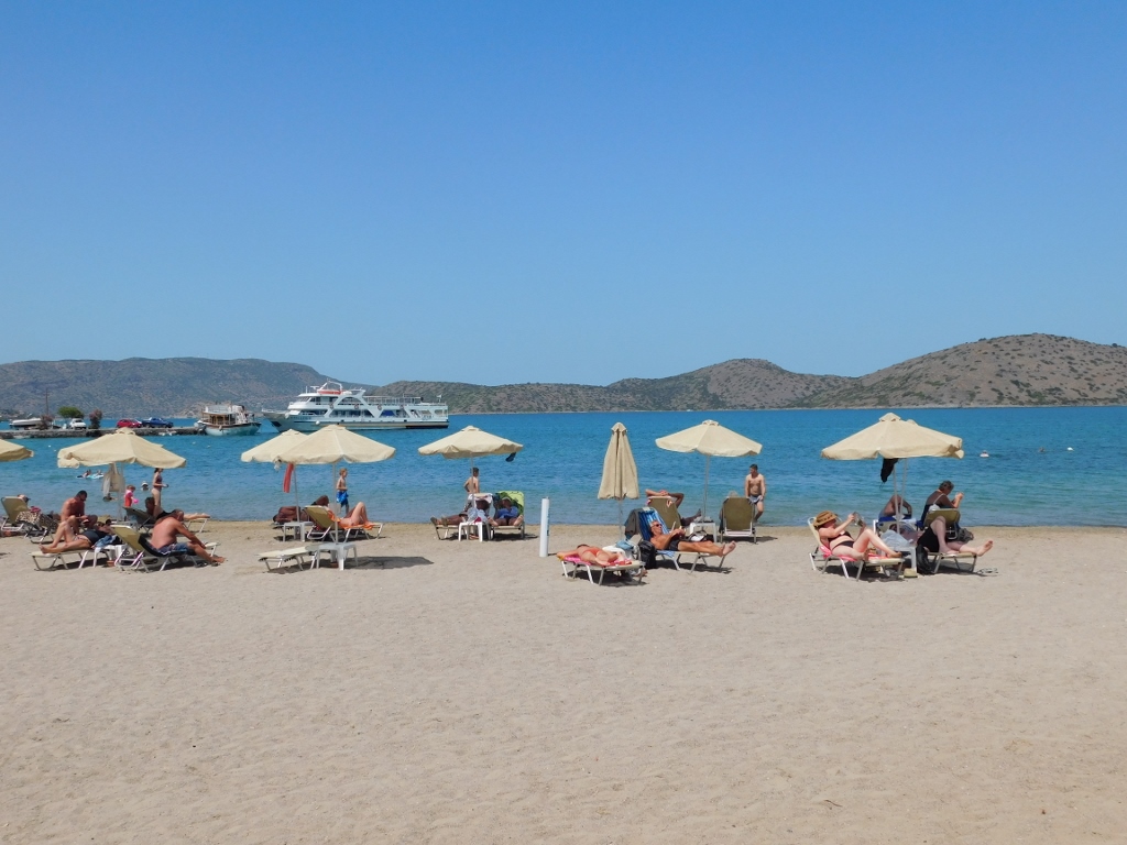 Shisma Beach
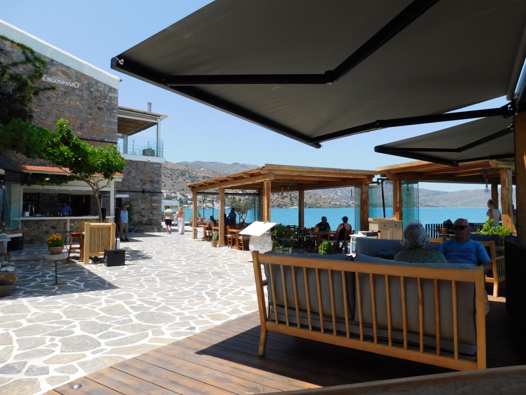
I was quite lazy this afternoon and I mostly spent it on the balcony of my hotel room or by the pool, in both places thoroughly enjoying the nice view. This was really starting to look like a proper summer vacation, but I knew it was the end, since already the following day I was to continue with the driving and doing the sightseeing. I took advantage of this lazing around to prepare a map with the places that I planned on visiting the next day. And, since I organised the issue of food much better than the day before, as I was waiting for the day to end I could enjoy in yet another cocktail accompanied by a splendid view at Mirambelo Bay.
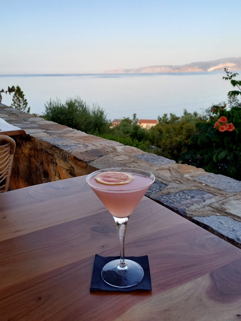 A cocktail with a view
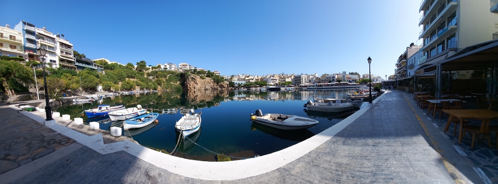
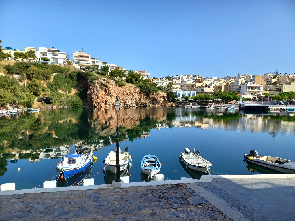
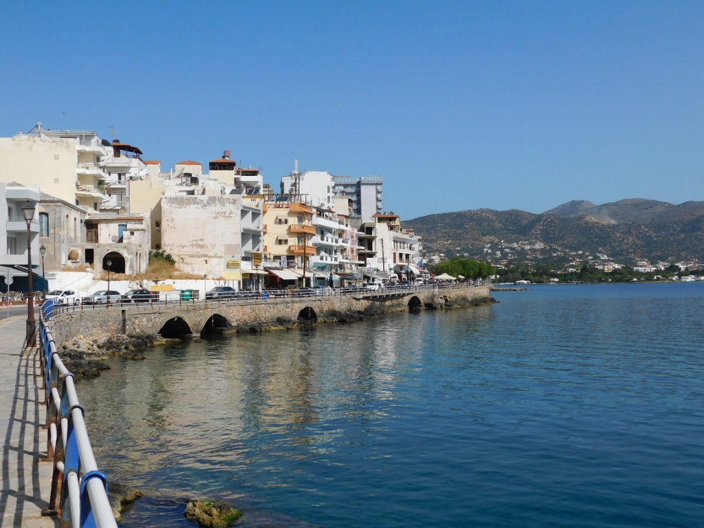
So, the next day I transferred to the centre of the city of Agios Nikolaos where I first needed to find a parking lot and then I walked around. This is certainly a pretty place, but probably its main attraction is Lake Voulismeni that is situated in the centre of the city.
 Lake Voulismeni
 Lake Voulismeni
I was quite enchanted by the lake that I approached from up high and then, while descending to its bank, I just kept on taking photos.
 Lake Voulismeni
 Lake Voulismeni
Once upon a time, it was believed that goddesses Arthemis and Athena bathed here and people also used to think that the lake had no bottom. As for the bathing of the goddesses, this has never been either corroborated or seriously disputed, but it has been definitely ascertained that the lake is almost 50 m deep which actually makes it deeper than the surrounding sea.
 Lake Voulismeni
The lake used to be mostly made of freshwater, but with enough mixing with the seawater to make its water not potable. However, over time (it is presumed after the 1856 earthquake), the source of freshwater was interrupted and the lake turned into a rather stinky pond. The solution was found in a canal that was dug out in 1870 and that nowadays connects Lake Voulismeni with the sea.
 Canal that connects Lake Voulismeni with the sea
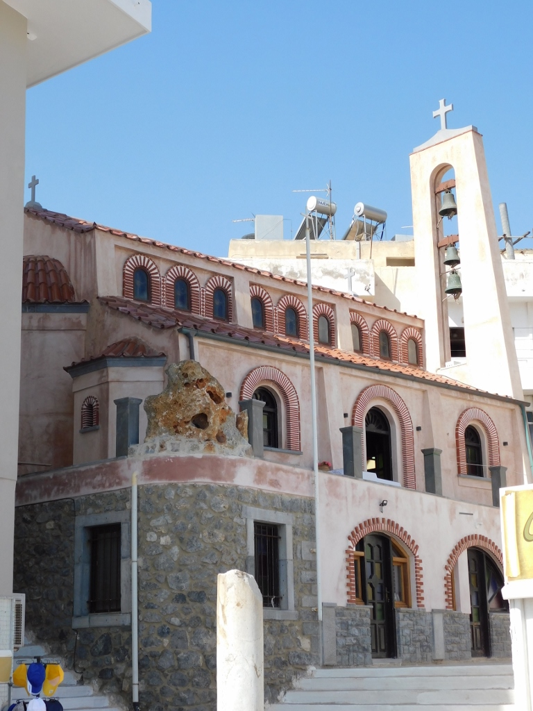
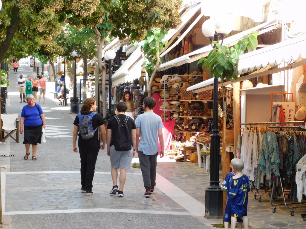
Originally, I planned to have a seat at a café in the city, but I was actually still quite full from the breakfast. That’s why I only briefly walked by the shore and one of the numerous churches in the city, as well as along a pedestrian street that is, needless to say, full of souvenir shops. Soon I was back at the parking lot and the car, and could continue with my sightseeing of this area.
 Agios Nikolaos, a detail
 Agios Nikolaos, Church of St. George
 Agios Nikolaos, a detail
Now I headed for the hills and a lovely village named Kritsa, but before getting there I stopped at the Church of the Virgin of Kera which everybody calls by the Greek version of the name – Panagia Kera Church. The church is situated right next to the road leading to Kritsa.
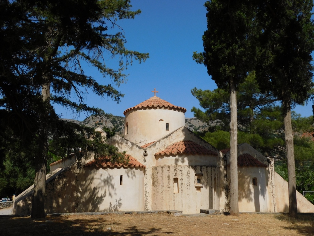 Panagia Kera Church
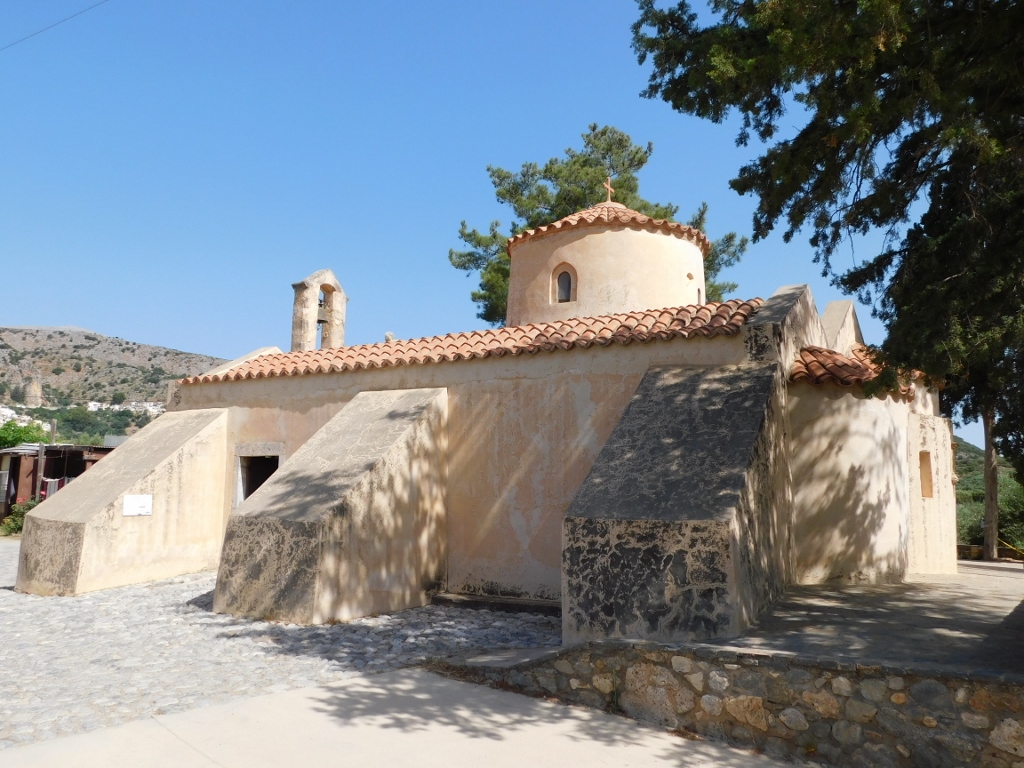 Panagia Kera Church
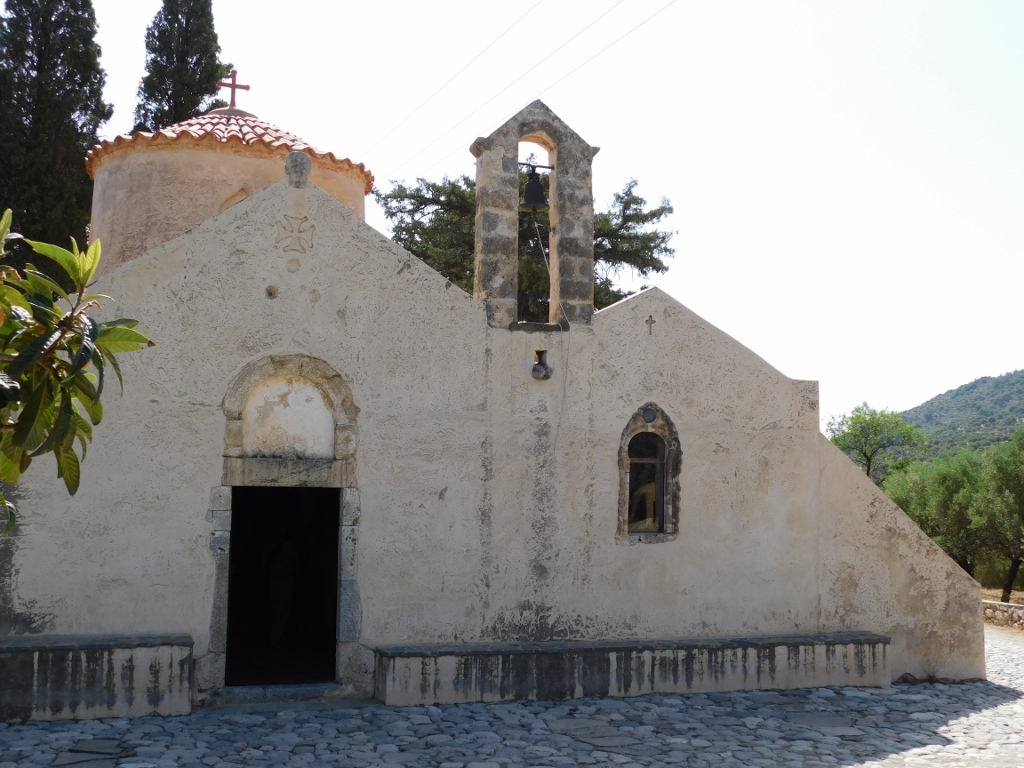 Panagia Kera Church
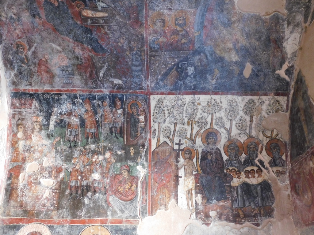
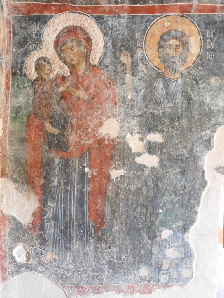
This is a small three-nave church from the 13th century. What makes this church particularly important are the exceptionally beautiful frescoes from the 13th and the 14th centuries that are practically the best preserved frescoes from the Byzantine period on all of Crete. For this reason, in order to get into the church the visitor must buy a ticket, but it is absolutely worth it.
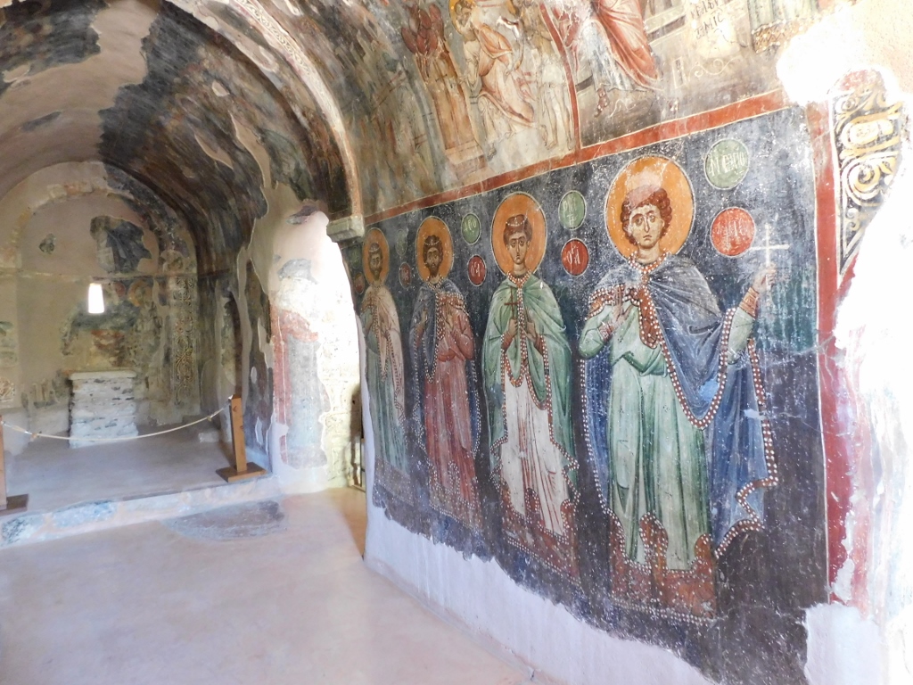 Panagia Kera Church, a detail
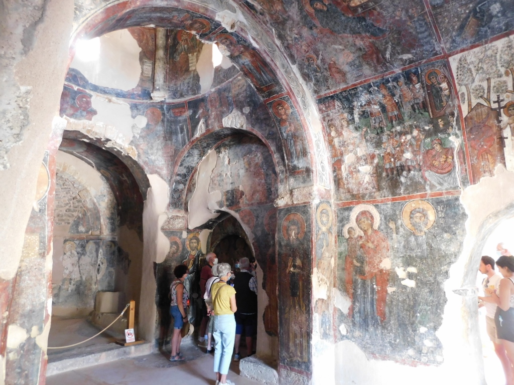 Panagia Kera Church, a detail
 Panagia Kera Church, a detail
 Panagia Kera Church, a detail
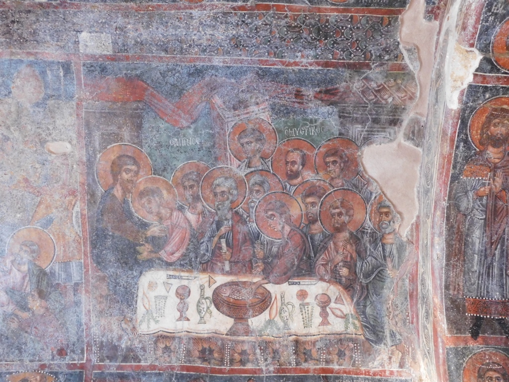 Panagia Kera Church, a detail
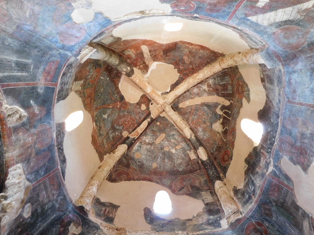 Panagia Kera Church, a detail
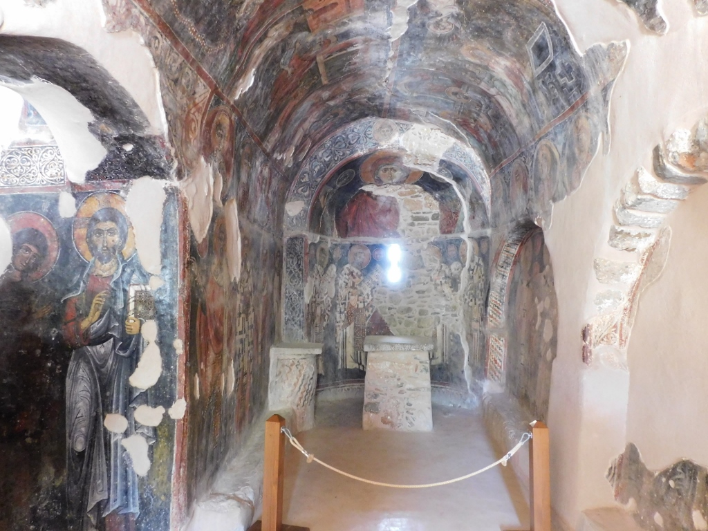 Panagia Kera Church, a detail
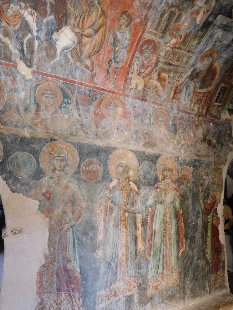 Panagia Kera Church, a detail
Although I could see village Kritsa located on a slope of a hill from the surroundings of the church and from the road, after the visit to the church I actually first drove to the remains of the ancient city of Lato to be found some 3 km north of Kritsa.
 View at Kritsa
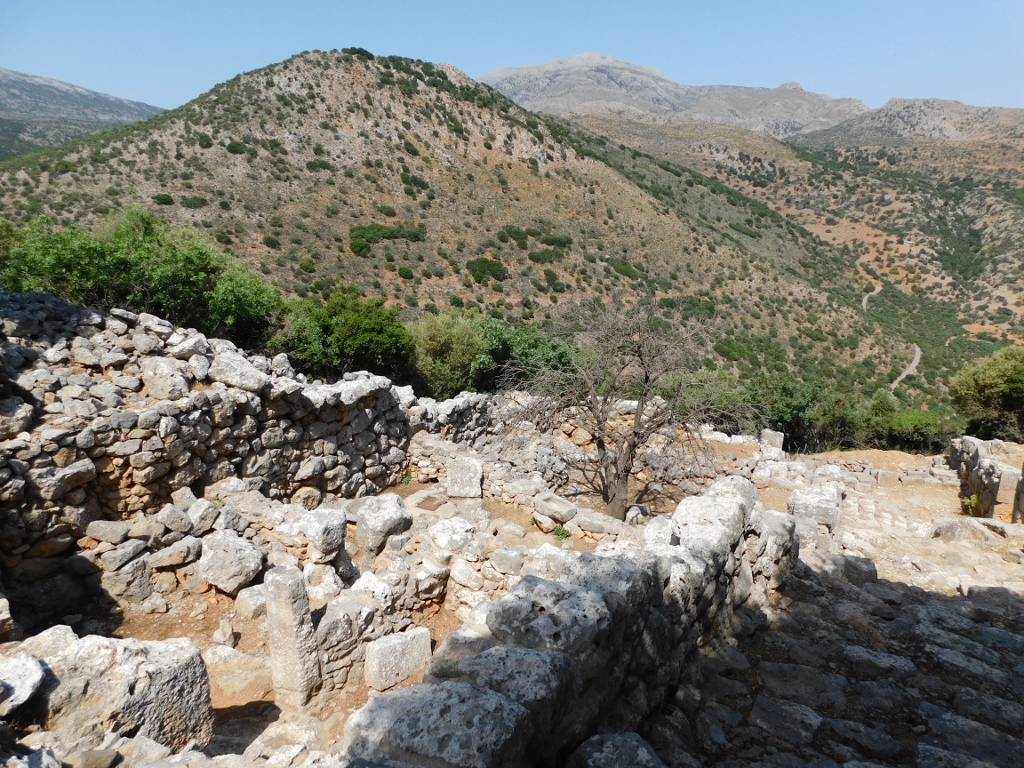
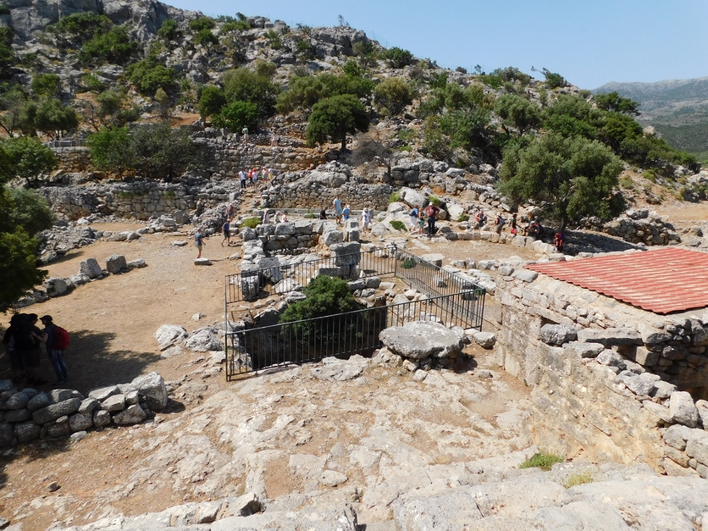
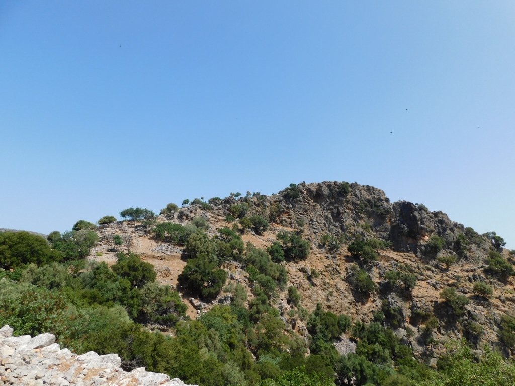
I parked the car, bought a ticket and started to climb towards the archaeological site. The view at the surrounding hills and valleys was superb.
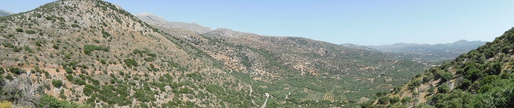 Surroundings of the archaeological site of Lato, view in the westbound direction
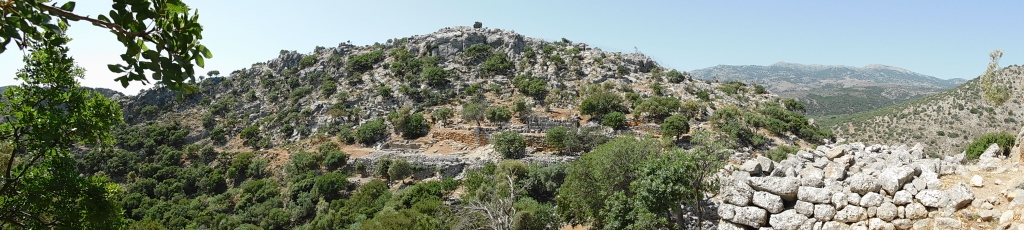
At first sight it may seem odd that this city-state was ever built in such a place, between and over the slopes of two neighbouring hills. However, this position allowed for a full control of the passage from east to central Crete and for this reason the earliest finds at this site show that the place was inhabited already from the 12th century BCE. But, this fortified city reached its heyday only later and most of the ruins date back to the 5th and the 4th centuries BCE. The city was destroyed and abandoned around the year of 200 BCE.
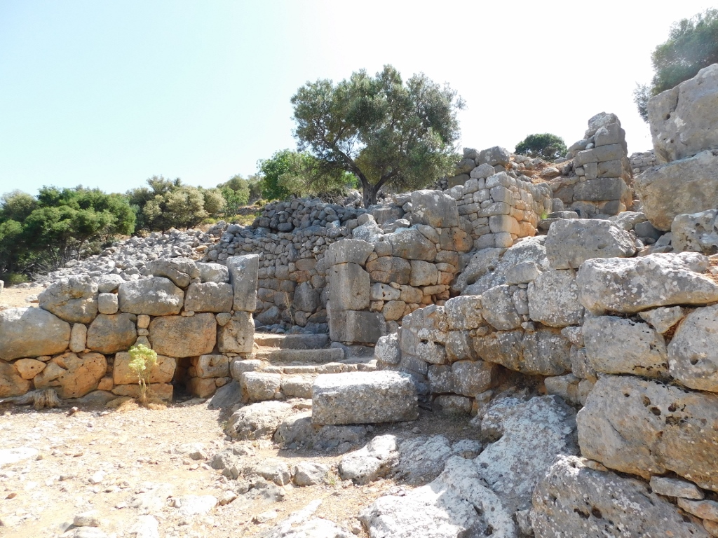 Lato: the main access
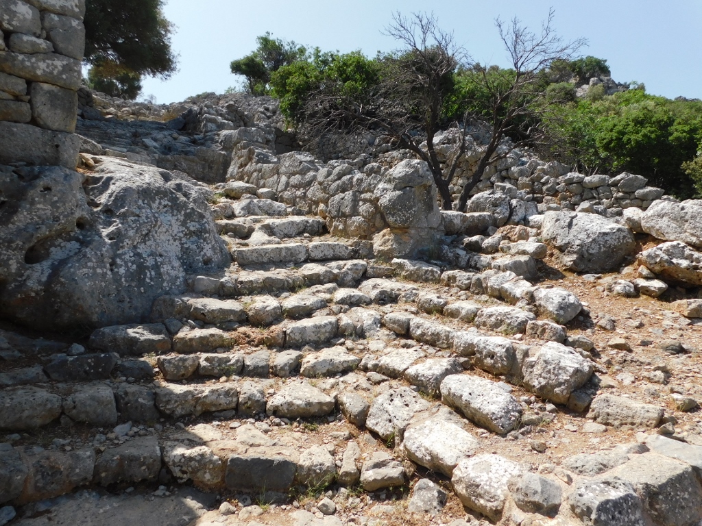 Lato: steps that are a part of the main street
 Lato: shops and workshops are to the left, while the section of the main street I have already climbed is to the right
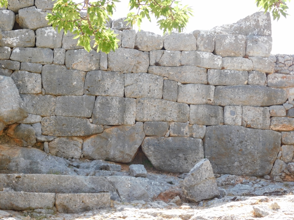 Lato: a support wall
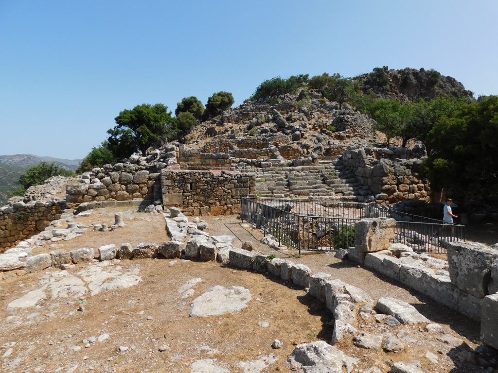
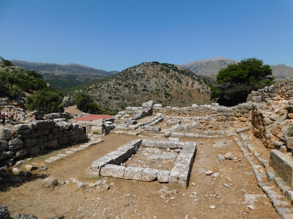
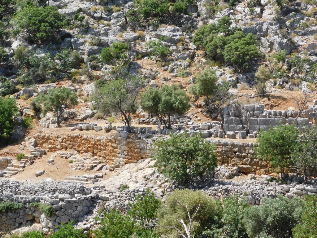
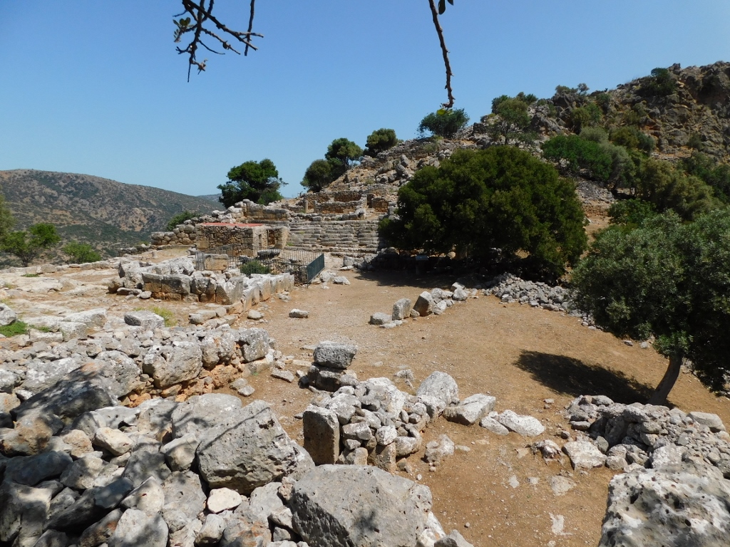
After the comparatively steep ascent from the entrance to the site, the main street leads to agora – an open space between the north and the south acropolises. The acropolises were built on the summits of two neighbouring hills, while the agora is situated on the saddle.
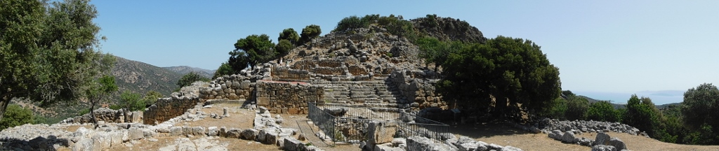 Lato: the agora and the north acropolis
Remains of several buildings may be seen within the agora, including a stoa, an open platform and an open-air temple, as well as a large underground cistern.
 Lato: the agora, a detail
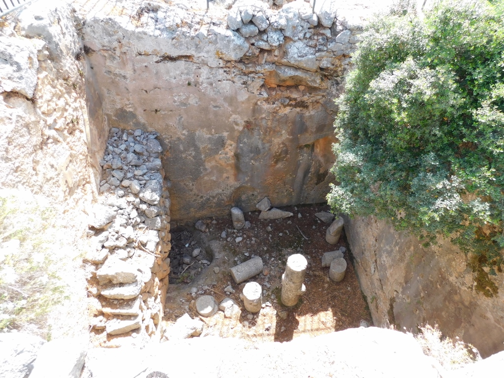 Lato: the underground cistern
On the north side of the agora there is a monumental staircase that served also as a place of gathering with steps divided in three sections that were used as sitting benches. The staircase used to lead to a prytaneion, which is the name give to a building in ancient Greece where representatives of the city authorities used to meet.
 Lato: the monumental staircase
 Lato: the prytaneion
From the top of the monumental staircase there is a fine view at the agora, as well as at the south acropolis on the slopes of the neighbouring hill.
 Lato: view at the agora
 Lato: the south acropolis
 Lato: the south acropolis, a detail
But, from here, there is also a splendid view at Mirambelo Bay and the present-day Agios Nikolaos.
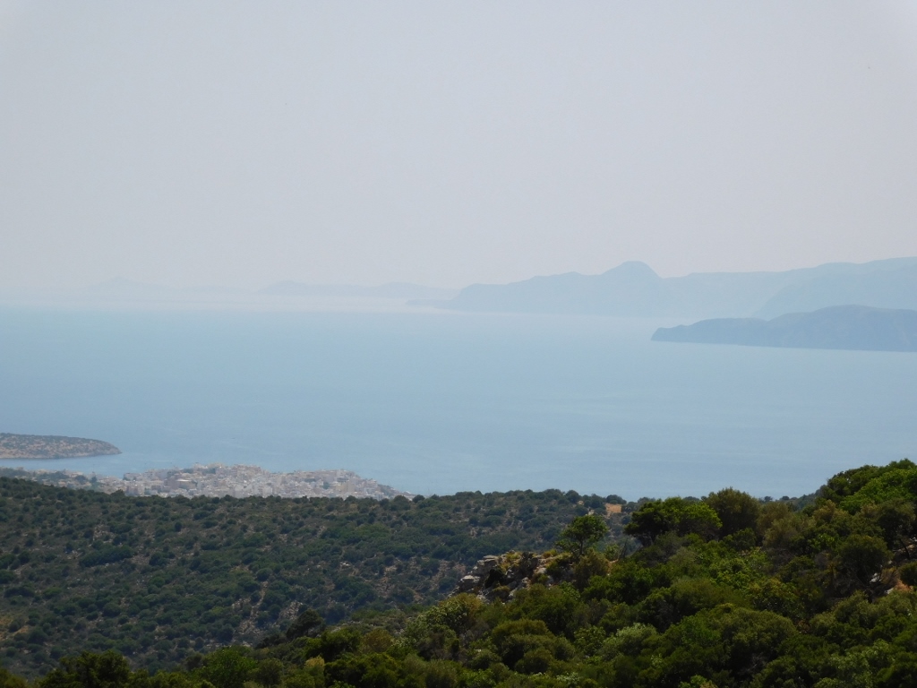 Lato: View at the Mirambelo Bay
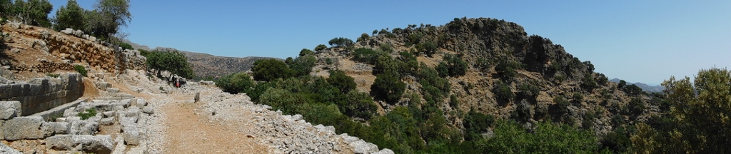
As for the south acropolis, in one of the previous photos it is possible to see support walls of a terrace and remains of the Temple of Apollo built on that terrace in the 4th-3rd century BCE. I did not plan to climb up there, but I did walk along a path that led me to the remains of a theatre that are also located on the south hill.
 Lato: the remains of the theatre
From there, I looked again at and took photos of the theatre, the path and the north acropolis when I noticed something exceptionally interesting, but not on the ground – it was in the sky.
 Lato: the view at the north acropolis
Oh, yes... there were several Eurasian griffon vultures (Gyps fulvus) flying above the north acropolis and I was absolutely delighted that I noticed them in the first place, plus I even managed to take a couple of photos of them in mid-flight.
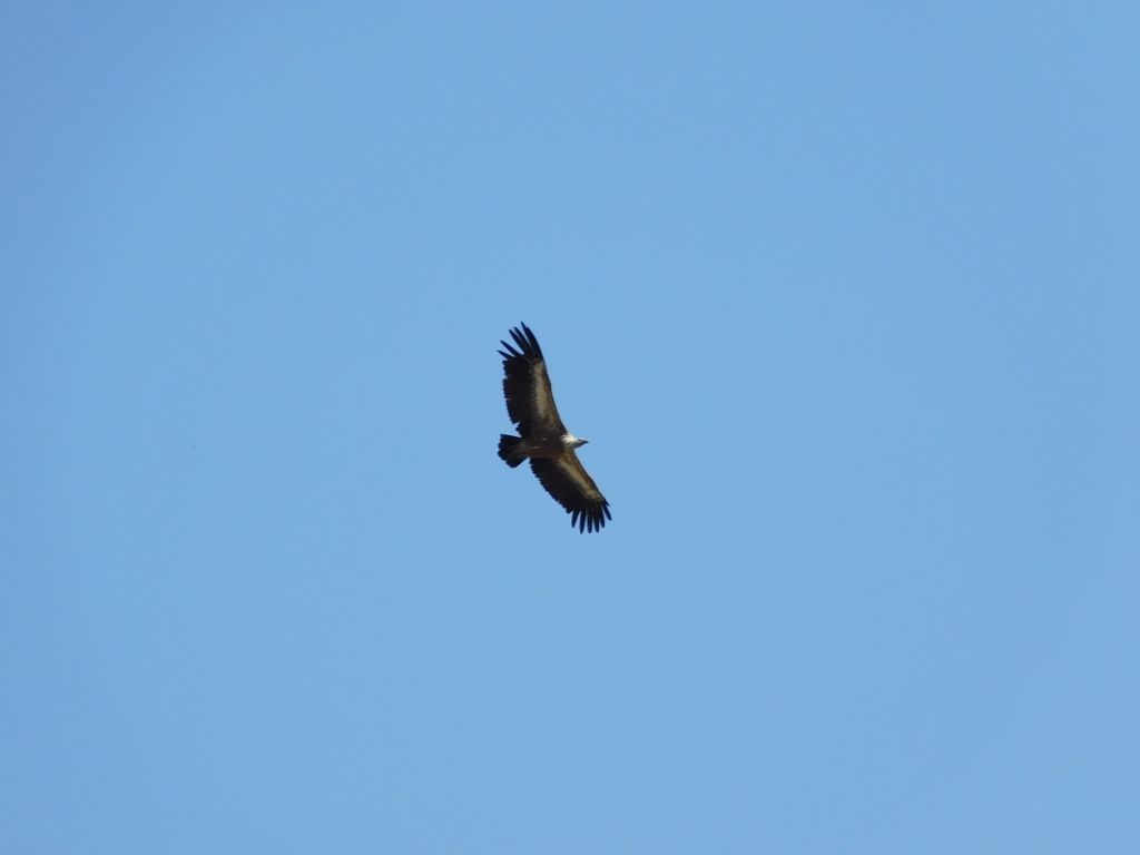 Griffon vulture
If you look at the photo below a little more closely, you can notice three griffon vultures on the right-hand side of the sky.
 North acropolis of Lato and griffon vultures
Having spent some time looking at the birds, before they flew away and disappeared from my sight, I returned towards the agora and soon after I went down to the car in order to continue with my sightseeing. The next destination was village Kritsa.
 Lato: view at the agora