During my visit to Crete in May 2022 I rented a car in the second half of my stay there and after a visit to a couple of beaches and an archaeological site in the northeast of the island, I continued my journey by heading along the north coast in the westbound direction.
Here is again the map that shows all the places I visited during this journey:
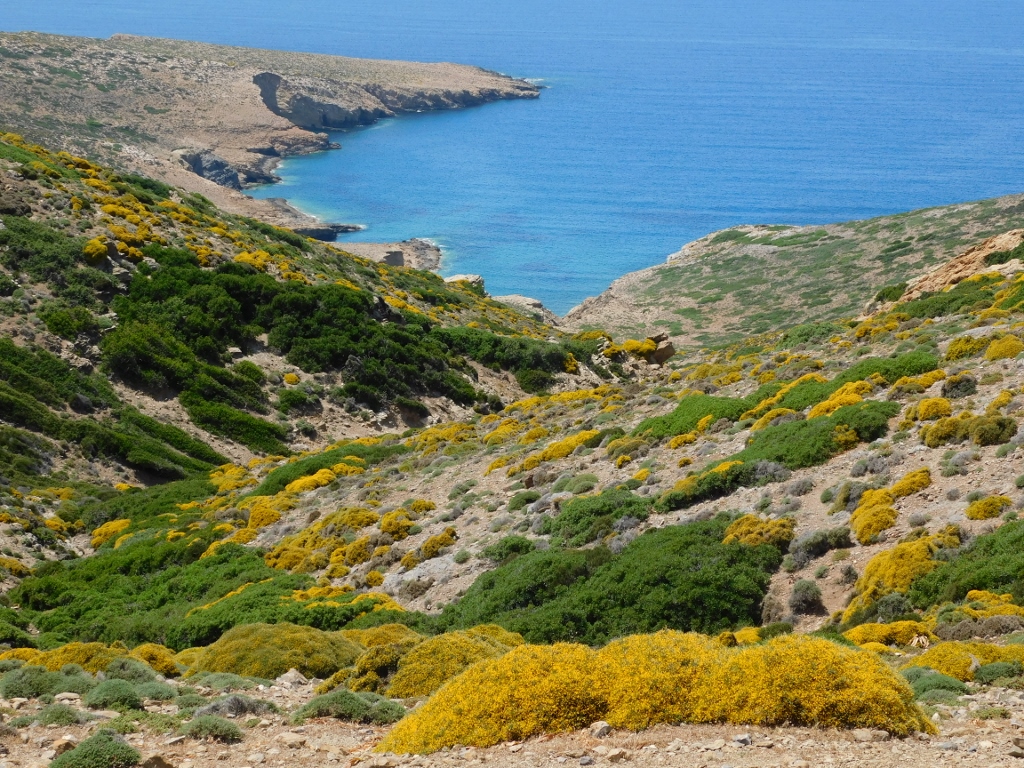
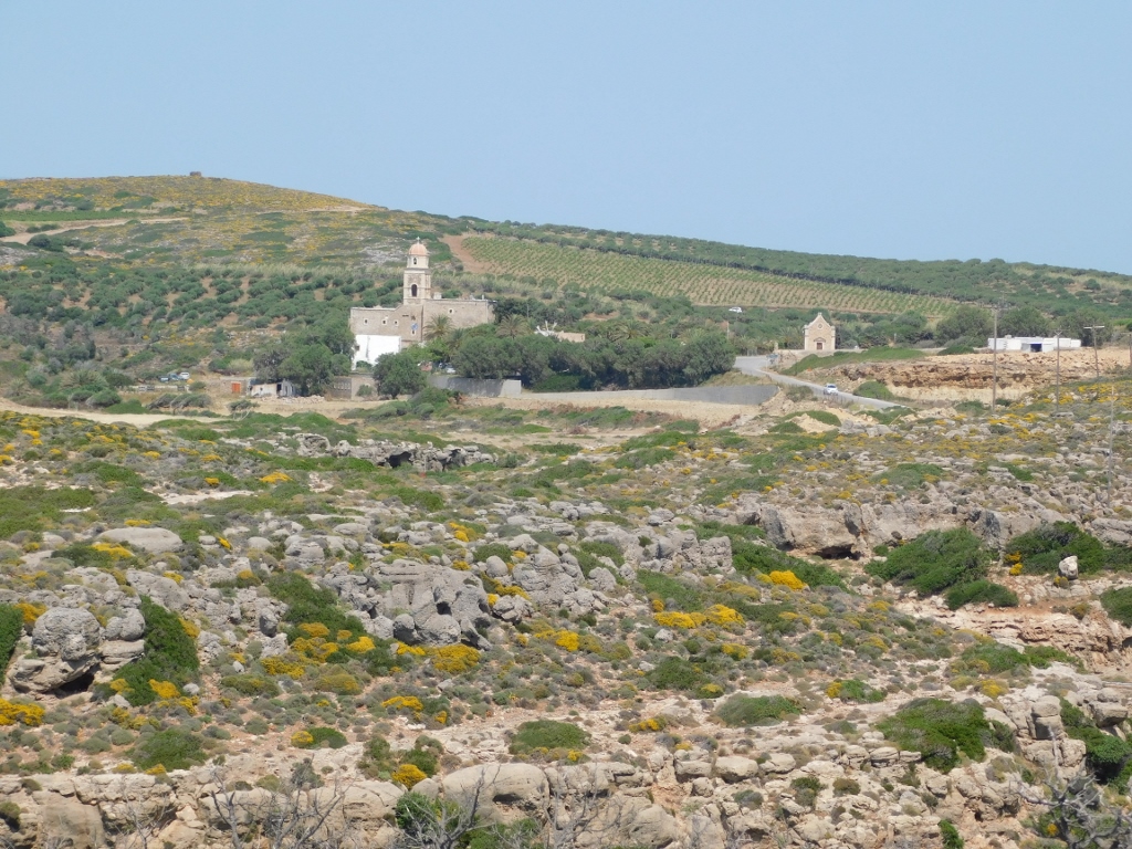
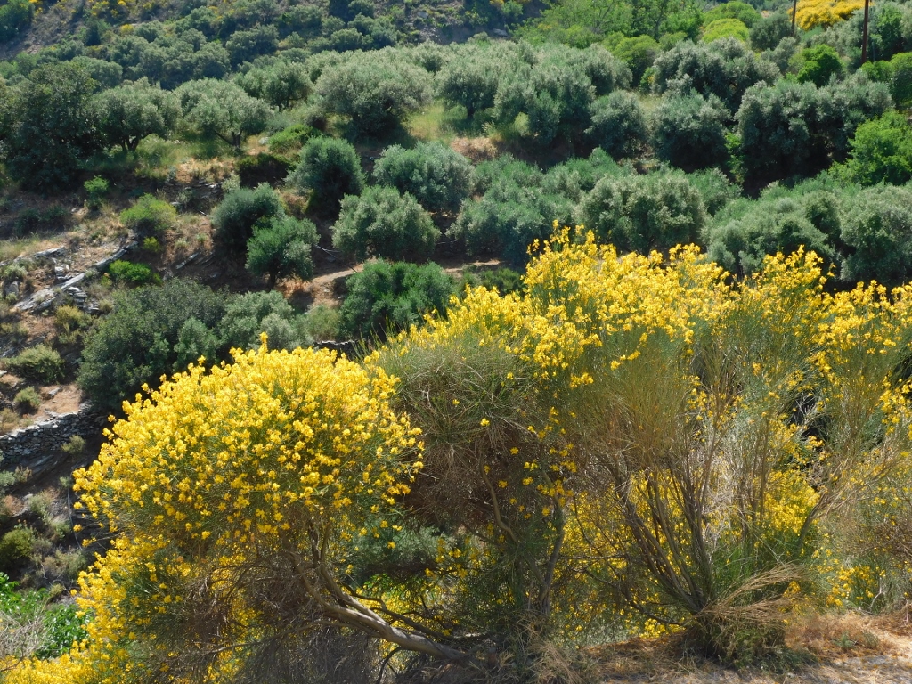
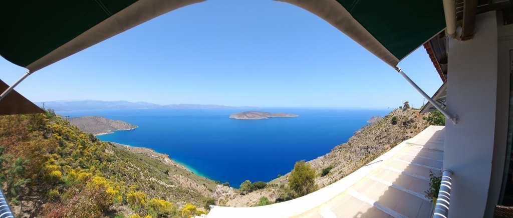
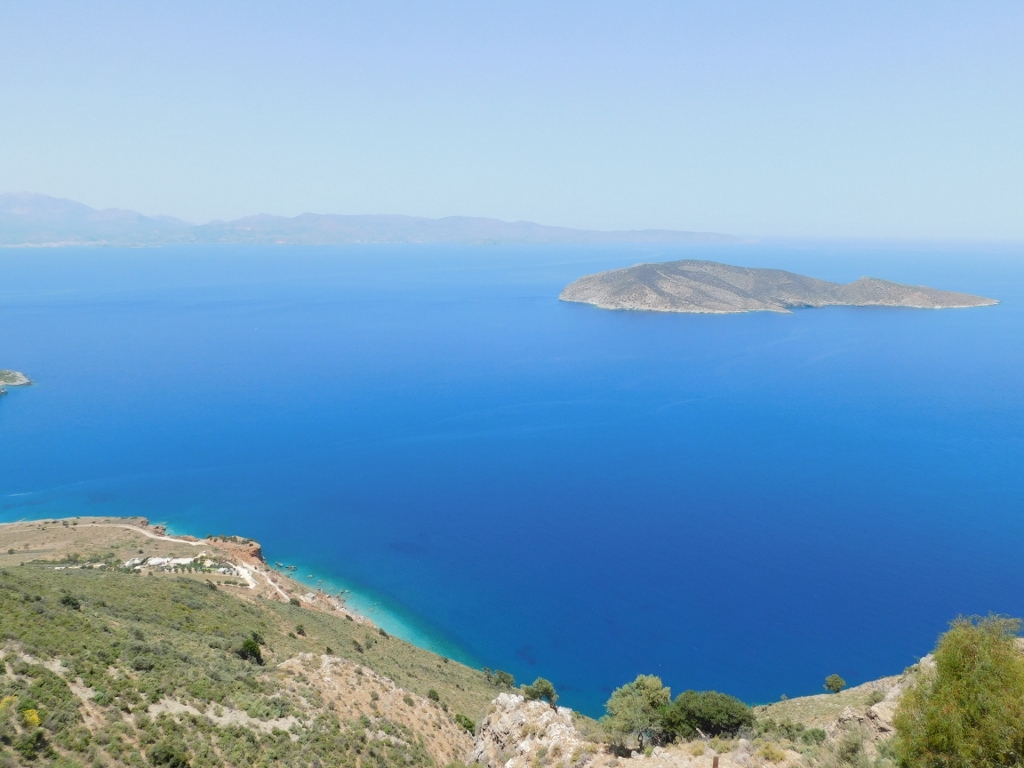
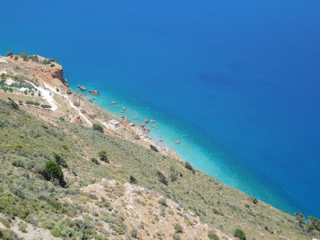
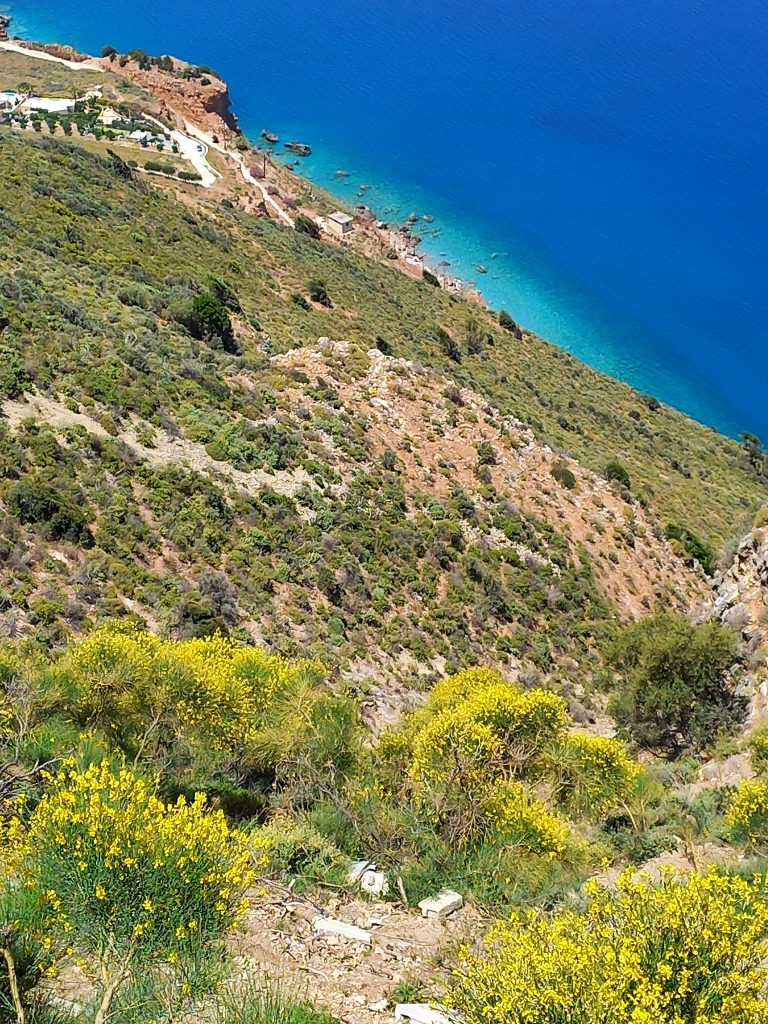
At first the road runs along a plateau and at some point I simply had to stop at an expansion by the road since the landscapes were seductively beautiful.
Although this whole area seemed rather rocky, these rocks combined with low shrubs, a half of which was covered in tiny yellow blossoms, appeared incredibly attractive.
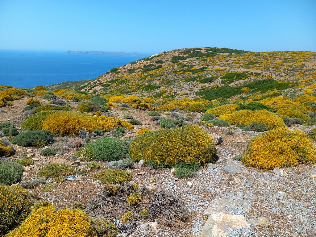 Landscape in the northeast of Crete
 Landscape in the northeast of Crete
 Landscape in the northeast of Crete
There are no human settlements in this part of the island, but I drove past a chapel that I took a photo of from the car, since I must admit that I was just too lazy to get out of the car.
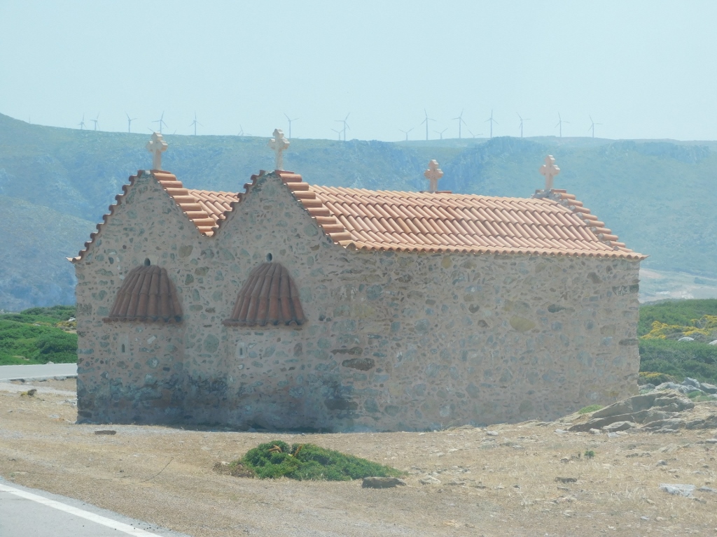 Sight by the road in the northeast of Crete
Not far from the chapel, there was my next destination, so I knew I would be getting out of the car there. This was Toplou Monastery.
 Toplou Monastery
Toplou Monastery is a Greek monastery dating back to the 14th century and it is considered one of the most important in Crete. It is dedicated to the Theotokos and St. John the Theologian.
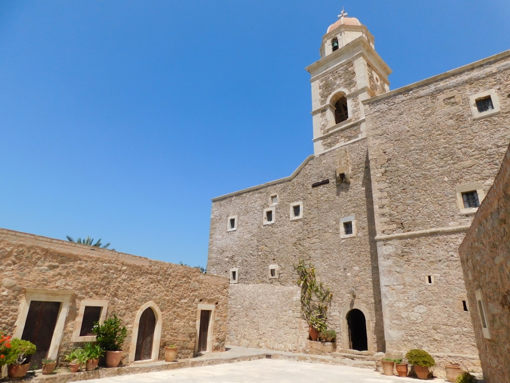
It is situated by the main road and when seen from the parking lot on the other side of that road, its walls seem as if belonging to a fortress. No wonder, since the monastery suffered very turbulent and often tragic fate.
It was attacked and plundered by pirates and conquerors already in the 15th and the 16th centuries, while in 1612 it was destroyed in an earthquake. It was restored and functioned until the arrival of the Ottomans when it was abandoned. It remained as such until 1704 when it was re-inhabited. In the 19th century, because of the uprising against the Ottomans, it suffered again – in 1821 all of its monks were slaughtered and for a while the monastery remained deserted, while in 1866 it was significantly devastated again.
Even in the 20th century it did not have peaceful existence – there was a wireless radio belonging to the resistance fighters hidden at the monastery and the Germans discovered it. The result: the hegumen and a couple of monks were first tortured and then executed.
Nowadays, the situation is quite different – everything is tranquil and functions harmoniously, and I could go for a sightseeing visit.
First I went to the old windmill that used to be used in order to pump the water up from the underground springs.
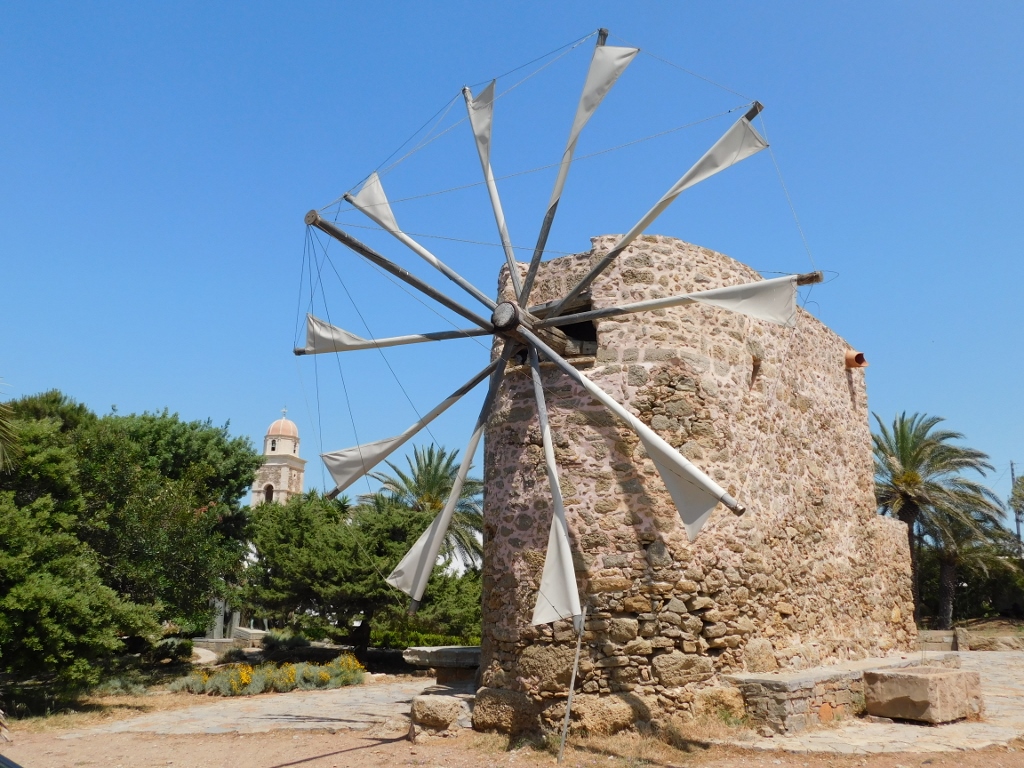 Toplou Monastery: the old windmill
Namely, the monastery was built on the south top of a ravine called Toplou Gorge. There used to be a copious spring there from which the water flowed into the gorge, but over time, this windmill was built and it pumped the water from the natural underground storage up to the surface.
After this short stop here, I continued with my visit to the monastery.
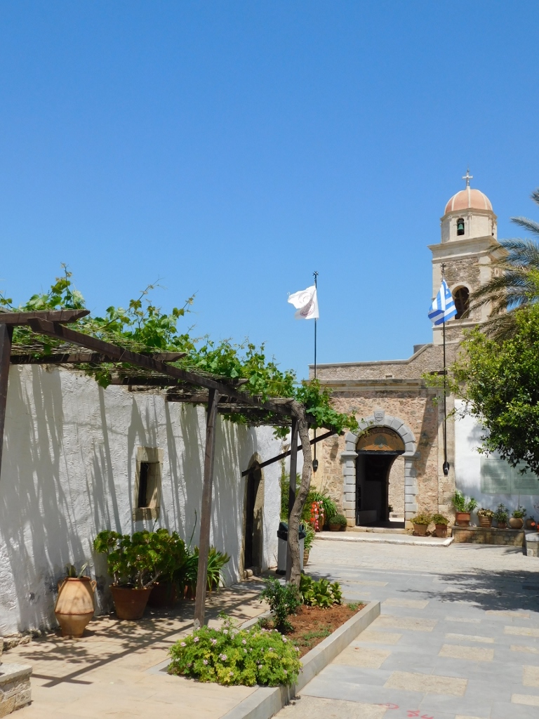 Toplou Monastery: access to the main gateway
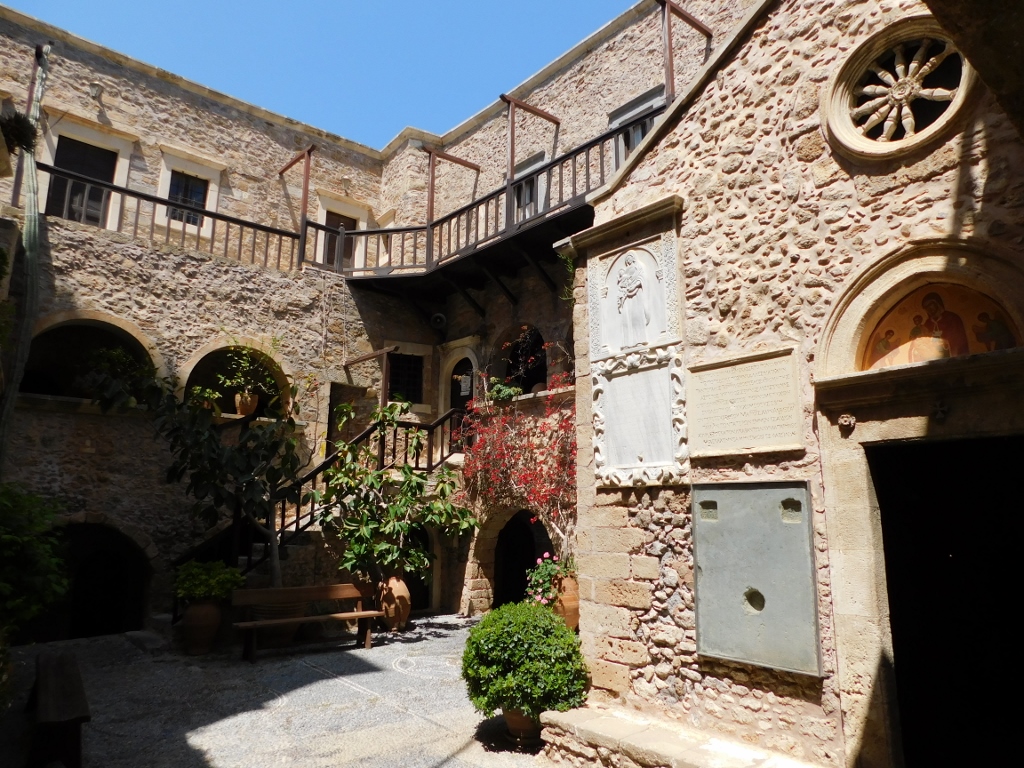
The monastery is not very large and its main parts are concentrated around two courtyards.
 Toplou Monastery: the first, larger courtyard
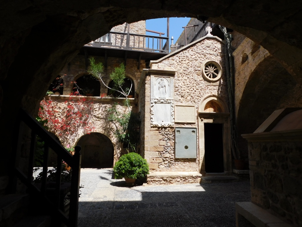
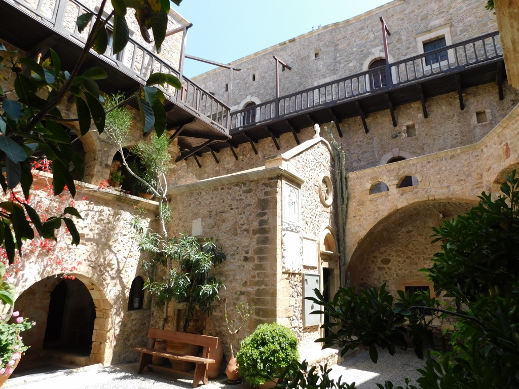
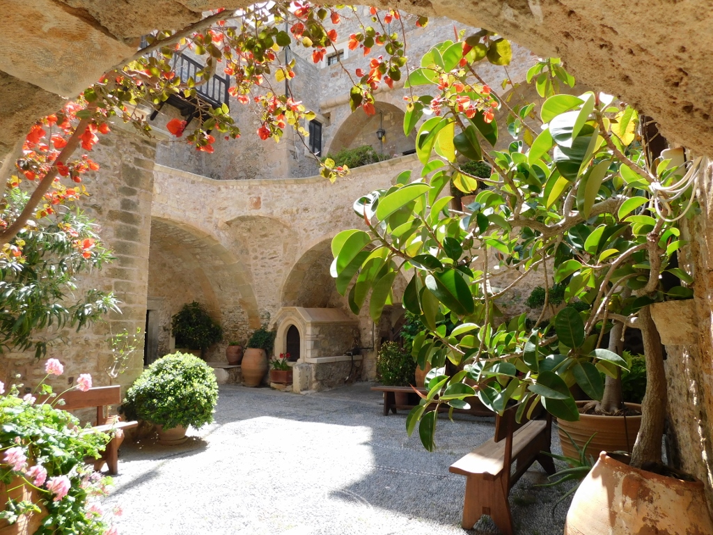
The second, smaller courtyard was particularly picturesque.
 Toplou Monastery: the second, smaller courtyard
 Toplou Monastery: the second, smaller courtyard
In this other, smaller courtyard, there is a church from 1558. I went it, but no photography was allowed inside and therefore there are no illustrations about this segment.
By the way, the monastery is also famous for its rich treasury, important icons, etc., and there is also a smallish museum by the main gate where the visitor can admire the monastery’s collection.
 Toplou Monastery: the second, smaller courtyard
 Toplou Monastery: the second, smaller courtyard
I walked a little around the less prominent parts of the monastery, while in the section leading to the gardens I encountered a picturesque resident. This was a red admiral butterfly (Vanessa atalanta).
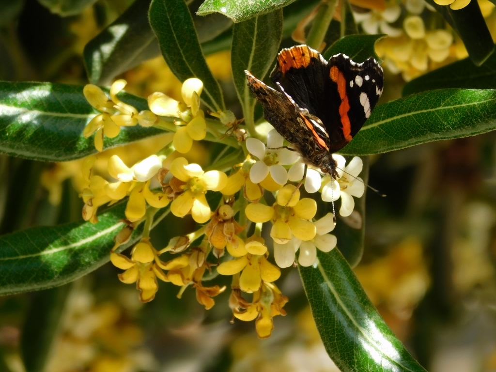 Red admiral butterfly
Before leaving the monastery, I also entered their shop. Namely, the monastery is famous for the wines it produces, so I bought a couple of bottles. Completely out of character, I also bought a bottle of olive oil produced at the monastery. As a rule, I do not buy bottles with liquid that I would pack in the bag to be checked later with the airline, plus I had a few more days of this journey left, which is important on account of the bottles and liquid being heavy. But, they did wrap up the bottles very well and I was fully aware that except on the last day, I would not even feel the weight of the bottles, for I would just keep them in the car trunk all the time.
After leaving the monastery I did “have to” stop a couple of times. First in order to take a photo of the monastery I had just left and a little farther in order to take photographs of the north coast of Crete that I was going down towards.
 Toplou Monastery in the distance
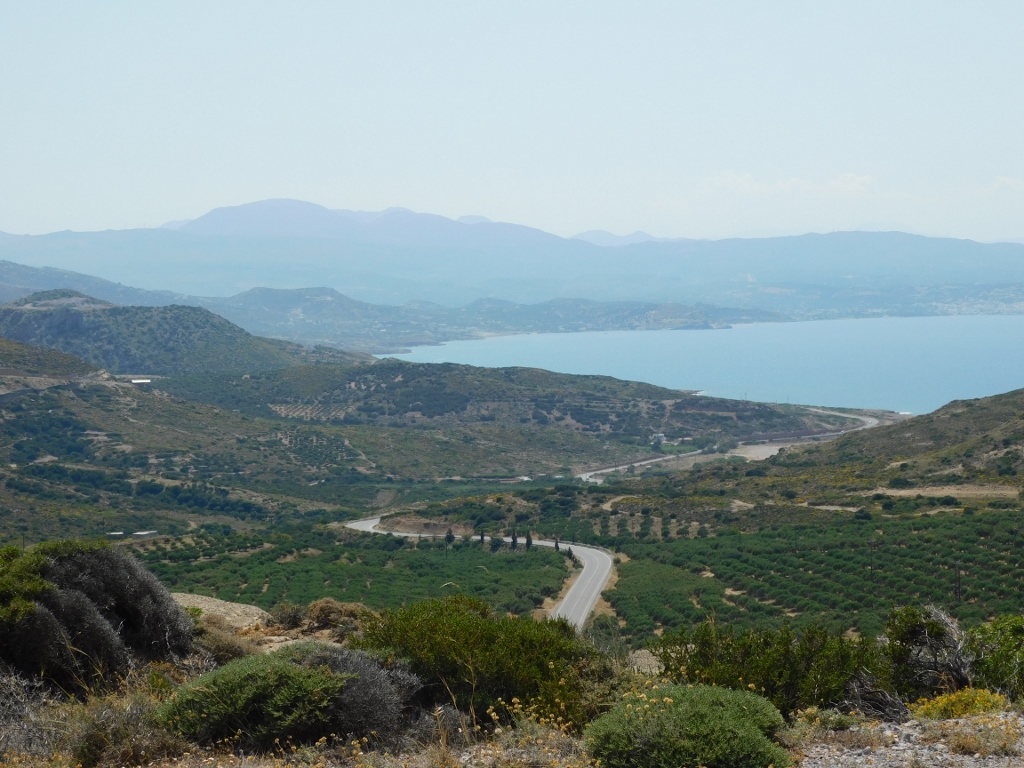 A part of the north coast of Crete
When the road goes down from the plateau to the area around the sea, it practically continues to follow the line of the shore of a wide bay at the west end of which there is a city of Sitia which was my final destination for the day.
Before getting to the city and settling at a hotel where I had booked a room, I had to stop at yet another place in order to take a photo of Plakes Beach and Sitia farther down.
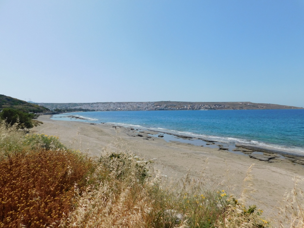 Plakes Beach
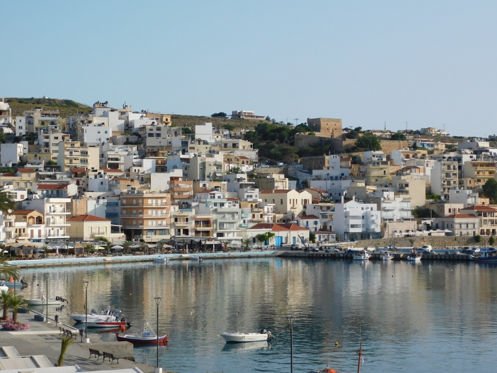
As for Sitia, this is a nice place in the east part of Lasithi region, tucked on the west side of a wide bay named after the city, Sitia Bay. I came here to make a short respite in my active visit to Crete, so I first left my things in the room and got ready for a relaxed stroll around the city. I also took advantage of the excellent position of my room in order to take a photo of Sitia, on the left-hand side in the photo below, and the beginning of a sand beach, on the right-hand side of the same photo.
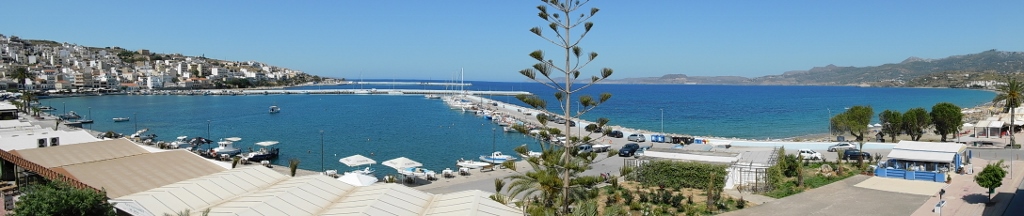 Sitia
Sitia
I first walked by the shore and then I ventured a little along the streets of the city, but not too much. All of a sudden, I became quite lazy and was not in the mood for any substantial sightseeing.
 Sitia, a detail
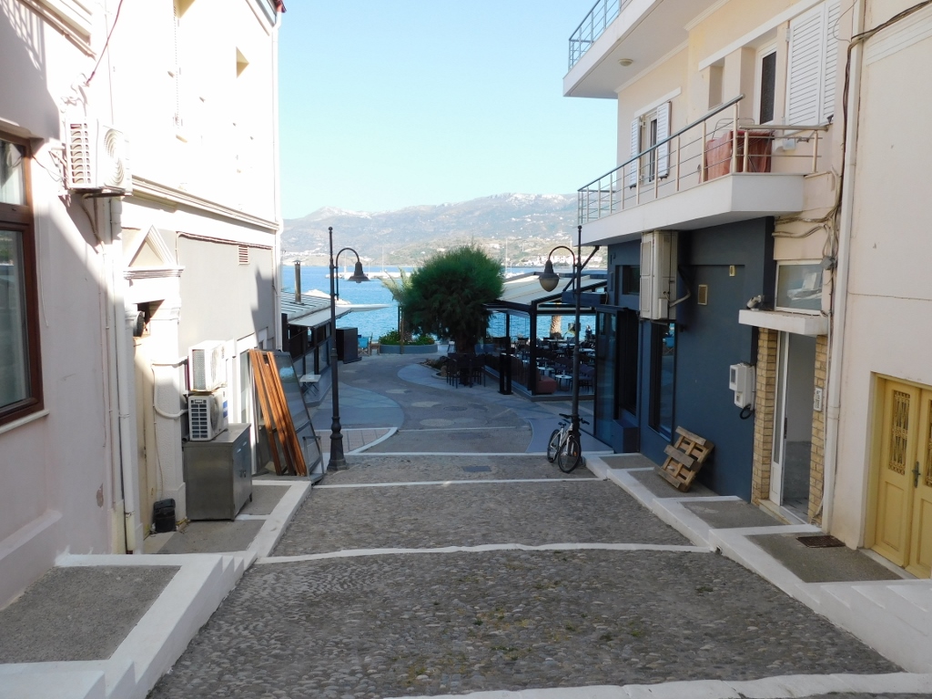 Sitia, a detail
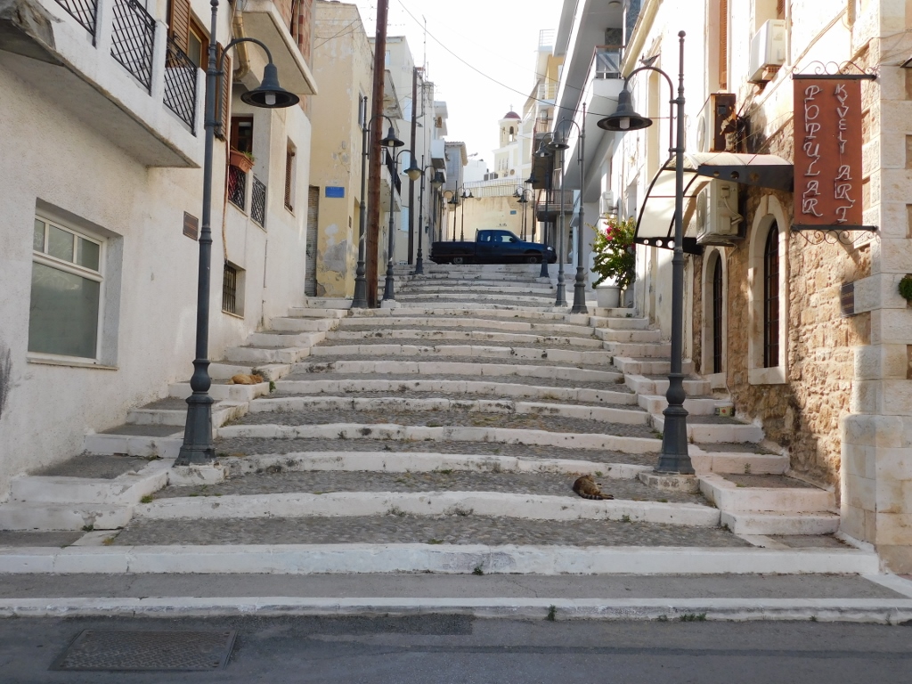 Sitia, a detail
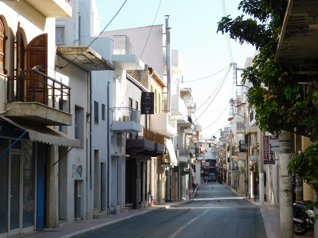 Sitia, a detail
Moreover, I decided to go for a very early dinner – it was still the daytime, but the food was excellent.
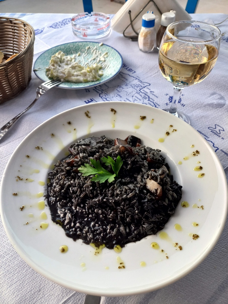 Early dinner in Sitia
Later I went to a café where I had a cocktail, but it was still early when I went back to my room where I actually slept through the night quite well.
Although in comparison to some other places Sitia may look inconspicuous, I sort of liked it. It seemed to me like a place where one can have a nice, quiet holiday with no pretentions. Of course, I am a middle-aged woman on the brink of the third age and I had a room with a nice balcony and a fine view at the promenade along the sea and most of the city. I even thought that just by sitting there on the balcony, with my feet up on the railing would be a nice kind of holiday.
 View at Sitia lit by the morning sun
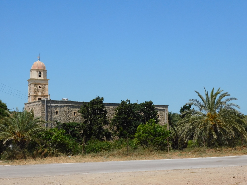
On the other hand, there are places in Sitia which an interested visitor may go and see – such as a couple of good museums or Kazarma fortress built by the Venetians in the 13th century.
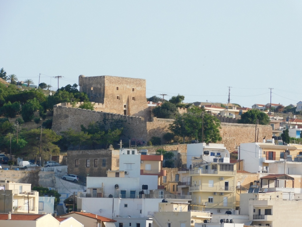 Kazarma fortress
After getting up, I actually quite enjoyed just sitting there on the balcony, sipping coffee and waking up slowly. Still, I did not come to Crete in order to “rest,” but to do sightseeing and so, right after the breakfast, I first went for a walk by the beach in Sitia.
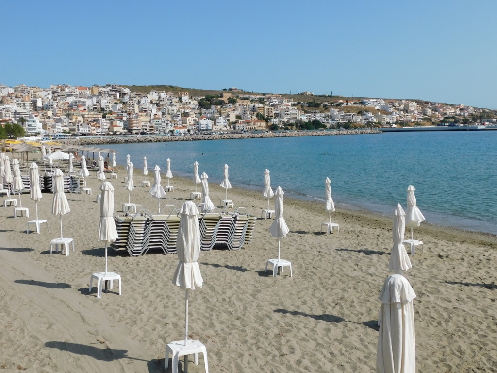 Beach in Sitia
There I noticed some local elderly people getting into the water and I thought that maybe the water started to warm up enough for me to have a dip myself one of these days. There was also no wind, which meant that the water did not cool down by the wind chill effect.
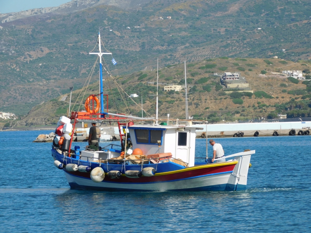
Still, I was not in the mood even to dip my feet into the seawater and I simply went back to the hotel. Once more, I took a photo of the marina and Sitia, and soon after I transferred my luggage back into the car trunk and moved on.
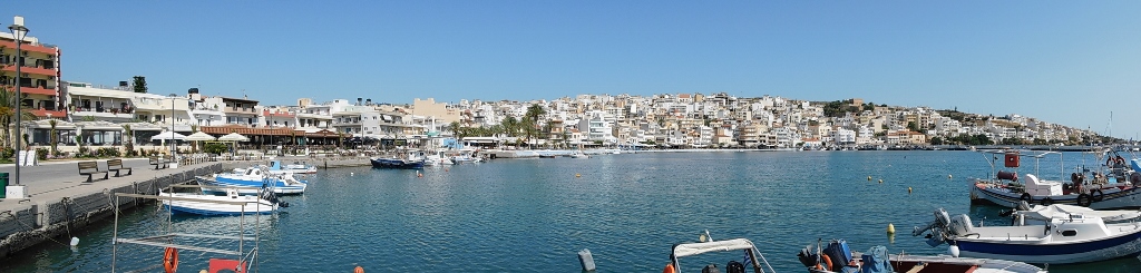 Sitia
Sitia
Now I followed the main national road that extends along the north of Crete (from the east to the west), for in this way I was practically closing down some kind of a circle that I made travelling around the island. The final destination on this day was the city of Agios Nikolaos (or more accurately, a hotel somewhat more to the north from the city), but along the way I had two planned breaks. As it would turn out, I also made a couple of other, unplanned, breaks. There is great beauty when you organise the travel yourself.
First I stopped at a parking lot beside the road from where one can start to descend down yet another of the numerous gorges that exist on Crete. Concretely, this one was Richtis Gorge. The route length is 4910 m and the foreseen duration of walking down to the rocky beach is around 1 hour and 45 minutes. Unfortunately, it was clear to me that I had no time for something like this, so I just took photos of the bushes of Spanish or weaver’s broom (Spartium junceum) with blossoms that emanate a wonderful scent.
 Nature close to Richtis Gorge
After some ten minutes, I made again an unplanned break, this time at a very fine viewpoint where there is a café for those who would like to sit there and enjoy a while longer.
There are several nice viewpoints in this section of the road leading to the city of Agios Nikolaos, with one of them being rather well-known. I did plan to make my second break of the day right there, but this viewpoint where I first stopped was also great because it allowed me to have a look at village Mochlos where I was heading now. Namely, my first planned break was precisely that village. Opposite the village I could also see Agios Nikolaos islet.
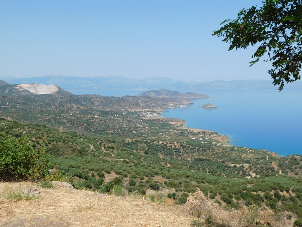 View at the north coast of Crete, the small fishing village of Mochlos and the islet opposite the village
 View at the north coast of Crete, the small fishing village of Mochlos and the islet opposite the village; in the background, one can see larger island Mochlos or Pseira
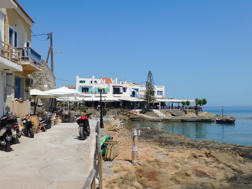
When you turn from the main road towards Mochlos, the road is quite narrow with a lot of hairpin turns. Although it may seem that the village is close to the main road, on account of these curves one needs to drive for some 6 km. It was actually very good that I was here in May, outside the high season, and therefore there was almost nobody else on the road but me and I could even stop a couple of times and take photos from the car. But, I did that hastily and the photos in the end did not turn out well. Nonetheless, it was fun. At some point I reached the village, parked the car and went for a short walk by the sea.
 Fishing village Mochlos and Agios Nikolaos Islet
Here the taverns and cafés are positioned one next to the other, but the size of the overall space simply does not allow that Mochlos is turned into a large seaside resort.
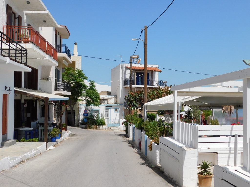 Fishing village Mochlos
 Fishing village Mochlos
The beach is rocky with a lot of flat and low rock plates, but it was clear at once that the water was superbly translucent. Quite close to the shore there is the islet of Agios Nikolaos, i.e., St. Nicholas. You can see archaeological ruins of Mochlos there, while the distance is only some 200-300 m. I think one could easily swim over. Of course, at the time when the seawater is warmer.
 Fishing village Mochlos and Agios Nikolaos Islet
I walked a little by the shore and then I decided to take a seat at one of the restaurants where I ordered a frappé coffee with a scoop of vanilla ice-cream. I intensely enjoyed the picturesqueness of the place and the pleasantness of the experience.
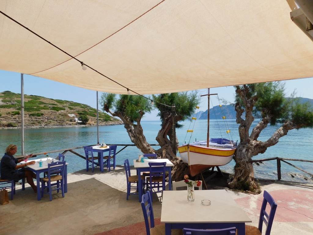 A place to relax in Mochlos
Later on I played with taking photos of some interesting details from this lovely fishing village.
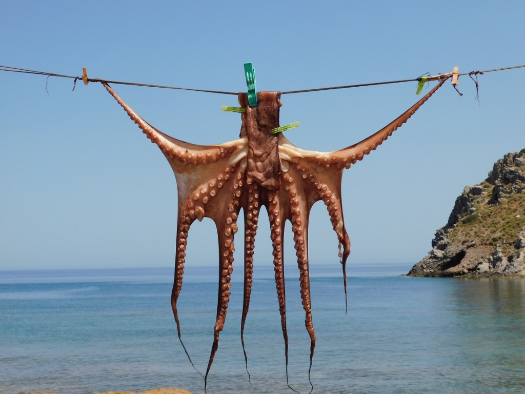 Some people hang laundry to dry, some others hang an octopus to dry
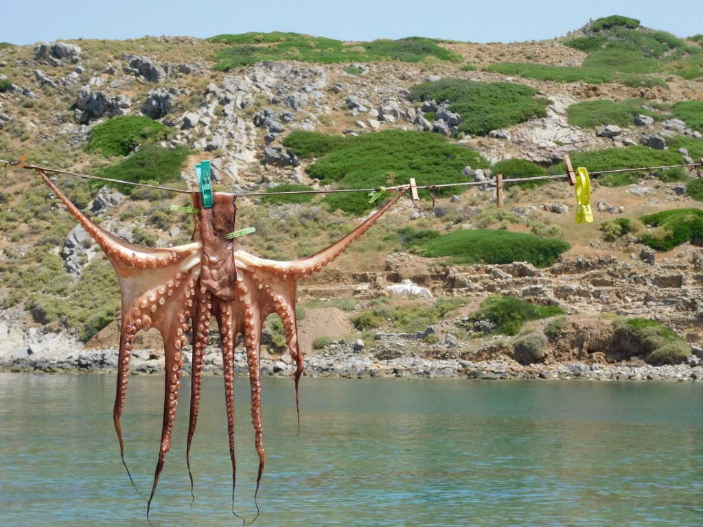 Some people hang laundry to dry, some others hang an octopus to dry
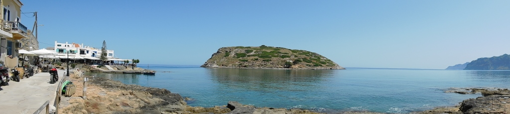
I also took some more photos of islet Agios Nikolaos and the remains of the ancient settlement that can be seen there.
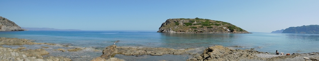 Agios Nikolaos islet
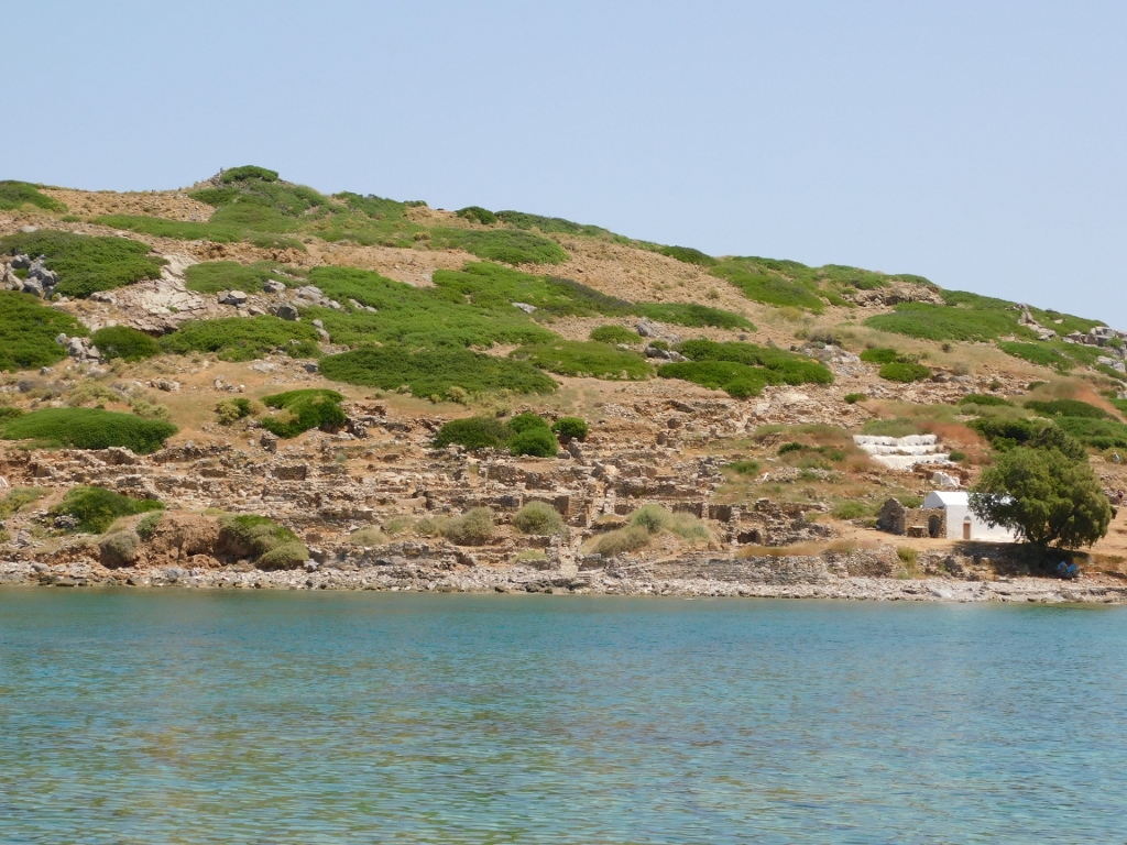 Agios Nikolaos islet, a detail
While passing by different taverns in Mochlos I saw some very interesting proposals for lunch and I even thought it may be a good idea, but I realised that I actually wanted to move on.
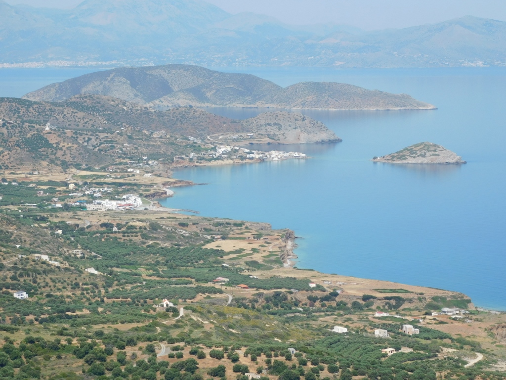
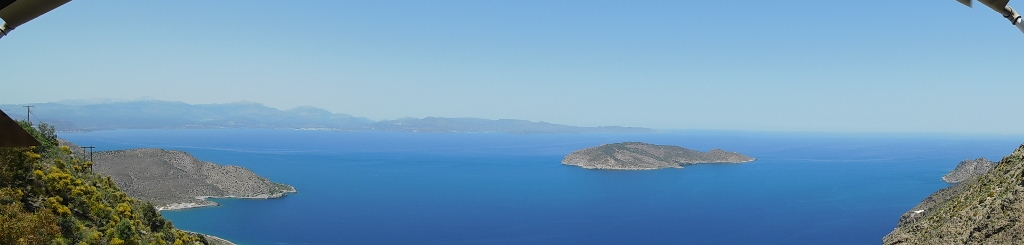
Again, I first drove uphill along a narrow road until I reached the national road. A couple of kilometres farther there is renowned Platanos viewpoint that is one of the places where one simply has to make a stop. In fact, there are a couple of viewpoints there, almost one next to the other. One of them is actually a parking lot from which there is a fine view and at the other one there is a tavern. I had been given a recommendation for the tavern and that’s why I planned my second break right here. I presume that the view is just as beautiful from the other viewpoint with no food or drinks.
 View at Mirabello Bay from the tavern at Platanos viewpoint
Mirambelo or Mirabello Bay, the largest bay of the Greek islands and even the fifth largest of the Mediterranean Sea islands, can be seen quite well from here.
The previous photo shows the island of Mochlos or Pseira. On this rocky island, there used to be settlements from the early Minoan to the late Minoan periods.
 View at Mirabello Bay from the tavern at Platanos viewpoint
I was here, however, much more fascinated by the colour of the sea at Malavras Beach.
 Malavras Beach
 Malavras Beach
I took a seat at the tavern and ordered freshly squeezed orange juice. The day was perfect in every sense and it felt good just to sit there and enjoy the beautiful view.
After a while I got ready to move on, but I simply had to take yet another photo of Mirabello Bay since my plan was to spend the next couple of days there.
 Mirabello Bay