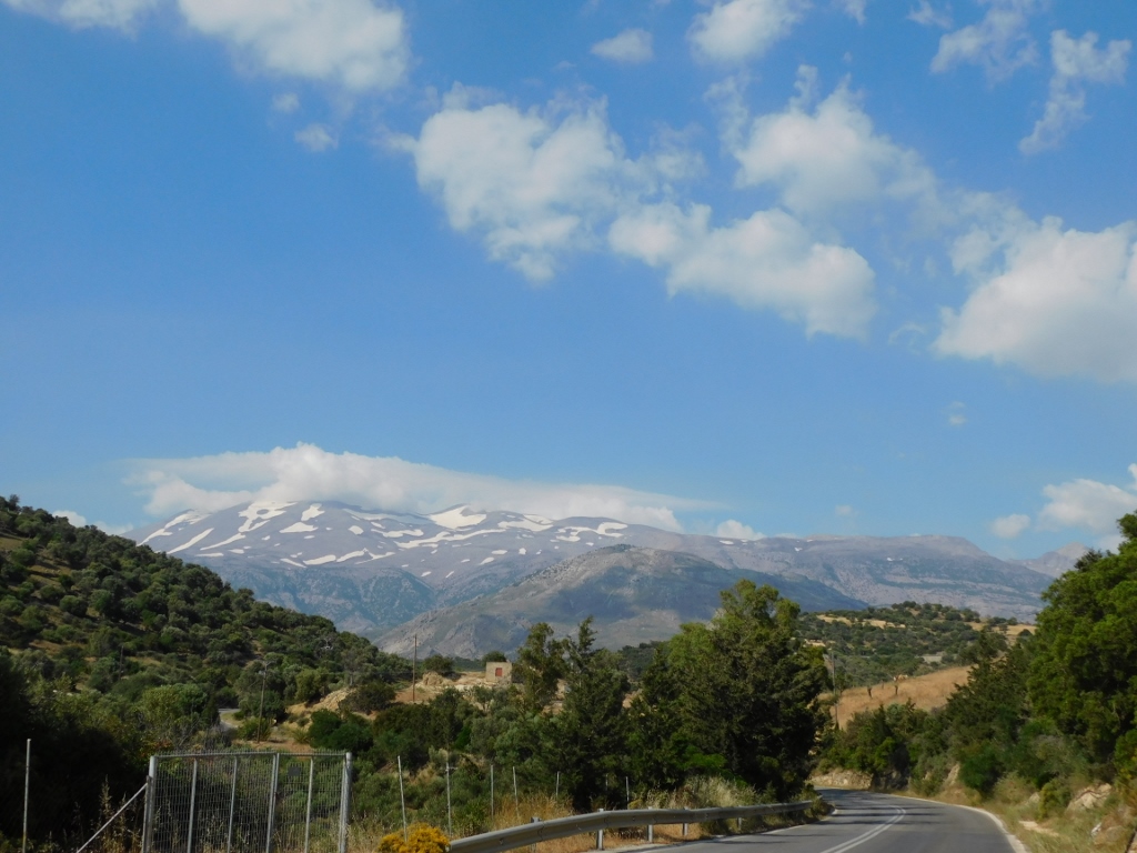
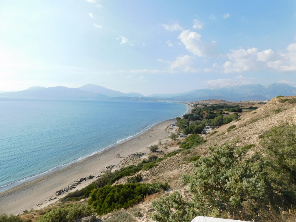
On this day of my travel around Crete, I transferred by a rented car from the north to the south coast – I started in Rethimno and my final destination for the day was the town of Matala. Along the way, I made a few stops, either for sightseeing or to eat something and then I continued with the drive intensively enjoying the beauty of the landscapes I was passing through.
From time to time, I could not resist and I would stop very briefly on the wider sections by the road just to take a photo or two. I have already explained earlier that this is the way I express my admiration. It’s not enough just to enjoy, I feel the need to take a photo. It’s always been like that and then this turned out to be quite ok, especially when I started to write these travel stories of mine. I don’t know how much these photographs help others, but they absolutely bring me back to the place and the moment when I took them. Each time it is as if I’m travelling again.
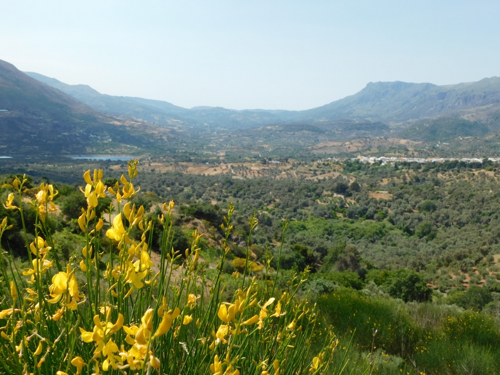
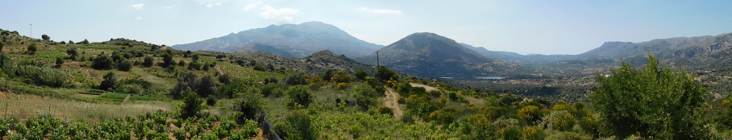
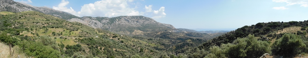
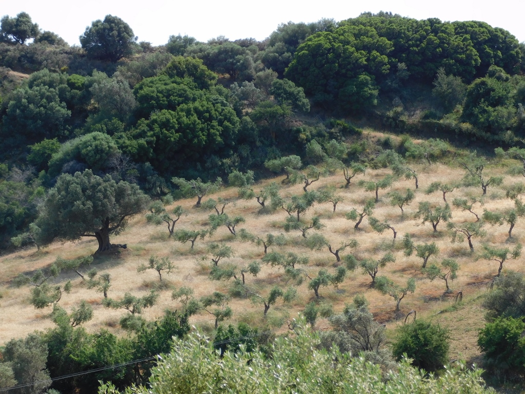
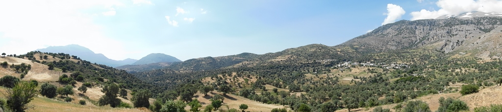
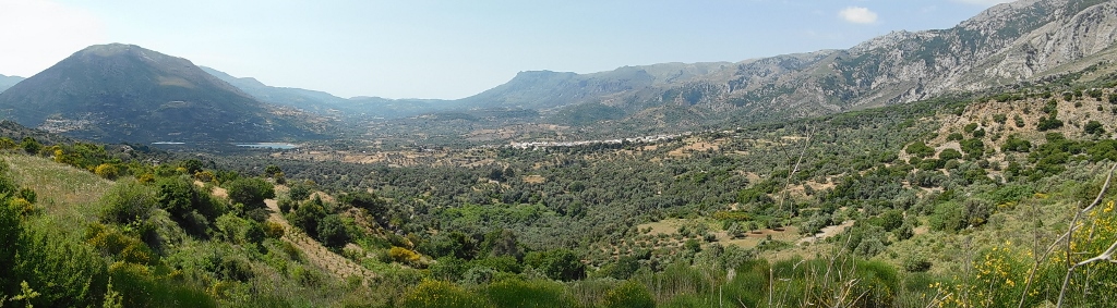 The interior on the south side of Crete
 The interior on the south side of Crete
 The interior on the south side of Crete
 The interior on the south side of Crete
 The interior on the south side of Crete
 The interior on the south side of Crete
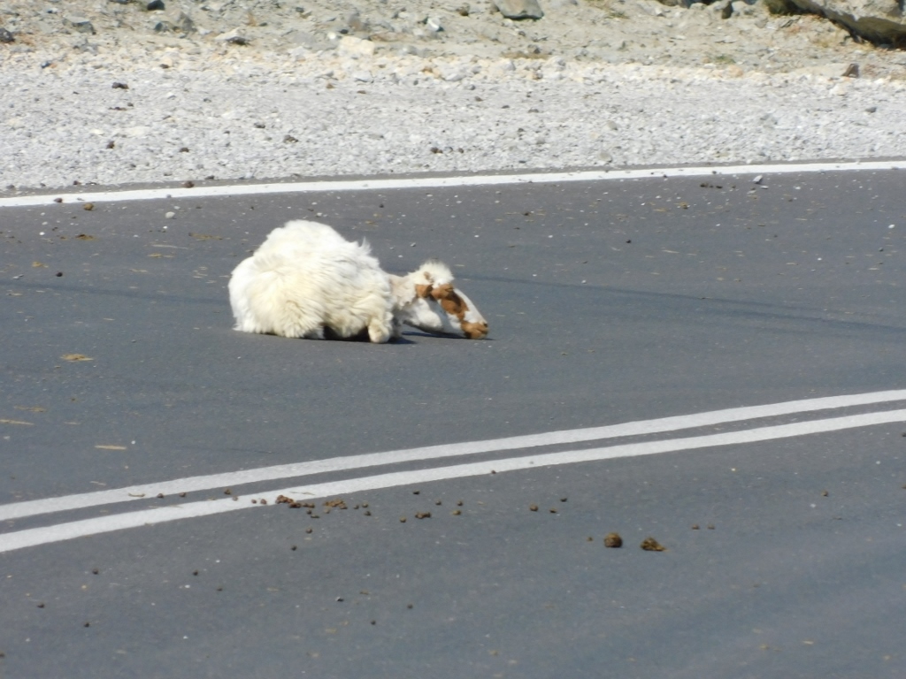
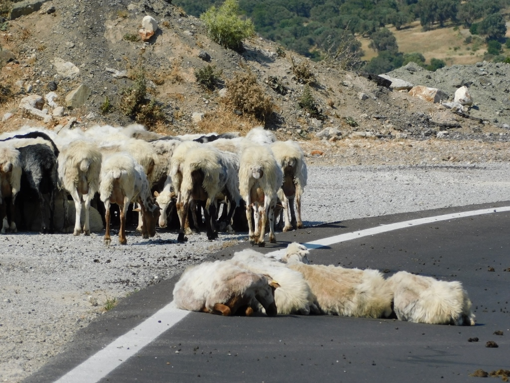
As I was taking the photo above, I could clearly hear the sound of a bell that came from the olive grove on the right-hand side of the photo. I zoomed in, but I could still barely discern a few sheep that grazed there.
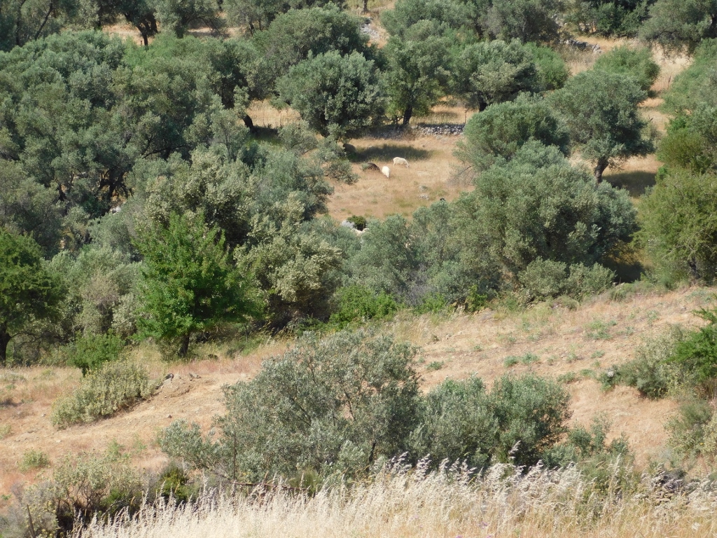 The interior on the south side of Crete, a detail
But, some ten minutes later I had quite a fine opportunity to see some sheep. Moreover, first I had to overpass some of them very carefully since they lay apparently quite comfortably in the middle of the road and then I stopped and took a couple of photos. I did not want to approach them, lest I disturbed them. My impression was that they enjoyed rather nicely in the warm asphalt and the extension by the road.
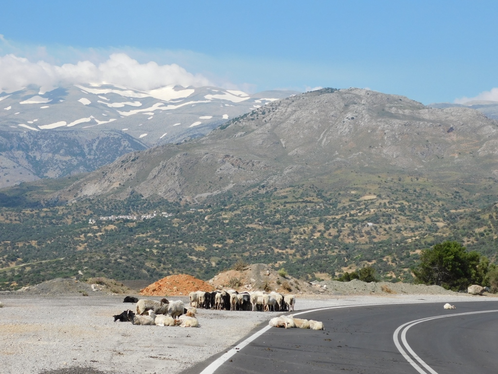 What is the sign for “Sheep on the road”?
 What is the sign for “Sheep on the road”?
 What is the sign for “Sheep on the road”?
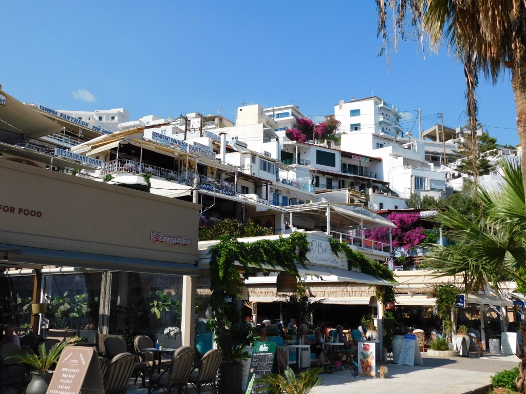
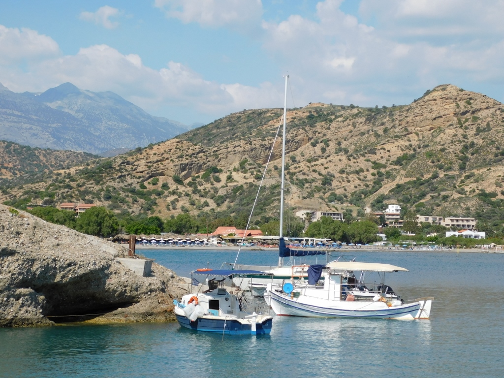
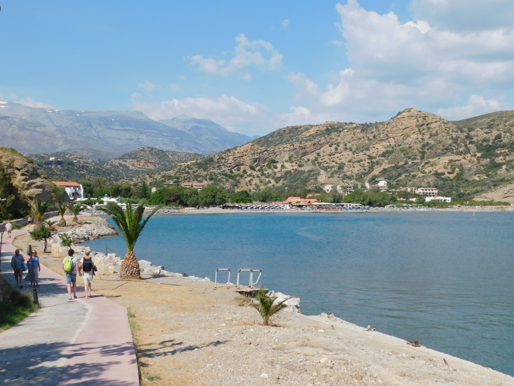
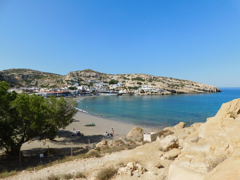
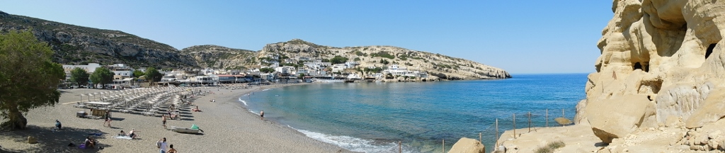
After this short stop, I continued with the drive and soon I descended from the hilly and mountainous parts of Crete reaching the shore of the Libyan Sea or, to be more precisely, reaching a place called Agia Galini. Earlier I had come across a piece of information stating that there is a very nice beach here, so I wanted to check it out. Also, the village is tucked away from the sweeping winds and it is said that the water in its port is always calm.
My first impression was that Agia Galini was a true summer destination. The place is full of hotels, restaurants, cafés and tourist shops, since Agia Galini is rather popular.
 Agia Galini
 Agia Galini: sights during a brief stroll from the port towards the beach
 Agia Galini: sights during a brief stroll from the port towards the beach
There is a fine promenade from the port and the centre of the village to the beach and I started to walk along there. But, bearing in mind where I also planned to make stops on this day, I did not go all the way to the beach, opting rather just to take photos from a distance and then I returned to the centre.
 Agia Galini
There I made a stop at a café in order to drink something fizzy hoping it would help me digest the over-salted moussaka I had for lunch. Well, it did help a little bit.
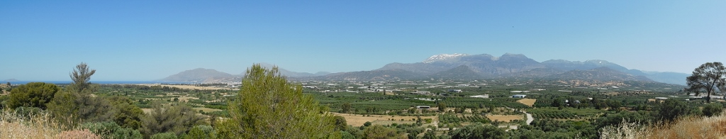
Then I got back into the car and moved on. The road first took me uphill and northwards and then it continued to the southeast and further on towards the most southern part of Crete’s shores.
 Leaving village Agia Galini
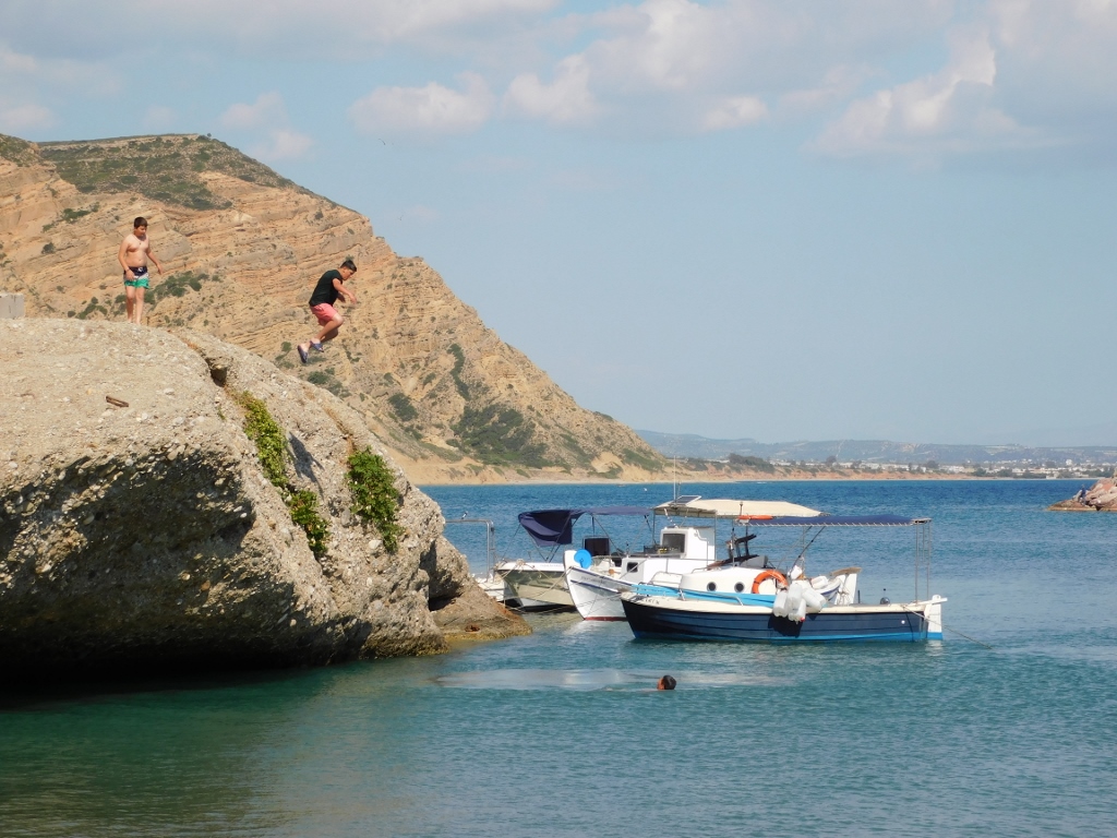
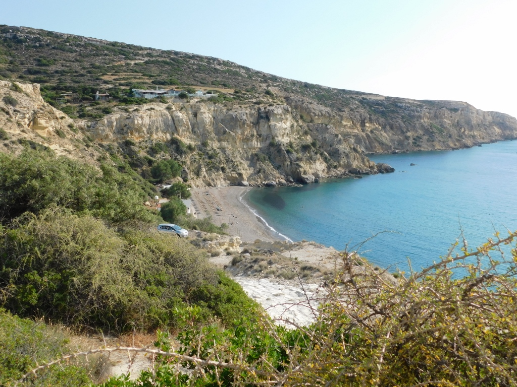
Before coming to Crete, I searched on the internet to see which beaches are considered to be particularly beautiful, although I had no intention whatsoever to venture into the sea at this time. It was May and I had already tried in the northwest of Crete to enter into the sea water of seductively attractive turquoise colour, but it felt freezing, although it was very shallow (which should give it the opportunity to warm up). But, this was not a reason not to look for different beaches while here. And so I headed for Kommos Beach.
Still, the information signs by the road confused me a little and so I continued along a road that as it turned out did not lead directly to the main Kommos Beach. I did not mind, since it took me to a much, much better place.
To start with, there was a nice clearing and a plateau that served as a viewpoint with a spectacular view at the wide Mesaras Bay.
 View at the main Kommos Beach
 View at the main Kommos Beach
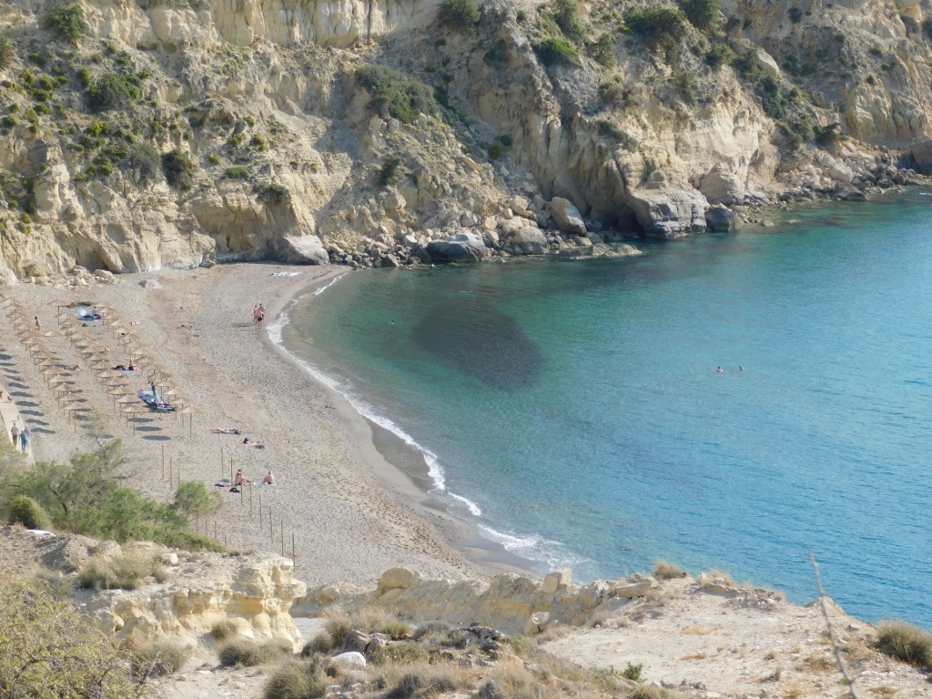
I say “the main Kommos Beach” here because to the left from the viewpoint there is a smaller, southern section of the Kommos Beach.
 View at the south section of the Kommos Beach
 View at the south section of the Kommos Beach
And on that plateau by which I parked and from which there is the perfect view at the surroundings and the setting Sun, there is also a small Church of Saint Pantaleon that stands there as if built just for a picture-perfect experience. This was apparently not only my opinion, since when I arrived here, there was a woman preparing the small church for a wedding that was soon to take place.
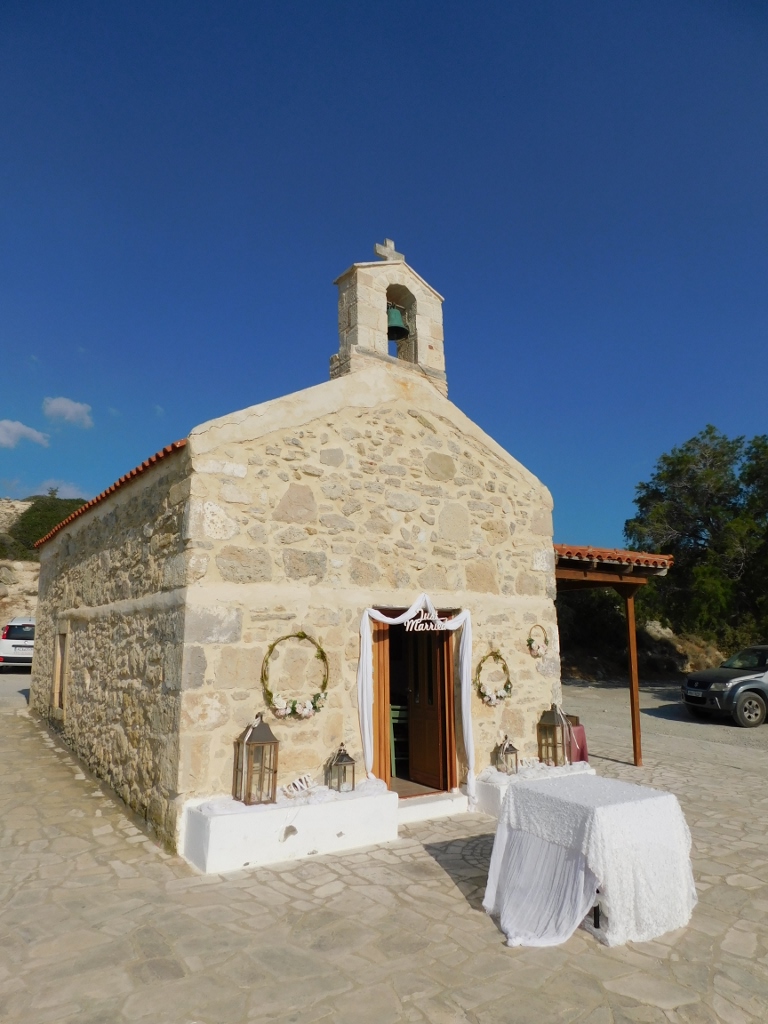 Church of Saint Pantaleon
The church certainly functions as such, but at this point in time it seemed like a storage space for wedding materials. The preparations were going on.
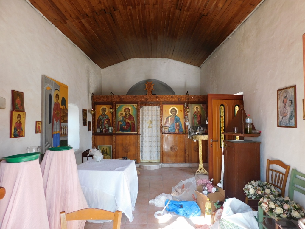 Church of Saint Pantaleon, the interior
After the short stay at the plateau with the small church where I enjoyed the fabulous view, I got into the car again and now I drove to my final destination for the day – a hotel in village Matala.
I settled well and changed my clothes, and then, since I still had the daylight, I went for a walk towards the beach. Matala is a small fishing village and nowadays everything is geared to tourism. It is no wonder for this is the site of one of the famous historical or, rather, mythical beaches – and there are not many places in the world that can boast such a status. Namely, when god Zeus, disguised as a bull, abducted Europa who was a Phoenician princess (nowadays Lebanon), he brought her to Crete or to be more accurate right here to this beach in Matala. Then he turned himself into an eagle and transported the princess to the place called Gortyn or Gortys that is some 20 km away from Matala where he had sex with her. Still, he did make her an “honest woman” and had several children with her, including also King Minos whom I have already spoken about and who rendered the name to the entire civilisation from Crete that is considered to be the first civilisation in Europe.
In addition to these mythological visitors, there are also finds that show that this area was settled already during the New Stone Age or the Neolithic, while during the period of the Minoan Civilisation, Matala was a port of the major urban centre, Phaistos, that is located around 11 km more inland. Later, the area around Matala was also ruled by the Ancient Romans.
Today, as I’ve said, Matala has turned from a quiet fishing village into a primarily popular tourist destination. Therefore, to start with I wanted to go and see that beach and along the way, in addition to numerous shops, restaurants and hotels, I also passed by a small church. This is the parish Church of the Assumption of the Theotokos.
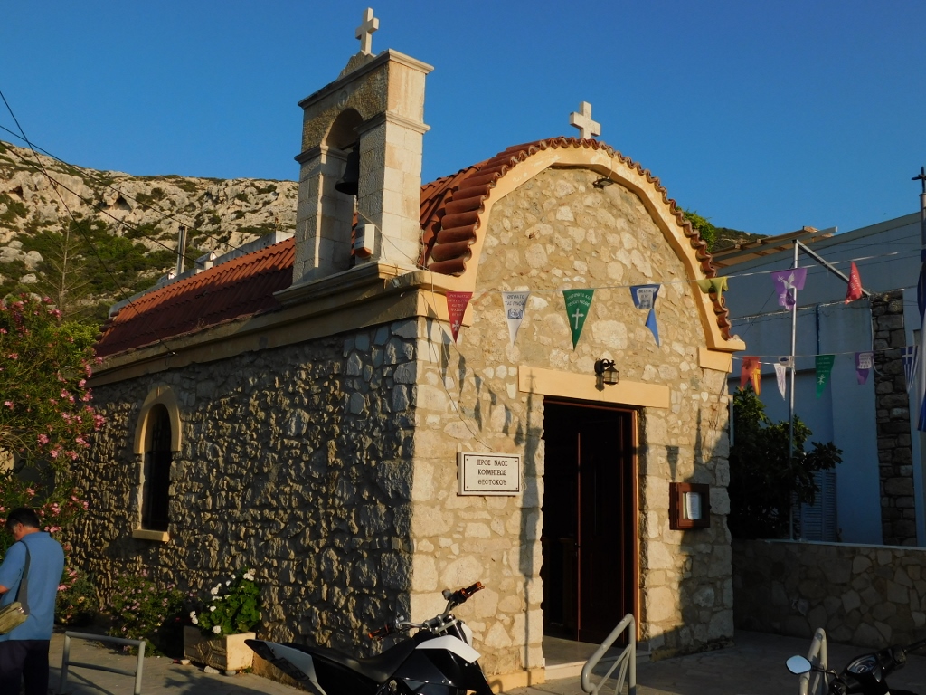 Church of the Assumption of the Theotokos
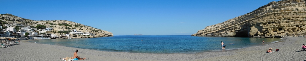
Only a few dozen metres farther from the church, one comes to the beach in Matala. Without parasols and sun loungers, this could quite understandably be a wonderful romantic place to which Zeus would like to bring the latest subject of his desire.
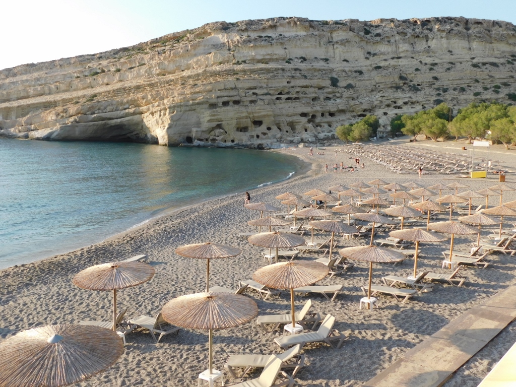 Matala Beach
But, joking aside, although the beach is indeed pretty, there is also a most interesting cliff on the north side of Matala Bay and this is the cliff that can be seen in the photo above. Here it is again in the next photo, but from up close, since I walked along the beach and thus approached the cliff.
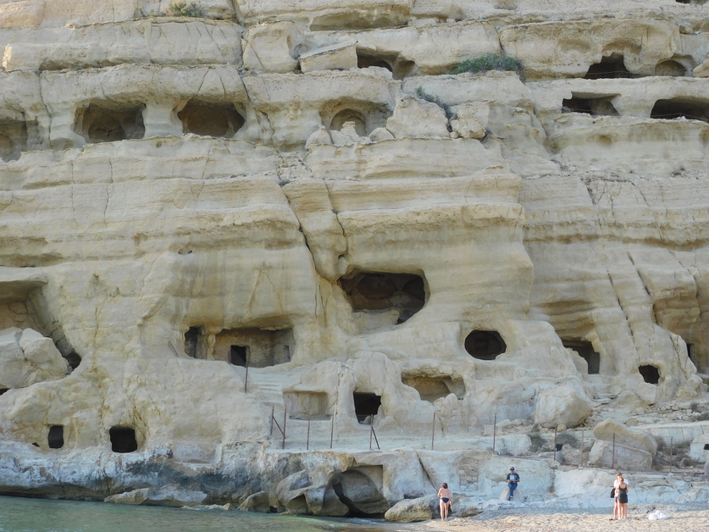 Cliff on the north side of Matala Bay
So, if you look at it more closely, you will notice that there are some caves here. These are artificial recesses made already during the Neolithic Age, although I also came across some information claiming that they were made during the Roman and Early Christian periods. In any case, I came here for a visit the following morning, but for now I just walked back along the beach.
 Matala Beach
Having walked by the shore, eventually I took a seat at a café that also had tables and chairs by the beach and so I could enjoy until the Sun set. I was exceptionally content with the day and it felt good to relax.
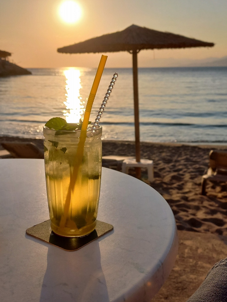 At Matala Beach
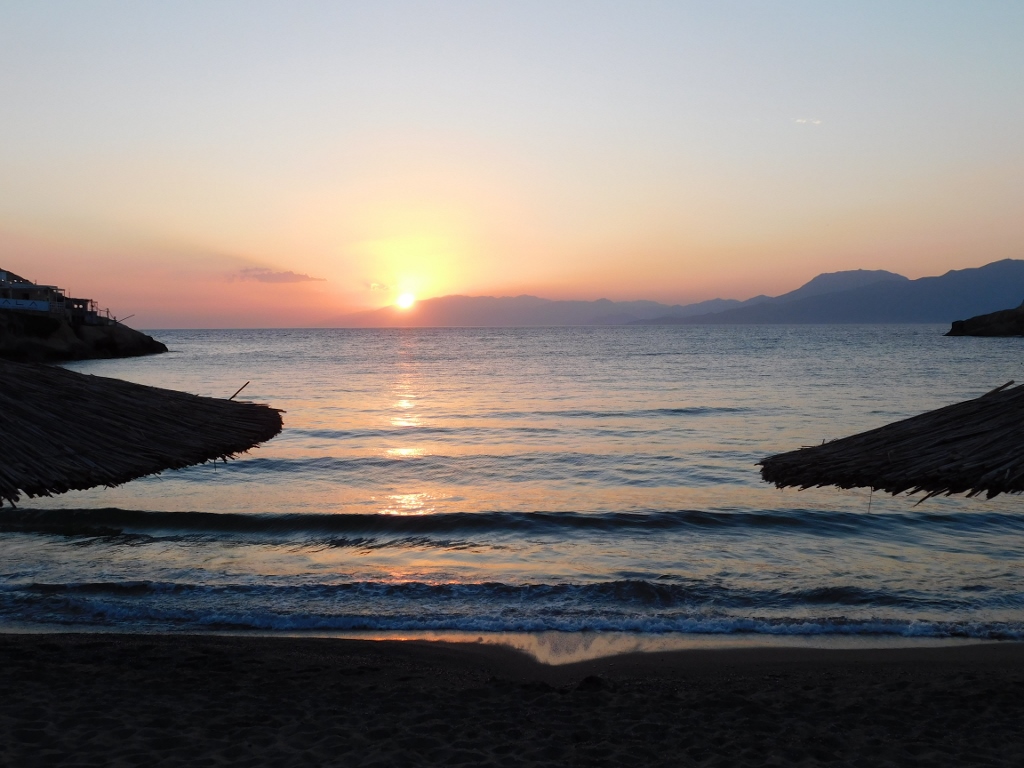 Waiting for the Sun to set at Matala Beach
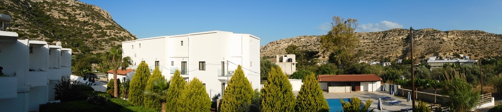
After the good night’s sleep, I was again greeted by clear and sunny weather. While in Matala, I took a room in a family-run hotel that is a couple of hundred metres away from the beach. Although my plan was to leave Matala on this day, I still had the time to walk to the shore and the beach once more.
 Matala, a detail
 Matala Beach
The previous photo shows well that Matala beach is in fact the end of a deep bay and this is probably what allowed for the life here already during the Neolithic period. The reason why I wanted to stay in Matala this morning was that I wanted to visit the prehistoric caves made in the rocky layers that comprise the cliff on the north side of the bay.
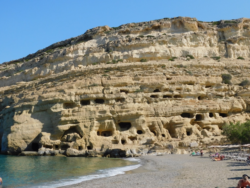 Cliff on the north side of Matala Bay
I came here even before the site was opened, since over time the caves had been protected by a wire fence, so I had to wait for a little while, but this was not a problem at all.
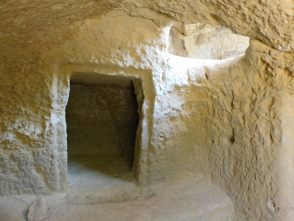
 Caves in Matala
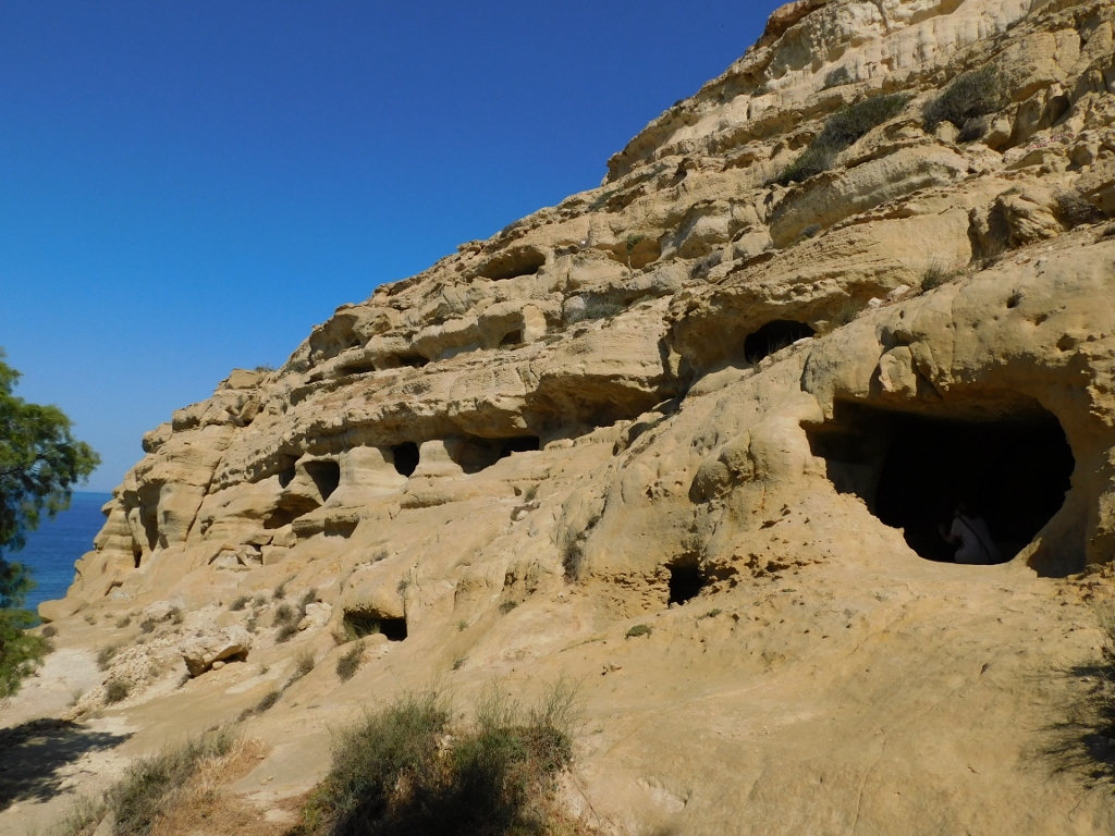
The caves can be visited quite nicely and freely, but there are information signs warning visitors that they have to be careful especially if they climb to the caves on higher levels. I did not have proper footwear, so I did not even try. But, even the caves on the “ground level” were more than sufficiently picturesque.
 Caves in Matala
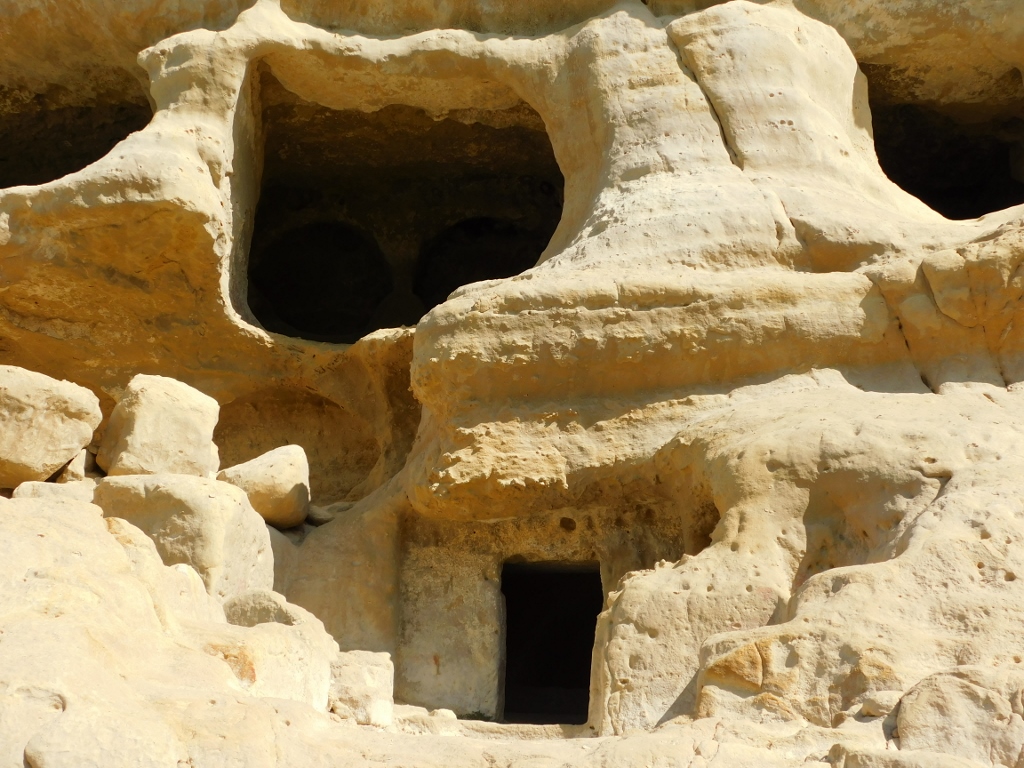
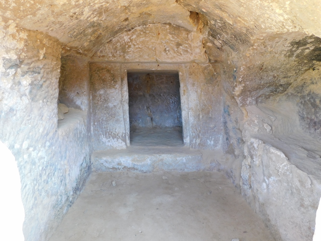
In addition to the lack of consensus about the time when the caves were made, the scientists also cannot agree about why these “caves” were made in the first place. Some say that they were used for the burial of the deceased and such theory is supported, for instance, by the cave seen in the photo below, as it is possible to distinguish quite clearly that there are tombs chiselled out of rock.
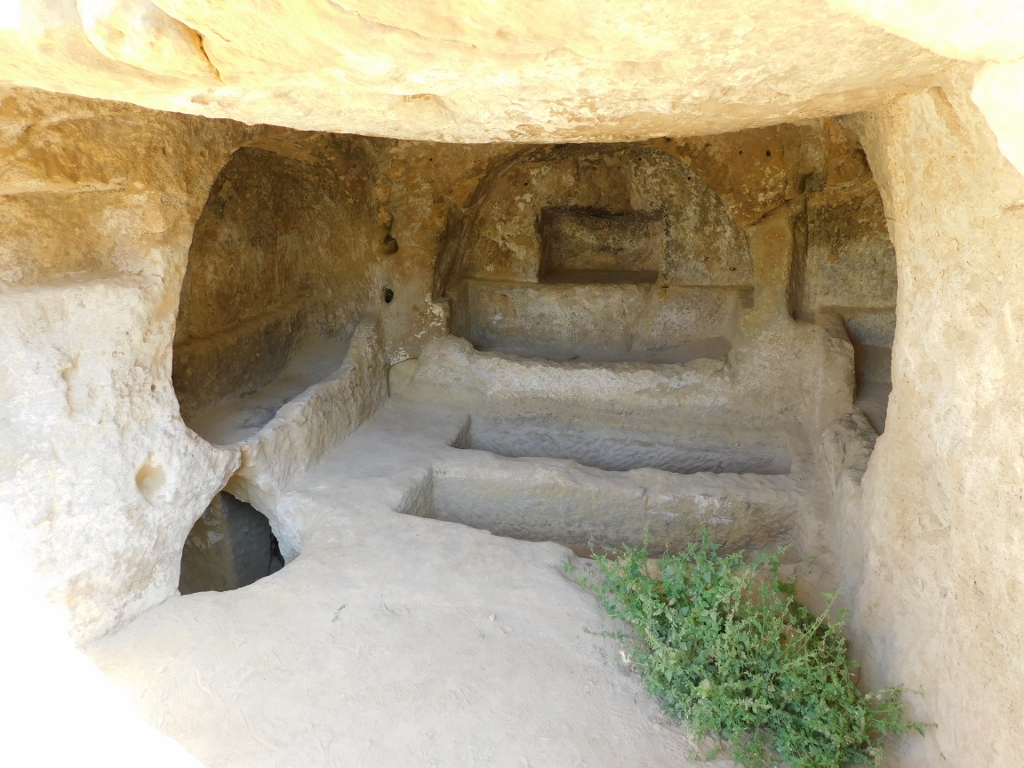 Caves in Matala
On the other hand, bearing in mind the size of some of them, it is rather unlikely that they were used for the dead alone and instead there are claims that they were used either as places for rituals or for the habitation of triglodytes.
 Caves in Matala
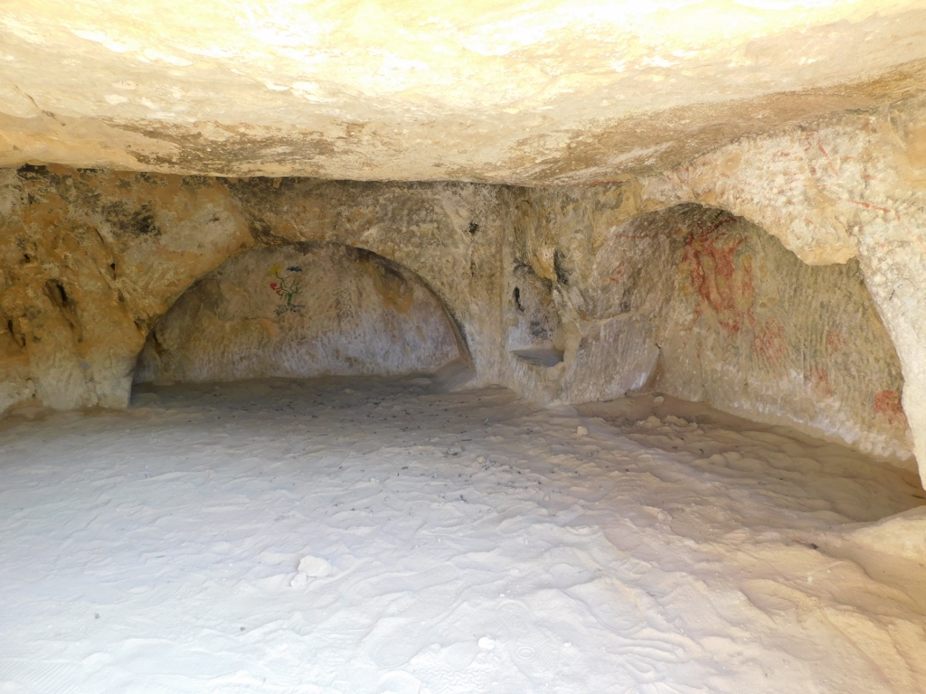 Caves in Matala
 Caves in Matala
It is interesting that during the 1960s these caves were occupied by the hippies. This is particularly interesting bearing in mind their life-style and comparing this to the traditional life-style of the local residents who until that time almost did not see even ordinary tourists. Still, the “problem” of the hippies was later resolved by driving them out.
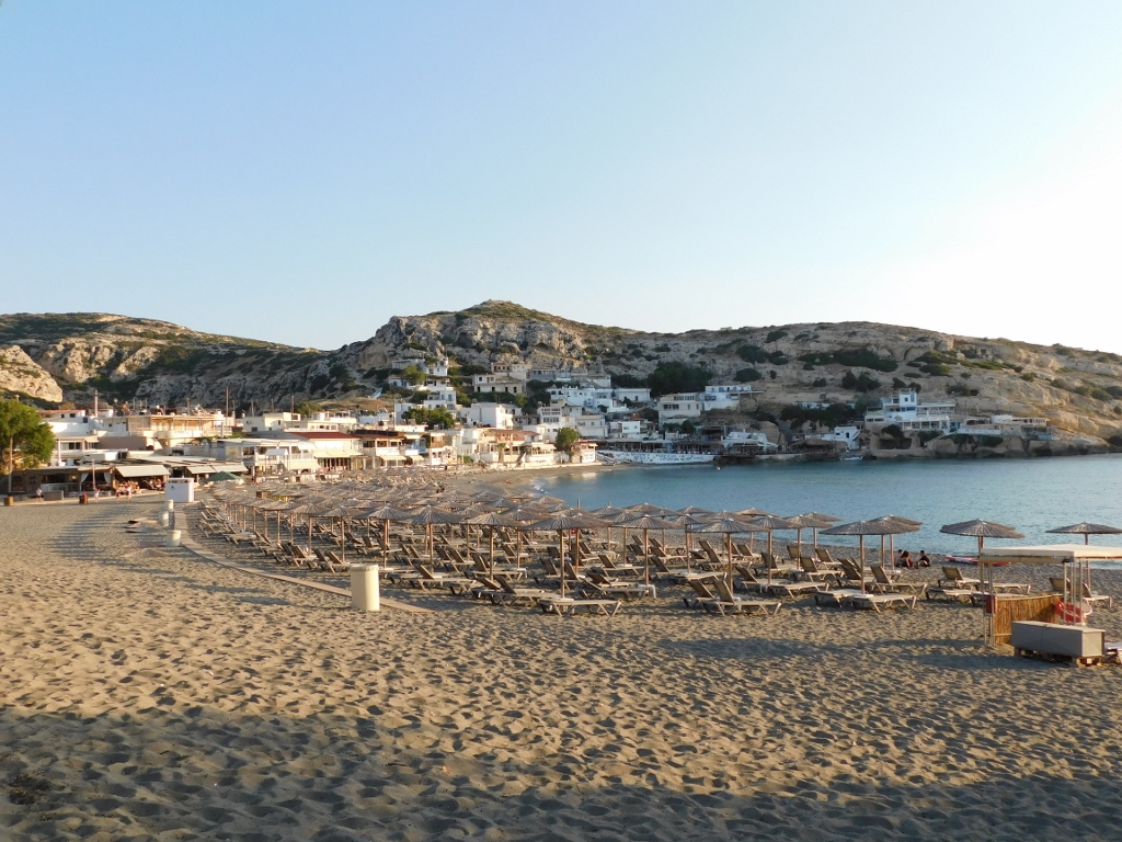
Be as it may, nowadays, as I’ve said, tourism is the backbone of the activities of the local population and when you look at the beach and the sea, it is quite clear why.
 Matala Beach
 Matala Beach
By this time I had to go back to the hotel where I got into the car and drove to the nearby site of Agia Triada, some 13 km away from Matala.
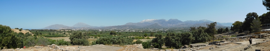
To start with, I got to an extension of the road that serves as a parking lot and from where there was a fine view at Mesaras Bay, on the left-hand side in the photo below, and at the north, including also the Psiloritis mountain massif.
 View from the area around the archaeological site of Agia Triada
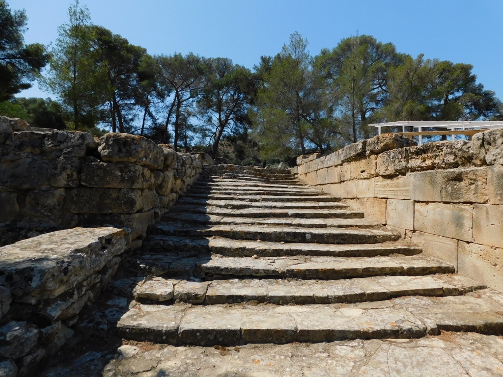
In order to get to the site, one needs to go down some stairs.
 Access to the archaeological site of Agia Triada
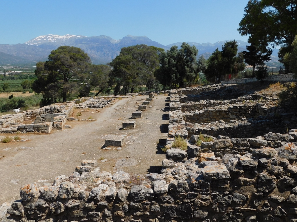
 Archaeological site of Agia Triada
The archaeological site of Agia Triada (it can often be found as Hagia Triada) got its name after a tiny medieval village that used to exist in this area, since actually nobody knows for certain what this place was called during the Minoan civilisation period to which the site generally belongs. On the other hand, the research has shown that people used to inhabit this area ever since the Neolithic.
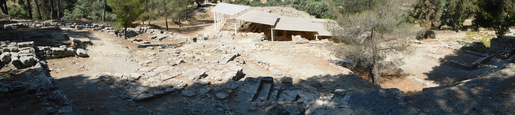
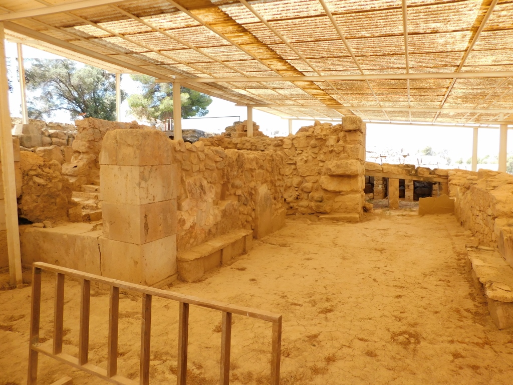
The main structure within the site is a Minoan royal villa or palace and because of the proximity of Phaistos as the main Minoan centre with which Agia Triada was linked by a road paved by stones (the straight-line distance is around 2 km), it is believed that this place was inhabited by somebody close to the rulers of Phaistos.
 Archaeological site of Agia Triada: view at the canopied remains of the royal villa
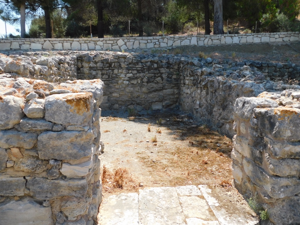
First I briefly looked at some remains to the left from the staircase that led me to the site, but these are just remains of the walls of different structures, including a shrine – the brochure with the map that one receives on the spot is rather poorly done and is not of much use.
 Archaeological site of Agia Triada, a detail
Not far from here, within the site, there is also a small Church of St. George from the 14th century, decorated by frescoes. Since I was already close, I went there and then I dealt with the Minoan remains.
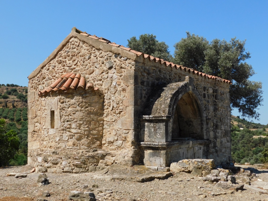 Church of St. George at the Agia Triada archaeological site
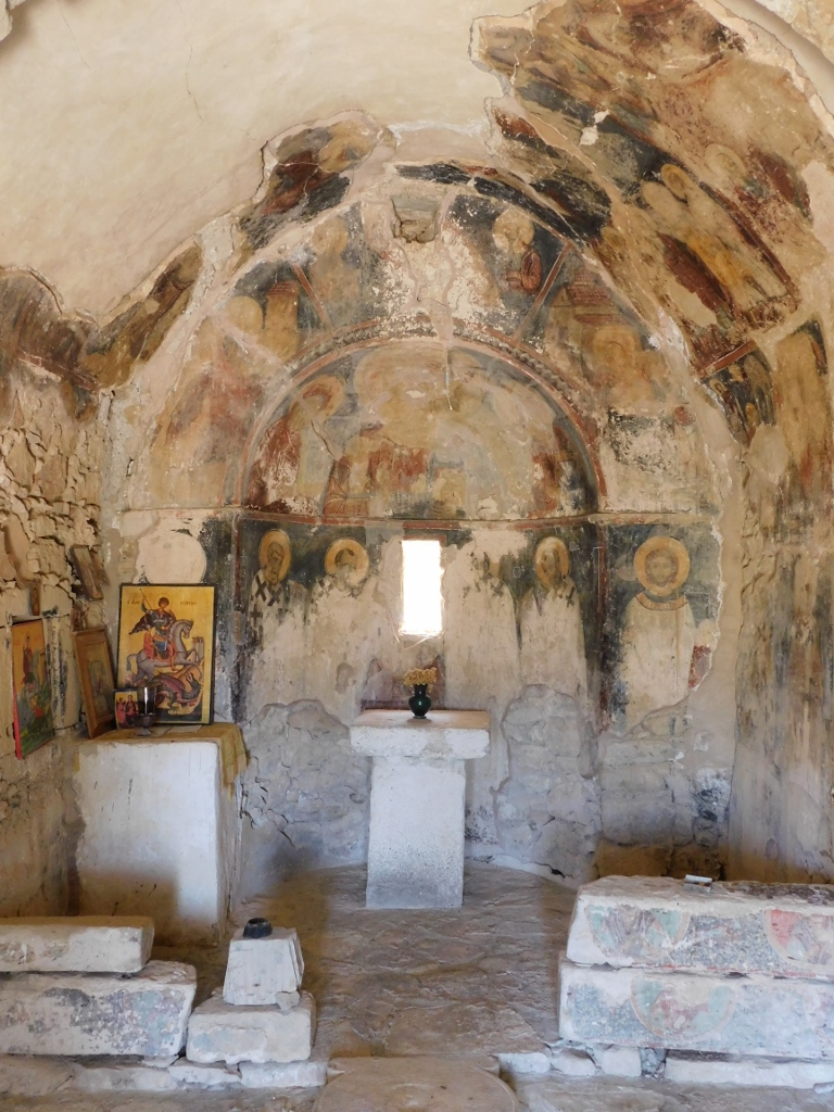 Church of St. George, a detail
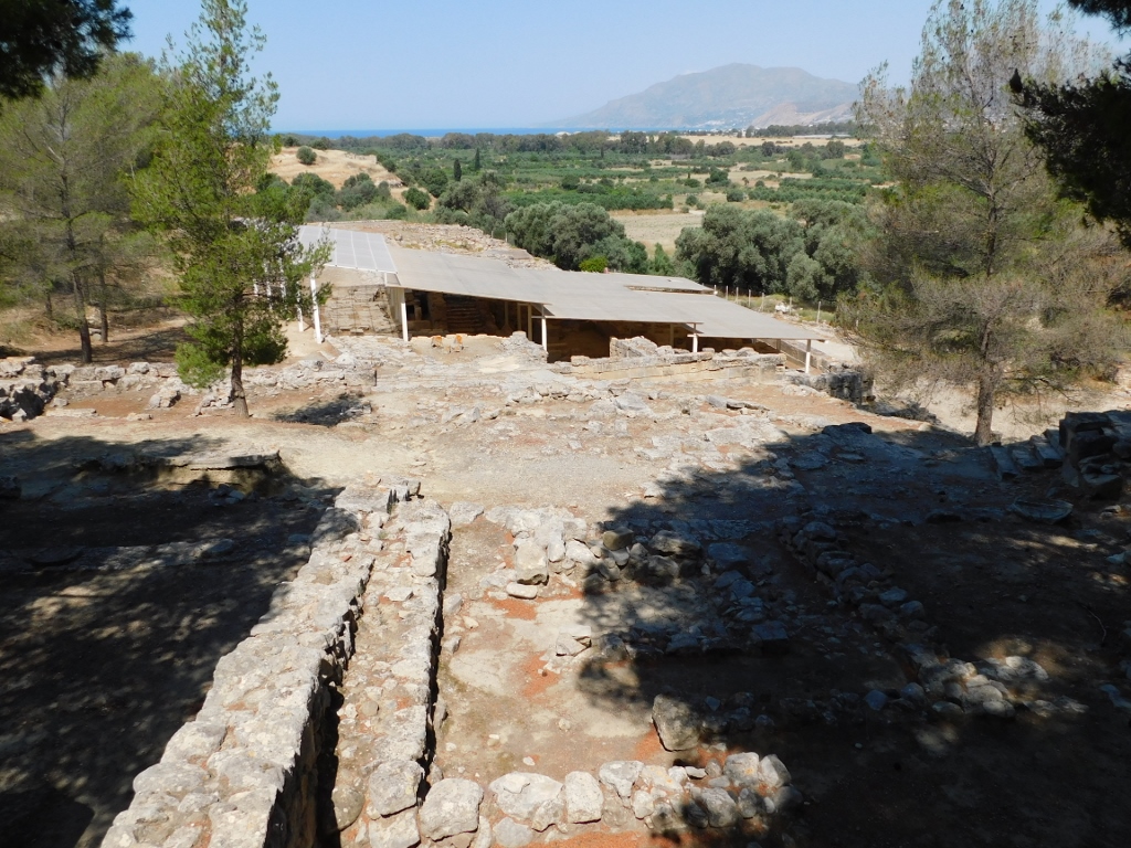
By the way, the view at the surroundings from the plateau by the church is also splendid, with an addition that from here one can look at different parts of the archaeological site as well.
 View from the archaeological site of Agia Triada
In the photo above, down and to the left, it is possible to discern parts of the remains of the structures in the west section of the site, while on the right-hand side there is a part of the canopied remains of the palace that was the next structure I visited.
In fact, judging by its size, this structure built around 1600 BCE is nothing like the palaces that can be seen in the other important centres of the Minoan civilisation, so it is believed that this was more of a (royal) villa.
 Agia Triada archaeological site, the royal villa
Still, the building did have at least two storeys, which can be concluded because of the encountered staircase, and it incorporated reception rooms, storage rooms and a royal megaron, i.e., a large hall. It was luxuriously decorated, with painted floors and walls.
 Agia Triada archaeological site, the royal villa
In any case, the palace or the villa was destroyed around 1450 BCE either as a result of inner skirmishes or in an earthquake when other palaces and Minoan centres (with the exception of Knossos) were destroyed. After this, around 1420 BCE, the Mycenaeans came from the mainland and conquered Crete.
By the way, within the villa, as well as in some other places at the site, it is possible to see remains of a drainage system servicing both the villa and the nearby settlement.
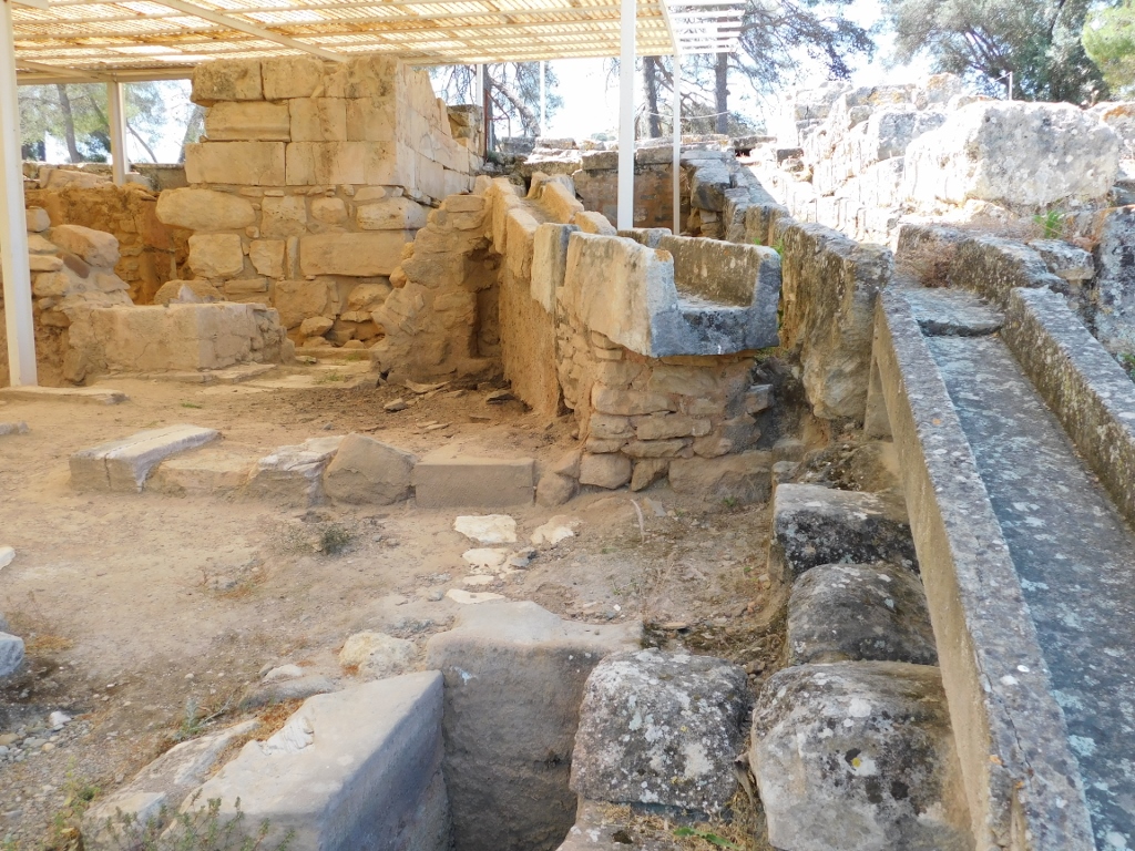 Archaeological site of Agia Triada, a detail
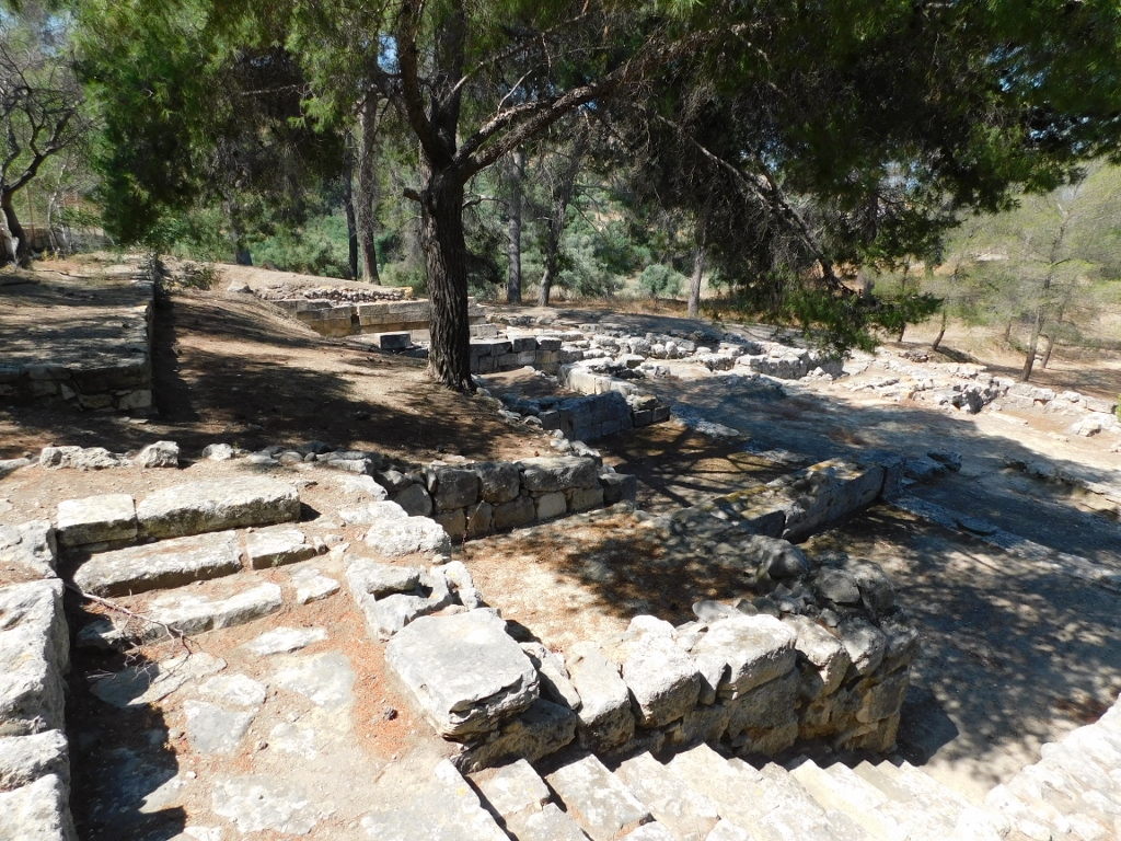
In the north part of the site, there are visible remains of the settlement. It has been ascertained that this settlement existed already in the Minoan period, but later, when the Mycenaeans ruled Crete, some new buildings were made, too. Namely, after the original destruction, Agia Triada was reactivated in the 14th century BCE as an administrative centre and the construction in it continued until the 12th century BCE.
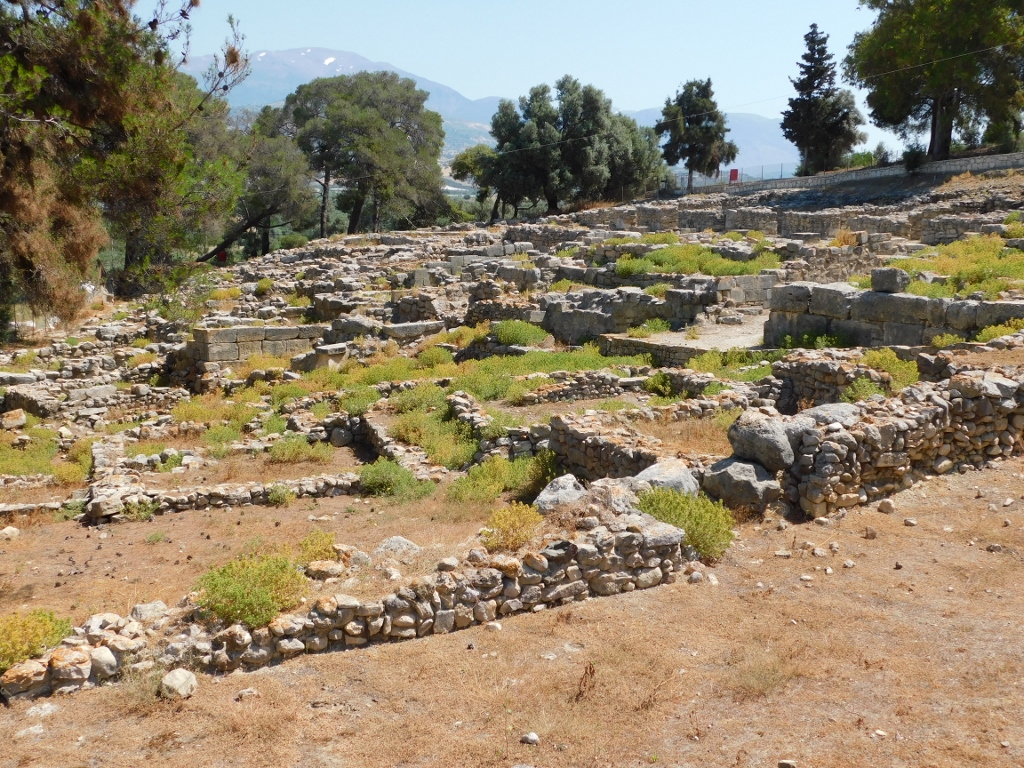 Agia Triada archaeological site, remains of the settlement
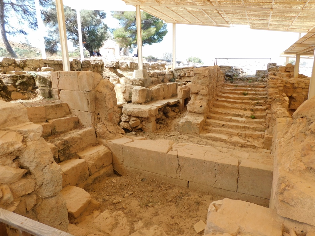
On the east side of the settlement, there is an agora, a public square, with a portico and shops.
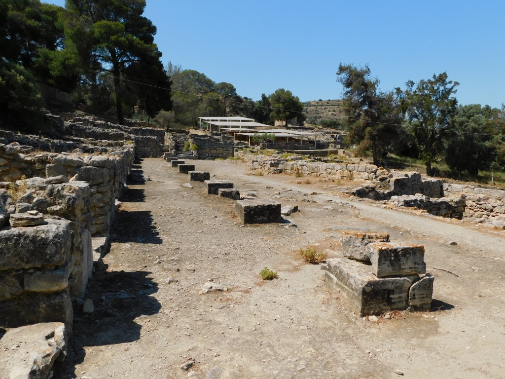 Agia Triada archaeological site, the agora – the shops are to the left, the settlement is to the right, the villa is straight and behind the villa and a tree you can discern the Church of St. George
 Agia Triada archaeological site, the shops along the agora
 Agia Triada archaeological site, south view at the agora – the settlement is to the left and the shops are to the right
 Agia Triada archaeological site, staircase by the villa that extended into the road to Phaistos
Let me just mention that an incredibly beautifully painted sarcophagus from around 1400 BCE was discovered at a cemetery belonging to this site. This is the only sarcophagus made of limestone from that period that has been found to date and the only one that shows narrative scenes linked to the Minoan funerary ritual. Nowadays, the sarcophagus is exhibited at the Heraklion Archaeological Museum and it can be seen in https://www.svudapodji.com/en/crete-5/.