The coach to Puerto Natales was leaving in the afternoon, so after an easygoing morning, we decided to kill the free time by going to Zona Franca, i.e., the duty free zone in order to check it out. Namely, Punta Arenas is a border territory, close to Argentina, so the duty free zone has some big stores with all kinds of goods and we primarily wanted to get some small things which we had in the meantime realized we needed them.
Afterwards we went back to Cecilia’s house where she waited for us. That day, she was in charge of preparing lunch and we all had the meal together. Then Sneza and I had to hurry up a little lest we missed our coach. The trip was comfortable and I was absolutely delighted for finally travelling through Patagonia which I had been dreaming of since my childhood.
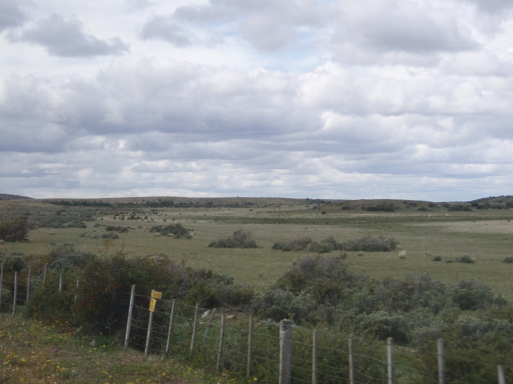
Patagonia is a huge region in the south of the continent divided between Chile and Argentina. When you leave from Punta Arenas, at first everything is flat, then it is flat again, and a little bit more, and it was only in the distance that I could see some minor elevations. This entire part we were passing through was covered with vegetation, but this predominantly meant grasses and bushes. There were practically no trees.
The weather was changeable, a little cloudy, with clearly visible rain in the distance, only to have the sun burst occasionally through the clouds. From time to time we passed by some canals, ponds and lakes. Here and there we could see some simple fences and we also saw scattered sheep grazing around, but the whole landscape was such an immense area that one didn’t get an impression there were any people around. Only rarely would we pass by a parking lot with a coffee shop by the road or we would see a couple of structures belonging probably to the same holding (estancia), and then we would see no other human dwelling around for a while. Only flatland with grass and wonderful clouds and the sky above the horizon.
 Patagonia
After a while, I also noticed some horses grazing around and then finally there were some minor elevations and sporadic trees that I could notice. And just as I got happy that there were trees after all, we started passing by brought down and/or dried out trees and the whole scene appeared as if there had been a hurricane. Later we learned that what killed the trees was some lichen, a parasitic plant that starts to grow on its host and then destroys it completely. On the other hand, the trees that were alive were very funny looking, as their tops conspicuously grew only to one side in the direction in which the winds tend to blow.
As we approached Puerto Natales, the nature around us started to change – there were more hills and snow-covered mountains in the distance, there were more trees and green colour of the vegetation, and the human settlements were more frequent as well.
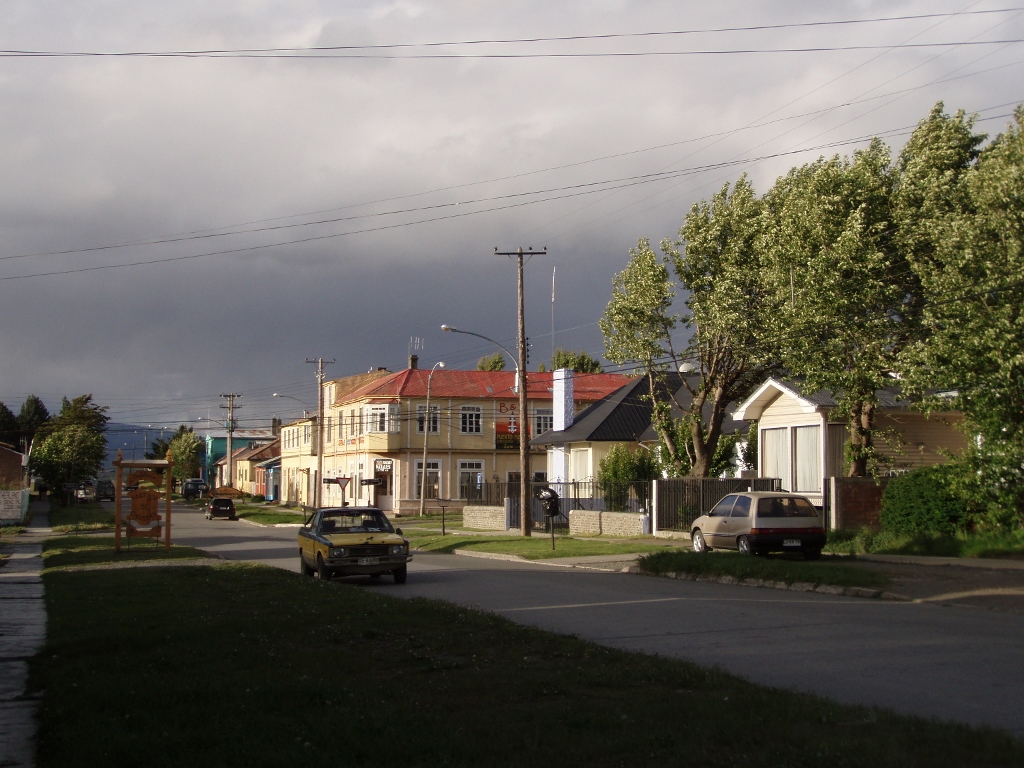
After arriving in Puerto Natales, we settled at a modest hotel and then headed for a walk around the place. The whole thing was made easier by the fact that at the time the night was falling quite late. At the end of November, the sun sets around 10.30 pm, while already at 4.30 am it is broad daylight.
Puerto Natales is a small town on the shore of a bay, completely far from “civilization.” After all, the bay is called the Bay of Last Hope (Seno Ultima Esperanza), so you’re getting the idea, right? In a central park it is possible to see a small train locomotive, for it is obvious that in the past Puerto Natales could be reached by rail, but this is no longer the case. Nowadays, it may be reached by plane or coach. There is also a possibility to take a ferry that links Puerto Natales and Puerto Montt, and that journey lasts for four days, but to our huge disappointment and sorrow we didn’t have the time to do it. As far as we read about it, the ship passes by some breathtaking landscapes and this certainly remains as an idea for some future travels that keep tickling my imagination.
In Puerto Natales, houses are mostly low, everything is linked to tourism and there are lots of hotels, boarding-houses, hostels, restaurants, cafes, as well as tourist agencies. During our walk, we stopped at a cafe which advertised itself as the “Chocolate factory.” This seemed so promising that we both felt we should not miss out.
 Puerto Natales
 Puerto Natales
After the sweet break, we continued with our walk and got to the waterfront, i.e., to the shore of the bay I have already mentioned. Somewhere there we came across an empty playground, so it occurred to us to get on to the swings while enjoying the view at the bay’s waters. And then some kids came and with their attitude clearly made a point that they expected us to move away, which we eventually did, as they obviously had the advantage of home turf.
Our enjoying everything that surrounded us was not, however, impeded by this “incident.” Namely, the sky kept making imaginative twists – it rained for a little while, then it would stop for a while and the sky would become clear again.
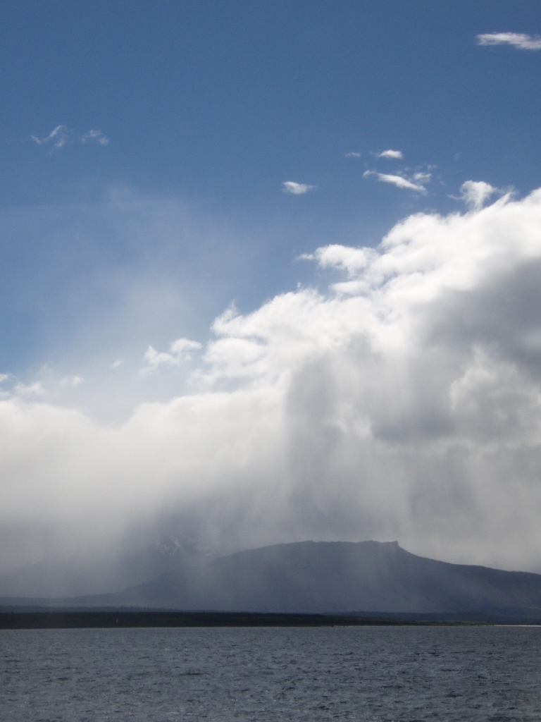 Puerto Natales, the whimsical sky above the Bay of Last Hope
Thanks to the wind which practically continuously blows here, the air was palpably fantastically clean. But, this wind also provided for a chill factor, so we had to be well dressed, but it was not icy cold. Quite the contrary, it was rather pleasant for a walk before the night fell and we had to go to bed, for the next morning we had to get up early. At 6.30!
The reason was that we were to be picked up by a mini-bus and taken for a visit of the Torres del Paine National Park. Then it turned out that we had to wait for a little longer, but when they eventually did come to pick us up, there was a nice surprise for us. The girl who was the guide for the group was Kaja from – Novi Sad (Serbia)! A few years earlier, she came to visit some family friends there and then she stayed. The world is small indeed!
The trip first took us to the Milodon cave thus called after a herbivore mylodon, a type of a ground sloth that used to measure up to 4 metres in height and that got extinct some 10,000 years ago. The cave was discovered at the end of the 19th century and today it is a part of a National Monument that includes several caves, as well as a huge bolder called Devil’s Chair (Silla del Diablo). It is interesting that on the basis of fossils found in the cave it was established that it used to be under water. Nowadays it is around 20 metres high, 80 metres wide and some 200 metres long. At one elevation there is a mylodon replica.
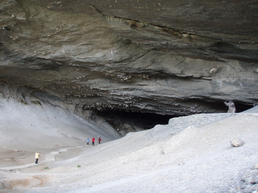 Milodon cave; a mylodon replica may be seen on the right-hand side of the photo
And this was all very interesting, but my strongest impression came from the setting we passed through on our way from the mini-bus to the cave and back. The impression was particularly strong on account of the contrast when we left the grey, dry and rocky cave. The path there leads through a green area, with snow-covered mountain tops in the distance, with the fresh wind that kept blowing in gusts, making the air beautifully clean, and with continuous play between clouds, sun and the blue sky which occasionally created extraordinary effects. And then, as if the nature didn’t have enough of it, at a few points we passed by some big bushes which despite the coldness that permeated everything had bright red blossoms.
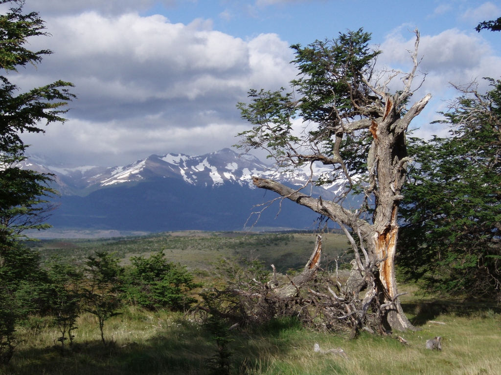 Surroundings of the Milodon cave
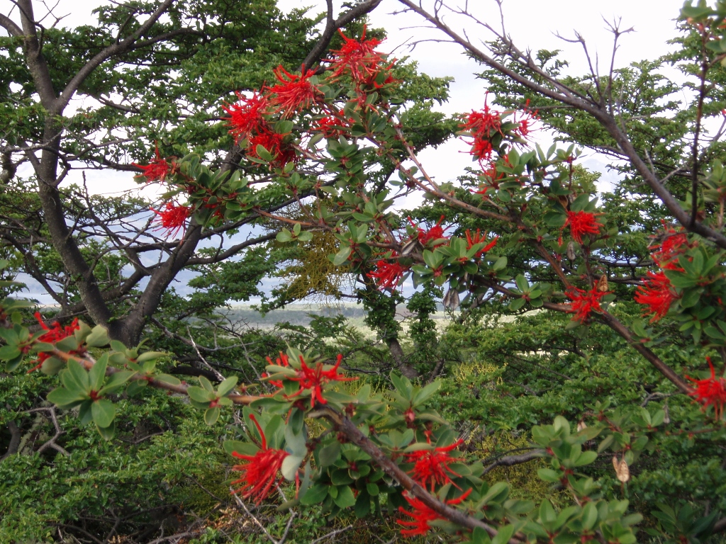 Surroundings of the Milodon cave
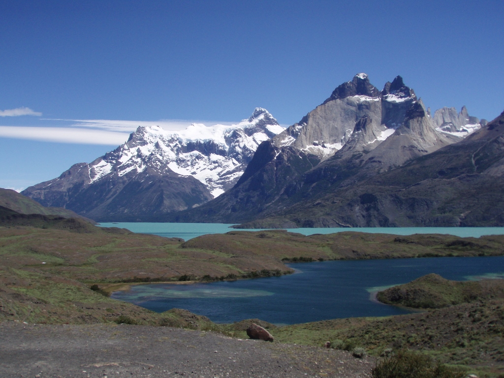
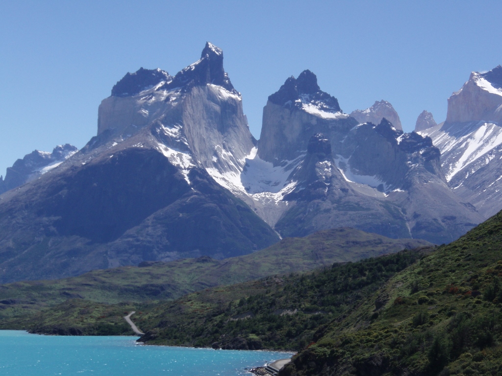
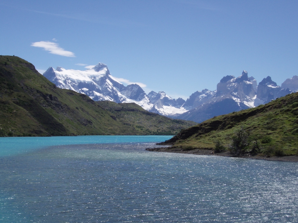
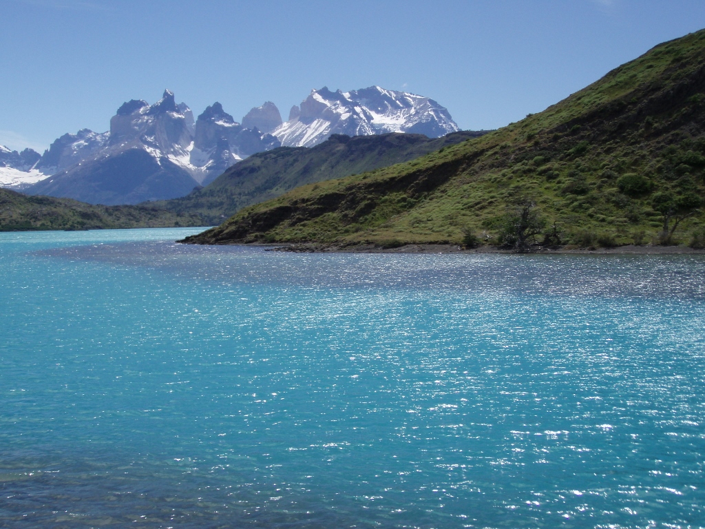
Then we headed for the NP Torres del Paine. We made a break at a viewpoint in order to admire the landscapes and take photos of the mountain massif which constitutes the central part of the park. It was clear already there that the nature was munificent without any bounds and that it had decided to show itself in all its beauty and glory, and each point of view left me breathless although we had not even entered the park yet. Still, this viewpoint was a good place from which to see the “towers” (torres), the three peaks that give the name to the massif. The other part, “paine,” in the language of the indigenous people means “blue.”
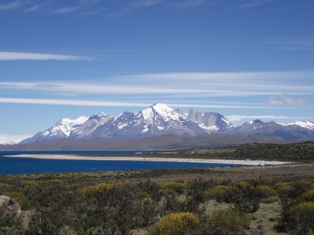 Del Toro Lake (Lago del Toro) and the massif in the NP Torres del Paine
After this short break we moved on and soon came across guanacos from the family of “camelids” that includes camels, for instance. This same animal family also includes vicunas, alpaca and llamas, at least as far as South America is concerned. I have already mentioned this in one of my texts on south Peru where there is my photo of vicunas (See: https://www.svudapodji.com/en/south-peru-peru-and-bolivia-summer-of-2005-part-2/).
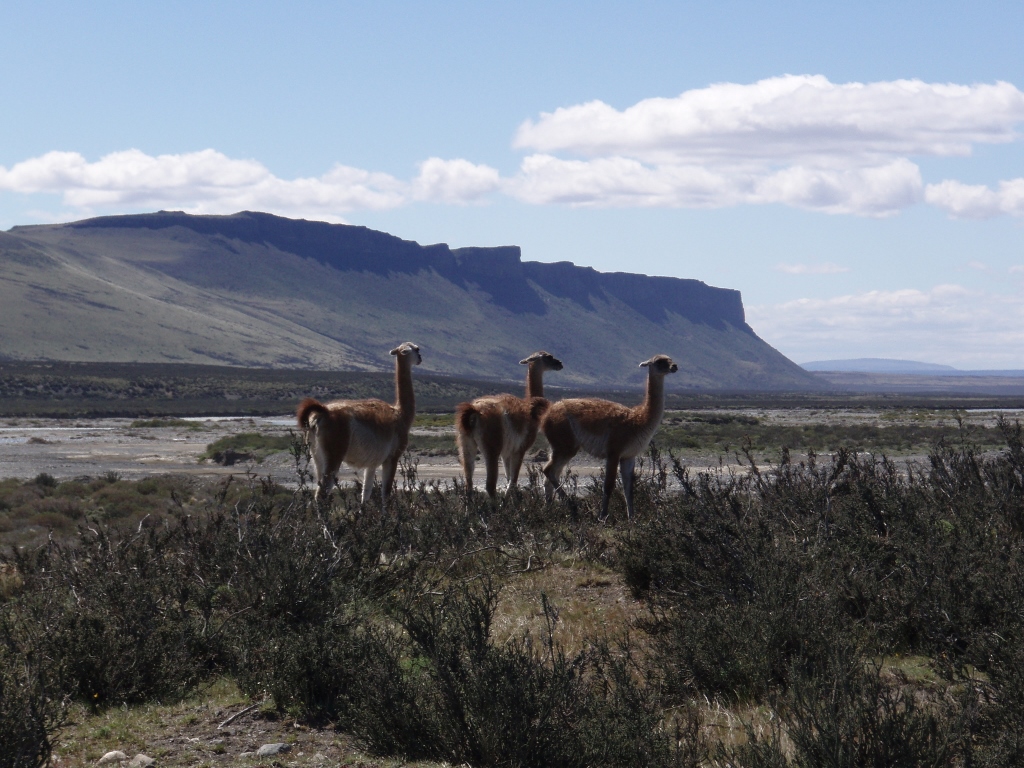 Guanacos
The road then took us beside Laguna Amarga, meaning “Bitter Lake,” and I do wonder who has tried it and named it like that. It is interesting that back in 2006 it was shrinking. It could be clearly seen by the edge of the lake and the trace there that each year there was less and less water in the lake.
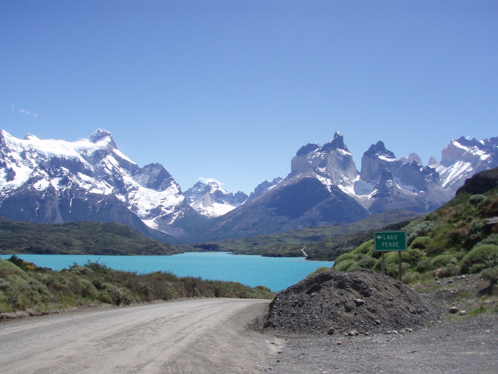
After this, we stopped at the official entrance into the National Park to buy the tickets. Other than having a closer look at a part of the massif, there we also saw a small river with glacial water (murky blue-white). This entire national park consists of a large mountain massif which is surrounded by a glacier, lakes, rivers, hills and fields.
Having bought the tickets, we entered the territory of the National Park and until the end of our stay, there we were simply exposed to continuous change of indescribably beautiful sceneries. The mini-bus with its darkened windows that were sporadically covered with some stains stopped frequently in order for us to get out and enjoy the true colours of the landscapes. On the other hand, there was a very strong wind and it was quite chilly, so none of us was too interested in standing in one spot for hours, although the images around us certainly inspired such a notion.
 NP Torres del Paine
At one point, we stopped to watch the Salto Grande waterfall.
 NP Torres del Paine, Salto Grande waterfall
 NP Torres del Paine, Salto Grande waterfall
 NP Torres del Paine, „The Horns“ (Los Cuernos)
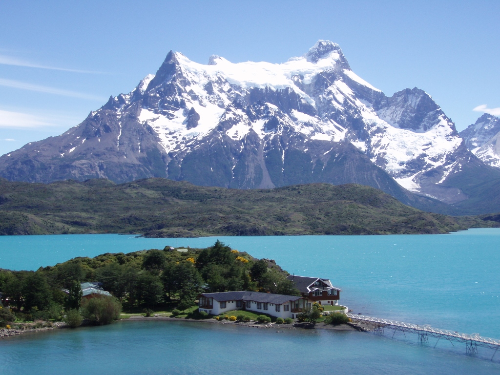
A little later we passed by the first place for accommodating guests that had been built in the park. Namely, nowadays there are places where it is possible to stay within the park, whether this is one of the camps, mountain huts or hotels, and this is done by people who come here for a few days in order to walk around, hike or do alpine climbing around the massif.
Still, there are some very strict rules for visitors here. Namely, a few years before my visit, a careless hiker lit a fire within the park and did not put it out well, so there was a large fire then. This was efficiently taken care of, but since then significantly stricter rules were introduced concerning the behaviour of humans. Animals always behave.
The next stop of our group was by Pehoe lake and the reason was to see one of those accommodations, as well as the mountain massif itself. The scenery in front of me seemed as if somebody had got completely carried away and then decided to put in as much beauty as possible.
 NP Torres del Paine
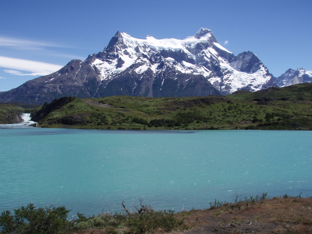
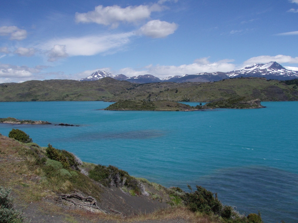
Then we reached the Weber bridge that leads over the Paine river which practically links all the lakes within the park and then enters Lago del Toro from where it goes to the Pacific. As I’ve said, “paine” means blue in the language of the indigenous people. It’s completely logical. It was here that I saw some of the most incredible blues in nature.
 NP Torres del Paine
 NP Torres del Paine
 NP Torres del Paine
 NP Torres del Paine
Soon we passed in the mini-bus over another bridge crossing the Grey river. It flows out of Lake Grey (Lago Grey) and joins the Paine river a little farther downstream. And it was precisely its source, i.e., Lake Grey that was our final destination. Still, before getting to it, we went for lunch at a restaurant near the lake. There were also accommodation possibilities at this place and a couple of people from our group stayed there with agreement that they would be picked up by another group in a few days.
While we were waiting for the lunch, I had a small mental pause to allow my impressions to settle. And the impressions were straightforward – the park was absolutely fantastically spectacular! Such natural beauty always fills me with great satisfaction and I feel completely exhilarated. In such places and at such moments, all other aspects of my life fade away and disappear, and these are rare situations when I live truly ideally – here and now.
After the lunch, we went for a walk. The path took us across a suspended bridge. The bridge swayed, of course, and we were told that no more than six people should be crossing the bridge at any one moment.
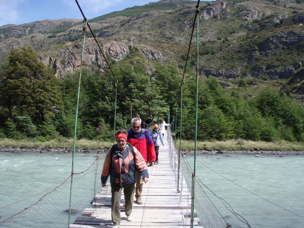 NP Torres del Paine, suspended bridge on our way to Lake Grey
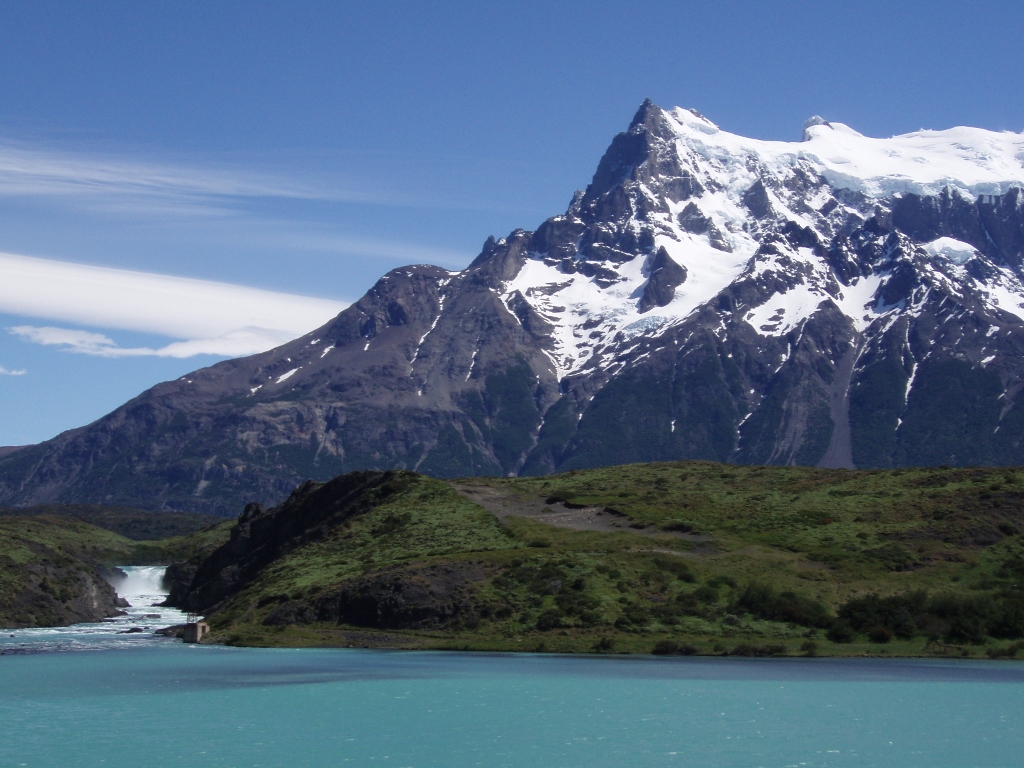
Then we continued walking among trees before reaching Lake Grey and its spacious sand shore.
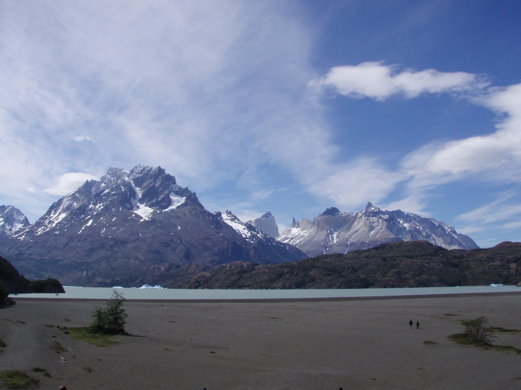 NP Torres del Paine, Lake Grey and the mountain massif
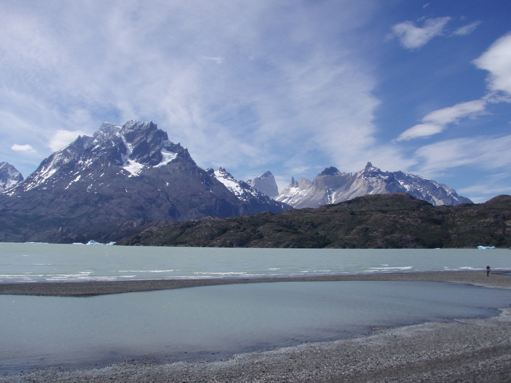 NP Torres del Paine, Lake Grey and the mountain massif
The water of the lake has murky grey colour because it comes from the melting of a glacier. Sometimes more, sometimes less, but there are also icebergs floating on the lake.
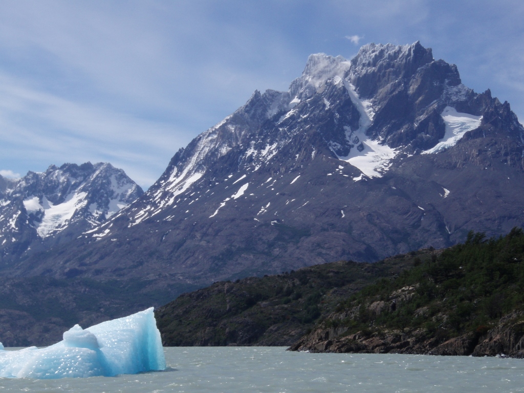 NP Torres del Paine, Lake Grey
When we got to the very edge of the lake, left to the massif we saw the enormous glacier that feeds the lake. Or rather, we saw only its small portion, as it is the second largest glacier in the world outside the polar zone and it is in fact called an ice field. Campo de Hielo Sur or the Southern Patagonian Ice Field, to be more precise. In order to get a picture about the true size of this glacier, look carefully at the following photo – the icebergs fall off the thin dark blue line which may only slightly be discerned between the grey waters of the lake and the grey-bluish surface of the glacier and may be seen in the photo just above the text.
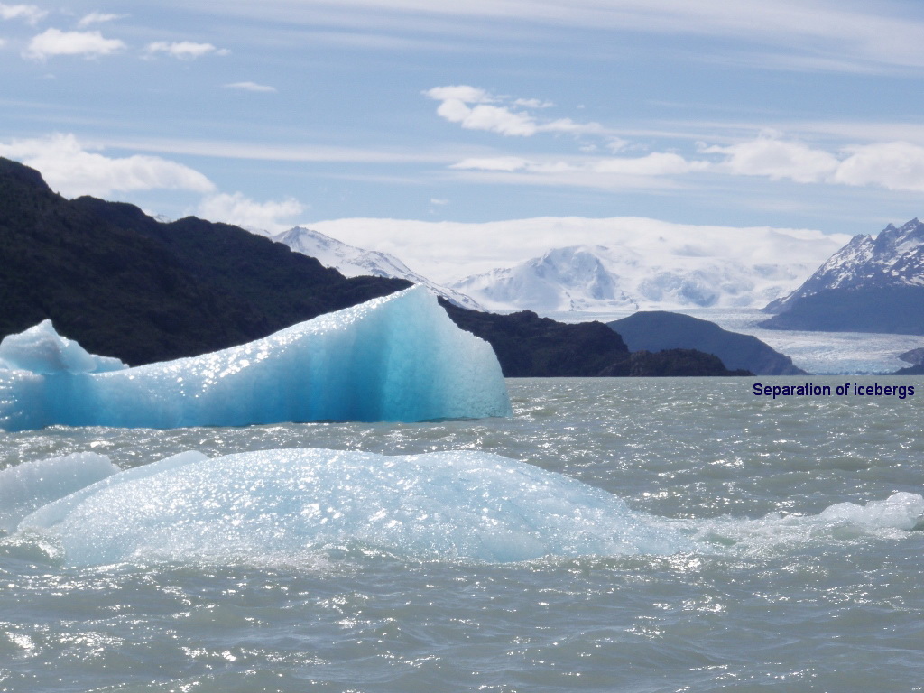 NP Torres del Paine, Lake Grey and icebergs
And in order to get an even better idea of the enormity of the ice field, here is a photo I took from the plane when a few days later I was flying northwards right above this area. The entire white section under the caption “Ice field” is precisely what the caption says – a huge ice surface. On the left hand side of the photo, under the caption “Lake and end of the glacier,” it is possible to see a “branch” of the ice field, as well as a lake it creates together with icebergs. These are the white dots on the surface of the lake.
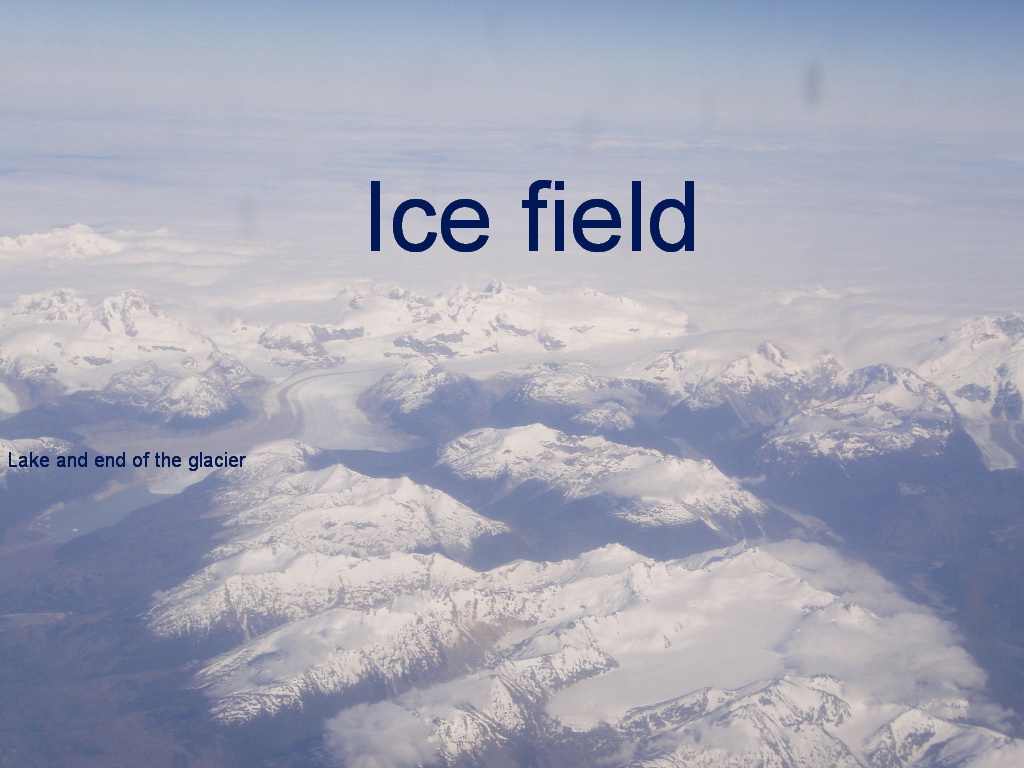 Bird’s-eye view of the Southern Patagonian Ice Field
While we admired the scenery around us, we had to tuck our jackets well, as it was windy – monstrously windy! And yet, it was not really cold. I could see that by my hands which I didn’t need to put into gloves, regardless of the wind. Moreover, I dipped them into the lake in order to check its temperature. Still, the sensation around the head, neck, face or body (if I opened my jacket) was very unpleasant.
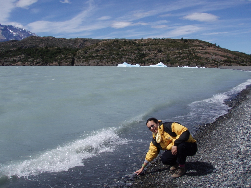 The glacier water was not very cold
And this was where our sightseeing finished and the only thing left was to go back to Puerto Natales, practically following the same road. On our return journey we didn’t make any breaks, which suited Sneza and me perfectly, since just as we got back to Puerto Natales, some 15 minutes later, we had a coach to Punta Arenas. It all fitted very well and when we reached Punta Arenas we even got off the coach earlier at the place from where we walked to Cecilia’s house.