I have met Tanja through my friend Sonja. From the very first time we met, it was clear that she was a genuinely lovely woman – friendly, talkative, interesting, and wonderful to spend time with.
At the beginning of 2026, the two of us even talked about taking a week-long trip to France together. In the end, though, it didn't fit into Tanja's other plans and it actually worked out perfectly for me as well because I was unexpectedly offered an amazing and exceptionally rare business trip. So, everything fell into place, the universe was in harmony and everything turned out exactly as it should and in the best possible way for everyone.
Then Tanja invited me to visit her in June in Blace, a town in southern Serbia.
Tanja has a family house in Blace and every year she celebrates her Slava (family's patron saint's day) there, Saints Bartholomew and Barnabas the Apostles, which, I would say, is quite an uncommon Slava. It is observed on June 24.
I knew that Sonja, as well as Jasna, Tanja's childhood friend, went to Blace every year for the celebration. On the one hand, it is a wonderful few days of women spending time together, and on the other, close friends help Tanja prepare for the celebration. In 2026, I had the honour of being included as well – both to enjoy the company and to lend a hand. I happily accepted the invitation.
Besides looking forward to spending time with these wonderful women, this was also a great opportunity for me to visit some of the cultural heritage sites that interested me along the way to Blace and in that part of Serbia.
So, I agreed with both Sonja, who was driving her own car, and Tanja, with whom I would be staying, that I would leave a day earlier so I could explore the places that interested me. And that's exactly what I did.
Without any particular rush, I set off from Belgrade one Saturday morning, heading south along the motorway.
Here is a map showing all the towns and sites I visited during this trip:
At one point, I left the motorway and then I drove to Varvarin. There are two cultural heritage monuments there that are listed by Serbia's national Institute for the Protection of Cultural Monuments, which is my main source of basic information. I first drove to the landmark known as the "Site of the Battle of Varvarin and the Monument to Count O'Rourke," located about 4.5 km south of Varvarin.
I have to admit right away that I had never even heard of the Battle of Varvarin, let alone Count O'Rourke. Clearly, I should have done a bit more reading to fill in this gap in my education.
So, the Battle of Varvarin was fought in September 1810 on the Varvarin Plain. It was part of the First Serbian Uprising, which began in 1804 when the Serbs initially rose up against the Dahijas, marking the beginning of the long process of liberation after centuries of Ottoman rule (see: https://www.svudapodji.com/en/south-of-belgrade/).
By a twist of history, two years later, in 1806, the Russo-Turkish War broke out (lasting until 1812). At the time, Russia saw the Serbs as natural allies who could tie down a significant number of Ottoman troops in the Balkans. From then on, Russia began providing the Serbian insurgents with financial support, weapons, military advisers and, at times, regular army units.
This brings us to the Battle of Varvarin, where the Serbian insurgents fought alongside Russian soldiers. The battle ended in a victory for the combined Serbian-Russian forces, and that victory proved significant both for the further course of the First Serbian Uprising and for the development of cooperation between Serbia and Russia.
However, in 1812, Napoleon launched his invasion of Russia, forcing Russia to conclude peace with the Ottoman Empire as quickly as possible so it could redirect its entire army against France. Since Russia could no longer provide military protection to the Serbs, the Ottomans launched a major offensive in 1813 and crushed the First Serbian Uprising.
A side note from the perspective of 2026: As can also be seen from geopolitical developments around the world in the third decade of the 21st century, when great powers go to war with one another, the conflict rarely remains confined to a single location, a single front, a single country, or even a single continent.
But let me get back to the cultural monument I had come to see. I'm not entirely sure that the broad plain covered with crops across from the monument is actually the Varvarin Plain, although it probably is. What is certain is that in June 2026, everything here was completely peaceful and remarkably beautiful and harmonious.
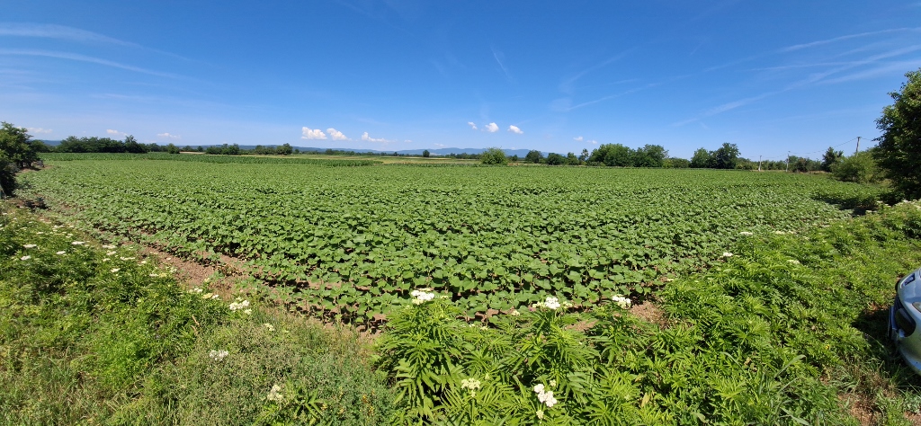 Varvarin, a detail
Various butterflies added to this sense of harmony and I even managed to photograph one of them. It was a clouded yellow (Colias croceus), a species of butterfly that had landed here to drink nectar from a thistle flower.
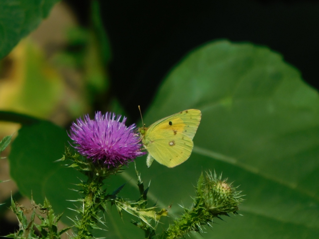 Clouded yellow
Across from the meadow where the butterflies were having lunch stands the monument I had come to see – the Monument to Count O'Rourke, shown on the right in the following photograph.
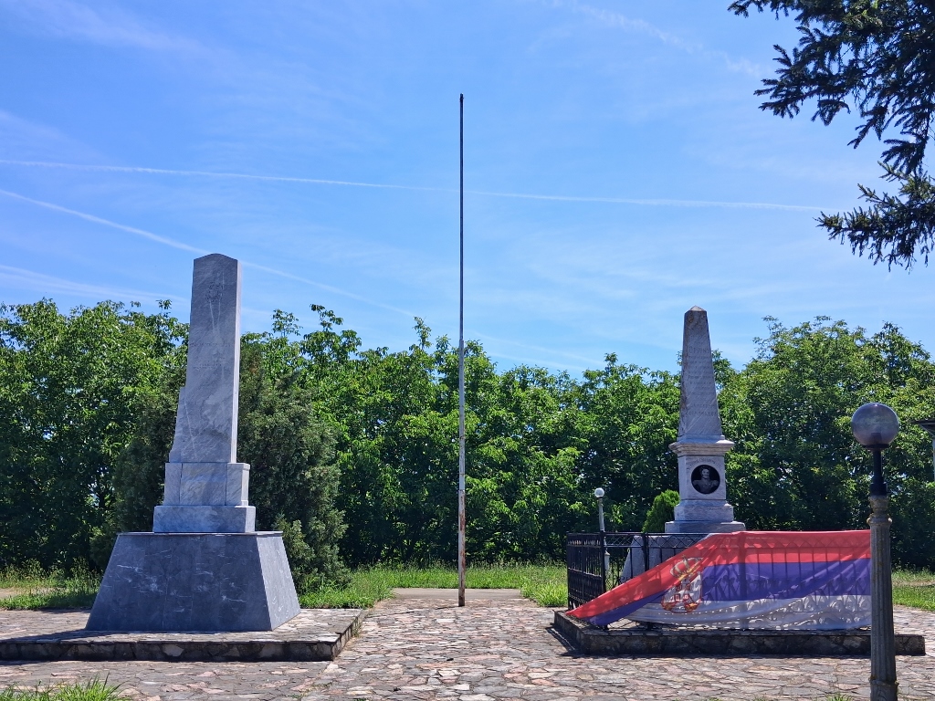 Battle of Varvarin site and monument to Count O’Rourke
Joseph Cornelius O'Rourke came from the old Irish noble O'Rourke family, which left Ireland after the defeat of the Irish Catholics in the 17th century. At that time, many Irish officers entered the service of European states, particularly France, Austria, Spain and Russia. The O'Rourke family eventually settled in the Russian Empire, where it was granted noble status, while its members went on to build distinguished military careers.
During the First Serbian Uprising, Count O'Rourke was a general in the Russian army and commanded the Russian detachment that assisted the Serbian insurgents. He was seriously wounded during the fighting and died shortly afterwards from his injuries. Because of his role in the Battle of Varvarin, he is remembered in Serbian history as one of the Russian officers who gave his life fighting alongside the Serbian insurgents.
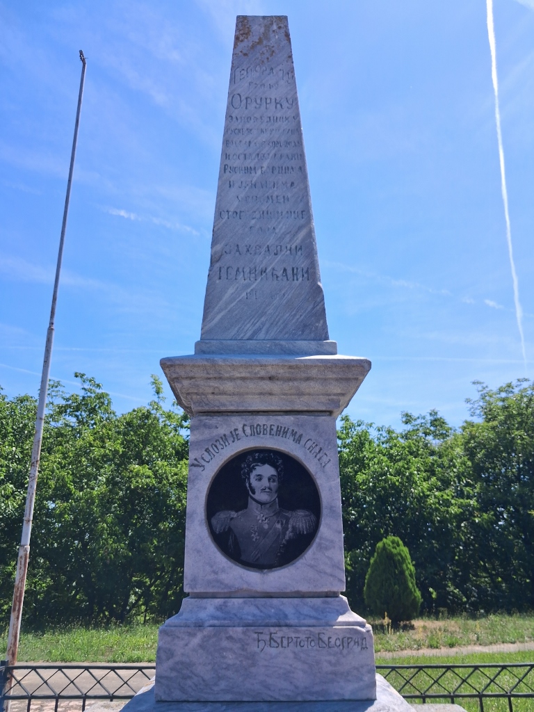 Battle of Varvarin site and monument to Count O’Rourke, a detail
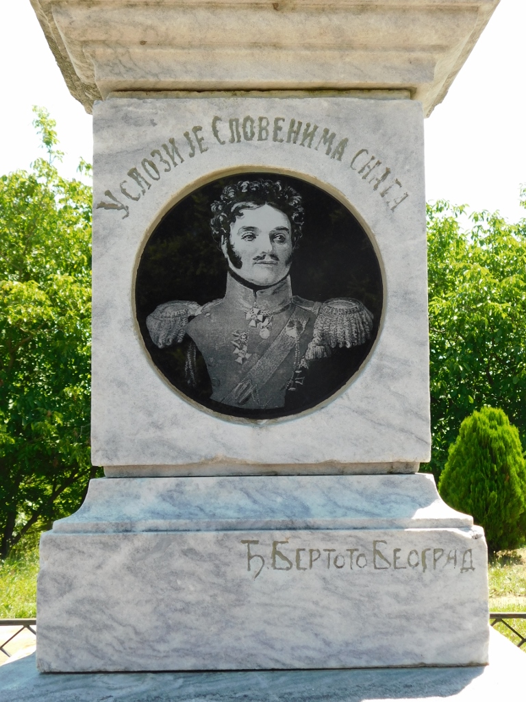 Battle of Varvarin site and monument to Count O’Rourke, a detail
At this site, you can also see plaques clearly marking the 100th anniversary of the Battle of Varvarin, commemorated here in 1910, and the 200th anniversary, marked in 2010. It is good to preserve the memory of those who offered help in difficult times.
In order to reach the second cultural monument in Varvarin, I started heading back towards the town centre. At one point, however, I turned off the main road and continued along the paved streets that run more or less around the edge of the town. I even crossed a small bridge that looked rather questionable at first, but it was actually doing its job just fine. Right after the bridge, I parked the car and got out because my map indicated that the cultural monument known as "Knez Mileta's Watermill" should be somewhere nearby. I set off on foot along the only path leading towards the spot marked on the map I was using.
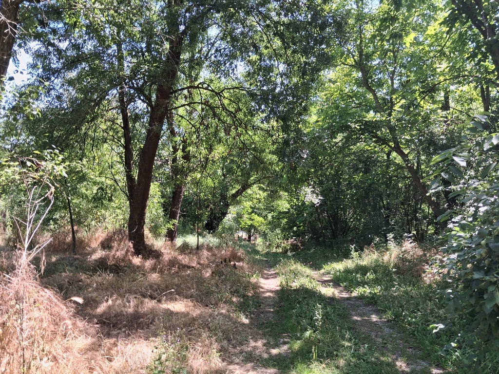 Varvarin, a detail
The watermill was built in the early 19th century by an aga from Jagodina, but his wife and daughter later sold it to Knez Mileta Radojković (1778–1852), after whom the mill was named. Knez Mileta is best known in Serbian history for leading the largest uprising against Prince Miloš Obrenović, the so-called Mileta's Rebellion, in January 1835. The rebels sought to limit the prince's authority through a constitution, which ultimately led to the adoption of the Sretenje Constitution in February 1835, the first modern constitution in Serbia. In other words, Knez Mileta was, indirectly, a very important historical figure in the development of Serbian statehood. The mill that belonged to him is an important example of traditional vernacular architecture. Built of logs and equipped with four millstones, it underwent several alterations over the years.
As I walked along this grassy dirt path, watching where I was stepping, I soon came upon a house. I called out a cheerful greeting in order to see if anyone was around. A man appeared and I asked him about Knez Mileta's Watermill. He told me that I had already walked right past it and pointed out where it was. He also said that he had wanted to repair it, but that "the institute in Kraljevo wouldn't let him" (I assume he meant the regional institute responsible for the protection of cultural monuments). And then, the watermill collapsed.
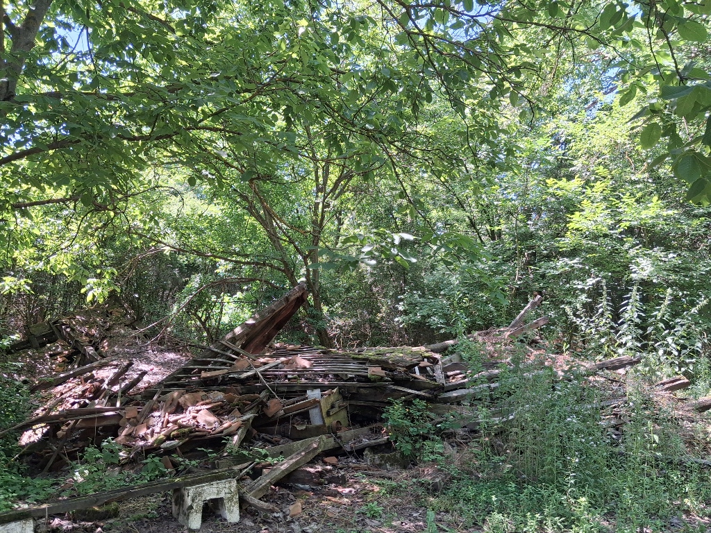 Knez Mileta’s watermill in June 2026
I understand that we are not a wealthy country and that an old watermill on the outskirts of a small town like Varvarin may not be considered a priority. But we do not have Versailles, or the Colosseum, or the Taj Mahal; what we have are watermills from the beginning of the 19th century – or, rather, we HAD some of them. Now we do not even have that. I was left speechless. Perhaps a sign should be placed here saying: “Future generations remembering the deeds of those who came before them”?
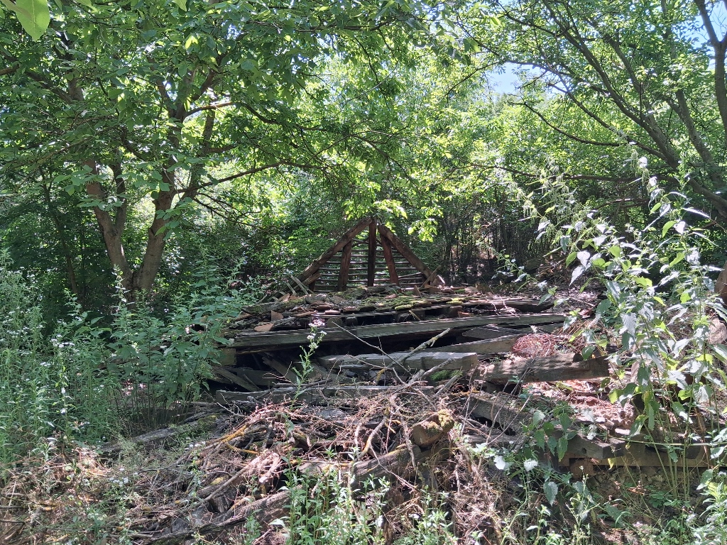 Knez Mileta’s watermill in June 2026
Quite disappointed, I then made my way to the centre of Varvarin, parked the car in a lovely shady spot and sat down to have a coffee.
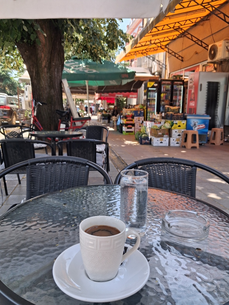 Varvarin, a detail
However, I did not want to reduce my visit to the centre of Varvarin to just one coffee and a pleasant chat with the young woman who worked there. So I went for a short walk, which first took me along the main street, from where I could observe the central parts of the town.
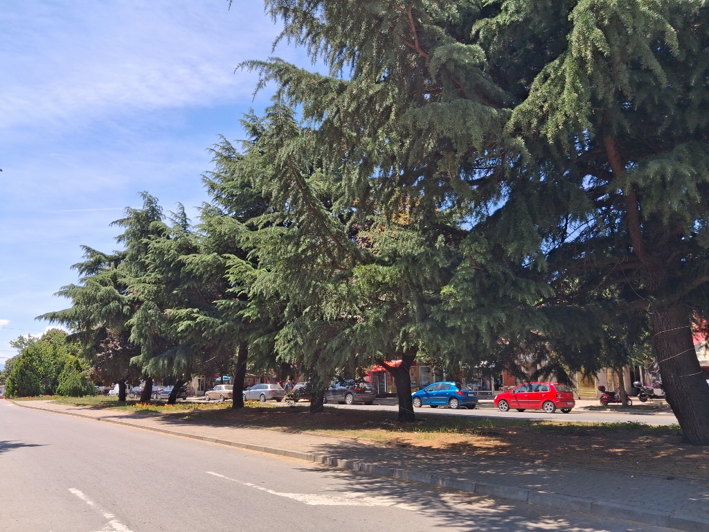 Varvarin, a detail
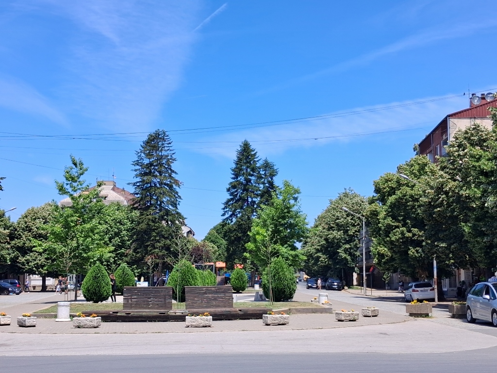 Varvarin, a detail
I also passed by a house where fresh vegetables and a variety of homemade preserves were being offered for sale under a canopy. Since I am a woman who makes her own preserves, I did not buy anything, but I certainly admired the selection.
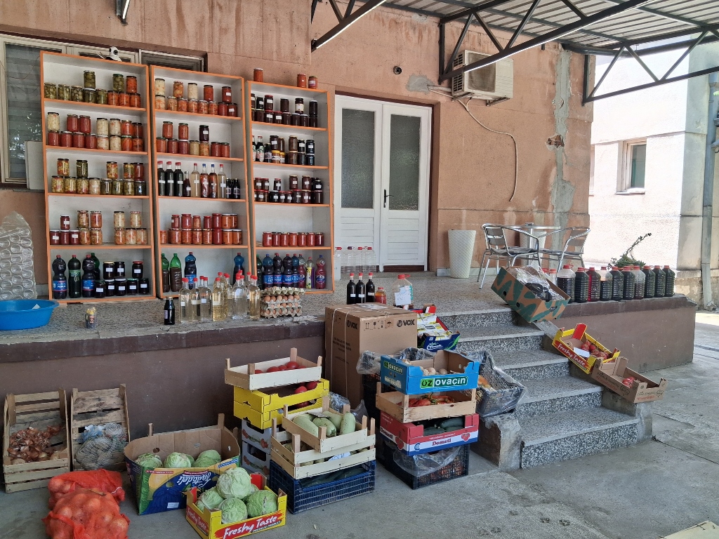 Varvarin, a detail
Then I came to the park near the Church of the Assumption of the Most Holy Theotokos. I did not have much time, as there was still a lot more I had planned to do, so I did not go to the church to look for Knez Mileta’s grave, which is somewhere nearby. However, along the way, I did pass by the monument to Jova Kursula.
Jovan Petrović, better known as Jova Kursula (1768–1813), was a famous Serbian hero and fighter in the First Serbian Uprising. According to tradition, he was tall and strong, and although he fought alongside Karađorđe, the leader of the uprising, in many battles, he was particularly known as a megdanžija – a warrior who challenged the strongest enemy fighters to single combat. Thus, in 1810, on the Varvarin Plain, he killed a Turkish champion known as the Black Arab in a duel, which made Kursula one of the most celebrated heroes of the uprising. This is why his name is prominently featured on the monument erected in the centre of Varvarin to mark the 100th anniversary of the battle.
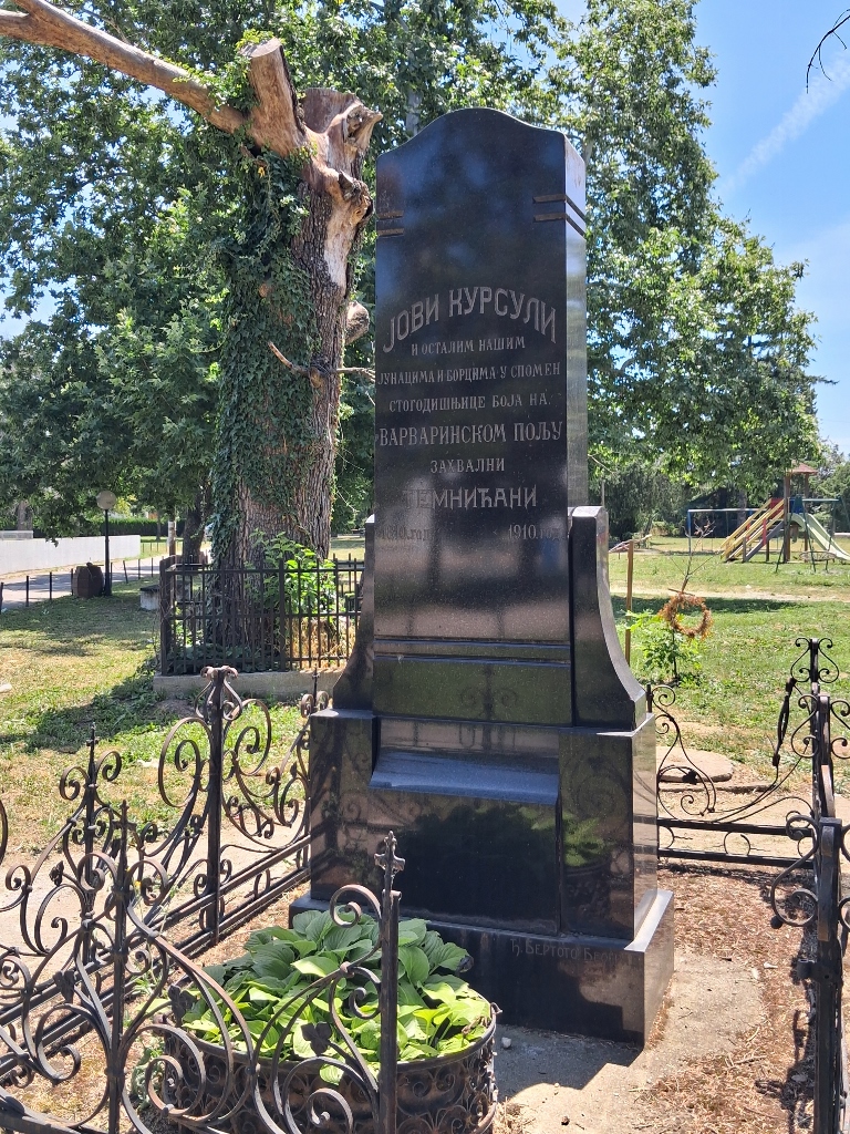 Varvarin, a detail
I was actually heading here towards the bridge that I had crossed by car when I arrived in Varvarin and that is located about 100 m from the town’s main church. It is a bridge over the Velika Morava River (the Great Morava), which is only about 4 km long at this point, since just that distance upstream, closer to Stalać, lies the confluence of the Zapadna Morava (West Morava) and Južna Morava (South Morava) rivers.
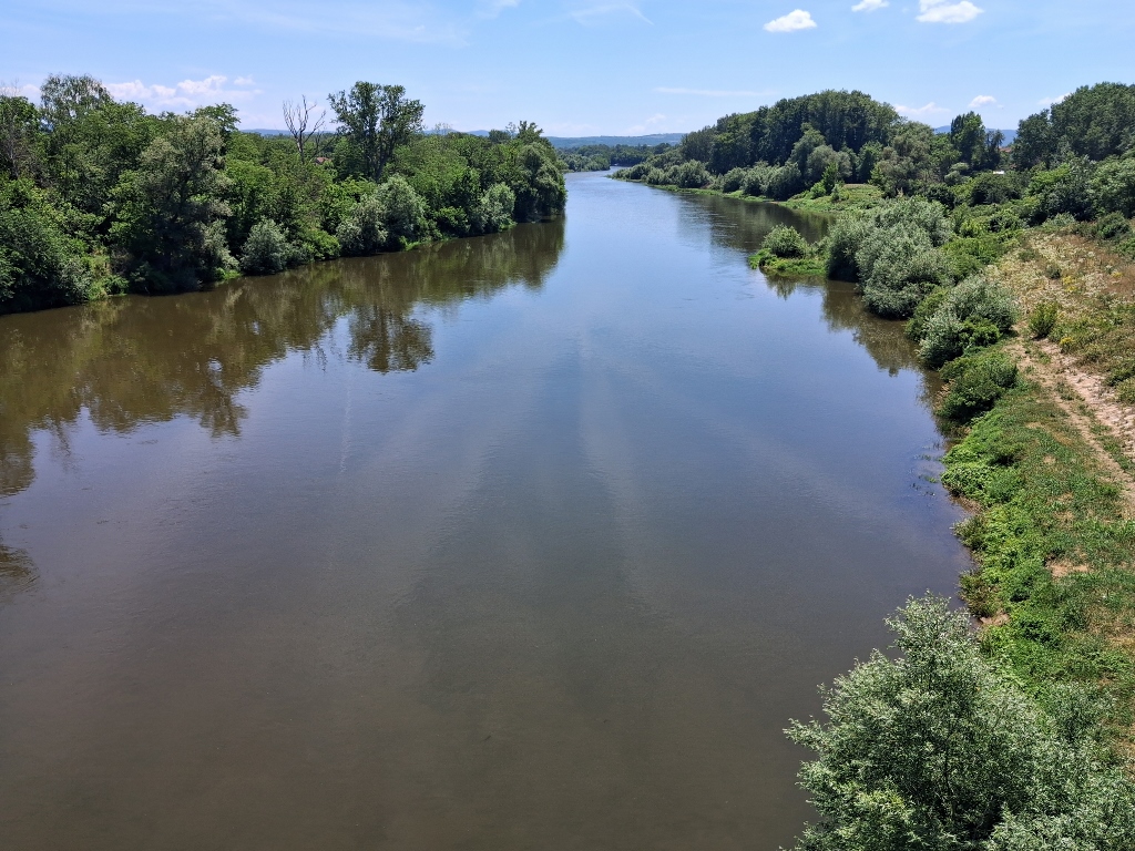 Varvarin, a detail
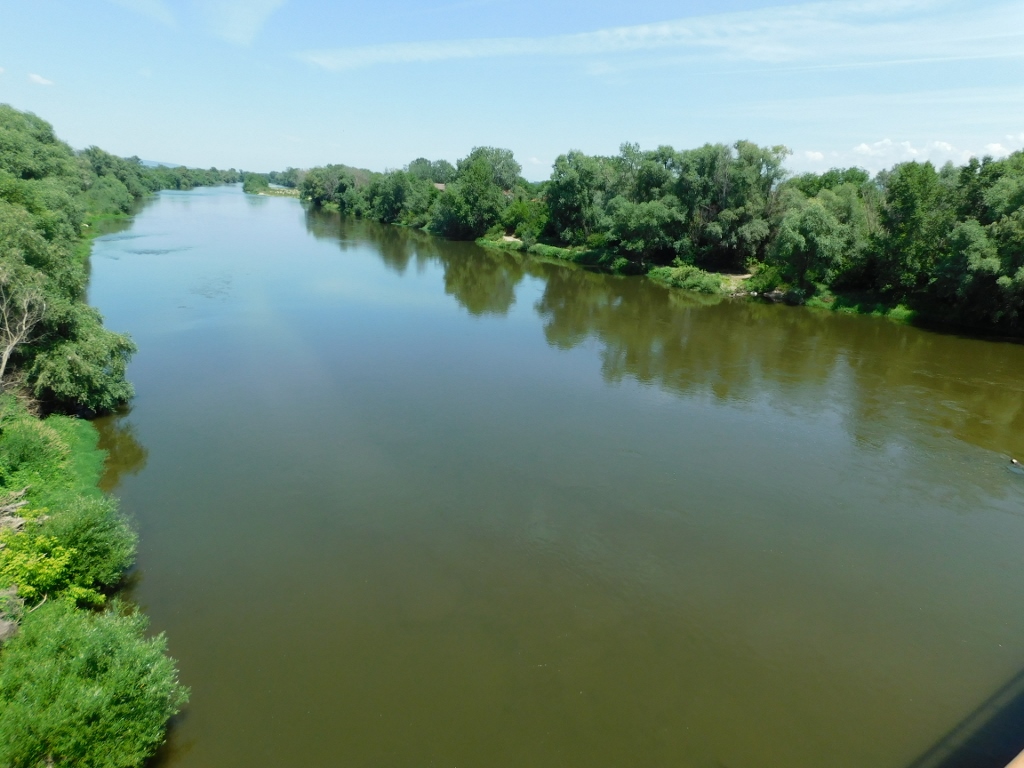 Varvarin, a detail
On my way back to the car, I also passed by an important memorial.
During the 78-day NATO bombing campaign of the Federal Republic of Yugoslavia (Serbia and Montenegro) in 1999, when neither Serbia nor Montenegro had attacked any member state of NATO, which to this day likes to describe itself as a defensive military alliance, NATO aircraft targeted the bridge in Varvarin on 30 May. By the way, the bridge had no significant military importance and there were no military facilities in its immediate vicinity. NATO stated after the attack that it had considered the bridge a legitimate military target.
However, that day was the feast of the Holy Trinity (Pentecost), and a fair and open market were being held in the town, so there were many people near the bridge. The very first aircraft strike caused injuries and several minutes later, when citizens and rescuers rushed to help the wounded, a second attack followed, in which the largest number of people were killed. Ten people lost their lives, while 17 others were seriously injured.
Later that same year, the bridge was rebuilt, largely thanks to charitable contributions from Serbs living and working in Switzerland.
In memory of these events, a small memorial site has been erected on a small plateau across the road from the park with the church.
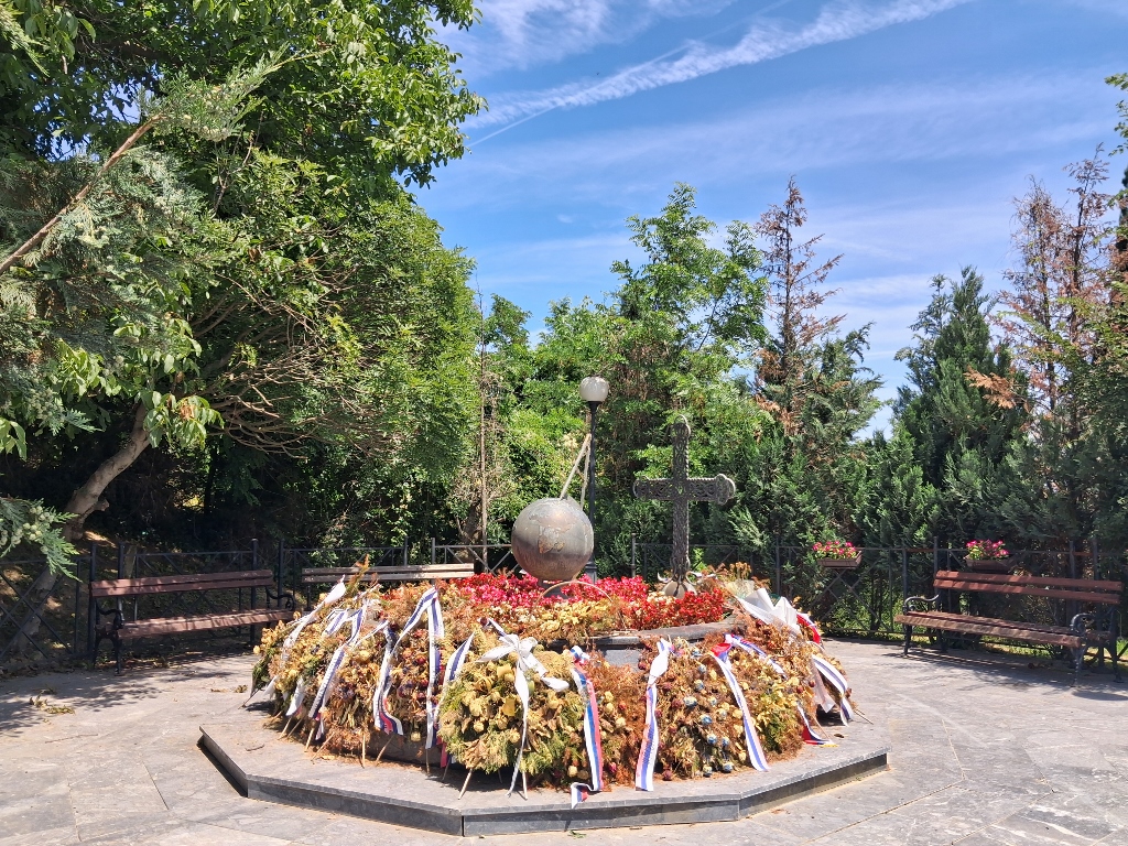 Varvarin, a detail
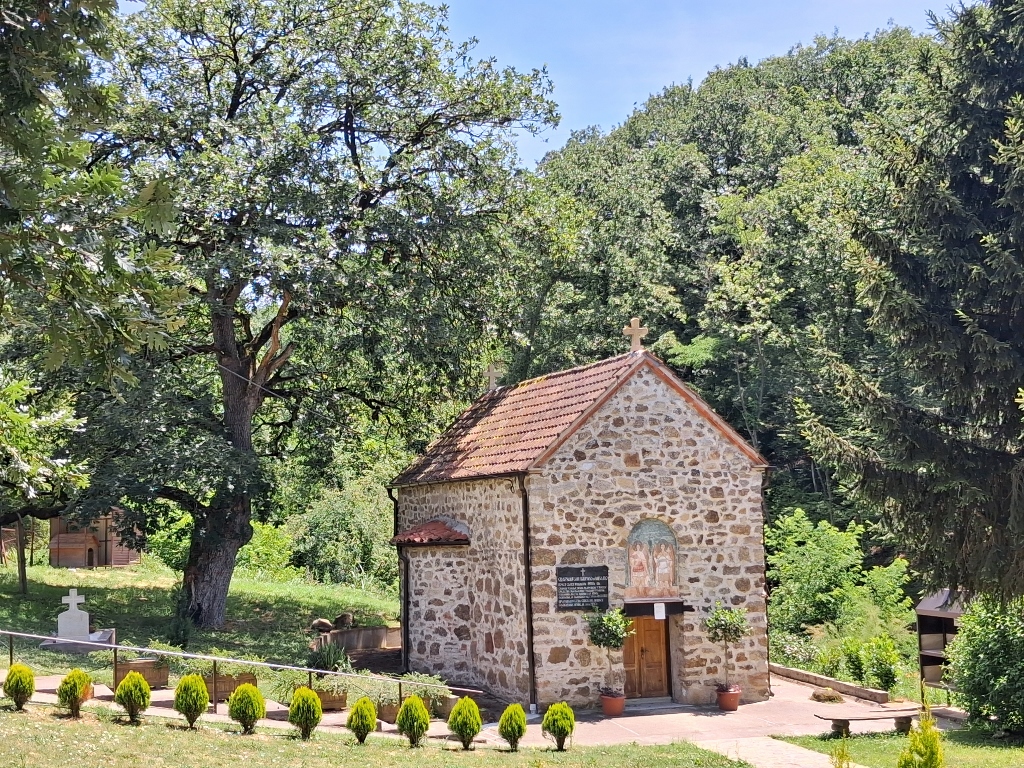
After this short stop, I returned to the car and drove to the neighbouring village of Stalać. There, I first went to the Church of St. Archangels (Michael and Gabriel), which is located about 2 km south of the settlement.
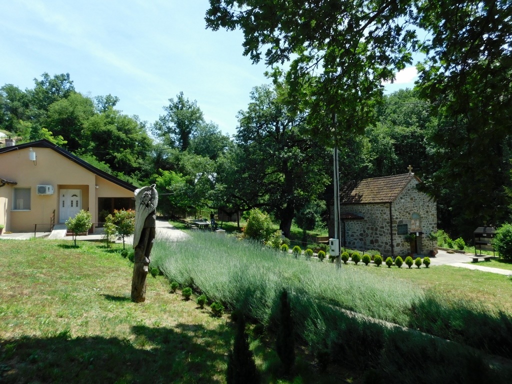 Church of St. Archangels (Michael and Gabriel)
Although some sources state that the church dates back to the 14th century, recent archaeological research indicates that it was built during the period of Ottoman occupation, most likely in the 16th or 17th century. Regardless, the church has been classified as an immovable cultural property of great importance.
The churchyard is very nicely maintained and when I arrived here, I saw a young woman who suggested that I immediately buy candles, which were being sold on the porch of a modern house built slightly above the church. I also noticed that a plateau with a large cross had been constructed above this house, with an asphalt road leading up to it.
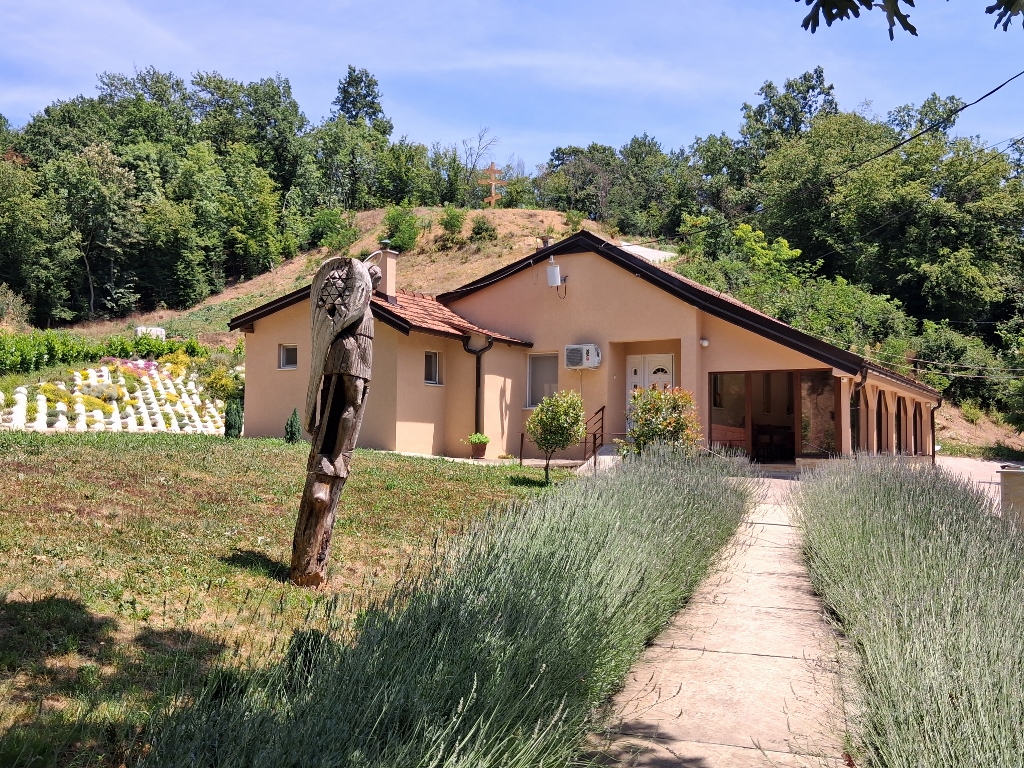 Church of St. Archangels (Michael and Gabriel), a detail
I bought the candles, but when I went down to the church, it turned out to be locked. The young woman said she would see if the church could be opened and she went into the house.
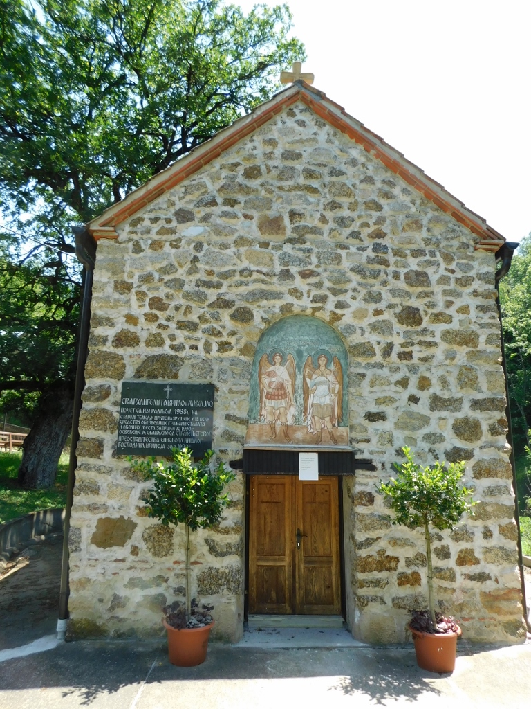 Church of St. Archangels (Michael and Gabriel), a detail
A plaque on the church states that the construction of the church we see here today began in 1988, on the foundations of an older church that was destroyed in the 18th century.
In any case, the ground plan of the church is of a triconch (trefoil) design, with the semicircular apse being more spacious, while the side conches are shallower. The materials I consulted mostly describe what the church used to look like, or what it might have looked like, and they also mention that the frescoes have survived only in fragments.
Soon, the young woman came out of the house and said that the church could not be opened because, apparently, someone inside was talking on the phone.
What could I do? I went over to light the candles, thinking that at least that would be something. Then it turned out that the place provided for lighting candles was the most impractical one I had ever seen. It clearly stated on typed pieces of paper that the candles should not be placed against the metal wall, but instead should be fixed with their own melted wax onto the surface, which in this case was made of marble. The problem was that the candles simply would not stick to the surface and this was not just my case, because all the candles that had been lit before had also fallen over. It was disappointing and I thought about how there is usually no point in trying to reinvent the wheel. I realised that this must happen regularly and that is why people tend to lean their candles against the wall, which apparently bothers the church and/or the priest. I think that by now they could have found a better solution, i.e., returning to the traditional base made of sand/gravel with water.
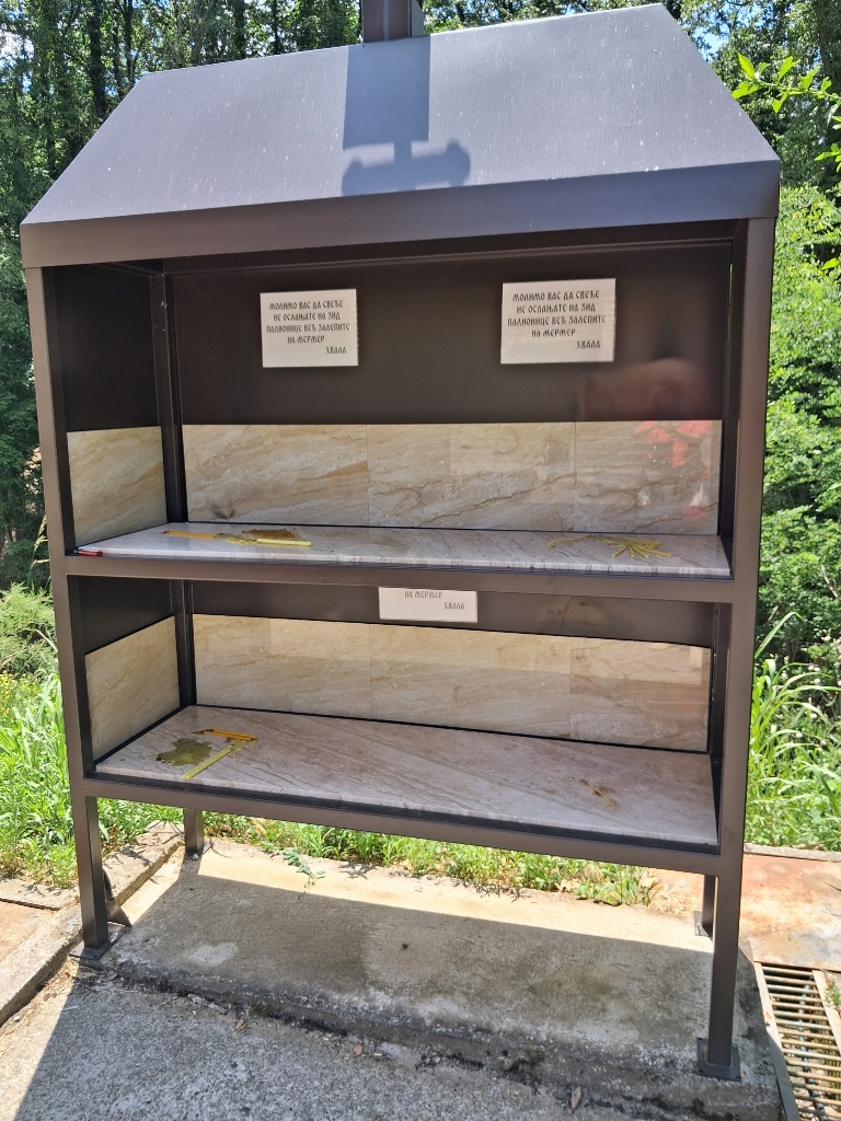 Church of St. Archangels (Michael and Gabriel), a detail
On the other hand, the church has a very charming appearance, if that can be considered the right expression, and I have already mentioned that the churchyard is exceptionally well maintained.
 Church of St. Archangels (Michael and Gabriel)
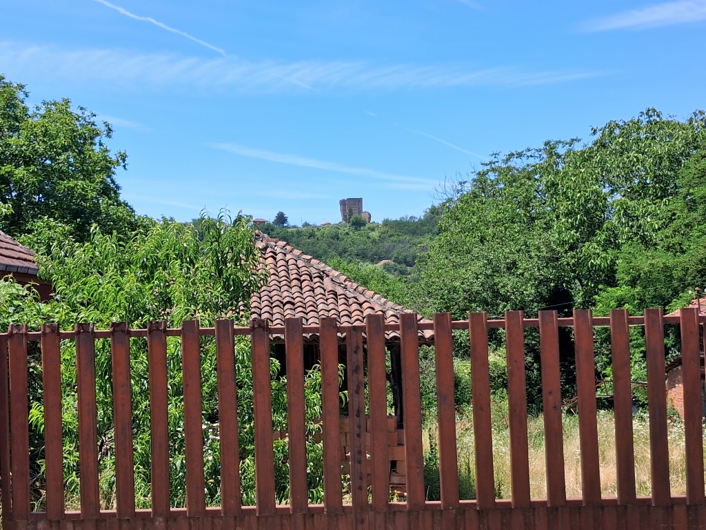
Then I headed back towards Stalać, parts of which are situated on both banks of the South Morava River. On the left bank, on elevated ground, lie the remains of the medieval Stalać Fortress. I was able to see the keep even from the road along the right bank of the South Morava, which I took on my way back from the church towards the settlement.
 View at Stalać Fortress
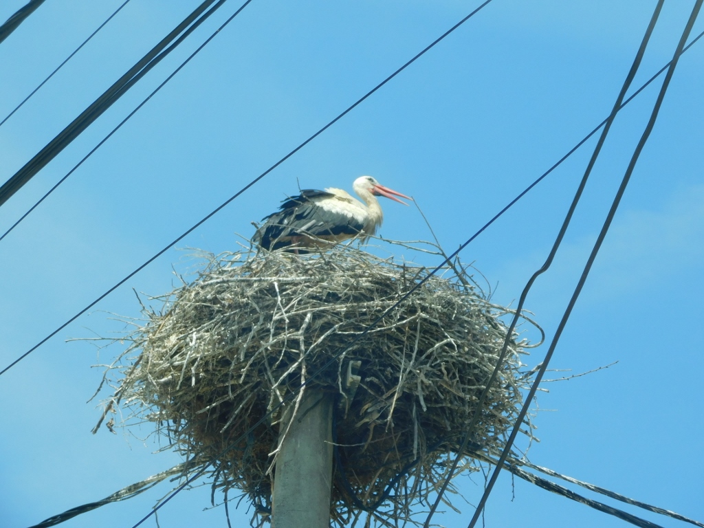
Since I was already driving slowly here, occasionally glancing towards the remains of the fortification, I noticed a stork as well, so I stopped briefly to take a photo of it.
 Stork in Stalać
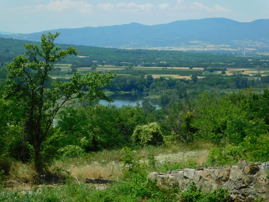
Now I had to take a somewhat roundabout route because that is how the roads run, but I eventually reached the part of Stalać located on the left bank of the South Morava. There, I needed to follow the road uphill, but the signs were confusing me and the navigation was even worse, so I asked some people I passed for directions. After a bit more wandering around, I finally made my way up to the remains of the medieval fortress located on this elevated ground, which is almost squeezed between the South and West Morava rivers as they prepare to merge into the Velika Morava about 3 km to the north.
Although the keep that one encounters here is extremely impressive, I first took a moment to look westward, where a section of the West Morava River can be seen.
 View from Stalać Fortress
I did the same in the opposite direction, where the river could not be seen because of the trees, but this was also the area where the Church of St. Archangels, which I had visited earlier, is located.
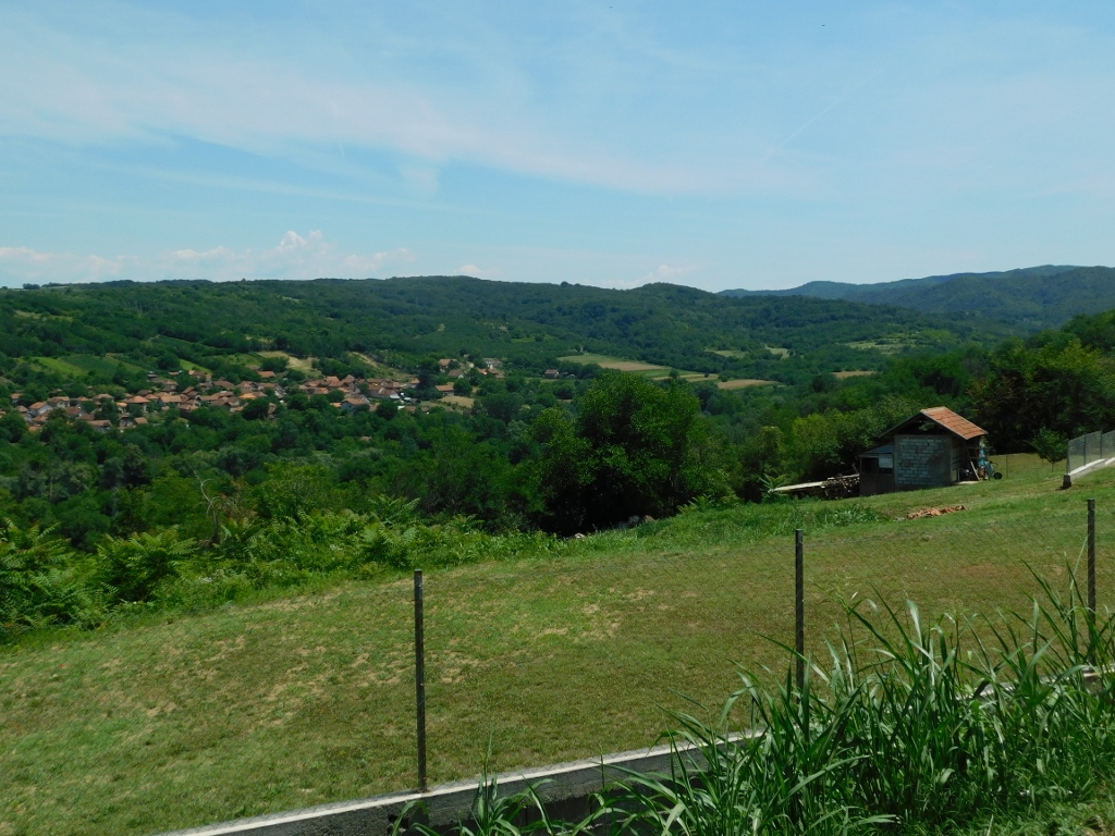 View from Stalać Fortress
And now, let me say something about the medieval town of Stalać, or rather, its fortress.
Stalać had strategic importance because it provided excellent control over the approach to Kruševac, the medieval capital of Moravian Serbia. Nevertheless, traces can be found here suggesting that this advantageous position had also been used earlier for protecting the main Roman road in this area, which ran across the South Morava River. The medieval fortress was built sometime between approximately 1350 and 1375, and it was first mentioned in historical records in 1377. Based on old sources, it is known that the fortress was destroyed by the Ottoman Sultan Musa in 1413, while he was on his way to Kruševac. After its destruction, the fortress was never rebuilt as a military stronghold and lost its strategic importance.
Today, the fortress has been declared a cultural monument of great importance and represents one of the most significant medieval fortifications in the Velika Morava Valley.
Archaeological research shows that the fortress occupied an area of approximately 400 × 200 m and consisted of the Great Town, which contained residential and economic buildings, and the Small Town (castle), which represented the most heavily fortified part of the complex.
The best-preserved structure is the main keep tower, known as Todor's Tower. It is a four-story defensive tower that served as the final line of defence and also functioned as a lookout point.
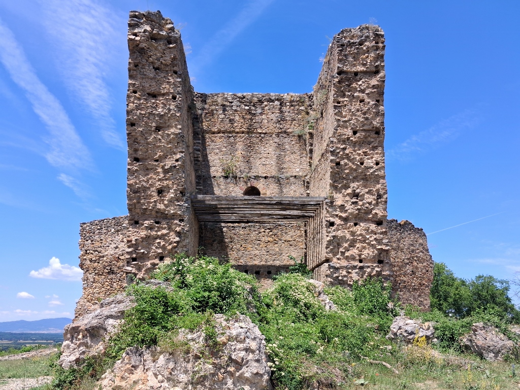 Stalać Fortress, a detail
By the way, the name "Todor's Tower" does not come from any historical figure, but rather from local tradition that developed through the blending of folk memory and epic poetry ("The Death of Voivode Prijezda"). This is how the hero known as "Todor of Stalać" came into being.
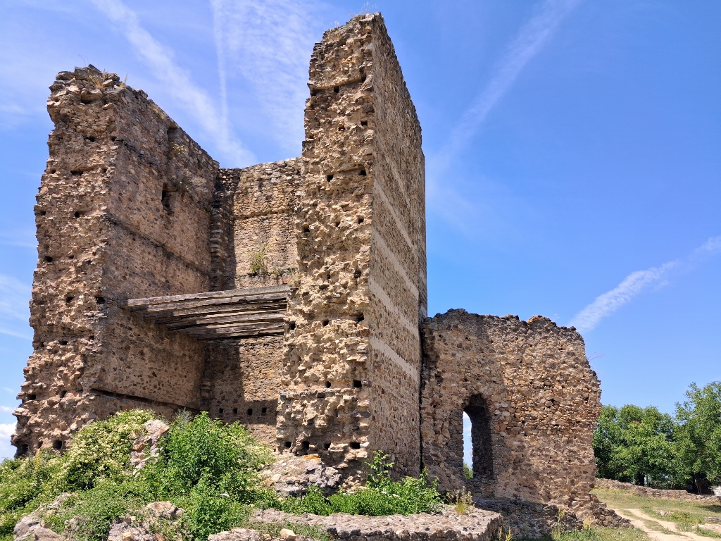 Stalać Fortress, a detail
The preserved remains of the former fortress include sections of the walls, foundations of some structures, and Todor's Tower. Researchers therefore talk about the Great Town and the Small Town, the remains of a palace with a portico, and so on, but these features are much harder to identify on site unless you are an archaeologist or historian. There are no information boards, at least none that I saw, but it was certainly interesting to walk around this relatively small site.
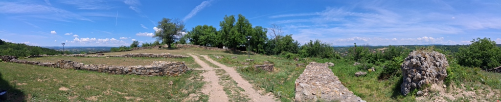 Stalać Fortress, a detail
Nevertheless, a visitor’s focus inevitably turns towards Todor’s Tower.
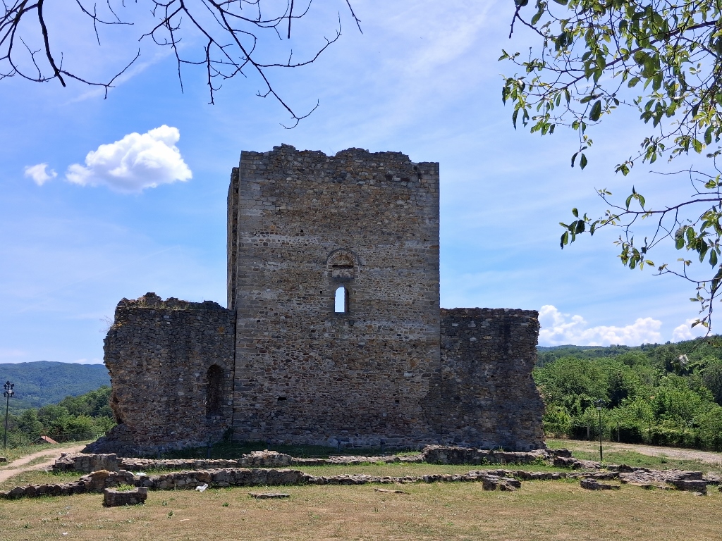 Stalać Fortress, a detail
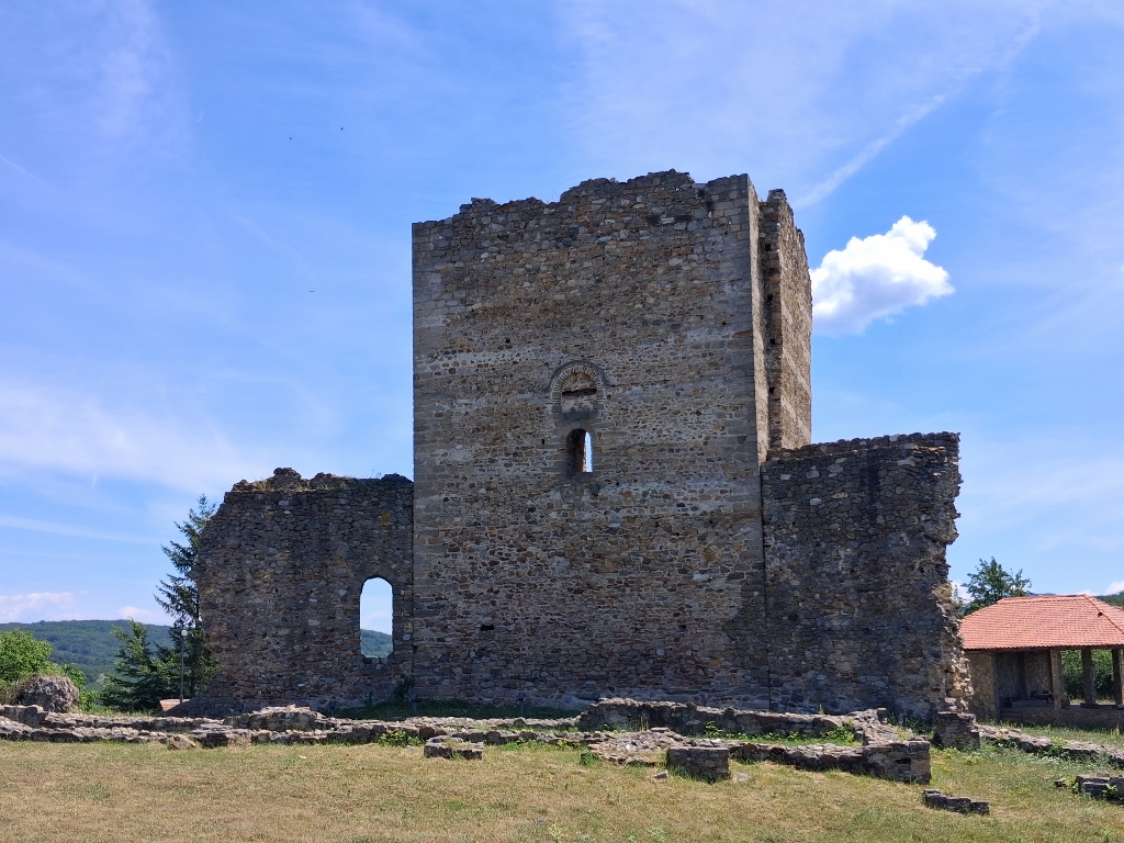 Stalać Fortress, a detail
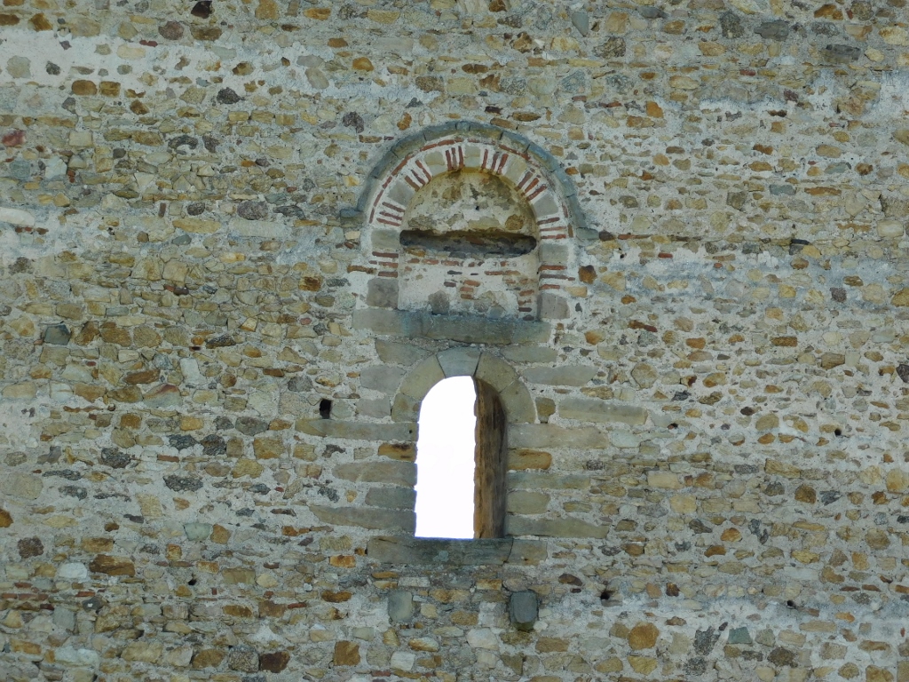 Stalać Fortress, a detail
Then I returned to the car and drove it a little further down the slope of this hill, because another important cultural monument is located there.